
14. The spatial organization of Rome was itself a map of temporality. As much as survey the forms of mapping Rome, this post is concrete in the particular pleasure of such maps of place to orient views to the city’s situation in both time and space, and the unique work maps did. Maps of Rome are striking in their acts of balancing qualitative views of place and immersing viewers in the past fabric of the city–inviting viewers to admire the commemoration of spaces in the ancient urban polis and seat of empire and the structures built over it by Popes and government.
Famously, the humanist Leon Battista Alberti mapped Rome’s ancient buildings as if to celebrate his recovery of its ancient past for highly literate readers of the Renaissance. As an early archeologist who measured the buildings that were sunk underground in the city, Alberti sought to transpose ancient buildings on a radial grid about 1450 as if to locate them more concretely in a symbolic game of imaginary excavation of the city’s monumental buildings in which readers of his map could partake, enjoying in the recovery of the past in what seems a typical Renaissance pursuit of creating knowledge form the past. To do so, Alberti adopted surveying techniques to experimented with ways to orient viewers to the past city of ancient Rome, physically present but lost to immediate memory, yet able to be recreated in a map and to be given presence ty doing so. His diagrammatic tools for transcribing the disposition of monuments served to persuade readers of the past city’s physical plant capture this spatial dialectic of making present from ruined remains, and inaugurated a particularly rich but also almost compulsive tradition of mapping emerged among cartographers from the Renaissance. Working in paper and ink and engravings, and later in paint, artists and mapmakers compulsively returned to the peculiar problem of fashioning presence and representing relations of space and time–often by mapping the relation between the two, as if to clarify the presence of the accumulated past by sorting out spatial relations in scaled plans.
The project that did not exactly begin from Alberti, but was continued in the projects of making space into knowledge, emerged around the ancient and modern buildings of Rome as a particularly fraught process of untangling of a relation between space and time, and of matter and memory, that becomes a project in the remapping of Rome informed the city’s subsequent excavation in the nineteenth century, when the use of maps to diffuse a new image of the recovery of the city’s past gained far more readers than it ever had: the depiction of the “eternal city” attempts to paper over the temporal divides between eras, alternately subsuming or elucidating the historical character of different periods. Indeed, the Roads to Rome project may, in some hidden way, refer to the promise of literacy and knowledge that maps of Rome offered as a way to convert not only knowledge but culture to a map, and which became an epitome for the mapping of a “western” cultural heritage and ideal of cultural formation, long before Jane Jacobs, of the city’s public space: Jacobs’ insistence on the lived environment of the city, and the vibrant ballet that she located in the exchanges between neighbors, markets, delivery persons and street traffic, or the neighborhoods of old buildings from the habitation of its sidewalks to the crossing of its streets, is a far cry from the static images of ancient Rome, but Rome provided a basis for making good on the promise to make Rome’s lost structure present and accessible in particularly and especially tactile ways, as if to return the city’s plan so that it was once more ready for inhabitation.
15. For the mapping of the cognitive relation to the city proposed and repurposed a new sense of urban character and identity: the built landscape long presented a palimpsest of different eras, so much as to be taken as symbolic tokens of a cognitive relation to the past by the nineteenth century, when Sigmund Freud famously adopted an imagined map tracing its built structure as a model for his project of excavating the simultaneous lamination of events in human memory, but that also echo the increased use of maps not only for celebrating, commemorating, and remembering the built order of the city that challenged techniques of surveying and engraving alike, but also the function of tools of mapping to orient views to the city’s individual character: indeed, the mapping of the city over time provided a model for personifying the city by making its past present, and remapping its eternal structure, whose power is underestimated and under appreciated when treated as akin to a new sort of picture plane, and not an act of re-commemorating the city’s space.
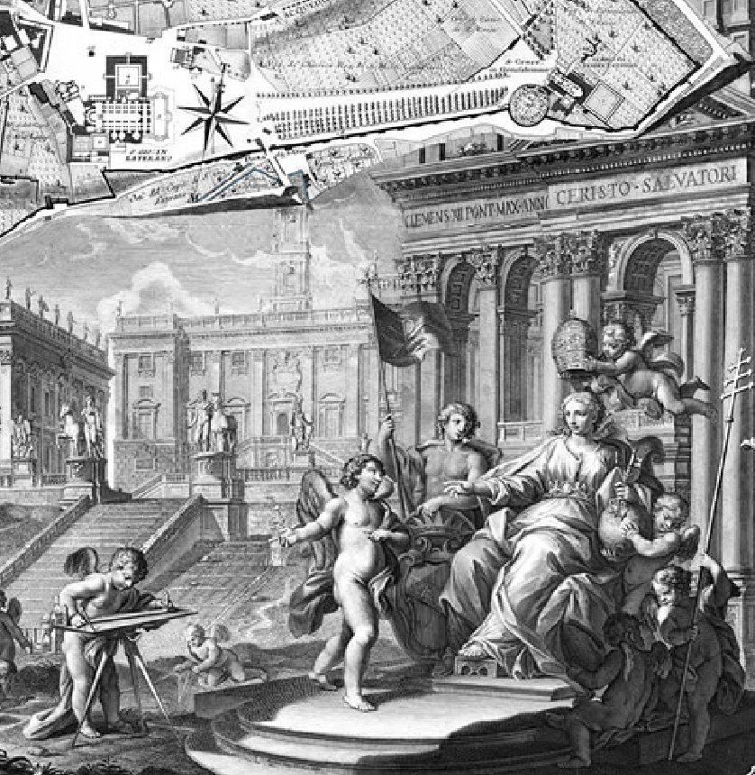
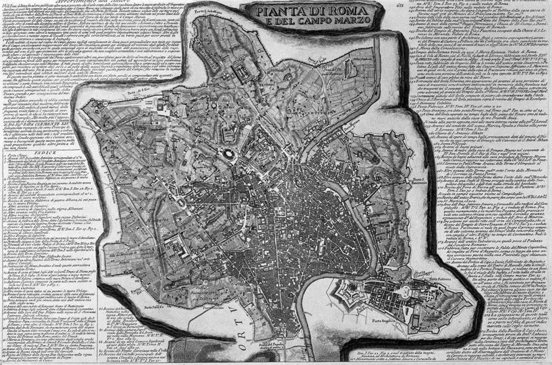
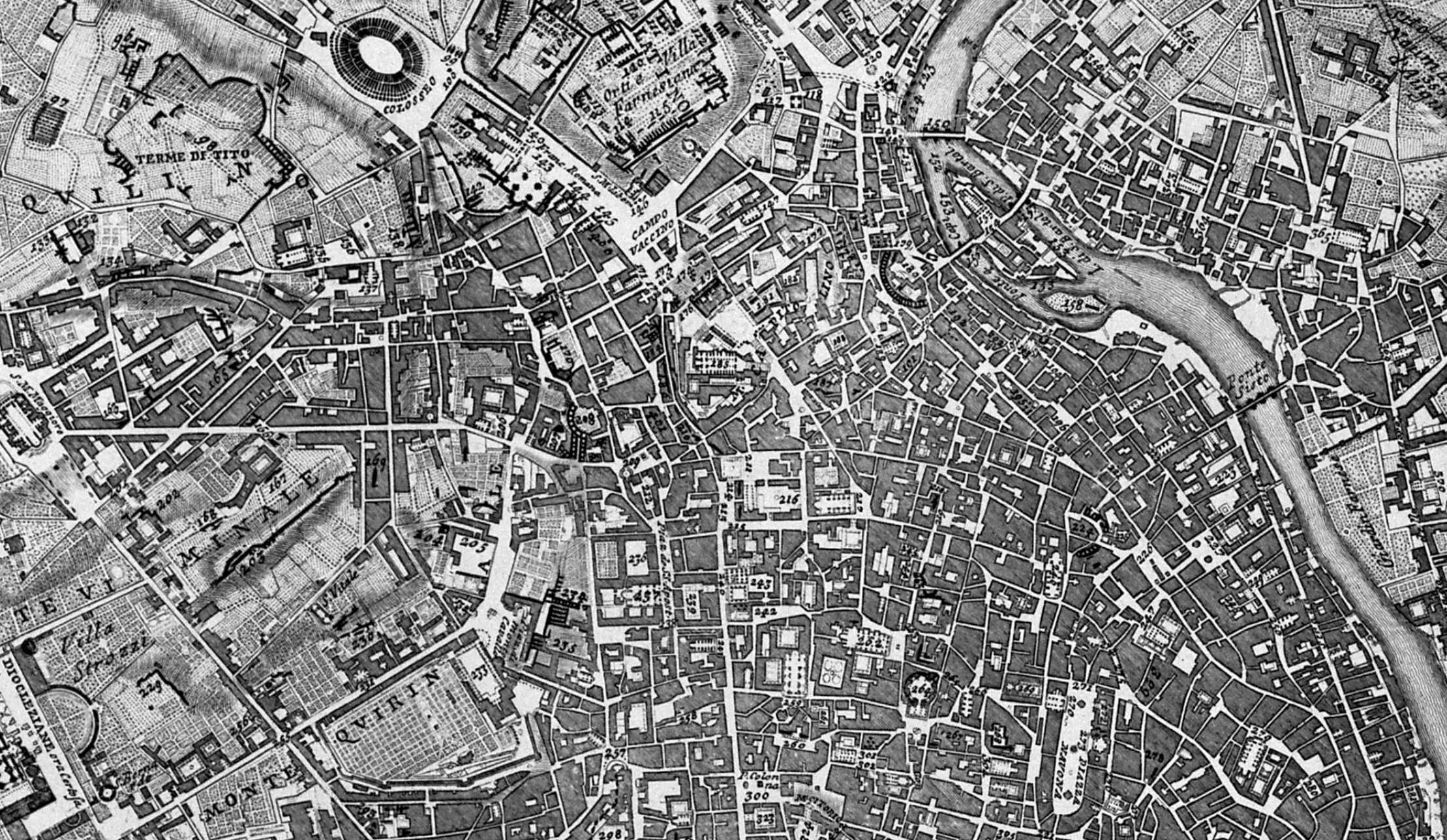
Commemorating the identity of Rome was on the table front and center in the triumphant untangling of the past, evident in the elegantly unfurled scroll at the base of the 1748 iconographic Pianta Grande of the Nolli Map of Rome, created over a decade by surveyor and architect by means of a surveying table of his own device, celebrating not only the spatial structure of the city but the new character of the city reborn by sustained projects of papal construction: the city’s plant is bounded by a qualitative view of the architectural projects of the pontiffs in its lower right, paired with the ancient ruins in the lower left, as if to embed its complex urban fabric building projects of recent popes–elevating what James Tice called the “dialectical relationship between buildings and their context[s]“to allow individual buildings to be read in a coherent urban plan, portray Rome’s “genius loci” as resting in the presence of papal building projects among the city’s monuments. For the deciphering of place that the map invites us to engage in by paying such close detail to its physical structures and topography–now facilitated by the web-based version of the historical eighteenth-century Nolli Map–commands attention as an unpacking of these physical layers and relations even from afar.

As much as struggling to synthesize an abundance of local information of its Rome’s built structure, the map seems a gambit to create spatial continuity and uniformity in a region whose multiple temporal levels and layers the architect has synthesized in one vision for Benedict XIV, celebrating architectural projects that gave urban identity to the city from the square of the Capitoline or Campidoglio, long a seat of civic government but famously designed by Michelangelo at by the Renaissance Pope Paul III, to the buildings far more recently commissioned by Clement XII to Benedict XIV.
As much as survey the Nolli map’s contents, the online Nolli Map allows us to unpack the extent of the new urban structure that the map celebrates, integrating its ancient and modern structure in a new coherent way: the surveyor Nolli’s iconographic map, based on surveys of the city streets over more than a decade, used an innovative portable tool of surveying, as David Freidman has argued, provided a map that offered viewers to experience walking pathways of its individual streets, past churches, classical monuments as the Pantheon [Pantheon], palazzi, piazze, ancient ruins, alley ways and expanded thoroughfares that preserved the exact sizes of each of its streets, ancient buildings, and churches, each enumerated to allow a legibility that affirmed a united fabric of a city across historical ages in an urban form through which views could walk. The united organic whole whose architecture synoptically described in detailed fashion did considerable cognitive work in how it afforded a clear relation to the built fabric of the city and embodied the Rome of Benedict XIV–the Second Rome, or Catholic Rome, which it situated as a new historical identity of the city.

The achievement of Englightement cartography provides a striking celebration of the architectural creation of ancient and modern Rome, as well as of its own artifice. This post takes the manner that Nolli’s Pianta Grande or Nuova Pianta di Roma—which continued to be reprinted through the nineteenth century given its beauty and unsurpassed accuracy–celebrated the achievement of architectural order eclipsing ancient Rome in its splendor and elegance, as an attempt to wrestle with the ancient past that so often seen as a standard against which to measure its present space, and which returned, in the nineteenth century, as a model of how the accumulated past haunted the present. How the commemoration of individual buildings of the past and their integration in a material landscape haunted mappings of Rome is the subject that this post attempts to survey–as the pleasures with which maps produced the visual integration of separate time-frames.
The nagging sense of the past’s haunting of the present allowed maps of Rome, this post argues, to provide an important materialization of the continuity of the past by which Sigmund Freud would find confirmation that affirmed his sense of the role of cultural production as a basis to deny death–crucial in his formulation of the pleasure principle–as the charting of its construction was a figure for that denial as it was the paradigmatic illustration of ancient culture; the revelation of layers of Rome’s historical monuments in the subsequent maps of Rome that illustrate its archeological reconstruction–in a manner quite different from how Nolli effectively celebrated the construction of contemporary Rome within the Aurelian walls as confirmation of papal Rome’s reclaiming of Rome’s ancient grandeur in the Pianta Grande of 1748. Unlike Nolli, Freud had a privileged relation to the ancient sites of Rome, which he “contemplated” in 1901 as a communion with the fragments of the ancient city in which he lost himself, not possible for the “Second Rome” of the Papacy or entirely for the modern Third Rome–perhaps because it jointly embodied in their condensation of a violent destruction of the ancient city even while providing testimony of its survival, albeit in ruined form, as an aesthetic unity as an embodiment, albeit fragmented, of western culture.
16. Despite serious attention to the ambivalent dynamic that Freud famously felt to Rome–a site of desire, but also of anxiety, if one where he felt in contact with genius loci even from afar and during his approach–the role of maps has been underestimated vastly in constructing a deeply personal relation to place. The cartographical invasions to scrutinize the different layers of the city and to engage in an imaginary excavation of the relations between the structures of its past provided not only an elegant aesthetic metaphor of a relation to personal human memory for Freud in Civilization and its Discontents (1900), but provided a basis to develop so intense a personal relation to the city’s urban space. To look at the 1748 Pianta Grande of Nolli is in a sense to participate in a tradition of invitations to excavate the relation between its material layers, and to try to conceive of the coherent of Rome’s interlocking layers and Rioni as a spatial unity. Five years after H.G. Wells penned The Time Machine (1895), Rome offered the paradigmatic physical archive of the past, whose ruins were in the process of being catalogued, as they always are. The city, even more than Vienna, provided a unique site that allowed cultured visitors to experience the coexistence of multiple pasts.
The densely detailed urban topography that Giambattista Nolli created from sustained multiyear surveys preserved the clearest evidence of the buildings in the city’s historical center that provided, until the late nineteenth century. Organized on magnetic north, the Grande Pianta offered the most accurate rendering of its dense habitation and architectural wealth, blending the detail of ancient monuments, giving prominence to its modern buildings to reconcile the presence of remains of the ancient ruins and pagan past. The map that Nolli crafted for the enlightened pontiff Benedict XIV showed the city presided over by the triumphant church, resolving tensions between layers of times embodied in the city by suggesting the pontiff’s leadership of the city, illustrated by the crowing of the personified Rome by airborne angles with the papal tiara, at the base of a map depicting architectural projects of Clement XII to Benedict XIV that redesigned its ancient urban form. The urban coherence Nolli’s sustained surveying of the city allowed provided a benchmark in mapping the continued coherence of the city’s long-inhabited space.
The difficulty of preserving coherence among the layers of Rome’s past across its pagan and Christian pasts perforce wrestled with the abundance of the city’s pasts as well as its physical settlement. Maps of all older cities suggest a resource of preserving memories that have been something of a topos of the excavation and persistence of the past. But the repeated mapping of Rome suggest a struggle of embodying its pasts and making them present through a selective record, unique in the semantics of most maps of urban space. The excavation of the map as a space–and how maps not only orient to spatial disposition but how their material production offer a basis for investigating built space, the emphasis on engaging the architectural construction of Rome’s ancient, medieval and modern space is compelling as a subject that has been repeatedly raised in maps, if only to sort out their relation for their readers. For the city map serves as such a compelling way to embody the “dead” space of ancient Rome, and serve as compelling forms to visually return to the ancient world by embodying it anew.
Any map of Rome wrestle with the problem of the preservation and accommodation of the presence of historical past and wrestles with its attention to ancient precedents to make its mapping a particularly compelling exercise: and it seems likely for this reason that Sigmund Freud was quick to imagine, in a famous passage of Civilization and its Discontents, which took the city as a model of human memory as well as civilization. In the short book, Freud imagined the imagined hologram that allowed the contemporary existence of layers of the ancient republican, imperial, medieval, and Renaissance Rome with the modern nineteenth-century city as a model for the individual’s mental landscape, which revealed its own aspect at different ages and times as if they were contemporaneous. Freud’s conceit is in a sense a model of the vision of the psychoanalyst as master-archeologist, to be sure. Freud was an avid antiquarian, who owned Otto Richter’s Topographie der Stadt Rom, an archeological treatise, based on Lanciani’s pioneering work of antiquities, and would have taken Rome as epitomizing the project of exhuming the coherent whole of the past, much as the images orienting one to Rome’s archeological ruins promised. Freud was not only an avid antiquarian, but widely consulted such works before he even visited the city, as if in preparation for the long-planned trip he seemed to have sought to make to Rome, for which he prepared with considerable anticipation–they would have provided him with important symbolic tools to orient him to the city as a repository of the past, indeed, as well as to orient them to its physical space.
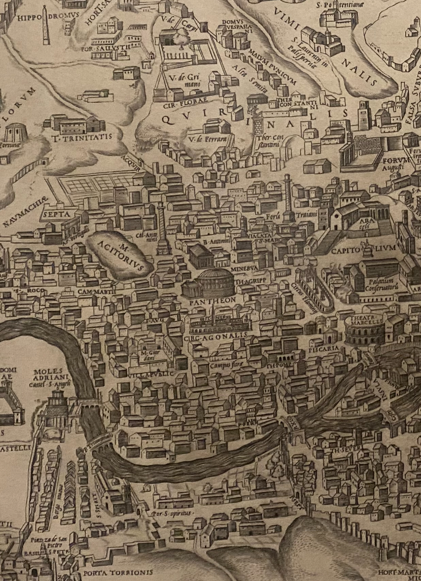
Maps of Rome provided a repertory to embody the city across historical ages, embodying different layers to be admired of its levels of built ancient, imperial, Christian, or Renaissance architecture, and the subterranean worlds of catacombs and crypts that lie beneath, all of which are selectively embodied in maps: indeed, if individual engravings often embodied isolated ancient monuments of the city, the map provided a dream to embody its coherent structure before viewers’ eyes, in ways that made the mapping of Rome, in particular, so compelling as a material figuration of human memory and mental life, despite its destruction by fires, invasions, and time. Indeed, anyone who is perusing the maps of Rome wrestles with a problem of qualitative chronological and cartographical abundance, in the sense of deciding what aspects of Rome to incorporate and embody in a map–and wrestles with the problem of embodying a city that existed across several periods, and as it exists in each one. At one extreme, Antonio Bosio’s monumental Roma sotterranea [“Underground Rome”], engraved after his 1632 death, mapped the discovery of a wealth of evidence of early Christianity in its catacombs. While selective in its attention, Boise’s work prominently included a synthetic map of ancient monuments in the city, locating isolated monuments among the city’s hills by situating recognizable naturalistic views of the isolated images of the Colosseum, Vatican, Castel Sant’Angelo, pyramid, Circuses in its timeless, pastoral landscape as if to wrestle with a similar question of selectivity and local abundance once again.

The map “works” by gathering ancient monuments for viewers to admire, based on the 1561 multi-plate engraved map designed by the antiquarian Pirro Ligorio as the first naturalistic visual excavations of ancient Rome–but shows the monuments removed from its actual urban plan. One might go much further: for the map removes Rome’s monuments from the actual floods that the city had endured in 1557 and throughout the sixteenth century, and reveals the continued survival of its eternal elements as enduring in the city’s space, as if perpetually in this first mapping of the city’s palimpsestic order. The mapping of these multiple orders in maps encouraged the delicious metaphorical treatment of the city’s built space as enduring mental furniture.
 Antonio Bosio, Roma Sotterranea (1650)
The end-point of the ongoing excavation of Rome has not been reached by any means. But the graphic re-animation of its recovered ruins, and indeed their embodiment in maps, suggest a long-term project of recovered memory–as, indeed, the observation of its pasts and the organic order of its monuments, mapped in a number of imagined maps that synthesize the apparently chaotic order of its pagan and Christian pasts, became a subject of individual formation, and an undeniable attraction to that most visually attuned of nineteenth-century men, Sigmund Freud, who not only regularly visited the ancient city that he saw as a sort of counterpart to Vienna, but approached the city through its maps–which he must have projected onto his experience of the ancient city. Although mostly hidden in the authority with which he evokes the mental map of the city’s successive ages as a model for memory formation in Civilization and its Discontents, maps such as those of Droysen offered something like a material manifestation of time travel that could be concretized in a recognizable visual form. Freud’s intense personal tie to Rome–and the transport that he felt upon encountering its ancient ruins–encouraged him to wander in its Forum, among its temples and public squares. And much as Freud proposed to understand consciousness as “the subjective side of the physical processes of the neuronic system,” whose storage of the past could be recovered, the coexistence of ruins in Rome represented a truly tangible archive of the continued life of subjective traces of the past–and a model which his readers might be able to readily experience and access.
17. The spatial situation of the Capitoline hill has long offered a privileged point to view the ancient Forum–site of public life and worship, and the clearest surviving manifestation of ancient architecture to be excavated that could be readily surveyed–that is often the basis from which to visually map its coherence. For Gibbon, standing on the Capitoline provided the inspiration for his vision of the totality of Roman history, which he described as the setting for an epiphany of historical narrative, as well as self-realization as a historian, by the sense of coherence it offered on the ruins of the ancient city. The imagined position of coherence had long created a market of maps to orient viewers to the coherence of Rome for one’s eye, that was able to be held in one’s mind’s eye, not only to navigate but to distinguish between the laminated layers of its pre- and post-Augustan construction. The mapping of Rome encapsulate a history of the cultural arguments of maps, and indeed of the culture of mapping a city’s past. The problem was in part of crafting a selective but coherent record of such cartographic abundance, inescapably a theme in the mapping of Rome, a problem of materializing the past that would have made its maps–as well as its material presence–an object of continued fascination to Freud.
Maps of Rome challenge the viewer to assemble the abundance of Rome’s material ruins, monuments, and hybrid constellations of ancient, medieval and modern buildings, at the same time as to orient oneself to the chronological cornucopia of its built space, in ways whose experience sometimes seems to defy coherent systematization as a network, if not to inspire surrender to the eternal unpacking of the texture of its individual detail. Indeed, the compulsion to map the past in Rome, and discern the survival of levels of its past, have defined a strain of recuperating the persistence of the past in maps, unpacking its spatial continuities and chronological discontinuities in a harmonious image whose measured surface can be easily scanned. Most frequently, such maps begin from the Forum–a central square, imagined as the stage for conducting public politics: the fascist government used the image of the Forum as a means to perpetuate its imperial heritage–Mussolini’s government renamed the street alongside the fora a “Street of Empire” Fora” [Via dei fori imperiali] and used it a site for the staging of public government spectacle to consolidate an imagined genealogy that the Fascist government sought to cultivate, and indeed to remap the symbolic capital of the forum to create a new image for the nation.
Maps of Rome since the Renaissance presented as providing a clarifying palmipsestic orientation to the past and to the deep history of built space, predating the notion of an Italian state. Indeed, maps were particularly valuable for those aspiring to disentangle the temporal phantasmagoria of architectural layers of the ancient city’s arena, fora, temples, and monuments against its modern neighborhoods. For many the buildings in the early modern and contemporary maps of Rome lie at a great chronological remove in their excavation of a densely settled space. Even as quantitative records, their qualitative associations as an ordered image orient viewers to persisting monumental structures of the ancient city that made them evocative objects of attention and study–and indeed the observation of its organic structure as a subject of study and individual cultural formation, or bildung, in ways that increased the currency of the metaphorical treatment of maps of buildings of different ages in Rome to convey an image of the contemporaneous existence of different periods in an individual’s mental landscape–a concept crucial to Freud’s understanding of the archeological layering of human memory and the excavation of a coherent relation to the matter of the past.
In a work which Freud ostensibly dedicated to the persistence of impulses of aggression as an effect of society, Civilization and its Discontents, Sigmund Freud powerfully imagined the survival of individual memory through the metaphor of a historical reconstruction of multiple ages of Rome’s many ages and physical appearances as a sedimentation of maps from different era–strikingly akin to a virtual map or a holograph that depicted the contemporaneous reconstruction of its several ages, although this technology was not present in his time. It reveals a distinct puzzling over the coherence of the lack of historical coherence of his experience of Rome’s architecture from different ages, but a thought experiment or flight of fancy that surpassed the mapping technologies of his time. Freud imagined the problem of ordering the ruins of Rome in a cosynchronous map able to show the buildings of ages spanning the Etruscans to Republican Rome to the middle ages and Renaissance, at which one could detect the overlapping structures of different periods in what he felt was the most apt image of the preservation of memories across different periods of one’s life that coexisted in an individual mind–to be excavated, no doubt, by practiced psychoanalyst.
The image is particularly felicitous as it gives Freud a pleasurable occasion to wax on his antiquarian love of the city’s different structures and palaces, but to provide him with a strikingly new figure–which reads as if it was taken out his notebook or diary–of the . For the passage which condenses Freud’s understanding of memory is emblematic of a struggle with the superabundance of qualitative information in the city’s maps, and the sorting out of maps that he must have commonly consulted in his navigations of its ancient sections. Freud was long fascinated by the antiquity of the forum and the monuments of the ancient city, and famously imagined it as a locus for the embodiment of the totality of the past to communicate the wealth of the presence of the multiplicity of individual memories in the human mind from different ages as a sort of microcosm of Rome’s copious pasts. In an extended poetic revery probably written before 1914–but published in 1930, Freud fancied “remains of ancient Rome are found woven into the fabric of a great metropolis which has arisen in the last few centuries since the Renaissance” even as “much that is ancient still buried in the soil or under the modern buildings of the town.” The seeds for such Freud’s cartographical fantasy of recuperating the excavated ancient city may have arisen if not been inspired by Richter’s Topography of the City of Rome, which he read in his Vienna library, Mommsen’s History as well as Ludwig Lange’s Antiquities, which provided the seeds of his avid antiquarianism and no doubt his hunger for visiting the city.
For Rome offered Freud a welcome retreat from Vienna. The city broached the possibility of a communion that he did not feel at home, and yet the material maps that he saw of the city’s archeology and ancient plans would have mediated the sense that its presence was in the end not fully attainable save in contemplation of its ruins, and his sense of merger with its organization would remain forever incomplete: when he first arrived in the city, Freud famously remembered moments that seem particularly internal which he experience in Rome, that have a somewhat meditative quality of confronting the past that he had seen in maps, but in which he actively participated in their presence, as if in a bizarre sort of conversion experience: he described, famously, how “I contemplated ancient Rome undisturbed. . . . [and] I could have worshipped . . . the remnant of the Temple of Minerva.” If his sense of personal troubles dissipated at the rapture he felt in contact with its antique presence, he mourned the failure to develop a similar rapport with the buildings of other periods–particularly with Christian Rome–even when “liking” modern Rome. When observing the city from the railing on the deck of a passing ship over a decade later, in 1913, he desired its presence as “that still smokey and fiery hearth from which ancient cultures had spread,” where “classical antiquity existed in all its splendor and ruthlessness”–as if to evoke the lost vibrancy that persisted in its ruined structures.
The construction of Rome famously became for Freud an illustration of the role he asserted all culture played for humans of denying death. The uninhabited ruins of the ancient city provided a sort of cavernous monument that survived the death of its inhabitants, in ways that would have offered an illustration of cultural survival in the face of death that led him to describe as a persistent attraction during his life–if it was a desire that was repeatedly frustrated, as the philosopher Sebastiano Timpanaro has argued. Freud adopted Rome’s ruins as a basis to reflect on the destruction of World War I; he turned to Rome’s ruins less as a figure of the destruction by foreign invaders than as a figure to describe the preservation of past memories in the human mind. While he may have arrived at the felicitous image before the war, he evoked the possibility of a coexistence of structures of Rome as if they had never encountered destruction, fire, or invaders’ frequent attacks, which might be seen, as if in a holographic map, as a figure for the “mental life in which nothing which has once been formed can perish” and in which “everything is somehow preserved.” The overlapping structures of Rome offered a figure designed to orient one to the persistence of the past in the human mind. In this sense, it became an illustration of the creation of culture in the face of death which was particularly difficult to look at or confront–and which neurotic inhibition may have, indeed, frustrated repeatedly; the archeological maps that demonstrated the survival of the pasts of Rome with reference to its current physical plant which he owned, moreover, would have provided material confirmation of the cultural coexistence of its pasts.
Was it perhaps natural for him to turn to the figure of the preserved pasts in Rome in order to imagine the city’s uniquely palimpsestic order of its stratigraphic layers? Freud took the city’s structure as embodying a material allegory for the permanence of mental structures that was not offered otherwhere in the material world at a time when cities in Europe were increasingly redesigned with not traces of their former order: the city’s memory provided a model for individual memory, and the traces that survived in Rome oddly effective in his broader reflection on on the effects of civilization on the human instincts and the mind. The city was well-known to Freud, and not only from maps. Freud had often visited Rome, returning to its ancient spaces as sites of particular interest, may have been compelled by the interpenetration of several historical stages in Rome’s pasts preserved in maps–maps that he imagined as partial, if ultimately inadequate, models for the coexistence of what he called the “memory traces” that coexisted in the mind: for Freud, the visitor to Rome “equipped with the most complete historical and topographical knowledge,” might reconstruct parts of its ancient layers, and if equipped with a breadth of archeological information greater than exists, might discern not “the jumble of a great metropolis that has grown in the last few centuries after the Renaissance,” but whose copious and abundant past might be excavated to reveal “all earlier phases of development . . . alongside the current ones” by representing mental life in what he called “pictorial terms.” The coincidence that they are also cartographical does not seem happenstance. It cannot be failed to be noted that so many terms of Freud’s psychoanalytic parlance–transference (Übertragung); projection (Projektion); topographical models and theory (Topographie)— used to assert the science were also established bona fides of cartographical empiricism.
18. Freud saw this image of the survival of memory traces in the individual as fundamentally representational and pictorial. He invited readers to envision an imagined map of the city in cartographical terms: in which the “viewer would only have to change the direction of his glance or his position” to discern the past layers that coexisted that allowed in one space, and parse the temporal accumulation of past structures and their afterlife: he allowed that trauma may prevent the preservation of such layers in mental life, but invited and squint at its reality, as if maps of the excavation of urban space embodied problems of orienting oneself to memory’s accumulation: Freud imagined the conservation of memories as an phantasmagoric relation Rome as a fantasy map of historical reconstruction of the city he had regularly returned and studied in terms of how the past was indeed embodied in maps of the city’s excavation.
The metaphor of archeological excavation was so compelling that it is difficult to imagine save in reference to the archeological maps of the habitation of the ancient city, reminding us how all maps act as talismans of memory.

In Freud’s Rome, fragmented ruins were restored simultaneously to their past grandeur, and evidence of invasions and fires were obliterated: its sedimented structure was no longer “a human dwelling-place, but a mental entity with just as long and varied a past history: that is, in which nothing once constructed had perished, and all the earlier stages of development had survived alongside the late.” Freud’s cartographical flight of fancy was particularly compelling–urging us to imagine the ruins of its city as if they had never been visited by destruction or wars. In ways that suggest the creation of a virtual reality of a city that had long challenged viewers to process as a coherent whole, Freud invited his readers create a mental map of Rome by switching “the focus of his eyes . . . in order to call up a view” to comprehend multiple Romes simultaneously, as if to discern clarity of order in the coexistence of multiple chronological times at once.
The aim was to preserve a visual image of the conservation of the past in human memory, partly analogous to a map, but more of a hologram of the city’s parallel intersecting pasts in three dimensions: “This would mean that in [this heuristic image of] Rome, the palaces of the Caesars were still standing on the Palatine and the Septizonium of Septimus Severus was still towering to its old height; that the beautiful statues were still standing in the colonnade of the Castle of St. Angelo, as they were up to its siege by the Goths, and so on. But more still: where the Palazzo Caffarelli stands there would also be, without this being removed, the Temple of Jupiter Capitolinus, not merely in its latest form, moreover, as the Romans of the Caesars saw it, but also in its earliest shape, when it still wore an Etruscan design and was adorned with terra-cotta antifixae. Where the Coliseum stands now, we could at the same time admire Nero’s Golden House; on the Piazza of the Pantheon we should find out only the Pantheon of today . . . , but on the same site also Agrippa’s original edifice; indeed, the same ground would support the church of Santa Maria sopra Minerva and the old [pagan] temple over which it was built.”
But the archeology both uncovers–and obscures–more. For such an excavation of temples, echoing the temples of the Temple Mount in Jerusalem, is an archeology recognized by the cultivate man, but haunted by the rebuilding of the second temple over the ruins of the first, the Temple of Solomon, in a sort of holiest of holies that is removed from the spiritual realm. For Freud, Rome felicitously naturalized how spaces of memories exist in our heads, as in a stratigraphic map, as a theater of memory that formed part of a tradition of western culture. Freud seems to have regarded the figure of a map as a way to communicate and indeed heighten the serious cognitive work of mediating a past, and preserving a structure or a desired object in our minds, and a sense of the deep sacred value of uncovering the past, as a sort of ethics of archaeology that redoes the operations of biblical archeology in a secular scientific key. Did archeological maps of the city’s ancient ruins provide a useful figure which Freud used to imagine the temporal continuity of past memories within the individual’s mind? Or did the visual power of maps invited Freud to assemble visions of the coherence of Rome’s past in particular inspire him to turn to this complex if creative confusion of a historical reconstruction–it would not be seen by viewers, but by squinting, “equipped with the most complete historical and topographic knowledge” encoded in maps, they might discern the survival of “memory traces” in the city’s fabric, grasping the persistence and coexistence in the mind of pasts in a figure of infinite regression: “nothing once formed in the mind could ever perish, that everything survives in some way or other, and is capable under certain conditions of being brought to light again . . . when regression extends back far enough.”
The temporal remoteness of Rome’s past had been invested with presence and palpability as it was excavated from its ground in this oddly evocative passage–the ultimate act of historical recreation–and its neighborhoods or rioni retained its ancient plan at the turn of the twentieth century. Erasing the violence of the repeated destruction of Rome, the imagined effort of historical reconstruct was a restoration of unity and coherence, enabling the city to be invested with lost coherence. The frequent mapping of Rome attempted to affirm its coherence, to be sure, but Freud when one step further, hoping to mediate the palpability of the ruins of the ancient city that surrounded one without orientation, enabling it to be suddenly viewed as a coherent surface one could touch in particularly inviting if elusive ways, embodying the lost past as well as negotiating relations between the modern lived space of Rome and its ancient past.
No doubt, the repeated mapping of Rome’s past provided a model to negotiate present and past of such formal proportions that the sedimentation of past layers in Rome’s physical plant afforded Freud with a particularly apt figure to imagine the mental ordering of the personal past in the individual mind, if not a model for how heterogeneous “memory traces” can endure within the human mind. What “historians tell us” about the Rome offered the necessary synthesis of credible testimonies of its expansion from the Palatine Hill to the seven hills, later to the region enclosed by the Servian wall, and finally to fill the Aurelian walls, as if the city’s stratigraphic layering of pasts was collapsed but transparent, and “traces of these early stages” that “a visitor to Rome may still find today,” miraculously entire, within the spatial organization of the city’s modern form.
19. In this context, one might reconsider the recent remapping of the spatial networks that Rome created try to embody the coherence of past periods, sacrificing or moving beyond the complicated visual relation to the lived past that seems to have entranced Freud as an image–and which was returned to in earlier maps’ qualitative richness. The evocation of such mapping this past, so compellingly conjured as an imaginary act of historical reconstruction by Freud, is perhaps a lost exercise in imaginary map-making that reflected the culmination of a tradition of engraved maps–but his reflections offer an interesting point to observe the and reevaluate the attitudes of viewers before the recent GIS-based maps of the city and empire, and Roman world.
Indeed, Freud’s reflections compel us to consider the material relation maps can create, and the animation of the ancient world they create. There is particular compulsion in animating the Roman Empire’s imprint by network-mapping offered in web maps of Rome. Rather than only contrast their use of datasets to the rich qualitative forms of local mapping, I can’t help but be struck by their similarity as recreations of the past, and the similar effort of recuperating the past in dynamic maps, albeit in new cartographical formats.
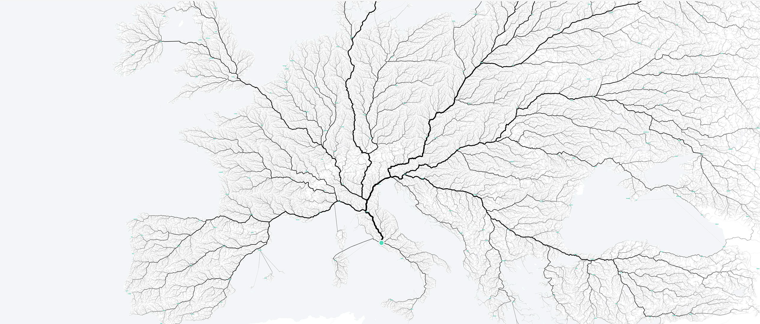
The contemporary spatial turn recently led moovel lab to create Roads to Rome to replot a data distribution of routes through the former empire that led to Rome, rather than that topography. By routing a million investing an almost organic unity in the network of ancient life, the web map runs against the grain of the intensive historical mapping of Rome’s built and repeatedly rebuilt place–locating a million routes arriving at Rome from a large area approximating the ancient Empire, shaded by traffic intensity or road use that gave it an almost organic coherence as a brachiation from Rome, as if the infrastructure of the ancient world might be transposed to images that recall the server of Google Maps.
moovel lab/FlowingData
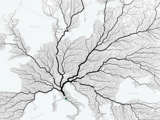
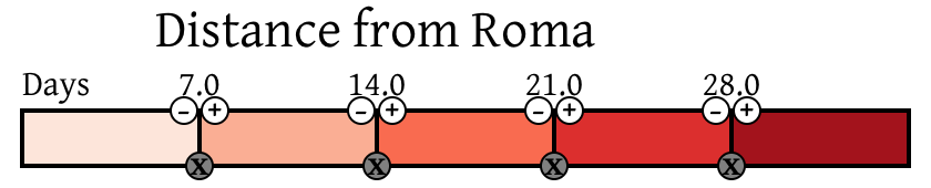
Reflecting less the ancient roads of the Romans, than the network of the half a million routes to reach Rome in the continent, the interactive visualization is a sleek piece of data art, less historical in scope than the communication network traced by the ORBIS project which maps ancient routes across three continents, comprehending the Empire as a network, travel between whose cities can be mapped in days of transport and cost, and visualized by the fastest routes of travel. The data distribution extracted from ancient records in ORBIS recreate the network of military government and administration and economic exchange, orienting users to the constraints and supports of established networks of travel along imperial routes, viewed as a georectified cartogram, coloring place locations by days of travel to better comprehend its multiple overlapping ancient spatiality’s of its own–to which one’s attention is drawn by a somewhat jarring inclusion of ancient toponymy oddly dissonant with a familiar modern interactive mapping format.

Although the data distribution is removed from a material mapping of the ancient city, it maps, in keeping with modern networks, cost of communication by time and expense–sacrificing the materiality of the map, perhaps, creating a GIS visualization of the organization of space but digitizing historical detail in a map that can be queried for movement of transportation, commerce, and military travel to analyze the empire as a whole and familiarize oneself with dynamic stories about past space across its expanse, and envision the empire by its networks of travel and transport as webs that exist independently from individual cities, as from Rome to the outer reaches of the Empire, to suggest the main routes of settlement:
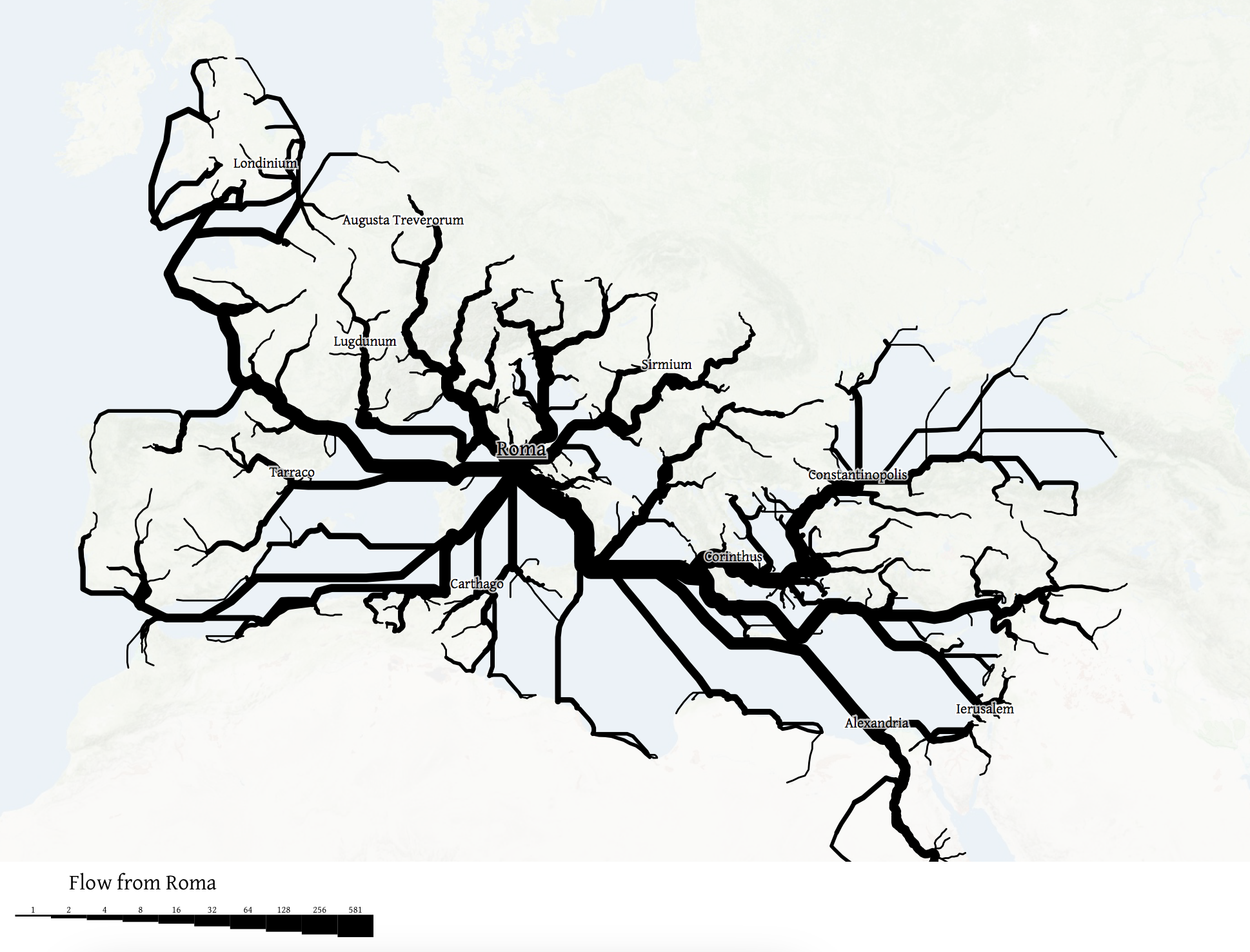
Rather than see the envisioning of networks as quantitative records distinct from the qualitative images conjuring an ancient place, both data maps provide contemporary counterparts to the maps of Rome’s built space, enabling one to capture the empire’s expanse as much as its built capital across the 50,000 miles of crisscrossing highways and routes that spanned the ancient Empire, from the edge of the Danube to Turkey to modern Britain from the imperial capital. If the folks into urban designing at moved lab used the conceit to create algorithms to visualize routes to Rome from a modern map of the continent, emphasizing the use of roads through the thickness of their lines, they also play off of the manner that local maps of Rome long provided something of a surrogate and metaphor for public space–on a far larger canvas of the visualization of space. The mapping of pathways and networks of exchange and travel shift attention from the limits of locality, excavating a historical or cartographically sedimented notion of space.
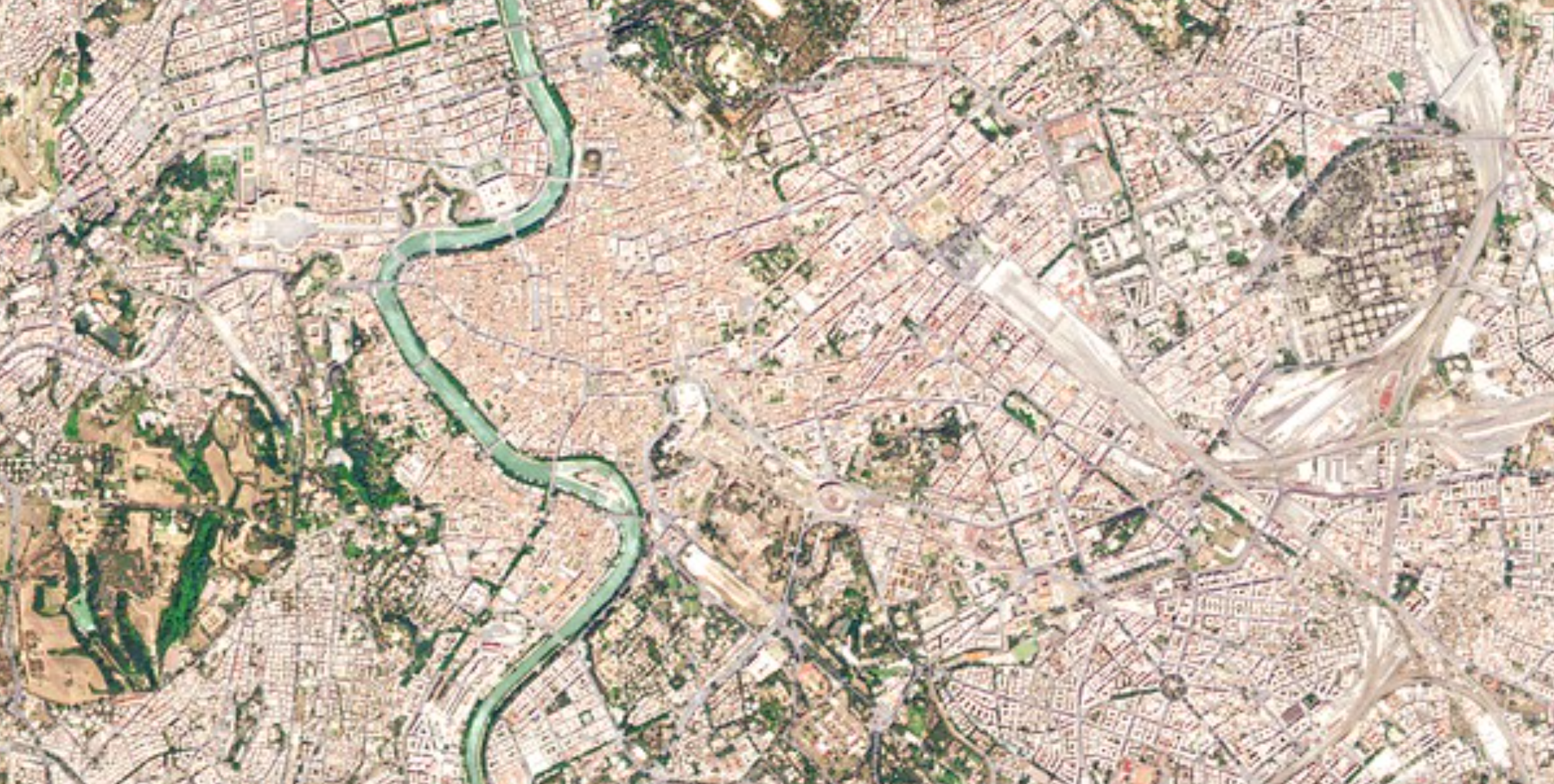
The roads of the physical plant of Rome are able to be imagined, if without much indication of their lived experience, in a satellite mosaic of the city which is so oddly removed from its inhabitants, if stunning in the purity of its cloudless coverage.
Might one imagine a happy medium?
The novelist John Edward Williams, ventriloquized the imagined testimony of the visitor to Rome Strabo of Amasia in his 1972 Augustus, addressing Nicolaus of Damascus in Alexandria to orient him to the city, which seems to have particular resonance for the ORBIS project in how he took the city as a means to describe the journey and the letter as a means to bridge the geographical distance travelled in the ancient world. Strabo raises questions about attitudes to space in the ancient world, sending “greetings from Rome, where I arrived only last week, after a long and most wearying journey,–from Alexandria, by way of Corinth; by sail and by oar; by cart, wagon, and horseback; and sometimes even by foot, staggering beneath the weight of my books.” To orient his correspondent to the city, Strabo admits that when “One looks at maps, and does not truly apprehend the extent and variety of the world. It is a new sort of education, the gaining of which does not require a master . . .” The future biographer of Augustus from Alexandria invites Nicolaus, his correspondent, in pressing tones, to visualize the city–“Imagine, if you will, a city which occupies perhaps half the area of that Alexandria, where we studied as boys,–and then think of that city containing within its precincts more than twice the number that crowded Alexandria. That is the Rome I live in now–a city of nearly a million people, I have been told.”
The following meditation reflects attempts to materialize its lost world in a striking first-person narrative of spatial acclimatization to its uniquely busy space that seems almost akin to offering the viewer an actual microcosm of the ancient world: “And how they crowd themselves together, these Romans. Beyond the walls of the city lie some of the most beautiful countryside that you can imagine; yet these people huddle together here like fish trapped in a net and struggle through narrow, winding little streets that run senselessly, mile after mile, through the endless city.” “And yet at the center of this chaos, this city, there is, as if it were another world, the great Forum. It is like the fora that we have seen in the provincial cities, but much grander–great columns of marble support the official buildings; there are dozens of temples to the borrowed Roman gods; and many smaller buildings that house the various offices of urban government.” Williams barely describes the monumental space that is familiar to one’s mind’s eye, but portrays the human geography of the ancient monumental space of the forum from the perspective of its visitor, recalling the prominent place the Forum has long held in its spatial imaginary.
20. The above web maps do serious cognitive work in offering a new sense of the spatial network of Rome’s past, expanding far beyond the search for organic unity that Freud might have found within the learned maps of Richter, Platner, Mommsen, and Tuebner, or in his own Baedeker. The worlds that these city maps of Rome created for viewers, and served as forms of address built into any mapping of Rome as a place is this post’s subject.
Cartographers who mapped Rome long adopted particularly innovative ways of re-embodying of the ancient city’s past for multiple scholarly and popular audiences who looked to see the ancient city, making it more material than its ruins offered, that the recent remapping of the networks of the ancient world and its routes of travel and senses of space build upon. Rather than map the achievement and stresses of the Empire, such urban maps provided a unique focal points, if not symbolic touchstones, only orient one to space, but provide and embody records of the habitation of lived space, embodying Rome’s made space, using maps to create the reality of Rome’s space that appeared so tantalizingly close in how they overlap. Is there a way to unpack the materiality of the map-and specifically its engraved materiality–as a way to capture the sensation of entering the layered levels of past chronology within the city of Rome?
Mappings of modern mega-regions express patterns of work and movement, as much as physical constructions. Yet as urban space rapidly changed during the late nineteenth century, expanding to accommodate new populations, the growth of the city organized by familiar rhythms increased the attraction of the built unity ascribed to ancient Rome–the city acquired status as a touchstone of the historical past, as well as recognizable forms of an architectural canon–in ways unlike viewing of its ancient ruins in the Grand Tour, as its construction and architecture took on a second life in maps this post takes as it subject.

If painters embodied Rome’s ancient ruins as a visual pastiche of recognizable forms gained popularity in pictorially virtuosic capricci as imagined spaces whose idealized forms are set within the fantastic space of a mythical architectural museum–

Pannini, “Architectural Capriccio with Figure among Roman Ruins,” circa 1630
–whereas most nineteenth-century archeological maps expressed the uncovering of the coherence of its stratigraphic layers to embody a spatially coherent relation to the ancient past, endowing it with a new coherence. The image of the forma urbis of the ancient city of Rome within its Aurelian walls–which survived in an engraved marble map carved in antiquity, and known in its multiple fragments as the early Severan plan–provided a sense of the organic unity of the older city. The space of the forum became evident in the monumentality of the ruins of arches and temples recovered in the Roman forum, whose monuments became a point of historical reflection and of the Grand Tour. Its spatial organization provided a topos of the remembrance of the past occupation of space, as well rendering the material recovery of its remote past. Rome has gained many incarnations in the various maps of the ancient and modern city, often at a remove from its lived space.
For if architectural accomplishments in Rome are regularly foregrounded from several periods in maps, any mapping of the city involves some degree of excavation of ancient, imperial and baroque constructions that viewers are challenged to unify: maps provided a compilation of the discovered traces of antiquity, and a distillation of the superfluity of signs of the disappeared people of an ancient space that invited if also frustrated acts of remembering by reinforcing temporal remove. The remapping of the ancient forma urbis Romae revisited in engraved maps of rebuilt Rome not only across the Renaissance and Reformation, or the periods of the baroque and Enlightenment, but indeed to twentieth century fascist Rome, and can result in compelling spatial fantasies.
For any encounter with the built city, even if not on paper, invites concerned attempts of remapping that attest to the continued habitation of the city as well as to uncover the form of the city able to be exhumed city whose life continues, if submerged, beneath its built structures–and to process its entirety through traces of past ages. As much as providing a recuperation of the lost ancient plan the frustrating proximity and remove of ancient Rome invites cognitive mapping and remapping–as in this late eighteenth century plans of Rome and images of its monuments that sold in a brisk trade by the architect and engraver Giovanni Battista Piranesi. Piranesi mapped the overlapping monuments of Rome as an imagined archeology that fed a new popularity of antiquarianism, casting Rome as the theater of monuments of truly sublime detail. His engraved plan of ancient Rome presented the fragmentary map on a marble tablet of irregularly shaped fragments as a surface he could translate and transcribe, the ancient buildings ringed, mutatis mutandi, within theAurelian walls–the older, fourth century BC Severan walls largely shaded a darker grey, elevating the craft of city mapping as a true sublime, in 1774. The fragmentary map was the culmination of a career of designing sublime views of the city’s ruins that he crafted far away from his native Venice–having fled the city of Venice to create his own own sublime archeological imaginaries as in Venice, he confided to his sister, he was unable to find “a theater capable of giving pasturage to the sublimity of my ideas”–if not a visual subject matter capable to inspiring archeological imaginaries to excavate similarly fantastic pasts, that Freud was something of a connoisseur, and one of which, of a truly fantastic overlapping of modern and ancient, both prompted and was appropriated as the subject of one of his favorite dreams.
 Pianta di Roma of Giovanni Battista Piranesi, circa 1774 (courtesy of the Getty Institute)
If Rome provided a sort of muse for the architect, Heavily annotated, and keyed by numerical references, as well as differently shaded regions, the conversion of the city to a text stands at the culmination of a tradition of its mapping and remapping. And Sigmund Freud famously found the ruins of Rome a powerful figure to unpack the coalescence of preserved memories, simultaneously held in one space–but are rarely tied to the scrutiny of structures exposed to diachronic analysis. Such maps attentively parse the overlapping of ancient and modern built space, informing the view of Rome that is the focus of one of his dreams that placed him unable to move before the same landscape, now transposed and re-imagined as seen from the window of a train showing what is known as the Castel Sant’Angelo and Ponte Sant’Angelo, but was engraved for the first time c. 1756 as the Ponte d’Elio Adriano, in Le Antichità Romane, a corpus of four volumes of dramatic archeological views of Roman architecture. Dislodged from that context of four volumes, the engraving that juxtaposed the ancient marble bridge across the Tiber and the tomb of the Roman Emperor, since widely reprinted in the late nineteenth century, seen by Freud in the sitting room of a patient of Vienna’s Bildungsbürgertum.
The layering of time is in a sense the inviting subject of an imaginary archeology in Piranesi’s print. The architect all but invited us to detect this layering, in the language Freud would use in Discontents, to pair the classical bridge, since converted by Bernini’s statues to a walkway flanked by stations of the cross, and the ancient mausoleum now the backdrop for the fishing boats on the Tiber today, the dome designed by Michelangelo looming in the background, as a reminder of the other era of architectural design. The focal points in Veduta del Ponte e Castello Sant-Angelo of the Vatican dome and burial of St. Peter, beside the mausoleum of the Roman invader of Jerusalem, may suggest a site of death; but Freud described the ‘well-known engraving” he transposed as if from the window of a train he was unable to leave, or to enter as a puzzle–the view existed only as a print, as the Vatican was removed from routes of an actual train; the Vatican palace and burial of St. Peter and mausoleum of the Roman invader of Jersusalem is read by critics in a rather Freudian lens less as a design, however, than a site of death or longing for sexual conquest. For Jeffery Moussaieff Masson, the image is linked to Freud’s “hero worship of the Semitic Hannibal” whose troops laid Rome waste; Daniel Boyarin sees Rome as incarnating Freud’s desire for possession and conquest of the gentile. Yet Piranesi’s sublime suggests a new spatiality of overlapping pasts and presents, both revealed to the eye and hidden; it captures Freud’s fascination with the visual puzzling of Rome mirrored how he admitted to be “not sufficiently collected . . . to anything in addition, other than possibly studying the topography of ancient Rome,” as if contemplating Rome’s ruins posed a tempting possibility to untangle a coherent meaning from a sublime picture of a city from which all civilization flowed, and of which he became the willing spectator.

Piranesi, Veduta del Ponte e Castello Sant’Angelo (ca 1745)
The Piranesi map suggests a new monumentality of space, and maps, both reconstructing signs of the ancient city, keyed in the legend, and creating a new marmoreal map designed to endure. Indeed, unlike the fragmented monumental map of the marble Severan plan, known only by fragments from the late sixteenth century–now known by 1,186 surviving fragments available online, any map of Rome was an imaginative effort and historical act designed to recast its coherence for the spectator in new monumental form. He certainly set a new standard for the archeological sublime as able to be assembled for the viewer’s entertainment, in a composite form that might be surveyed to overcome the fragmented nature of its archeological remnants and remains, in an image of fantastic assembly and reassembly that provided a new medium of visual entertainment if not a new historical sublime. If Freud had found his own obsession with Rome a “deeply neurotic” might be a longing for possession or death, the dreamed scene from the window of a railway car as a “promised land from afar,” as if seized in the print by the aesthetic longing of a sublime, perhaps fundamentally foreign and dangerous to a Jew, but also undeniably atttractive. Freud placed himself in repeated dreams in Rome, a city he had never visited, as if all psychic roads will lead him back to it, and to ancient Rome’s conquest of Jerusalem. In the sublime engraving Piranesi sold as an image of Rome’s architecture gained mass consumption in the late nineteenth century, Freud disdained the common nature of Piranesi’s widely reprinted view, but was awed by the “copious past” it held, to taken them as a token of what dreams opened in consciousness.
The focus in this one image on the tomb was not only as a site of death: is it only a coincidence that the art of interpreting dreams was first codified in the principal work of Artemidorus of Daldis, as Freud reminded readers in his Introductory Lectures on Psychoanalysis first delivered in 1916-17, whose own Oneirokritikon set for the precepts of an art that he claimed not to fully understand why it ever declined? Artemidorus’ very title–On the Interpretation of Dreams–was rather silently adopted without acknowledgement by Freud in his own catalogue of the meaning of dreams, which included the dream he recounted of the view from a window of a train in his dream as a “fulfillment of a wish” to arrive in Rome. The image was a desire not only for the cultivation he wanted to aspire–and to which Löwy was part–if it is estimated that at least a third (fifteen of the forty-six) of the personal dreams Freud described in The Interpretation of Dreams are set in Italy, the adoption of Piranesi’s 1745 view offered a model for the archeological analysis (archaeo-analysis?) of dreams, if Freud doubts the critical value of retaining the analogy the eternal city as a model for consciousness. But the sublime nature of the map offers a compelling figure for describing the science of psychoanalysis as a voyage and an adventure.
21. The disentangling of such structures were especially evident in the contemplation of a map. And it seems no coincidence that that great consumer of city maps from Vienna, Sigmund Freud, found the ruins of Rome a powerful figure to unpack the coalescence of preserved memories, simultaneously held in an individual mind. Freud’s metaphor for the structuring of memory as the coexistence of multiple strata of archeological time seems less a poetic fancy than a metaphor rooted in studying maps that revealed multiple strata of archeological time and lived experience, or structures exposed to diachronic analysis in maps. Can one perform a similar disappearing trick of conjuring the materiality of Rome’s past, and then moving to the individual mind, convinced of one’s ability to endow the patient’s past with a similar sense of personal monuments? Or is this dependent on the elevation of the perspective of the patient as a sort of monument, a bourgeois self-investment of the mind as a cultural creation worth the care and devotion of a Schleimann or Freud to render coherent again?
Maps showing the overlapping between ancient Rome’s built space across different periods–plans that occasionally made symbolic reference to Rome’s contemporary design, but emphasized the coherence of the ancient city’s architecture across time. Such maps of Rome’s ancient physical plant inspired the skillful negotiation both of historical ages and offered comparison between lived space and mapped space; Rome, which seems the model of the civilization of space and the lost center to which not only all roads once seemed to lead–but where built space in a sense began–seemed a model whose built form held compelling visual interest, and indeed whose discrimination required a practiced or trained eye to unpack its qualitatively complex spatial organization.
Freud appreciated archeology as a figure of the human sciences of the overlapping of ancient and modern built space. Yet the negotiation both of historical ages and between lived space and mapped space, was particularly poignant in the case of Rome, which seems the model of the civilization of space and the lost center to which not only all roads once seemed to lead–but where built space in a sense began–but whose physical form could be mapped in qualitatively complex terms as a site of compelling visual interest. As if prefiguring how the built space of Rome would provide Freud with a metaphorical topos for the excavation of the past, Piranesi had earlier attempted to map ancient monuments comprehended by Rome’s Aurelian walls in the eighteenth century, by rendering ancient buildings in different shade to ensure the legibility of the antique in the urban fabric, and allow the spatial situation of antique. Piranesi allowed the interpretation of the spatial situation of antique structures within the modern city for those who seek to better understand their significance and the spatial layering of time, darkening tint to reveal the presence in Rome of ancient structures, as well as numbering monuments for readers–as in an early form of keying place similar to GIS–but, unlike GIS, used the stronger shades of grey to depict the organic unity of buildings in the ancient city–“marking antiquities in a stronger shading [si sono marcato le antichità con tinta più forte, perche si comprendano piu agevolmente]“–to embody the ancient city’s presence against Rome’s current streetplan.
 Piranesi, Antichità Romane (1762)
Roman ruins suggest narratives of loss that obscure the outlines of a genealogy of former greatness, and the death of earlier periods. Meanwhile, their lacunae raised questions about a lost space, embodied only in maps, that gave the city something like a second life–particularly marketed to visitors, eager to grasp the entirety of the city from its fragments. The Roman forum seems a pre-eminent “thing of the past” which it invited observers to admire–less by the flâneur who saunters among its ruins than as a surviving structure of ancient art in the age of the End of Art, an abstract spatial idealization of concrete beauty. As an image of educational cultivation and cultural formation, the status assumed by the ruins of the ancient Forum became a destination of pilgrimage within the Grand Tour analogous to a religious pilgrimage: The Forum was represented as embodying and incarnating a spirit or Geist in maps, a concrete if idealized manifestation of the structure of Rome across overlapping periods of universal significance as “a thing of the past” that was kept alive in cartographical form. It was a site from which one sought cultural and historical orientation, as well as of architectural magnificence–even in the mid-sixteenth century, when the city barely filled its ancient Aurelian walls, but when its ancient monuments were clearly visible and foregrounded and magnified as focal points of its urban fabric, visible beside the churches of the Renaissance city in the popular print.
Ugo Pinard, Urbis Romae Descriptio (1555) from Speculum Romae magnificentiae
If the problem of which Rome was most important to look at was posed in early printed maps of the city as a sort of cognitive test, it became instituted as such in early archeological maps of the city by the later nineteenth century.
When the Renaissance humanist Michel de Montaigne south to orient himself to the ancient city he had so expected to arrive during his travels to Italy, he drew on a similar repertory. Montaigne was trained and after retirement had again educated himself in classical literature and history, eagerly visited Rome, some thirty years after the printing of Pinard’s map of its buildings, he ascended the Janiculum in hopes to “contemplate the configuration of all the parts of Rome, which may not be seen so clearly from any other place,” increasingly feeling frustrated assembling a coherent sense of the plan “he spent his time only in studying,” surrounded by “various maps and books read to him,” according to his Secretary, but only encountering greater disorientation. Montaigne’s persistence echoed that of Freud, but rested on a clear archeological wish of recovery of a lost landscape that he had so repeatedly visited in texts within the library in a tower of his family’s castle. Determined to grasp the “plan of its site,” Montaigne was frustrated that “nothing remained to the senses.”
Seeking to penetrate the Holy Grail of an underlying plan whose temporal remove he feared he might not conquer, Montaigne ascended the Janiculum hill above the Vatican to grasp “the plan of its site” even if nothing remained to the senses” of the ancient city. He sought to apprehend “the buildings of this bastard Rome . . . attaching to these ancient ruins” whose “disfigured limbs which remained were the least worthy . . . of all that was most beautiful and most worthy.” If a master of bricolage, Montaigne remained deeply frustrated by the troubling dissonance between ruins and a pristine past Rome’s ideal. Maps commonly tried to smooth in order to create some coherence that allow access across temporal distance to its past. The steep cognitive dissonance Montaigne described, and the dissatisfaction that he seems to have experience, was a tacit subject of concern to smooth in later urban maps of Rome, which preserve the city’s multiple periods in one frame, as if to present its ages as part of a common or shared collective imaginary, and to decipher its past habitation. In nineteenth-century guides as the Baedeker, the built space of the city was mediated as if it belonged to a shared collective imaginary.

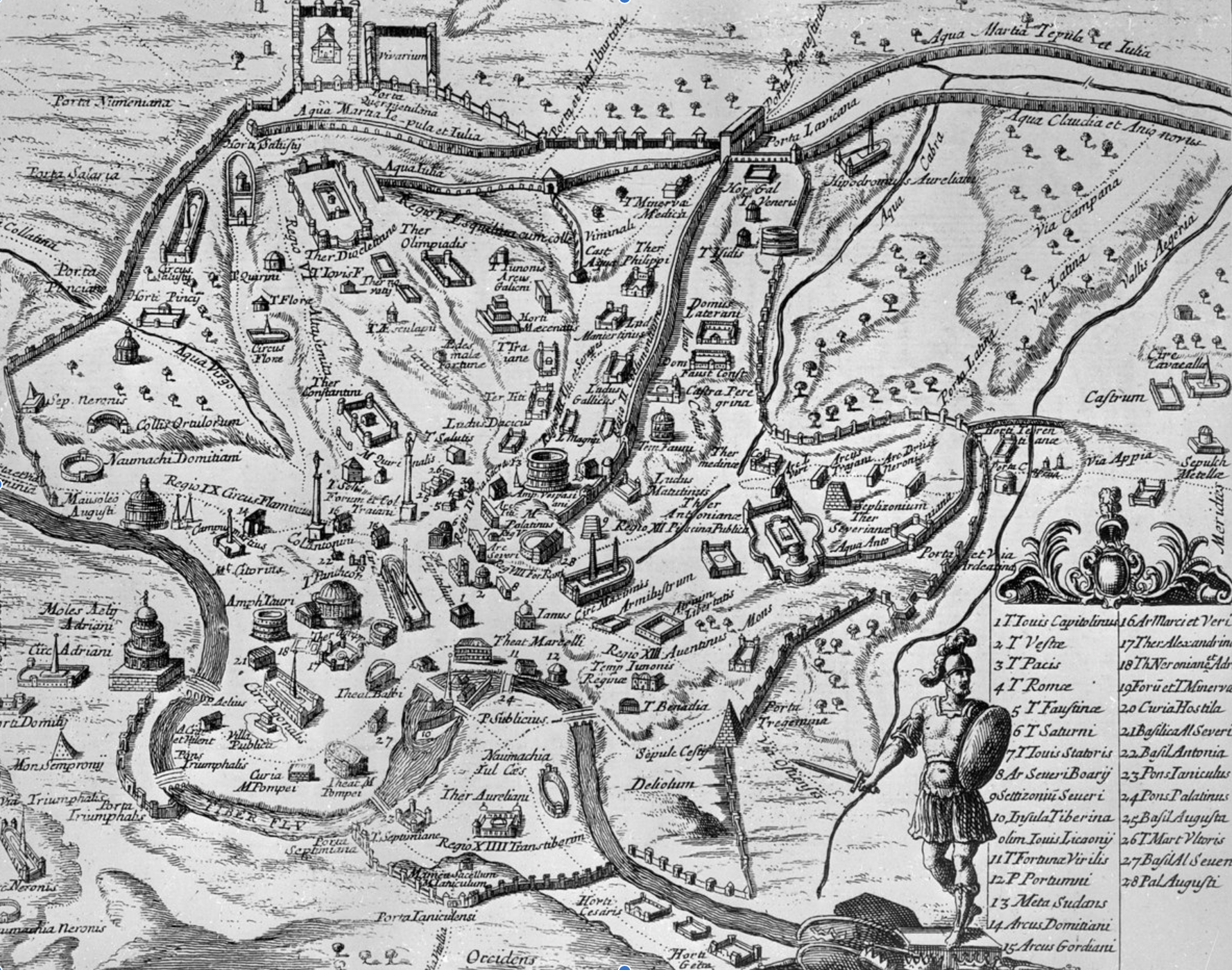
10. Rarely has the intensive mapping of one city generated such intense inquiry as a subject of study designed to bridge that gulf of spatial disconnect that leapt between the seen and unseen. For what distance there was between the fragmentary ruins and the image of Rome depended on skilled reconstruction, the process of collective archeological construction over time that was itself tantamount to a secularization of the image of Saint Augustine’s City of God and the actual ruins of the city’s forum: the very monuments of Rome’s forum provided a sustained subject of reflection as powerful as poetry, to invert Shakespeare’s topos that neither monuments or the gilded monuments of princes should outlive his rhyme. The ruins embody poetic conceits, as monuments creating a space that constitute an image as durable as the buildings of the Forum were intended, if in fragments. The worn and partly crumbling marble on their columns and flagstones endure as a monumental space that has haunted western civilization, whose monuments have become an icon of government and peace, situating ancient marble monuments of the Hippodrome, Coliseum, Baths of Diocletian, and theaters among seven hills the Capitoline, Quirinal, Viminal, and Ianiculum.
Pirro Ligorio, Urbes Romae Situs cm iis qua adhuc conspiciuntur veter monument[is] reliquis (1552)
A veritable outpouring of engraved maps of the Renaissance mediated and enabled the persistence of Rome by its “monuments and remains” space across time for a large audience. The Neapolitan antiquarian and historian-engraver Pirro Ligorio took it on himself to embody the disembodied ruins of the city in a living map, as if to give rebirth to the plant of the ancient city, in 1552–above–in ways that offered a legible surface and a record of the ancient city’s design. For maps have lent the imaginary of the city’s plant the possibility of a second life or afterlife removed from its actual lived space. One might speak of a two-fold life of the physical plant of the ancient city from its social space enabled by cartographical representation of the joint seat of republicanism and Empire which blur a single temporal frames of reference, and in which entrances the viewer because of how multiple frames of reference overlap within its topography in one frame. Reinhard Koselleck very famously interrogated after-life of concepts of a chronological past that persist into lived presents, and the ways that past concepts found new lives, and the persistence of the design of “Roma Antiqua” provided an elusive present, sought after memory traces of an ancient past, in the images sold to tourists long before Baedecker was born, keying the city to its ancient monuments..
Roma Antiqua (English Copy)
Within the interaction between how past, present, and future combine in the perception of history and space, Koselleck argued, concepts of the past intersects or folds into the distribution of its own physical space in modern life. Modernity is slippery. But there are few cities where past historical time so clearly present and so difficult to disentangle as how Rome’s physical plant emerged over time. If physically present in multiple places, the sites are interwoven among spatial orders built in intersecting periods apparent in overlapping but coexistent physical plants in elusively challenging ways–and in few cities in the organic unity of the city so identified with perceiving the relation between its layers. The city’s past intersect in its sacred and civic space, but the ancient plan of the city also contests and escapes the sacred spaces by which Rome was mapped, and indeed the sacred nature of the city as the second Jerusalem and head of the Catholic Church is perversely reversed in the archeology of a city that reveals a living substrate before the foundation of Christianity or birth of Christ. The excavation of a sense of the forgotten if present past is of course what Freud used to emphasize the concretely enduring existence of the unconscious–buried and yet not buried, able to be deciphered and charted to be made real, as if it were a scientific practice of epistemic value, rather than being the stuff of evanescent dreams.
Indeed, the reaction to expanding archeological excavation of ancient Rome’s plant in the late nineteenth century was seen as the recovery of a common patrimony–which was unlike either the legal context of the excavation and administration of the past in Paris, whose ruins were owned by the city, while ruins lying on private property in England: the Italian Sovraintendenza per i beni archaeologic inherited the management of the ruins of ancient Rome as a worldly archeological patrimony, to be preserved and made present for other nations as its monuments partook of a shared past, if it is treated as a national “good” subject to the constraints of state management. The sustained observation of the Eternal city, if extending from antiquaries to the Grand Tour, was increasingly tied to the disentangling of its pasts and the internalization of the subject of the city in even more material fashion in the age of its public excavation. After the revelation of evanescent existence of glimpses of its past were afforded by the uncovering in the 1880s of the ruins of the Forum and temples, whose excavation provided a basis for contemplating its history, the place of Rome grew both in the active mapping of its physical plant and the cataloguing of its material testimonies more explicitly mapped than ever before: the organization of the plant of the ancient city, and the glimpses that this offered to its past organic whole, offered for many learned visitors a basis to internalize its dynamic constitution, from Republic to Empire, the internalization which served as a form of individual cultural formation and personal cultural formation and bildung. Viewing Rome’s antiquities, and viewing the forum, was no longer only accessible in private collections or the spaces of contemplation of palazzi and museums. In printed form, it could be both spatially navigated and surveyed–most famously from the Capitoline hill, as Gibbon rather dauntingly conjured his own ability to envision the scope of his historic narrative.
The view offered an imaginary space that could be entered and comprehended as a spatial order, both opposed to and the counterpart of the new built spatial order of European cities, and a sense of a historical prospect on the ancient world that had been recently excavated, eerily if not uncannily present for an instant with some imaginative effort. The comprehension of the formerly living structure of the ruins of Rome provided a way of narrating the political history of the ancient city, and of communing in tactile fashion with its very survival–and, of course, allowed the means to internalize that survival within the individual subject. The metaphor of the excavated city could have provided Freud with such a compelling a model of individual memory, in this age of the uncovering of multiple layers of the past and the reconstruction of historical buildings and layers of the city in increasingly legible form. Both city plans and maps that were constructed with a level of accuracy unprecedented in their scope and attention to specific detail provided particularly compelling records for temporal transport, ordering the excavation of its topography from the physical traces of its ancient spaces to which mapmakers had regularly returned, enabling an access and tangibility if not investing a permance by arranging its multiple traces of the antique.
22. Indeed, the excavation of the idealized organic structure of the city created a sensitive screen, in which Freud constructed a material image of the lamination of the mind with individual layers of individual memories across different discrete periods of time: the figure of the potentially simultaneous excavation of the city’s ancient buildings across multiple stratigraphic layers in a sort of personal archive, offered a powerful viewpoint with which to view and describe the temporal formation of the self, and indeed the role of the analyst as an investigator of the psyche whose work followed compelling positivistic models. When he turned to Rome for a fitting figure to describe human memory, Freud may have turned this mapping of Rome into such a compelling figure to express the layering of memory-formation–and indeed the burying of the unconscious past preserved by the individual–by using the “map” to describe the analyst’s interpretation of individual memories stored as if in a personal archive that the project of psychoanalysis would be oriented toward–maps offered Freud an unlikely ally for a program of training readers in the skills of interpretation and excavation of memory traces.
For as Freud described the excavation of “memory traces” to the ability of the visitor to Rome who arrives “equipped with the most complete historical and topographical knowledge,” maps offered the guides necessary to the interpretation of the physical traces of the past in the city of Rome. The equipping with such an authoritative historical map seemed suddenly comparable to the course of training to observe memory traces in the mind of the analysand. For a visitor to Rome, searching “Of the buildings which once occupied this ancient ground-plan . . . will find nothing, or but meagre fragments, for they exist no longer.” Even though equipped “with the best information about Rome of the republican era, the utmost [such a visitor] could achieve would be to indicate the sites where the temples and public buildings of that period stood,” the imagined excavation of the individual past must surpass the extent to which ruins occupy places in Rome, and often “the ruins are not those of the early buildings themselves but of restorations of them in later times after fires and demolitions.” The qualification of needing adequate topographical knowledge (most familiarly condensed in maps) as keys to interpretation of physical traces in the city–maps which were widely produced in the Age of Excavation–offered a suitable figure of speech for the observance of the ancient traces that remained of the organic whole of the ancient city, and unintentional traces of the analogy between maps to the proper course of training would allow the analyst to gain a similarly spectacular prospective on the memory-formation of an individual.
Freud had often consulted maps of the city’s excavation in his library, which he consulted in preparing for his visit. Their illustration of images of excavation would have offered a measure of credibility to the interpretation of surviving memory traces in the mind. Such maps afforded powerful metaphor and figure not only for the organization of memory but for what an objective map of memory by which to detect and view the coherence that existed within traces of one’s personal past sedimented within individual consciousness, whose coherence might be recuperatively reassembled only by detecting buried memories repressed as if under stratigraphic layers. Their coherence, Freud implied, might be authoritatively assembled in a comprehensive detailed temporal map. Such a map would provide a narrative, and a dynamic structure, more analogous to the keyed GIS image of a dynamic map, to be sure, but which departed from the GIS precursors that seem embedded in the tagged structures of Rome’s excavated topography–by “squinting,” as it were, to reveal the superimposition of structures of different times.


Baedeker Guide, engraved “Plan of the Forum Romanum” (Darmstadt 1868)
Maps and plans such as those that were diffused in Baedekers were designed to invite readers discern the organic order of the city in its ruins, and indeed to celebrate the organic unity of apparently disembodied ruins: the laminated layers of the historical city had been regularly celebrated as a sublime moment of internalizing the coherence and dynamic of the city’s history as if conducting a medical autopsy of its ancient ruins. Disentangling its layers of time was a surrogate for witnessing the tensions between republican and imperial Rome as enacted on the Palatine. As archeologists revealed the layering of its monuments of travertine atop one another, discerning the relations and tensions of the state from Republican through Augustan Rome in sites of public assemblies, commerce, and public spectacles, offered a space of cognitive mapping, as one actively disentangled the temporal relation of its roads, temples, and urban plant, with reference to maps of Baedeker guides copiously illustrated with elegant lithographs of its built space, or maps Samuel Ball Platner included in his Topography and Monuments of Ancient Rome (1903). The assembly of the excavated city was in other words repeatedly enacted in maps, as much as maps only offered Freud an an elegant figure of speech.
A plan revealed, even in the imposition of structures and basilica of different ages, the concealed but organic whole of the city–and its architectural exemplarity–in impossible ways by disentangling the fragmentation of actual temporal layers with a timeless organic plan, allowing the superimposition of different historical ages within the same frame.

Platner’s Topography and Monuments of Ancient Rome, 1904
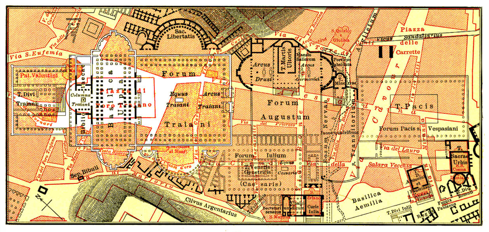
Both Platner, and Hans Baedeker before him, designed exact city plans to explicate the dynamics of the form and situation of ancient Roman urban space–and to render legible the spectacular view which could be seen from atop the Capitoline Hill. The commerce between the observer of the scene of public life and the formation of the individual subject were not only cultivated and pronounced. The tension between intuiting the order of the architectural plant within the actual disorder of appearances was acute–“thy very weeds are beautiful, thy waste/More rich than other climes’ fertility/Thy wreck a glory, and thy ruin graced/With an immaculate charm which cannot be defaced“–and none of the maps were primarily designed for travel, but rather as mental aids: the traveller was enjoined to purchase a separate rail map of Edoardo Sonzogno, both for fares and time-tables and planning travel, even as the Baedeker described one’s every move–and provided an opportunity for time-travel as well, as one negotiated the italicized Italian place-names of actuality with the boldface topography of the ancient world that was coexistent with it–and uncover and discern, in an act of individual excavation, exhuming the organic city of Roma Vetus, Constantine’s Basilica of St. Peter in place of the Vatican, Diocletian’s baths on the Quirinal, fora of Trajan, Domitian and Augustus restored to the cityscape and Forum itself in place of the Campo vaccino, all within surviving if long fragmented Aurelian walls.
 Karl Baedeker, Handbook for Travelers. Second Part: Central Italy and Rome (1869)
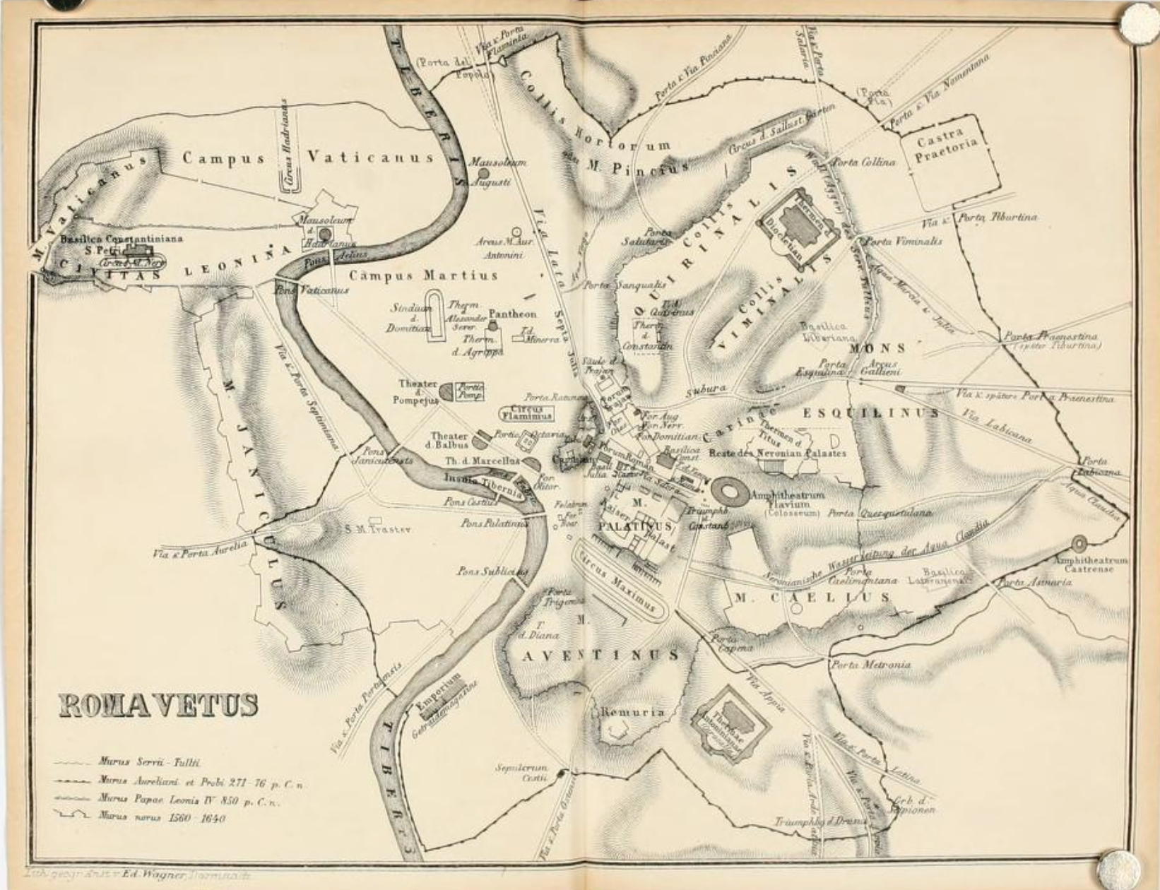
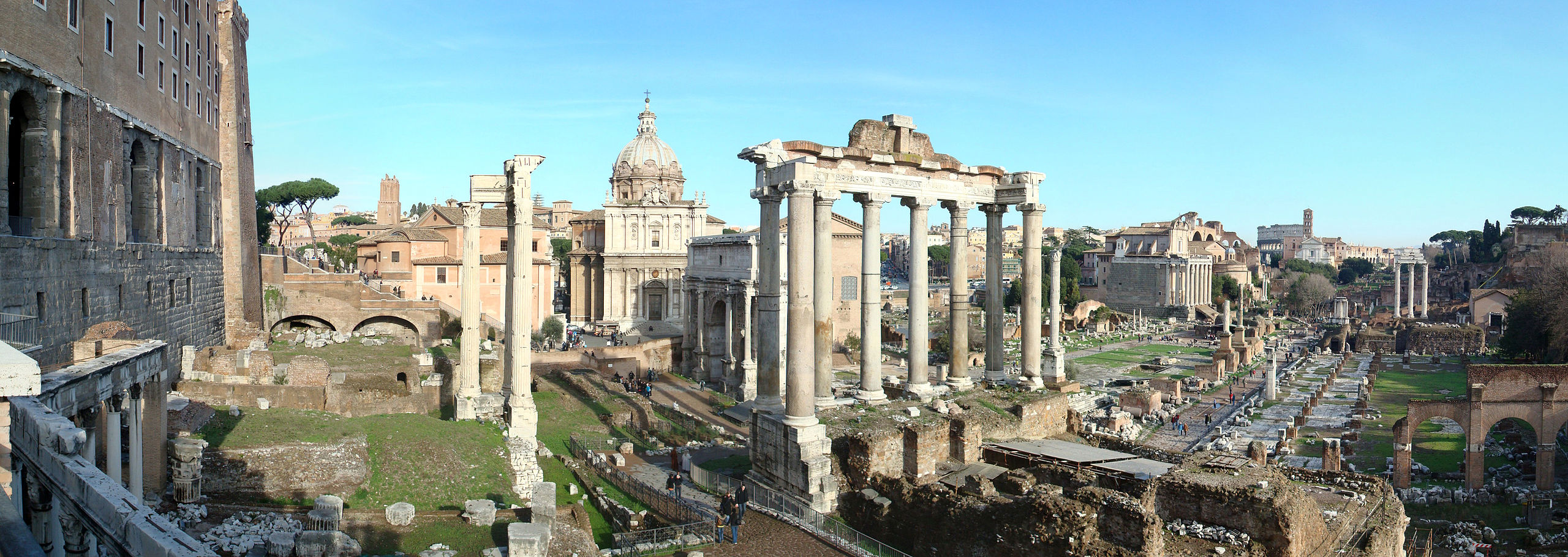
The act of imaginative force required particular skill at disentangling overlapping buildings, basilica, and fora that could be anachronically remapped beside one another:
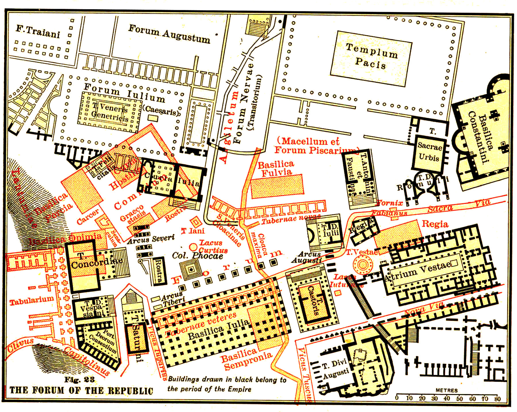 Platner, Topography and Monuments (1904)
23. The curious interpenetration of the spatial and historical was a particular preoccupation that was attended to for viewers of inter-layered topographies of ancient and modern Rome to disentangle the presence of the ancient in the city as if to excavate its layers: and the overlay of its sacred space was increasingly foregrounded atop its ancient plan in the Reformation–wrestling with the entanglement of sacred, classical, and imperial spaces, and the ecclesiastical administration of sacred monuments. When Freud enlisted the image of the overlapping of these spaces as a subject of individual formation he offered a suitably scientific metaphor by which to generalize the objective persistence of the past in an individual memory traces as artifacts–as he evocatively described the Forum and Eternal City as a basis to understand not the formation of the individual subject–and orient him to the subject of memory as they oriented the individual to an almost archetypal public space in particularly powerful positivistic ways, particularly powerful in how it elided spatial and temporal continuity.
The material precedents of Freud’s chosen metaphor for individual memory in a map’s surface have rarely been rooted in their image of a structural superimposition of time, as if by the overlapping layers of distinct ages, as if one could comprehend the relations between superimposed structures that continued to exist in one space. The figure was so powerful to Freud, perhaps, to replace the material model of these almost pedestrian and easily accessible guides, printed for the tourist or for the armchair scholar, as a basis to orient oneself to a historically receding ancient past, presented as if a means to reanimate ancient ruins. Yet the topos of formation from looking at the tensions or dynamics within the organism of the ancient city provided a recognizable figure from which Freud could compellingly ask relatively educated readers to consider the individual mind. As well as providing Freud with a powerful figure of speech, maps of the eternal city afforded a something close to a scientifically objective language to situate the temporal coexistence of memories in the mind. The maps provided not only an orientation to the past, but an image of the continued organic survival of structures of the past that were particularly appealing, for they suggested the organic survival of earlier physical plants, partly erased with time, as if a sort of mental furniture: if Freud was an antiquarian, the image of the map of the classical city, borrowed from those included in the Platner or the average Baedeker guide, or from other archaeological works.
There was, for Freud, significant longing for the inaccessible, and indeed an image of the living dead, close if forever elusive and removed from direct contact, in the maps of ancient Rome that he enjoyed reading in Vienna, but which only must have reminded him of the removed nature of Rome, and the temporal remove of the ancient Rome that he could have most directly perceived when visiting its ancient forum.
24. The historicity of space was similarly evident in the intersecting temporalities in Rome’s layered architecture and architectonic plans. The city’s classical plans coexist with its sacred space and civic space. The plausibility of the simultaneity of its archeological layers no doubt encouraged Sigmund Freud to suggest, “by a flight of the imagination,” take the ground plans of Rome’s across different periods as a material metaphor of the psyche, as if, as Gibbon atop the Capitoline Hill, imagining a temporal pastiche of the panorama in which all buildings from every time that might be imagined to coexist side by side: the potential coexistence of multiple periods in one single physical space provided a metaphor able to embody Freud’s model of human consciousness, where memories would lack historical specificity, but coexist with one another in surprisingly scientific and immediately understandable ways, as if a Procrustean inheritance that persisted in each individual, even as the brain’s physical structure altered from childhood.
What was internalized as an organic form of the ancient city, in other words, was taken by Freud as a model for the successive and active lamination of mental furniture of individual memories in the individual psyche. Then formal promise of the map that uncovered their persistence, moreover, allowed the possibility of their objective interpretation, from a view as privileged as that which the Capitoline offered of the different layers of Rome’s Republican past, even in a plant from the age of Augustus. The dramatic architectural and spatial modern transformation of most central European cities in the Austro-Hungarian Empire, from Vienna, Cracow, Brno and Budapest, as well as Bratislava, Zagreb, and Timisoara–following the expansion of London and Paris, constituted a massive change in the aesthetic and physical presence of the city as a landscape of urban life. The public reception of built space and new forms of architecture in the International Style after the dissolution of the Hapsburg Empire contrast to the organic unity attributed to Rome’s physical plant. In contrast, the plant of Rome provided a compelling basis to objectify the layering of successive stages of the individual’s past memories as if they were a collective edifice. If the metamorphoses of these metropolises reflected a triumph of sustained urban planning, rooted in modernist architecture and design, Rome provided an emblem of the persistence of earlier ages.
Ancient architecture’s cosynchronous mapping may have indeed offered a compelling objective correlative for the Freudian concept of the persistence of individual memories across its neurological development as it existed in maps. While Freud willingly allowed that demolitions and constructions in the development of a city made it appear “a priori unsuited for a comparison with . . . a mental organism,” Freud privileged Rome’s space as a unique figure to imagine the formation and lamination of individual memories in the mind, and the lamination of successive memories that continued to persist and structure in the mind, as much as the formation of the individual, and whose persistence Freud believed continued to structure individual actions: if his own trip to Rome would for a Viennese–albeit a Viennese Jew–have been associated with personal bildung, Freud saw Rome’s spaces as offering an objective image to articulate how the encrustation of memory persisted in the individual’s character across the neurological changes in the brain’s structures and physical organization, otherwise difficult to map or visualize: acting on his frequent longing to visit Rome, he visited it frequently since an initial pilgrimage in September 1901–if conscious of deep fears of facing death and mortality that perhaps prevented him from reaching the city laced with fears of the intimations of mortality. Freud seemed terrified of the complexity of its many layers, both visible and invisible, riddled with absences; he was fascinated by the urban structure of such presences and past traces, consulting not only Baedekers, but Richter’s Topography of the City of Rome, Mommsen’s History and Ludwig Lange’s Antiquities. Each revealed Rome’s layered topography to Freud and were tools to prepare himself for this visit by the discoverer of the Arch of Augustus. He first visited the city in the late 1890s to observe these antiquities, and later returned almost obsessively, as if in search for meaning and lucidity, admitting to have a “longing . . . deeply neurotic” for the city, which seemed to him “a cloak and a symbol for several other deeply desired wishes,” that emerged in the course of his deep application of himself to study its topography in the late 1890s, after which his arrival at the city’s Forum must have seemed even more stupendous.
The familiarity that he gained with the cityscape of the Eternal City definitely domesticated any latent fears of its ruins or unmasterability. He came to call the Forum and Palatine his “most favorite corner of Rome”in 1910, returning often to the region of Rome in the twelve days he spent in the city, and even celebrating his mastery of the local topography during the visit that he had earlier feared as the culmination of his self-analysis. By 1912, he wrote to his wife on a separate visit to Rome with some surprise about how “natural to be in Rome” it had become that “I have no sense of being a foreigner” and the “delicious, somewhat melancholy solitude” with which he wandered along the Palatine, and returned in 1913 “visiting old haunts” in the city where he wrote the Introduction to Totem and Taboo. (Revisiting the city again, with Anna, in 1923, prolonged for several weeks, spending time in the Forum and on the Aventine with some fear that he would not revisit them after he had already become ill, coughing blood on the train down.) Freud’s return to the city seemed more obsessive and in search of its elusive integrity than driven by fear. Freud returned to the topography of the city, famously, when stuck in his composition of the Interpretation of Dreams, and traveled seven times to Rome in his life, fascinated by Michelangelo’s Moses and by the city’s antiquities. As much as the idea of a site of past vestiges of earlier eras existed in the material city he visited, these experiences would have been mediated through maps in crucial ways.
The relation of city’s overlapping temporally specific structures and spaces offered a concrete representation of the lamination of memories of the past in the individual psyche: even if, as he put it, “the thymus gland of childhood is replaced after puberty by connective tissue” in the human brain, and the bones of the child disappeared, the ruins of Rome provided a figure for how memories were stored by the individual both persisted and shaped the individual’s psychic life, and indeed provide a sort of road-map by which the personal choices one made could be understood. For Freud imagined the survival of subconscious memories in the mind as if from the outlines of maps of the city’s plans in a trusty Baedeker, or later guides to the organic whole of Rome commonly used by visitors–in so doing, converting the city from a site of the intimations of mortality to a figure of the human mind. Plans presented a similar palimpsest in which the earlier layers are not fragmentary, but continued to be actually present in the same space: Freud had perhaps arrived at the realization while interpolating plans of different eras in the actual city and cross-referencing its physical monuments with the guide he might have had in hand when comparing the place of buildings from different periods in its panorama to the marble monuments he saw, switching from map to viewpoint with possible frustration for points of orientation to distinguish the historical layers of construction simultaneously before his eyes–much as the plans promised to distinguish the levels of material building within the ancient Forum, dignifying his perspective of the individual psyche by analogy to the privileged position of space from the Capitoline.
The map became no more a metaphor for bildung, but a metaphor for mapping one’s own memories and their progressive encrustation atop one another in one’s mind, an accretion of memories constituting for Freud the formation of an image of how the lamination of specific memories maintain a continued presence in the individual psyche.

Karl Baedeker, engraved by Wagner & Debes, 1900 (1:1,600)
The conceit perfectly expressed the ability to view the psyche in its totality–as ell as an image of mortality that Freud felt compelled to confront.
Freud’s memorable conceit of miraculous spatial simultaneity from multiple periods and historical times in one and the same space was served well by Rome–“an entity in which nothing that has once come into existence will have passed away and all earlier phases of development will coexist beside the latest one” would exist, he realized, by an analogy he felt even lay readers would grasp to reach a new state of sublime for the privileged observer of a Rome whose historical periods would somehow coexist: by a wave of the wand of cartographical fantasy, so that without the Palazzo Cafarelli having to be removed, one might see within it the Temple of Jupiter Capitolinus in each of the era it survived, including the Etruscan, and one could, in a spectacular feat of historical recreation, actually admire Nero’s long-destroyed Golden House in its original splendor.
Ever the assiduous scholar, Freud was rapturous before the image of the superimposition of historical periods and buildings from different historical eras in the very same physical space. It is almost unsurprising that the panorama captured the difficulty of processing such a unified mental space of the human mind: while his descriptions seem based on the Cambridge Ancient History on Rome’s founding, it more closely recalls the didactic renderings of built space Karl Baedeker used to show the historical formation of the Forum in the 1900 edition of his city guide. The Baedeker map, now often taken as a figure of the most indispensable of guide to place, remind us how maps are important forms to think about and encounter its built space not apparent to the human eye:
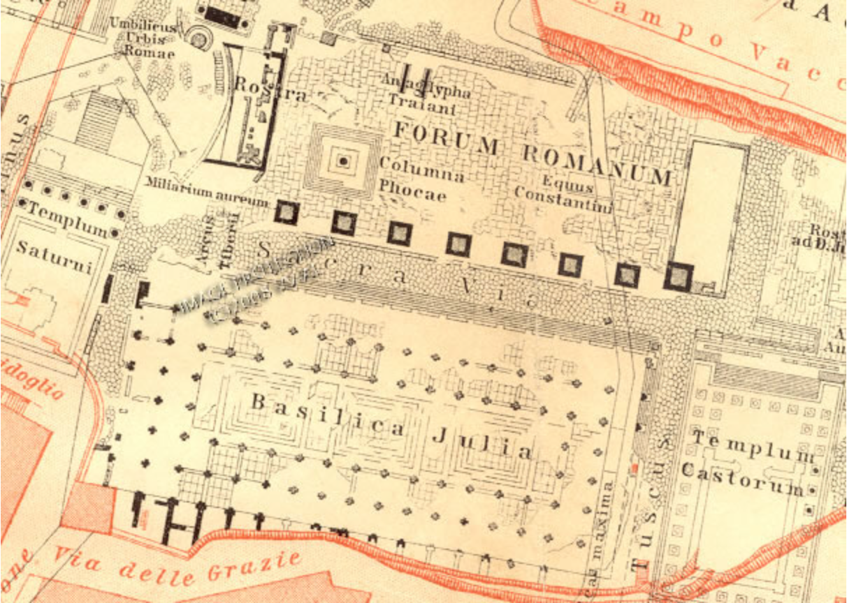
The overlapping if not tangled layered spatial entanglement of historical periods are able to be pried apart by the viewer, assisted by the different depiction of stratigraphic layers in red and black ink– rendered to reveal the sedimentation of layers of place names in Latin and, in printer’s red, in Italian. The dissonance of times is quite readily registered by current visitors to the Eternal City, as mid by a magic trick. Maps as these provided a model for Freud’s understanding of the persistence of an organic whole across multiple periods of one’s personal history, and tools to decipher a built past whose organic forms were readily accessible by the skilled reader–or interpreter. If his apparent anxiety about making an actual voyage to Rome may have partly lay in his fears of his abilities to be able to interpret the entangled chronological spaces of Rome’s ancient architecture, his return to the city suggests the particular pleasure he took in encountering its multiple pasts.
The architectural palimpsest of the city proves cognitively challenging for those who navigate its streets, where one constantly processes, either with or without the maps of a Baedeker guide, the city’s physical plant through space–assembling the panorama from viewpoints as the Capitoline suddenly demand the reassembly of its elements in distinct ways. The Baedeker engravings present an analytic disassembly of place–top0s–that allows the visitor and reader to interfoliate archeological plans with their own experience, they constitute a unique spatial practice quite akin to Freud’s cartographical fantasia of excavating the continued materiality of past memories in the individual mind. The practice of excavating the lost but organic whole of Rome’s physical past echoes a longstanding antiquarian practices from the prototypical humanist master-builder, Leon Battista Alberti, who remeasured Rome’s excavated monuments for his friends as a form of sociability and amusement, to sixteenth-century antiquarians as Pirro Ligorio, to papal librarians and erudite as Luc Holste, to the numerous engravings of the ancient buildings that were sold in Rome but appeared as orphans outside their original urban plan and built structures of the ancient city. The making present of Rome’s physical past was a concentrated effort of erudites as much as a mental recreation of a lived space that never stopped haunting the city itself. The decoding of Rome was a common hobby, a revelation of humanist skills, and a wedding of practice and theory that allowed one to gain a more clear-sighted appreciation of the survival of the past, and indeed to participate in the unpacking of the past in the present, not only to situate oneself as the informed tourist but to make the obligatory visit to the city a formative extension of one’s education.
For these engraved maps, Freud was no doubt aware, echoed in their exactitude and precision the lost if partly rediscovered marble Forma urbis of Imperial Rome, a massive incised plan of monuments in the city carved and erected between 203 and 211 CE, of which only 10% of the original one hundred and fifty marble slabs survive. Collectively mounted in the center of Rome in the Capitoline Museum in 1903, including the 490 fragments found since 1600, they provided a new record of the city’s lost plant.
The ancient map provided a celebratory image of the peacefulness of the city appropriate to the setting in the Temple of Peace [Templum pacis]–or may have provided a permanent record of buildings against which cadastral maps were drawn. Known only by its fragments since 1561, the newly discovered pieces of the Severan map of the city of Rome’s buildings offered lost knowledge of the ancient city that provided a partial record of Rome’s lost past–and indeed the structure from which the modern city emerged. If the original map of eighteen meters by thirteen meters (sixty by forty-five feet) offered a ground plan of urban architecture delineating all buildings in the city for functions not clearly or adequately understood by a scale of 1:240, perhaps based on exact cadastral surveys, distinguished the city’s public buildings by the unique double-outlining.
25. As an architect, Venetian-born Giovanni Battista Piranesi suggestively arranged surviving fragments as fragmentary shards in post-modern manner in his eighteenth century map of Rome of 1762, less as evanescent fragments of ancient Rome to which erudite archeologists returned to reconstruct its continuity, the Baedeker guide rehabilitated their iconography for the cultural memories of new readers, but acknowledged its effective stripping away of the built layers of the city by mapping is forms within the fragments of the map rediscovered gradually from 1561. Piranesi, soon after moving to Rome, perceived the possibility of assembling the ruins of the city in paper form, as he wrote in 1756: “When I saw the remains of the ancient buildings of Rome lying as they do in cultivated fields or gardens and wasting away under the ravages of time, or being destroyed by greedy owners who sell them as materials for modern building, I determined to preserve them forever by means of engraving,” dedicating himself to the assembly of images of the city’s imaginary architectural space that provided not only a variation on the caprricci that his predecessor Tiepolo offered of his native Venice, but by shifting his longstanding family interest in magnificent architecture as he explored Rome’s major archeological sites, visiting Hercolaneum by 1743 and moving to “preserve them forever by means of engraving” in a distinctive manner that might be called the first proper archeological maps.
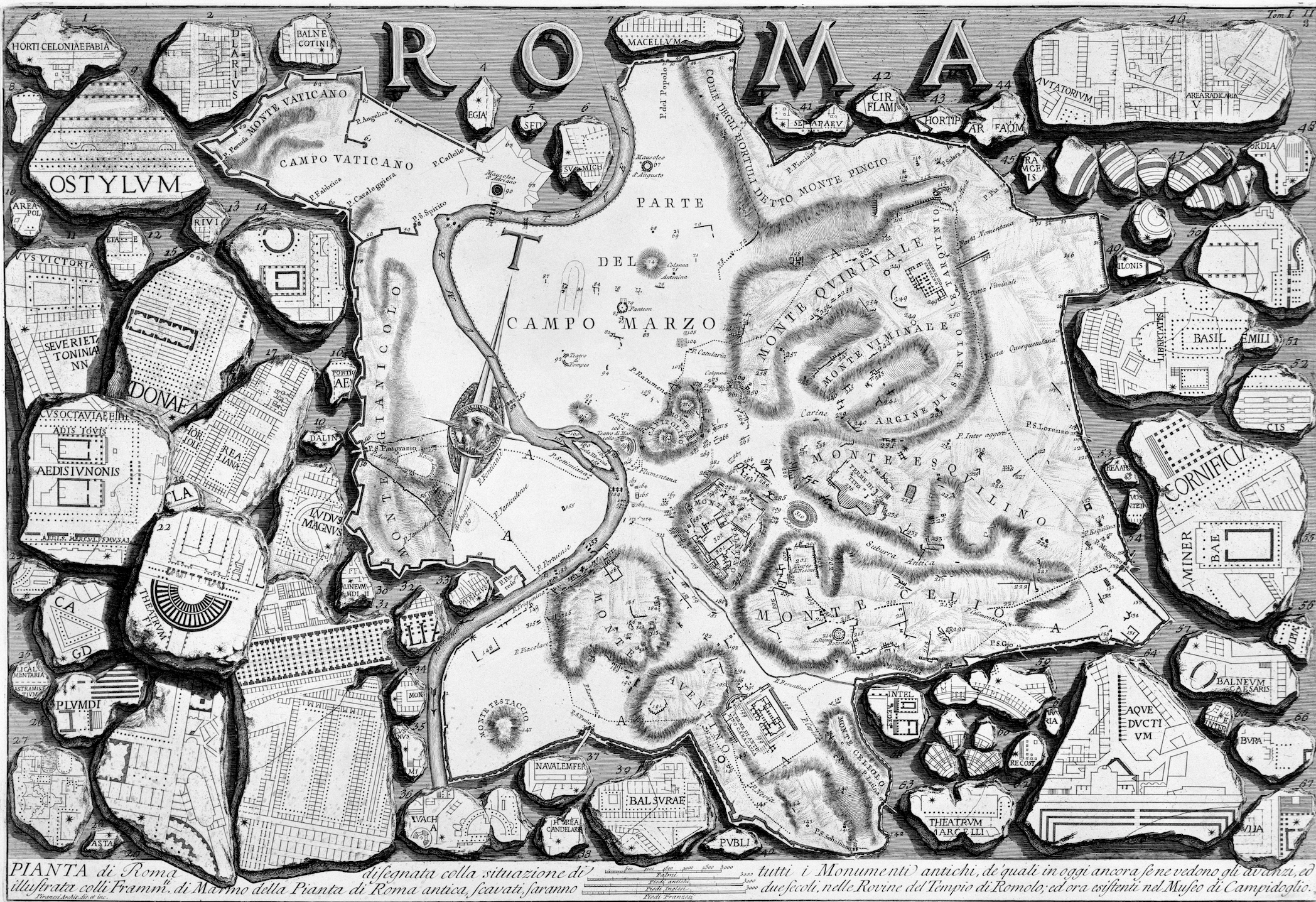
The reconstruction of cartographical fragments of the Severan plan that frame Piranesi’s 1761 map of Campo Marzio in his Roma offer an image of intentional melancholy. They suggest the difficulty of assembling the ancient map of Rome, but remind the viewer of the temporal remove of the past in its dislocated fragments.
Piranesi may have known of Giambattista Vico’s recent 1741 Scienza nuova–but it may be suggested by Piranesi’s visits to Naples in years immediately following. At any rate, Piranesi flanked Rome by material fragments of the Severan map of the ancient city as if to suggest the discovery of fragments of the ancient city brought to light if long concealed, in line with Vico’s metaphysics of the recovery of ancient meaning–as much as in a melancholy relation to the lost past: assembled around the modern map of Rome, the marble fragments of the Severan map are less a fragmented record than offer evidence of a still earlier past, now surpassed, and an assertion of the unique made nature of the ancient city’s space: the Severan plan emphasized the made nature of Rome’s monuments for Piranesi, perhaps echoing how Vico privileged the made nature of all human knowledge in the Scienza nuova–and the distinction Vico gave ancient Rome as a unique center for making knowledge.
![Camp [o marzio].png](https://dabrownstein.com/wp-content/uploads/2016/04/camp-o-marzio.png)
The continuity of these fragments as engraved by Piranesi seems uncanny: unlike in other cities, whose past is all too often rapidly obscured, the organization of the forma urbis has such a staying power in the city’s physical plant that most regions, if only fragmented, can be immediately recognized as a disposition of space that has been occupied in new ways:

This image, on the edge of the Forum and broken just beyond the Capitoline Hill, maps the Isola Tiburtino against modern Rome. Piranesi included such fragments of the Severan map about his map as if to provide a reflection on the made knowledge of all things cartographical–and an graphic embodiment of the emphasis placed by Vico on the made nature of built environments–reminds us of the suppression of the city’s ancient space. The extent to which such fragments of marble from a once entire map exhibited for public view describe a loss of the harmonious expression of the built city responded to Giambattista Nolli’s recent comprehensive cityscape for Benedict XIV by surveying tools of his own device.
The unearthed fragments of the Severan plan provided an eloquent foil for Piranesi’s project of mapping its lived space.

Such intensive efforts of recreation provided the background against which the architect Giambattista Nolli mapped the augmented expanse of modern buildings the had come to occupy Rome’s earlier physical plant, as if to place Rome once more on the map in the mid-eighteenth century, and celebrate in comprehensively detailed fashion its expansion under sustained papal attention and commissions to an expanse that indeed could be seen as coming to rival the ancient city once again. Among those Nolli employed in his project, Piranesi developed a similar intensive focus on the ancient monuments that survived in the city and ensuring their preservation in a single cartographical form. Piranesi’s involvement in the project of preserving the entire cityscape from 1741 would inform his later assembly of what he saw as disjointed fragments of its urban plan.
For Nolli offered a triumphant encomiastic vision of its continuity for the “enlightened” pope Benedict XIV as a celebration of the elegant expansion of the city as a built space. To do so, Nolli applied new arts of surveying he innovated that combination craft and art to transcribe that new expanse and the monument of Rome from the restored Capitoline to St. Peter’s itself, as if to illustrate the organic coherence that the city had attained that advanced the visual argument of the extent to which the city surpassed its former fragmentation. Rather than recuperate a past organic whole, in other words, Nolli celebrated the achievement of a new sense of organic presence within the historical Aurelian walls. Benedict XIV openly ought to elevate the place of Rome within networks of learning that he knew so well, both in Italy and abroad, so as to place it on the intellectual map of Europe once more, and the Nolli plan figuratively as well as literally did so, illustrating technical capacities to map the Holy city in unprecedented detail and do so by the most recent surveying techniques.
The cartographical choices of these plans of antiquities constituted a strikingly different strategy than the plans of earlier cartographers. The massive multi-sheet map Nolli created for Benedict XIV presented an image of the continued and sustained magnificence of buildings within the papal city, whose crisp contours captured and celebrated the current expansion of the city within its ancient walls, in a Grande Pianta that balanced the habitato and the disabitato within the Aurelian walls, even as it celebrated the architectural triumphs that had remade Rome as a cosmopolitan center which had regained its earlier integrity if not its past expanse. The stark precision of the mid-eighteenth-century plan of the Roman cartographer and architect Giambattista Nolli (1701-1756), whose multi-sheet plan is particularly striking for its contrast to this entanglement–perhaps because of the extent to which it organized space as a uniform continuity. It may have met a commission to disentangle the historicity of its monuments from the city over which the papacy presided: if one in which the church and papacy oversaw the perfection of its spatial order out of the possibility of historical confusion of space, investing an increasing clarity in the city’s layout that would be widely mistaken for objectivity.
Viewers of Nolli’s map could discern the unified spatial order of the city as if stripped down and clarified from its historical past, removed from its clanging bells and overhead arcs of birds, and from the water carried to the city that reappears in its many fountains, as if the urban space is disentangled and unfolded from its past and represented under the aegis of the church: the surety of his cartographical line seems a clarification of the city under papal auspices, removing the city from the shadow of past futures lying in its ruins and revealing streets’ precise course, orientation and often varying widths, thereby allowing one to disentangle it from overlapping layers of historical time. The surveying table which Nolli had innovated for transcribing urban space map seems secondary to the surety of line and shading, dark but legible lettering and fonts to render the city’s plan legible–transcribing its clustered public spaces by numbers that can be read without any unwanted crowding of cartographical space.
The cartographer offered a satisfying purification of the disposition of urban space. The elegant trompe l’oeil masterwork of Nolli reserved Rome’s complex topography in the mid eighteenth century in ways that had rare been able to be previously registered. Engraved on eighteen folio sheets of paper, surrounded by monuments, that invited viewers to survey the copious detail that is encoded in multiple pleasurable ways. If the commission from Benedict XIV invited the architect to survey Rome to demarcate its 14 traditional rioni or districts, the striking detail of noting each building and square contained a proliferating abundance of information rather than proposing the city be comprehended by a simple bird’s-eye view, wrestling with the complicated alignment of axial urban streets, most of which lie oddly askew to one another with a crisp clarity and focus of unprecedented detail and accurate measure as they could perceive it in stunning detail.
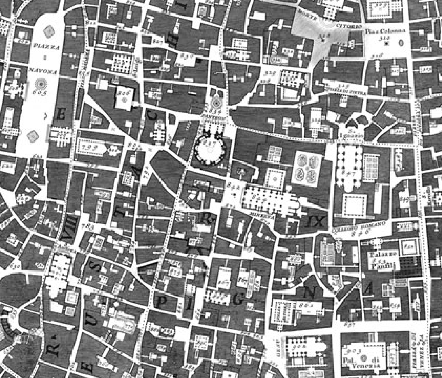
Nolli’s adept transcription of architectural artifice clarifies the complex historical layering of Rome, and the multiple perspectives that comprehend the construction of a new architectural identity atop the past, may seem the subject of the particularly dense engraving, that pairs regions of the uninhabited Rome–Roma Disabitata, between the inhabited center and the city’s Aurelian walls–with the streets and buildings, pairing the black stretches of the city street plan with the elegant cartouches on the floating scrollwork. Indeed, the putti that hold the legend of the Pianta and lie at its base with the surveyors’ table and viewing device that Nolli had innovated are not purely ornamental: the table offered the a the almost divine aid for transferring a multiplicity of surveying points to a single surface and bringing one’s attention to bear on multiple sites and focal points in the baroque city in ways impossible for the individual human eye, offering a special form of assistance to Benedict XIV’s demand to measure the city’s regions.
The crispness of clearly rendered streets and buildings preserve a sharp observational record that, mutatis mutandi, became a standard of the objectively empirical future mapping of urban space. Indeed, the whitespace of its streets, squares and serpentine rivers appear a crisply defined as an aerial view of a city after freshly fallen snow–as was the case when a blizzard of January 2016 placed the street plan of L’Enfant’s Washington, D.C. under expansive snow cover in this recent RapidEye Satellite view.
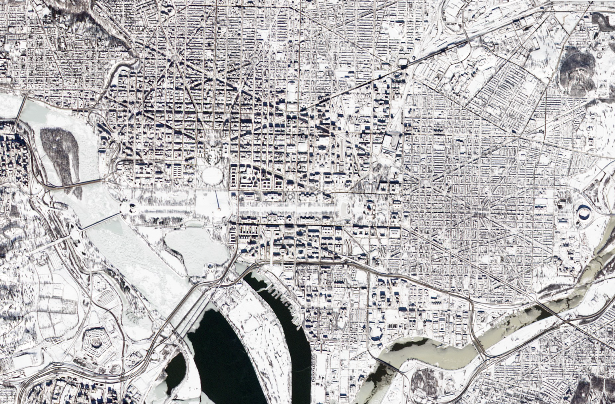 RapidEye Satellite View © PlanetLabs, Inc.
The massive achievement of the Grande Pianta is perhaps most present in its preservation of urban spaces in a now largely rebuilt mid-eighteenth century city, but its framing of urban space with monumental views provided a basis for rendering the physical presence of the city’s physical plant–whose rapid reprinting in the same year, ringed by views of the city’s monuments, inaugurated the tradition of inviting viewers to place monuments in an accurate network that preserves all their actual asymmetry, as measured by a surveyor’s plane-table and a magnetic compass, which he referred to the meridian inlaid in the marble floor of the Roman church of S. Maria degli Angeli from 1702. As well as offering what Alan Ceen called the “continuum of accessible urban space” in the rebuilt city inherited from the Renaissance and Baroque, the image made good on the etymological promise of ichnography, a term adopted from the ancient builder Vitruvius, as combining writing with pictures to offer a legible record of the urban space. It is an architect’s map, and was collaborated on in a second edition with Nolli’s fellow-architect Giambattista Piranesi, whose prospective views of Rome elaborated its precision.
Suspended by a pair of poised putti, the topography of the ancient city is revealed to viewers who can delight in views of the Vatican, obelisk in Piazza San Pietro and Gregorian University, as well as the towers of its medieval churches, as if to convert the eight years of labor the architect Nolli devoted to his quite savvy map such an apparent labor of love–as much as demand that they pour over the details encoded in each of the city blocks that Nolli used a drafting table to painstakingly survey with instruments of his own device to allow him to draw its complex street-plan in an “ichnographic view” as if nested in a panorama, suspended by weightless putti who unscrew its map and legend before the viewer’s eye. For all its baroque visually distracting elements of scrollwork, the inset map of the city employs actual dimensions of each street, based on Nolli’s own personal gauging the shifting width of every street corner, thoroughfare and piazza within its walls as if to decode the curious combination of ancient monuments while preserving a lightness of touch of the numbered legend that unrolls in a weightless fashion beneath a putto‘s left leg, as if delicately pinned by his knee, as he raises the troupe l’oeil map, or the cartouche on which another putto reclines. Whatever heaviness exists in its darkly lined buildings, they seem temporarily transfigured by the weightlessness that inheres in the map’s stunning achievement.
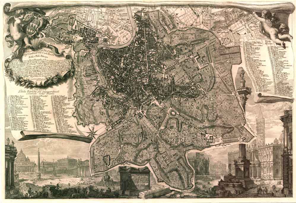
The majesty of the map masks any breaks in the individual sheets of the large ichnographic view and pastiche panorama of the ancient city, caput mundi through which the river Tiber sinuously and somewhat timelessly curves: if the very term “ichnography” evokes the horizontal sections of each of its buildings plans recalls Nolli’s architectural expertise, it also recalls the term used by the ancient Roman Vitruvius’ widely glossed educational treatise on architecture (1.2), it is apposite as a combination of tracing and writing. For any map of the city of Rome is a testimonial, the engraving reminds us, of the city that has continuously stood at the site of the ancient city, as well as of the city that occupies its site. The place of diminutive spectators who crowd its lower right, awed by the immensity of detail that the map encompasses, condensed in the images on the 1744 version of the Capitoline hill–the seat of Rome’s civic government–and St. Peter’s and the radical shifts in its built and unbuilt environments.

“La Nuova Topographa di Roma” illustrates Nolli’s artifice of mapping a seamless whole of a city spanning epochs, architectural styles, and street plans. The iconography of the map is now viewable in detail online in interactive form that is the culmination of the many years of study Ceen devoted to this map’s unique construction and two professors from the University of Oregon who have worked with a large team to allow us to explore the endeavor that the architect Nolli pursued for eight years from 1736 to 1745: the zoomable virtual version, if a bit slow to load, reveals the attention to the innovative instruments of surveying by which Nolli sought to measure the complexly shifting outlines of the space of Rome’s streets against its hilly topography, empty fields, and turning Tiber–as if the surveyed city floated over the multiple periods of time encompassed in its actuality.
26. But the transcription of a plan of accurately preserved dimensions of streets of varied width in individual microcosms of its neighborhoods and seem oddly angled to one another are somewhat secondary to the sense that the seventeenth-century ground plan marks the expansion of the city’s actual re-habitation on a scale that seemed to rival antiquity in the actual elegance of its built environment. Whereas many of the maps of the city had mapped its ancient ruins from Leon Battista Alberti in the mid-fifteenth century to Pirro Ligorio in the mid-sixteenth–as the trade in engravings that sold most briskly in Rome showed the majesty of the city’s antiquities and marbled monuments from St. Peter’s obelisk to the Campidoglio’s civic government–the map celebrated the scale of the current city’s construction, and its own comprehension of its so distinctively layered urban topography of a city which had still not filled the Aurelian walls, but had reached a new level of architectural splendor and grandiosity–in a massive act of historical reconstruction whose monumentality might have inspired Freud for the tactile contact that it offered to an earlier time.

Nolli’s Nuova Topografia (detail of lower border)
The mapmaker’s inventive iconography seems as impressive as the city as a whole, and the putti who push open the top of its imagined scroll to reveal a legend and dedication that almost detach from the map’s surface mask the huge labor of surveying each of its streets.
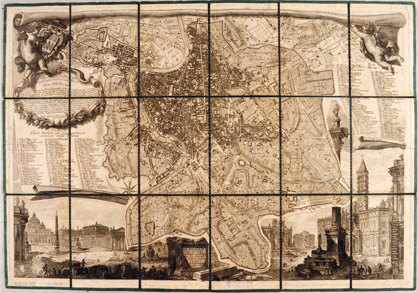
27. The relatively recent collaboratively developed interactive website helps allow viewers to better grasp the scale of Nolli’s historical reconstruction of the ancient city. For it allows viewers to explore the material construction of the map in detail offers an attempt to examine the footprints of each of the buildings that it includes, and appreciate the imposition of a vision of apparent harmony that the map in its Renaissance and Baroque topography, and the pleasure that the map now has in making this lost Rome present at an unprecedented scale. Nolli’s map has long been seen as a monumental cartographical achievement, but the detailed scrutiny of each of its alley ways, piazza, and even church interiors provide a way of navigating the structure of the lost city in a way that few visitors could have access, but which is also wonderfully evocative of any experience of a visitor to contemporary Rome, who can vicariously extend their own experiences of the city to what Nolli so exactingly measured, recorded and engraved with benefit of his sighting table.
As much as preserve the accuracy of the width and shifting course of each of the streets of Rome, which were surveyed in ways to preserve their measurements in the Nolli plan, that reflected both the rebuilt and human format of the cityscape that was stamped by papal authority, but also by multiple piazza, individual streets, and built environment, creating a record of the achievements of recent constructions sensitive to the layers of historical negotiation of its public space in Rome:
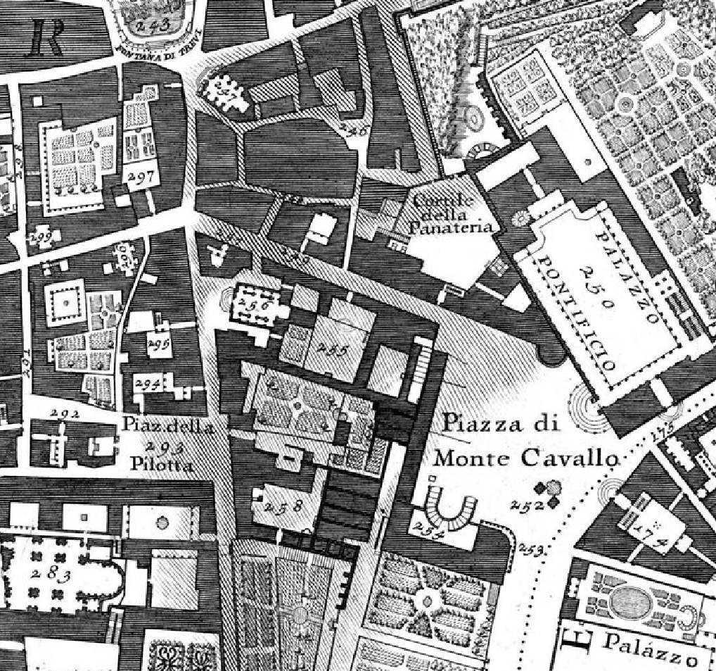
The result was a sensitive record that promised to clarify the legibility of the complexly crafted urban space, often using the sharp contrast of dark grey that signify buildings or built space to call attention to the civic spaces that provided a counterpart and counterpoint to the density of its darkened blocks of built space:
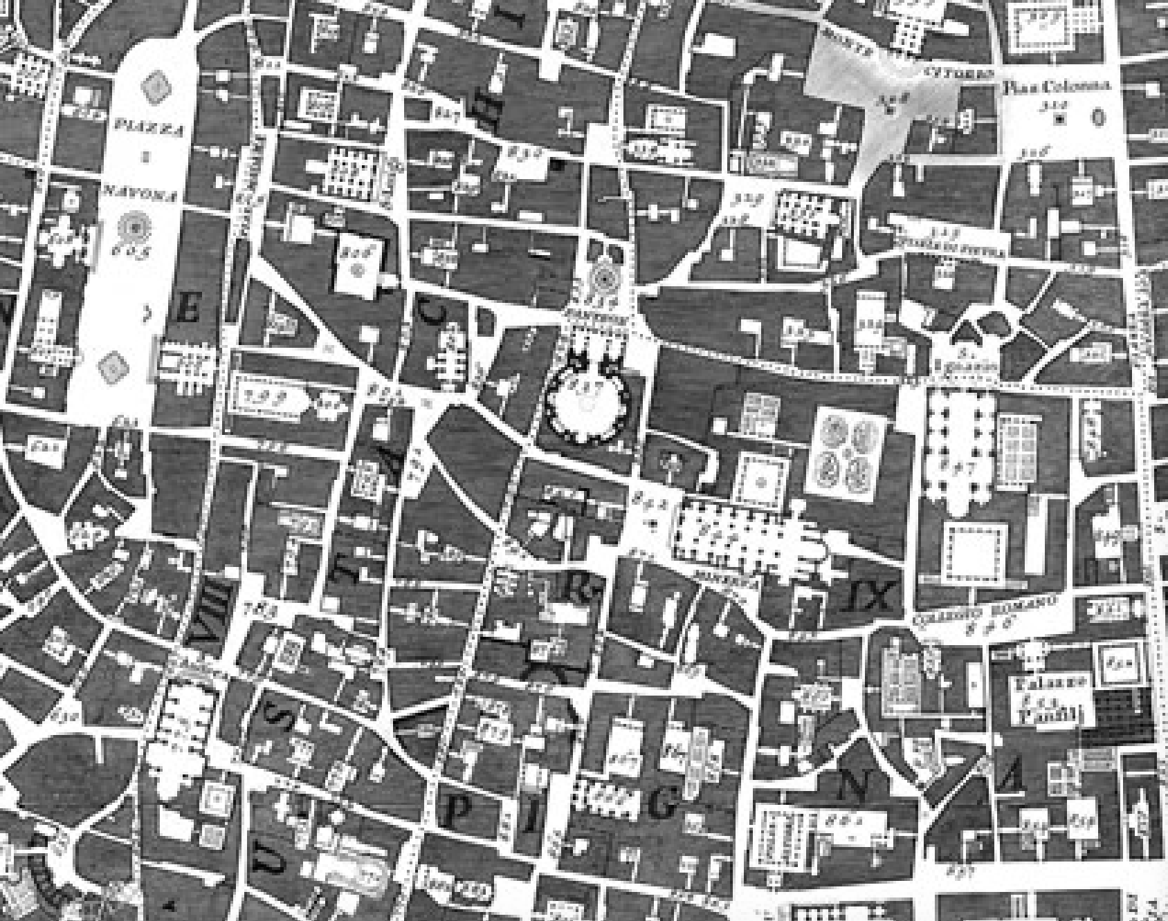
The images allow one to trace dotted itineraries of pilgrimage to its ancient sanctuaries, long the subject of so many earlier maps of Rome, and the purported subject of Sixtus V’s late sixteenth-century expansion of its roadways, and still the source of much of the spiritual capital of this seat of the Christian church. But the itineraries of devotion are in a sense secondary to the build space of the city and the churches and monuments whose floorpans Nolli seems to include in the street plan–which remarkably remained the base-map of the city that public authorities employed until the 1970s, and viewed as authoritative through the late nineteenth century.
The underlying network of the 14 rioni that divide the city can be read, if with difficulty, on the crowded urban landscape keyed with over 300 items, and the close relation of built and unbuilt areas that was so long a characteristic of the city, lovingly rendered against the flowing course of the River Tiber, whose waters are delineated in shades of grey–
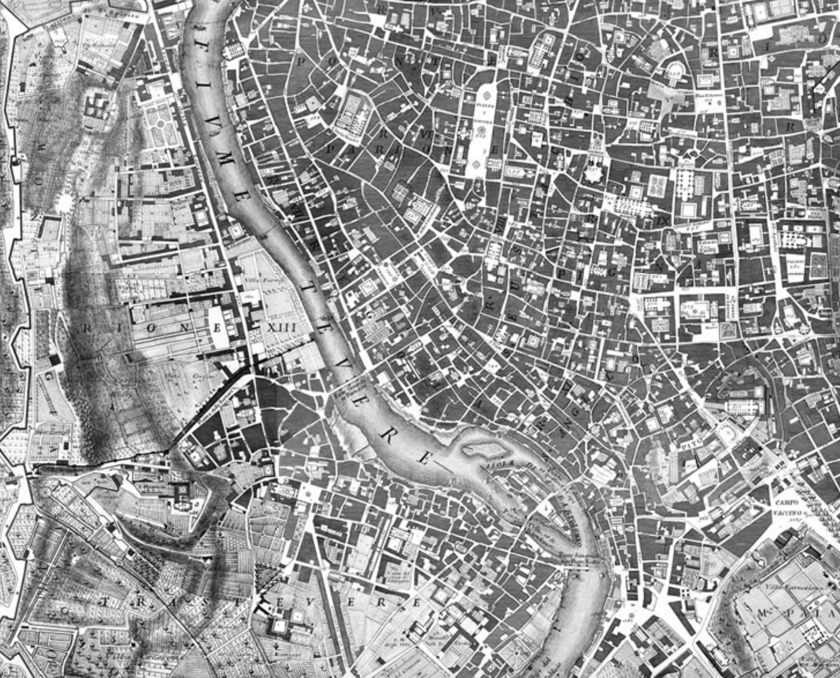
–as grays allowed Nolli to foreground the substantial the built environment of modern Rome’s monuments with a crisp clarity that truly seemed modern.
In 1748, when the monumental map first appeared–conspicuously dedicated to the Enlightenment Pope Benedict XIV–it constituted a “new topography” of an ancient city. The Pianta Grande di Roma Nolli created by new tools as the surveying table, pictured beside the Capitoline hill–the site from which the humanist Leon Battista Alberti earlier famously surveyed Rome’s monuments and ruins for his circle of humanist friends for them to envision accurate measurements of the ancient built city within its ruins.


The sighting tool that Nolli seems to have developed proved an accurate way to gauge the shifting breadth of Rome’s streets, quite approximately perpendicular and all too often sinuous products of the accretion of multiple architectural choices to be traced previously in comparably exact detail.
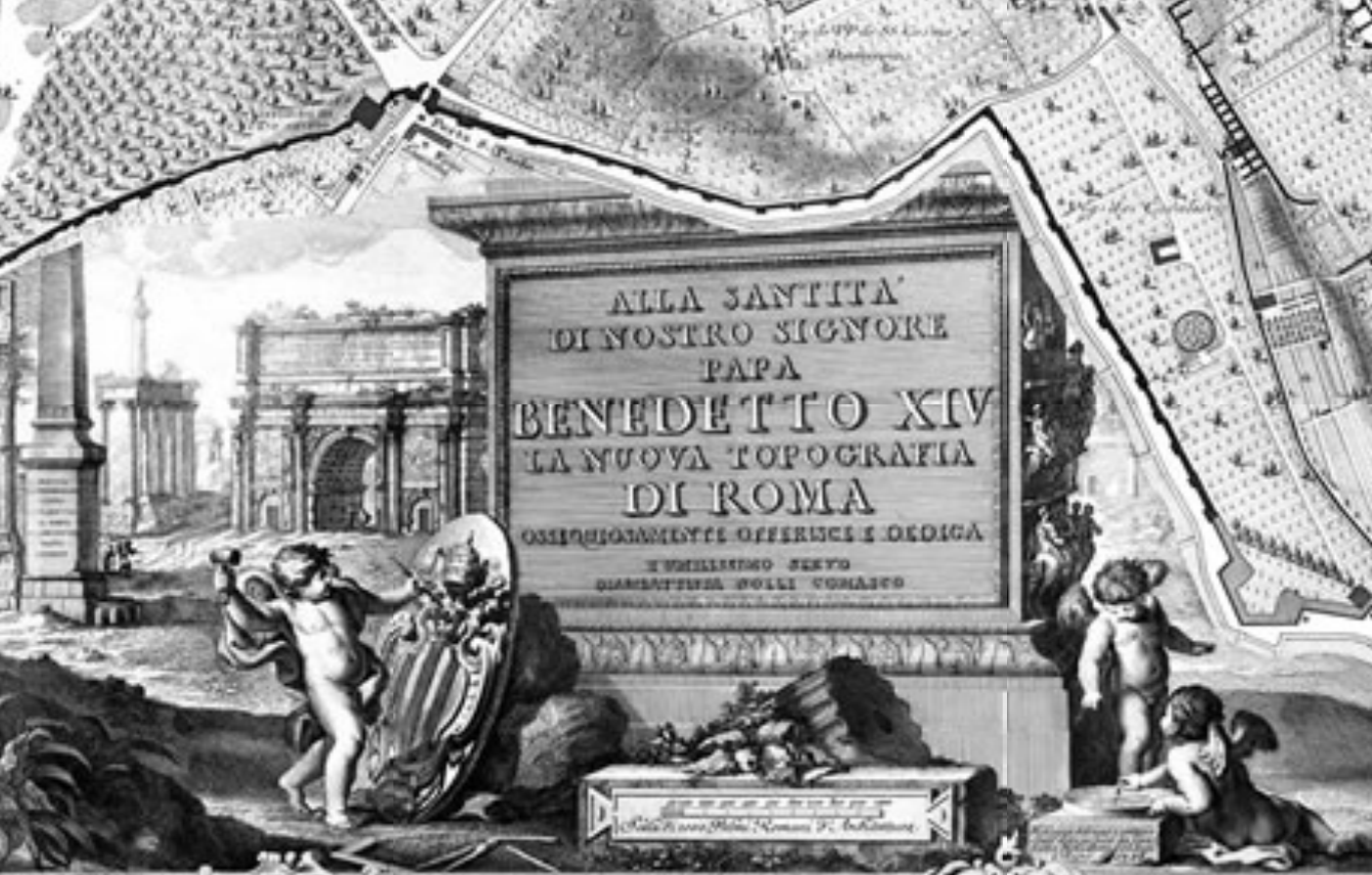
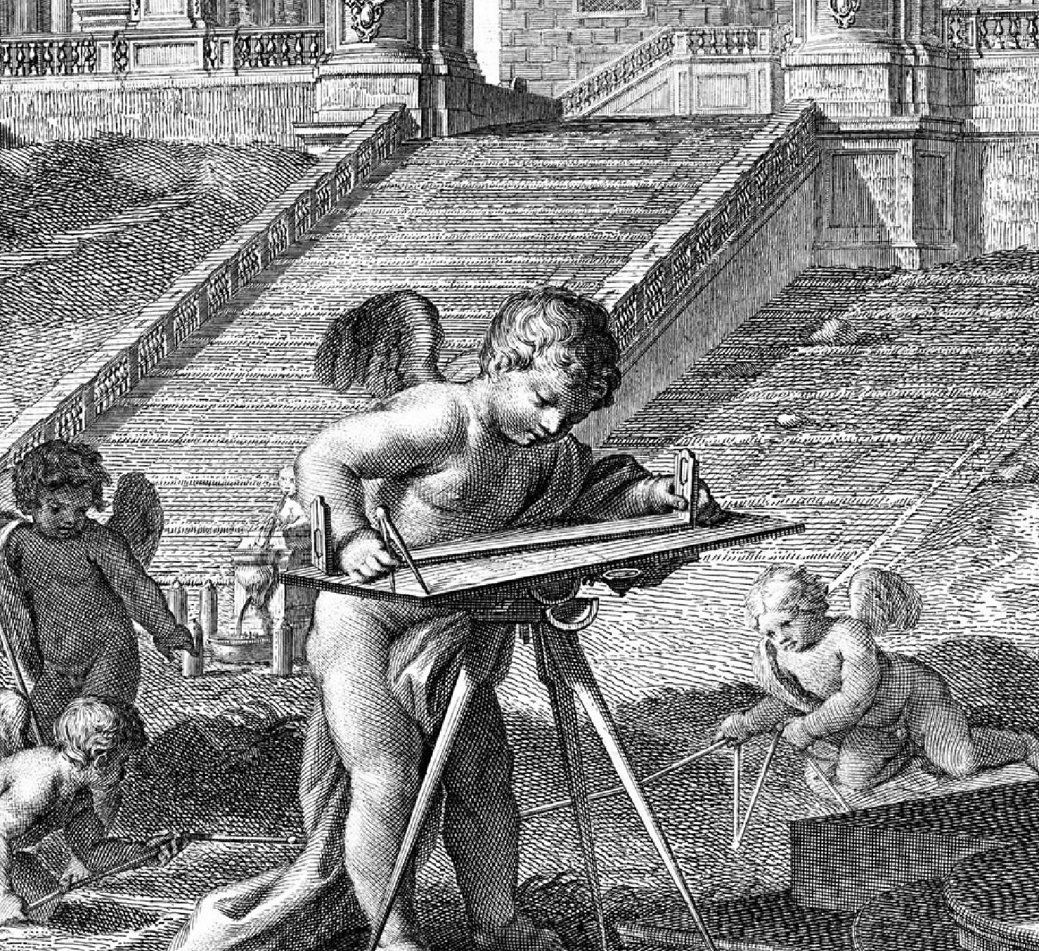
The 2005 interactive virtual map crafted with such exquisite detail at the University of Oregon, run by Jim Tice of Oregon’s Department of Architecture and Erik Steiner of its Department of Geography with InfoGraphics Lab, the result is Nolli Map Engine 1.0, offering a way to examine Nolli’s choices in detail, and illuminates the multiple historical frames of reference that the Nolli map comprehends. The interactive map allows one to focus in on specific neighborhoods in a sometimes frustrating but usable way, and toggle between the map and satellite images of the city that suggest its homogeneity in ways that are abstracted form the lived experience of daily life, and increase its legibility by highlighting the river, fountains, or monuments of Rome.
28. Freud saw the Third Rome as a site of promise–and potential deep enjoyment, more immediate in its pleasures than the city of popes. Nollis dream of a comprehensive vision makes a nice point of contrast and counterpoint to the famous sectorization of the city in the pioneering cinematic director Roberto Rossellini’s wartime Rome: Open City, or Roma, Città Aperta, when the Gestapo officer Bergmann has divided and conquered the human canvas of the city into fourteen zones in order better to capture and defeat the members of the continued urban Resistance through his network of spies, hoping to infiltrate the pockets of resistance that have continued in the occupied city–and which form the focus of the film’s plot. The air of supreme remove with which the Nazi officer dispassionately analyses the overlays set atop the lived city’s enumerated sectors erases its multi-centered space, replacing the city with a simulacrum that Bergmann believes he can survey through his police spies and pierce the secrets of its inhabitants and resistance groups or Romoletto.
In policing the city that they have occupied–now rendered an “open” city, and a site for transporting munitions, opened by its invaders, the map is a todos for the relation that the Nazi invaders hope to achieve by controlling its population and eliminating the members of the resistance that continue to haunt its streets. The map presents so powerful an image in Roberto Rossellini’s film as an image of fascist intelligence that it occupies the entire screen every so often as a haunting image of the specter of total control–even as its monuments are being contemporaneously destroyed or threatened with destruction from possible allied bombing raids that would unintentionally have targeted its ancient structures. The authoritative relation of the gestapo agent who is explaining the new sectorization of the city to his Italian underling indicates the ancient center of the physical plant as a subject of control.

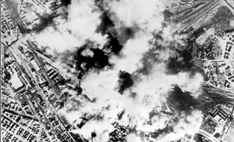
The imposition of alternative fonts that overlay one another in the film’s title frame echoes the imposition of a new sort of order on an organic city after its invasion and occupation by German troops–the breaking of its walls and transformation to an “open city”–as if to concretize the alternate visions of the city that occupiers and resistance hold, a contrast made more dramatic given that it was filmed in the black period of occupation it documents:
The black capital font letters that blanket the panoramic view of the city’s crowded buildings is almost an echo of the black font used to describe the neighborhoods and rioni in Nolli’s map, as if they were somehow embedded and interwoven with the lived texture of its human geography. The Nolli map casts the city as a site, perhaps of redemption and imagined integrity, but never indicates or includes the lived city that inhabits its space, and is eerily absent from the sharply drawn grey of its street plan or somehow lies underneath its idealized image of the city’s streets.
Was the imagined integrity of the map only as illusory, and as constructed, as the wartime sectorization of the city into clear divisions of policing by the invading German soldiers? Or was it just another attempt to extricate the city from history, endowing it with a legibility that removes it from the historicity that is the most palpable and immediate way to encounter its human geography? Freud offered an answer, in taking the complexity of its anachronic geography as an analogue or emblem of the successive lamination of memories within the organic whole of the individual human mind. But the map is only as good as its message. Considering the potential role that the maps he consulted continued to have as models for thinking about the mind, one might do well to ask not only about the cultural work that such maps continue to do, butthe cognitive work that maps continue to perform across different media.

