
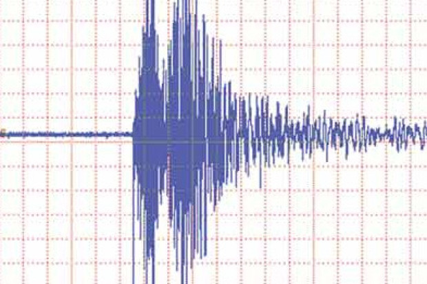
The ways of mapping the effects of latest 6.1 earthquake–the largest in a quarter of a century–raise questions not only of the damages it left in its wake, or tragic human injuries, and property loss, but the web of services it disturbed. The expanse across which the quake’s rumbling was felt at 3:20 am endured only twenty seconds but seemed to last several minutes, shaking the sides of buildings and houses, waking panicked residents, and breaking 50 gas lines and 30 water mains, leaving some 10,000 without power. In ways that oddly echo the interconnected nature of communication networks, the quake centered in American Canyon was hard to embody or illustrate, if the measurement of the rumbling along the stretch of major faults lying along the San Andreas Fault that lies between the Pacific and North American tectonic plates was exact.
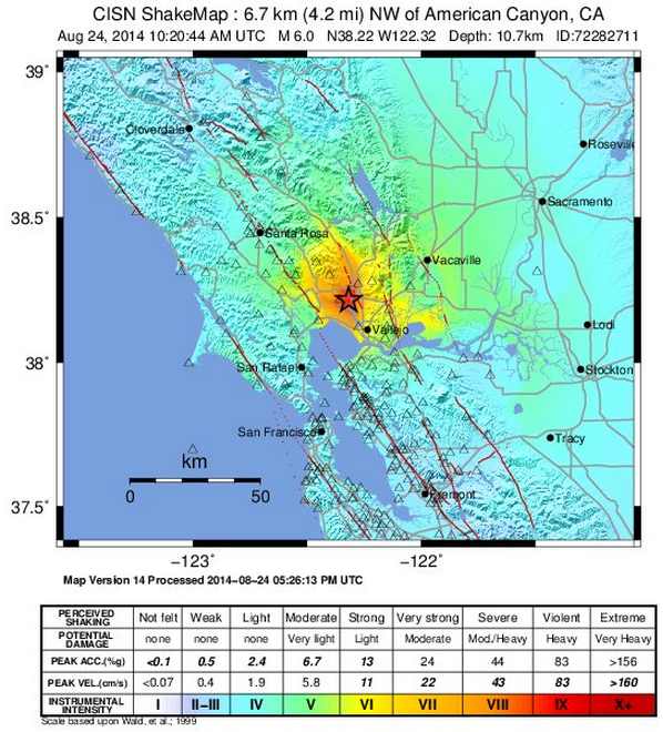
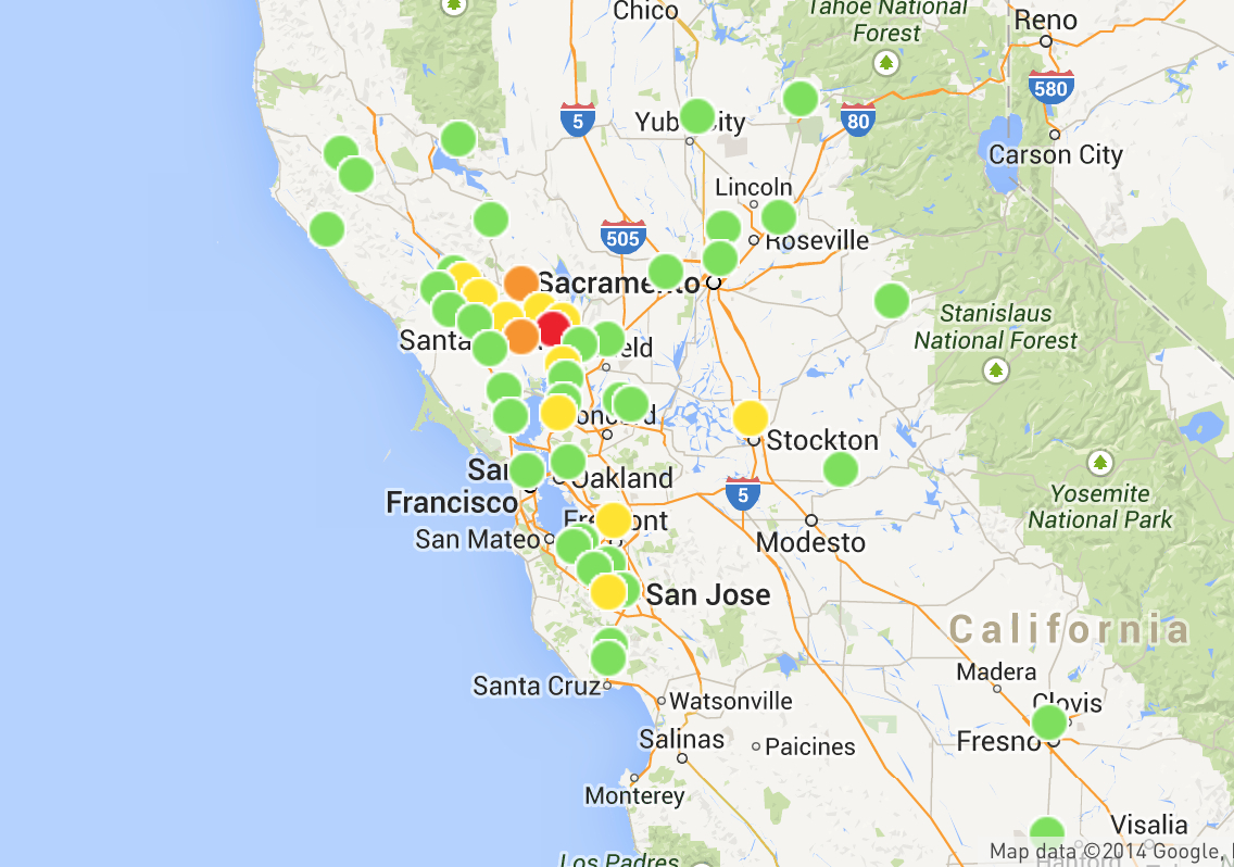
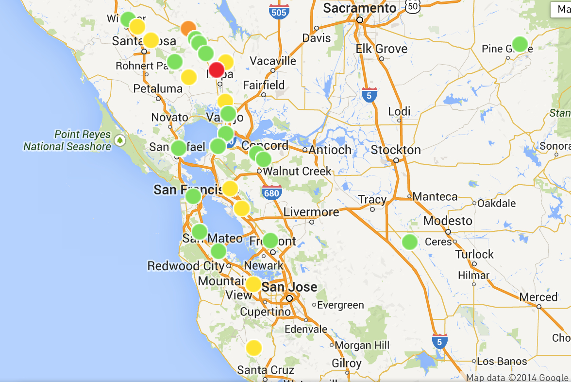
The “shake map” quickly generated by CISM revealed a quite specific concentration of incidence, some 6.7 miles underneath the earth’s surface, whose effects reportedly woke sleepers in the early morning both in San Francisco and Oakland, and as far as the South Bay and Davis.
The distribution of losses created by Napa restaurant closures and damages to buildings or rows of shattered unopened wine bottles might be on some minds–and a multitude of isolated images of individual incidents proliferated on social media, even as maps were created to track its impact. But for all the many images of local damages and disruptions, from trailer parks to freeway ramps, posted on Twitter and social media, images of the web of outages in PG&E outage maps seemed the most compelling representation of the effects of its wake, even if the most abstract–and in a Google Maps format, that reveals the extent of the energy supplier’s range of gas lines and power lines.
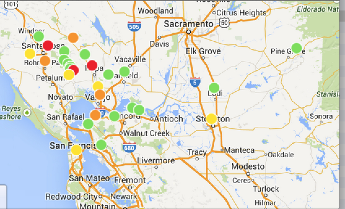

The comprehensive coverage of the map–and the surprisingly uneven progression of individual outages from the epicenter–make the map a clearer synthesis of the earthquake’s impact than the dramatic footage of fires in trailer parks diffused on news agencies, or the images of damages to unreinforced masonry buildings in downtown Napa. The distribution that it reveals are both more convincing and readily apprehended descriptions of the cascading effects of the earthquakes in this region than the specific descriptions of injuries and damage paraded on the nightly news.
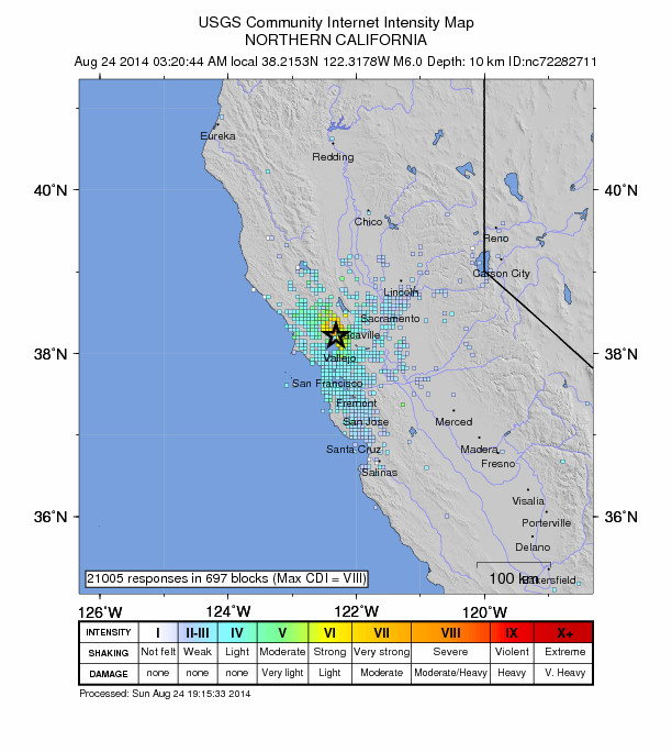
The range of individual maps generated in response to the event convey a less vivid sense of its disruptions, perhaps as they were less immediately able to register its impact in ways viewers could apprehend. The USGS generated their own crowd-sourced “Did you feel it?” map, somewhat less scientifically, that tried to measure the dispersion of intensity around northern California, taking the 3:20 am quake–and not its several aftershocks–as its focus:
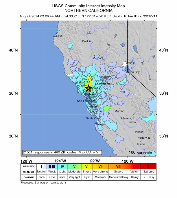
The geocoded responses provided data for an intensity map over a surprisingly restricted area, using 21,000 unsolicited responses:
Later that morning, service seemed to have been partly restored, but if the range of local disruptions reported at 11 am diminished, their effects also apparently extended far beyond the aftershocks experienced by inhabitants of nearby regions:
By mid-afternoon, or 2:30, the disruption only slowly diminished.
Even though such automatically generated maps lack an author, the data they display organized a collective story for readers by which to understand the scope and scale of the earthquake’s effects.
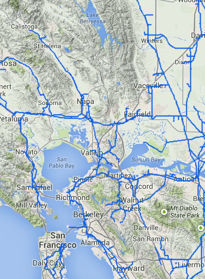
Yet such maps might also serve as greater sources of information. The greater engineering superstructure of the Bay Area–including highways, exit and entry ramps, gas mains, airports, public transportation, rail lines, and sewage systems–are all particularly serious potential sites of damage still difficult to be adequately mapped. Indeed, the parallel expanse of a still relatively poorly mapped network of gas lines in the PG&E system–many of which recently existed only in the very paper forms in which they were originally drafted years ago–makes the final and continued effects of the earthquake difficult to determine. The web of aftershocks indeed shadow the expanse of a poorly mapped web of gas lines across Northern California that has yet to be fully monitored for leakages in an antiquated system or even comprehensively mapped, whose potential leakages could trigger a disaster more serious than the San Bruno explosion of a natural gas pipeline in 2002, for which PG&E sustains it has no responsibility.

Focussing only on the mapped network on natural gas pipelines in northern California that might have experienced breakages or fissures in the American Canyon quake, whose particularly dense network of gas mains around Napa is here mapped at greater scale:
The questions of liability that would be raised by the inadequate mapping of the state, condition, and quality of existing gas mains around the Bay Area to public safety make it mandatory to release a full and comprehensive mapping of the quality of existing gas main lines and the potential dangers to which they would be exposed in earthquakes, far beyond the documented physical damage to buildings. As much as counsel customers on its Facebook page “If you smell gas or are experiencing another electric or gas service emergency as a result of this earthquake, please call 1-800-743-5002 immediately,” and caution them that “If you shut off your gas service, do not turn it back on,” the availability of a truly comprehensive map–unlike the above maps provided by PG&E’s GIS system, “as a courtesy and for general information purposes only,” without a disclaimer that the map’s information is accurate without independent verification.

