
Among crowd-sourced mapping projects, Cat Tracker is something of an innovation: rather than map a human environment, it is dedicated to mapping the motions of specific outdoor cats–their individual, day-by-day itineraries–rather than create something like a comprehensive map of a region, such as the HOT (Humanitarian Open Street Map Team) mapping of West Africa to track cases of Ebola. But the mechanics of mapping are strikingly similar, if perhaps not destined for a larger audience. While the HOT team uses the Bing imagery to trace a set of shape-files on different quadrants of Liberia or Sierra Leone, high-accuracy GPS sensors attached to the harnesses of individual cats provide the overlay for maps of cities to which they are resident, so one can imagine the regular radius of their strolls.
User experience designer Alex Lee took the time to track his own cat’s motion by an attachable GPS sensor, tracing his motion around a London neighborhood over a few days to track her explorations around his home.
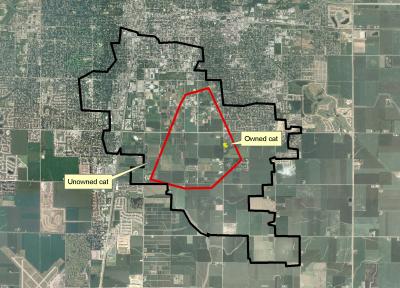
Where Kitty might go might be quite restricted, and be ompholocentrically concentrated about where she can count on being fed. Researchers had earlier argued in 2011 that the meanderings of domestic cats are far more spatially restricted or circumspect than the zones of feral cats, one of whom roamed over 1,350 acres in rural areas–the domesticated cat only roamed in the area designated yellow, or usually less than two acres:
The issues of the rise of feral cats, and the danger of zoonotic transmission of protozoal diseases like toxoplasmosis is a serious issue that is only increased by the considerable breadth of their geographic wanderings.
The availability of sensor-laden harnesses to fit domestic cats with accurate GPS sensors has most rapidly expanded, however, and provoked a parsing of feline itineraries that might strike some as just TMI–although they carry the promise to provide a better sense of how cats interact with their urban environments, and engagement with urban wildlife. While the initial tracking of cats might map as something like noise–
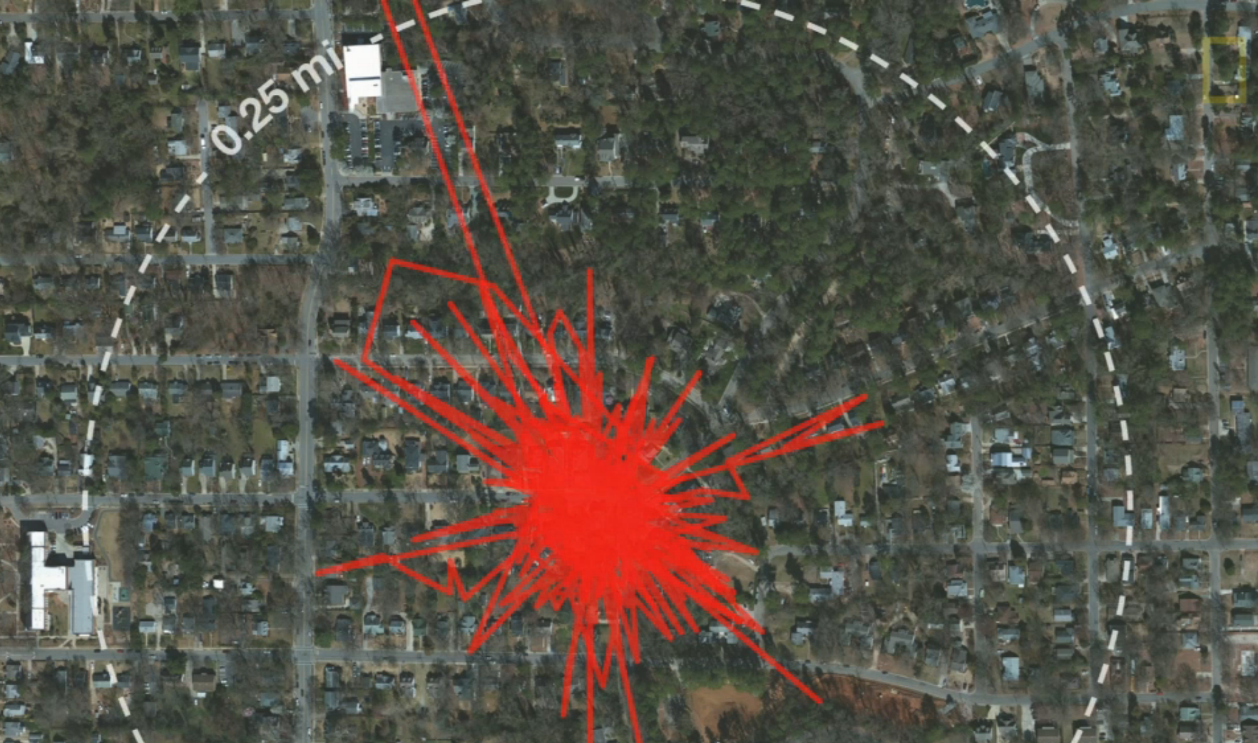
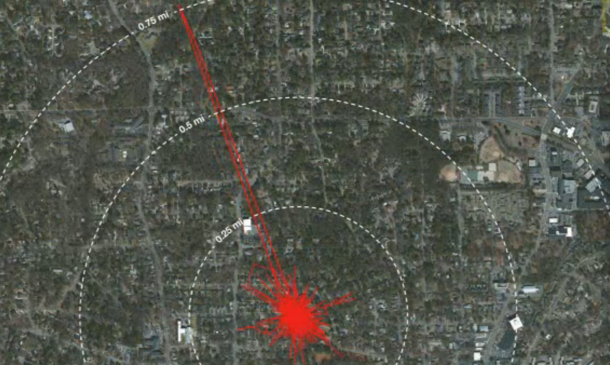
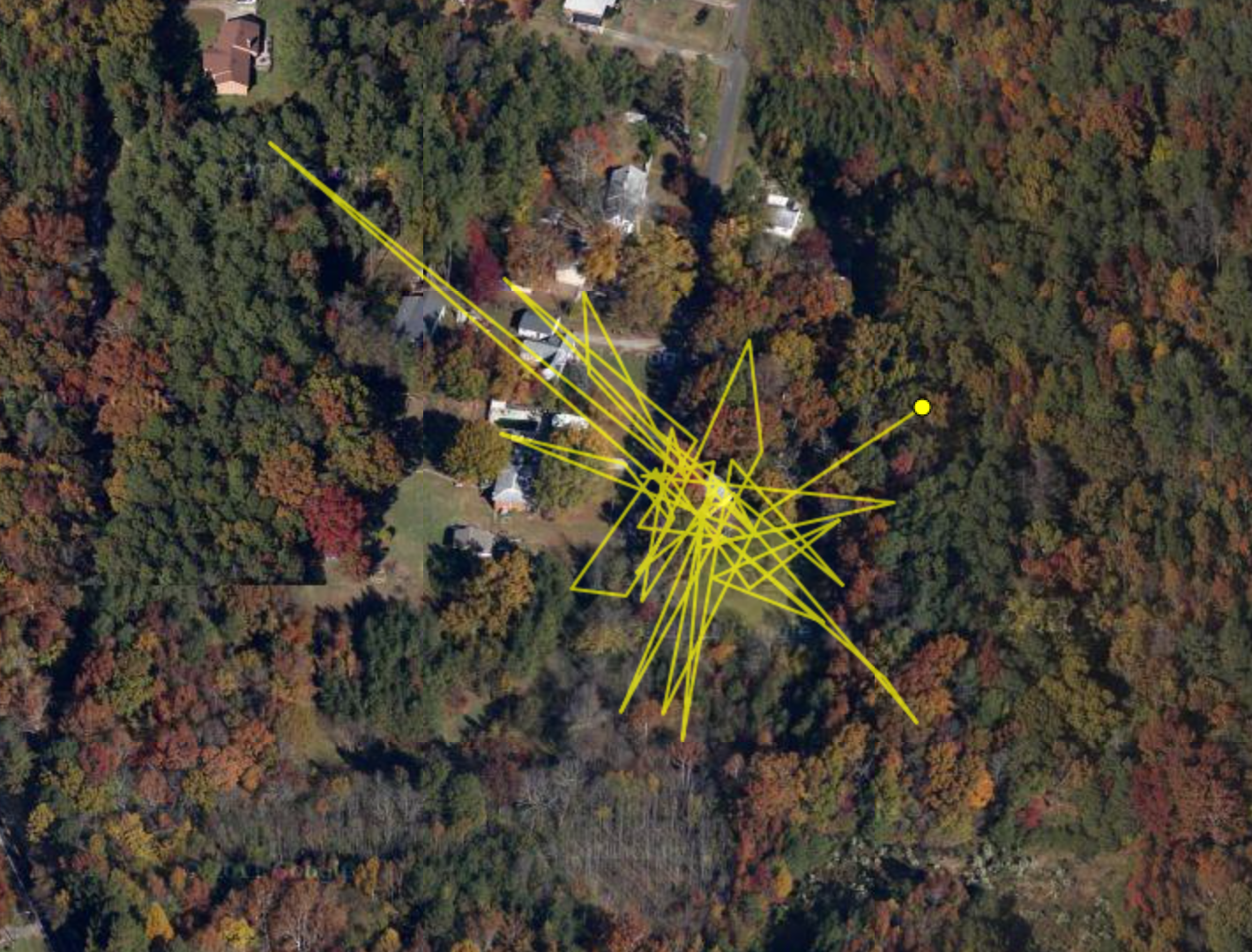
an image of itineraries over several days might distinguish paths or even register that one time that the cat’s owners were out of town, and their pet made an itinerary to their old house in the hope of finding food when it could not locate them otherwise, traveling unerringly for almost a full mile.
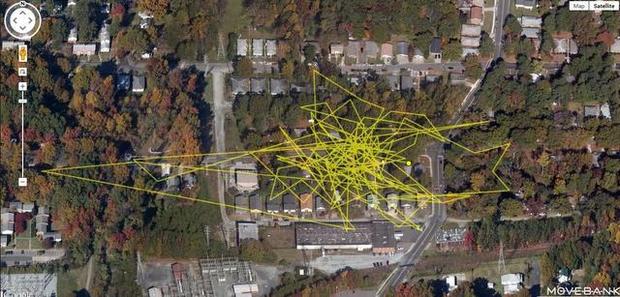
Creating a more complicated overlay distinguishing different days allows one to trace a clear record of the cat’s relation to its environment–and the potential incursions cats make into the wooded areas around towns such as Raleigh, NC, where Cat Tracker has posted feline itineraries mapped with the North Carolina Museum of Natural Sciences and an online database dedicated to tracking animal movement, Movebank.
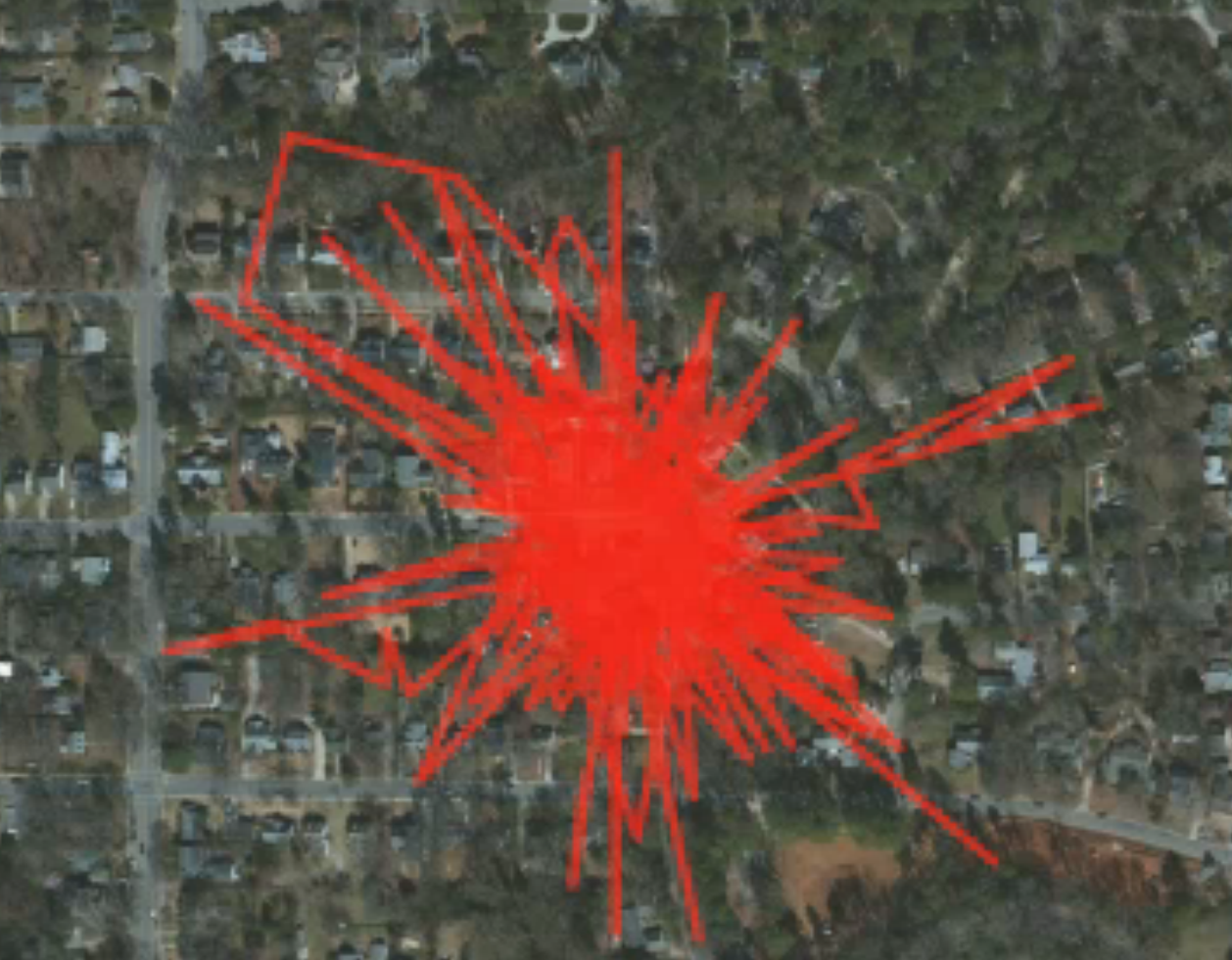
Tallulah K seems to have been attracted by a variety of surrounding rural prey or targets, but avoided most major roads:
Sometimes cat travels seem to record instances driven by car, as a record of feline meanderings over multiple days shown below. (It is unlikely, if possible, that cat space and human space were so completely congruent.)
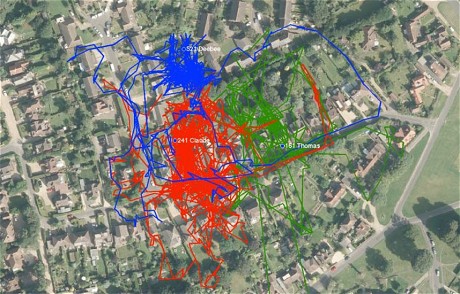
Similar results of GPS tracking, perhaps especially entertaining to cat-owners who let their felines out of doors and wonder about their whereabouts, might provide a composite map of cats from different houses in a single neighborhood, in an attempt to find out what cat-roaming was about, or if it followed any particular logic at all–or what their relations might be called one another’s routes.
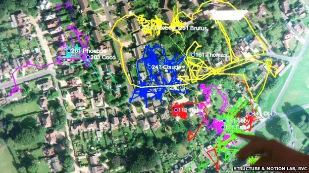
Royal Veterinary College, Structure & Motion Lab
The maps tracked by the Royal Veterinary College offer a basis to answer questions of how cat space maps onto human space, as much as to merely document feline itineraries.
Mapping cats in Surrey may seem like a bizarre surveillance of the domesticated:
Despite the sense that the signs tracking cats have limited legibility, do they signify a premonition of things to come? On the one hand, this seems an extension of our own expectations for tracking and searching geographic locations. Mapping seems to have its own logic here, providing the very terms by which we can undertake the variety of projects that technology allows. Perhaps we’re experimentally using our technologies on our allegedly domesticated animals, as we affix ankle-bracelets with GPS trackers onto sex offenders, and map their residence and whereabouts, at the same as we get used to being tracked ourselves.
That is not to say that the same technology does not have other benefits, or that it should be demonized: but it suggests a fear of wandering, and a potentially intrusive sense of helicopter parenting, if one in which we bring our pets into our surveillance world. But we can look at the other side of the coin as easily, through the attempts to control the ravages that our highways or marine travels perpetuate on wild species. A recent project of GreenInfo Network, with the Santa Clara Valley Open Space Authority, near the city of San Jose, suggested as much. The client wanted to ensure that Highway 101, a well-trafficked artery, could be mitigated in its effects of cutting across an active habitat corridor of wildlife, and specifically how bobcat roadkill could be reduced, and a series of recommendations about the roadway made to the Peninsula Open Space Trust, Since the road runs through a habitat connector, and there is little chance of moving it, the map provider used telemetry data of bobcats’ movements to make recommendations about problematic areas of bobcat’s motions, in the hopes of making recommendations on underground tunnels and alternative transit routes; the image of bobcat itineraries, if echoing to some extent that of domestic cats, was revealed a dense tangle of crossings–
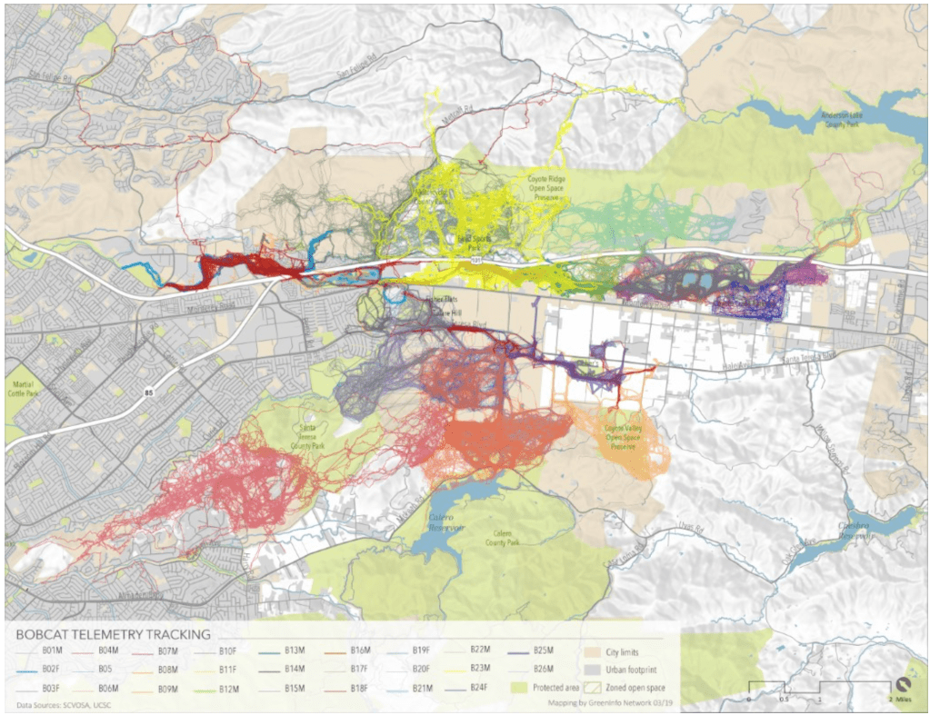
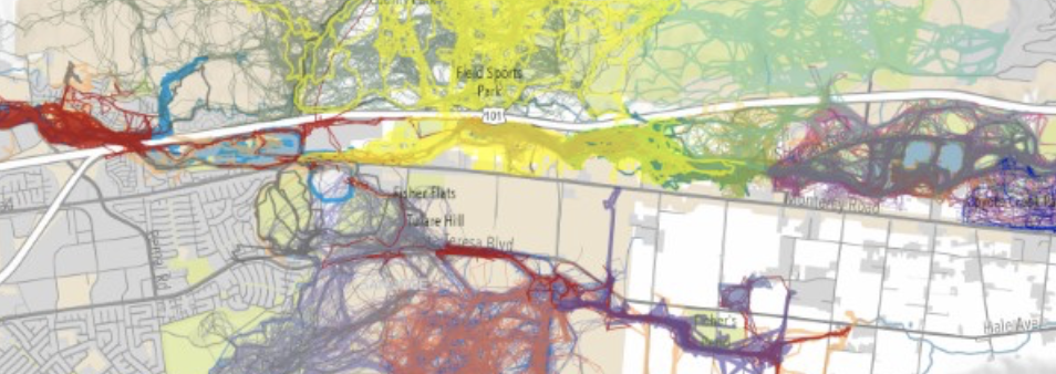
–of feline wanderings and itineraries around the busy road that, in this case, ran through the habitats where bobcats had long lived.
The result was rather astonishing in context: rather than tracking the cat as a possession, the routes were tracked to be tried to be protected, as interested parties and stake-holders were interested to do, and the pathways of feline travel could be preserved in the sense of an on-road onslaught from humans who the bobcats had no clear idea why they were driving across the land they had long wandered.

