The new connotative images of place that decorate license plates exist at a considerable remove from the weight that the form of the map once organized. Their prominent presence across an unending proliferation of license plate designs seems an artifact of graphic designers and the expansion of abilities of digital printing on metal surfaces, or a conjunction of the two that have effectively diminished the longstanding centrality of maps as a record of where the driver hails from.

Indeed, in an age of constant geographic mobility of many, notwithstanding an increasingly evident decline of actual geographic mobility in regions of the USA over time of some note–
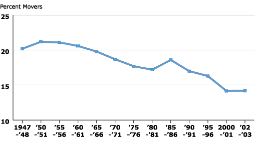
Source: U.S. Census Bureau
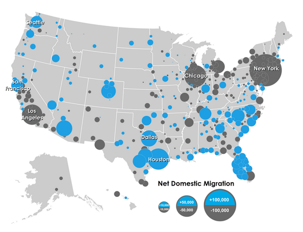
the lack of interest in the map as a designator of place of origin is pronounced, perhaps reveals an increasingly parochial pride in localism. But it seems related to a declining authority of the symbolic form of the static map, in an age when everyone is their own cartographer on Google Maps and Bing, and the former fixity of the state map seems a less stable designator–and of far less interesting visual interest. Despite a far greater shift toward the movement of populations to southern climes in the lower forty eight–

City Lab: Growth of Urban Populations, 1970-2000
The relation is somewhat mirrored in the growth of southern cities, although we still see considerable growth as well across the country’s regions–

City Lab/Eric Jaffe
–which Richard Florida has cast in a far smaller year spread of 2012-3 as focussed in its largest metro areas.
Richard Florida/Marin Prosperity/City Lab
Does the recent shift to the cities find a reflection in the bucolic image of the countryside, increasingly out of reach, which has made a huge comeback in license plate design? While generic in design, the landscape that stands in for a map, depicting a relation to place as a scenic background with no actual specificity. The corollary to this new style for designating site of registration is the effective symbolic demotion of maps from the field of vision offered in a license plate. For a map nerd, this shift of visual registers seems dangerously close to an emptying of meaning, and a reflection of a broader devaluation of the cartographical sensibility long part of the aesthetic of American license plate design. If such a shift relates to the material practices of printing with colored inks and half-tones, the new aesthetic of place in license plates seems one of an interchangeable background, less tied to local jurisdictions than to conjuring an affective relation to place.

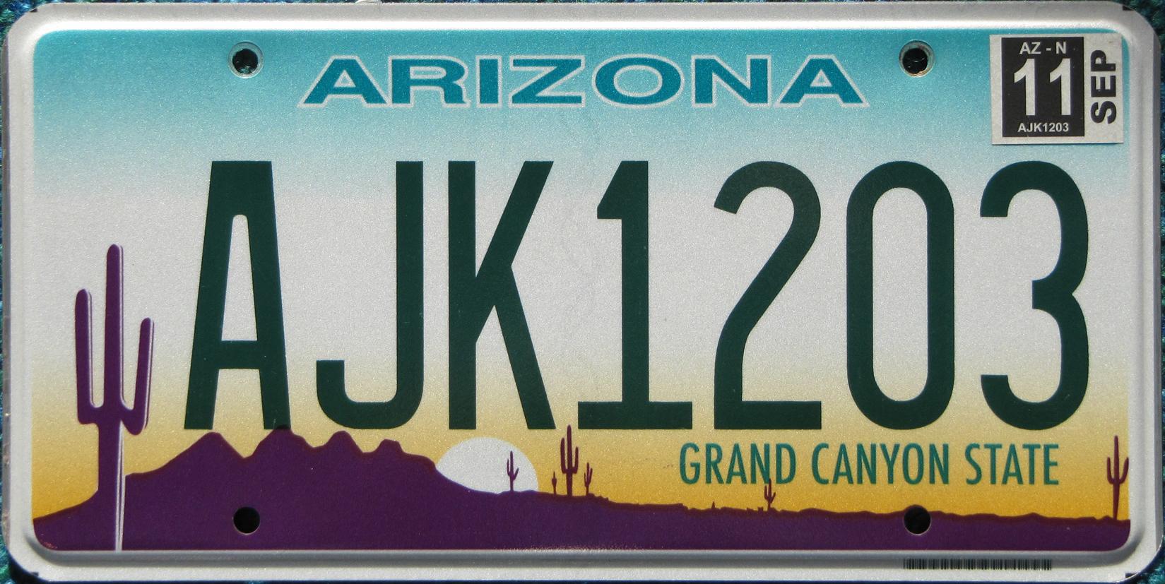
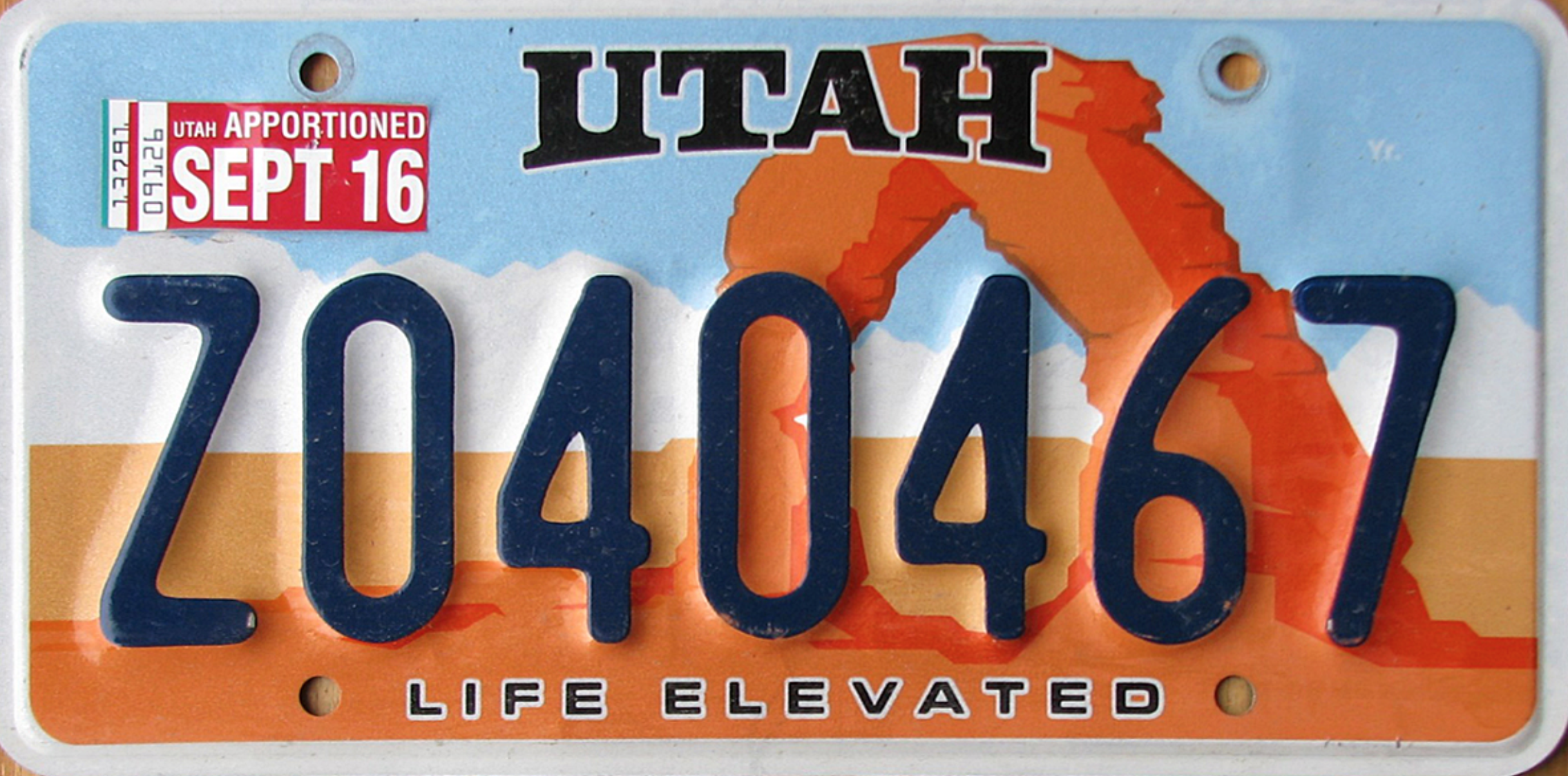
The shift in the digitized design of license plates is somewhat striking if one confines oneself only to its emergence as an almost affective relation to a local landscape at the same time as we have witnessed a growing homogenization of most environments. Indeed, the generic western landscape of Arizona, much as an inviting image of Utah’s arches–
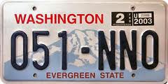
or the mountainous northwestern state of Washington and its snow-capped peaks–
–which don’t really only suggest ways of raising consciousness about environmental degradation and chances for the survival of landscape in an age of environmental pollution and global climate change. For on a symbolic level, they surely most sharply contrast to the conservative declaration of origin in the license plates of generations back when license plate design wasn’t an area of work covered in the state budget, and when iconic maps had semiotic centrality in the license plate’s field of vision. Indeed, the current offer of “choice” as a measure of individual expression, that can be selected online–
–seems but a logical if not a necessary extension of the rise of such promotional plates that approach advertisements of locality, in place of a line-drawn map. The obsolescence of the map, indeed, as a simple flat polygon, seems to have occasioned its replacement by a dynamic landscape, just as the decline of map-reading has made the landscape far more interactive.
To be sure, we now locate one another online in how we stream information or locate ourselves in information webs or economies of information that define a filter bubble–
–but the problem of mapping place in license plates seems most overwhelmed by the resurgence of the license plate as a field of individual expression, the emblem of the atomized society that goes bowling alone, as the vanity plate–and the creation of individualized messages that one forces all to read–has replaced a sense of geographical stability that was once not only tacitly shared, but inscribed for all to read on the backs of cars.
Perhaps the sense of the state as a collective unit of meaning has also greatly declined, with the growth of extra-urban areas that spill across state boundaries, and the homogenization of most of the national highway. In this context of placelessness, to be sure, the license plate has curiously become a place to evoke place once more, rather than to map spaciousness, or reclaim a sense of place and locality by pictorial connotations. If in part a travel advertisement, the license plate is suddenly more atmospheric than ever before.

There is, to be sure, something of a pronounced resurgence of the romanticization of a relation to landscape, that has replaced a declaration of provenance or a consensus of the mapping of place. Indeed, one might argue that the change reflects a decline of cartographical literacy–or in the shared perception of the expansiveness and power of the map’s semantic surface.

This change is echoed in the emergence of the license plate as a field suitable to plea for that landscape’s protection, and used to link its mountainous interior and popular ocean coast:

For the landscape has similarly replaced the map in the case of Oregon, whose earlier trumpeting of itself as the “Pacific Wonderland” was replaced by the emblem of a tree from 1988–an evergreen douglas fir set against a forest, but often viewed apart from the stenciled mountainous landscape in which it is set:

The outdoors image of Oregon, far from poverty that dominate parts of the state and the wealth concentrated in its larger cities, exists in the license plates that present a bucolic countryside of plentiful opulence, removed from wealth–as a meeting of land and sea of majesty–
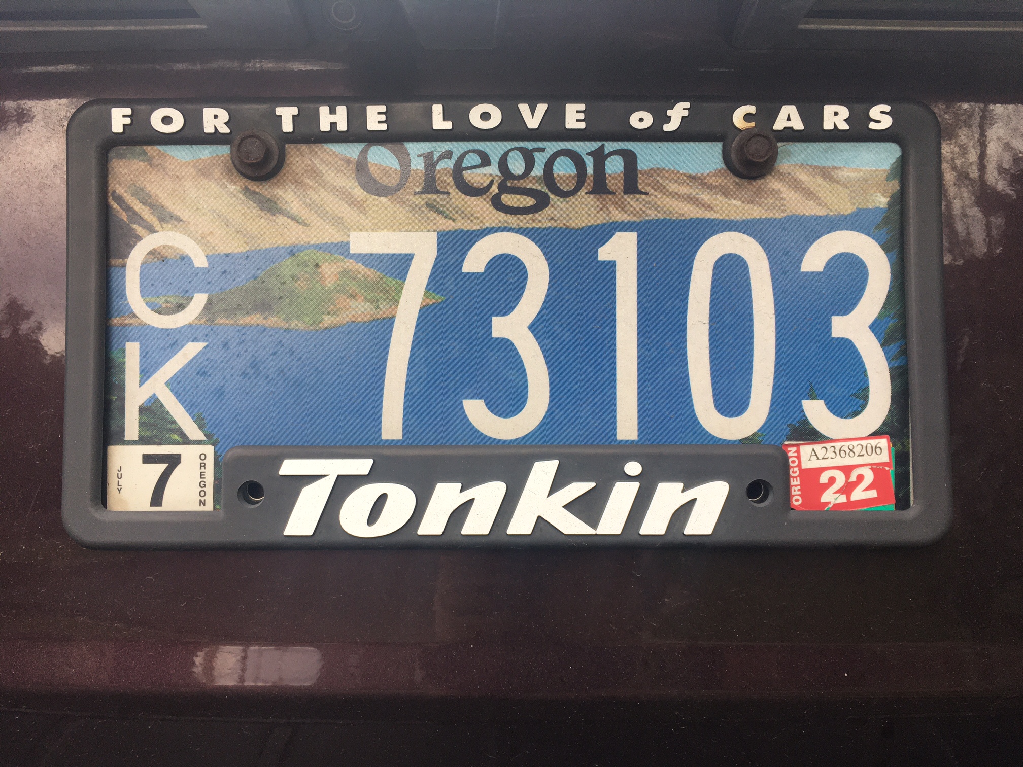
–and even a cultivated wilderness of fresh, vibrant greens that invite one to relax.

There’s similar sort of formal fun of eliding the plate and region is evident in Canadian license plate design, at least where the landscape of the spectacular Northwest Territories incarnated in the form of a polar bear who prowls its piney plateaux:

To be sure, the increased variety of vanity plates suggest an attempt to individualize the plate as a form of property–or public statement–but the shift in license plate design seems most evident in the appearance of the airbrushed landscape plate in recent decades, that describe the place of registration in pastels, as if landscape has more broadly replaced map as a designator of where one lives–in part because of the inclusion that a shared landscape provides, as if a surrogate publicity statement for the state’s Office of Tourism–as much as offering objective declaration of vehicular registration.

Whereas maps once occupied a privileged pride of place in defining the plate as something bestowed by state agencies in earlier eras, the widespread pictorialization of the landscapes on recent license plates, which read like travel advertisements for a vacation, parallels the marginalization of the place of the map now reduced to a hyphen or semantic glyph reveal a real but radical reduction of the meaning of the map as a region.
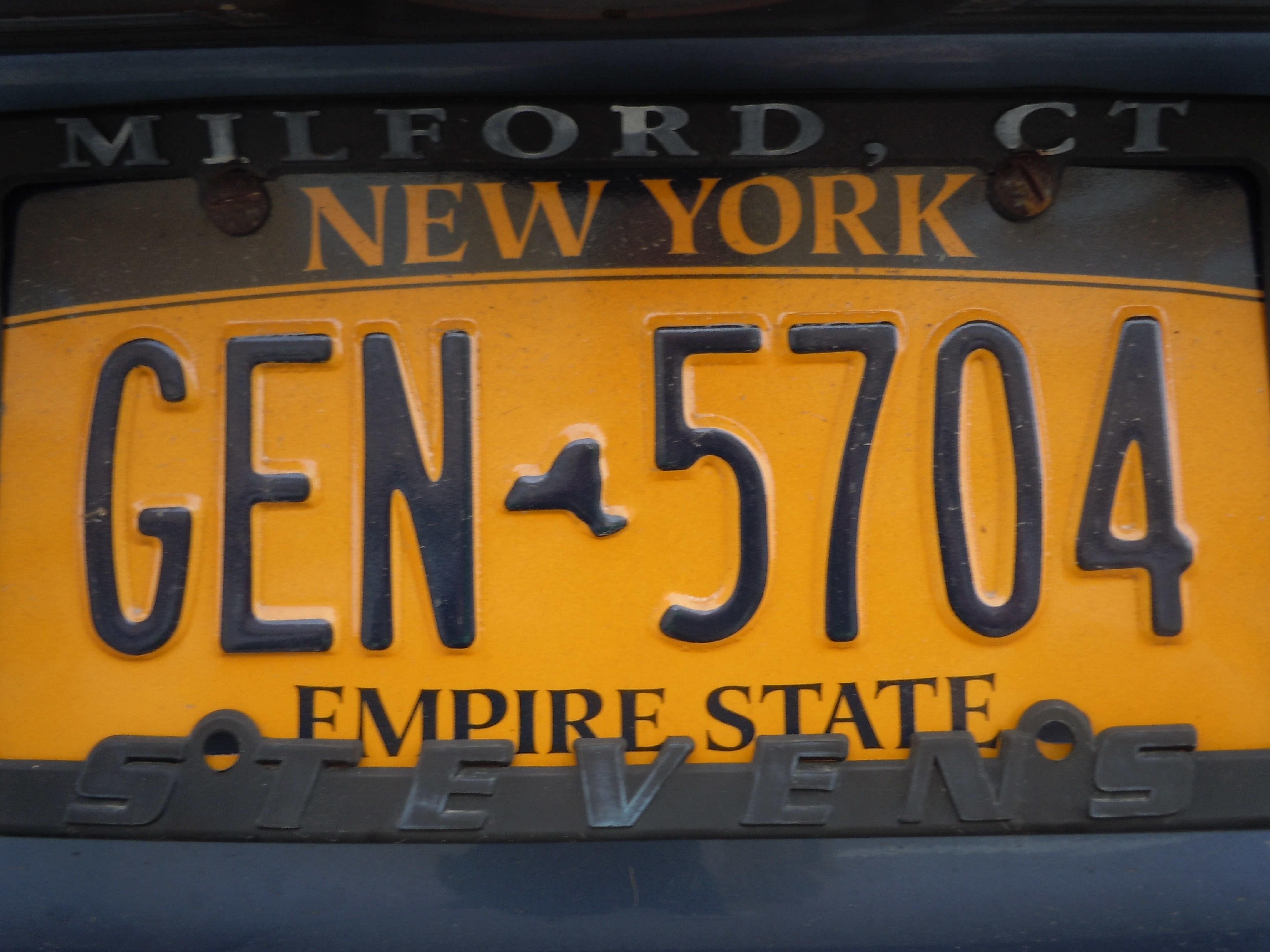

How did the map find itself to be so widely supplanted–as it is in this image of the rolling Tennessee Hills–by the landscape as the designator of place? For the increasing ease of replication of printed plates has come to include an increasing amount of painted emblems for the state, as the elision of an imaginary landscape of New York State, that stretches, here, from Niagara Falls to the Empire State building, that stands as the collective identity for the Empire State, above the map transformed to hyphen–
or a symbol that stands in an almost ghostly presence behind the most popular citrus fruit long exported from the state. The orange indeed seems a superimposed signifier placed over the map of Florida–at considerable size atop a ghostly half-tone green form of the state, which might suggest how the devotion to citrus crops and growing has changed its local economy and helped empty them of watersheds. And the range of possible mottoes or legends offers at http://www.myflorida.com suggest that the state is less prominent as a subject or signifier than the personalization of attitudes the owner might claim.

There is an untold but not hidden history in the gradual obscuring of the state-map as a designator of origin in the history of license plate design seems somewhat significant. For within the fifty states has been replaced by the prevalence of a landscape scenery designed to decorate license plates of a decidedly more air-brushed aesthetic–as if to propose an idea of the local point of origin as sharp graphic alternative to the abstracted aesthetic of Google Maps that we now consult more often when we are afoot or behind the wheel.
A look backwards at what was lost may be in order . . .
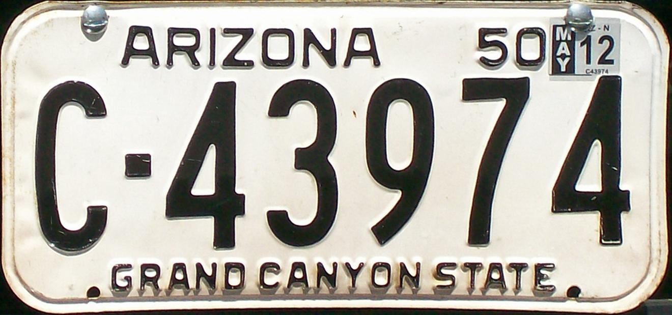
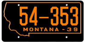
There was a time when the authority of the printed map stood as a prime designator of one’s site of origin–as if the registration number were most suitably framed by the frontier like boundaries of the state map over some fifty years: