
What’s the significance of names on a map? Do they register roads that belong to the territory or only reflect continued use? What sort of authority does a mapped road, byway, or highway retain in common law–and for how long must it be recognized as a road? The existence of place-names and routes on a map have become an increasingly contested way to preserve a sense of place, and the survival of the “sleeping roads” of Vermont, the “Class 4” roads that are not maintained by towns, even if some receive some limited maintenance, suggest a historical network of the past, still partly visible and indeed rarely used, but providing a vanishing network of the past inhabitation of rural space and its organization before the introduction of the interstate system.
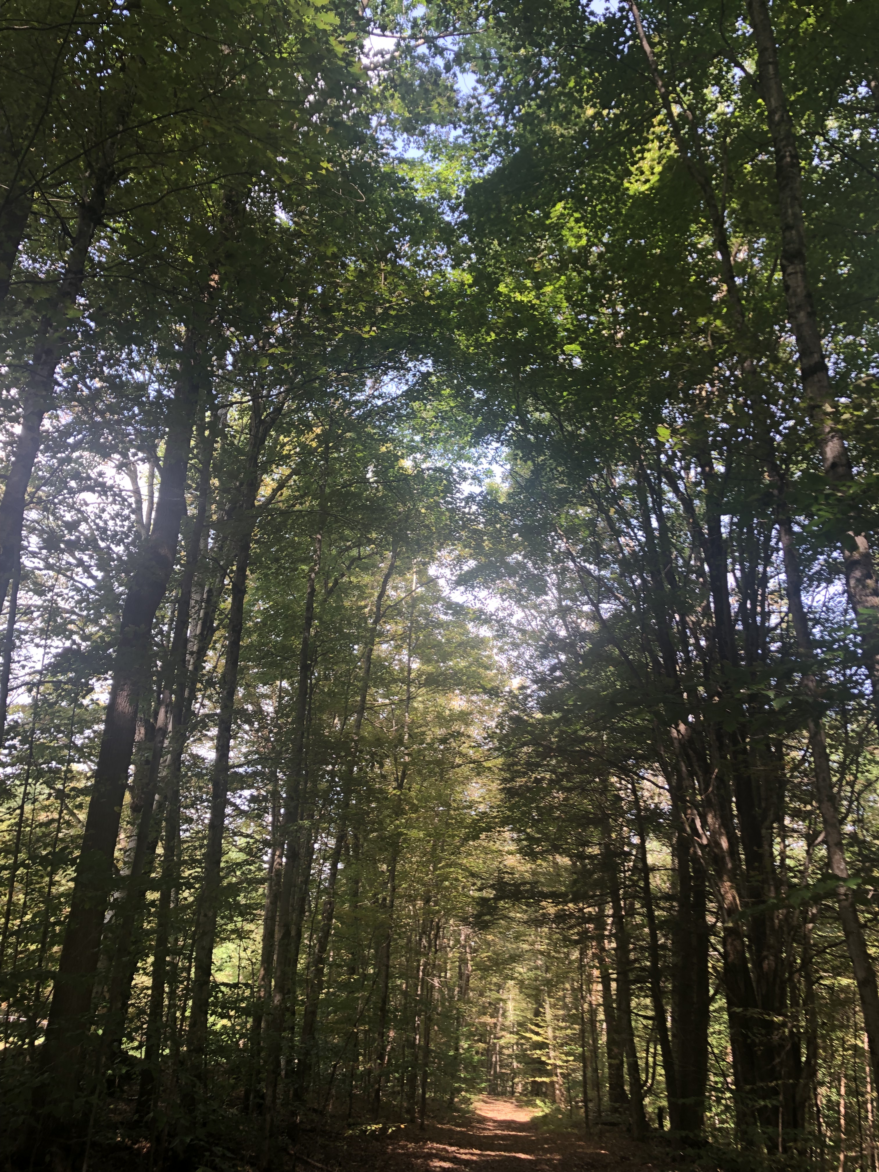
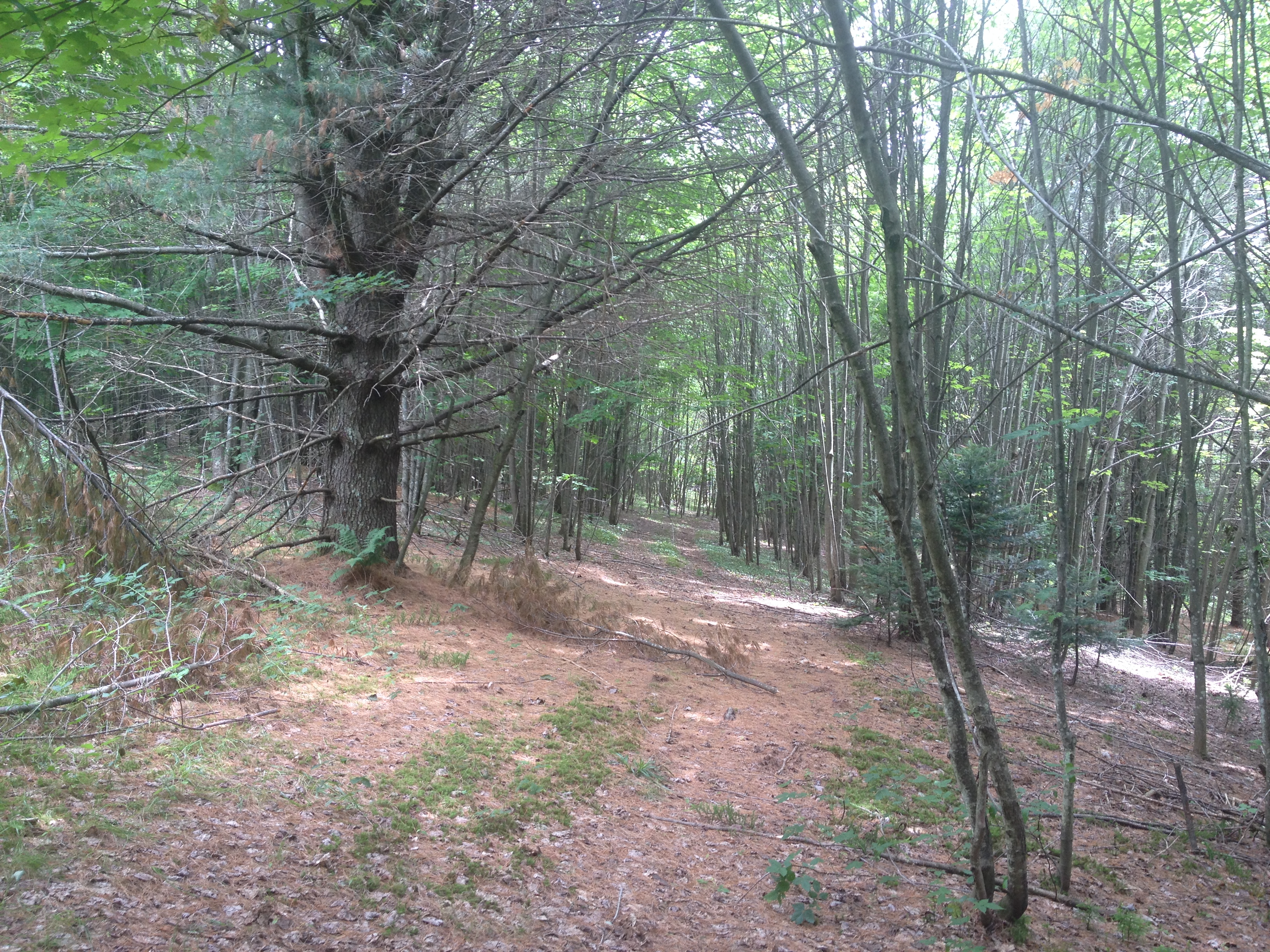
“If you walk down that road,” a Vermont farmer gestured at the end of Lavender Road in Central Vermont, “it’ll be like you’re walking into the past.” Meaning that the flat stone walls bordering the path, now overgrown with ferns, fallen logs, exposed granite, and an abundance of mushrooms and twigs, not to mention suspicious looking poison ivy, was an earlier system of land management and division, as well as an earlier route of access among the private property that divided Central Vermont hills, Long before I-89 ploughed through the countryside of central Vermont as a central artery of automotive traffic, cut through dark bedrock of metamorphic Cambrian and Ordovician eras, seizing thousands of acres across the state and displacing houses and farms, the roads we now see as arteries that cut through old forests and Silurian and Devonian metasedimentary rocks displaced the roads that once defined travel, reducing once luscious habitats of oak forests to the veils of Potemkin forests. Those illusory strips of six to ten trees deep to create the illusion of forest for tourists and motorists on the highways that cut across New England, vestiges of an earlier arboreal ecosystems living only in the minds of motorists on paved roads from which they rarely deviate or depart.

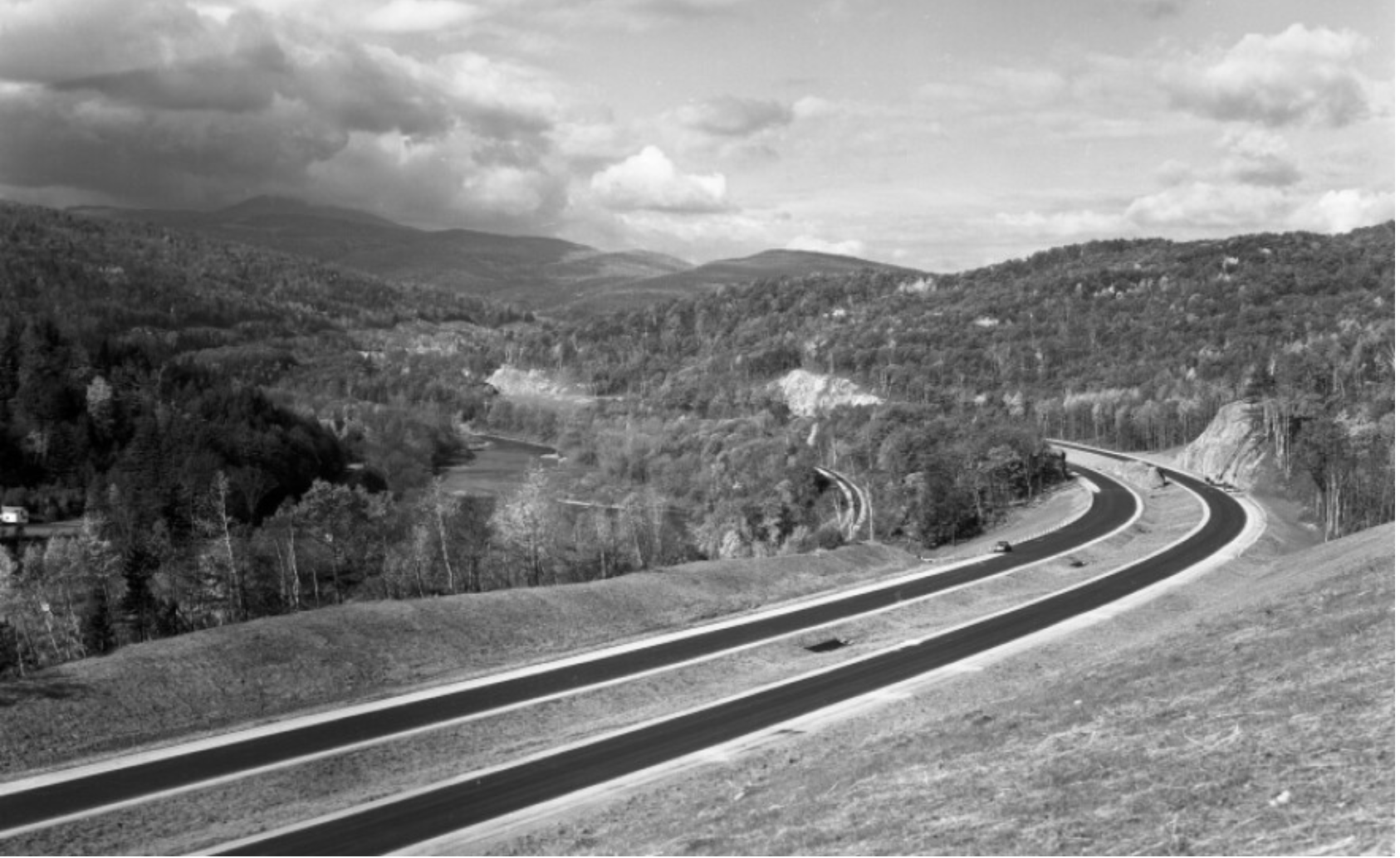
Newly Paved Interstate Curves through the Waterbury/Middlesex region, circa 1960/Vermont Historical Society
The very same roads that are no allowed to afford prospects of the fall foliage for which the same landscape is so well known were, of course, creations of an earlier area of land-movements and massive landscape shifts. What roads lie beneath them? How can they be seen or even mapped?

Interstate 89
The survival of so many earlier “sleeping roads” are increasingly threatened in an age of the road. The increased division of the long predominantly rural state on property lines, driven by a market of construction threatens to obscure local knowledge and a long-valued sense of place that the cutting of highways had long altered. If the preservation of dirt roads without much gravel in Vermont towns was an early development, which contributed recently to the real fears of erosion with flash floods and inundations, the drainage problems of the considerable number of municipal roads in the state have remained largely unpaved–about 75% in 2018, of municipal roads that comprise some 70% of total road miles–the problem of best drainage practices are an inheritance of the longstanding protection of the states rural character in its towns. But the landscape of the interstates brought a deep local resistance to the remapping of interstates and federal roadways that Vermont towns were quick to protect their local character in keeping with a longstanding agrarian economy, rooted in pasture and the production of cows’ milk.
Yet the increased presence of paved miles, even despite the increased danger that the state faces from stormwater damage and erosion in cases of increased stormwater and river inundations, has threatened the value of local roadways. The rapidity with which many roads were re-graveled, and provided with new culverts, ditches, and drainage systems after they washed out in the massive rains of the summer of 2023 led to a sense global warming as the latest threat conspiring to wash out the old lattice of historic roads in the state, and a quick and rapid defense of the local roads that were so much of the tourist industry depends. The deep sense of injustice in the prospect of loosing the legal status of “ancient” and long-pathways preserved in records of in local townships face possible obliteration in the legal memory as such unpaved roads–often more tacitly known than still used for commerce–are going to be reclassified. Indeed, as the state’s legislature has decided to reclassify common law roads to homogenize property records across the state, the outburst of local mapping seems not an act of antiquarian obscurantism, but a defense of local knowledge in an age of globalism and satellite mapping, where few of the older roads might appear from the sort of satellite-based mapping systems on which we increasingly depend. While many of the “class 4” roads might be sought out by mountain bikers, eager for off-road experiences, or back roads where they can snake around mountain farms, but only maintained if deemed necessary for the public good. Yet the rediscovery of these “ancient roads” that are still able to be found on some edges of historic farmlands open up prospects of the topography of the past, evident in the gaps between tree tops and the old stone walls of the edges of the pathways, rather than their navigability or use.
The plan for a massive reclassification of “ancient” highways on the books but actually dormant in much of the state of Vermont may be a pro-development land grab, but suggests that the struggle for designating once common lands as private property (and resistance to it) are waged on maps. The recent promise to reclassify registered but unnamed byways in the state–a mass of roads which were at one time used or previously surveyed as common-law byways, but have since fallen out of use to different degrees–has unintentionally generated a set of local storms about public memory. In a state where many current town roads remain unpaved, and many more have faded into the largely forested landscape, their traces still in evidence in the midst of a somewhat bucolic space of passage, tree growth impeded by the stones and often muddy road between old flat stone walls that had once been built to separate famers’ bow long overgrown fields.

The drive to reclassify the diversity of unpaved roads and common law byways once preserved in local jurisdictions reveals the rise of property development for whom the retention of old systems of spatial classification obfuscates the exchange of private lands. And if the preservation of old farmlands in Vermont provided a rare historical perspective of longue durée for early twentieth century historians as George Perkins Marsh, who rote long before the rise of environmental history or of the Annales school focussed on land management practices as a lens to observe long-term changes in social history. And in a fascinating illustration of how local collective mapping practices provide a unique point of resistance to mapping software systems that are primarily oriented to paved space, rather than the commons, or, as it is now known, the closely connected right to wander.
The Vermonter developed a broad history of the dialectic relations of what we call the Anthropocene between “man” and “nature” avant la lettre. He dis so out of a deeply American vantage point on world history, as he contemplated the “destruction wrought” on his native state’s local landscape in 1864, about twenty years after Henry David Thoreau lamented the presence of the intrusion of railway lines in the idyllic space of Walden Pond. He offered a global perspective that took its spin from his deep impression by the effects of the retreating and shifting landscape of Vermont, where he had been born in a farmhouse, the vantage point from which Marsh defined his perspectives on human destruction of the global landscape. After travels in Italy and study of the deforestation Mediterranean basin, he bemoaned that the case of Vermont’s loss of native trees as a similar global historical shift of consequence; in the introduction of his massively learned work, Marsh affirmed that “The earth is fast becoming an unfit home for its noblest inhabitant, and another era of equal human crime and human improvidence . . . would reduce it to such a condition of impoverished productiveness, of shattered surface, of climatic excess, as to threaten the depravation, barbarism, and perhaps even extinction of the species.” In his metahistorical masterwork, Man and Nature, Marsh contemplated the “wide a circle of disturbance we produce in the harmonies of nature when we throw the smallest pebble into the ocean of organic life” and watch it send ripples across the surface of a body of water, offering one of the more prescient images of the cascading effects of anthropogenic change in the Anthropocene.
Vermont’s deforestation was so accelerated and traumatic in scope that–long before the expansion of its interstate that destroyed farms, homes, and an agrarian economy–the state offered an important perspective for articulating an early environmental vision of the planet’s dire state that in 1874 Marsh found it to carry “the force of revelation.” As immersion in the resettlement of dustbowl refugees prompted historical reflection of self-made environmentalist Clarence Glacken, about man’s relation to the habitable environment; his experience of resettling refugees forced from farms by a lack of rain prompted sustained reflection on the relation of “man to environment” that resulted in the synthetic surveys he taught in the 1950s, which culminated in Far From the Rhodian Shore, a compendium of classical to enlightenment thought that was in the course of being complemented by a second volume when it appeared in cloth in 1976. If Glacken viewed the interaction of humanity and the environment as a baseline for humanism, the devastating experience of deforestation provided for Marsh a baseline for the dangerous rewriting of relations to the natural world; the scale of the deforestation witnessed in Vermont as a circumscription of access to natural worlds provoked a terrifying resonance with the deforestation of the Mediterranean he witnessed, leading him to view environmental change as a altering one’s relation to the world, when the logging industry clearcut oak, birch, below 2,000 feet in a massive harvesting of wood, producing 375 million board feet of wood by 1889, and leading the treeless slopes of Mt. Tom near a town known as “Woodstock” to experience massive soil erosion with hard rains that it altered its shape in Marsh’s own line of sight. His own reflection on “man [as] a disturbing agent” able to turn natural harmony to discords wherever he arrives generalized the land-altering consequences of clearcutting without constraint as a force of history: and whereas metahistorical interpretations of Hayden White and others may smell of the libraries where men like Michelet, Burckhardt, Marx and Vico worked, we might well map the alteration of lived environments provided the optic by which Glacken and Marsh structured pessimistic historical dialectics of their own.

The massive rewriting of Vermont’s once rich arboreal landscape by the 1890s was so extensive to alter the economy of the land and man’s relation to it. The scope of devastation was not without resistance as the old map of a relation to landscape was preserved, in no small part by th donation of a Middlebury legislator who incarnated local ideals of environmental stewardship by decrying devastation of “timber butchers”: as soil erosion was devastating local tourism, legislators founded a Forestry Commission, similar to the Board of Agriculture, leading Middlebury legislator Joseph Battell to act preemptively to purchase and donate a thousand acres of forested land comprising Camel’s Hump, Bread Loaf Mountain, and other peaks of the Green Mountains to the state so that they preserved their form–and later donated lands from Hancock to Fayston, to his alma mater, Middlebury College, a land grant that provided the nucleus of the broadleaf trees in the Green Mountains National Forest.
If the extraction of wood from the state’s lands reshaped the soil as the cutting of trees on many hills was accompanied by rise in quarrying to mine slate, granite, marble, and copper; often, smelting left wastelands behind in place of forested lands–leaving old growth trees to act as wayfinding signposts for a drivable road network created on cleared land, paved or graded to allow increased automotive traffic unsuited to dirt roads from 1908.
Did not the rebuilding of paved roads as Interstate 89 not encourage the growth of a fossil fuel economy in the 1960s as it cut across once forested terrain, forcing the vision of Marsh’s coherent landscape further into the receding past, as automotive space shifted the function, use, and scope of a local infrastructure of roads?
![The back of this 1964 photograph reads, "Unvailing [sic] of new gas signs on I-89." An exhibit at the Vermont History Museum features historic photos from before, during and after the construction of the state's interstate highway.](https://www.vpr.org/sites/vpr/files/styles/medium/public/201311/interstate-signs-2.jpg)
New Gasoline Station Signs placed along Interstate 89 (1964)/Vermont History Museum
The local resistance to such a reclassification of roads in the rural state, which has attracted its share of fierce defenders of the local rights of communities long granted precedents to federal or state law, make the proposed elimination of “Ancient Highways” from local law a matter of contention. The proposed reclassification of a multiplicity of roads poses a problem of having ceased to reflect the sort of use of landscape that developers want to encourage and private home-owners want to ensure. Given the shifting nature of land use in Vermont, where older houses are increasingly on the market, as smaller agricultural farms close and die out, a premium has developed for the clear definition of ownership without any liens or qualifications. Hence the increasing tensions between local municipalities in the state and any move by state government to abolish roads they long oversaw. In a sense, the increased interest in helping demand for fungible residential properties that can be sold without qualification have run up against the multiplicity of roads that have continued to remain on the books.
As the real estate market in Vermont seems poised to heat up in much of the state, and smaller towns face a demand for brisk sales and a large pool of properties arrive on the market, the state seeks to remove any obstacles to development or become notorious for arcane property laws, remapping the “ancient” roads of Vermont opts to treat them as ancient, and, far more than unpaved, not part of its future landscape. Yet the quilt of county regulations of roads that existed for most of the eighteenth century and was retained in most local maps before World War II reflected a local landscape of counties and townships rarely challenged before the arrival of interstate federal highways across the state during the 1970s, erasing the varied paths, trails, and common-law roads, long overseen by local city Selectboards and regarded as parts of the local landscape.
There is hence considerable resistance to transferring the criteria for local routes of travel to the state, and removing the common-law routes now often used as ski trails, snowmobile routes, or day hikes to a form that will conform to local properties. In a sense, this seems the end of the commons to local residents, who have begun to resist the declassification of roads as an unwanted remapping of place. The challenge to the status of common law property is also an interesting instance of the resurgence of re-mapping as a form of excavating hidden pathways and expressing the state’s historical identity.
1. Mapping the course of these common law roads has become widely accepted among many as a form of resistance of articulating a challenged relation to the land, increasingly compromised by the threat to the generational transmission of spatial knowledge and, perhaps implicitly, by new technologies of mapping that fail to preserve a sense of place. It is particularly striking that in an era when surveying seems displaced by the authority of Google Maps as the preeminent medium of way-finding, the resurgence of re-surveying ancient roads in towns across the state of Vermont has offered a way of affirming the existence of dormant “lost highways” to redraw the state’s map. The project of retracing formerly dormant roads suggests a cosynchronous image of the use of space in the state, analogous to the image Sigmund Freud conjured in Civilization and its Discontents of the historical layers of its urban topography as a figure of the presence of an individual’s past–as if the remapping of lost roads offered the chance for the rehabilitation of a collective memory that threatens to be lost, and, in due time, no longer visible to the eye.
The potential erasure of the legal status of historical pathways long preserved by local law seem have raised the stakes on the dangers of a loss of an immaterial culture long part of the predominantly rural state’s psyche. Freud asked readers to imagine the lost layers and buildings often traced by the forma urbis to present an image of the multiple pasts that a psychoanalyst was able to disentangle, and a figure of his own ability to excavate those layers of past trauma, as if a master-archeologist of individual pasts. The recent decision of Vermont’s legislature to discriminate which common law by-ways be recognized as “actual” roads that enjoy legal status suggest a similar operation of disentanglement–if one that will result in the purging of pst roads. Freud’s attraction to the persistence of past chronological layers in Rome was deeply personal, although Rome also terrified him, and the very European identity he claimed in his affinity with the city’s ruins–Freud claimed to be far more attracted by the majesty of the abandoned ancient city’s forum than the papal architecture with which it was also encrusted–provided a metaphor for his imaginary archeology of a point of origin.
The impression of Rome that Freud retained was not only animated by the experience of contact with the vitality of antique tradition, however, but as a unique model to discriminate and distinguish the architectural layering of the city as a European. Unlike Vienna or other cities, the discrimination of classical structures of different epochs in Rome that were uncovered by archeologists offered a basis for imagining intellectual powers to unearth dead structures seemed built atop one another in all their beauty–in a decisively aesthetic figure of the psychoanalytic exhuming of the past. Rome offered an instance almost unique of what he believed to be the cosynchronous existence of destroyed layers only partly visible beneath its surface–both challenging to comprehend in their entirety, but simultaneously captivating attention. The exhuming of a “second life” of Vermont’s sleeping roads rests on a similarly deep knowledge of place, and indeed the preservation of particularity in a changing local and global terrain.
Like the cosynchronous presence of multiple pasts in the historical layers in Rome, the roads across Vermont’s “ancient” townships reveal traces of past uses of and motion in space. The surveying of such “ancient highways” across the predominantly rural state creates a problem of how to envision the complex of routes competing for federal recognition. How could these past common-law pathways and byways be mapped, and what would their collective mapping look like? Should they coexist in a map, or could one imagine something like an interactive map, above a time-sensitive “slider bar”, allowing the viewer to view the different town highways, roads, and unpaved roads over almost three centuries that have constituted the constellation of collective courses of travel across the state? Or can one better map the state, using new tools of GIS and LiDAR, as a palimpsest of roads and common-law paths, by which to create a blueprint for its future development? While one should be wary of naturalizing their built environment, and how such pathways served to negotiate the region’s topographic variations, and unbuilt land, one alternative might be to recall the mid-twentieth century surveys of the ancient paths by which the Mississippi river had meandered in its basin, although the hope would be to established a more fixed–and far less fluid–relation to space.

Ancient Courses, Mississippi Meander Belt
Debates about the erasure of once-recognized roads in Vermont towns and hamlets raises questions of what constitutes a sufficient thickness of a cartographical description. All maps transmit public relations to the land, and the decision of which roads should be preserved in a map–or devolve into the possession of local landowners–raises questions of the status of common-law lands in a still relatively sparsely settled state, whose rural character is increasingly protected. Vermont has famously preserved much of its woodlands intact, with forested acreage growing considerably since the late 1960s, and public uses are protected in many ways by the unique combination of public and private land-ownership. Private land-owners in the state are traditionally bound to work with public authorities more closely than many other states, and constraining private property ownership, and particularly doing so in relation to the preservation of public rights-of-way–the inventories of historical preservation in Vermont placed few obligations on owners, but requires consideration of the impact of any new buildings, demolitions or subdivisions on the state’s historical landscape. Is the prospect of the disappearance of public roads from the official map, despite quite long traditions of their registration in town records–a willful amnesia designed to erase public rights of way?
What recourse exists for the respect of sanctioning such historical amnesia? It has taken considerable effort to calm concerns among Selectboards and local Aldermen about how the state’s “ancient roads” will be either reclassified or incorporated in the state map in an “Ancient Road Practicum” to assuage fears of the erosion of public rights of way. Regional maps create a distinctly affective relation to place, beyond registering locations: which unmapped public paths and roads recognized as common-law trails, but often only preserved in property deeds and registers, however remain on the books in Vermont, as all surveyed roads, and raise the problem of what to do with them–and what role the accretion of “Town Highways” long on the books across the state’s municipal corporations will play in an age of private property development, where the flexibility which was characteristic of most common law “roads” that were open for public use have become problematic in that they have been seen as pretexts for lawsuits–and obstacles for regional development.
The very plurality of roads that once existed in the maps regularly printed for townships in the pre-WWII period contrast to the demand to clarify rights of way. And although the unpaved road has long been part of the prized characteristics of the long rural state, the variances that once existed between Unimproved Roads, Primitive Roads, and Untraveled Roads increasingly threaten to be subsumed into the category of Ancient Roads that will be winnowed from the list of roads that will remain on the books.
2. The legal status once accorded such unnamed ancient roads seems emblematic of a shift in relations to space, and the forests which constitute the majority of Vermont lands, whose patrimony carries clear consequences of stewardship indeed. For the construal of “roads” is perhaps less the subject of contestation in the re-mapping Vermont’s phantom roads that have devolved into “unidentified corridors” than the construal of use. The measure now known as Act 178 claimed to assist towns in determining the “legal status of roads or public rights of way” in their jurisdiction, and provide a protocol to reclassify their legal status as “unidentified corridors” not requiring local maintenance.
The decision to ease the removal of the legal status of such paths provided a protocol to resurvey town highways by 2009, or be effectively voided and erased, based on the lack of their current public use. The response to Act 178 was worthily called attention to by tireless BLDG BLOG blogger Geoff Manaugh, who followed the unfolding of attempts to recover the state’s “lost roadways” with interest since 2008. Manaugh has written quite sensitively and in detail about the particular resilience of the local in a state that prides itself on the independence of municipal rule and the preservation of local property deeds and local repositories of historical memory. He followed how the Vermont Agency of Transportation has responded to the interest in clarifying the role of such “Ancient Roads” to explain protocol to sifting through submissions to be granted legal recognition with special attention to the local remapping of the state by self-styled surveyors who, empowered by GPS, have undertaken to tirelessly re-trace images of ancient roads and to reclaim the rapidly receding past knowledge of the local landscape in Vermont, and to preserve a record of an earlier common-law roads that were registered in the state.
The prospect of discontinuing all unidentified corridors from the map–and the ruling that they will revert to property owners–might be placed more centrally both in the environmental history of this least-populated (and perhaps most decentralized) state of the union, and the new reaction to space that the arrival of developers in the state have posed. The phantom roads preserved raise specific questions of the reception of maps’ contents, and have received considerable local attention as they have become emblematic of a past relation to the state’s local lands. The roads of Vermont have long been classified in relation to local and state authorities, and often depend on public liens of private property, in ways that respected local public usage of roads, and create limits on what statutes bind towns to be responsible for their upkeep. While usage of roads is not easily mapped, an interactive map, with a slider at its base, would offer a basis for measuring actively used roads over the previous two centuries as a sort of virtual compendium of rights-of-way–that preserves the traditions of land-use, and perhaps affords a palimpsest of local traditions of land-use that may be valuable for determining the course of local development.
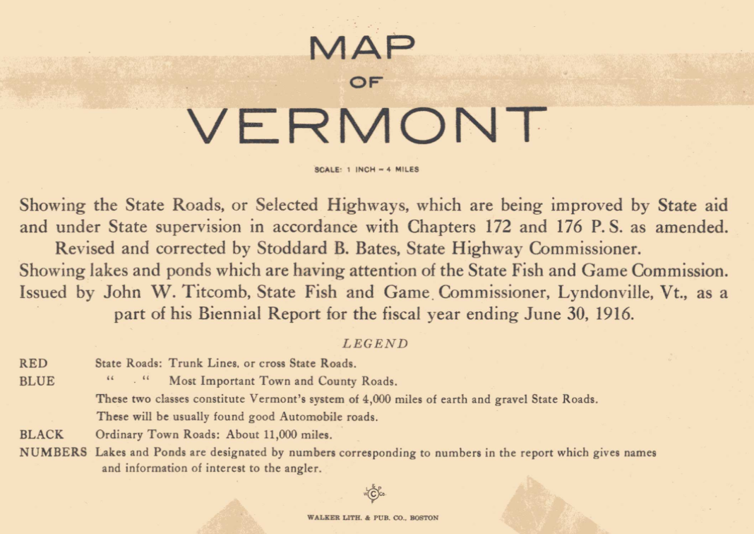
The stakes that were driven into the earth for interstate I-89 around 1970 created a break in how cars moved through the state. For the interstate offered a different sort of road through the Green Mountain state–not without some resistance. Indeed, a new notion of the “Highway” provided both a new relation to landscape of the state, and introduced a model for travel through its space–something like the major chemins in late nineteenth-century France set a standardized mode of transport linking Paris to the French provinces, as fellow-cyclist Graham Robb recently argued in The Discovery of France. But whereas Robb described a loss of past ways of moving through the countryside with the rise of a centralized system of roads, the long-decentralized nature of administering Vermont’s roads creates a unique repository of mapping space. Although the local ecology of roadways and byways in Vermont’s formerly thriving economy created in a relatively small space a flourishing network of some 4,000 miles of unpaved earth and gravel roads–in addition to some 11,000 “town” roads–around World War One. Much can be learned sometimes from the legend of a map, sometimes more than from its contents, and especially about attitudes to the land. The legend to this map of “selected highways” in the state of 1916, for example, illuminates a considerable amount about the legendary back roads of the state of specific relevance to the debate about the permanence or disappearance of the state’s phantom roads, and deserves to be closely read for the heterogeneity of roads and thoroughfares that it noted:
The specific ecology of such network of roads was long maintained by a system of easements to allow public use of byways, and encouraged all town roads to be registered locally–and to not disappear from the books–in ways that seem increasingly to be replaced by the monoculture of the highway. The creation of a large class of “ancient roads”–roads not comparable in actual age to the common notion of antiquity, but rather than reveal the administrative network of paved itineraries that organized and gave unimaginable coherence ancient imperial spaces, are associated with notions of “use” judged of almost analogous remove. They seem unwanted distractions of a bygone era of local municipal corporations.
DEA/ G. DAGLI ORTI/De Agostini/Getty Images
Are these common-law byways evidence of a well-tended landscape, as much as a bygone relation to moving through space? Rather than dealing with the roads, of course, debate about the mappability of Vermont’s ancient dormant roads, focusses on maintaining local public highways in maps. The very legislation that has destined roads preserved by local ordinance alone from the legal landscape has provoked the growth of interest in re-mapping as a way of asserting local identity and knowledge is far more than a curiosity in cartographical practices; the combination of such research into past roads is profoundly populist in its fervor. For it suggests a deep shifting the lived relation to the land–and an economic interest in the redefinition of public space, and the value of preserving recorded pathways and preserving town’s existing rights-of-way.
The proposed massive reclassification of roads has elicited fears of a major revision of ways of moving through the land. Maps are not only repositories of meaning and interfaces, but offer a terrain often actively contested. The Vermont General Assembly laid the groundwork for a massive reclassification of the roads recorded in local registers as “unidentified corridors” in ways that would render them legally obsolete from July, 2015, and erase the very easements that created the unique combinations of public byways and private property that long distinguished Vermonters’ relation to the land.
The adoption of Act 178 diminished Selectboards’ authority to determine byways, but in taking the mandate for preserving roads form local municipal corporations, it reframed a local struggle on a cartographical canvas that promoted GIS-enabled amateur cartographers to view their maps in distinctly self-empowering ways. For while local interests established town highways and common-law byways in ways once mediated by powerful municipal selectmen, the growing demands of the exchange of property and development in Vermont have redrawn relations to the land. When George Perkins Marsh bemoaned the “decline of Vermont” as a model of deforestation, agricultural runoff, overfishing of its rivers, and dams in 1864, he coined a model of environmental thought that took its spin from the transformation of the state where he was born; his work, strikingly illuminated by geographer David Lowenthal in later years, became a basis for Lowenthal’s own massive study, The Past is a Foreign Country, that examines the attraction to “lost” landscapes as illustrative of another era, playing on the truism as a motto of the geographical imagination. The threat to strip ancient roads of legal status are less directly a problem of land stewardship, but suggest a past that is receding or has receded from the present landscape, rearticulating one’s relation to the land as well as the history of land-use in the state. If not explicitly environmental, the costs of erasing such unnamed roads and dormant byways create environmental consequences, based not only on a new set of principles for organizing land, but the abandoning of a long-conserved local customs of the conservation of how one moves through space.
It is perhaps interesting to compare how much of France’s provinces were, as late as 1867, not only poorly mapped and known when some 43% of its territory was seen as “dominated by the forces of nature,” from wildlife to forests to shores. France’s principal roads were defined from Paris; the the nation’s residents often existed in isolation from each other through the expansion of rail before the First World War, when a national system of roads created dominant routes of automotive travel that erased or displaced earlier relations to the land. Vermont enjoys a far more decentralized notion of the recognition of roadways. Yet in legal terms, much of Vermont’s terrain has remained relatively uncentralized and were both locally administered and understood.
Such long-dormant paths are not the unmarked tracks taken around or through hedgerows or running through tunnels of vegetation, but rather are routes that shaped places–and are most often found off the roads and in unexpected places, in the partly submerged stone walls, boulders that might have marked the edge of fields, or old paths that create a pattern as off the main roads to reorient ourselves to place and rediscover familiar places, but which may soon revert purely to being private property. The complex relation to local roads–now reclassified en masse as “unidentified corridors” that will be absent from the State Highway Map, and without legal basis–suggests a new relation between place and space. But existing maps provide few tools to help us move from one perspective to the other, or from the gradations of paved and unpaved roads, legal trails and discontinued roads, trails, and footpaths which are not so clearly classified or apparent in a view from a state capital.
3. The prospect of pruning of the legal roads seems intended to favor property owners, erasing previous claims to “sleeping” roads lest landowners be surprised that they lie across their property, and create lawsuits that impede projects of future construction. But it has also opened the possibility of private cartographers’ re-negotiation of their survival. Vermont’s thinly distributed residents have resisted proposed erasures of rights of way, town highways or byways before selectmen or select boards in the past. The authority of municipal corporations have gained less economic authority in the state, a standardization of the mapping of property laws has been promoted to prevent the possible lawsuits, considerably expensive and unwanted, that plague many towns, by the “massive reclassification” of town highways no longer in current use.
The decision to extinguish the legal status of unused roads which would devolve into the owners of adjoining lands, reflects the diminished authority of local select boards in the state. The enactment of Act 178 has effectively restricted recognized rights of way, in a gift to property developers desiring to be less hampered by building restrictions. The massive reclassification of rights of way has offered limited recourse to towns without access to surveyors and attorneys save unpaid volunteers. The multiple classes of roads–some maintained, other not–were effectively redrawn in deference to property lines and developers, rather than local Selectboards. Such resistance to remapping place reflects the deep-seated local resistance to projects of development across the state, which, while dismissed by many as essentially romantic, build on deep fears of the loss of localities which survived the paving of the I-89 interstate in the 1970s–and have cathected about the possible disappearance of roads from the map as if they affirmed a loss of local knowledge. The issue turns on the slippage or rather permitted coexistence of both a public right to passage and a private right to landholding that is specific to Vermont in the United States: for while easements on privately held land were long permitted to create public ways in Vermont, in a common law highway creation, the creation of town highways in many cases only require recording an act of surveying, after which it can’t be voided or extinguished even by non-use; the act of collective reclassifying “class 4” highways–town highways for which no statutes exists stipulating that town is obligated to maintain–has only rested with the town, either because of a petition from town residents or a decision of the town’s local select board.
Local property lawyers have hence bemoaned “the curse of Vermont’s phantom roads.” As much as an exercise specific to an underpopulated state, the support for affirming former thoroughfares on the books by local statutes and in town clerk’s registers reveals the deep persistence of local mapping–and assertion of the importance of their mappability. Vermont possesses more unpaved roads than anywhere in the US, and many residents want to keep it that way. Perhaps the contest as to whether lost thoroughfares as less deserving of legal recognition–and the state’s “Ancient Roads” discontinued–indicates a shift in attitudes toward the land in a state once predominantly agrarian, but whose former farmlands have been increasingly open to turnover and resale. It mirrors a deep defensiveness, almost proprietary in nature, of the state’s agrarian history embodied in its roads. For battles of local litigation were openly waged on a cartographical canvas, to defend the prospect of the disappearance of landscapes once described as so deeply known as the back of one’s hand. But that landscape is hardly uniform, as mapped below–in an image of the different ways of moving through Vermont’s almost three-quarters wooded land. The increased number of paved roads in some regions underly the fears of the prospect of a deep change in attitudes to space and how the landscape is navigated; dirt roads have long distinguished perceptions of the state’s landscape, and the advent of paved roads on the counties near its borders suggest a considerable change in the local landscape. The majority of Vermont’s roads remained unpaved as late as 1996, revealing the deep-set defensiveness about the dirt road in Vermont, where the 8,000 miles of unpaved dirt roads, overseen by roads commissioners, make the state distinct in the United States, and where the central interstate that is increasingly clogged with traffic and transport rigs has only been around since the early 1970s, when it joined the Eisenhower interstate system. Unsurprisingly, those regions where the ratios of unpaved to paved roads are significant, the interest in defining ancient roads has been particularly pronounced. For such roads constitute regional icons that are inseparable from a map–and defines the integrity of local landscapes. Whereas more than 14,000 miles of roads exist in the state, only a fifth belong to the state highway system—roughly 2,700 miles.
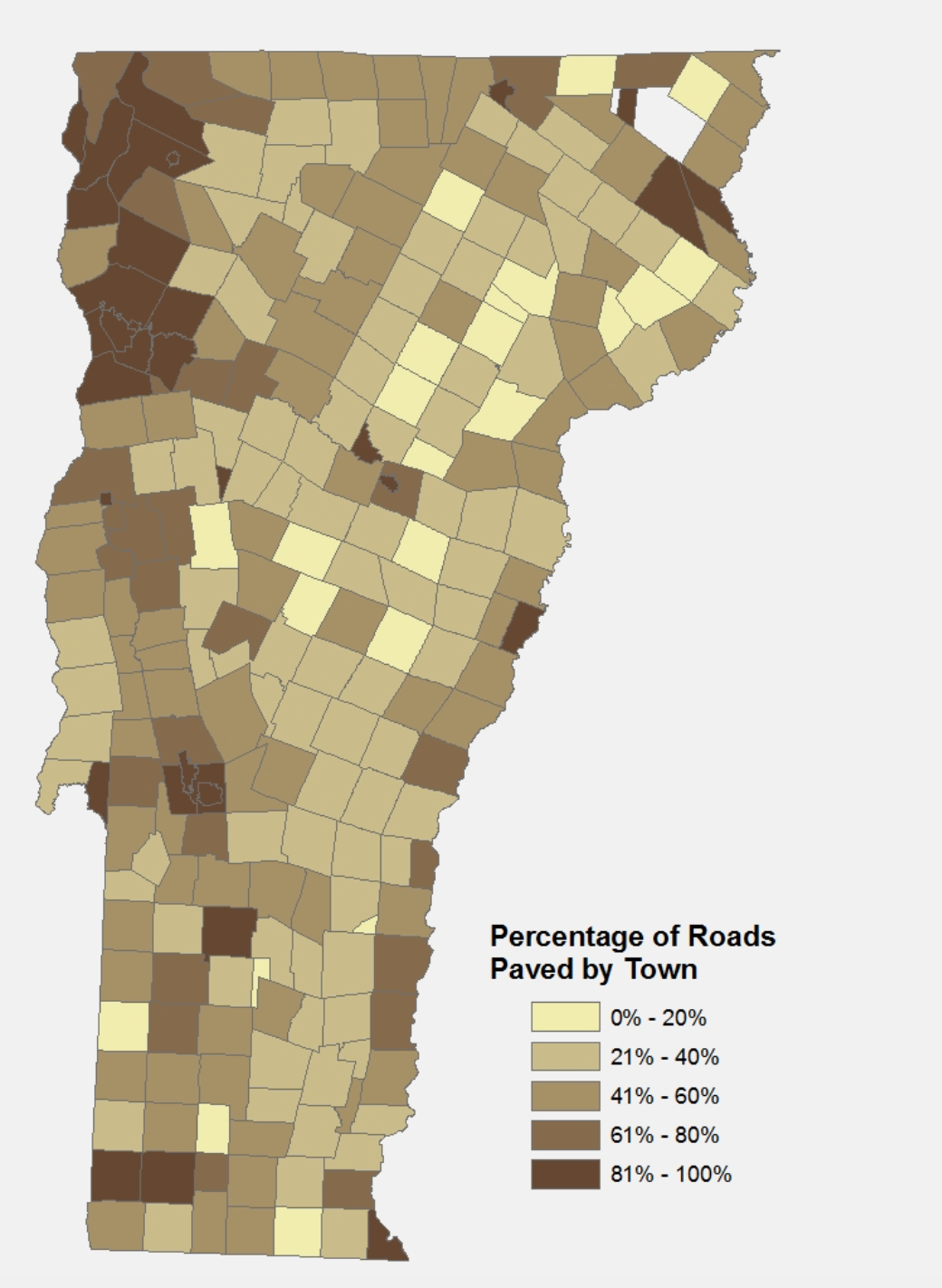
Static version of Public Assets’ rollover map available here, from GIS data of the Vermont Agency of Transportation
The uneven presence of paved roads concentrated around Lake Champlain, the state capital, and the state’s edges in “Where the Roads Go,” a map taken from the public maps of a public agency responsible for the maintenance of state roads, reveal shifting attitudes to space and in the human geography of Vermont’s predominantly forested lands, as well as profound differences in how space is passed through that come increasingly into evidence in central Vermont, where they are highly valued. A more relevant map would be, of course, of road use, but that would require a complex tracking of roads by sensors or real-time maps. But the above map suggests clear pockets of the conservation of dirt roads–and the surprising local persistence of an earlier relationship to space, not registered in land maps. Indeed, the unique metamorphosis of most state highways that shift to town roads while passing through Vermont towns offer evidence of the uneven integration of a state-wide road system into a network of town highways. Unsurprisingly, in municipalities where paved roads are in the minority, after examining data in the rollover map of Public Assets Institute, “ancient” roads has been contested. Because this rollover map plugs the GIS data of the Vermont Agency of Transportation, a public agency responsible for the upkeep of roads, and omits those roads labelled “unimproved/primitive” or “untraveled,” the addition of ancient roads would only increase the ratios of unpaved to paved roads. In many counties of Vermont, the sense that la diritta via era smarrita has encouraged the redesignation of “unidentified corridors” as official town roads; the resurveying of byways seems in danger of being definitively written off the books once such roads are absorbed into privately owned property lots, as such “unidentified corridors” without proper names vanish from existing state maps.
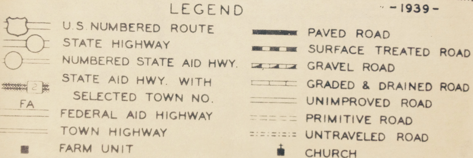
5. The growing demand for a standardization of property deeds encouraged the rewriting the legal status of Vermont’s byways–and the reasons for which formally sanctioned public roads would continue to remain on the books and to be recognized as legal roads. And the race to map common-law byways was the subject of Geoff Manaugh‘s post, which provides the starting off point for a contemplation of the power of how a state like Vermont is mapped, and exactly how adequately “thick” a description might be preserved in a highway map of the state. 2. Although many local statutes to maintain and create “highways” have long remained the same, the retaining of the term “highways” pertaining to roads that towns were granted authority to legally create on the basis of a survey from 1808 has made it difficult for the term to not be a topic of deep misunderstanding–as does the declaration by the town that the “highway” was open, even if the town select-board did not place it on the state highway map. But the place of such Ancient Roads, however frustrating or obfuscating they might appear to modern property deeds or development, are artifacts of a local ecology of mapping, revealed in a local survey of the range of highways in Vermont mapped in 1939 in Berlin, Vt., outside the state capital, which discriminated thirteen varieties of roads, from “state highway” to “untraveled road” and “primitive road.” These classes of roads are continued in the five classes of roads as they are currently mapped–the fourth and fifth lower ranks of which have been recently subsumed in the category of “Unidentified Corridors.”

The parallel existence of four classes of state-supervised highways, town highways and county roads had been clarified in the legend of a 1916 map of the state’s highways, before funding for Federal Aid Highway Act of 1921, the Golden Age of paving of roads from the 1920s and long before stakes were set in the forests for the paved artery of I-89 after 1970 that eventually allowed big rids like eighteen-wheelers to carry goods across counties without encountering any steep grades, and to leave trails of pollutants from drip to fossil fuel emissions across the state. Such distinctions might seem quaint now, but once served to designate major avenues of mobility.

Vermont Highway Dept./Fish and Game Dept. State Map (1916)
Continuing questions prompted by the semantic slippage between “state highways” and town highways were revisited in 2006. The passage of what was later known as Act 178 promised to reclassify the roads recorded in local registers as obsolete and vanish from the landscape into homeowners’ property deeds if they weren’t approved by July of 2015. The hope was to open the state to further real estate exchanges, declaring earlier highways null and void, to clear the slate for a new relation to the land by cleansing the map of what many saw as the true basis to help local development and growth, dismantling the local diversity of mapping of common-law by-ways by their massive reclassification. The approaching July 2015 deadline mandated by Act 178 has however encouraged several self-styled surveyors to dedicate themselves to effectively excavating “ancient roads” by reviewing town records and re-surveying their courses by GIS so that they may recover former common-law byways suddenly threatened with erasure and mandated obsolescence, and to resurrect past “highways” which property owners did not want to recognize as rights of way. For the persistence odd amalgam of local statutes and common law in Vermont has so confused the question of the uniformity of landowners’ titles and property claims that it was seen as necessary to guarantee homeowners from not having to learn about undeclared thoroughfares that once crossed their lands. (The confusion encouraged a new map comprehending those “clearly observable” byways and highways, but nonetheless acknowledging the ability of towns to declare “unidentified corridors” as a class of roads–lest they be extinguish from being grounds for legal action.) The longstanding unpaved highways in much of the state were so much part of its landscape that the prospect of voiding these thoroughfares’ legal status has provoked a resurgence of counter-mapping to take cartographical note–if not possession–of corridors, thoroughfares, and sleeping roads whose “un”-mapping constituted a loss of historical patrimony.
University of Vermont Landscape Change Program/Vermont State Archives
The lack of clarity has lead many to seek to reclassify such “unidentified corridors,” lest they be swept from the map as public rights of way and effectively . . . lost. “Maps Don’t Show Vermont’s Sleeping Roads,” announced a banner headline of Yankee Magazine alarmingly back in 2009. The article describing the dilemma that although most landowners want to leave roads open to cross-country skiers or snowmobiles: if they are annoyed by finding beer cans and garbage as the snows recede, the considerable imprecision of where such roads lie across privately owned lands has created disputes between not only hikers and homeowners to a conflict between private property owners and conserving Vermont’s fading agrarian past–and opens up a shifting relation to the land’s use as the agricultural society that defined the state in the 1970s seems definitively on the wane, despite the survival of former cornfields and roadside farm-stands.
The dynamic of documenting Vermont lands may reflect the outlier nature of Vermont as a site of local towns’ record-keeping. Town clerk offices and town halls in the once largely agrarian state have retained written records that document any road which had been surveyed in the state stay, and the legal recognition accorded this network of hidden roads or planned was directly addressed by the state legislature in 2006: but for the first time, Act 178 introduced a window through this July for submitting any additions to the map–fashioning a feasible protocol for adding “ancient roads” to the state’s general highway map. It has encouraged the drawing of a counter-map responding to the imperiling of the past landscape of the state, giving voice to the unrecognized in the compilation of lists of sleeping roads lest they atrophy from collective consciousness and be removed from a historical patrimony. To be sure, only in select regions of the country where systems of record keeping are still stored in town record books and vaults, and localities retain a certain preeminence that the local government respects from having to take the time to absorb, can the confusion about what constitutes a highway or “open road” exist.
But the semantic sedimentation around the word “highway” seems only half of the problem, since their existence is the bugbear that developers face. For the existence of roads can continue if they remain long on the local books, “even if nothing of them remains except a musty record book in a book in the town clerk’s office,” as Paul S. Gillies of Montpelier puts it in his recent Ruminations, and if “they only survive as legal ideas.” The poor maintenance of town highways in the state already muddies the issue of their maintenance.
6. Does the umbrella term of “highways” create both a contextual and conceptual problem of what remains on the Highway Map, proving far more confusing to the question of processing where a road lies and who bears responsibility for its upkeep? What is a road, anyway? Well, who wants to know? The debate about what constitutes a “town highway” has provoked local reluctance to relinquish routes not visibly used, so the question really turns on the construal of use–and questions of converting easements attached on privately owned land that was previously made to public use. Can such easements that were made for “reasonable and convenient” “public use,” asked Alexander Hood in 2010, be converted to “state use,” and can the process outlined in Act 178 prevent local statutes from being adopted to reclassify “unidentified corridors” as a permanent road, and thereby further cloud the hopes for its extinction? This is certainly what the petitioners who intend to re-open the designation of “unidentified corridors” in the state had hoped to achieve. “The challenging task is a recovery of lost knowledge once familiar to many residents of the town, and then lost through unintended neglect,” Paul Gillies has advised local map makers who had volunteered to undertake the “worthy task” of excavating town highways and old roads, and advising them to undertake to document the “full history of the highways of your town” in a “fully-annotated, correct map of the road network” for future use. For what constitutes an “ancient road” is itself of course a matter of perspective. If ancient roads embody an idiosyncratic Vermonter sense of the antique, they are no doubt a consequence of the perceived stakes of a loss of earlier inhabitation of space. The recent attempt to rediscover the roads that have remained off most maps of the state, and were never listed on official Highway Maps, reveal a lattice-like network hibernating common-law roads that were ever proposed in the public record of routes from the reign of George II. A proviso in a dormant law has long granted all towns authority to enshrine laws on the books allowed common law transit routes to long accumulate across a state, ensuring many seasonal roads to be used in alternation by Vermonters. Yet as insurance companies have come flatly to refuse to write title deeds in certain towns, and some towns to deny applications to build additions to their houses outright, what as emerged as a site of access to a historical patrimony of how the land was lived have threatened to significantly dampen an active real estate market. The hope for relabelling such common-law rights-of-way as “unidentified corridors”–in the words, allowing sleeping roads to be identified and some to be added to official town highway maps, while allowing others to be stripped from the official books and wither away. Act 178 was adopted to strip the state map of the legal baggage of surveyed roads that have long fallen out of use, as if they were a system of vines or unwanted underbrush, in hopes to facilitate the future fungibility of a brisk traffic in property sales by minimizing home-owners’ risk, it has set off an alarm for the a reassessment of local roads–lest “unidentified corridors,” not only be stripped of legal status, but disappear into the local landscape rather than provide active precedents for easements.
Mutatis mutandi, the dream of assembling the hidden or virtual lattice of unused roads and hidden pathways across old agricultural lands has become a goal in itself and a sort of hidden patrimony of the state, as individual nameless roads have been recovered from title deeds and town records and relocated in the landscape by GIS. Which goes to show, debate that focusses on the addition or subtraction of places from a map–and the map is accorded explicit authority as a repository of memory: there is a strong sense that what is or is not included in the final version is perceived to have potential consequences far greater than folks might usually feel. Whether the network of unused roads which still on the books constitute an actually active repository of knowledge or a hindrance to property sales is immaterial to such surveying–Act 178 prompts of a loss of the way-finding and foresting long central to Vermont lore in a state whose landscape still carries the imprint of its agrarian origins even as property sales increase, and the mappability of byways is increasingly contested as impinging on homeowners’ property rights.
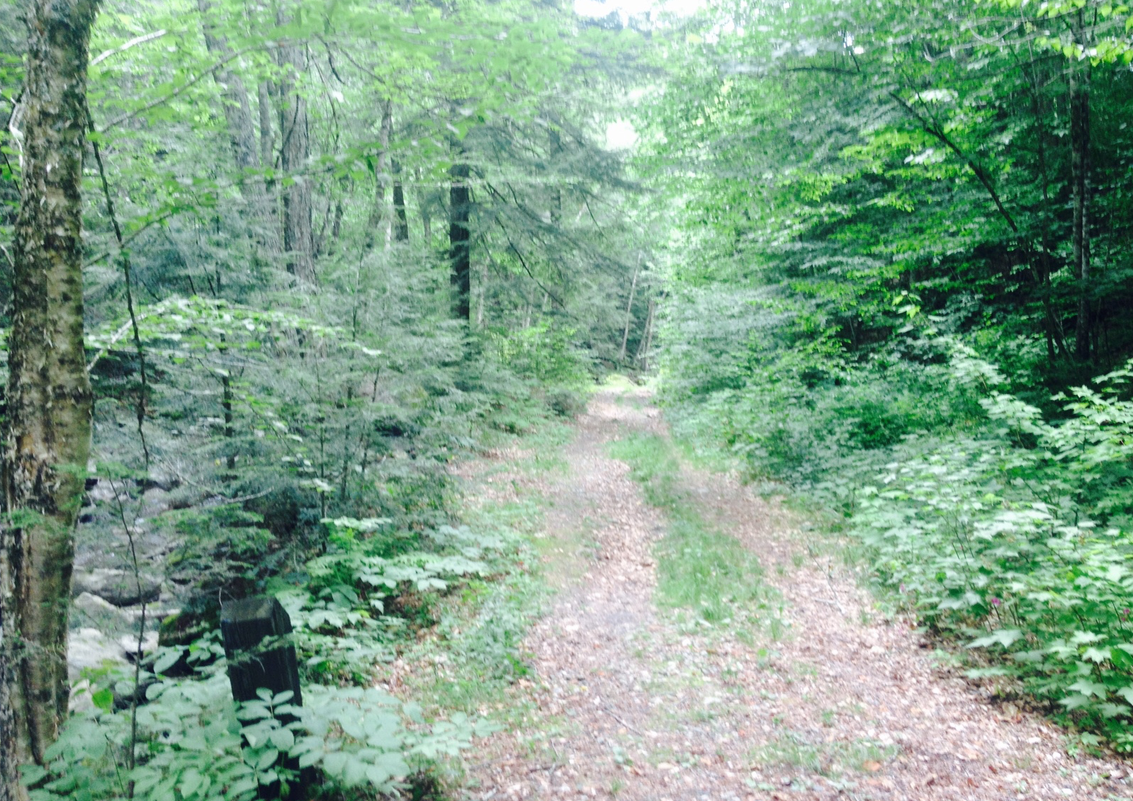
Brookfield, Vermont (photo by the author)
The authority attached to the practice of surveying–and Vermont was quite intensively surveyed since the eighteenth century–invested an authority in written records that are increasingly being supplemented by re-surveying, GPS, and even flyover LiDAR surveys to mark abandoned “ancient” public roads across the state, and often across forests and private property, was increasingly seen as more than a hindrance to encourage a market of local real estate and development: for as the number of non-industrial landowners in the state, almost 80% covered by forest, has grown consistently from the early 1980s–and by a third in the fifteen years from 1983 to 1998 alone–the briskness of property transactions in recent years have provoked a challenge to the sense of its spatial order where the demand for the fungibility of land may lead the recorded roads once preserved in public records to disappear.
The authority of an apparent atrophying of local knowledge about place–a prized possession in a state of relatively strong localism and regional autonomy as well as pride–has been met with a range of remapping place with an energy often not seen, or imaginable, by a crew of retirees who have acted as a crew of self-annointed local historians. The identification of ancient roads by GIS systems or LiDAR has mustered an increasingly ideological weight in Vermont. For in recent years, as a deadline for filing requests for the recognition of roads, increasing individuals have sought to remap routes, acting as self-styled renegades in the tradition of the Green Mountain Boys’ brigade–not to fight with arms for their land, but to reclaim place as they re-survey Vermont’s ancient roads to inhabit the region’s historical patrimony.
The search for old trails and ancient roads that were filed with local town councils over time created a sedimentation of routes that once open for review have helped generated excitement to reclaim place in a world registered by GoogleMaps. The shifting sense of the social that the elimination of accumulated rights of way suggest an unnecessary challenge to the ecology of information in the state in a state where some counties remain 94% forested, and the state is the second least populated. The acts of reclaiming roads have created a drama worthy of attention because of the local efforts of remapping that they have inspired. In places such as Huffington, VT, a group of ten volunteers taking the defensive-sounding name of the “Ancient Roads Committee” composed of a GIS analyst, ski patroller, and biologist for the Audubon Society, moved by their ties to the local landscape, retirees have emerged as latter-day Green Mountain Boys to remap some 138 roads in the region to enshrine their legal recognition. Their ringleader, Aaron Wortheley has hurled such defensive inspirational battle cries as “For us it’s about old maps, history, and a way to better understand the town.” The battle is met on the ground and by archival research in town records. The former forester Norman Arseneault, of Granville, VT–with dirt roads of 17.6 miles, and paved roads of 11.9, and adjoining the Broadleaf Wilderness–has worked assiduously to compile a survey of “ancient roads” to be submitted for consideration as “ancient,” and which, even if not enshrined as permanent rights of way by the state legislature, will be self-published for locals and visitors. Even if many such “roads” may remain GIS shapes, lacking names, waiting to be placed on a topographical map, and were only mentioned in the 1850s, by remaining on the books they have either become spots that seem in need of pruning, to use an agrarian metaphor of gardening, or preservation–either being fetishized as historical remnants or providing access to a receding past. In the town of Hinesburg, VT, near Melbourne–dirt 34.9 miles, paved 29.1–the local Selectboard is working to identify roads that “state law dictates that towns retain the rights to . . . whether they have remained in use or not,” even if the only evidence of their founding remains in the town vault, establishing an ‘Ancient Roads Committee’ specifically dedicated to reviewing old records to map old roads, working to reclassify “unidentified corridors” lest they become defunct, and absorbed into private lands.
7. What generated this efflorescence of map making and feelings of local bereavement at the reclassification of unused thoroughfares? The roads lie between common law usage and thorns in the side of a booming market of private-property. This still-unmapped aporia of legal interpretations have created a cartographical combat zone about the relation of roads’ relation to space. For only the preservation and legally binding nature of local geographical land deeds have documented the rights of way being collated to fashion a palimpsest of phantom roads that remain on the books across the state, and provide a legible record of how it was once inhabited in the past–even if listed in coordinates by eighteenth-century surveyors and have gone unused for over 150 years. Much as “paper towns” that exist only in maps were designed by cartographers to provide protection against cartographical copycats, but acquire an after-life after being encoded in maps, the hope is that mapping such “phantom” roads may prevent them from disappearing into the local landscape. (Randolph Center on Route 66, below Mt. Ascutney, and enjoyed fame as an early site for the capital since it stood at the geometric center of the state–it remained a contender for being its capital into the 1800s–but is now barely noticed by drivers save as an intersection with one General Store.) Popular YA author John Green loved the cartographer’s conceit of the “paper town”–an invented place on a map existing only on maps, devised to serve as a copyright trap, rather than point of orientation–and adopted it as an idea for the setting of a road story of teenagers trying to measure their own relation to the world. The conceit of the “paper town” raises questions about the world as it exists on a map, and its existence at an angle to reality, in the heads of his characters, as it becomes something of a basis for self-discovery for its protagonists in Paper Towns, who have to loose themselves until they can find themselves in the final weeks at the end of High School: the voyage to the invented town of Agloe, devised by cartographers Otto G. Lindberg and Ernest Alpers at a crossroads as a sort of cypher composed only from their own initials, not only existed as a site that “was imagined, and then real, and then disappeared, [before it was] then imagined again in my story,” as Green said, but suggests the gap between all maps and reality. If Agloe seems the secret of the mysterious Margo, and the most complex of clues she leaves for her repeated disappearance in her teen years, it becomes a gateway to a lost world. The sleeping roads of Vermont, if long absent from any official state maps, provide an important site for local contestation in a state designated in its entirety among the “endangered historical places.”

A trail near Waitsfield, VT; photograph by author Town Log Book of local property deeds in Granville, VT; photograph by Geoff Manaugh
Mapmakers have long invented the “paper towns”–places that exist only on paper–as a form of copyright that allowed them to spy copycat mapmakers who relied on their own inventions: such “copyright traps” have been so common in print that the wised up editors of OpenStreetMaps hence actively discourages its contributors from relying on past printed maps, but only rely on images of Google Earth or live photographic feeds to limit errors that might otherwise creep into OSM maps: and the idea that OSM would introduce errors into maps is distinctly unpalatable.
Debates as to whether such “sleeping” routes and ancient roads belong on the map, or are more properly permanently expunged from it, have raised the stakes about the worth of including “unused” roads on maps. The resurrection of such abandoned or only-recently-registered roads have gained attention as they have emerged as obstacles to a brisk traffic in property–and as that traffic is seen as a burial of the deeds and customs that affirmed local autonomy and knowledge in the state–in ways that may lead them to be definitively expunged from the maps that seek to define a new standard in the fungibility of property and real estate. While the debate is about what is included in the map, the lines on which the debate are drawn reflect different notions of land-use. The combat lines in this cartographical struggle are as difficult to disentangle as the roads from the leafy landscape. For as much as create a coherent map of actual thoroughfares, the archeology of abandoned pathways and proposed a common-law roads evoke a spatial imaginary and palimpsest of Vermont’s former economies by a range of mapping techniques. The excavation of these roads document began as a way of defending property rights against claims, and calming homeowners uneasy with the quirks of local laws, but the official appeal of the state legislature to invite claims to roads has fostered an attempt to retrace these ancient roads as a sort of “commons,” if it began as an attempt to scrub the cartographical palimpsest across fields and forests that might be invoked as local legally binding precedents. Written records have provided a durable way to retrace the byways and highways surveyed or noted as a matter of public record from the founding of Vermont’s towns, cities, villages, grants, and gores that extend in the public record from the reign of King George II. But do these byways need to be preserved, if the state’s economy has definitively moved from its predominantly agricultural past? Since Vermont’s General Assembly resolved in 2006 to redefine the ownership, responsibility for, and access to those “unidentified corridors” that were “not otherwise clearly observable by physical evidence of their use as a highway or trail,” and which might devolve to property owners. Since then, something like a charge has emerged for using such records to recognize roads “not clearly observable as highways or trails on the landscape.” recalled Jonathan Croft of the Vermont Agency of Transportation‘s Mapping Organization.
Is the charge to affirm the existence of those “unidentified corridors” not on town highway maps is a peculiar instance of the persistence of the local in the world of maps? It may also have been encouraged by the familiarity of the landscapes in a rich tradition of regional mapping, and a sense of the value of the preserving the local in a landscape that some fear to be soon lost. The impending end-date of Act 187 created something like a clarion call for the emergence of local historians to reclaim the lost landscape through unidentified corridors and ancient roads to preserve them in the Highway Map of thoroughfares to be subsequently published, and uncover the lost landscape that digitized maps failed to register or comprehend–although a field of green in which I-89 runs like a ribbon of red from St. Albans to Montpelier to Brattleboro has created a basis for transport in the state.
8. Remapping the land is perhaps the clearest way of taking it back for local cities, who have increasingly encouraged the resurveying of local roads. The deadline of July 1, 2015 has provoked cartographical investigations of localities and a scrutiny of past maps, deeds, and manuscript records to serve as mediums to let land speak, and provoked an Ancient Road Practicum for all local governments, in an attempt to describe the hopes for augmenting the inclusion of all legally recognized public rights of way on new state highway maps. The project of pulling back a corner on an almost lost history of the rural back roads of state increasingly preoccupied about the danger of traffic on its overcrowded interstates, the new image of the state is particularly exciting, and especially interesting as a bottom-up exercise of collective mapping, expanding the notion of the “highway” in a debate about what constitutes a public road. Whereas many of these roads were not registered in Google Maps or on official state maps, the re-mapping of nameless roads seems to have grown within the gap of how the way we write maps: as absence of local knowledge became increasingly clear in LandSat images, roads could not be seen cannot be seen but within the almost epistemic chasm of map making styles incarnated between a Google Maps API and the openly editable OSM state map. Given these alternatives, the prospect of losing the accumulated knowledge seems a deeply alienating prospect of alienating oneself from how the land was once lived, already stripped from the sanitized image Google generates. In contrast to the information the web of local roads offer about how the land was once lived, the loss of such nameless ancient roads seems a loss of a historical patrimony of micro cultures of mapping that once distinguished the territory of the state. The absence of a diversity of mapping abilities in the monoculture of Google Maps remains striking. But so is the difficulty of mapping a region more defined by rivers, in most maps, than by roads, where rivers and mountains have long provided the primary forms of orientation to the topography and other byways were only ever intended to be known to the locals–rather than openly mapped for housing development.
Such a contrast was, of course, not the original intent of the decision to include these trails and local town highways to Vermont’s General Highway Map. When Vermont’s General Assembly passed Act 178–“Adding Ancient Roads to the General Highway Maps“–they perhaps intended to winnow the number of roads on the books. Yet, as said above, the revisionary Act of streamlining has opened doors to remapping, and provoked a fighting ground where paper maps become weapons whose arguments are effectively rehabilitated to present a more polyvocal map of the second most uninhabited state in the union. The point isn’t to offer better commute routes to Burlington or Montpelier, of course but rather to uncover how the hills were once inhabited and navigate what has most often become landscape by following the few surviving clues.
The effort has offered an impetus to a way of rediscovering the landscape that was lost, as local legal battles are increasingly enacted–or projected–onto a cartographical canvas, by a heterogeneous variety of mapping tools including GIS, old maps, LiDAR, and on-the-ground surveying to reawaken a network of “sleeping” roads from local registers, property deeds, and tax records not only a romantic quest for part of an earlier agrarian economy or protecting rapidly receding a body of common law rights of way. 6. It is as if a window of resistance was opened against the local view of inhabiting space that have been preserved over time, barely visible on Google Maps or the and the carving of property lines. In this context, what constitutes a road is a topic of contentious debate. The idea of comprehending and reviewing all legally established highways has created the category of “unidentified corridors” stripped the legal status of unwanted roads, perhaps running across private properties, even though they were laid out by due process in the past. The network of these roads that the state wants to be pruned from official roads goes beyond the roads that tied towns, mostly founded in the late eighteenth century, that linked rural areas, but were proposed over two hundred years in ways that suggest the accumulation of a relation to a lived landscape around the rivers and across jurisdictional regions.
The use of paper records as repositories of memory may be limited to specific areas in the
United States such as Vermont, but provide tools that can be interestingly paired with GIS and LiDAR tools to record a changed relation to the land of “lost highways” that have heretofore gone unmapped in state records, but still remain legally recognized in the state. In Vermont, the declaration of past roads not only stays on the books, but has proved to gain considerable appeal as a way a point of access to the not entirely departed past: for the records of such “sleeping” roads suggests an enticing new way of occupying the land. For even with the long existence of printed maps and public surveying, local trails, logging roads, non-paved byways and commercial roads not noted in a tradition of state mapping that privileges Vermont’s major thoroughfares, railroads, rivers, quarries, and streams–rather the trails that often lie along or beside them. The question is whether these roads deserve preservation in a map respected as a true repository of memory, or what might be a place to preserve the precedents of local knowledge of place that a monoculture of mapping would effectively erase.
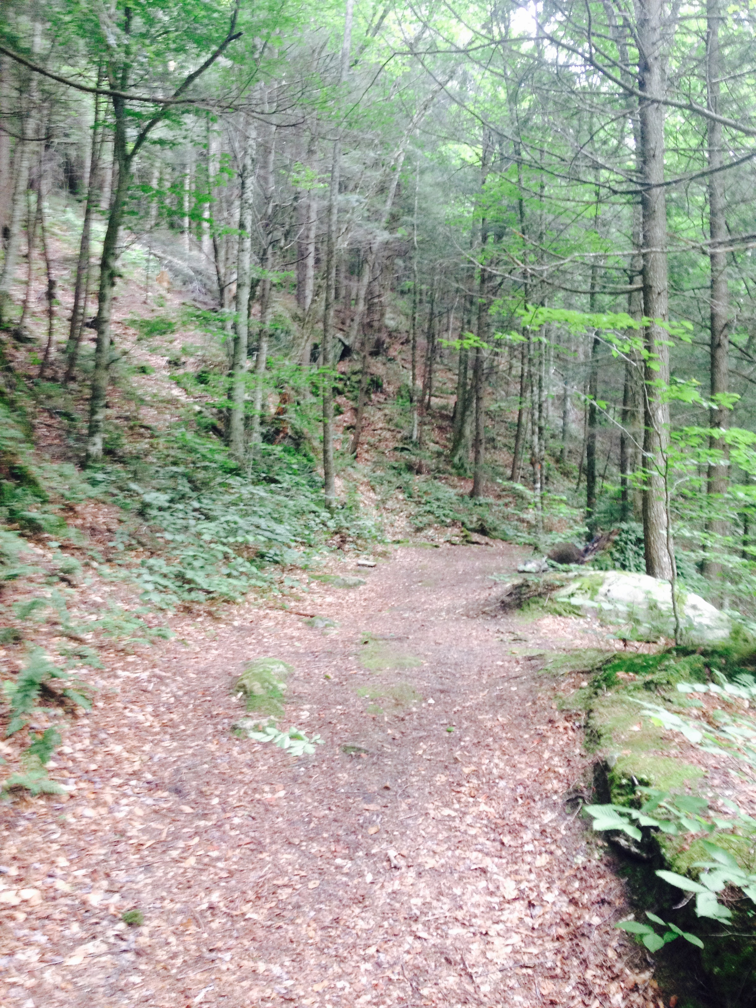
Photo by the Author
Indeed, the romance of the recovery of the informal byways and common thoroughfares hearken back to an ideal of common law land ownership, at odds with the individual claims to property with which maps are often associated: the uncovering of “sleeping” roads, or what the current state has labeled “unidentified corridors,” lest they be endowed with legitimacy, are a way of romancing the past of the local at the same time as it seems on the verge of vanishing from our national landscape, particularly focussed in a state at last count nearly eighty percent forest.
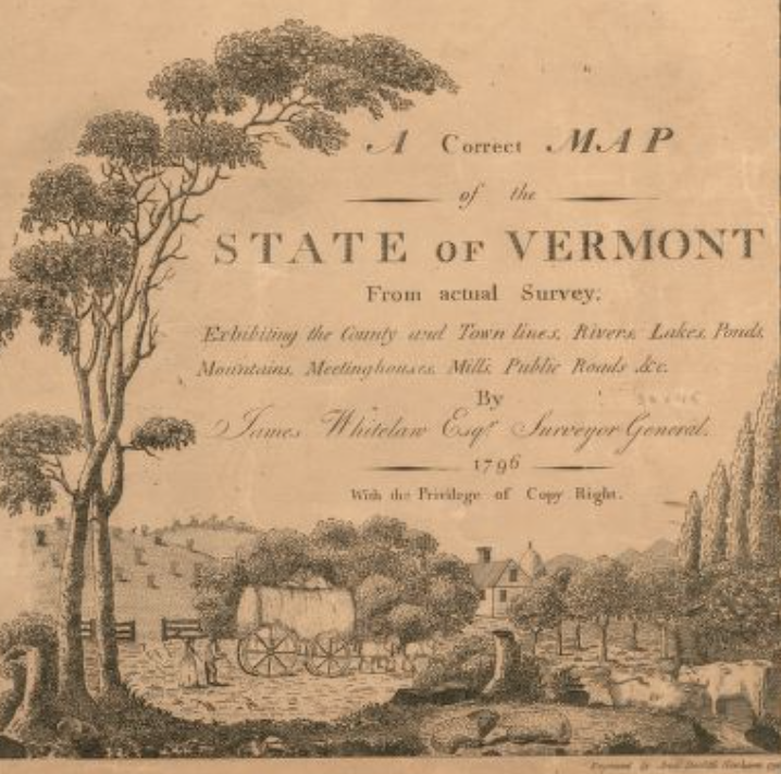
“A correct map of the state of Vermont : exhibiting the county and town lines, rivers, lakes, ponds, mountains, meetinghouses, mills, public roads &c.” (1796) Library of Congress
The effective cartographical reconstruction of such once well-trammeled routes in a landscape of green mountains uncovers the division of the state’s mosaic of counties by the current parcellation of its largely rural and forested expanse along private property lines, disrupting the notion of common greens and pathways along which towns were long functionally organized–rather than an inorganic understanding of individual property lots, that might be understood in terms of the best view, or remove from highway noise, but are often removed from history.
9. The attention to both serves as a basis to negotiate the common-law rights-of-way in Vermont’s countryside, and indeed to explore the habitation of past landscapes that might seem increasingly removed from current conditions of land use. The recuperation of such “lost” or “sleeping roads” across the state of Vermont began as a legislative exercise in trimming legal precedents, but its expansion in recent years seems to have stemmed from an active and collective effort of refamiliarization with the lived landscape that proves both the power of the paper map–and the power of paper records to orient oneself to a landscape that was once lived–and the interest in proposing new additions to the promised revised map of the State Highways that will be the result of this call for towns to curtail the plethora of local roads–“unidentified corridors,” to not even grant them the standing of roads or highways–that once provided a basis by which to understand space.
One is struck by the active heterogeneous culture of mapping, drawing on both written records, new surveys, exploration, and remote sensing in the recuperation of a lost landscape of the Vermont hills, working to recover a landscape of such “sleeping roads” which often lack names or were only proposed, but which are all of a sudden being re-mapped lest they be lost. As if a low-tech form of collective mapping that hearkens back to the days before open source data, the composition of a guide to lost roads and byways that were, of necessity, locally excavated, suggests an oddly retrograde–if ultimately postmodern–compilation of geographic knowledge, which privileges the local far above LandSat imagery, and seeks to discover past testimonies of land-use as much as the condition of the current network of state highways by rereading and breathing life into long unused surveys to find precedent of past land-use. The more minor roads that were long noted in logbooks of local towns were rarely if ever included in early state maps. Such maps were largely limited to placing the major thoroughfares in relation to rivers and train routes. The attempt to uncover evidence and precedents of common use of the ancient roads of the state of Vermont has proceeded not like out of a perceived good of public history, but the relative nuisance that the accumulation of so many unused roads and trails enjoy as being on the books.
The hope from which state legislators acted by setting a decade for the recovery of such “sleeping” or ancient roads in local log books was to trim the local sedimentation of unpaved byways rarely are, registered in local repositories and only now recovered. But the romance of the recovery of old roads that have been abandoned within the current landscape may also lie in the hope to rectify the “false totality” offered viewers by Google Maps or Earth View, or the complex relations between topography and noted roads in the state map that takes into account the long-term history of land use. The map below was made for drivers, indeed, who have little interest in the unpaved byways inaccessible to their vehicles, but the monoculture of mapping it imposes is quite limited view, given its omission of locally accumulated geographic knowledge. For no doubt the increasing claims of totalistic coverage of contemporary mapping media turned cartographical scrutiny to what the state has referred to as its “ancient” roads, ones no longer used or kept up, as well as the rapidly receding sense that old timers share in where those “ancient” roads lay.
The hope of legislators who enacted to clarify their legal existence, given that most only exist conceptually–and may be either in utter disuse or perhaps never even constructed, although surveyed. For the translation of what is surveyed into a living cartographical tradition is by no means evident.
10. While the majority of these roads were simply never transcribed with comprehensiveness, perhaps, no doubt, because they remained of local concern and were administered by municipal Selectmen or later Selectboards, the standards of common law by which they were recognized are now in the sights of state legislators. Despite the demand to recuperate the records of all roads officially surveyed–even if they were never built or paved, or are not maintained–within the collective rights of way belonging to a landscape rapidly receding from public memory. The archeology of ancient roadways was a consequence, rather than ever being an intent, of legislators’ desire to protect homeowners from claims brought regarding the existence of thoroughfares that homeowners did not know to have existed. But their compilation triggered a collective familiarization with remapping a landscape as it was once locally known, and recreating the maps of Vermont regions and towns. One important back story of the remapping of unwanted roads is in the growing value of home-ownership across the state, evident per capita income in the state–now the twenty-fifth in the nation, with an average income in five places of over $35,000, creating some pockets of clear wealth, and a substantially higher home ownership rate than the USA–albeit also a state with relatively low income differentials. In a state with long claims to local autonomy, the economic upswing in has provoked a shifting relation to place, rooted in the security of land ownership against legal claims, manifested in the new interest in erasing the recognition of ancient roads.
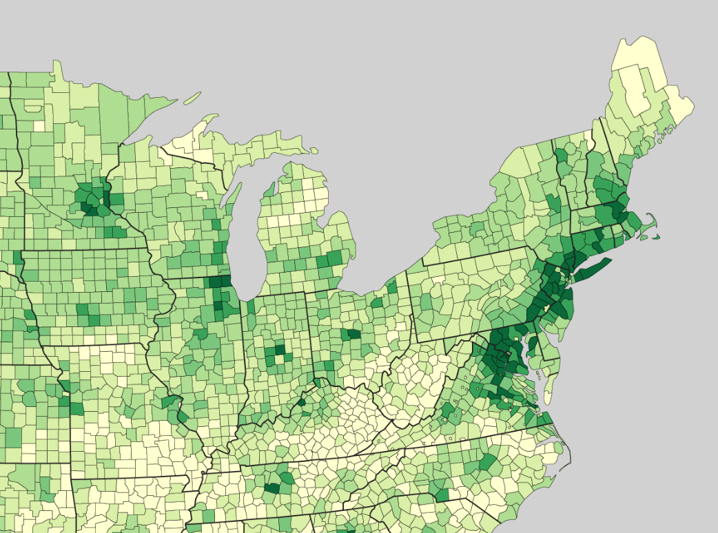

Median Household Income in Northeastern United States, 2009 Per Capita Income across eastern United States, 2012
A quite considerable gain in county-by-county median incomes in the northeast between 1980 and 2010 were located in Vermont, whose individual counties colored in dark green are among the greatest growth of median incomes in the nation:
Patchwork Nation/Jefferson Institute
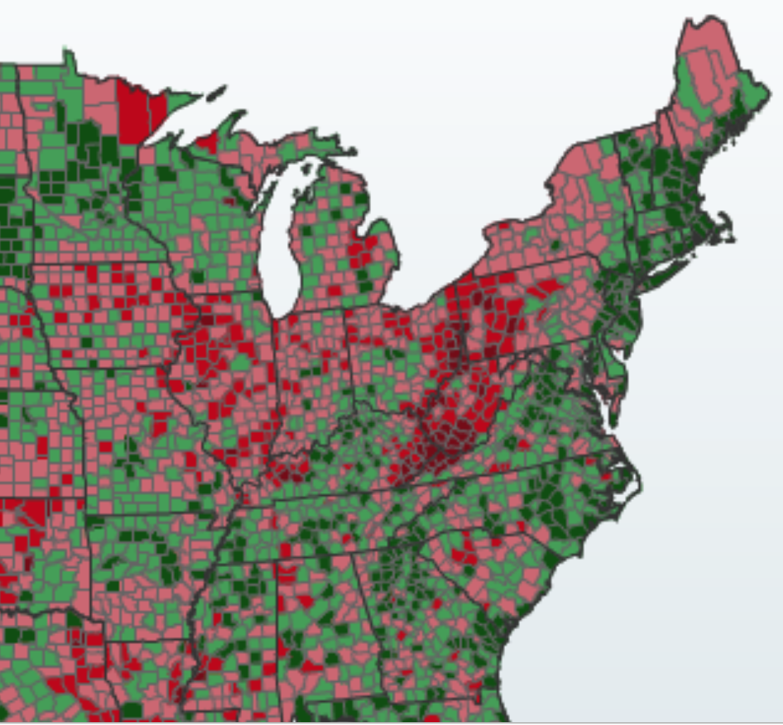
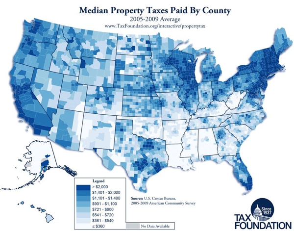
The states of both Vermont and its slightly wealthier neighbor, New Hampshire, registered the largest gain in median incomes and growing property tax values, placing an increasing premium on the protection of homeowners–according to a 2005-9 visualization of the Tax Foundation. Even if this map has been accused of cartographical deceptiveness, as it exhausts at a “low” rate of $2,000, it colors Vermont, once considered a poor state, a solid dark blue at the time Act 178 was first passed.
from TaxProf Blog/Paul Caron
The division of the state by “designated downtowns” in red, villages in tan, and centers of economic growth in green suggests the landscape of economic revitalization Smart Growth imagines and a project of the consequent transformation of the state:

At the same time, much of Vermont has long insisted on the value and preservation of the local–manifested in new ways in both the anti-factory farm movement, the foodie prizing of a Vermont Fresh Network, and local stewardship of lands such as the Vermont Land Trust and Woodlands Organization. While not linked in any formal way to one another, boosted by the wedding of an environmental as well as a preservationist ethic, many of these organizations are based on a new concern with the loss of a traditional sense of place and for which the cartographical rehabilitation of what were once “sleeping” roads provides a powerful cartography to the highway map. Any consideration of the amplification of the search for local roads that was provoked by the desire to set a limit on what can be recognized as a legal claim to a road in the state, in part to protect the sale of property deeds without concern of the future declaration of pathways or thoroughfares as open to public access. But the desire to winnow out the number of legally recognized roads in the state–and reduce the number on the books–seems to have led the Assembly to seek to clarify which “ancient roads” towns wanted to preserve, and which “ancient roads” would be left unmapped, and become “Unidentified Corridors” that would cease to be public roads–or town highways–and should cease to be difficulties to private land-owners by remaining possible public rights-of-way. Yet the “unidentified corridor” offers valuable evidence about how the land was once occupied. In ways that test of the power of the accumulation of a surfeit of written documentation of roads in an age of Google maps–the limits of whose accuracy of rural regions in Vermont I’ve earlier noted on this blog–the remapping of these roads by spirited amateur cartographers combines local history, foresting, and oral history, with a love of the local to re-survey lost paths and scratch the surface of a past landscape in unprecedented detail.
11. The reliance on manuscript maps to excavate the hitherto “unidentified corridors” and concealed thoroughfares of Vermont–routes that, while legally confirmed as roads, are overgrown with greenery and hardly navigable to a car–remind us of the peculiarity of resilience on repositories of paper maps to recover traces of roads rapidly receding into the landscape, as they also provide a basis for breathing life into the lost landscapes of transit. The excavation of heretofore “unidentified corridors” or “sleeping roads” in Vermont is a curious archeology of the deep history of place: long recognized in property deeds and towns’ Survey Books, the investigation into the ancient roads of the state stand at the intersection between large-scale maps and the local terrain, and offer an interesting case in the persistence of paper maps and local surveys in an age of digital mapping.
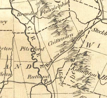
The peculiarities of what survives–and what doesn’t–within maps that might be taken as comprehensive cartographical authorities. The case of deciding what counts–or what doesn’t–as a town highway may depend on the perspective of the user, but reminds us of the peculiar power of maps. The collective memories that are synthesized within any map’s surface make the a repository of information: the invitation to find evidence of the traces of ancient or sleeping roads may lie most clearly in written town records, if they must be teased out of the landscape in order to be officially recognized, and they have been recovered in light of the ultimatum of the state legislature to review the existence of any road legally recognized in the past two hundred years by the lapsed date of July 1, 2015. Despite apparent state hopes to erase such “unidentified corridors”–those town highways which were once legally recognized by local governing bodies–and banish their legal precedent has galvanized interest in ancient roads revealed tensions not before so explicit between Vermont’s legislative body and local jurisdictions by actively pruning “ghost” or “sleeping roads” from legally recognized roads.
The compilations of roads locally preserved on paper in Vermont towns are, to use a rural metaphor, being pruned and weeded in an attempt to create a uniform authoritative record of roads municipalities are responsible to preserve. Indeed, the invitation that Vermont’s General Assembly extended in 2006 opened the doors to an unprecedented amplification of byways that had fallen off the official books, inviting localities to define routes on the record books stored in vaults and past deeds resting in town halls over the next nine years–or with the cut-off date of July, 2015. For in confirming Act 178, the legislature has openly encouraged a search for previously “unidentified corridors” or unmapped thoroughfares among self-styled local historians combing through local archives to assume the status of mediums of the dead to remap lost ancient roads and otherwise unmarked byways for the preparation of a revised state map–with the proviso that no future claims to add roads be accepted or recognized. And the considerable frenzy of cartographical feeding before this deadline unearthed hitherto unknown layers of “unidentified corridors,” which, even if not registered in the revised Highway map, will survive in local compilations rather than be forgotten for good. What became known as the now-notorious Act 178 has necessitated several subsequent glosses of clarification, because its meanings were not immediately or clearly locally understood. It established a window of ten years for the locally inventoried “ancient” roads from 2006, designating July 2015 as the final date for submission of roads that might be legally recognized. The flurry of attention responded that followed represents a particularly compelling case of the resilience of the local in a state that prides itself on the independence of municipal rule by selectmen–or selectboards–and the preservation of local property deeds and local history.
The Vermont Agency of Transportation an entire page to explain protocol and state of play for adding such “Ancient Roads” to future General Highway Maps–not to gain aid in their upkeep, but grant them legal recognition, but discontinue all unidentified corridors which will revert to property owners. Such a pruning of the legal road network seems to favor property owners, it also opened the possibility of private cartographers’ re-negotiation of their survival: the state legislature has allowed ten years for the inventories of local “ancient” roads in 2006, known locally but not noted on state maps, by designating July 2015 as the final date for submission of prospective roads. The idea is theoretically interesting, because it raises question, in a logical sense, about the mappability, or about how many roads it makes sense to include on a map–putting aside the clear value of an cartographical cleansing for attracting non-local homeowners to the state. The possible absences in the mapping of roads in such internet-based map providers are readily imaginable, and makes the intensity of mapping “unidentified corridors” particularly exciting as an exercise of putting them on the map. There are important instances of assisting archeologists, ecologists, and farmers by aerial mapping can reveal local landscapes most sensitive to coastal flooding allows England’s Environment Agency to provide open data on sensitive issues that affect multiple communities–a prospect that seemed particularly suited to recognizing hidden paths through the woods.
Detail of LiDAR map issued by Environment Agency (UK) after 2014 Winter Flood
12. The use of LiDAR to excavate a relation to space are not widespread in Vermont. But the tools might help uncover many of the lost ancient roads that criss-cross the Vermont landscape, in concert with the consultation of a large body of paper and printed maps from the nineteenth century to search offer evidence of their past use, even as practical knowledge of these ancient roads has diminished across generations, and slowly atrophied as mapped pathways, to disappear from most all printed maps despite the long and respectable history of state-wide surveys and detailed topographical hiking maps–as well as trails maintained from the 1930s by the WPA. The memory of the landscape revealed in local deeds suggest strong local traditions of surveying that supplemented traditions of surveying the principle state-wide roads that run through the valleys, beside the state’s multiple rivers and railway lines. But the lowly populated state included many of these “unmapped paths” and byways once important for regional commerce to mills, lumber depots, and tanneries. Large-scale printed surveyed maps of the state from the early nineteenth century show a parallel growth in roads and rivers that embodied the state’s economy, offering something of a parallel resource to recover ancient roads. For printed maps offer a template for coordinating such investigations in parallel with LiDAR surveys, to provide a picture of how the state was traversed before the introduction of the interstate I-89, and indeed, perhaps, before the train routes that so reshaped the perception of space across the state, but might be suggested before the roads and rivers by which the state was surveyed before the Civil War.
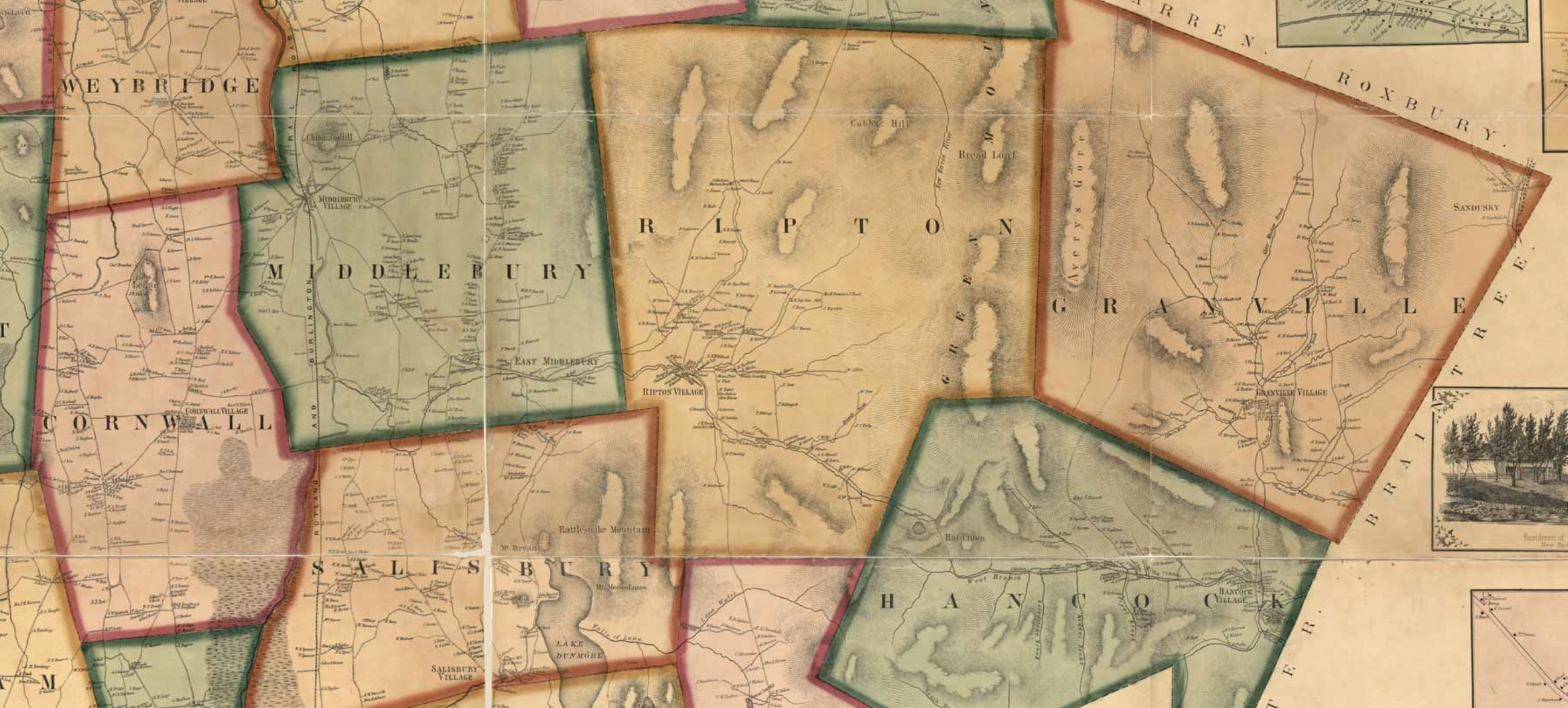
Rivers and Roads in Map of Addison County, 1859
The attempt at an erasure of past town thoroughfares hopes to streamline the historical accumulations lest the state be compelled to acknowledge legal challenges to private property challenges. But they ran into counter-claims of the prominent place such roads and byways enjoy in local history. The existence of roads in the state were not noted in the early 1838 survey of the state, created by the authority of the US Congress, which was limited to the rivers that ran through all its counties, which is distinct for its absence of railroad routes–and indeed leaves local byways and roads off the map, as if they were more important for town-dwellers than for the map-reader:
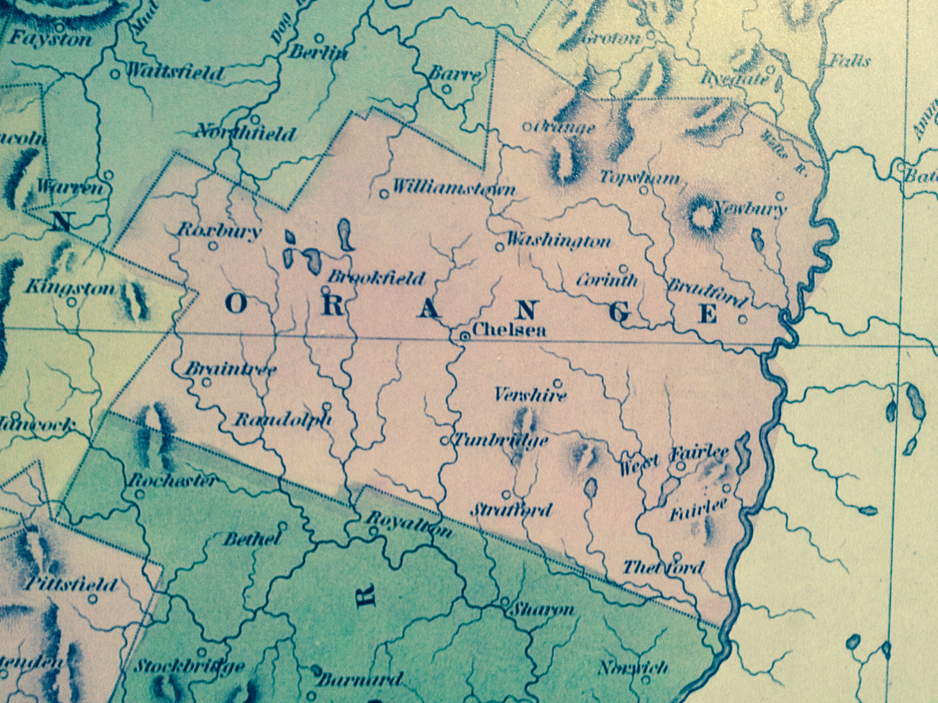
The attempt to reconcile local and state land maps, in ways that suggest not only greater centralization of mapping byways and highways across the state, but a potential wiping away of a well-archived local historical memory. The memories do not survive in the many maps of the state that were surveyed and printed though the nineteenth century, a particularly fine collection of which do survive–and exist online, but which are dedicated to major thoroughfares and routes, but seem more attentive and exact when it comes to rivers’ paths from the great Payne map of 1799 to maps of the Beers atlases–as rivers were the main sources of power, commerce, spatial connectedness, and settlement that unified largely agricultural areas of settlement, and no roads seem to be noted, as if most travel remained local.
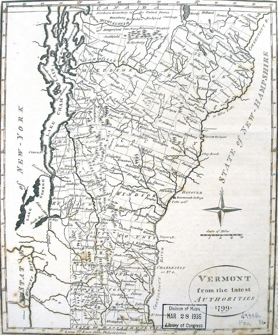
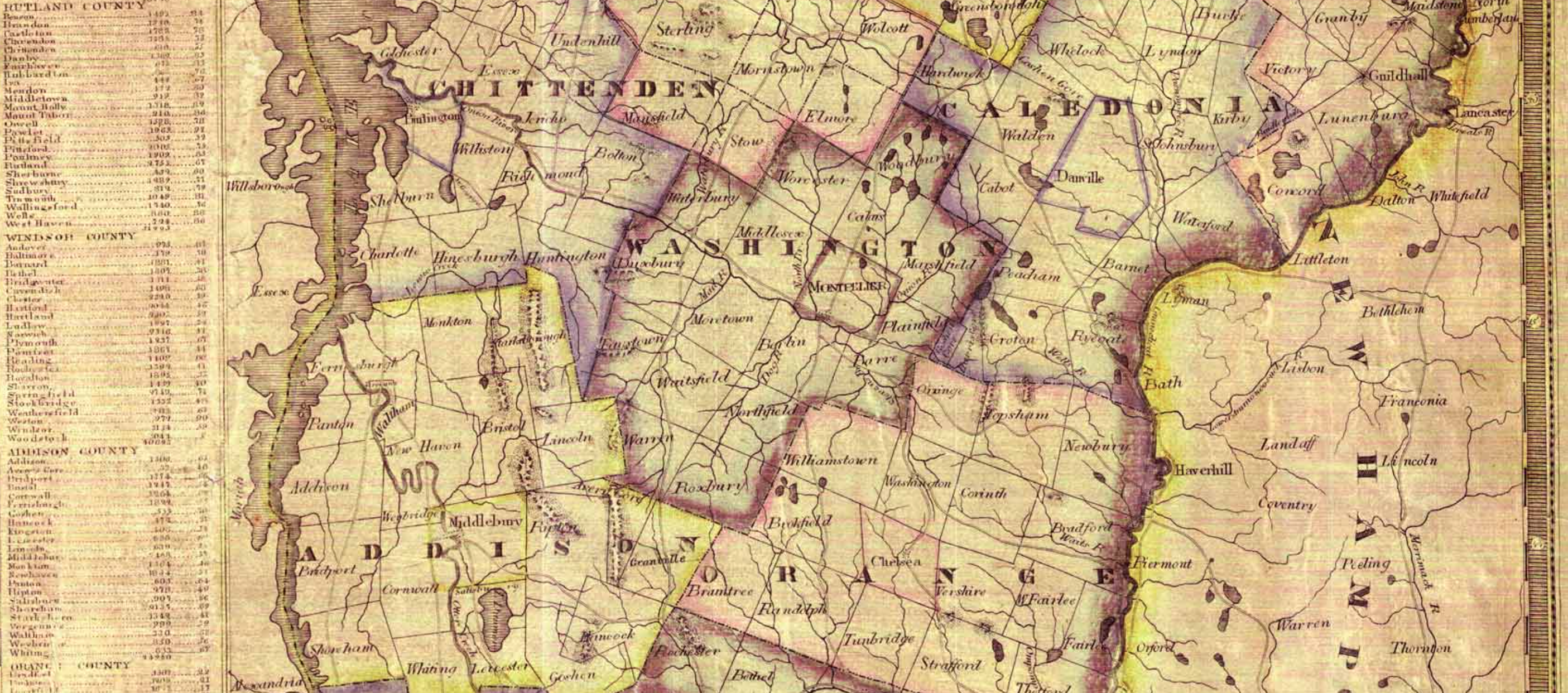
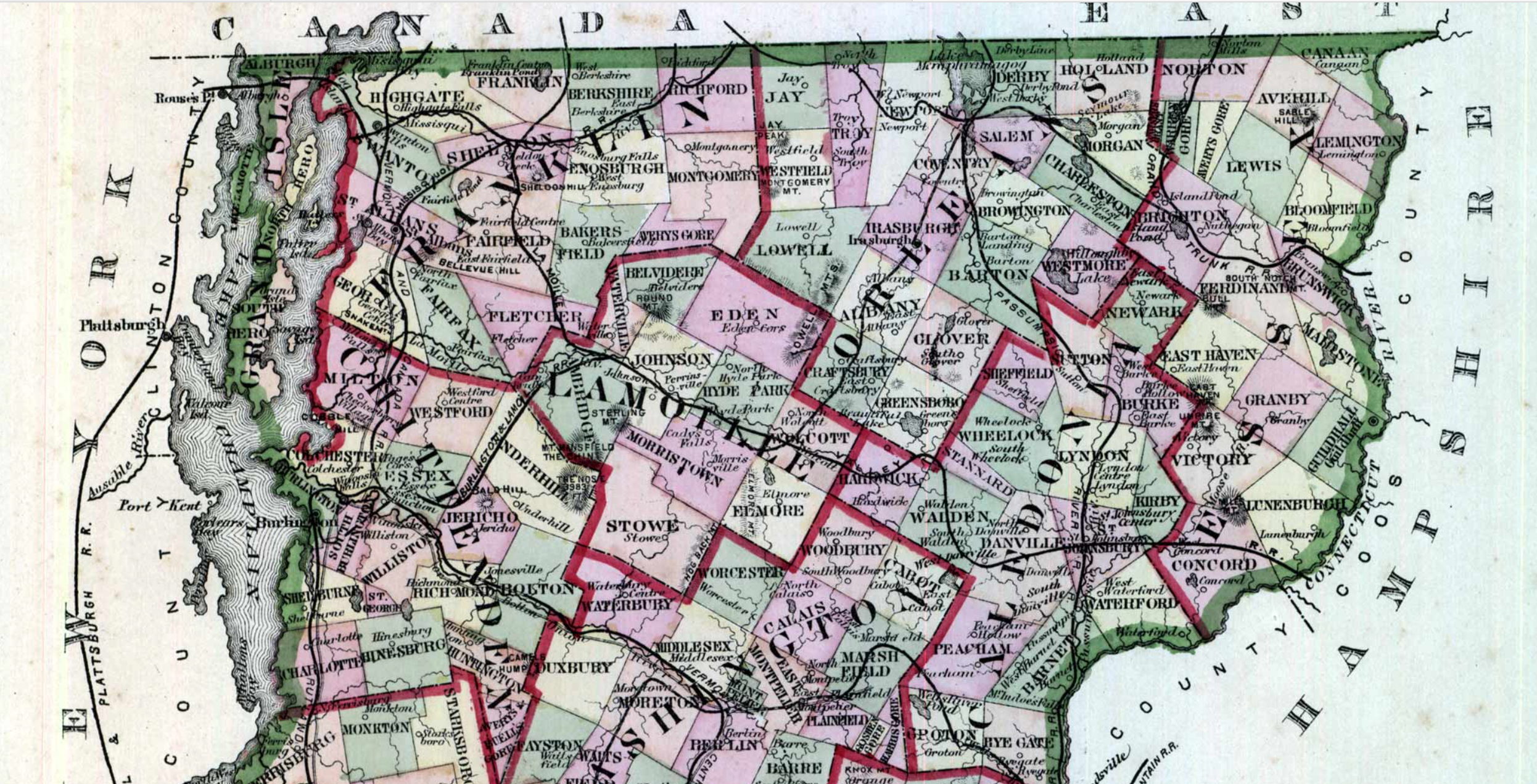

Payne Map (1799) Beers Atlas, 1843 Beers, 1877 Beers, 1879
Many of the county maps note local roads and rivers, but they are, as in this map of Addison County of 1858, loosely sketched below, but however only skim the surface of the collective lattice one might come across today, and suggest as many questions as they resolve as to their founding, construction, or use, but suggest the deeply fragmented nature of travel in state counties and the relatively small-scale nature of local itineraries and knowledge.
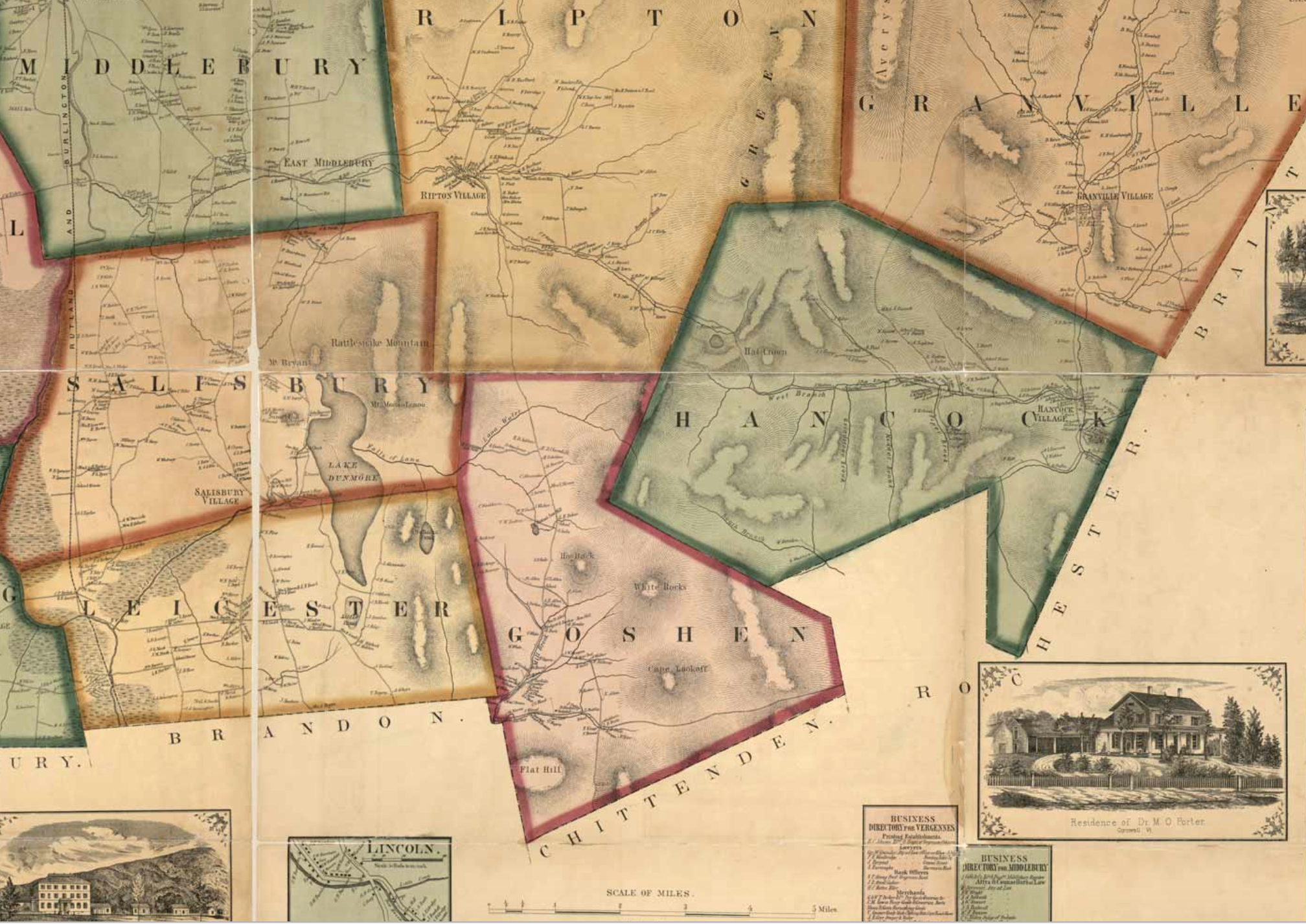
The combination of efforts to recover such ancient roads indeed offers the possibility of mapping a far richer and hitherto unseen landscape of the local and the back roads never or very rarely noted in USGS topographical maps or earlier state atlases, like a Beers Atlas.
13. The legal recognition traditionally accorded to any roads that were filed in Vermont towns developed in ways that offer a rich paper repository in local towns to act as a medium to uncover the landscape of what once was. The particular state of affairs in Vermont, whose “forgotten roads,” “ancient roads,” or “sleeping roads” are just beginning to be recovered, may derive from the 1781 mandate that highways be surveyed “by the Compass” within two years or lose whatever status they locally enjoyed as legal roads, led to the proliferation of Road Survey Books in local municipalities, which have been continued to be laid by Selectmen, even after they have not been maintained or those very points, pastures and buildings that they connected have been lost to memory, until it was decreed in Act 178 of 2006 that the “ancient roads” should finally become “dead roads,” and “All class 1, 2, 3, and 4 town highways and trails shall appear on the town highway maps by July 1, 2015.” A keen sense developed that the longstanding tradition of the public ownership of legal rights of way were being undercut by private property, and that the memories that log books, if not maps, preserved, were being all too suddenly erased and collectively junked–and the repository to knowledge about the lands potentially sacrificed.
But there are records of these roads, often described as “beginning . . . near a maple tree” or “beginning in the middle of the road from the Burnham farm to the river on the southerly bank of said river, thence north,” as Geoff Manaugh wrote in a recent article, written after witnessing wide popular local interest in recovering the state’s “lost roadways” back in 2008. Manaugh’s account captures the conflicted politics of remapping the region’s lost roads of which few traces or “use” remains. While the state of Vermont is bisected by a “Y” of interstates, between the 89 that runs from St. Albans through Montpelier to White River Junction, where it joins I-91, running on the New Hampshire side of the state down from Canada to St. Johnsbury to Springfield, the road system of Interstates that avoids Mt. Mansfield was effectively created and laminated over a far more sensitive register of spatial knowledge–a range of pathways of movement and communication that are often forgotten for drivers, and unused save by intrepid snow-shoers, cross-country skiers and runners, removed from the spaces down which we drive, leaving streams of fuel emissions across the green state. Since such roadways are often absent from Bing or GoogleMaps, the search for lost roads has evoked a wealth of detail and local knowledge that would risk being lost, and unearthed roads rarely pictured on the blank green of highway maps, or on many USGS topographic maps of the state’s surveyed terrain.

Yet there is a move to make these maps far more legible. The deadline to grant legal recognition to earlier historical rights suggests something more than a concern of local historians, but a question of the survival of a time-honored tradition of how to inhabit the local landscape and the land.
14. As much as a form of cartographical assertion of the value of local knowledge, the deadline has precipitated something of a struggle for public memory through the remapping of the otherwise unmarked network of the state’s lost highways, that, even if it is trying to be stewarded by the Vermont Agency of Transportation, has encouraged a resurgence of local public history, pouring through Town Record Books and going through over 200 years of property deeds to find roads pinned by surveyed coordinates of rights of way that would otherwise fade into the landscape and the roadless light green regions of the state highway map, which the state seem to have, after so long a time, decided to wipe clean of prior claims. This led to some to propose the benefits of Foliage Penetrating Radar like LiDAR to detect these ghost roads, but the search for precedents of public mapping of roads, or the hope to find old-timers who might detect the lost ghost roads that run through the landscape, most always without names, that provide a palimpsest of how the land was inhabited. Uncovering the abandoned geometry of lost lot lines that once bound the now-forsaken orchard, the stone wall of the past property line, the lost farm, and the abandoned paths of logging.
These submissions provide a new set of tools to explore the back-country and woods, to be sure, like the self-published “History of Granville Roads” compiled with both considerable attention and loving dedication by Norman Arseneault, combining searches of property deeds in the town vault in Granville and Survey Books in conjunction with the surveying skills needed to explore forests he gained while working as a forester for the US Forest Service in Oregon: Arseneault has lovingly tracked and retraced the courses of lost roads on the detailed printed topographic maps of the state where they are lacking, and will probably gain a larger audience for his findings not only because of his expertise, but because of curiosity into this landscape of the past, which suggests the matrix of roads of a vibrant local economy.
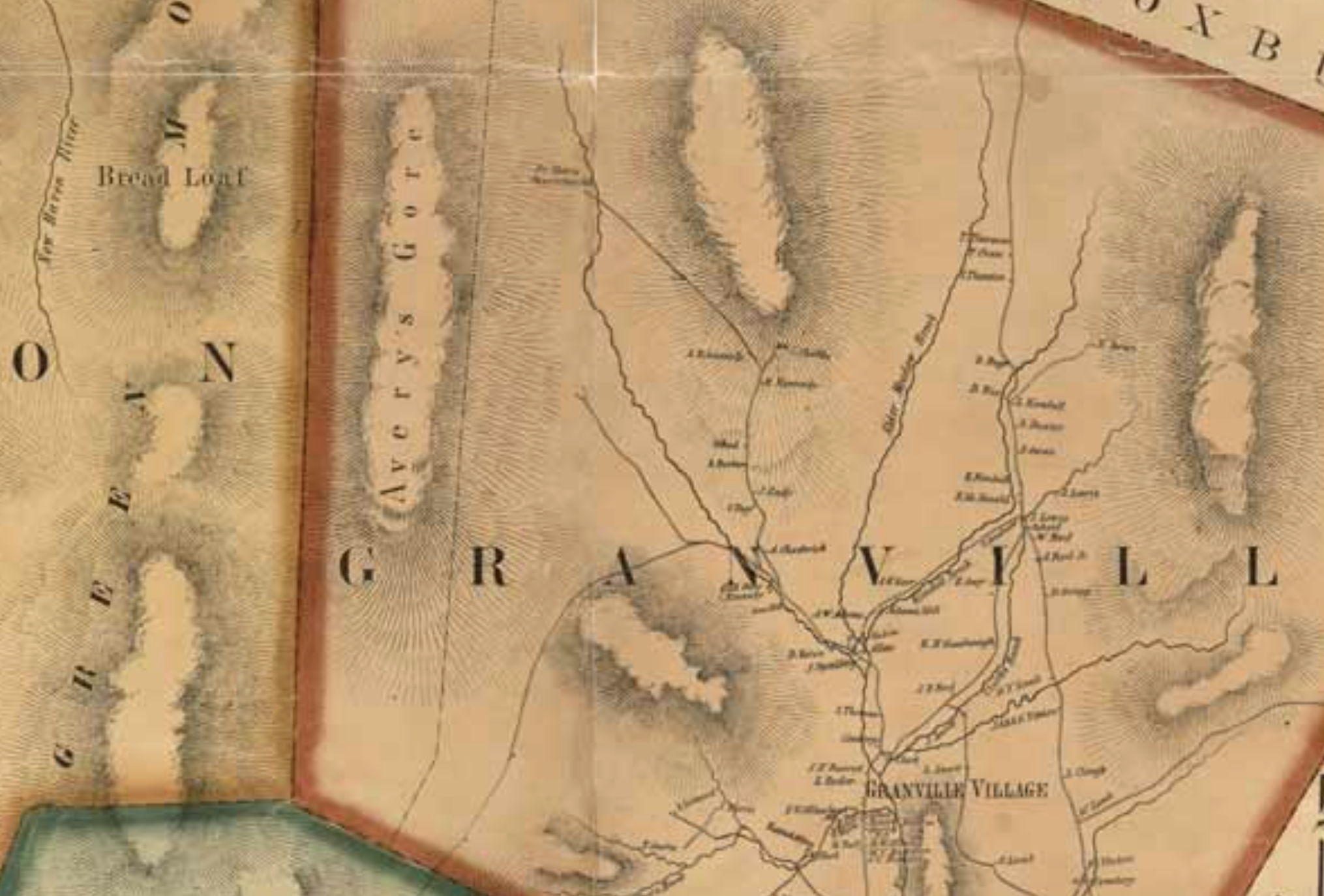
For the sense of remapping the ancient roads of the state is a way of discovering new landscapes in maps, as much as preventing old roads from reverting to landscapes: the discovery of these new landscapes in old maps is indeed more than half the fun, together with navigating the unused roads themselves to puzzle over what sorts of landscapes they fed. The routes suggested will also ostensibly result in the attempt to weigh and combine the results of regional and local searches that have been submitted within a new version of the state’s official highway map, which sets the bar from now on what is a recognized road and what is not. But the conversion of these ghost roads or forgotten thoroughfares by including them on a printed map is an odd form of remember of a medium that is not usually kind to including new information, or uncovering lost landscapes. But there is long precedent, of course, to having landscapes discovered in old maps.
15. The introduction of sites from which one might engage the toponymy or routes of a map is in a sense the oldest basis for fiction, but the indication of new landscapes have a neat parallel in the “trap streets” that some cartographers have placed in their printed maps as a form of claiming priority on their designs. So notorious are some of these “traps” as forms of cartographical signatures that OpenStreetMaps hence warns contributors not only to rely on past printed maps, but use live satellite views to limit the number of errors that might otherwise compromise their maps. An inversion of restoring past routes and memories exists with the significance that the addition of invented copyright traps in printed maps of fake (or paper) towns. The excavation of Vermont’s “ancient roads” suggest a replacement or renegotiation of sites on the map in ways that echo the meaning that was read into the placement of one invited city–Agloe–at the crossroads of two roads. Aloe is one of the most famous of such copyright traps, for its insertion set in motion a cartographical fiction. In the New York maps designed by the General Drafting Company, the town is “shown” as if it bordered the Catskill Forest, where two actual roads meet. Its location has gained renown as it became the central mystery that the emblematizes the arrival of adolescent high school seniors to embark on a road trip in John Green’s Paper Towns, where the fiction innocently devised by Otto G. Lindberg (O, G, L) and Ernest Alpers (E, A) provided a destination that stood as an analogy for growing up, or recognizing the realities behind the images that each of them constructs for themselves. The imaginary town of Agloe was Lindberg and Alpers included by combining their initials in a concealed signature, but soon appeared as a place. The placement of the copyright trap in upstate New York had an afterlife Lindberg could have imagined since it offered a way to move through a new space: after the map was distributed for free at a chain of Esso gas stations from 1925, described as a town was listed as having a population of 0 to 500, it led folks to travel to it to found a fishing lodge and a General Store to provide for the folks who supposedly lived there.
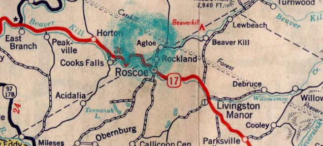
At first, the trap soon seem to have done its work well for the General Drafting Company: employees noted with surprise the name on a Rand McNally map of the region, and quickly threatened suit. But the investigation that followed revealed the power of maps to embody place and bring them to being. Although Lindberg believed he spotted fraud as the encoded signature cropped up in other maps, a visit to the intersection of rivers revealed the site of the Agloe General Store. For his idiosyncratic map had provided a new way of reading the landscape, allowing discovery of a place hitherto unknown. Esso not only distributed free copies of the General Drafting Company maps, but had decided to found a station at the “Agloe General Store” in the place it was located on the maps, and in doing so they had released the proprietary name into the common domain, about the same time that purchasers of a home at the intersection of Beaver Kill and Spring Brook proudly gave their new property the odd proper name of “Agloe Lodge.”
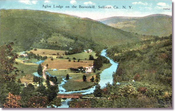
The discovery of Agloe in the actual landscape of upstate New York had migrated to Google Maps through March 2014, when if supposedly deleted–as an “unofficial town”–it also persists, amalgamated with the nearby town of Colchester, as if to satisfy those who want to visit the area which readers of John Green’s young adult will remember he located the final scene and culmination of Paper Towns, the destination of the collective road-trip that makes the end of high school, and offers a particularly enchanting metaphor for the defamiliarization of place, and reconstitution of an already tight coterie of friends.
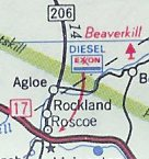
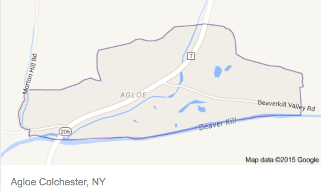
The enchantment of Aglow grows out of the map, on which Quentin traces, in Green’s novel, the elusive and perhaps endangered disappeared Margo, and it provides the surface for reconstructing her itinerary by a set of pushpins on a map. For Lindberg’s map created the place as it spoke truth to its readers so persuasively to realize what was only a conceit. The purely propositional place helped create a settlement where Otto Lindberg had placed a signature to catch lazy cartographers became a place that other map-makers mapped, and opened up the landscape in new ways. As Rand McNally successfully claimed in court that their “Agloe” did not derive from Lindberg’s map, the mapmakers’ invention persisted in road maps distributed by Esso (and later Exxon), and from the 1930s, a fishing lodge was founded in Agloe, and a 1957 travelogue about rambles in the Catskills described scenic drives through Agloe, as the cartographical creation became a reality.
John Green smartly observed that “the idea that a fiction created on paper could become real was really encouraging to me as a writer”–and Lindberg and Alpers have created a place for self-discovery as much as a cartographical conceit, as their fiction provided a nice way for Green to construct his compelling book. One might even wonder if the popularity of this book–and the upcoming movie version–lead this imaginary town to be reinserted in Google maps? For the lost landscape that the map evoked lead its readers to find this interesting lived landscape this fork of two rivers.
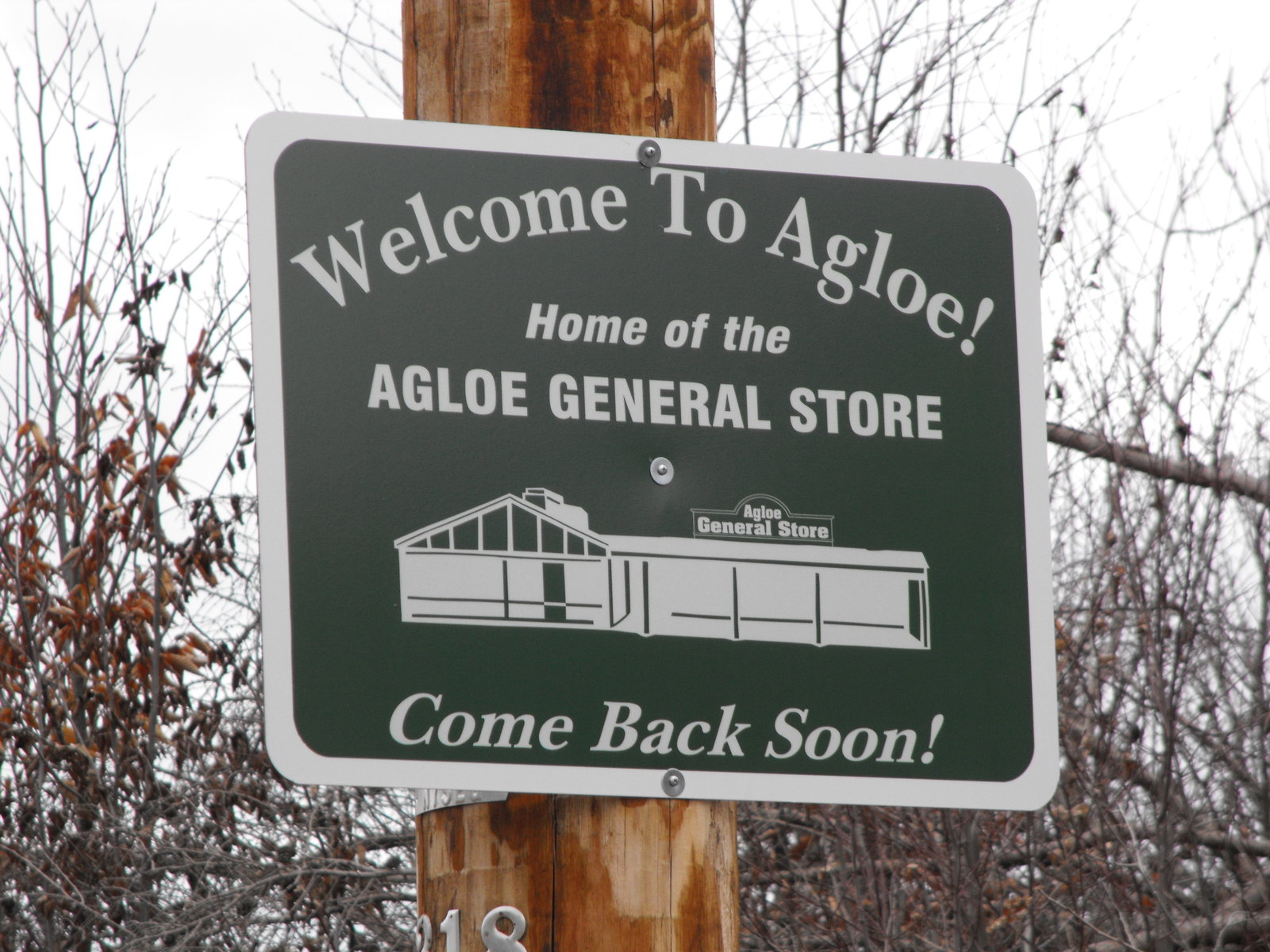
Perhaps the restoration of “forgotten byways” that have been excavated in Vermont’s landscape will affect a re-enchantment of the rural landscape. For even before they are weeded for consideration on the Vermont Highway Map, the new repositories of local mapping, born out of consultation with paper records, will not only to serve hikers or cross-country skiers, but nurture a new understanding of the land and reach a new audience of map readership. Perhaps the uncovering of sleeping roads will counter-intuitively lead people to drive off of the interstates, raising the prospect of listing new numbered roads where none were until quite recently even thought to exist–and even if the roads are not included in the future highway map. But their accumulation and deciphering from the landscape has prompted a curiosity for codifying such unidentified corridors and lost highways, and exploring the sorts of landscapes that they will find. Maps are repositories of meanings, if they are interfaces that are always being contested as well.
Whether that means opening them up to individual and commercial exploration is unclear, but by making long lost navigational tools available to the public, one effect of Act 178 will be to help us experience the historical landscape as it was once lived, and distance the starker highway map’s uniform green colors. They might provide a new way to inhabit the land Google maps will most likely never allow. The rehabilitation of such nameless roads may lead developers to places they might not otherwise travel–but loss of the roads may suggest more devastating development, deeply divorced from the past.


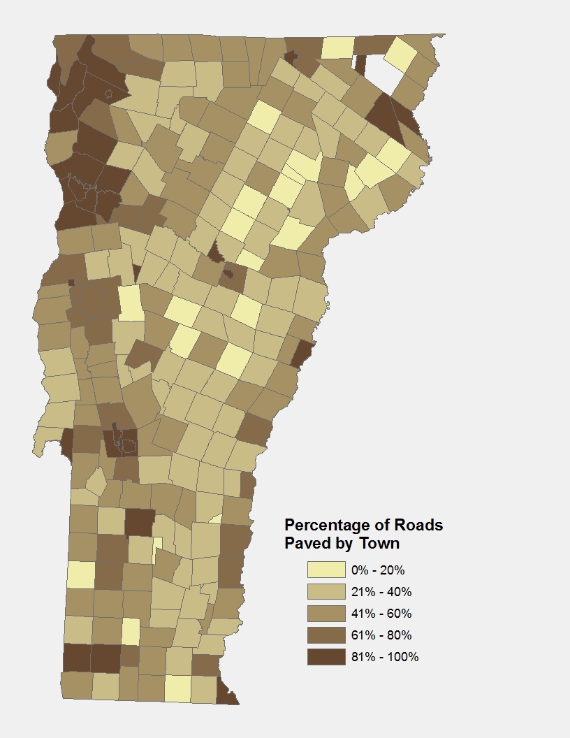