
The United States of Trump is making an oddly globalist argument that it must defend the “free flow” of oil to the rest of the industrialized world, reminiscent of the Reagan days. But the question of what are the sovereign limits and sovereign authority of the Islamic Republic of Iran to control its airspace, national waters, and export passageways across a strait that at its narrowest is but thirty-four miles wide. And although the notion of “transit passage” through international straits such the Hormuz strait was approved by the 1982 UN Convention on the Law of the Sea, the convention by which the Islamic Republic of Iran extended rights of passage to all ships accepting a convention which the Reagan government and United States never committed or signed, raising new questions about the passage of any naval ships that would enter the territorial waters of Iran by approaching its shores within twelve miles.
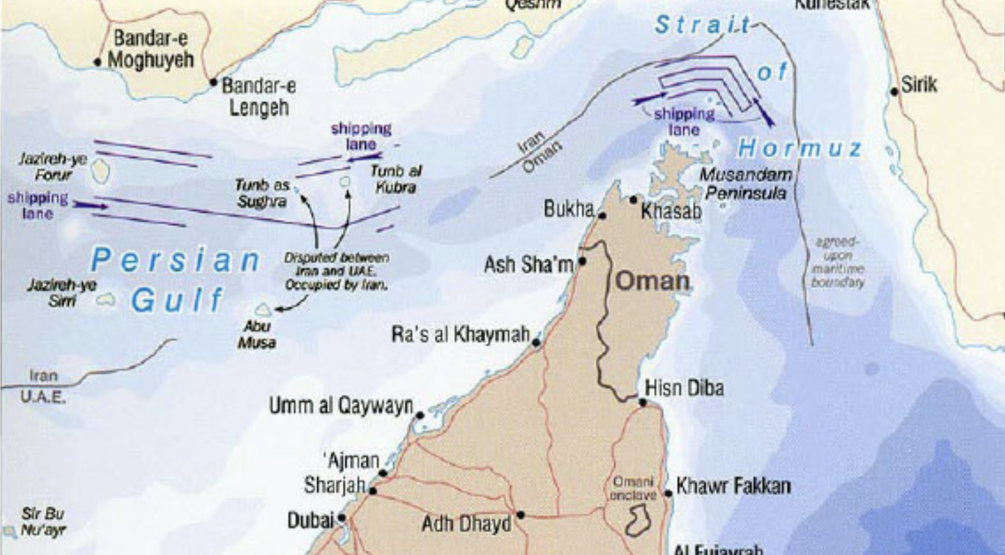
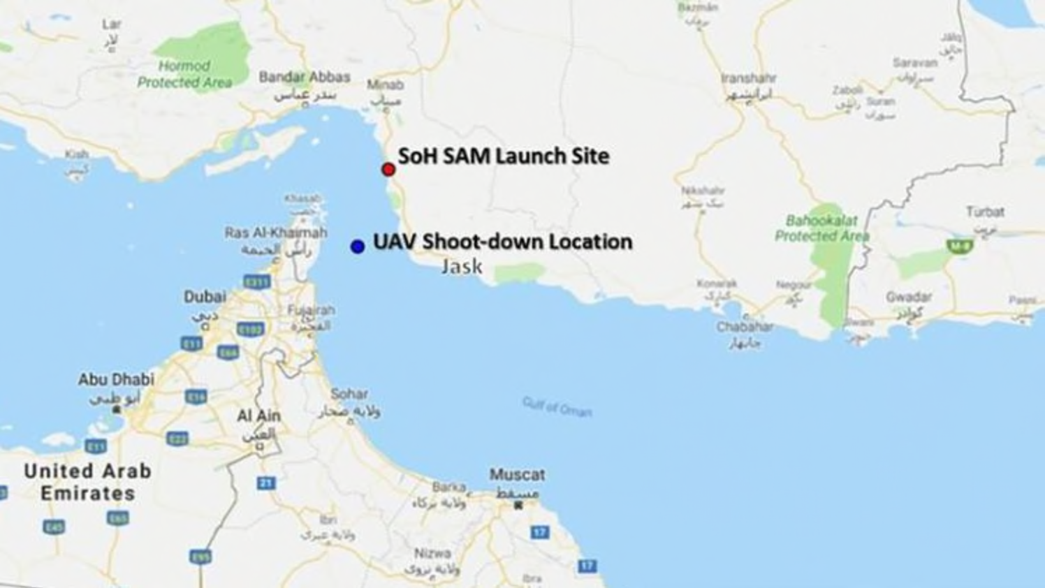
The question of incursions on national airspace of Iran came to the forefront with the downing of the U.S. unmanned Global Hawk drone after it was mapped as entering Iranian airspace, given the heightened tensions around The Iranian government is insistent that they shot down the high-flying U.S. drone as it had errantly entered the airspace of Hormogzan Province, and seemed a national threat, As much as entering Iranian airspace, it entered the abilities of radar detection at the height of 20,000 feet, as it was ostensibly monitoring the danger of attacks from Iranian shores on the many oil tankers that navigate the Strait of Hormuz, bearing loads of oil to global markets.
The Northrop Grumman Global Hawk is an emblem of the new tools of engineering mastery of global space. The Global Hawk drone flew at a heigh believed safety to avoid radar detection, to stop the danger of tankers being targeted, but after the approaching drone was taken as spying, and sent two warnings, and shot downs as it lopped back over the Strait of Hormuz into Iran’s national waters, perceived by Iranians to have brazenly entered its airspace, while flying to escape detection. Although American Army who remotely piloted the craft assert it was hit in international waters, the shutdown that almost led to military conflict erupting immediately was based on a debate not only about tracking, but about how the American drone pilots believed their fancy piece of hardware could escape official detection. At a time when Iran has long protected the “rights of the Coastal States to take measures to safeguard their security interests including the adoption of laws and regulations regarding, inter alia, the requirements of prior authorization for warships willing to exercise the right of innocent passage through the territorial sea,” the presence of the U.S. Army has already raised red flags and tensions about any ships traveling within twelve nautical miles from its coastline, even if the United States was never a signatory to this global policy of the Law of the Seas. This narrow passage way is the site of transit of three-quarters of all Japan’s oil supply, and over a fifth of the world’s global oil supply, making it a likely flashpoint pitting energy concern for oil-consuming countries and Iranian abitlies to defend their sovereign air space–as was so clearly acknowledged in the U.S. Army’s own air map of an expansive Air Defense Identification Zone in the Strait.
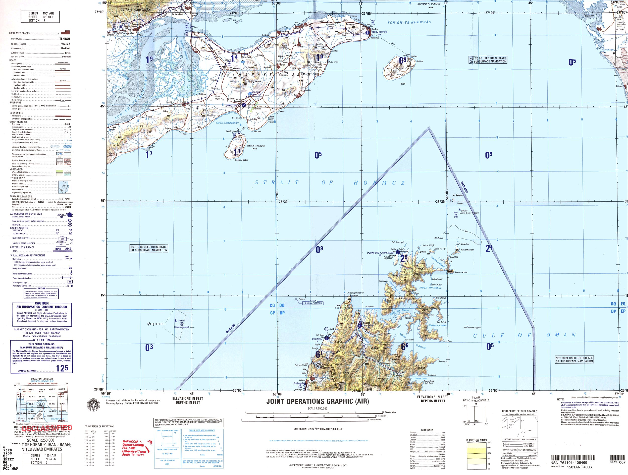
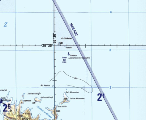
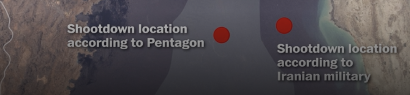
The interpretation of the exact location of the place where the American Global Hawk drone–and the refusal of Americans to acknowledge where the drone flew opened an international debate on the trustworthiness of maps, incredible in the age of Google Maps, with the Secretary of Russia’s Security Council, Nikolai Patrushev, now affirming independently that their military intelligence traced the drone in Iranian airspace at the time it was shot down, and Iranian fishermen have found fragments of the drone’s wreckage in Iranian waters,. The United States’ government continuing to insist their drone was clearly flying over international waters when shot down, issuing a map that immediately entered the social media circus of speculation but hardly seem to have forestalled future debate–although it has increasingly seemed that the potential for an error in judgement in these remotely operated mapping systems may be at fault, and particularly in the remote mapping of drones in the Persian Gulf.

And although US DOD attempted to release a map to quell debate, huge doubts around its facticity, or value, which seems to have only grown over time; the consequences of the interpretation of the map only grew as Donald Trump took the opportunity as an occasion to announce that attacks on “anything American” would be grounds to merit Iran’s “obliteration” in his eyes. There are ample precedents for Trump’s adoption of a language of bullying, but they gave a terrifying potential of reading the DOD map as a basis for war, even if its basis in fact was unclear, especially since Trump had only previously noted that consideration of the fact led him to conclude that the deaths of a military strike couldn’t be said to be “proportionate to shooting down an unmanned drone.” The downing of the surveillance drone seemed to have added significance to Trump as it ended a vision of American globalism, in which the United States had power to protect and surveil all traffic of oil from the Persian Gulf, without much accountability, and the meaning of Iranian airspace didn’t have to be taken so seriously at all, given the 20,000 feet of altitude at which drones flew, and their remove from Iranian radar.


I love all this. There are map people and non-map people, and I’ve definitely become one of the former!