Category Archives: Homeland Security

The Distributed Geography of “Homeland”

When Michel Foucault told a gathering of architects that “the anxiety of our era has fundamentally to do with place” in 1967, he was describing prisons.  Foucault’s fierce generalization argued that the growing shift from time to place was a crucial means to understand the attention of governments, but he could not have foreseen the level at which place has become a focus of anxiety in the Global War on Terror–either in the ramped up security at public buildings and in mass transit, or in the targeted assassinations and shootings of individuals.  As threats of terrorist strikes seem to respect no battleground, we are consumed with tracking global networks on which we have no geographical orientation.  The conflation of such conflict as global, and the elevation of the attacks of 9/11 to a regime of terror instilled fears of where the next possible target of terrorism might be.  It has opened a sense of the place-lessness of the War on Terror–described as global, but long increasingly located in Afghanistan and Pakistan–has increasingly disoriented the American public from the world, and left them reeling for a narrative to orient us to its origins, which the convoluted narratives of the television drama “Homeland” takes such particular delight in purporting to unmask.

And the audiences that have emerged around the made-for-television thriller “Homeland,” a psychological drama which crosses multiple boundaries and suggesting the confusion or the problematic status of clear boundaries in its dramatic structure, asks audiences to decide what the nature of patriotism in fact is–and indeed the possibility of mapping places of safety in what increasingly seems a post-cartographical world.  For despite the previous security of the mapping of lines of battle and sites of safety that were perpetuated in World War II and its aftermath, as a new era of stability, by a President who looked at its surface from a measured distance–

Roosevelt and Globe.pngCentral Intelligence Agency/”President’s Globe” US Army Presented on Christmas, 1942

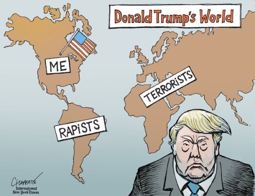
–the mapping of danger and of sites for surveillance have so proliferated in the Global War on Terror to make any coherent narrative about them seem cognitively challenging to knit, save to affirm the omnipresence of danger in the world.  While Homeland provided temporary narrative coherence to this world in ways that were increasingly satisfying to its viewers, in ways that have not been fully understood, the Reality TV figure Donald J. Trump created a sense of an imagined link between security, flows of capital and immigration—claiming to reverse the decline of American centrality and supremacy that was avoided by his opponent, but which increasingly dominated the rallies, public statements, tweets, and rallies that Trump held over the two years of the election.  For in the election, Trump provided a sense of the national imaginary that was besieged and looking for moorings that responded to the dislocation that the “Global” War on Terror brought, and that was ramped up in troubling ways by each possible terrorist attack that occurred on “American soil” and which reminded us of national vulnerability.

20kristof_cartoon-articlelarge

If the confusion of place, patriotism, and boundaries has in large part contributed to the election of Donald J. Trump–driven not only by economic anxiety, but where economic insecurity became the stand-in on which to displace far deeper fears about the homeland and about national frontiers and belonging–and to respond to a deep feeling of disempowerment not only in the economy, but an emotional satisfaction in an era of particularly acute dislocation.

Vulnerability was the dramatic theme, of course, of Homeland, which questioned the role of patriotism in a country that was infiltrated by hidden networks of terrorists far more than was evident to most.  It was an insider’s look at the War on Terror, from a place that we have only imagined to be able to stand.  For the status of place as a focus of anxiety has been elevated and transmogrified in the broad generality of a Global War on Terror to lose ny sense of security.  In the “Global War on Terror,” there is no clearly defined battlefield, but suspicion and surveillance have been generalized across space in ways that have confounded much of the nation in ways we have rarely seen before.  For a society in which the heightened ratcheting up of anxieties about place are difficult to narrate or indeed process, we have perhaps come to seek new figures of collective strength.  We have been trying to narrate what the new instability of space, and lack of a harmonious sense of place, has come to mean–or the lack of security of any given location with the confusion of sites of military engagement and sites of fear, and of where exactly the Home Front or the next sites of military engagement and future site of terrorist attack might come be.

The destabilization of place was rife in the 1960s, to be sure.  One remembers the instability of the home front during Vietnam that the poet Denise Levertov perceived so acutely:  during the Peoples’ Park Riots in Berkeley, CA, Levertov wrote ominously in her diary, “War/comes home to us,” as police and national guards arrived to quell protestors:  during the Vietnam War, she voiced a common concern that the circulation of soldiers from its front to nation, as teargas, bayonets, billy clubs and bullets appeared in the park off of Telegraph Avenue.  The narration of a deep discomfort with place in HBO’s psychological thriller “Homeland” captures the deep dissonances and uncertainties of place in the Global War on Terror–GWOT–where the act of terrorism makes a fear of violence felt everywhere, and the storyline of a suspected sleeper terrorist introduces us to a broad hidden network of terrorism.

1.  The Global War on Terror may be the only possible culmination of the profoundly asymmetrical invasions of Iraq, before minimal resistance, and inuagurating the declaration of war not against a fixed target or country, but an emotion, Rebecca Solnit noted, and the generalization of the emotion became something of a justification for the war.  The open-ended notion of a GWOT, without  fixed site, has encouraged the expansions of a battlefield less clearly drawn than ever before, confusing categories of “home” and war in ways that the dramatic television series Homeland has dramatically structured over seven seasons.  The War on Terror has provided an everywhere war.  And as we watch the series drawn by the mirror it provides on how fear of the ineluctable infolding of “war” as a threat to “home.” For the GWOT has provoked such heightened tension about place–and the place of a possible attack–to compel a sense of narrative   about place, and the uncertain nature of the front line, or even of where the enemy lies, that the television series on HBO has come to provide on our televisions, where we can watch the narrative that maps the presence of terrorism both on our shores and in our military, and even stage that drama in Syria, Pakistan, and the generic Middle East, from refugee camps to houses and families of suspected terrorists, as if to give palpable stories to the increasing fears of a strike in our homeland that cannot be stopped.

The permeation of anxiety in the nation has in a sense created a captive audience for a drama that unfolds the increasingly complex contours of the a “war” on terror, and map out the sites of contested arenas in ways that they are suddenly materialized and rendered not only as fears, but as something like a clash of civilizations. As sites of engagement on the edge of state sovereignty have engaged the nation in the wake of the attacks of September 11, 2000 with particular unease, as if the shock of a narrating a reaction to the attack on American soil has both challenged our sense of place and compelled us to orient ourselves collectively to place, whether to accept a surveillance apparatus to track terrorist organizations with a largely imagined degree of accuracy, or to acknowledge the edges of sovereignty to be effectively redrawn.  The pretence of pin-point precision of drones as combat tools seems designed to quell the anxieties of place with which we are increasingly best.  The ominous disorientataion of how it is that war now “comes home to us” is thematized in HBO’s dramatic thriller Homeland, as inner lives, and we turn to it to  inhabit the changed geography of terror, narrating a changed a collective relation to place through the stores of protagonists whose paths question and trace the margins of state sovereignty.

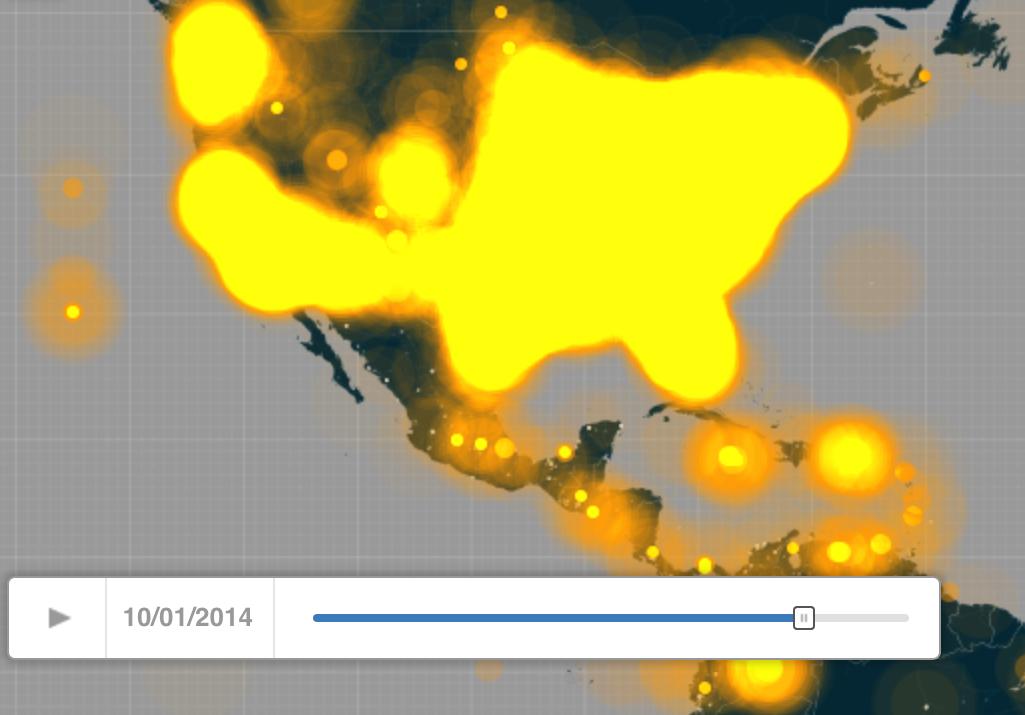
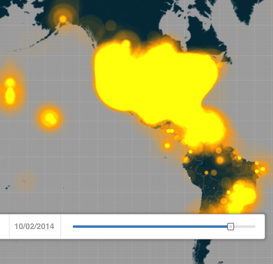
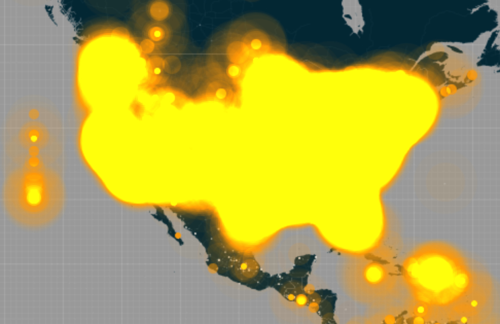
Place, and the uncertain fear of its obliteration, is questioned from the return of a marine suspected to be a terrorist operative in the first season of Homeland, whose life reveals the presence of terrorist networks across the country, and who in later seasons of the television drama we trace to examinee the rewritten boundaries of state sovereignty with a vertiginous level of anxiety that starts form an increasingly uncertain relation to the map and the opening up of new areas of national vulnerability, as if to offer a parallel escape narrative to the terrorist threat map that he Homeland Security Department regularly generates on its website, as if to tabulate and contain the new threats to national stability at specific sites where sovereignty seems endanger of being undermined.

Terrorist Threat map.png

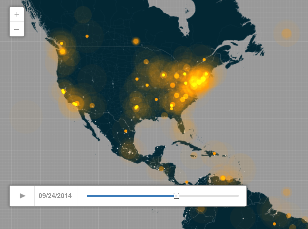
The rise of the tabulation of “Islamist threats,” of which we are advised that our troops bear the brunt, with law enforcement, are displayed the website of the Dept. of Homeland Security as if to stabilize fears but in ways that destabilize of sense of place,  now inundated with an anxiety of future attacks to which we are most everywhere potentially susceptible, in what seems a deeply unethical  remapping of unending terror.  We mark attacks in hotspots and begging interpretation as if it were the weather, operating by  isolines and isotherms, as if we might predict the future sites of vulnerability to terror strikes–or the level of “terror threats,” calibrated for easy comprehension as “high” in the U.S. homeland, which begs the question of place after all, but all the more unsettles us.  But what would a “high terror threat” be?  Is the map a way of orienting us, or is it a method for disorienting us?  What possibility of orientation exists in an age of such sorts of uncertainty that a new set of attacks might occur anywhere?

For we seem to conceal that none of this has any contingent logic, but tracked in the manner of a disease map or a record of local virulence, it is embodied in spatial terms so that we can try to impose logic on and live with deep anxieties of place.  Yet, of course, the Daily Terror Threat is unable to be mapped by any “snapshot,” and the analogy of a documentary or diagnostic record is only an illustration of our current addiction to maps to which we turn for better hopes of certainty or stabilize insecurity, but whose function seems to suggest the unseen presence of ISIS in our lives and in the space we know.

TerrorThreatSnapshot_Graphic_August_SMALL_Website.pngDaily Terror Threat

And, as the monthly assessment of terror strikes is mapped online, we turn as if for relief to Homeland, in hopes to better gain purchase on a perpetual fear of place the maps as the above, tracking Hatchet attacks that we are assured our troops and law enforcement bear the greatest brunt, placing us in a state of seige unless we can delink, as some aggregated news website warn us of increasingly immanent “main events” on the Homeland as if “Islamic Terrorist Network” is able to be mapped across the majority of the United States.

islamicterrorthreatmap

“Sporadic attacks” seem so recurrent in intelligence assessments that we may forget that right-wing domestic terrorists as “equal to” or “in some cases greater than” foreign-born Islamic terrorists, such as ISIS, and need to generate our own maps of domestic “domestic anti-government terrorist groups”that proliferate in parallel, covering even more of the map, and more than doubling our fears–and having little apparent coherence as well.

domestic_terrorists_map.jpg

2.  Homeland seems to orient geography that was begun by the War on Terror, on the margins of the very boundaries of state sovereignty in ways that we never expected to be allowed, and its invitation is extremely compelling because it seems to map the edges of state sovereignty that are increasingly questioned or up for grabs in terrorist attacks.  Indeed, the series’ own structure has opened us to the danger of localized destruction by immersing us in an extension of its landscape of fear that has no set battlefield, but where any place can suddenly become a new front of engagement, and its progress cannot be clearly mapped.  Much as the fear of terror strikes have justified police raids and surveillance to an unprecedented degree, and opening attacks to new forms of mapping that have placed “place” within a new complex of geospatial control, the dramatic series boasts to orient us to it in ways for which a distinct thirst exists–and it fills the new contours of an everywhere war with recognizable human faces as we follow the protagonists to explore what sort of space for individuality the ongoing and widely distributed “War on Terror” allows.  As we move to the edges of state sovereignty where violence is greatest, the series asks us to explore the new topography of a world where straight edges between terror and civil society can’t be so cleanly drawn–and that violence erupts most strongly and fiercely on the edge of civil societies.

For the uncertainties of drone targeting provide a recurrent theme in the episodes of the first four seasons of Homeland, as if to orient viewers to the landscape of the War on Terror, where any place is invested with instability as a site of potential terror attack.  We move at the margins of space of sovereignty in the television drama, where any site is both able to struck, and exists in a GPS armature at the limits of sovereign space.  With the figure of Carrie Mathison, the heroine and intrepid protagonist who moves on and across these boundaries of sovereignty, moving across actual boundaries between sovereign states–as the publicity for the show so graphically announces in color-contrast–as if moving on the very frontier of state sovereignty and danger.

homeland-add-carrie-blond

Continue reading

Leave a comment

Filed under aerial bombardment, Homeland (TV Show), Homeland Security, terrorism, War on Terror

Mapping the Current State of Surveillance

Near my house in Berkeley, a curious street sign that canceled the word DOPE beside warned motorists near a low-income housing police are reading their license plates.  A relic of a war on drugs of an earlier era, when crime waves spun through a now gentrified neighborhood, the signage beside a four-way stop dissuaded prospective drug sellers–in what must have once been a hub of clandestine activity–of the vigilant eyes of ever-present police cameras–with added messaging that they have entered into a residential neighborhood that has taken crime “seriously.” How seriously? It offers a visual illustration of the etymology of surveillance from the French surveiller, “to oversee or watch.”  This surveilling will, in other words, anticipate their punishment.

Beneath a roving eye, this Berkeley Neighborhood Crime Watch warns potential felons they will “immediately report all suspicious activities to our Police Department” as a caution to all, giving “buyers and dealers” cognizance that “your license plate numbers are being reported to the police.”

Signage on Ward Street, Southwest Berkeley, CA

The old signage that seem smart of a nation-wide advertising campaign of the 1980s and early 1990s to urge school-age kids to resist drugs, best known by Nancy Reagan’s “Just Say No” program, a slogan that gained national attention after the First Lady used the simple phrase in response to the question of an Oakland girl, interested in how to respond to the offer of drugs from her own cohort, responded in words to immediately powerful that “Just Say No” clubs emerged around the nation as well as at Oakland’s Longfellow Elementary School, where she was visiting. (I’d long been told it was used at my daughter’s elementary school my daughter frequented, but will cede the honor.)

If the feeds must have been unobtrusively mounted on traffic posts by the Berkeley Police Dept., at bout the same time, the open eyes of neighborhood surveillance linked to local police offered a new tech whose innovation has provided a new market for surveillance of cars, far beyond drugs, as the images of snapped license plates of cars, stolen or not, fills a nation-wide market for surveillance. If the cameras suggested a need for adult monitoring of the streets beside schools, however, or in border line neighborhoods, the market for clandestinely snapped up imagery has provided tools of mapping cars, traffic, and individual vehicles, as huge databanks that these cameras have generated provide a new form of big data for which endless new markets are being discovered–often without any knowledge of the owners of cars who happen to drive by vigilant cameras. We may soon need a set of signs, warning folks that their cars of vehicles may be fed into new information markets in ways that they little suspect, as license plate cameras have become significant intrusive tools on personal privacy.

The ACLU has explored the expansion of crude techniques used by the FBI in mapping American Communities–in a sort of darker side of the illuminating geography of data amassed in the US Census’ American Community Survey.  Much as Senator Jon Tester not that belatedly strove to balance his desire for “law enforcement agencies to use cutting-edge tools to catch criminals and protect our borders” with the appearance that such technologies “potentially violate the Fourth Amendment and represent a significant intrusion into the lives of thousands of Americans,” the ACLU has recently mapped a growing geography of surveilling that the FBI has created in recent years that include the very surveillance devices of dirtboxes which Senator Tester, who has quite staunchly supported citizens’ civil liberties, invited Jeh Jenson of the Homeland Security office and the Attorney General to take time to explain to the country.

Senator Tester’s belief that stricter oversight is needed stems from the “extreme lengths” to which federal agencies have so assiduously cloaked such programs in secrecy, his letter of request about the widespread use of dirtboxes that act as cellphone towers to intercept phone communications by both US Marshals and the US Drug Enforcement Agency may well have stemmed in part from the geography of a widespread surveillance program that the ACLU has started to map in the state of California, but which might reveal both the dissemination of military technologies of surveilling across the nation, and the local expansion of the new level of worldwide surveilling recently focussed on and directed mostly toward areas outside the territorial boundaries of the United States.  While we are waiting for Mssrs. Jeh and Holder to respond, the arrival of the scope of the mapping of residents of California–or even those traveling in the state–might well give pause if not raise expectations for the scope of what levels of individual surveilling will be revealed.  For the map of degrees of surveillance shows something of a microcosm of the extent of the expansion of surveilling ourselves of the very sort that Senator Tester was so rightly wary that he has promised to his best to publicize should it pose so clear a violation of the US Constitution as seems the case, in an attempt to place them under the oversight of both courts and the US Congress in order to restrict their use.

The maps of surveillance that the ACLU has taken upon themselves to provide is not only “cutting-edge” in its use of tools of surveillance but suggest the degree to which law enforcement agencies actively aspire to something along the lines of precognition of which groups might be likely to commit crimes in recent years–as if in a gambit for the foreknowledge Philip K. Dick imagined pre-cogs helping police apprehend criminals before they commit crimes in Minority Report,  but based not on the psychical foresight of “pre-cogs” so much as the statistical prediction of categories of probably cause of criminality or value of surveillance that runs against many of our legal traditions.  Such snooping for intelligence gathering recalls the sort of racial profiling former which Attorney General Eric Holder (quite rightly) once lent his voice to strongly oppose, following the 2003 DoJ “Guidance on Race”–yet which he incrementally allowed from 2008 for both national security and law enforcement alike.  Holder has hesitated to restrict or unmask such activities as an abusive expansion of surveillance over Americans.  And he has allowed investigation and surveillance of “behaviors” and “lifestyle characteristics” to be directed at American Muslim communities from New England to Northern California.

These activities have actually continued to expand dramatically over the past decade–including instances of the outright abuse of community outreach programs first initiated to build trust.  In a bizarre absorption of such outreach into the apparatus of a tentacular system of state surveillance, the monster seems to have been fed by the deep fears of the insufficiency of procuring further information,  and the need to gather it at all costs.  In ways that recall the suspension of individual human rights in the use of torture to obtain state secrets–but is directed to monitoring its populations, much as the extraction and mapping of such racial and ethnic data by the FBI’s Domestic Intelligence and Operations Guide (DIOG).

Such crude tools of mapping function by a pervasive sense and logic of invasiveness.  We are mapped in ways that lack even the logic or ethics one expects from a government service, it appears, as government services aim to create a sort of all-seeing eye for mapping populations, vacuuming up information in an almost paranoid manner.  ACLU’s Chris Soghoian has recently disclosed the existence of widespread surveillance program among US Marshalls across the state of California, including a fleet of airplanes flying from five metropolitan airports dedicated to collecting cell phone data and equipped with dirtboxes to do so–since 2007,  that parallel the NSA’s programs of surveillance, now known to be concentrated on the Southwestern border of the US by the DEAImmigration and Customs Agency, Homeland Security Agency, and FBI.

The degree of widespread and almost routine adoption of public surveillance systems by the government across the United States might be best understood as a sort of surveillance of the everyday, ranging from video surveillance, false cell phone towers, or facial recognition software that offer a range of tools to map populations to a degree never known.  The new nature of law enforcement mapping may suggest something like a desperation to agglomerate information, and a deep difficulty to hold back on abilities and technologies to extract information on individual whereabouts, and indeed to track persons where they could not be often seen.  The ability to map the invisible, and to try to intercept signals that move through the air, transcends whatever notions of mapping to which we might be habituated, cultivating new abilities of collating information that seem deeply intrusive.

spyfiles_marquee

ACLU

Techniques of mapping populations have grown in their intrusiveness far beyond the mapping of ethnicities, initially pioneered by men like Francis Amasa Walker, that offered a statistical visualization of the demand for more information than most maps can provide.  When Walker mapped the nation’s populations from 1873, as Secretary of the Census, he offered a way of reading national space in new ways for public ends as well, potentially, for the needs of the government.  The recent mapping of ethnicity and behavior has of course augmented in detail in order to track individuals’ spatial position over time, as well as to chart patterns of individual behavior.  The compilation of such an exhaustive map of spatial position has grown for reasons of security, but meets a increasing interest in reading maps of local populations at a level of detail and crude classification renders Walker’s tools of tabulating the composition of the population something of a precedent for enlisting new technologies of surveillance used to create the appearance of safety and quell  fears–although the forms of tracking, intelligence gathering, and remote sensing must have created a broad body of map-readers whose charge it is to interpret the massive range of data that is daily culled.

alker Legend

What has perhaps most radically changed is the studied intrusiveness with which such data is culled–and the precision of ongoing surveillance that it allows by a proxy army of drones. stingray tracking devices that mimic cell phone towers to capture identifying information, cameras of automatic license plate recognition and scanners of facial recognition systems to create a state of surveillance that we are only beginning to map.

The quantities of data that such tools amass is suggested by a survey of the layers of procuring information across the state, recently issued by the ACLU to draw attention to their amassing of data without public notice, which seems to complement the large-scale infiltration of Muslim communities.  But it goes beyond them, in suggesting a mapping project that monitors daily behaviors and to target individuals by a battery of technologies which abandon and depart from tools of rendering to collate data human minds could not visualize.  These technologies cannot but change how space is experienced–and perceived–even if we lack an image of the results that such surveilling will be able to produce, since the master-map will remain inaccessible to our eyes.

The government money that is directed to maintaining an intensive level of intrusive surveillance of the everyday across the state of California alone has been mapped by the ACLU in interactive form to allow comparisons between levels of surveillance that exist in California’s communities and fifty-eight counties.  The map was appositely issued together with both a community guide to resist intrusive surveillance technologies whose use has so dramatically expanded, oriented to different technologies currently used, and its initiation of a statewide campaign against abuses of intelligence gathering that use drones (used in three counties or cities), body cameras (used in thirty-two), tools of facial recognition (used in sixteen) or video surveillance (used in sixty-one–roughly half the number of cities and counties surveyed).

Video Surveillance in CA

Highcharts/US Census

That’s right, the cost of such surveilling of the state?  Quite a bit over $18 million.

The number of states and counties using Automatic License Plate Recognition, a particularly invasive mode of monitoring populations on the road that comes at only a slightly lower cost, is similarly quite expansive (fifty-seven), suggesting the broad range of areas that are subject to surveillance in California’s largest cities and (interestingly) the Central Valley:

ALPRE

Grouping the technologies, Attorney General Kamala Harris, the state seems strikingly well covered for less than $50 million of your tax dollars:

Grouping the Technologies

While Facial Recognition techniques are concentrated in mostly in the Southlands, it augurs a particularly invasive form of individual mapping, whose apparent concentration on questions of immigration may be destined to expand with time beyond the sixteen counties and cities where it is used currently.

Facial Recognition
Face Recognition--CNN

Although we have focussed on the technologies purchased by local police in Ferguson MI, we have done so perhaps ignored the spending spree on body cameras by local authorities across the nation.  Uncovering the considerable expenditure of some $64 million on mapping the whereabouts of potentially suspicious individuals poses a new level of government invasiveness across the state.

The ACLU has created a specially designed checklist for local governments and authorities across the country to consider, before adopting technology that we associate with the NSA.  Such advanced technologies, enlisted as useful without clear oversight practices having evolved or being instituted, or even with public notice being given, have been seem designed to create a comprehensive map that echoes, in microcosm, the state of surveillance we’ve been learning about increasingly this year.  Stingray technologies, able to track a person’s location based on cell-phone signals, are a high-precision level of mapping, already adopted in twelve counties or municipalities including by police in Oakland CA, are increasingly widely used by police throughout the United States in fifteen states, the adoption of which can be tracked interactively, if you are planning on Thanksgiving travels and would like to know.  (And it’s not only the government that is now in the business of using cellular interception technologies for the ends surveilling, we’ve been recently reminded, lest this sort of snooping only be understood as a top-down activity, rather than a widely available software for intercepting unencrypted calls long considered private by means of a radio scanner.)

Stingray USe

ACLU invites members and non-members alike to send email letters, with the subject line “Don’t Map Me or My Community,” to express their desire to help restrict such intelligence-gathering and mapping tools that are regularly based on practices of ethnic or racial profiling, and set new standards for invasiveness.  NSA has long been doing this sort of tracking worldwide, but the intrusive mapping of populations across the US has come home to roost.

google_cameras_inside

Surveilling is a backformation dating from the 1960’s from “surveillance.”  Its use has, however, unsurprisingly really taken off recently, even if it has crested from about 2000, as databanks of license plate information are sold on the open market. In may ways, the omniscient folks at Google let us know . . . and the question that this post might principally pose is just how much it is destined to further grow in common usage and in ubiquity in the physical world.

Surveilling

Increasingly, this is the State of the State, a growth of the postwar national security apparatus, perhaps, but a rapidly escalating compilation of tracking that has been normalized since 2000.

Leave a comment

Filed under Homeland Security, mapping surveillance, police surveillance, surveillance mapping, unwanted surveillance

Ebola and our Nation


New fears that the infectious Ebola virus might mutate into an airborne disease have triggered deep anxieties of national safety in recent weeks–and elicited fears about national preparedness rarely–if ever–raised before the arrival of Thomas Eric Duncan at Texas Health Presbyterian in Dallas, Texas.  Those fears are insistently restated and summoned in the range of monitory posters affixed in all hospitals across the country, creating a widespread mapping of the dangers of the spread of disease far more alarmist about the possible proximities of infection than about geographic knowledge: the point is almost to suggest that this modern disease, or potential third plague, will itself transcend spatial categories of the past, for the very reason that the possibility of contagion is augmented through the connections created by airplane travel and indeed that epidemiological understanding of the danger of infection by the disease is mapped as if mediated by the vagaries of the inter-connections afforded by the networks of global airplane travel–even if infection by the disease depends on the exchange of bodily fluids.

The not-so-reassuring sign at an Oakland, CA hospital reminds viewers to remap their possible relations to the disease, and be mindful of the network of possible communication of the Ebola virus by the vector of airline flights, much like that which brought Eric Duncan to Dallas, and the interconnected nature of a disease’s communication in a globalized world.

liberia

The rise of one case of infection that spread in that hospital helped further to transform a dire health emergency located only in West Africa into a danger seeming to lie at the edges of a nation increasingly obsessed with patrolling its borderlands.  How did a virus whose expansion as a world health emergency was so sadly ignored for months as it spread in West Africa come to be re-dimensioned as a subject that, with a dose of posturing, was a concern of national security?  The answer partly lies in the steep challenge to spatially orient individuals to the possible pathways of viral infection, and to hold the fears of potentially new pathways for its contagious transmission at bay.  (The infections of two nurses exposed to the disease raised fears of the abilities that we have to contain the illness in a hospital setting early on.)   Even if concerns that Ebola virus may mutate lack much grounds, given the virus’s unchanging nature over time, the mutation of mapping the spread of a disease in West Africa to tracking possible pathways of communication outside the continent has provoked far more intense reactions than did news of the spread of the virulent disease over several previous months.

Equipped to Handle

Fear is difficult to quantify by exact metrics or measures.  But the increasing density of levels of tweeting with the term or hashtag of Ebola offers a barometer of alarm about Ebola virus’s transmission.  For the 271 million active users of Twitter exploded with 140-character pronouncements about the arrival of the infectious disease across the Atlantic, beyond the expected boundaries in which the highly infectious disease had been first tracked over several previous months.  The rapid expansion of tweets mentioning Ebola illustrates how the virus came to infiltrate (and infect) social media world-wide exploded from the first of October, when the increasing density of tweets in the United States’ 52.7 active users so drastically grew.  The twitter maps show a marked explosion mentioning or tagged #Ebola dating from the announcement an infected Thomas Eric Duncan, a Liberian-American afflicted with the Ebola virus was being treated for the disease in Dallas on September 30.  Within a week, and for the week before his recent death, the virus had migrated to national news when the arrival of a patient afflicted with Ebola in the United States had raised questions of how his arrival had not only been permitted, but how the way that Duncan had gone untreated after arriving at an emergency room in Texas Health Presbyterian in Dallas opened the avenue to the infection.  Even as confidence grew that health risks were minimized, the density of tweets that illuminated the country insistently up to just three days before his death, as if threads that so inundated the twittersphere had themselves grown so intense so as to obliterate the boundaries of the United States, so intensely exchanged were tweets to overload the mapping abilities by firing off some 6,000 tweets per minute with astounding rapidity, compared, according to Time, to a frequency of 100 tweets per minute in the days before September 30.

At the risk of attributing the nation one identity, Twitter users across the country were suddenly passing news of the virus’s arrival in the United States with newfound intensity, in ways that don’t only betray the mass-enrollment of the medium’s 48.2 million US-based users.  The electrifying confirmation of the actual arrival of an Ebola-infected patient spread throughout the country in something like a Great Fear which had been prepared for by the unrelenting news of the infectious virus’s spread across the Atlantic.  While acknowledged, the disease’s spread–or the hashtag–was less clearly an issue of the moment that merited tweeting about.

October 1 Twitter Traffic

October 2 Ebola tweets high

October 3 Twittermap

Twitter Explosion on Ebola oct 5

The mapping of geo-tagged tweets with the hashtag Ebola had dramatically mushroomed as early as October 1–or from the moment news of the arrival in Dallas of the tragically infected Duncan spread.  They register the panic generated as word got out quite quickly that the first case of infection had arrived, undetected, in the United States, not only at the Dallas airport but in Dallas itself, to a local family, in ways that seemed suddenly to confirm both the permeability of our borders and the lack of geographic remove of a virus whose infectious virulence was widely known, but appeared contained in West Africa.  While in mid-September, the extreme intensity of tweeting appears limited to the major cities in the United States, the proliferation of twittered conversations by October 1 triggered something of an information about the arrival of the term in public debate and led to issues that had no prior tie to the infectious disease.  The tweet that the CDC issued describing the spread of the disease by contact with bodily fluids —

–retweeted over 4200 times, bearing the calming words “Ebola poses no significant risk to the United States“–have been balanced by numerous alarmist tweets of the arrival of infected airplane passengers who entered the nation’s purportedly poorly guarded borders and inadequately monitored points of entry.

From a concentration of alarmed tweets largely the coasts of the continental United States, messaging proliferated after the Duncan’s identification as a case of Ebola in the Homeland with an unheard of density that overwhelmed the nation’s cyberspace and clogged up the twitter sphere in something of an information overload as Ebola became the hot topic of 140 characters.

Twitter about Ebola 9:16


October 1 Twitter Traffic

October 2 Ebola tweets high

October 3 Twittermap

Twitter Explosion on Ebola oct 5

It is interesting that while the United States was set aglow with alarmist tweets, as was England, the countries across our borders, Mexico and Canada, show relatively low traffic–as to mark the rebirth of Ebola as a national phenomenon with Duncan’s arrival, at times, by October 2-5, in a startlingly uniform manner across the nation, whose tweeting density cartographically overwhelmed registration of its own borders:  the radii of tweets expanded beyond the shorelines of the continental United States, as if registering the overwhelming nature of national attention to the virus on the internet.  If as early as this last summer, tweets had wondered, with the first news of Americans infected with Ebola to return to the US in hopes of being cured, “How many degrees of separation are between you and #Ebola?,” our friends at Fox posted a handy projection whose alarmist tone seems designed to stoke fears by casting the disease as a national problem by mapping potential treatment centers within our shores, to suggest where those afflicted with the contagious virus might be transported in due time:

Quarantine Stations

Coming shortly before the WHO declared the outbreak an “International Health Emergency” on August 8, the mapping of CDC Quarantine Stations on the nightly news recast the problem of mapping Ebola’s contagion as a problem that might be located within our shores, rather than across the Atlantic ocean.  After all, the map reoriented our attention in relation to the Ebola story as if it were now a national issue.

(The BBC map of early October 2014 that tracked the future displacement of patients that contracted Ebola virus while in West Africa showed the eventual global ramifications of the virus, before the first known case where Ebola virus was contracted in the United States, spreading new fears of transmission that involved state, local, and federal officials; it provides a strikingly poor notion of the spread of the vectors of contagion–

_78177689_ebola_worldBBC

based as it is on a map of countries, rather than pathways of infection, and illustrates the high levels of anxieties around placing Ebola in space.)

The expanding radiation of tweets from major cities charts the emergence of a geographically removed epidemiological crisis of Ebola within the national borders of the United States around a very precise date.  From a phenomenon that was confined to major US cities on a September 28 twitter map, whose points of greatest density were confined to Baltimore and Bethesda, the New York area, Charlotte and Atlanta–

Focus Oct 28 Twittermap

September 30 provided a burst of tweets from Dallas in the center of the country, consumed by tweets–

Focus Sept 30 Dallas Explosion

–which went national by the first day of October that suggest the knitting together of the national twittersphere with new focus by Oct 2 as the entire country increasingly tweeted about the virus’ spread grew to overwhelm the messages that Americans posted on the Internet:

Focus Oct 1 Twitter Explosion National

Focus October 2 Twitter USA

The limitations on tweeting in mid-September in the United States–mostly confined earlier to the northeast and Los Angeles, as well as Texas, was truly explosive.  #Ebola developed conversations in many fronts, at the same time as it was inevitably poised to enter public discourse about the nature of the United States’ borders, until regular checks and screenings at airports and screening agents in full protective gear, poised with thermal guns to greet visitors from the most severely Ebola-stricken nations like Liberia, Sierra Leone, and Guinea, in order to detect elevated temperatures that might betray signs of the fever associated with the virus, and, should need be, placed in quarantine.  But even as attempts to start screening procedures in hospitals and airports, the fears about the invisibility of the disease, and the difficulty of detecting those infected in the earliest stages, has triggered deep-set anxieties (if not paranoid fears) into which several politicians have, however improbably, sought to tap, in ways that create a powerful new hybrid between infectious pathways and national threats.  The difficulty of screening folks who arrive in the country on all flight pathways leaving countries afflicted with Ebola–given that no U.S. Airlines actually fly to West Africa, outside of Lagos and Dakar–and that any restriction of imports to the region would paralyze local responders.  (One of the more widely diffused maps of the accelerated viral communication air flights from West Africa could encourage imagined the arrival of Ebola from Dakar to New York and Washington, DC alone, rather than Dallas.)

senegalFlightsMapJLMother Jones

A subsequent more DIY iteration of a similar map projecting the dangers of contagion from airplane flights, if one of considerably more questionable politics, imagined the multiple flight-paths, this time from Lagos as vectors of disease from Ebola-afflicted countries:

ab33f9ca620ac10e95ee6da85629920e

Such maps raise impossible questions of how to quarantine for Ebola linked to questions of national safety, and oddly removed from a global context in which pathways of viral communication might be charted–or the global count that now exceeds 4,000 deaths.  They have led to multiple maps of the global cases of Ebola to be charted on Wikipedia to more alarmist WordPress blogs, to come to terms with the spread of the fatal disease whose name is now on everyone’s lips–often suggesting, with the intensity of an infographic, information that is somehow being withheld or not fully released to the public.  (The rise of such self-made maps of Ebola, often using data on a Google maps template, has put it into the hands of all to act as muckrakers and unmask the new dangers of the virus’s future spread.)

The “inside story” that has developed on Ebola’s transmission have no doubt generated the spread of miniblogs about Ebola across the twitterverse.  Even the screening measures that are able to be introduced at airports, CNN reminds us, are, in the words of Laurie Garrett, author of The Coming Plague, “something to calm the nerves of the American people, the British people, the French people, and so on” as if this were a first-world problem of anxiety-control; Mary Schiavo, former Inspector General of the US Department of Transportation, dismissed them as “entirely window dressing, because we have to do something,” but have little sense of what to do at any rate.  Schiavo cautioned “there’s much more that needs to be done to keep people safe,” as if the government were being lax.  Yet for a disease that does not reveal symptoms for some three weeks after infection, the tracking of potential vectors of transmission is extremely difficult, if not impossible.  On a related front, shortly after Texas Governor Rick Perry announced at Texas Health Presbyterian that “Professionals on every level of the chain of command know what to do to minimize this potential risk to the people of Texas and this country,” mutated over the following week to a message from a Border Control agent in the Rio Grande Valley that “we might not know how to respond [my italics added].”  “Did they train up or come up with a plan to respond to this? I don’t know,” he added, spinning up new fears in the mind of the general public and linking border-mania to Ebola.  The tie between Ebola and our borders materialized the threat of the virus as a “homeland risk” in ways that prepared for its entrance into national debate; members of Congress like Rep. Duncan Hunter (R-Calif.) preposterously describe Ebola as “another instance of the federal government ignoring the ongoing problems on the U.S.-Mexico border.”

Thomas Eric Duncan’s arrival in Dallas weeks after the mapping of imagined pathways of contagion itself suggests a far more complex threats of a network of indirect flight paths than can be revealed in a map of direct flights from Dakar–and reminds us that the danger of infection on airplanes is far less than the transport of the infected.  The data overload mapped on Twitterfeeds reveals how Americans came to suddenly process their relation to a disease that had arrived on their shores, some seven months after volunteers first rushed to West Africa in hopes to contain the disease’s spread.  The delay was astounding, as was the revealing of the increasingly limited and mutable nature of the attention spans that might be measured by Twitter feeds–and the inevitably metastisization of debate about the arrival of West Africans with the disease not only by airplane–a vector of transmission long feared  as it almost inevitably hybridized with other discourses on national vulnerability.  The first warning from a border guard about the danger of Ebola entering the United States in the Rio Grande came from the suspected apprehension of an Ethiopian, so widespread was the fear of African provenance of the disease that had come to appear as if it lurked just across our borders.

Did the relative lack of tweeting on Ebola in Mexico suggest a lack of interest in the spread of Ebola there, or just the absence of how the disease so readily intersected with fears about the preservation of boundaries?

Despite the confidence of the CDC at the abilities to control and staunch the spread of the disease, a panic rapidly grew around the vulnerability that the arrival of Duncan in Dallas suddenly suggested itself across the United States.   For his illness, the story of his rejection at the hospital, and his ability to pass undetected through the Monrovia airport, beyond the fears stoked by quarantining of those with whom he had close contact, offered evidence that our borders were not secured.  The anxieties that were unleashed were either cunningly paired or themselves latched onto, as if by haphazard association, the obsession with borders in the United States, from the wall that has been constructed to keep out Mexican immigrants from the country; fear of illegal migration was openly conflated with the arrival of a threat from which the US government was insufficiently protecting its citizens.  And in a triumph of isolationist thought, talk radio foresaw that should any US soldiers be dispatched to help with the treatment of West African countries that lack an public health infrastructure, they would turn into vectors for the disease to be brought to the US, in something like a homeland security threat some even cast as a plot to inflict punishment on current residents of the United States for sins of slave-holding, linking the severity of the infectious disease in Liberia to the founding of the nation by former US slaves in a despicable bout of geographic free-association and tragicomic transhistorical whimsy.

The story of #Ebola, it was proved, not only has legs, but will travel with the rapidity of the infectious disease itself, in ways that make it the most attention-getting news item at a time when political pundits are thirsty for news stories that would be able to make a big impact and circulate.  The contrast in twitter maps over the course of just two weeks is striking, as is the spike at the time of the announcement of Duncan’s arrival on US soil:

Twittering about Ebola 9:15

Ebola on Twitter in US

October 2 Ebola tweets high

And by October 3, the United States seemed distinctly obsessed, aside from non-Twitter users in Montana:

Focus Oct 3 ExplosionOctober 3

Focus October 4 tweetmapOctober 4

Focus Radiation of Tweets Octobver 5October 5

Much of this retweeting seems to have lain not only in an understandable fear, as the knowledge grew about levels of Duncan’s compelling tragedy and inadequacy of his care, but much of the tweets were no doubt panic-inspired 140 character alarms, a condensed Great Fear in miniature, as the shock that lurked behind Duncan’s tragic history mutated into intense fears about national vulnerability and preparedness–or national safety.

The notion that Ebola should mutate from a global public health emergency to national threat seems particularly cruel, since the long-threatening virus has suddenly gained such widespread traction after being grafted onto free-floating fears for national security.  A categorical confusion occurred bout the infectious nature of Ebola, which mutated as make Ebola’s attack on the lining of internal organs suddenly gained immediacy.  Despite the concern about the future spread Ebola outbreaks historically confined to West and Central Africa, the illusion of the geographical remove of Ebola created a compartmentalization of public health responses that were suddenly, with Duncan’s arrival in the United States, been breached:

long confined to West Africa

Several public response, as manifested in Pennsylvania health posters, predictably seem considerably more measured:

AR-141019960

But the fears of how Ebola disrupts previous models of the communication of especially virulent diseases seems to reflect how it stands to disrupt our categories of thought, breaking imagined gulfs between cultures and bridging oceanic expanse, in ways that even the utmost vigilance creates no barrier for.  And in an era when making barriers to immigration, to terrorism, and to the new nature of risk.  The readiness to install teams of officials equipped with infrared temperature guns to take the temperatures of all passengers arriving from Liberia, Sierra Leone, and Guinea is by no means a fool-proof method or one even guaranteed to detect the presence of the virus among all passengers, but the intensity of the screening procedures enacted by the CDC’s division on global migration and quarantine (who knew it existed?) to be conducted by customs and border protection officials from the Department of Homeland Security–wearing Homeland Security badges–who are already mobilized and stationed at John F. Kennedy International airport, and already invested with authority to stop and search all international travelers.  Eventually, their place is to be taken by members of the Coast Guard and eventually medical workers under contract with the government at five airports, but the men conducting the “expanded screening measures” are supervised by the Office of Homeland Security’s unit if US Customs and Border Protection.

The link was present in fear of border-crossing allowed the risk of Ebola to grow so expansively across the country.  But the breach was apparent not in the breaking of any actual national boundaries, but in the new category of the “homeland”–from airport screening to border stations to the protections that the government can offer to its residents–in a way that made no real sense, but that suddenly invested a new logic in Ebola virus that allowed it to move from the far-off to the close-at-hand.  All of a sudden, the disease acquired  a new identity as it became a “homeland risk.”

That said, we might do well to pause, even given the dangers that outbreaks of Ebola poses, over the multiple other risks for death in the nation.

causes-of-death-ebola-labels.pngBusiness Insider

For the magnification of the local risk of screening for Ebola, for all its rootedness in a deep instinct for self-protection, seems to mark a turn away from an epidemic that is already worldwide–in a dramatically misleading graphic which, while this map by AmericanXplorer13 has made its way to Wikipedia, misleadingly suggested that local transmission of the virus has spread throughout the Eurozone and to at least three states in the US.

Map_of_Ebola_Outbreak_-_1_October_2014.svg

Map of Ebola Outbreak – 1 October 2014″ by AmericanXplorer13 – Created with tools from Kartograph, released under the AGPL license

The irresponsibility of such a map, or self-made data-visualization, even though it was careful to note that no deaths from Ebola had yet occurred in several regions, almost intimated that the spread of the virus from West Africa, or out of the zone of its “widespread transmission,” had breached the barrier of containment.  Far better is the graphic from the New York Times, which transposed the same data to a far less troublesome data vis, but is so striking for how it attached a medical narrative to the two cases contracted out of Africa it described, but where the slight narratives of different coloration contrast with the anonymity of the ochre spaces that mark “Countries with Ebola outbreaks,” as if the responsibility lay with their governments.  How can one, indeed, give individual faces to the upwards of a thousand cases contracted each week.

Ebola out of AfricaNew York Times

The problem that we face of mapping the international health crisis of Ebola demands more informative ways to map the virus’s transmission.  We are in danger, even in our hospitals, of transmitting cartographies of fear that derive from a demand of soothing incoming patients’ deeply seated fears about the virus as if it might be indeed airborne–when will it mutate, and where?–instead of providing accurate information.  Indeed, the expansion of those countries included in the info graphics that confront patients in a rather hastily affixed sign taped to the welcoming desk found at the entrance of a basic hospital in northern California–where no cases have been reported as of yet, and where no Ebola treatment centers exist–dramatically magnify the precautions taken with those arriving from “countries with outbreaks,” building on the immediacy of the case of Thomas Eric Duncan in ways that seem designed more to prey upon fears than truly to calm nerves.

cartography of fear

The odd adoption of afrocentric colors in the warming poster–green, orange-yellow, and red–evoking an African flag or a Kente cloth fabric or a Rastafarian trim–both tries to remove the disease spatially as resolutely African, and to locate it as a by-product of cultural and human migration that has arrived on our shores.

1 Comment

Filed under Africa, CDC, Contagious Diseases, Customs and Border Protection, Ebola, Ebola Outbreaks, Homeland Security, Mapping Disease, mapping health threats, public health, Twitter maps, Twittersphere