
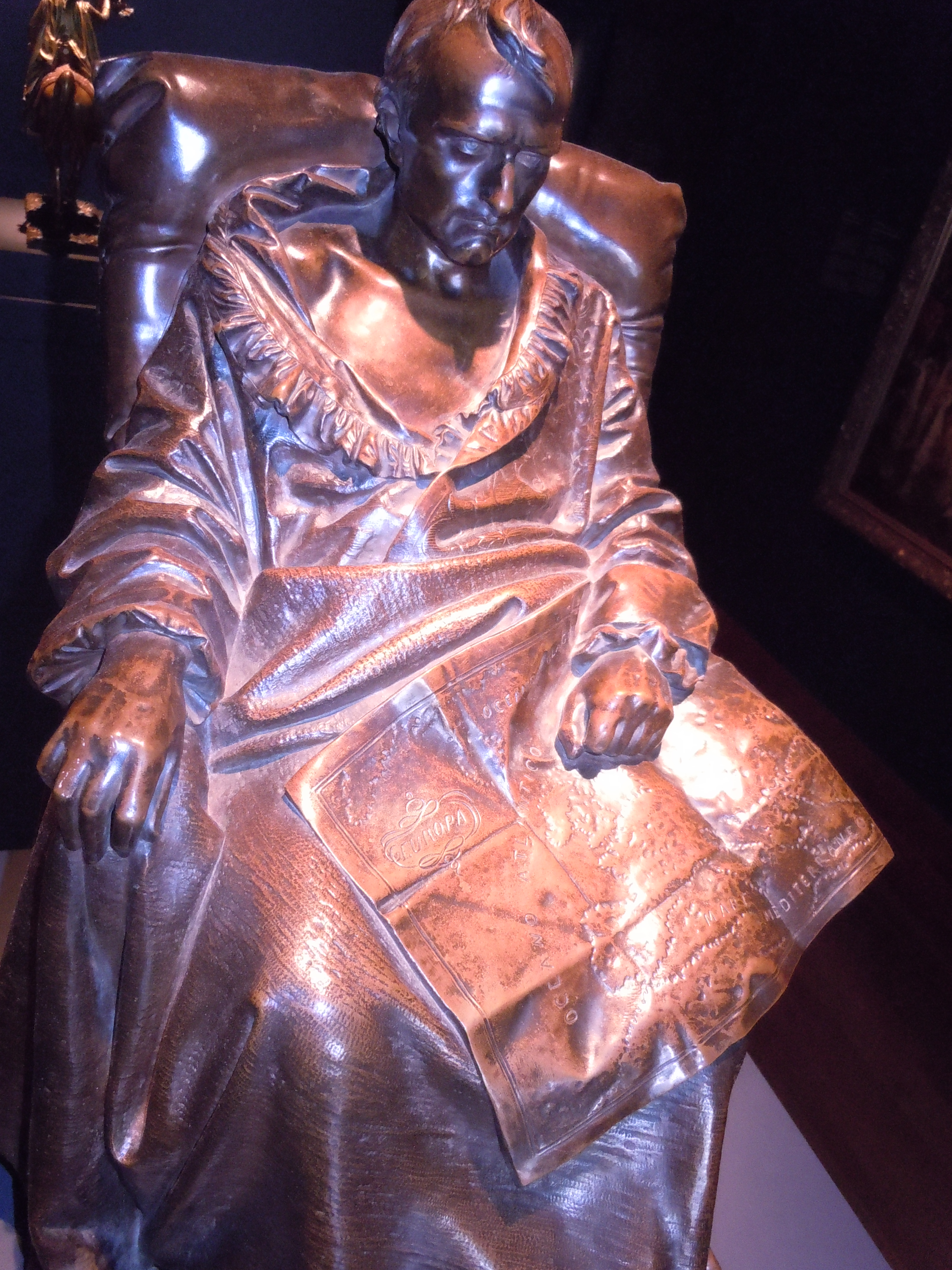
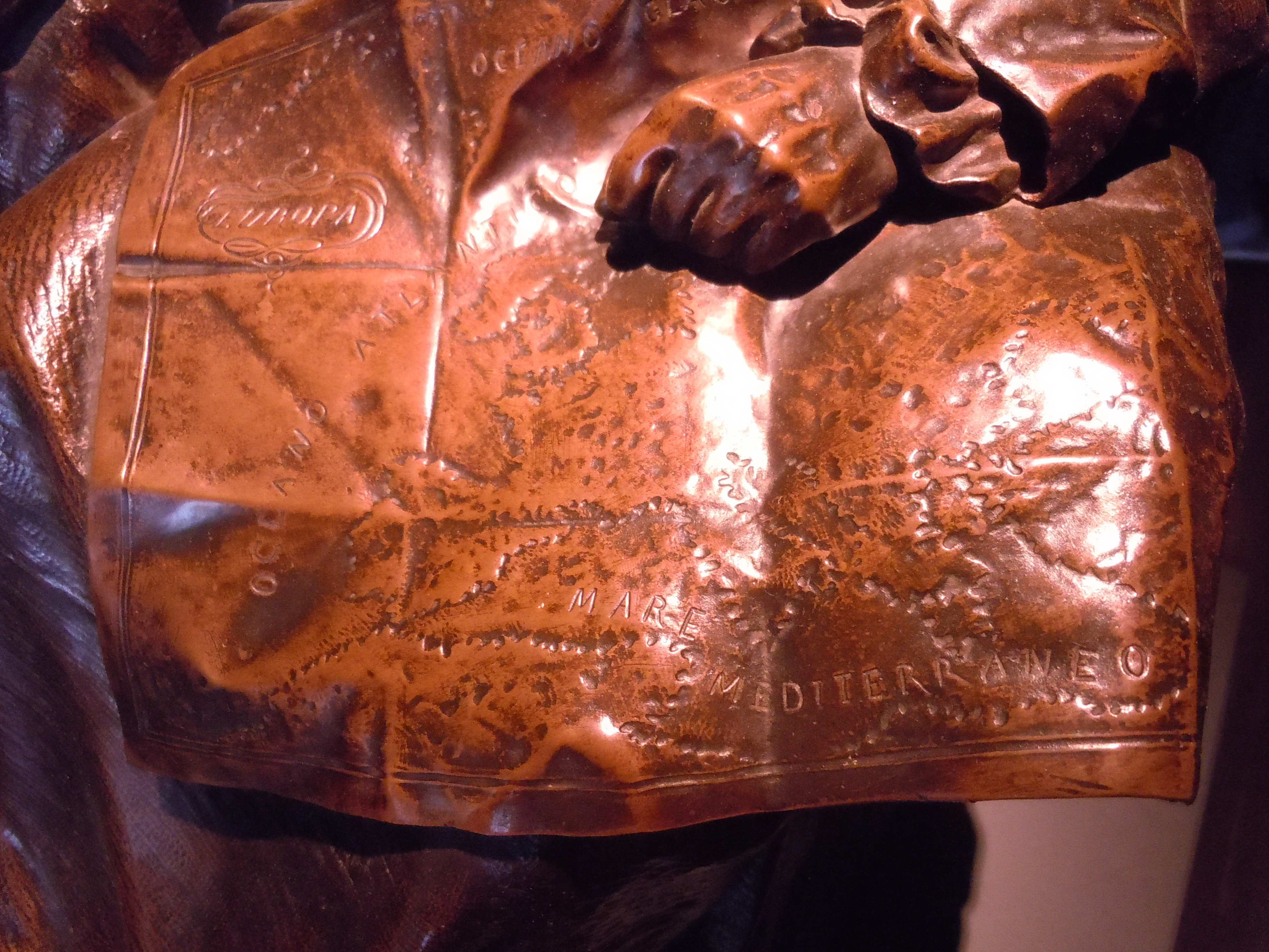
Even though one can barely detect the differentiation between land and sea from the capital letters labelling the Atlantic Ocean [OCEANO] or Mediterranean [MARE MEDITERRANEO] in the folded map resting across a seated Napoleon Bonaparte’s knees, it’s clear he looks at the topographic map with melancholy. The look seems a way of looking back on the expansive remapping of Europe in the Age of Empire Napoleon had inaugurated, if also an image that recalls the Emperor’s famed strategic brilliance on the battlefield it is filled with despair, slipping across his legs at his final moment in life. Does the close attention to the lettering on the map suggest a melancholy relation to the map as territory, and the map as emblem of a lost dynastic dreams? Leaving the map in a moment of reverie seems a way of saying goodbye to the world that Bonaparte had created.
Napoleon is not looking at a map that marks the advance of troops across Europe. Rather, this sculpted figure is somewhat lost in a reverie over a map, or finds the map slipping from his command and easy consultation. Bonaparte’s often imposing figure slouched is hardly studying the map unfolded on his knees, which he holds beneath a clenched fist; as the map almost slips off of his legs, as if to fall to the floor, is he saying goodbye to the transiency of worldly empire? Or is he contemplate the tiresome set of battles that he once waged across Europe, expanding and defending an now-faded empire?
Napoleon as a young soldier or commander of the Italian Army was often shown with his hands on a colored map, as if tracing his battles and a token of military strategic genius, who planned his attack on detailed maps of terrain where he would engage the enemy–
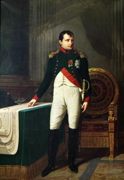
The iconic value of the map served as a reminder of the European map he had redefined.
In his marble sculpture of the moment of Napoleon’s death, the sculptor Vincenzo Vela captured the melancholy of consciousness of death in Bonaparte’s turning of attention from the map. His stare out to the viewer, as if ignoring the map lying in his lap, foregrounded his relation to the detailed legibility of the surface of the printed unfolded map of Europe at the moment of death. The map, in this moment, was less the tool of strategic engagement, but almost slipped off of the knees of a pensively abstracted, slouching Napoleon Bonaparte, as he stared abstractedly and with intensity into space, as if he had already left the earth after being defeated after his surprising return from exile.
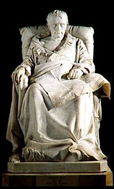
Vela dedicated himself to rendering the map as something like a veil for the psychology of the aging Bonaparte. Although Napoleon’s eyes are not clearly visible for its viewers, the sculpture captures the distance between the Emperor and the map, and the aging Emperor’s relation to European stage through his meditative reflection on the intent reading of maps in a monumental memorial statue of bronze, cast in Paris, which created a strong sense of the Emperor’s relation to the map and tools of surveying that were prized by the French–long after the cult of the Emperor had passed.
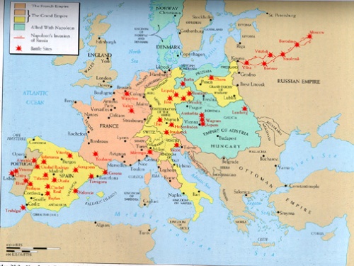
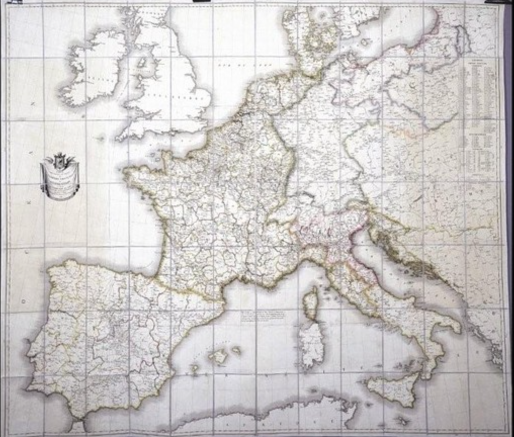
The figure of Napoleon reading a map of Europe was based on a larger marble statue first shown in the Universal Exposition of 1867. Maps are the only media able to illustrate the sweep of Napoleon’s ambitions and his massive military campaigns: the famous statistical map of the progress and retreat of the Napoleonic army’s voyage to Moscow lies at the end of a long tradition to process the scope of forces, men, materiel, and logistics in the Empire. From the massive ambitions for land surveying, epitomized by the project of mapping during the Egyptian campaign, wonderfully studied by Anne Goldlewska, to administer his empire, to the many maps on which he charted military victories and battles, maps were screens for imperial claims in Bonaparte’s empire. But it also recalls Napoleon’s unique military employment of maps, if it is retrospectively melancholy in its reading of the maps on which his battles were sketched–or the celebratory tricolor maps that, for Joseph Roth, he distributed as Emperor to his soldiers, marked the sites of military victories across half of Europe and the Mediterranean, extending to Egypt.
Maps were, in part, Romantic visions of the new relation of empire to space: not only was Napoleon well-known to study maps assiduously on the eve of military engagements as tactical aids, noting sites of battles, but purposefully collected a wide range of them in his personal library, which he studied the maps in their specifics. He made pinpricks in his personal engraved map of the Empire of 1812, lined with silk.
 Pierre-Jean Chalencon
The relation of the Emperor to the map is particularly melancholy, and, in a sense, a memory of the imperial title that he lost. The use of maps that the General Napoleon had repeatedly made to vanquish enemies was a recurrent motif in the legend of the emperor as a strategic genius.
Could it be, one reflects the claim of Bernard Coppens, that a recently discovered blood-stained map, claimed to be the very one that Napoleon used in directing the strategy of his troops at Waterloo, the final battle at which he was defeated, offered evidence that the error transmitted in a map created a crucial error in how French forces approximated the location of Wellington’s troops,leading Napoleon to lose his final battle and disorienting his relation to the battlefield that fateful day, due to an error of the repeated loss of material in hand-printed maps? If it indeed left him aiming canons in a direction that did not serve his cause, as Coppens argued, the printing error would have left Napoleon suitably disoriented as he tried to grasp his relation to the battlefield, it is argued. The conjectural scene evokes how the novelist Joseph Roth depicted he despairing disorientation of Bonaparte’s final days as general in the novel Hundred Days, and the psychic shock of a time when the map suddenly no longer corresponded to the territory.
The theory has encouraged considerable speculation by historians of maps that affirmed their study of the printing process on the vagaries of the mediation of information in the age before universal standardization, and a morality drama that reclaimed the centrality of maps in one of the most famous battles of all time. The introduction of errors with the printing of an incorrect hand-drawn map reflects links between Napoleon’s use of maps and military genius, and the role of maps in mediating space. The image of the reliance on an inadequate hand-drawn map introduced into the printed maps he consulted creates a lovely occasion to reflect on the mythology of Napoleon’s consultation of maps to strategize and reflect upon his past victories:
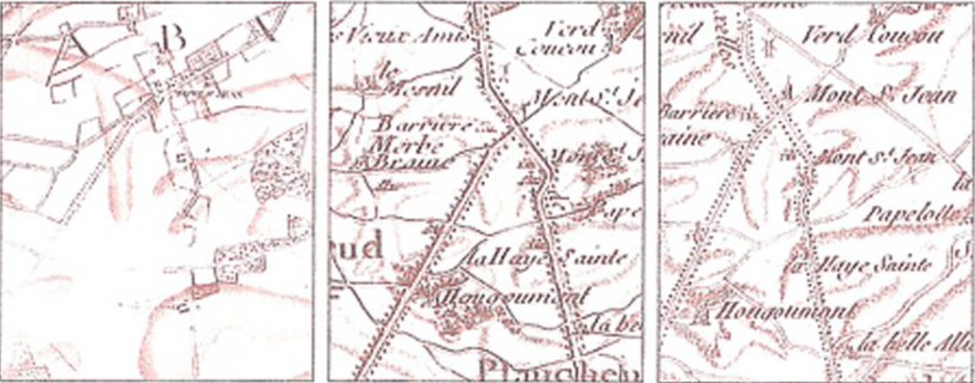 Hand run map and the errors in perpetuated in the printed map that seems used at Waterloo
If the recent claim reflects the reliance on maps as tools of strategy, it condenses the deep trust the Emperor had in maps, but was no doubt also closely tied to the interest in the historical mapping of empire that Bonaparte and the nineteenth century knew well, and the uses of maps in imagining empire.
The possibility of the map as a key to victory lay in how it offered a new way to imagine strategies of military violence. Roth describes, in Die Hundred Tage, the crazed emperor, having lost his reclaimed Empire after he had retreated from the lost battle of Waterloo, facing interrupted sleep in the the Elyseé, the very night after his abdication, and turning, engrossed in a set of maps as he even plotted the possibility of an impossible, final victory, suddenly able before his maps to “fathom why he had been so blind,” as “All at once, he felt illuminated as if Grace had come over him and he could guess, better yet know the plans of his enemies; he lured, outwitted, trapped, entangled, beat and destroyed them; the country was finally free, but he continued to drub the enemy, far beyond the frontiers; he had already reached the coast, the English were escaping in their ships to the safe shores of their island . . . ” The reading of the map is a final refuge, but also the occasion of the greatest nocturnal hallucination, liberated from reality: “He was not actually reading the map. He was instead visualizing the actual villages, the hamlets, the roads, the hills, the battlefields, and suddenly all of the beloved comrades of his youth rose up again . . . He would with the resurrected dead alone. It would be the greatest battle of his life, the most wonderful, the most brilliant . . . ”

A new consciousness of mapping a monumentalized relation to expanse perhaps inspired the historical maps of the Roman Empire’s expanse in the historical atlases of the nineteenth century as tools and forms to define the relation of territory to state. Mentelle and Malte-Brun’s Atlas de la géographie universelle ancienne et modern (Paris 1816) moved (or jumped) between classical antiquity to contemporary geopolitics. The consciousness of maps as vehicles to explain past empires to audiences created a new imaginative remapping of precursors to the nation state: A.H. Brué mapped the empire of Alexander the Great, the Roman Empire of Constantine, and ancient Egypt among the maps in his 1822 Atlas universel de géographie physique, politique, et historique, ancienne et moderne; its second edition inserted a map of Charlemagne’s Europe between the ancient world and Europe’s political landscape in 1789. Despite a growth of historical map making, Christopher Black noted Charles V. Monin’s later 1847-8 Atlas classique de la géographie, ancienne, du Moyen Age, et Moderne included “no maps for the period covering Europe for the period between the tenth century and 1813” (Maps and History, 41).
The gauntlet for comprehensive mapping had in a sense been thrown after Napoleon’s death, by Christian Kruse’s Atlas und Tabellen zur Übersicht der Geschichte aller europäischen Länder und Staaten (Leipzig 1802-18) which used maps to direct readers’ attention to the question of territorial control along clearly defined frontiers across time–a concept more relevant to the nineteenth century than earlier times. Later historical atlases designed as schoolbooks essentialized the national frontier; as the 1820 Historischer Schulatlas oder Übersicht der algemeinen Weltgeschichte, which effectively distilled world history to fourteen maps, or lavishly produced Historischer Hand-Atlas inculcated students and readers about their relation to the historical formation of national civil space, as well as orienting them to world history.
As the genre of historical atlases had indeed emerged, whose increasing focus emerged as an artifact of the emergence of the modern state, that extended the historical premium that the Emperor placed on the map as a strategic tool: the epitomy of this cartographical narrative is the expansive Historisch-geographischer Hand-Atlas zur Geschichte der Staaaten Europa’s von Anfang des Mittelalters bis au die neueste Zeit by the retired Bavarian army officer Karl von Spruner, whose third edition of 1880 was expanded by Theodor Menke considerably expanded its first edition of 1846. The background of this atlas, printed in Gotha, marginalized economic or social topics, in favor of military campaigns, political boundary lines, and the German contribution to world-history as well as the divisions of German-speaking lands. The bias is apparent in this historical atlas, which took pains to frame historical events from a uniquely German-centered perspective: the single map of Waterloo emphasized, for example, the contribution of Prussian forces more than of Admiral Nelson’s English fleet. The background story of its reprinting and expansion was the Franco-Prussian war, of course, which was also the background of Vela’s statue of the defeated Napoleon, left to contemplate a map.
The consciousness of mapping a relation to space, and a local relation to space, is the major source of melancholy in this portrait of the resigned and vanquished Napoleon–immediately bought after it was displayed by Napoleon III. The revision of the romantic figure in the form of a modern melancholy before the map of Europe is a sort of history of regret or of what was not: his fist covering the region of the fated march to Moscow and disastrous return in which so many troops either deserted or died, the map suggests a historical map that was not to be, as the unfolded map seems to slide off of his knee, and its reader seems almost aware of the incompleteness of the very dream that it offered.
The bronze copy of the statue shows a Napoleon nodding off, but whose clenched fist suggests the mastery that had finally eluded him, which now appeared located in the map whose well-worn use seems evident from its creases, but which seems to be about to flimsily fall to the ground as if to elude the dying Emperor’s final powers of concentration.
(Ben Weider Collection, Napoleon Museum, Montreal)
The monumental statue is striking for the considerable detail that is lavished on the inscription of the map of Europe, however, and the muteness of the register of the printed map, which bears a simple inscription of the political boundary lines of the continent and the difficult terrain over which the French imperial troops had travelled during their bitter loss:
What was Napoleon III thinking when he bought it at the very moment that he saw it on display? He must have recognized the appeal of Vela’s verismo and the sculpture’s evocation of psychological regret, a far cry from the romantic image of Napoleon as world-conqueror. Now confined to one island, left to contemplate his worldly defeat and what might have been, the statue is something of a modern image of melancholy, as well as something of an anti-historical atlas, as it ran against the grain of the tradition of Spruner’s popular atlases which focussed on distilling history to a sequence of maps of individual states. The map, declarative and decidedly non-narrative, faces the dying or haggard Emperor in Vela’s “Last Days of Napoleon” as if the encounter between former emperor and map was the primary occupation and obsession of the former emperor’s final days.

