Tag Archives: New World

Victory!

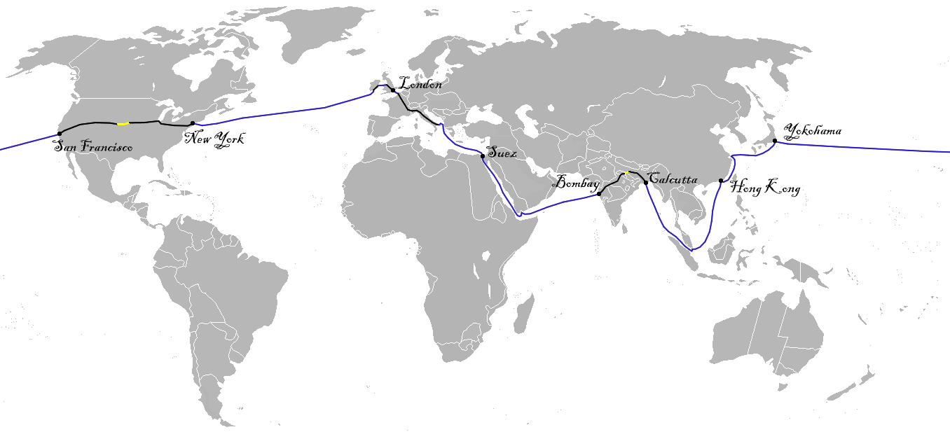
Conquests often lead to a renaming of place, a denial of the rights to land or water by former inhabitants, that is only confirmed by a map. As if sensing the need to administer a national shot of dopamine without much to accomplish for ending war in Ukraine–despite assurances of its imminent ending–or the transformation of Gaza’s rubble to beachfront properties, realizing our short attention spans, President Trump declared victory on the television screens and Google Maps feeds in the relative safety of the Brady Press Room, and declared victory over the maps to be provided Americans in the future of the offshore waters of the southern coast of the United States for the foreseeable future. While the font is shrunken over the deepsea area, the expansive claim to expand far beyond the nation’s Exclusive Economic Zone or the continental shelf is an act of what might seem bravura, but is also of a false patriotism, a patriotic rallying cry that conceals craven catering to the interests of the petrochemical companies to whom Trump’s campaign was indebted, and disguised the hopes to open bids on offshore lots to extract oil and gas in claims of hemispheric dominance. The aim to secure the popularity of his Presidency by lowering gas and oil prices was the rather simplistic hope of jump-starting the American economy, disguised in jingoistic claims that map servers like Google Maps and many news agencies were all too ready to accommodate.
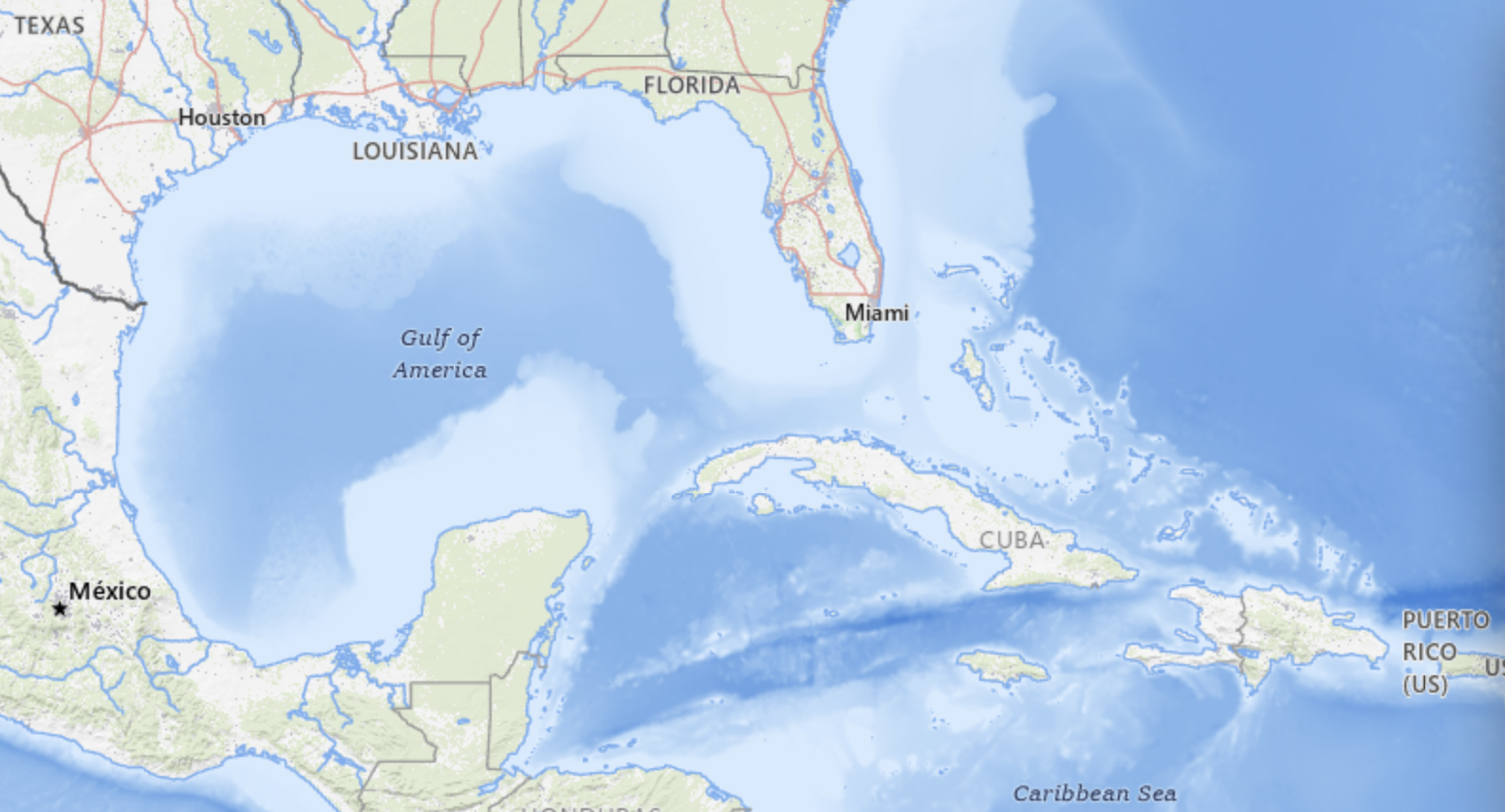
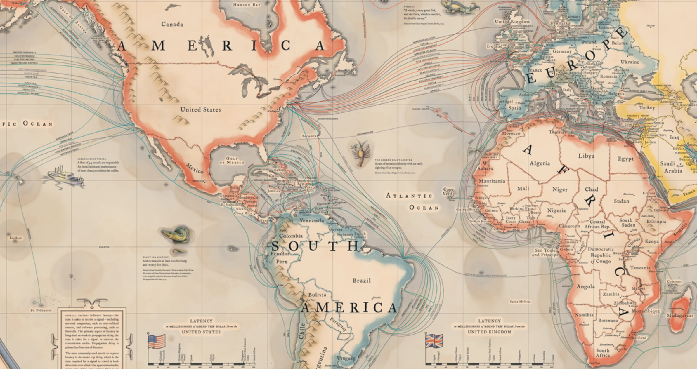
Google Maps

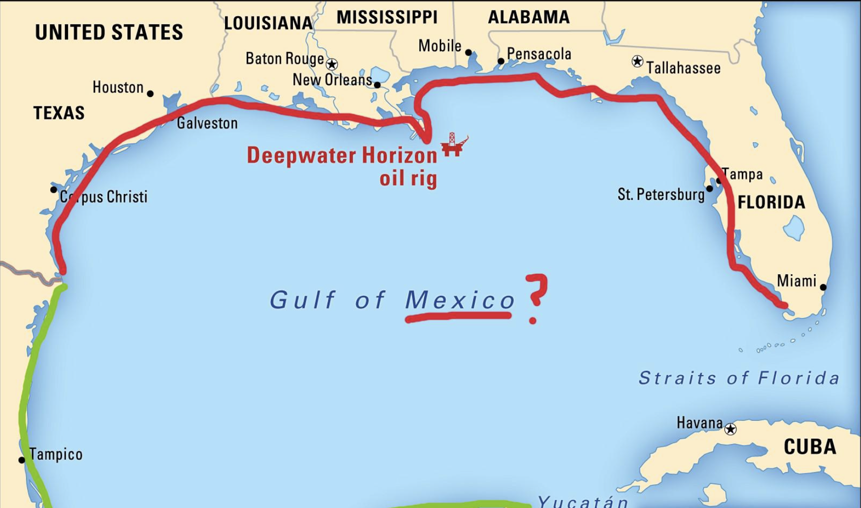
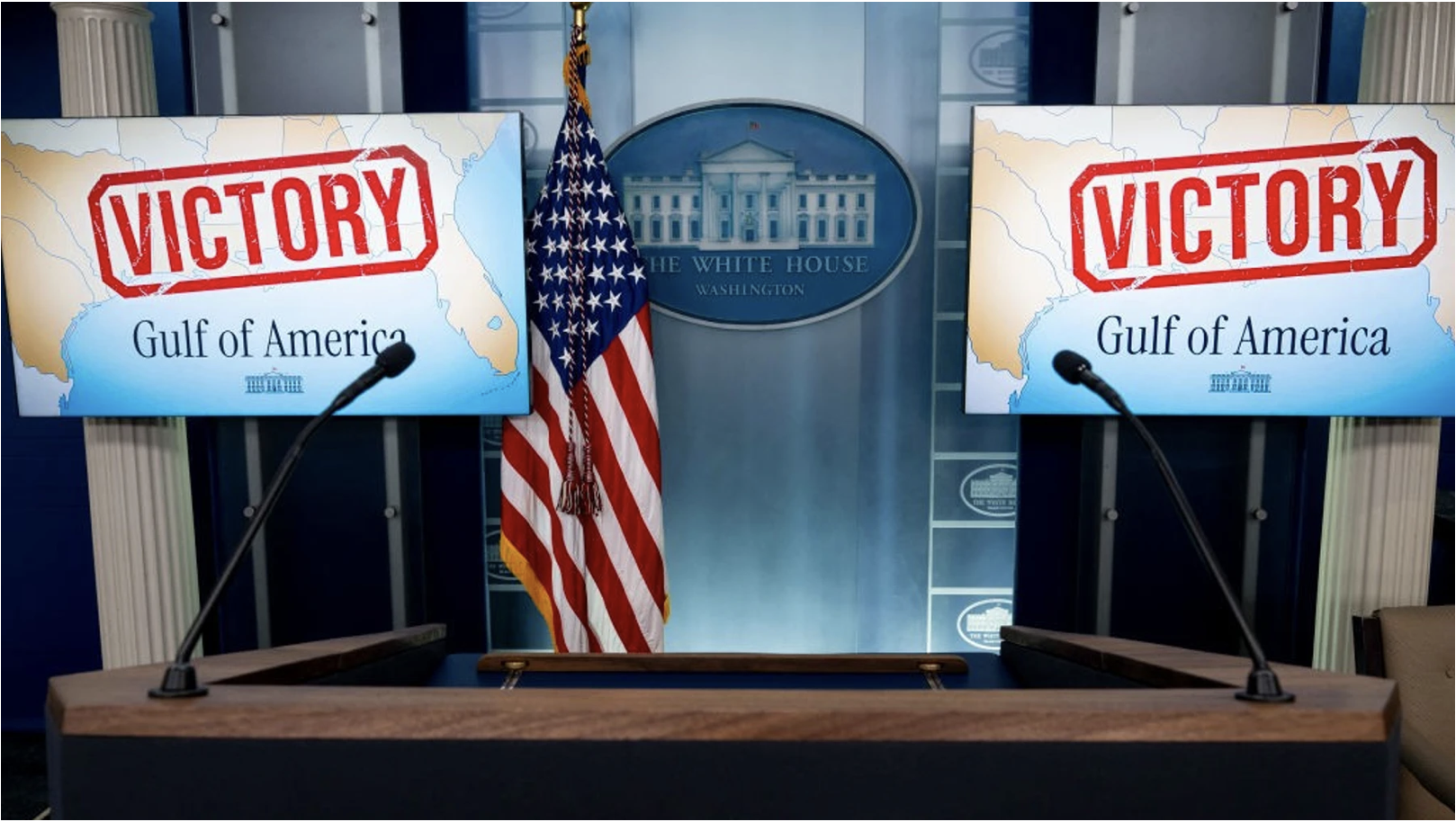
This rather brazen declaration of victory included a cartographic bill of goods and a dictation of the new policies of mapping servers and news agencies not only for the cameras. It was for smart phones and online maps, a stage-managed as a campaign event–which it sort of was. The celebratory display of a banner of victory above twin maps that illustrated a renaming of a body of water asserted its reclaiming for national destiny as a needed shot of endorphins to project victory in the global race. The Gulf of America was no mere outlier, but a gauntlet, expanding the earlier extension of offshore waters beyond the current continental shelf, as Trump moved its line, with great bravado, to erase the name of ‘Mexico’ as if the waters were contested, as the result of a war, if this was a war that never occurred, but was being staged for national news agencies he clearly expected to parrot his alternation of the hemispheric map, and the right to stage a name change.

‘Gulf of America’ seems, in retrospect, the terrain of the series of victory marches Donald Trump had mapped out in anticipation of his return to the Oval Office with an entirely new administration. His full-throated adoption of the terminology in news industries that went off so smoothly–indeed, without a hitch!–left him exultant at quick adoption of the new designation among news media, transformed to a spokesperson and portavoce of his truly dark geopolitical designs. With a new grim perseverance in the face of international blowback, Trump glided obliviously over the question of how international waters were being renamed by a nation on unilateral grounds, concealing most of the grounds he sought to be able to claim–and extract oil and gas–lay in the deepwater reserves that previous American administrations have taken off the lots auctioned to the petrochemical industries, that Trump openly wanted to put back on the table without regulatory oversight.

While we didn’t yet imagine that the Gulf of America would be a brand tod be taken on the road to the beaches of Florida–promoted as if it were a “another Trump Development” in its dedicated red, billed cap–the renaming led a rewriting of human rights in international waters, and a new chapter in American unfreedoms rolled out in the Trump regime. But the renaming was a way to push the project to Make American Great Again into international waters, a military patrolling of the expanded waters of America that might be patrolled by drones and bombed at will, if the U.S. military saw something untoward or criminal like a boat that was advancing in international waters suspected of possibly carrying drugs–a criminal but non-capital offense–toward American shores. For the predesignation of a Gulf of America as a part of the map needed to be made Great Again had expanded, as a side-benefit, the area of the nation or ‘national waters’ we needed to defend, because they were suspected of an intent to smuggle drugs across the border–“Every boat that we knock out we save 25,000 American lives”–so that killing three or five or fifteen people wouldn’t be that bad in the calculus where “you lose three people and save 25,000 people,” as Trump clarified, explaining how the elimination of the ships was ‘actually an act of kindness.’

While “Make America Great Again” was mostly understood as a metaphor for the interior, embracing economic issues and global stature, the Gulf of America skirts the boundaries of hemispheric dominance. For the new designation of the largest body of water in the hemisphere literalized the remade greatness of America as a question of magnitudes, embracing a new map of the Expanded Continental Shelf, to be sure planed and mapped by his first administration, from 2017 at the behest of the American Petroleum Institute. The expanded continent served as a way to promote the development of offshore resources of energy extraction, as a cartographic boondoggle that would coincide with the Trump Presidency–and conveniently erase the cartographic history of the negotiation of borders with Mexico, trumping them all by declaring the largest body of water in North America to be a natural extension of American sovereign space. And the new designation of the body of water got rid of a term that, it had to be admitted, predated the birth of the United States, as if this might allow its consignment to the dustbin of history, a relic of the world of a past era that fails to reflect how the United States has remade the world in its image.

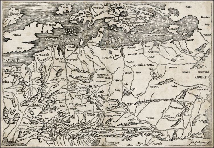
While the earliest authoritative treatise on the New World, compiled by the erudite Johannes de Laet based on the clearing house of the Dutch West Indies Company, described the separation of north from South America, or dividing the Terra Nuova to the north from Brasil to the south, by a gulf shaped like a half moon and filled with islands, like the Mediterranean, as the “Gulf of New Spain or of Mexico,” four hundred years of time seem to be compressed and elided by the renaming of the body of water as a Gulf of America. While the question of sovereignty was a bit up for grabs in De Laet’s day–there was the issue of Spanish sovereignty over the islands and ports, as well as the gold and sugarcane–the Gulf of America is in truth far less as a body of water for maritime travel: the blatant ploy focuses attention on underwater mineral reserves as the new mercantilistic logic of Donald Trump’s MAGA policy. If Spain claimed the gulf in the old mercantilism as a shipping route for precious metals mined in the New World, the new mineral wealth lies off the shore of petrochemical America, in the deep sea, rather than on the shipping routes of the past. If Spain wanted to ensure that the crown profited from mining mineral resource in the colonies, and the extracting of silver by mercury amalgamation and benefitting from the labor of large enslaved populations, allowing the metal of a new coin to be minted from New World silver, the extracting of gas and oil from underseas will demand an even more intensive extraction of oil reserves, by which the United States is increasingly ready to believe might keep its own economy afloat in increasingly unpredictable global energy markets of signifiant cash flow, the environment or biodiversity of the waters of the Gulf be damned–

–not to mention the precarious nature of its long settled shores and benthic coastal habitat.

The Trump Presidency dispenses with legal norms or precedent, seeing what it identifies as “worth it,” and trying to grab it in a desperate race to Make America Great Again by a new mercantilism of expanding the borders of maps, making obsolete the indexical frames as a way to read marine routes that the maps transcribe and organize oceanic space by itineraries in favor of the geolocation of deep sea wells that can be mapped to increase the national wealth by a region whose “bountiful geology” contains “one of the most prodigious oil and gas regions in the world,” already providing a sixty of America’s crude-oil production and whose seafloor contains abundant natural gas, whose opening to unregulated business would drive “new and innovative technologies able “to tap into some of the deepest and richest oil reservoirs in the world.” Renaming of the region was claimed to be merely restoring a body of water to its rightful place in the national map, but the very idea of “restoring” the name to “honor American greatness” was rooted in expanding the underwater reserves beneath it to a reserve of national wealth. And Trump was pleasantly surrrised that the gambit worked, in the sense that even if that name never existed on a map, it was adopted by collective assent on map servers in the first month of 2024. This was mercantilism by putting the cart before the horse, or expanding the map of minimal regulation before the economic business even had begun, outside of any adherence to the complex evolution of ocean regulations, flying into the face of international governance of the oceans by removing the old name from maps as if it were an obsolete inheritance of an old geography–fit for the history of cartography–

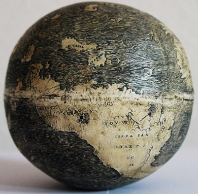
Jacques Nicolas Bellin, Carte Du Golphe Du Mexique et des Isles de L’Amerique (Paris, 1754)

to recognize a new economic reality. To be sure, Louisiana, Florida, Mississippi and Texas were states now, not just areas of land, entitled to sovereign wealth funds in the Gulf that America whose oil deposits United States companies had mined more than any other nation, the states bordering the Gulf, as much as the oil companies that have released the buried wealth.

To be sure if one went a bit father back through the centuries, the neo-imperial act of renaming was consonant and of a piece with how the same body of water had been a bit different seen in 1640, when it was mapped as a part of New Spain–when Florida was far more sketchily mapped, indeed, if the rivers that fed what was then simply the “Gulf of New Spain” fed a body of water whose naming reflected the global dynamics of colonization, removed from any sense of local nationhood, as if the mapping of a new body of water were indeed only fit for the projection of national dominion.

Johannes de Laet, Histoire du Nouveau Monde ou Description des Indes Occidentales (1640)

The rationale for renaming was of course then to define the control over routes for the silver trade, and ensure a monopoly on traffic through this bay that became a focus of economic traffic to the New World. Centuries later, the historical nature of this shift of names laid a claim American oil companies had staked to extract the region’s submerged wealth. The Gulf of America was a Sovereign Wealth Fund waiting to be extracted, there for the taking by multinationals with the Trump White House’s happy imprimatur. To be sure, the idea of a Sovereign Wealth Fund was never part of American government, but it fit the lines of Donald Trump and Don, Jr.’s friends in Saudi Arabia and Abu Dhabi–some states, as Texas, already had one, and the other bayshore states from Louisiana (then under French sovereignty) and Florida (then under Spanish dominion) had long changed to states in the union. Yet it is hard to cast the Executive Order simply as an updating of claims to sovereign in an area long known as the Gulf of Mexico–as if the name change reflected a pressing need to be bought into line with the Adams-Otis Treaty that freed Florida from Spanish sovereignty or Louisiana Purchase–rather than rely on antiquated mid-eighteenth century maps that identified “America” only with the surrounding islands, long out of date-and not a land grab of underseas wealth of hidden treasure that the United States felt itself empowered to annex.

Golphe du Mexique et des Isles de l’Amérique (Paris, 1754)/Library of Congress

Although promoting offshore development had roots in the commission to remap the Outer Continental Shelf (OCS) to oil and natural gas exploration to redress the status quo in which 94 percent of federal offshore waters remained inaccessible to plans for expanded energy extraction, a huge multiplier of state revenue streams of potentially untold dimensions, free from regulatory oversight. Indeed, the renaming of the “Gulf of America” is an annexation of mineral wealth, in case you hadn’t noticed, in what is far more than a media stunt.

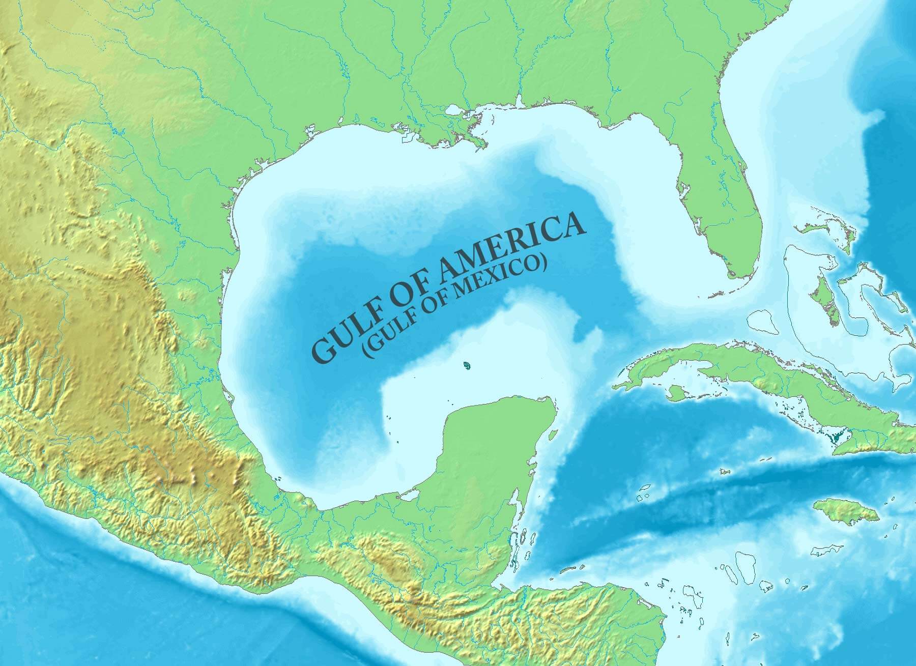
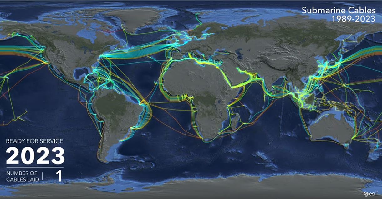
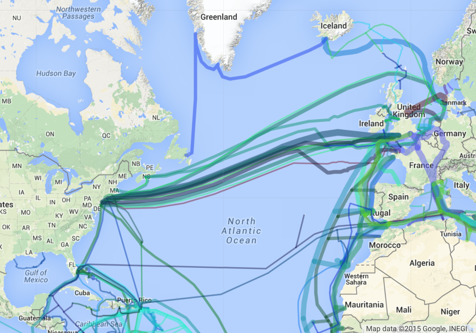
The problem of mapping the inlet of ocean water known for centuries as the “Gulf of Mexico” is illustrated by the MapBox imagery that locates the new name preciselyat its deepest waters, the contested areas body of water Mexican and American petroleum and gas seek to claim possession, adding a substantial amount of wealth to corporate ledgers, and boosting one national economy or another in ways that maps have suddenly put on the front burner of the Trump Presidency.

Gulf of America (The Gulf of Mexico) Map - Guide of the World

The problem of remapping is located in deep waters in either alternative name for the region, as the deepest areas of its waters–the “deepwater” sites of drilling and extraction–that were long held off the table during administrations with more concerns about environmental consequences, has long been targeted as a goal that the oil industry put on the front burner of the Presidential election, and Trump was, this time, more ready than ever to coopt as a platform as if it would Make America Great Again–or be an issue of domestic policy for the Secretary of the Interior to plan.

As much as the renaming of the Gulf of Mexico undercuts history and cartographic custom with a vengeance, the neo-imperial renaming seem to herald victory in an intense fight for underseas minerals waged by oil companies for leasing more offshore lands around the nation. For the un-naming the Gulf of Mexico is not only Newspeak of a dangerous sort, a spin on the rebordering of America that is a core MAGA principle, but is a craven advancement of oil companies’ interests. The renaming was presented free from any fingerprints, as if it was a right of the nation that would be at last rectified by the Trump Presidency, more than a priority of energy industries and petroleum extraction: the declaration on Inauguration Day that “[t]he area formerly known as the Gulf of Mexico has long been an integral asset to our once burgeoning Nation and has remained an indelible part of America” conjured the cartographic indelibility of a map of clear borders. The new name of this “integral asset” was a claim of ownership and property, as if the real estate agent in chief was able to annex what was already “indelible” just to remind us of what one has long known. The new name was a way of restoring to America what was hers, lest we be ripped off, as much as asserting the demand for expanding offshore oil production.

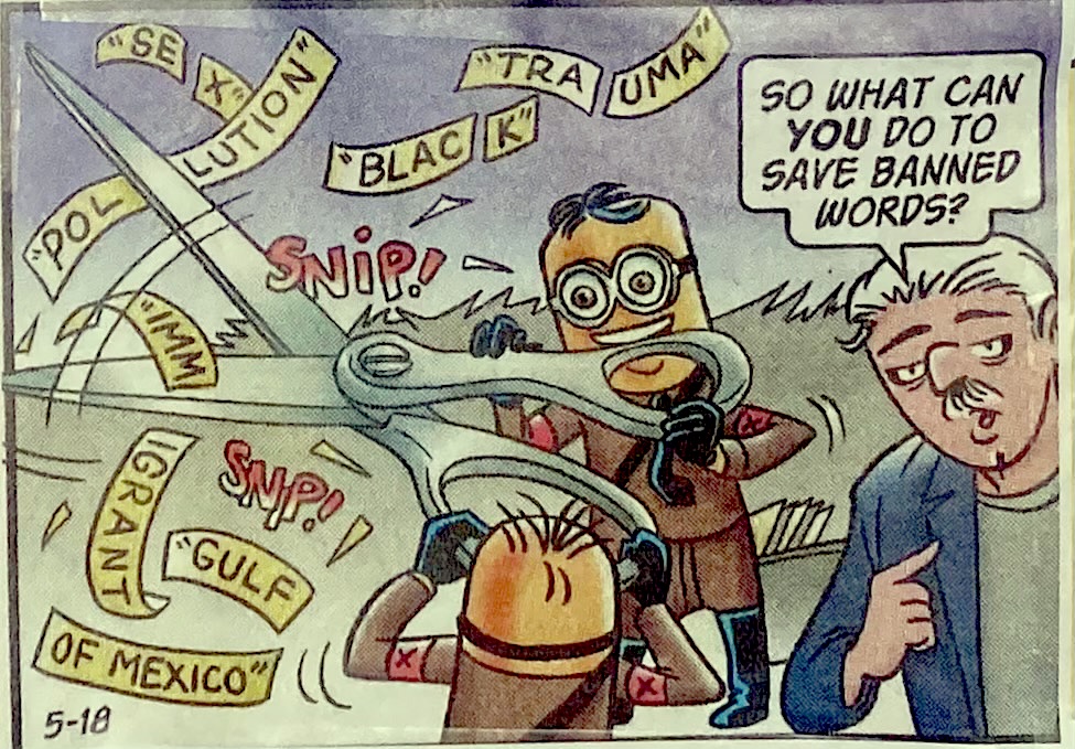
The un-naming of the Gulf of Mexico may mirror the un-naming Confederate monuments to Civil War Confederate generals, of slave-owners, or indeed of Columbus. For as an act of restoration and memory, renaming of the largest body of water in North America was a restoration of “American pride in the history of American greatness,” a rectified history more than asserting hemispheric eminent domain. (The name was to be reinforced as indelible by commemorating the February 9 edict as Gulf of America Day.) And as much as the parsing of other phrases suggested a snipping concepts was a Newspeak undermined cognitive abilities and mental tools, the severing of “Gulf” from “Gulf of Mexico” was an annexing of watery expanse in hopes to stake claims to energy reserves deep beneath the ocean floor, a search for wealth that, in the minds of the government and new Secretary of Interior, might be integrated into the nation’s economy and indeed be a promoted as a new foundation for national wealth, gained by cartographic fiat. As much as we abandoned terms as the results of the zealousness of complaint MAGA mixions wielding scissors gleefully to cut red tape and bureaucracy allegedly to keep down costs, sheering the language of governance by severing of “Gulf” from its less patriotic modifier to shift the hemispheric balance of wealth. The renaming planted a flag in an expanded underseas mineral and seabed–severing it from Mexico, in a voluntary act of Dada it was hoped public memory might mindlessly comply.

G. B Trudeau, Doonesbury 2025

This was nothing less than the perpetuation of a new religion of American grandiosity, an expansion of the boundaries of America to claim those areas of the Expanded Continental Shelf as if they were included in the Book of Mormon, and a recognition of American grandiosity recent maps had omitted and elided that placed the nation at a disadvantage, if one needed reminding, in a global marketplace. Yet this patriotic rhetoric of promoting a new religion, a truly revolutionary rhetoric worthy of the Festival of the Supreme Being, was a manufacturing of a new nation out of whole cloth, urging the nation to rally to “take all appropriate actions to rename as the ‘Gulf of America’ the U.S. Continental Shelf area bounded on the northeast, north, and northwest by the State of Texas, Louisiana, Mississippi, Alabama and Florida and extending to the seaward boundary with Mexico and Cuba” that would kill the spectral monster of “the area formerly named as the Gulf of Mexico,” an entity forthwith recognized as against the interests of state, and as thwarting American greatness. If global resistance mounted against the unilateral name change, that provoked perplexity and seemed an appropriation of a global map for national ends, the undoing of the maps recognized by the United Nations seemed as chrome-headed and obstinate as America itself, a vision of going it alone that seemed both bull-headed and deeply provincial, but was perhaps best understood as a crass claiming of power and hemispheric domination, aimed at ending global consensus.

How, Trump seemed to be asking the nation, did we ever allow this body of water in which so much offshore oil lay underseas, to be called the Gulf of Mexico, if much of our national wealth lay there? Trump seemed to relish calling for the collective brainwashing of the nation by beseeching “public officials and all the people of the United States to observe this day with appropriate programs, ceremonies, and activities,” as if the presence of the word “Mexico” in America’ offshore waters might be finally expunged, and we no longer need to ask why its presence was so long tolerated.

r/mapporncirclejerk

The rewriting of revenue streams from the Gulf Stream states by drilling outside the Western and Central Gulf of Mexico lead to the renaming of the region as a Gulf of America, as Trump seemed ready to see it–and remap it–as the new basis for a Sovereign Wealth Fund, What better place for staging such a performative statement than on the twin monitors of the Brady Press Briefing Room, demonstrating the usage newspaper reporters and the real guys on television would be compelled to adopt in order to be able to attend? This new expansion of American sovereignty that was being proclaimed in the Briefing Room was in a sense evidence of the generative nature of maps of the offshore regions in the erstwhile Gulf of Mexico, and Exclusive Economic Zone, as the Gulf of America was only the prime and currently privileged seat of extraction that was located in the expanded continental shelf to which the United State was ready to claim full jurisdiction. As much as being a reflection of Make America Great Again, the Gulf’s surprise renaming can be traced to the decision of oilman George W.Bush to end to the decades-long ban on offshore drilling in the summer of 2008, opening 500 million additional acres for new energy production that contain an estimated 14 billion barrels of oil and 55 trillion cubic feet of natural gas.

The map of “energy opportunity” dated back ages ago, rather than being a creation of the Trump Era, or even Trump 2.0. But the Bureau of Ocean and Energy Management had been eager to assess “undiscovered oil and gas reserves of the nation’s Outer Continental Shelf” as a new bonanza of a new Wild West, having claimed the discovery of a new reserve of a “technically recoverable” 90.2 billion barrels of oil and 404.6 trillion cubic feet of gas waiting to be unlocked, in ways that would make the debates about fracking in Pennsylvania that played such a prominent role in the 2024 election as mere window dressing and just a fig leaf of the emissions risks and costs of offshore pollution of the new map of energy resources that were central to the underseas research of the Bush administration, and an inheritance of the Reagan years.

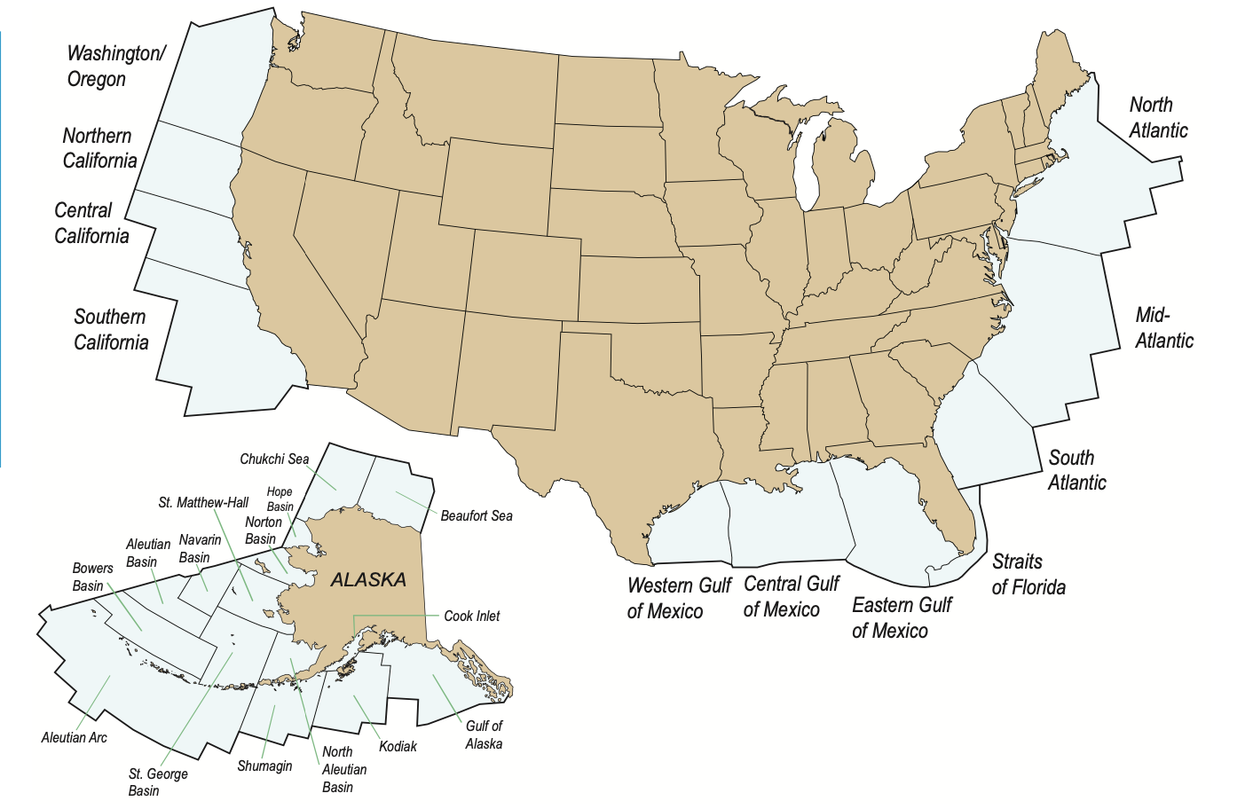
Bush envisioned a Wild West of the OCS–Offshore Continental Shelf–long floating around in maps, but which then-Senator Barack Obama vowed he would, if elected, stand firmly against. Yet the only “open” area seemed the Gulf of America, and it might as well be called what it was, and embraced into our national waters and territorial jurisdiction, even if submerged. To understand this map, despite the dominance of the flat, two-dimensional visualizations of the API and the Trump Presidency, only by looking at the maps of geolocation of offshore energy reserves that led to the mapping of the “OCS” as a geographic concept can the remapping of the region of the Gulf of Mexico as the Gulf of America be fully fathomed.

Bureau of Ocean Energy Management, 2011

While a nominal victory over reporters who bucked the Executive Order to retain usage of that quite storied nomenclature,”Gulf of Mexico,” in the face of guidances from the Trump White House.

Donald Trump 2.0 seems particularly eager to retire the qualification of Mexican territoriality as a geographic reference points of the twenty-first century. To be sure, the hopes for expunging “Gulf of Mexico” from all maps is less easily accomplished than by issuing guidances on geographic names. But the guidances demand to be understood not only a shift of names, but a demand for compliance, and a needed boost to map a new relation of the United States to the world order, akin to a wall on the southwestern border. If building is what Donald Trump has long described himself as qualified for the United States Presidency, the basis for a promise to Make America Great Again, the new mapping staked out the hydrocarbon reserves in the expansive basin once known by the nation of Mexico as a totem of the growth of American gas and oil, offshore areas that were opened by President Bush on an “Outer Continental Shelf” but taken off the table in 2010 by a former President who Trump has long antagonized to a degree that demands to be acknowledged as the prompt for his entrance to the American political scene–Barack Obama–whose every political act has been seen as a basis for Trump’s triangulation of his own political positions, in ways that go far beyond partisan divides–from the American Cares Act, DEI initiatives, immigration, climate change, coastal preservation, and the very celebration of America’s diversity–so much that he acknowledged bitterly the existence of a “through line for all of the challenges we face right now.”

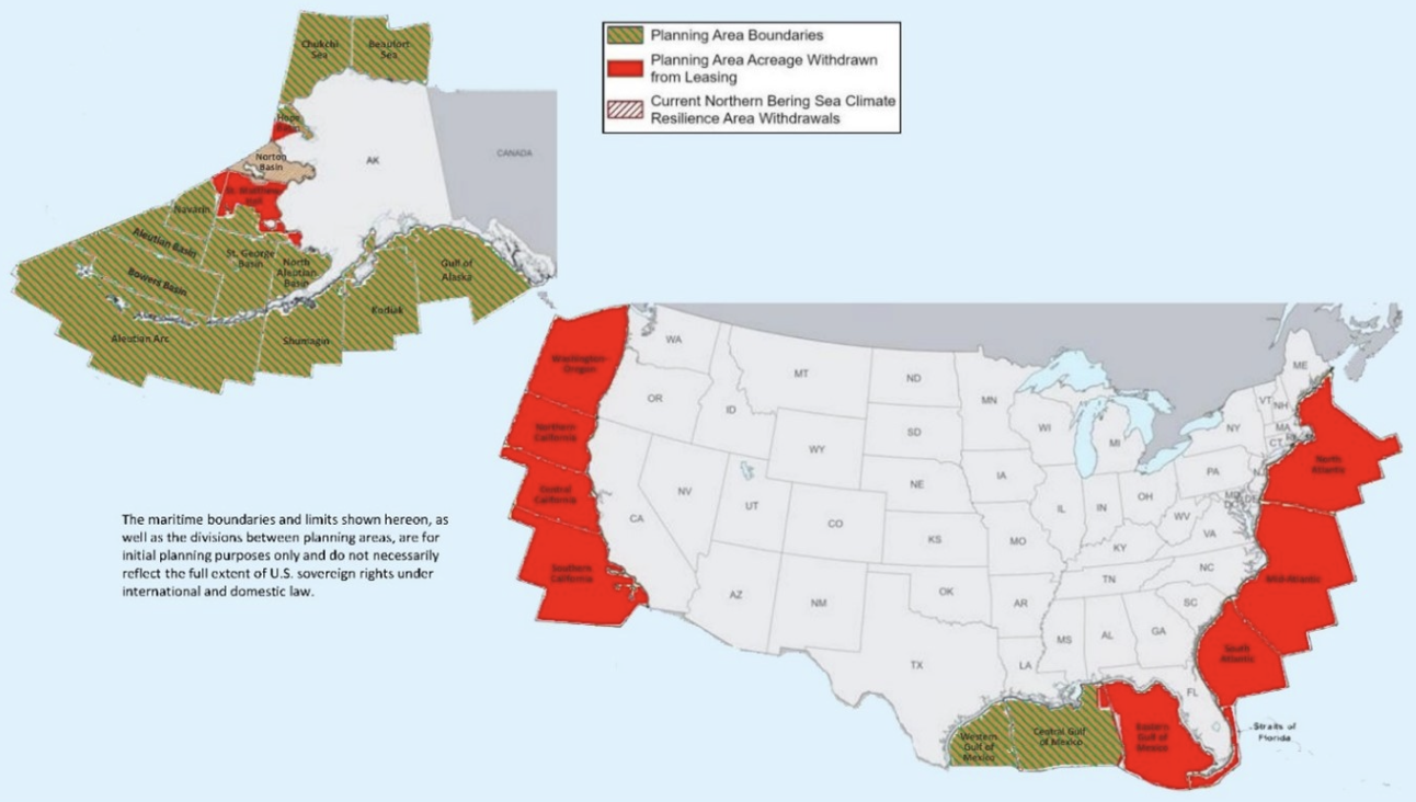
The deep anxieties that Trump’s 2016 victory and nomination of Exxon CEO Rex Tillerson as Secretary of State in 2017 led Obama to ban all future offshore oil and gas drilling from nearly 120 million acres of land in the Atlantic and Arctic oceans, from underwater canyons along the Atlantic stretching from Massachusetts to Virginia, virtually all of the U.S. Arctic, the entire Chukchi Sea and all but a slice of the U.S. Beaufort Sea, trusting that the permanent withdrawal of leases of underwater lands would sent a precedent that Trump would be an unlikely violation of decorum to revisit, would be difficult to rescind and violate all according of decorum to predecessors. But after her had opened some areas of the Gulf of Mexico to exploration, and even asked Congress to lift a ban on drilling in the oil-rich waters of the Gulf of Mexico, the areas withdrawn from drilling until 2022 were open for being revisited by the Trump White House–

American Petroleum Institute

–creating the perfect storm to retake the offshore areas once “open for drilling” that were withdrawn by 2010 to be open for energy extraction. For all the banning of offshore drilling in Trump 1.0 back in 2020, that withdrew areas of the Outer Continental Shelf from drilling, after being poised to open the offshore areas to oil and gas drilling–retricting OCS development in the face of open resistance from East and West Coast states–even as it also halted the development of coastal wind farms he has long opposed.

OCS/2019

The new Gulf of America was a slap against the notion of international development of what was once the Gulf of Mexico, as if building a virtual wall across the Outer Continental Shelf in a hazy patriotic bluster. While President Trump did not suggest he was undermining precedent, by actively excising a long cartographic history that placed the Gulf of Mexico in American maps–from teaching aids to atlases to cartographic reference points–works of reference were beside the point to a focus on offshore oil and gas. One might cite, to little effect, the accord of the Disturnell Map that was appended to the Treaty of Guadulpe Hidalgo in 1847, and marked the first survey of the 2,000 mile US-Mexico border, the boundary survey that led to the placement of a line of obelisks set in the arid plains “with due precision, upon authoritative maps, . . . to establish upon the ground landmarks which shall show the limits of both republics” from an age when few had actual paper maps who lived in the region–and would rely for property lines, farming, and territorial policing by marking the border with obelisks twenty feet in height visible from a “great distance” completed in 1857, to render the map visible on the ground by fifty-two monuments of mortar and dressed stone situated in barren and uncultivated lands.

Disturnell Map (1847) appended to the Treaty of Guadalupe Hidalgo. (General Records of the U.S. Government)

That map of a “true line” to “end uncertainty” of the “Estados Unidos de Méjico” took at a reference point the “G. de México” and the rump to which Trump would reduce the Gulf of Mexico, by Executive Order, of “Bahia de Veracruz.” By opening all United States waters for offshore drilling, the President was boosting an illusory image of “wealth” of America–promoting rights of renaming that smelled of the nineteenth century more than the twenty-first–by declaring a windfall national economic reserve and wealth as if none of his predecessors were ever assured to stake. By magnifying the seigneurial right over the Gulf–renaming the largest basin in North America by its deserved name–the right of the nation to the underseas reserves of energy that were possessed by Norway, Canada, Argentina, New Zealand, Australia, and Mexico–in ways that would suddenly amplify, as if by a needed magic trick, the offshore reserves of the United States by discovering the newly named Gulf of America.

Grassroots Opposition to Offshore Drilling and Exploration in the Atlantic  Ocean and off Florida's Gulf Coast - Oceana USA

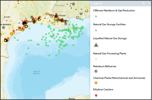
Early mapping of the “offshore” region of the OCS suggested an area of planer that Trump didn’t have his eyes on, but had a rather spectacular way of unveiling for open leasing on national television, performing as the pitch-man for the offshore drilling companies that had so generously bankrolled and funded his campaign, and which the opening of leases was the final quid pro quo, in the transactional presidency that so deeply relies on an essentially premodern notion of “patrimonialism,” in which the President empowers oil companies to exploit the hidden resources that lie underseas off the continental shelf, and augments its own power by declaring the ability to symbolically open the area to drilling by renaming it–and indeed revealing in how the offshore Outer Continental Shelf Areas of the United States are open to federal control–and the sites for some of the greatest public-private cooperations of all time. What more profitable way to reveal a President’s personal control than dispensing of rights to lease expanded areas for offshore Petroleum and Gas Production that augment areas currently operating in the Gulf of Mexico?

Offshore Production of Gas and Petroleum in Gulf of Mexico, Refineries (R), and Chemical Plants/Whistleblowers.org

While the initial decision to rename the Gulf date from the raft of executive orders that include withdrawing form the Paris Climate Accords signed a decade ago to reign in global climate emissions, as part of the “Restoring Names that Honor American Greatness” to rename waters of the “US Continental Shelf area bounded on the northeast, north, and northwest by the States of Texas, Louisiana, Mississippi, Alabama, and Florida and extending to the seaward boundary with Mexico and Cuba.” White House guidances discourage federal agencies form publicly referencing clean energy, Gulf of Mexico, Paris Accords or environmental quality on public-facing websites–

–that run the gamut to shift the relation of governance to cognitive equipment that seem designed to compel renaming the Gulf of Mexico to remap Americas’s relation to the globe. For as much as the attention to the region as a repository of offshore wealth removed from sovereign jurisdiction and taxation, the real riches seem to have been mapped in the BOEM’s assessment based on a “comprehensive appraisal that considered relevant data and information available as of January 1, 2009”–or just before Barack Obama took office as U.S. President–of the new “potentially large quantities of hydrocarbon resources that could be recovered from known and future fields by enhanced recovery techniques” which were never on the map–or visible–to energy multi-nationals of the past, but which Trump is now ready to claim as the seedbed for a Sovereign Wealth Fund.

Federal Outer Continental Shelf of the United States/Bureau for Ocean and Energy Management

So long, that is, as it is not being restricted in any way by the Environmental Protection Agency, and areas of drilling for gas and oil are taken off of the map for the seemingly petty reasons of preserving our coastlines and national shores. The triumph of a governance over these reserves, technically recoverable but taken off the table by the priorities a few Democratic Presidents set, meant that energy industries were ready to fund Donald Trump’s campaign, to have a person in the White House who as First Among Equals, Primus inter pares, was able to understand the priorities of the energy multinationals to evade regulations and restrictions, and indeed, as a poster boy of the type of evasion of regulation that had hindered energy exploration in the past, would be just what the doctor ordered after the restrictions on offshore drilling boded by the Biden and Obama years. For the areas “withdrawn” from drilling that Trump put back on the table as soon as he returned to office suggested a virtual orgy of offshore drilling with full abandon, of which the Gulf of America could be the poster child for recovering underseas reserves for a new Sovereign Wealth Fund.

Areas of Offshore Drilling in Offshore Continental Shelf Biden Removed from Leasing Restored by Pres. Trump

If the areas that President Biden removed from future leasing for oil and gas are now indeed unavailable online, having been purged from the newly unveiled Department of Interior website, as if the Gulf Waters were internal to the nation. Amidst discussion of the attempts of the government to preserve coastal economies, protect marine ecosystems, and protect local economies from the environmental impact of drilling for gas and oil were taken off the table by the Trump administration, to end the “war on offshore drilling” that Democratic presidents had long been waging at huge economic costs to the nation.

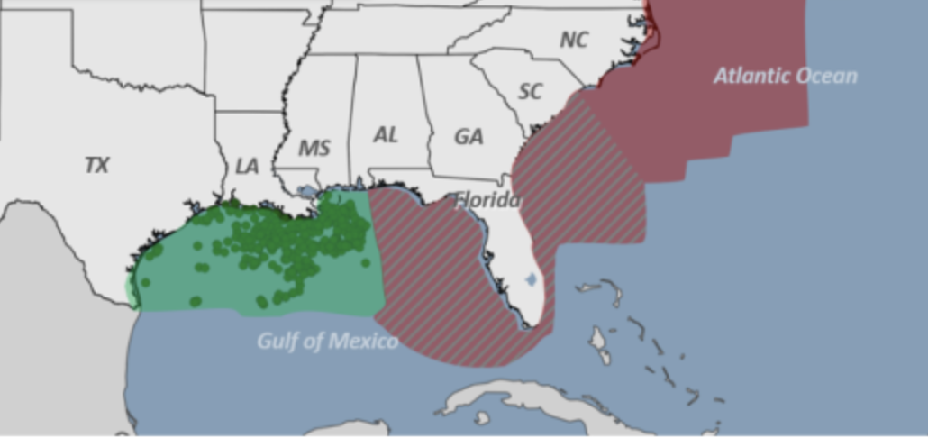
The suggesting of eliminating the Climate Crisis, Gulf of Mexico, and climate science at one blow from the national lexicon of governance suggests an inauspicious triad. The shuttering of office of environmental justice by the Environmental Protection Agency to assess environmental damages is a nation-wide blitzkrieg of unprecedented scale, transforming the environmental monitoring of the hundred and fifty factories packed into an eighty-five mile stretch of the Mississippi River recently mapped as a Cancer Corridor–suggest the new mandate of the agency as preserving business more than a healthy environment. Indeed, the map of the Gulf of America watershed below shifts focus from that river’s watershed to a coast that “is ready to protect” to “power our Great American Comeback”–placing a premium on a vision of government as a business-model of enabling metro-chemical industries by tapping the rich reserves of hydrocarbons that are so abundant on its floor.

If the “Gulf of America” is seen as an extension of the United States even beyond Central America in the public-facing map of the region the Environmental Protection Agency sports as its splash page-

EPA/Supranational Gulf of America Watershed

–the map is odd in its erasure of the United States-Mexico national border that was so foregrounded in Trump’s first Presidential campaign, and suggests the new view of autocratic government from Washington Big Oil wants to promote, of a blue watershed from rivers that flow to a bay rich in reserves of hydrocarbons in its depths, where 97% of offshore energy gas and oil are extracted, without environmental oversight.

The largest body of water in North America is now firmly part of American territoriality–and the area producing a fifth of crude production in the United States was gonna get bigger, boosting the onshore oil refineries already refining 45% of the nation’s oil and processing 51% of its natural gas. The boondoggle gift to energy companies would be quite the bonanza for the petrochemical hub. Indeed, if the United States ranks relatively low on the list of nations with proven reserves of oil, the sudden amplification of offshore oil production would not only reverse the ban Jospeh R. Biden issued on his way out of office–

–but boosted the low-ranking of the United States, one of the largest consumers of oil, among global nations with proven reserves of crude of their own.

The map illustrates the seriousness of seeing government as a business, not a duty of governance. The five million acres of the watershed suggest the of which only 2.4–less than half–are currently used for offshore oil and gas development, of which 1.7 million acres were but recently auctioned off by the Bureau of Ocean Energy Management (BOEM) the previous year, but more deepwater sights are to come. And even if the Supreme Court has deferred the recent demand of Gulf States to obstruct environmental lawsuits from being brought, a further curtailing of EPA authority, the prospect of an “EPA [that] is ready to protect” a region that combined the drainage basins of the Mississippi River and the Drainage of Basin of the Gulf from other waters, is a virtual land grab, not by any war but as a fait accompli. But the new nomenclature seems a bit like herding sheep; Google is sort of ready to play along with the name purge, and the sovereignty claimed over the deepwater regions of the Gulf in the newly mapped “territorial waters” of an Expanded Continental Shelf (ECS), surveyed over the past twenty years as if in preparation for a Trump Presidency, augmenting grounds to extract hydrocarbons and mineral wealth–expanding the national offshore perimeter to the continent’s “submerged edges” expanded, for ten million, the nation with the “right” to remap waters proximate to its national territory–and considerably expanded its wealth. (And these are the folks who call Social Security a Ponzi scheme! They know from where they speak.)

Google Maps

Google Maps rather lightly adopted the new terminology in a modestly sized low-visibility font, perhaps as if hoping that the name of aqua font seep into the waters that it colors baby blue that almost masked the real territory on the deepsea floor over which Trump sought to assume leverage by disassociating it from Mexico entirely, and promoting the deepsea regions believed rich with gas and oil alike of the Extended Continental Shelf as American territory.

Offshore Gas and Oil Production in the former Gulf of Mexico/National Whistleblowers’ Center

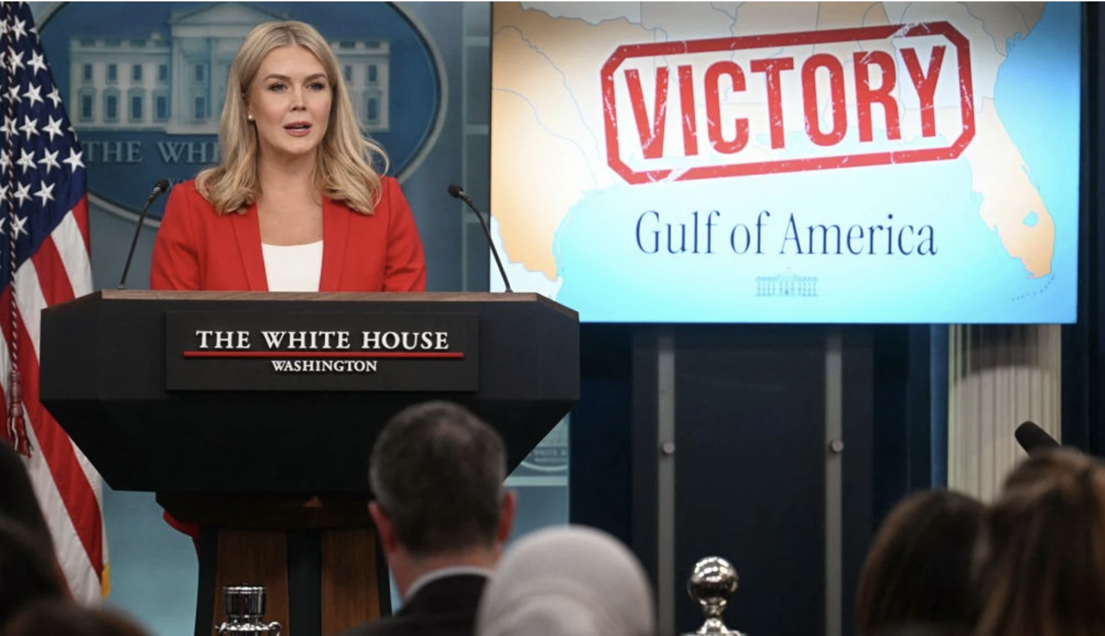
Compliance was shockingly swift in the weeks before the map was rolled out–on Trump’s flight to the Gulf States to attend the Super Bowl in New Orleans, where he must have shared high fives with Louisiana big wigs. The Coast Guard proudly adopted the change form January 21 to describe the maritime border between Mexico and the United States, as weather alerts across the Gulf States, but the remapping of the Gulf faced some pushback as a new way to envision the nation won. Despite the resistance of the AP, the apparent victory of a legal decision that the White House could ban news offices who failed to adopt the name from the White House and AirForce One if they retained Gulf of Mexico seemed a victory of sorts. Trump’s Press Secretary claimed befuddlement and a false outrage that befit the Trump administration, while deflecting where the decision to adopt the new name originated in government. News outlets who disseminated “lies” as they “don’t want to call it that” disguised “it is a fact that the body of water off the coast of Louisiana is called the Gulf of American” Apple and Google do, she noted.   (The New York Times and Washington Post considerately don’t to not confuse global news markets; FOX embraced the new nomenclature.)

The new map was presented on twin monitors at a news conference after the judge supported the new policy of disinviting the Associated Press to the Briefing Room, Oval Office, and Air Force One, as if it to spoke for itself, revealing an objective reality following the guidances for “Gulf of Mexico” among the growing list of name to disappear from public facing website, federal communications, and instruction–the list from “clean energy crisis” to embraced “Native American,” “hispanic American,” and even “orientation,” that might make one think the purge was cartographic, as well

For in excluding words from governmental language, we are impoverishing our own relation to the world. And the apparent victory came that the White House was not being punitive to restrict access to the President to those adopting the change in name of the largest body of the water in North America surely recast that body’s relation to sovereign space in ways that curtailed our understanding of global warming, and global relations, as well as concluding all transnational projects that were hoped to attract investment in the prospecting of energy from the Gulf.

The renaming is the latest foray of a decisive turn to running government like a business, rather than a government. The purging of the Gulf of Mexico from the Geographic Names Information Systems served “to reflect the renaming of the Gulf and remove all references to the Gulf of Mexico” was mapped on the two monitors placed on either side of the podium, emblazoned with VICTORY in telltale all caps, feeding news agencies with their basic talking points as a way of remapping America’s orientation toward the world. By visualizing a body of water on which American oil companies have long had their eyes, the Trump administration seeks to leverage as a vital resource for sovereign wealth–and the seedbed of a Sovereign Wealth Fund for the United States.

The maps foregrounded the gulf states’ new ties to the body of water had premiered on Air Force One, quite eerily as it flew above the waters, as if a mobile White House, as the President, flanked by the Interior Secretary Doug Burgum and his telegenic wife, symbolically claimed the region as a part of the interior. This was a declaration of enforcing compliance with the new mapping of the United States in the world in an era committed to make America Great Again.

The Executive Order to “honor American Greatness” was already a lot to unpack–partly because it assumed, MAGA style, that American Greatness exists and was able to be restored. The rebranding of a body of water uncannily transposed the language of conservation and coastal restoration to monetize the region as a hidden and untapped reserve. “Names that Honor American Greatness” mapped the basin’s “bountiful geology” not as a site of migrating wildlife or coastal habitat, but as “one of the most prodigious oil and gas regions in the world,” offering untapped reserves of crude and “an abundance of natural gas,” for big oil industries to “tap into some of the deepest and richest oil reservoirs in the world.” Beside being “home to vibrant American fisheries, teeming with snapper, shrimp, grouper, stone crab, and other species,” the environmental map dismissed risks to its delicate habitat before “the multi-billion dollar U.S. maritime industry.”

The excuse of adopting patriotic language sought to access untold bounty and plenty. The renaming mapped the waters to hint at the potential benefit of extractions–not yet mapped for public audiences–optimistically estimated by Trumpian exaggeration of “truthful hyperbole” at a hundred trillion dollars in “assets” of untapped oils and minerals. The hyperbole set the stage to create an expansive Sovereign Wealth Fund for United States overnight by clever mapping tools, of the largest sovereign wealth fund in the world. Despite recent hopes to combine a “US GoM” and “Mexican GoM” into a single commercial unit in an international investment community, renaming part of the Gulf so bluntly diminished any potential hopes for regional synergy, expanding access to the West Florida shelf and Louisiana slope, as well as the Mississippi fan, for Big Oil: extant offshore maps had constrained the expansion of offshore drilling in a basin where proliferating technologies of extraction were poised to exploit its resources far beyond the million oil wells already drilled in offshore shelves. The hope of expanding the number of deepwater rigs, without attracting any investment in the fifty-five deepwater rigs in Mexico’s national waters, was designed to promote America’s wealth, rather than to maximize resources of extraction.

The removal of the deepwater reserves ‘from’ the Gulf of Mexico seek to move the deepwater regions into the Expanded Continental Shelf of the United States, making it a source for sovereign wealth for future generations, in ways that move deepwater reserves into sovereign territory–

Of the Fifty Thousand Wells Drilled in the Gulf of Mexico, only Fifty-Five Existed in Mexican Waters

–as if moving the boundaries of marine territorial to include licenses to lease deepwater lands after the congestion of existing drilled wells, the name change conceals the hope to sell rights for drilling new wells into a region that was quite recently named the Gulf of Mexico. The body of water was defined mostly by American wells–but fifty-five were drilled in Mexican waters when Trump was elected–expanding offshore abilities to drill shelf and fans would end a moratorium on offshore drilling suggested a huge cash windfall to boost Trump’s ideas of a Sovereign Wealth Fund.

Continue reading

Leave a comment

Filed under energy extraction, gulf of america, Gulf of Mexico, national borders, US-Mexico Border

Around the World in Submarine Internet Cable

As we attempt to navigate the ever-expanding seas of data in the information economy, we can overlook the extent to which data streams run underneath the world’s seas to create a quite concrete sense of the interlinked.  For such cables underlie the increasing notion of geographical proximity we experience daily, from the world of big finance to mundane online transactions.  Ocean floor mapping had barely begun when the first cable was laid underneath the Atlantic, connecting England to the United States by being painstakingly laid by throwing thousands of kilometers of telegraph cable overboard ships from wooden beams loaded with cable, moving from the middle of the Atlantic in two opposite directions. The efforts that lasted four years, begun in 1854, created a subaquatic bridge of metal wire, by 1858, eight years after the first cable beneath the English Channel, brought nearly riotous celebrations in New York City,–where the latin of the first functional transatlantic cable led to citywide celebrations.

Crowing that “at last the great problem is solved,” Walt Whitman heralded the achievement of the laying of the Atlantic Telegraph as a precedent that “set all doubts are forever at rest as to the practicability of spanning the world with telegraph wire–of joining Europe, Asia, Africa, America and Australia together by electric current,” at the same time as revelers invaded City Hall. The celebration of the shrinking of the world was an early mark of globalization, and the erasing of continental frontiers. The image of electricity as a fluid able to be channeled, controlled, and conveyed, all the while insulated from harm, provided a basis for joining America to the Old World, founding father Benjamin Franklin had argued a century earlier, tying Philadelphia to the capitals of European learning, beyond state governance–long before a national electric grid. While the seashore was being celebrated as a discovery of the wild in an increasingly overpaid world, the laying of cable was an achievement worthy of celebration beyond previous limits of human travel, erasing all natural obstacle and edgess, if the cable’s breaking quickly emerged as the weak links of a triumphal vision of globalization: the increased vulnerability of internet cables in recent years, whether in the North Sea or Baltic or off the coast of Africa, suggested the material fragility of transnational networks of finance, communications, and audiovisual streaming we are overeager to naturalize, forgetting that they rest on infrastructure. If we want to see ourselves as modern, and globalized, overly eager to forget or deny the fragility of global linkages.

Even if the cable broke in four years, the insulating jute fibers wrapped around the wires eaten through by a hungry worm, the steel casing of cables’ housing was reengineered against breakage in punishing conditions of the ocean floor, the protection of deepsea cables has extended as an independent offhosre infrastructure we all depend, at depths of over 20,000 feet below. The electric lines were almost in fact a country apart. Several generations earlier, the founding father of America, Benjamin Franklin, animatedly announced “Electricity is a vast country, of which we know only some bordering provinces; it is yet unreasonable to give a map of it, and pretend to assign the laws by which it is governed.” The metaphor is pretty stock, but the map he imagined might have as its basis a way of attaching pre-revolutionary Philadelphia to the wider world, as, even by the Schuylkill, “we are in a fair way of soon becoming as well acquainted with that terrible element, as with . . . the invention of the air-pump,” by advancing the new nation into new realms by drawing electricity from the thundering sky, using silk as an insulator to protect the experimenter flying the kite from the shock of electromagnetic charge drawn from the heavens on the string on which he had suspended a key.

Benjamin Franklin was quite eager to imagine the European innovation of Teutonic scientists with sparks and charges to be recreated in the colonial entrepôt, imagining that the fearsome world of a fluid “electrical fire” might be “collected” and “drawn off” as a resource of generative power, if he imagined the kite would be flown from a window indoors, harvesting electricity from the heavens as a fluid resource that might be understood by market dynamics as flowing in directions and along straight lines. Franklin seemed to imagine electricity as a new resource of fluid wealth, drawn from the heavens and generated out of the air, whose currency might be gathered to be redircted across borders of nations or state jurisdictions, as if from as yet unmapped lands.

The attempts to map the current iteration of underseas cables that carry internet signals rather than only electric charge as a new vital network of a global economy, in inevitable need of repair but also of maintenance, demanding to be mapped as it runs outside of the limits of state governance. But the map of electric cables and WiFi lines across the oceans increasingly in need of mapping as the infrastructure of underwater current seems a country apart, a region offshore and hidden in the deeps. The generative power of electricity by which Franklin was so excited seemed able to be channeled through bodies, human and animal, as a dynamic “currency,” whose oscillating flows mirrored market transactions, as if it were able to suture the global division of continents by new “bonds” that carried and put in circulation the bipolar interface as a harmonized market, anticipating underseas cables, but depended on the material ties.

A photograph of a display showing cables of various thickness as well as a model of a grapnel.

The hopes of governance of a network of cables suggest almost a living structure of its own. The cables are the material substrate of our sociability and economic ties, but a have become increasingly difficult to map in necessary detail or expanse to scale. The mid-nineteenth century optimism of joining continents by underseas cable were imagined as a network that spun out from London, contracting the surface of a world that appeared the ghost of a British Empire, the delicate web of tangled underseas cables of fiber optic cable, that now are estimated to extend across the global seabed to connect most of the world’s data plans and streams at over 1.4 million km, along the ocean’s floor, buffeted by currents, mudslides, and even the lines of fishing trawlers, even as the global spinning out of submarine cables has grown astoundingly over the past thirty-five years, since the first fiber-optic cable extended on the Atlantic Ocean’s seabed floor in 1988, by ATT, France Télécom, and British Telecom, with an optimism mirroring the first underseas cable of the mid-nineteenth century.

Wired World: 35 Years of Submarine Cables in One Map ...

The mapping of such cables–carrying not only telegraph signals, as in the 1800’s, and, much later, wifi along fiber-optic lines wrapped in steel, lie among the hundreds of cables that would collective run over a million miles back to back beneath the earth’s oceans. The criss-crossing of underwater canyons and deepwater divides, linking the financial transfers, ensure the continued global transit of messaging signals, and internet providers’ continued service, in a complement to the satellites which ring the planet in outer space. Although the satellites are only be able to carry a fraction of the information that the cables send between continents that hug the seabed: satellites can indeed only carry a half of a percent of the traffic that courses across underseas cables, making them a vital infrastructure on which we increasingly depend in more ways that we imagine. The hidden infrastructure of the hidden deep suggests a network that is terrifyingly fragile, and is able to be mapped in quite concrete terms as a material substrate on which globalization can be mapped if its fragility can be maintained, and the dangers of underseas breakage and disruption prevented against.

transatlantic seabed profile

1. The global impact of the underseas cable was, to be sure, seamlessly felt to be a contraction of the global surface analogous to shipping routes of trade, as they were mapped in an 1893 global map trumpeting shipping routes and cables that contracted the world’s surface as the dawn of a new era of an earlier globalization.

The World on Mercator’s Projection, Showing Sailing Routes and Underseas Cables/1893

The smoothly curved hatched routes of lain cable that crossed from England to the Boston and Newfoundland underseas promised the realization of the globalization that Whitman had celebrated, if Thoreau turned a cold shoulder, predictably, to the “grandeur of this creates achievement of the Nineteenth Century.” Thoreau was not impressed at the cables of telegraphy, who found its benefits rested on illusion as much as advances, in his predictable skepticism, as “pretty toys which distract our attention from serious things,” presciently fearing the contents of the first messages born by underseas cables were more frivolous messages than ones of import, worrying that the haste of the construction of telegraph cables proceeded more quickly than there was information needing to communicate. But the amount of economic transactions, speculations, and data flows that are flowing under the world’s oceans outstrip the powers of reflection, or indeed comprehension.

For the American Poet, it confirmed the “practicality of communicating across the Atlantic,” on the eve of America’s Civil War, was a triumphant enterprise whose “immensity” threw cold water on doublers was cast in disturbingly radicalized terms, to be sure, as a bond that liberalized a bond by which “Saxon extends the hand of amity to Saxon,” of an “all-conquering race that is always progressing and extending its power and influence, whether in the icy Arctic and Antarctic or in the tropical heats of India” by “lighting flashes from shore to shore: Whitman sung the “chord of communication” that would “vibrate forever with the peaceful messages of commernse, the lightning-winged words of the press, and the thousand anxious queries of individual affection to the health and happiness of the absent and the loved” in the Brooklyn Daily Times, as an ethnic triumphalism that “conquered time and space . . by man’s inventive power” as a sublime achievement. And the raptures into which the transatlantic cable set the poet who so desired worldly unity in 1858 saw the miracle of allowing the world to “reason together,” “without the aid of palpable agencies” suggests a fascinating promotion of a discourse network uniting Old and New Worlds whose map was aptly chosen by Telegeography as a harbinger of a new horizon of information exchange in the twenty-first century.

And even as the landlubbers Leopold Bloom and Stephen Dedalus paused with the hoi polloi of actual sailors in a wooden cabman’s structure in Dublin, overhearing Italian and imagining the opening of new routes to London–not to say that they had ever traveled extensively–“fell to woolgathering on the enormous dimensions of the water about the globe, and ineluctably found the conversation of others turn to “talking about accidents at sea, ships lost in a fog, collisions with icebergs, all that sort of thing,” in 1904, the contraction of global transit cannot but be seen as a precedent of the smoothening of information transit today, pace James Joyce.

2. The spans of privately funded fiber optic undersea cables that have been lain across oceans floors, some stretching over 28,000 kilometers, are a literalization of global circumnavigation. They provide an image of global networking as well as offering the most massive engineering feat on earth that is hidden to human sight–and are more an emblem of globlization, in many ways, than the contraction of global space.  And the rapidity with which further cable is being lain to link the world’s data flows along faster and more secure lines of communication mirrors global interconnectedness–senses of connectivity and warping past concepts of proximity, unifying the differently owned cables. Conjuring of a surprising antiquated format of charting coyly suggests the increasing interconnectivity of the Information Age, and it also channels the extreme novelty of being interlinked. The retro iconography of a chat channels the very claims of modernity that TeleGeography, a global telecom, pioneered to channel information–and done so by familiarizing viewers with a distinctly concept of space by how we are increasingly interlinked on information highways often concealed far beneath the sea.  Rather than naturalize an image of high-speed connections, the clever choice to rehabilitate a slightly romanticized earlier mapping of oceanic expanse suggests the new space of online data.  And it takes the notion of the electronic frontier seriously, by seeking to orient viewers to the new mental space that such sunken data lines create.  If the map of the bridging of oceanic by sunken internet cables domesticizes the transcendence of distance through the increasing interconnectedness of information flows.

There is clear pleasure in the retrograde mode of mapping also reveals the actual distances that the physical substrate of the World Wide Web inhabits in so doing, and suggests that we would do well to remember the physical substrate by which the global financial economy is interlinked. To be sure, the format of the map echoes laying the first undersea cables across the Pacific, in the mid-nineteenth century in 1850, when the thrill of mapping the expanse of undersea cable was mapped for the first time enabled possibilities of direct communication networks in the Anglophone world that the poet Walt Whitman himself–he who asked readers ponder the image of a thousand acres, and the linkages among all Americans, and in older age would celebrate the inauguration of the first transcontinental railroad.

Whitman provided a vertiginous reaction that registered the excitement that the cable trigged in the United States in a rather short newspaper article of 1858 focussed on the “moral effect of the Atlantic cable” on the nation, which barely touched on its technological triumph: it is striking that Whitman, long practice in the material practices of setting type to mediate the human voice, celebrated the technology of the cables laid under the ocean by wooden boats as linking communication between England and the United States, as Anglophone nation, by a cutting edge technology of deeply spiritual significance by which he was fascinated. The piece is a sort of meditation on human geography, or the aesthetics of space that the cable changed in a profoundly deep historical–as well as submarine–manner, bridging distances of communication in new ways.

Whitman was long fascinated by the compilation of voices in type, and networks of communication that spanned nations as the railroad. In 1858, already an established poet, he celebrated the cable as as a material network for transporting semaphore, if not human voice, transcending space and binding England and America in truly inseparable ways as a sign of the fostering of global peace–attracting much popular celebration, even if he judged it would not “bring one iota of personal benefit” to the majority of American inhabitants, the electrification of “unbounded excitement” makes it seem as if the internet was introduced to all, in democratic fashion, generating a level of excitement, evoked in the map below of the Submarine Telegraph, worthy of “glorifying a grand scientific achievement” that outstripped any “merely material considerations” by its ability to “thrill every breast with admiration and triumph” in ecstatic terms: Whitman waxed poetic as he praised how “the sentiment of union that makes the popular heart beat and quiver,” more than its technological advantage, imagining that the network set a deep tie spanning the Anglophone world betwden two countries “no longer [able] to keep each other at arms-length.”

The role of technology in furthering the natural relations within or coherence of a nation–a point of fascination common to the institutional infrastructure of America Whitman also celebrated of his own poems–was almost cartographically conceived as a way of unveiling unities within the world able to bridge space, and even, at times, time, able to transport and convey messages that depended on oceanic travel.

Was the technology of the Submarine Cable an extension of the national unity Whitman already celebrated of the United States? The bond that the cable created was cast as a profound historical event, leading England and the United States to set aside any rivalries, having forged this deeper bond of both “heart and feeling”–the network was a deep-lying embodiment of shared purpose, even if it was not seen! Perhaps its very invisibility added to its power. Whitman had celebrated in the 1855 Leaves of Grass the very conceit of achieving such a “merge” through his poetic voice, a merge between peoples, races, and classes; he was open to the idea that the Cable achieved a merge between nations, allowing voices or at least semaphore to span space. Accordingly, he invested the transatlantic coupling of two nations with almost spiritual dimensions. The cable’s laying open new chapter of global history opened by triumphs of ingenuity, skill and technology was less of interest than the “exultation with which it has been greeted and the unbounded enthusiasm with which it has everywhere been received” to foster a sentiment “that makes the States throb with tumultuous emotions and thrills every breast with admiration and triumph.” The cable indeed became a form of sexual congress and intimacy between continents, for Whitman, as much as a communications network, the cable from Newfoundland a fundamentally triumph over international dissensus.

Can one imagine a better promoter of the sort of information highway that realizing poetic goals “material bond for the transmission of news of the rise and fall of stocks,” as Whitman seems to merge his role as newspaperman and poet to celebrate the mystical resonance of cable that would make the designers of the internet applaud. Whitman was amazed that the “mighty outburst of enthusiasm all over the land” that the laying of the cable provoked in the United States, greater than any in his recollection, beyond other celebrations of the nation: the apparent contradiction that “Probably to an immense majority, the Telegraph Cable will not bring one iota of personal benefit” would be outweighed by the “union of the Anglo-Saxon race, henceforth forever to be a unit.”

Whitman was almost anticipating how TeleGeography didn’t only borrow the antiquated iconography of marine charts to celebrate globalization, but found a precedent to celebrate relying high fiber optic cable across the ocean floor: a communications network has perhaps rarely been cast so openly in spiritually elevating terms by someone not its promoter. There was of course considerable physical effort, and much planning, now unseen, as well as the loss of thousands of cable underwater for several years, until warships, loaded with cable, divided the oceanic span by setting off from a point in the midst of the Atlantic in opposite directions, to create a subaquatic bridge, after having lost kilometers of metal wire, by 1858.

The first message took over sixteen hours to arrive in full from England’s Queen Victoria to U.S. President Buchanan, by undersea cable–

The shrinking of distances was a powerful breakthrough of the ability to map space in different metrics, however, than every seemed possible for transatlantic travel. And it’s hence quite apt that the antiquated techniques of mapping global relations were reprised by the folks at TeleGeography to remap the current global growth of internet cables by the syntax and aesthetics from an Age of Discovery.

The appealing charting of the hidden network of submarine cables designed by TeleGeography didn’t only borrow the antiquated iconography of marine charts from an Age of Discovery in order to promote the expanding spread of submarine fiber-optic cables in amusing ways.  For the image served to suggest the shifts in spatial connectedness that such increasingly rapid data flows have allowed, and to suggest a map that, in focussing on the seas–and the overlooked areas of marine space–returned to an interesting if somewhat overlooked spatial metaphor to consider and visualize the extent to which global financial networks and information systems move in particularly flexible ways across the permeable boundaries of nations, if not the degree to which national units have ceased to be the confines that matter, as cross-border flows are increasingly the primary sorts of traffic that matter to be mapped.

Phone Calls in 2012

4. A more familiar global remapping of phone calls,constructed on a study by students of business, Pankaj Ghemawat and Steven A. Altman, partly funded by the logistics firm DHL, an approximate quantification of globalization was made by the metrics of cross-border telephone calls in 2012 worldwide, in which the thickness corresponds to the minutes spent on the phone–and presumably the closeness of connections, if filtered through the relative costs of calls and the ability to pay them.

In a sense, the chart featured by TeleGeography openly incorporates less data, while noting the varied speeds of connections, in an image of interconnectedness, and positions itself less as a cutting edge snapshot of globalization or globalized than at the dawn of the possibilities of future interconnectedness that the laying of fiber-optic cables of greater speed can promote.  If the map of telephone calls raises questions of information flows, some 41 percent originating in what the authors identified as “advanced economies” to “emerging economies,” and only a small fraction (9%) originating in an “emerging economy,” the technology may also illustrate the precise demographic that continue to adopt telephony:  the authors observe that the dominant “calling patterns” reflect “interactions due to immigrants,” with most international calls being placed from the United States to Mexico and India, countries of first-generation immigrants–rather than reflecting actual information flows.

TeleGeography seems decidedly optimistic about the possibilities for global circumnavigation fibre-optic cables can promote.  In place of offering a map of actual flows of data, or a revealing look at where cables lie, the adoption of an aestheticized image and iconography of the nautical chart to map the ever-expanding web of cables that connect the world advances an argument about the sorts of ties cables facilitate, in order to illustrate and promote the ever-increasing multiplicity of ways information can travel across the globe without regard for the bounds of the nation-state.  Even as we bemoan NAFTA, or raise concerns about the Trans-Pacific Partnership, the networks of cables that currently span the terrestrial sphere divide into 285 separate privately owned segments show a coherent network has rapidly grown–its extent more than doubling in length over the past three years–and seems poised to only grow in coming years, to render national protectionism a thing of the past:  the map leaves viewers only to imagine its benefits.  While not seeking to quantify actual data flows, the scope of the map seems to be to naturalize the broad range of traffic lying such cables allows, if it is also jumps backwards over the many traditions of oceanogapahical mapping to show a seafloor that is not marked by drifting continental plates and scars of underwater earthquake activity–

ocean_floor_map_1050x700

NOAA

–but a smooth surface of cables that seem to be lain without ever encountering natural obstructions or topographical variations in the ocean floor.

The expansion of transcontinental submarine travel was on the cutting edge of the 1850s, and the laying of miles of lost submarine cables the Atlantic floor may have led Thome de Gamonde to realize hopes for a tunnel between England and France that parallel the previous laying of cable–

–and project the first underwater tunnel linking England and France in 1855 for rail, a project stopped for “strategic reasons” though the idea of such a chunnel–imagined by Napoleon’s mining engineer of mines as conveying horse-drawn carriages–

–was only completed until Francois Mitterand was driven by Rolls Royce (a concession?) to board the inaugural train.

The linkage between the nations was a feet of boring a hole, but bridged the very question of territoriality that the first plans of the 1855 version, presented to both Napoleon III and Queen Victoria to be forged through undersea rock, as if piercing the earth’s mantle–

–posed to territorial bounds, and the definition of sovereignty.

5. The submarine network of cable now totals upwards of 550,000 miles.  Although it is never seen above ground, and lies concealed beneath the seas, it now seems to animate most international commerce.  There is a pleasant irony in adopting the decorative aspects of marine charts to map a contemporary image of global circumnavigation, since they gesture to deep shifts in the seas of information, but also evoke the marvel of rendering visible what is all but unseen.  The exact locations of such cables are not displayed, of course, but the stylized presence suggests a decidedly early modern form of boastfulness–“according to the best Authorities [and] with all the latest Discoveries to the PRESENT PERIOD,” the extent to which the infrastructure of the Information Age spans the seas.  What once was a site of marvels revealed by the officer turned conservationist Jacques Cousteau is a field for information carriers, even if monsters inhabit its depths.

submarine-cable-map-2015-l

The “New Map” updates the recent rapid exponential expansion of the network fiber optic cables in recent years as a sort of corporate promotion, rehabilitating the marine chart to naturalize the submarine network that now carries a large share of global financial and administrative information worldwide.  Retrospectively mapping the expansion of this exoskeleton of the anthropocene ignores the technologies on which such mapping suggest, recalling the abilities to technologically harness steam, wind, and power to recreate the romance and adventure of global circumnavigation in an updating of the 1873 romance and fast-paced adventure Jules Verne told of a race against the mechanized clock by a constellation of transit networks.

Verne en 80 Jours

For much as Verne offered a quickly paced adventure mildly disguised celebration of technological unification of the globe, the retrograde if glorious map masking as an engraved superimposing high-fibre cables on image of the ocean as understood in days gone conceals the clear corporate interests or material technology that underpin the Information Age. And the recent expansion of a trans-continental high-tension submarine fiber network able to carry 26.2 terrabits/second of data across the undersea floor–which once took seventeen hours and forty minutes–is an awesome acceleration of time that unbinds us from all accustomed temporal constraints in a dizzying fashion. Even as Russian and other spy ships are operating in dangerously close proximity to the cables that carry an infrastructure of global communications that maintain the illusion of the open exchange of information across territorial bounds. (The safety of the antiqued map dispels any such fears of disruption of information exchange in its friendly presentation of a mysterious unknown underwater world.). And now that 99% of global internet traffic occurs thousands of feet undersea–from Netflix to now literally offshore financial transactions to email, the more black-boxing a map can perform, the better!

The appeal of the map not only is of an oceanic unknown–but an act of traversing the very national boundaries that seemed so solidly perpetuated in paper maps. The map of the oceanic unknown celebrates the laying of a material web of the world wide web as if it were another oceanographical detail, but masks the unseen nature of the cables that were lain in hidden fashion underneath the seas:  indeed, rather than the slightly earlier Verne-ian classic of 1870 with which it is often paired, the map doesn’t heaven to futuristic science, but sublimated a similar story of submarine itineraries.  Indeed, the map offers a picturesque recuperation of an aesthetics of global unity that serves to reframe the newly prominent submarine network that ships recently strung across the ocean floor.  It conceals the labor and mechanical drudgery of doing so–both the engineering or the fragility of the fibre-optic network, and the material basis of an electromagnetic carrier lurking deep under the seas.  In the Cable Map Greg Mahlknecht coded, the spans of current cables already connect hubs of communication across oceans at varied but increasing speeds, now approaching 26.2 terabits/sec across an astounding 6,6000 km from Virginia Beach to Bilbao, Spain. And while the depths of such cables is not apparent in most maps, the lodging of the cables on the ocean bedrock, 8,000 meters beneath sea-level, is argued to promise the “stability” of such an infrastructure that seem removed from the effects of human interventions from such old-fashioned add-ons to the seafloor as anchors or submarines.

Greg's Active

And the planned additions to the network, in part enabled by warming waters, are poised to greatly expand:

Greg's Transatlantic

Greg’s Cable Map

The work that the map modeled after an engraving of global seas does is serious, for it integrates the growing network of fiber-optic cable at the ocean’s floor into the seascape that nautical charts showed as a light blue watery expanse.  For as the price for fiber-optic cables precipitously dropped since 2000, this material infrastructure of global financial markets has not only grown, but kept up with the rapid improvement in network communication along a growing network of 250,000 km of submarine cable most folks have limited knowledge, and whose public image is in need of better PR, the more eye candy the better. The complex web of what Russ Fordyhce of Infinera has slyly called “the workhorse of the Internet” using fiber optic–a seemingly antiquated technology in an age of streaming and cellular towers, in a high-speed fiber network able to carry internet traffic that roots a virtual world. Such high-pressure sub-sea links expanded subsea capacity by an Intelligent Transport Network, expanding the network of undersea cables to meet broadband needs across the word by 100G flows.

6. The increased speed of such expanded capacity for submarine transport is akin to a living network of “intelligence transport.” But it also suggests a massive updating of our notions of transportation, by a restricted number of undersea fiber cables that seem staged to supersede cable networks in providing bandwidth. The pictorial addition of such fairly florid decorative detail from nautical charts to invest the routes of hidden submarine cables’ with an aesthetic that both caused it to be named one of the best maps of 2015 and exemplifies how to lie with maps, if the current expansion of fiber network capacities suggest that the network of just four years ago are indeed antiquated by the Infinera and other organizations promising to transport data at significantly greater and greater speeds.

submarine-cable-map-2015-l
article-1196775-0568D94B000005DC-41_634x286

The 2015 map, published online, but emulating the paper map, seems to conceal the extent of work that went into not only laying the cable, but ensuring that it was not disrupted, but blended seamlessly into the surrounding submarine landscape.  FLAG–the Fiberoptic Link Around the Globe–after all offered a sort of modern updating of the boast of Jules Verne’s Phineas Fogg.  For Fogg wagered £20,000 that the speed of the combination of trains and steamboats would allow him to travel around the globe so that he could return to the very same seat he occupied in the Reform Club in London in only eighty days–a boast based on his trust in the speed of modern conveyances of steam travel.  For Fogg’s image of interconnectedness was realized in the copper cables that conducted telegraphy traffic.

These telegraphy cables lain under the Atlantic by the 1880s by the Eastern Telegraph Company across the Atlantic and Pacific, which by 1901 linked England to North America, India and Malay in a network of communications that offers a vision of corporate interconnection spanning the expanse of the British Empire and providing it with an efficient communications system that was its administrative and commercial underpinning.

british-empire-cables

Eastern Telegraph Company (1901), planned cables shown by dotted lines–Wikimedia

But rather than perform the feat of circumnavigation, the matrix of underwater internet cables is based on the creation of a submarine matrix to carry any message anywhere all the time–when it can be linked to an on-land cable–save, that is, in Antarctica, where the frigid waters, for now, would freeze the cable and disable it.  Fogg staked his wager after noticing a map showing the construction of British rail exchanges that allowed long-distance transit across India, believing in his ability to achieve global circumnavigation on a network of carriers, based on his trust as a passenger and subject of the British Empire–and the infrastructure the enabled news, commerce, and administrative connections to travel with velocity, leading twenty-four of the thirty ships capable of laying cable-laying to be owned by British firms by 1896.  The framed cartouche in the upper right of the 2015 Submarine Cable Map echoes the triumphalism of the “present day” in boasting of the achievements by which, since “the first intercontinental telephony submarine cable system TAT-1 connected North America to Europe in 1958 with an initial capacity of 640 Kbps, . . . . transatlantic cable capacity has compounded 38% per year to 27 Tbps in 2013,” as US-Latin American capacity has nearly quadrupled.

The map, revealing the material network to what most of us perceive as coursing through the air, less effectively places the course of cables in evidence than depicts their now naturalized course.  The seascape of the Information Age seems, indeed, to demand the naturalizing of the courses of submarine cables, shown as so many shipping lines, running across the Atlantic and to the Caribbean, around the coast of Africa, from India to Singapore and to Hong Kong and Japan, before coursing across the Pacific.  Is its quaint cartographical pastoralization of the courses of communication under the oceans, we see a reverse rendering of a materialized image of globalization, disguised by a faux nostalgia for the mapping of the as yet unknown world that will be revealed by the impending nature of an even greater increase of data flows.  Indeed, the breakneck speeds of data transport are noted prominently in some of the cartouches framed at the base of the map, which suggest the two-fold subject of the map itself:  both the routes of cables that were laid on the ocean floor, and the speed of data transport their different latency allowed.  The cartouche is a nice rendering of the corporate promise of delivering data that TeleGeography presumably makes to its customers, despite the different ownership of many of the stretches of cable that exist, and the lack of harmony, proportionality or geometric design in how the cables are in fact lain.

Latency of cables

That the network of submarine cable retains a curious focus on relays in England that is a telling relic of the nineteenth century.

The internet’s network still seems to start in England in Porthcurno, moving to Spain and through the Strait of Gibraltar, across the Mediterranean to Alexandria and then turn down the Gulf of Suez through the Red Sea, and around the Arabian Peninsula to Dubai, before moving across the Indian Ocean to Bombay and on to Malaysia and through the South China Sea to Hong Kong and up the coast of China, it creates an even more expansive set of exchanges and relays than Fogg faced.  For while Fogg was dependent on rail to traverse the United States as well as much of Europe, where he could pass through the Suez Canal to reach a steamer engine, and then cross India by train, before getting a ship at Calcutta to Hong Kong and Yokohama, the multiplicity of connections and switches that the submarine cables create disrupt any sense of linearity and carry information at unheard of speed–fiber-optic cables carry information at a velocity that satellite transmission cannot approach or rival.

Around_the_World_in_Eighty_Days_map

Voyage of Phineas Fogg by rail, steamship, and boat–Wikimedia

The relays of paired cables now enable the instantaneous transmission of information between continents realize a nineteenth century fantasy of an interlinked world in ways that expanded beyond contemplation, the possibility of visiting the countries that FLAG traces are actually verges on impossibility–if only since the network offers multiple pathways of simultaneous transit.

The ambitions of those earlier Telegraph cables in connecting the world far transcends Fogg’s plan to create a path by which he could move between transit hubs.  His plans are dwarfed by the ambitions of modernity of the range of active and future underwater cable revealed in Greg’s Cable Map in ways that suggest the ambitions of creating an ever-more intensely interlinked world, where increasing number cables have been laid to fashion the actual physical infrastructure of the internet.

Greg's Cable Map

Greg’s Cable Map (click here for detail on each lines)

We often render the “hidden world” of privately owned transatlantic and other cables as a separate underseas world of cables lying on the seabed, able to be disrupted at its nodes, but removed from alike the shoreline and terrestrial world.

Underseas World

In strong distinction from such an image, the recuperation of something like nautical engraving by TeleGeography makes the clever point of naturalizing the greatest infrastructure of the Information Age–one that sometimes seems to have outweighed investment in the visible infrastructures of our cities and roads–within the currents of our seas, and as colored by the very hues by which the land is mapped as if to show the seamlessness of the communicative bridges that they create.

Given the extreme overload of data that these maps reveal–and the eeriness of a world created by the extent of cable laid–It’s in fact quite apt that the telecom firm TeleGeography showcased the interconnected nature of global communications this year by adopting the style of nineteenth-century cartographical tools.  It’s probably not at all a coincidence that in this age of big data, there’s a deep romance in the symbolic reclaiming of the crisply engraved lines of nineteenth-century cartography that folks like Nathan C. Yau of FlowingData pioneered in the online publication of a Statistical Atlas of the United Sates with New Data, refiguring information of the 2010 Census and 2013 American Community Survey.  Although designed in bits, the maps emulate the engraved delineations created for Francis Amasa Walker’s first Atlas:  Yau announced he had done out of some disgust that budget cuts prevented the Bureau of the Census from creating the atlas displaying its data in a Census Atlas–despite its success in accumulating so much data.

A quite clever and versatile graphic designer, Yau has often publicly posted sequences of detailed non-dynamic maps that evoke the lithographic detail and crisp objectivity with which Walker created multiple legible embodiments as the Director of the US Census from 1870, when his interest in data processing led a set of new maps of the nation to be printed in Harpers Magazine, and the Census to grow to 22 volumes.  So well are we trained in grasping information via elegant visual forms that Yau bemoaned the absence of a similarly set of stately maps by evoking the project Walker envisioned as a form of mapping serving the public good:  and his online images embody data lying in the repository of Census data, from geological records to the distribution of human populations–and digest data to recognizable form, whose individual snapshots seem a nostalgic embodiment of data available from the American Community Survey.

landcover-forest1

FlowingData, “Map Showing the Area of Land Cover for Forests within the Territory of the Coterminous United States” (2015) from data compiled by American Community Survey (2013)

population-density

Flowing Data, “Map Showing Five Degrees of Density, the Distribution of Population” (2015) from American Community Survey (2013)

It is somewhat less expected that the format of an engraved or traditional map be showcased to reveal the system of submarine cables lying on the ocean’s floor:  few would consider the invisible network with nostalgia for the medium of the paper map.

To be sure, the very subject of internet cables are more appropriately rendered in an appropriately futuristic mode that habituates us to its ambitions by expanding the colors of a public transit map to reveal an image of an interlinked world–

internet-cable-map-640x433

The decision to “go retro” breaks conspicuously with such a choice for the futuristic design, and accommodates the multiplying extent of fiber optic cables that have been laid across the world’s waters so as to network the globe.  Only in 2014, TeleGeography issued a staggering map of the improvements in linkages of relays in submarine cable systems, suggesting the extent of the interlinked world to which we have become familiar not only thanks to Edward Snowden, but to our reliance on global data flows that increasingly enable financial markets worldwide, surpassing material constraints.

2014 Telegeography

TeleGeography (2014)

Such a map is overly schematic, indeed, since many of the cables’ paths are not openly disclosed.  From the land, we cannot see the landing sites where such fiber-optic cables go underwater, as Trevor Paglen has recently reminded us, in a series of diptychs that contrast the cables barely concealed in NOAA maps and the otherwise placid landscapes of the beaches beneath which they run; few realize the extent to which the information that travels on them is likely to be monitored as a form of mass surveillance, which we are far more likely to associate with satellites or surveillance, but are in fact far more efficient.

But the complexity of the how information is carried along such cables is as boggling to the mind as the awesomeness of its ambitions.  Perhaps recognizing the sense of overwhelming its readers with data overloads in its maps, the 2015 map of submarine cables from Telegeography updated the format of an engraved map, and put in online in a fully zoomable form, to allow one to examine its lovingly rendered detail in a map that harkens back to charts of nautical discoveries but celebrates the rapidity of delivering information in an updated version of the corporate triumphalism of the Eastern Telegraph Company.  That map, which boasts in evocative language to be revised “according to the best Authorities with all the latest Discoveries,” foregrounds the multiple linkages of fiber optic cables that carry the vast majority of communications–of which “oversea” satellites link but a fraction–so efficiently they at first carried upwards of a thousandfold as much data compared to the older copper cables that lay below the sea recently–280 Mbps of data per pair–and moved 100 Gbps across the Atlantic by 2012–and the prediction 39 Tbsp is even feared to barely satisfy demand.  For transatlantic cable have come to carry some 95% of international voice and data traffic, and are viewed as a fundamental–if unseen–part of our global infrastructure, potentially vulnerable to disastrous interruption or disruption.

The familiarity of the “New Map of the Submarine Cables connecting the World” is not only charming; it is a somewhat subtle naturalization of the  new materiality of information flows so that they are regarded as a part of our new lived environment.  To be sure, the paths of cables are highly stylized, as if they fit within the oceans’ currents, although they sacrifice accuracy even though they suggest their private ownership and considerable density.

submarine-cable-map-2015-l

The open-ness of this mapping of submarine cables has been rare until recently–as recently as 2009, the location of the cable that arrives in the UK at Cornwall Beach was kept secret even on military maps, although commercial fishing trawlers and other boats are provided with access to them, somewhat paradoxically but unsurprisingly, lest they run across and damage the undersea cables that relay so many vital data flows across the globe under the seas, and whose severing could potentially come at a cost of as much as $1.5 million per hour.

America to three continents

The actual density of such cables laid at the bottom of the sea is not displayed on the above map, of course, which conceals their precise locations or the complexity of their routes, which are tantamount to secrets of state and off most maps.

interactive Map
2013-04-20_093527

The map designed by TeleGeography is indeed a romanticized vision of the pathways that information courses around the world, undersea, in an information age; the recuperation of the iconography more familiar from a printed map of the seas than the layers of a web map or data visualization naturalize the presence of such submarine cables in an odd exercise of familiarization.  We might be more suspect of the cartographical tricks of rendering, naturalizing the courses that submarine cables take when we examine the definitive maps of actual submarine cables or study the extent of such offshore cables in an interactive map and more carefully scrutinize their actual expanse.  (Such maps are not actual renderings of their situation on the seabed, if the stark layers that chart these cables are decidedly less harmoniously balanced with the light shades of the mock-engraving, Submarine Cables Connecting the World.)

Decidedly fanciful if naturalistic sea monsters could denote the limits of the known world or the boundaries of secure navigation in many early modern charts, the inclusion of this most pictorial of cartographical iconographies familiar from early engraved maps are aptly appropriated to suggest the absence or gaps in the interlinked nature of space and of what passes as our sense of continuity in 2015–as well, on a not so subliminal level, to evoke the dangers of their disruption.

Transatlantic

So naturalized is its cartographical iconography that the map suggests the new environment of internet cables in which we live.  This naturalization might be nowhere more evident than in the exotic appearances of marine creatures included in its seas.  A longstanding historical association exists between sea monsters with the North Sea, after monsters were first rendered as crowding its overflowing oceans in glorious detail by the bishop-geographer Olaus Magnus in his 1539 map of the land and waters around Scandinavia, who seems to have borrowed from bestiaries to illustrate the dangers that sailors would face in its waters, and to delight his readers and attest to the variety of the created world.

b

James Ford Bell Library, University of Minnesota

A strikingly similar sort of horned seal and spouting fish quite appropriately make an appearance in the 2015 Submarine Cable Map of  TeleGeography within the North Sea and Arctic Ocean, as if to suggest the frigid waters that restrict the services such cables deliver–the spouting animals and seal lifted from Olaus Magnus’ Marine Chart frolic just beyond the regions that are currently covered by the cables’ crowded course.

Is this a hidden representation of what actual spatial limits constrain where countries are able to lie further submarine cable? Or is our dependence on underseas cable not a new affordance that we are unlikely to want to leave, demanding we fall back on the paper maps of the ocean floors as we attempt to repair, reconnect, and preserve the networks of cable on which we increasingly have come to depend? Telecommunications giants like Orange, the French communications company, have come to employ a miniature dedicated marine fleet of repair ships, on call 24-7, to address the dangers of cables broken due to mudslides, tsunami, ships setting anchor, trawling nets, or deepwater avalanches arriving with detailed nautical charts and grapnels to locate, capture, and rejoin the ends of cables in order to lift them up from the ocean floor to splice, repair, and then allow them to sink again to the ocean floor, keeping the fiber-optic network alive, for the time being, as if it were a living being, in need of rewiring and surgical repair. Several secret fleets are dedicated to repair what might well be the world’s most important infrastructure–and perhaps the infrastructure that has most enabled the phenomena of globalization–

Active and Planned Underseas Internet Fiber-Optic Cables, 2024/TeleGeography

The hundreds of thousands of miles of slender cables that lie on seabed paths along the world’s oceans floor is an apt image of globalization, aptly colored in deep sea blue by the Verge, remind us how fragile so much the oceanic expanse we neglect in our increasingly landlocked era is in the globalized world, linking Europe to Asia and erasing the divisions of continents, demanding constant attention for subsea repairs, ensuring the global network that carries bank transfers, internet communications, and an international economy can survive across borders, shepherding signals across the ocean deep we neglect at our own risk.

1 Comment

Filed under "Atlas of True Names", data visualization, globalization, information economy, World Wide Web

Mapping New Worlds on Eggshells: Adventures in the Artifice of Renaissance Map-Making

We have learned to expect to pause as Google Maps draw boundary lines, extending to new tiles which soon take forms bounded by in clearcut lines across uniformly flatly colored quite static blocks, as data streams materialize forms from blurs that delineate highways, city blocks, state boundaries, and mountains in gray, green, tan, or light blue–a poor surrogate reality that strongly contrasts to the vivid ways we experience space in early modern maps and globes.

 The convincing nature of the watery globe was far more pronounced in an era when the ocean provided the only medium for global travel, to be sure, and the immediacy of rendering oceanic space far more of a concern of global mapmaking.  (Indeed, for a more extensive consideration of map authorship and the concerns of its representation of oceans, see my post on its mapping of ocean waters.)  The  medium of the woodcut presented unique challenges of mapping the circumambient oceans, not defined by clear routes or itineraries, but as a unique medium of travel. The curving lines that lapped the shores of inhabited lands in an early map of northern Europe, reprinted as the endpaper to a universal history, the Liber chronicarum, ad derived from a map of northern Europe before the “discovery” of the New World, that set places and regions in northern Europe apart from a wavy sea–

33675mp

The northern seas are denoted by individual lines echo a global bifold map the same 1491 Liber Chronicarum, just predating the discovery of the New World, a detail of a crudely engraved world map in which one sees swirling waters that encircle the island of England and indeed all of Europe–and make one think of the difficulties of reconciling and bridging different registers of mapping land and sea for readers in the late fifteenth century.

Ocean curves.png

Unlike the on-screen conjuring of a demarcated space, the design of early modern maps invites detailed examination.   This undated miniature globe, engraved with considerable care on a two conjoined halves of two ostrich eggs, the size of a grapefruit, invites viewers to sail on the seas that swirl around a record global totality as something like a surrogate for actual world travel, its carefully worked details leave a clear trace of the hand, if not betraying the new phenomenological properties of the surface of engraved maps.

Although maps are often though of as paper constructions, the new properties of synthesizing land and sea in Ptolemaic maps are quite similarly approached in the very unique surface of this strikingly tactile engraved map–joining rounded halves of ostrich eggs–

Ostrich Egg Globe (1504)

–invites a distinctive attention to similar circumambient waters, which flow about the continents on whose surface we can see clearly engraved and legible toponyms: the seas are far more murky, as if they land had been the only legible area that was raised from their depth. The raised nature of the terrestrial surfaces on this globe–where the oceans are literally scratched away form its surface, as are the chains of mountains, coastlines, capital letters indicating terrestrial regions, and limited toponymy, suggest a marvel as much as a terrestrial map, and remind us of the interlinked discourses of maps and marvels, and the collection of curios as vehicles and mediums of geographic knowledge.

The engraving of a newly imagined expanse reported in marine charts created quite distinct operations of visualizing a newly materialized space–it displays one of the first maps to be printed that showed the New World’s form and recalls  the earliest printed images of North America.  The islands of “Spagnola [Hispaniola]” and “Isabella”, barely balanced with the huge area that it assigns to the Land of Brazil, or “Terra Sanctae Crucis” in something like an antipodal balancing act of continents around the equator, opposed in counterpoint to the Eurasian expanse. The coverage of the watery surface in the globe–which is in fact mostly covered by water–is even more pronounced in this apparently unique globe, composed of joined shell-like structures, treating the durable surface of the shell to create a luxury globe, which cannot, in its own way, but recall the famous apocryphal story of Christopher Columbus displaying the invention that was widely associated with cartographic modes for displaying the New World in flat maps, by challenging “lay a wager with any of you, that you will not make this egg stand up as I will, naked and without anything at all,” related in Girolamo Benzoni’s 1565 Historia del Mondo Nuovo [History of the New World], to compare the achievement of his discovery of the New World from “great men clever in cosmography and literature,” by the act of forcing the egg to stand on a table by allowing one end to be placed on a table as a support.

The eggshell map has no broken ends, but in its newly discovered form indeed stands on a table, allowing the observer to view to ponder the entire spherical surface of a globe, engraved on two ends of an ostrich eggshell, perhaps originating from a princely zoo, that lent itself to offer an exotic surface of cartographic demonstration to its privileged owners, quite unlike the manuscript or printed maps that are associated with early maps o the New World in the materiality with which it suggests the long voyage across oceanic expanse to reach a geographically enlarged (and now clearly out of scale) image of the New World islands, north of a creative rendition of a newly discovered South American coast, identified as the Terra Sancta Crucis, as if to retain the Christian eschatology even in the revelation of a world whose form seems foreign to whatever geographic knowledge is revealed in the Bible: the new islands of Isabel and Spagnuola are themselves court creations of Columbus’ royal patrons, and inscribe claims to sovereignty to these new lands, but the invention of the ostrich globe, recently discovered over four centuries after the discovery of the Americas,

Did the discovery of this inventive form of globe-making, unprecedented in the literature, link inventively, artifice, mapping and eggs that afforded a basis for Benzoni’s apocryphal claim?

New World in Ostrich_egg_globe

If the opposition of these continents in the ostrich-egg globe betrays significant cosmographical learning, the map itself reflects curiosity in the first mapped images of the New World, and a particular care to the definition of the coastlines of the newly found land masses we now call continents.  The exquisite care and delicate relief of the globe’s surface in this delicate construction made from two ostrich eggs has been recently dated to 1504 by its shell-density, based on a CT-Scan.  If the date can be ever established conclusively, the globe is one of the first images of the New World to have migrated from Portuguese marine charts to a particularly skilled level of craftsmanship, predating some of the known bronze globes of terrestrial expanse it resembles;  the image of Europe, Asia, Africa and the Land of Brazil could be scanned in analogously crisp detail to known early sixteenth-century globes and printed map-gores.  Indeed, the range of graphic tools engravers developed for embellishing the surface of maps set something of a standard for scanning land and sea, as their exquisite tones of shading increased the persuasive range of graphic forms that the anonymous artisan who made this eggshell map exploited to delineate the inhabited world.

Continue reading

Leave a comment

Filed under early modern globes, histories of discoveries, Mapping the New World, New World, Renaissance Discoveries