
The late, great outlaw historian of cartography, J. B. Jackson, founder of Landscape and a Lone Ranger of the Berkeley hills, argued that the geography of the freeway was a dominant but rarely appreciated subject of academic study. For Jackson argued that despite much study of maps and topography, cars coursing through space provided a new experience of space itself, and one that was poised to become the dominant way we experience the landscape. Contrasting the space of the highway to the space of Mexica adobes, Jackson believed he identified the problem of writing about the experience of national space in the twentieth century, explored in a series of essays on the shifting perception of geography and highways, and the mapping of the new settlement of space.
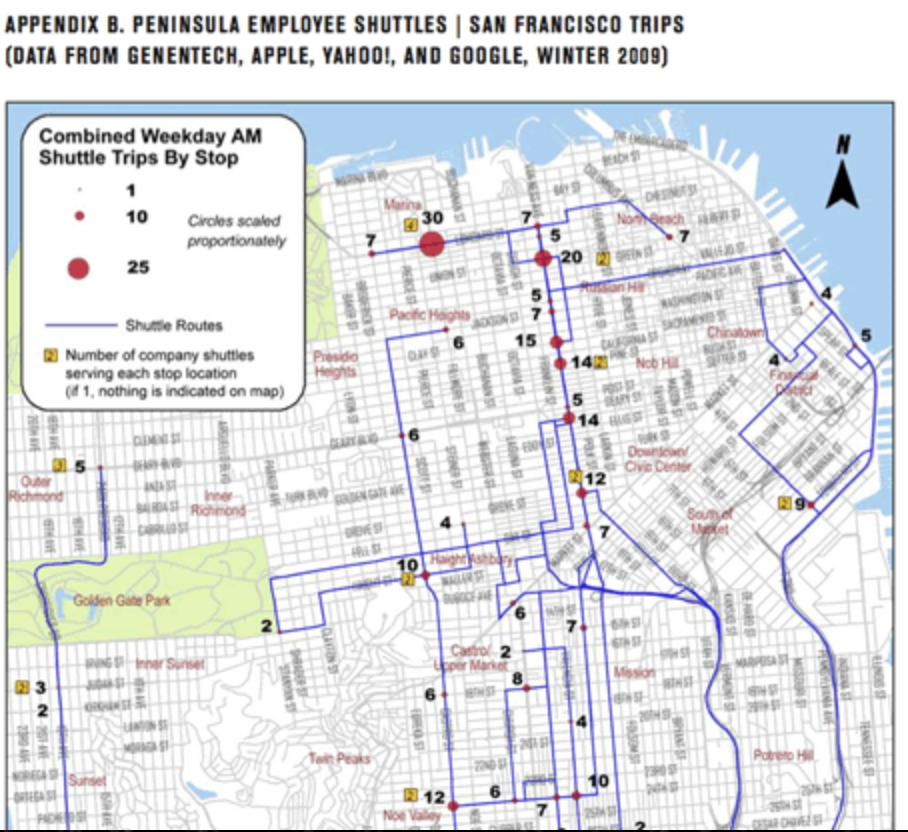
Rebecca Solnit published a lovely article that might be seen as an expansion of some of Jackson’s points, but which takes a map as emblematic of the ways that commute routes suggest the dangers of such a shifting of the inhabitation of San Francisco’s public space. For Solnit, the 2012 map that has been called “The City from the Valley” reflects the precipitous housing market of San Francisco as it makes evident the “invisible” network of a series of unmarked bus stops that ferry workers not to freedom, but to work. The maps mark what Solnit describes as the arrival of “Google Invaders” in the city, and she sees it as concretizing the menace that an influx of new cash from Silicon Valley workers that has flooded the San Francisco real estate market, and effectively placing many of its current residents–focussing on the artists who have made the city their own–not only at a disadvantage, but as the apartments were they lived become targets of eviction. As apartment buildings they lived in are converted from rental units to feed the insatiable demand for housing, the rising market prices of housing are met by an audience which uses a separate transit system–and renders unoriginal whatever organic community and economy Jane Jacobs saw as the basis for the American city.
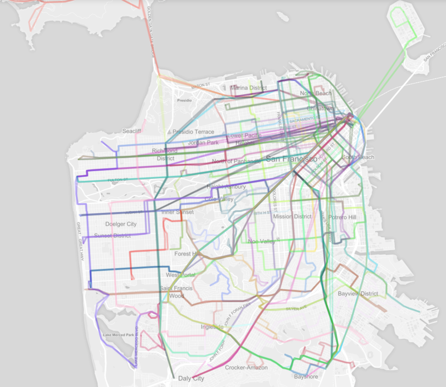
The “shadow” transit network of private busses that ferry workers to extra urban employers who pay low taxes–and none to the city–tells us much about the way the Valley feeds the city, and the ways the city stands in relation to the Valley. The mapping of transit contrasts, for example, to the apparent organic unity of the city’s transit system plotted from OpenStreetMaps, whose individually colored lines ferry workers and tourists within what seems its discreet organism:
Solnit has recently immersed herself in the problems of mapping San Francisco, and her piece brings together some of the familiarity with San Francisco as a residential city with an eery foreboding that San Francisco has come to symbolize a lifestyle with appeal among a breed of commuters to behemoths of Silicon Valley, who she characterizes as faceless sorts, ferried by dark-windowed private buses operated by each employer, as if Storm Troopers in suits. The possibility of buying real estate in this city faces a squeeze generated by hugely wealthy potential residents who work outside the city, contribute minimally to its quality of life, and rely on corporate subsidized commuter buses that undermine the prospect of public transportation–and adopt a new means to use the urban infrastructure for tech workers to travel to their jobs in Silicon Valley not sharing revenues with the city.
Solnit included with her complex and more multi-faceted argument is captured a single map of the new private transport routes that have been introduced, as a shadow system of urban transit, by Google, Apple, and EBay: Geoffrey A. Fowler crowed that “A San Francisco design firm has literally drawn a map showing how the city and Silicon Valley are growing closer together through a network of private corporate buses” in The Wall Street Journal, heralding the growth of a new archipelago insulated by new commute routes that linked monied preserves. Calling the network “the future of transit,” the routes are designated for corporate workers, rather than urban residents, and ferries them along special corridors from residences to places of work, severing connections to the places where they live without using municipal transport or brining benefits through local highway tolls. The transit system that serves this new population of inhabitants working in the Valley reveals a sort of parallel existence of a financial network that has vampyrically sucked or absorbed the housing market, and daily moves to work at a remove from the city’s space on multiple peninsula shuttles whose opaque windows move folks to their work away from home, and funnel every increasing salaries into the housing market: or, to reverse metaphors, the map that shows movement to and from the Valley might be seen as mapping not only the routes of busses that were not known publicly before the publication might be taken as emblematic of the influx of Silicon Valley money that increasingly feeds San Francisco’s population.
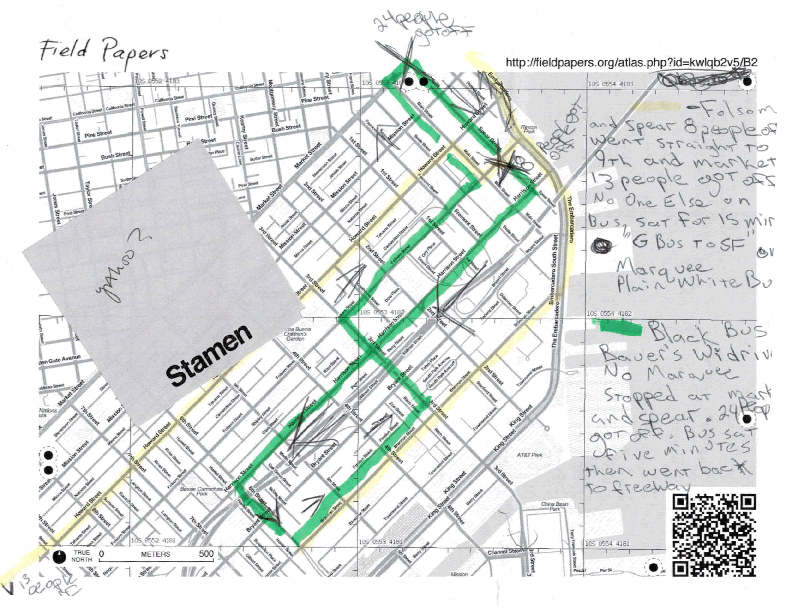
While such lines are private, and the sites of stops secret, the Stamen group used Field Papers to do an ethnographic mapping of private bus routes based on first-hand observation in order to create an alternate “atlas” from data traced by hand, and then scanned back and retraced in GIS systems like QGIS or OpenStreetMap. The result is to publish the shadow routes that the private bus lines use to ferry workers from San Francisco to Silicon Valley. Its designers devised the routes that these large busses with wifi and dark glass windows take to provide an elite mode of conveyance to work to contrast it to the existing transportation networks that serve the city, based on careful observations and plotting of such private bus routes based on close observations of the pathways that the buses actually take, using Field Notes to sketch the routes then assembled into a synthetic coherent system. And they have called it “The City and The Valley” to highlight the unique relation of a city where residents increasingly go to the suburbs to work, and money from the Valley enters the city to inflate its astronomically ascendant rents.
By plotting and publishing a rendering of the network of private busses against an OpenStreetMaps base-map, the exclusive commuter system could be charted in winking reference to a famous public transit system–Massimo Vignelli’s 1972 MTA map of the New York Subway, whose comprehensive Graphics Standard Manual invested something like modernity to the public transit system of New York City–that highlighted the exclusive clientele that the buses were created to attract, but imagining one would be able to similarly move between their lines in a nice conceit.
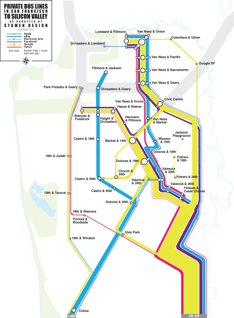
The map provides a basis to define the corridors of transit for those who are looking where to buy their houses that will guarantee access to the restaurants, theater, clubs, cafes or aura of their new chosen city of residence, San Francisco, in which they have arrive, and was indeed drafted by a small design firm most of whose workers live in the Mission–and have seen the busses rather than ever taken them. Solnit argues that the network of private busses effectively created a snare for its current inhabitants by forcing up real estate prices to unreasonable rates: the map addresses those bus riders who work for Google, Ebay, Facebook, Apple, Yahoo and Electronic Arts, and has itself already even been used by over-eager developers in Bernal Heights to show the convenience of location to these corporate buses, and promote the ease of access to private bus lines that their neighborhood allows.
The adoption of iconography from the familiar image of its public transport, the Bay Area Rapid Transit system, is telling. Urban routes of transportation are mapped but dwarfed by the major corridors of the bright yellow stream of Google commuters,––– overflowing the commute from Lombard and Filmore to Van Ness, accompanied by a strong bright blue line of Apple workers.
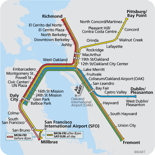
The colors reference the Vignelli map, but also seem to replace or revise the familiar image of BART routes, while appropriating the schema of primary colors that designate the Colma, Richmond, Pittsburg/Bay Point, Dublin/Pleasanton and Fremont routes. The subtle shifting of colors from the solid green, red, orange, yellow, and deep blue of BART lines seems undeniable: the day glo colors of the Private Bus Lines map are both more hip, squeaky clean and somehow more oblivious to their urban surroundings.
Jackson theorized freeway views created a relation to space that deserved to be acknowledged, and called for buildings to respond to its landscape. The darkened windows of private buses obliterate any relation to the landscape serve as pods that ferry highly paid workers from home to work, so that they needn’t be harried by the urban space that ostensibly surrounds them. They are less interested in a relation to space, or the navigation of lived space, than the preparation of a speedy route of commute.

