
The redrawing of Bears Ears is isolated, but foretells a terrible vision of the curtailment of federal lands by future leasing, drilling, and mining–at the same time as curtailing access to parks by substantially raising their entrance fees nationwide. Nowhere are the fears of opening lands to drilling more feared than in the Alaska’s Wildlife Refuge. Yet under the quixotic directive of ensuring “American energy dominance” the koan of the Trump administration, and the meaningless slogan “Energy Is Good,” the charge to remove regulations on coal, drilling, and oil pipelines are cast as a means to confirm our prosperity and energy independence as a nation, in deeply misguided ways that are based only on doublespeak, but epitomized by the withdrawal of any sense of custody for the increased scarcity of undisturbed open lands, or an obligation to future Americans.
The policy of leasing public lands is perhaps the nastiest and self-serving updating of Manifest Destiny and its promise of ever-open west. For it denies the immense contraction of public open lands in the past twenty years, and is based on a dangerously outdated image of unlimited geographical resources in an outdated image of American progress that conceals the coming dark clouds of toxic pollution unleashed across the landscape by extractive processes, trading as they do in an outdated image promising the unbound expansion of civilization across open lands, in John Last’s iconic allegory of American Progress of Columbia stringing the prairies with telegraph wiring. The belief linking progress to annexation and expansions was long seen as in contest with democratic ideals, but belief in a national right of annexation as “extending the area of freedom” has expanded to include the despoilment of public lands, without considering consequences of inviting industrial advance, as if we have failed to map such consequences with needed clarity.
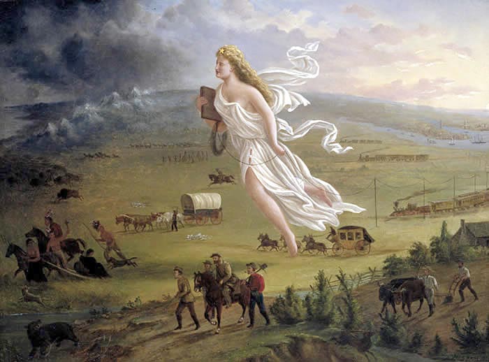
John Cast, American Progress, (1872)
The inability to assess environmental consquences “When you look at where the lights are around the world,” Lisa Murkowski noted before a map of night-time lights in North America and the world, “these are prosperous nations; where the lights are off, in Mongolia, in parts of China, and, unfortunately, in my state of Alaska.” The suggestion that undoing regulations to extract minerals and rare earths would create a sense of energy abundance stands to undo our protection of public lands. Senator Murkowski, indeed, has proposed development in sites as the Alaskan Wildlife National Refuge, or southeastern Utah, as liberation from government regulations: as scale communicates no sense of the risks of permanent damage and pollution to public lands. The image of state-sanctioned despoliation under the name of creating an image of national prosperity by a short-term strategy of modernization, eerily consonant with private interests from the American Petroleum Institute, more than the national interest. Yet in choosing to map that interest in a map of illuminated areas, erasing the risks and costs of energy extraction from the very region she represents, Murkowski
 Manuel Balce Ceneta / Associated Press
The proposed reduction of two National Monuments in Utah–Bears Ears and the Grand Staircase-Escalante–may be the start of a broad process of privatizing a landscape long central in the national imaginary, whose management is increasingly up for review: the central role energy firms hold in the reevaluation of National Monuments’ as protected demands to be mapped, in order to illustrate the dangers of recasting public lands as fungible properties able to be leased for profit as private real estate as their value rises, and indeed boundaries of protected lands “revised” in the light of mineral deposits and needed access to them: the premium place on a “push to energy independence” conceals a massive remapping of the American West, both redrawing the boundaries of monuments of historical and cultural legacy and renaming wildlife areas like “ANWR,” creating a plot of leased tracts that omit words like “wildlife” and “refuge” bears, and allow new standards of the valuation of property in the name of securing greater “access to energy,“ “energy independence” and “the global competitiveness of our country,” without any sense of the limited scale of lands under federal protection, and the relative ease of their rapid pollution and destruction.
The haphazard redrawing of their boundaries follows no other rationale than to allow access to sites of mining and transport of minerals–including radioactive uranium–through the former monument, by lifting all protections from the region save in the two remaining vestiges of Bears Ears. For in reducing protected lands of Bears Ears National Monument by 1.15 million acres, Donald Trump has preserved but 15% of its former expanse, and opened other regions to leasing. “I am a geologist,” Secretary Zinke has boasted, as if these were credentials o expand the National Petroleum Reserve into the adjoining Arctic National Wildlife Refuge, and not only to ascertain the presence of fossil fuel deposits. While Zinke’s actions of aggressive leasing may seem a scheme to reduce the budget deficit–leasing just 2,000 acres of the Wilderness Refuge could generate an easy billion in national revenue–his fake declaration of expertise conceals his defense of established lobbying interests of the petroleum and mining industries, and of libertarian outdoorsmen who openly attack federal agencies. By reframing land management in terms of the monetary fungibility of public lands, and promising billions from leasing them could bring, the cowboy in Trump’s cabinet seems to have promoted newspeak terms like “untapped resources” to conceal long-term consequences of their loss, much as the distorted scale of assertions of opening “about one ten-thousandth of the ANWR” to oil leases conceals the huge pollution leasing to energy industry would quickly generate.
The monuments were among the last areas of the United States to have been mapped, but their remapping in radically reduced form less than a sixth of their current expanse seems to fetishize only the buttes of the delicate federal lands–as if they were a backdrop for the sort of photo-shoot Zinke has posed for GQ magazine, rather than an ecosystem.
 Sec. Zinke Rides in Bears Ears/Scott Winterton (AP)
In choosing to turn attention from the protection of the delicate ecosystem of the region, Zinke seems to propose a remapping of federal lands and recent National Monuments by privileging underground mineral resources that lie beneath them. For the presence of lands able to leased for mineral deposits and fossil fuels motivated the redrawing of their boundaries to curtail protected status by five sixths, reducing their extent to expand possibilities for mineralogical prospecting. Bears Ears were effectively remapped by the GPS determination of mineral deposits–coal; uranium; zirconium; oil–but the landscape whose survival leaves it a pristine wilderness, filled with historical and cultural ruins as well as paleontological remains; it has been remapped by companies who privileged access to these deposits above the value of the ruins that densely crowd the region: rendering this region accessible to vehicular traffic will disrupt its sacred, cultural and paleontological ruins as well as the landscape of canyons and mesa that lie below the imposing buttes–and lift protections against the introduction into the region of pipelines, mines, drilling for oil wells, or public roads.
Georgy Frey, Getty Images (National Geographic)
The result is not only unprecedented as an executive decision of land management, but as a precedent for altering policies of the custom and preservation of federal lands. In amalgamating forest service, national parks, and federal lands had created a region of historical value and importance, preserving threatened ruins, prehistoric fossils, and sacred sites in Bear Ears that the imprudent decision to “resize” reduces it to a vestige and place-name: two buttes are isolated on the new map, stripped from the surrounding historical landscape,–as if it could be mapped on a register abstracted from time and from the rich surrounding historical and cultural setting. Bears Ears has become something of a poster child for the vision the Trump administration seeks to impose on public lands, setting a bizarre precedent for the remapping of the nation stripped from its sites of cultural memory as if to value the transmission of a cultural heritage, and rendering as much as possible of its open land and watersheds accessible to driving.
 Mapbox’s OSM Rendering of Reduced Bears Ears National Monument

Indeed, the fragmentation of the region that President Trump’s immediate predecessor helped frame as an accord between local stakeholders in San Juan County to join lands administered but he Forest Service, National Parks, wilderness areas and Bureau of Land Management in a federally protected region was severely shrunk to a shadow of its former expanse–

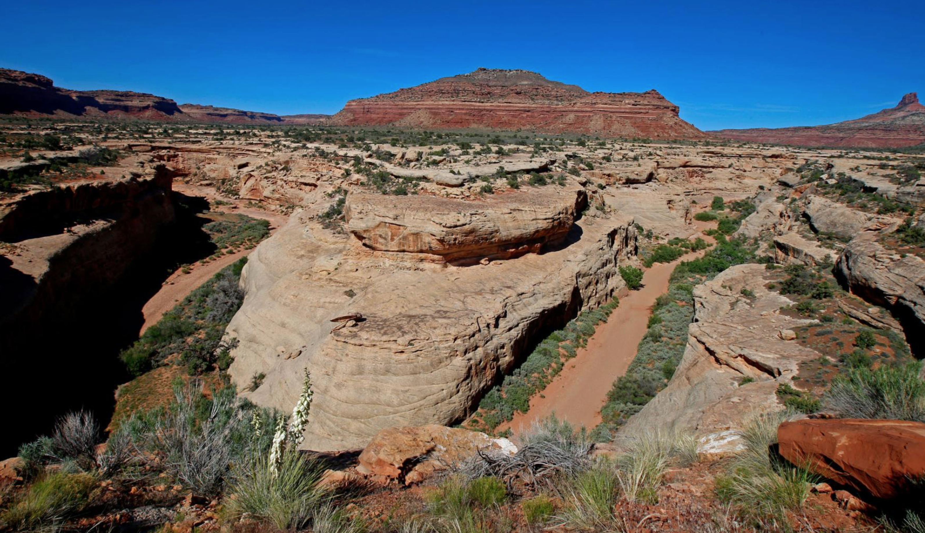
–and reduced and expanse of lakes, canyons, mesa and wilderness to two oddly bounded areas of land, difficult to supervise or protect, and leave vast traces of land unsupervised and available for corporate leasing. The reactionary remapping of Bears Ears as a National Monument not only releases it from protection, but indeed rents it out for the future unregulated and unsupervised exploitation of underground resources, reducing the extent of protected lands criss-crossed by prehistoric roads below the Buttes to vestigial remains, without public consultation with Indian Nations, diminishing the 1.35 million acre monument in ways that undermine the investing of responsibility to protect the national heritage, and reducing the protected lands in the nearby Grand Staircase Escalante that extends to the Grand Canyon by a half, splitting it into three mini-monuments. The major threats to the delicate region of Bears Ears may be the arrival of tourists, and expanded access to vehicles, and the disturbances they will create to archeological complexes including ancestral cliff dwellings, delicate sandstone. Trump’s Executive Order usurps the office limited to Congress to amend the status of monuments or federal lands, by using a GPS scalpel to protect private interests of extractive industries to access its mineral wealth, rather than ensure a sense of public good.
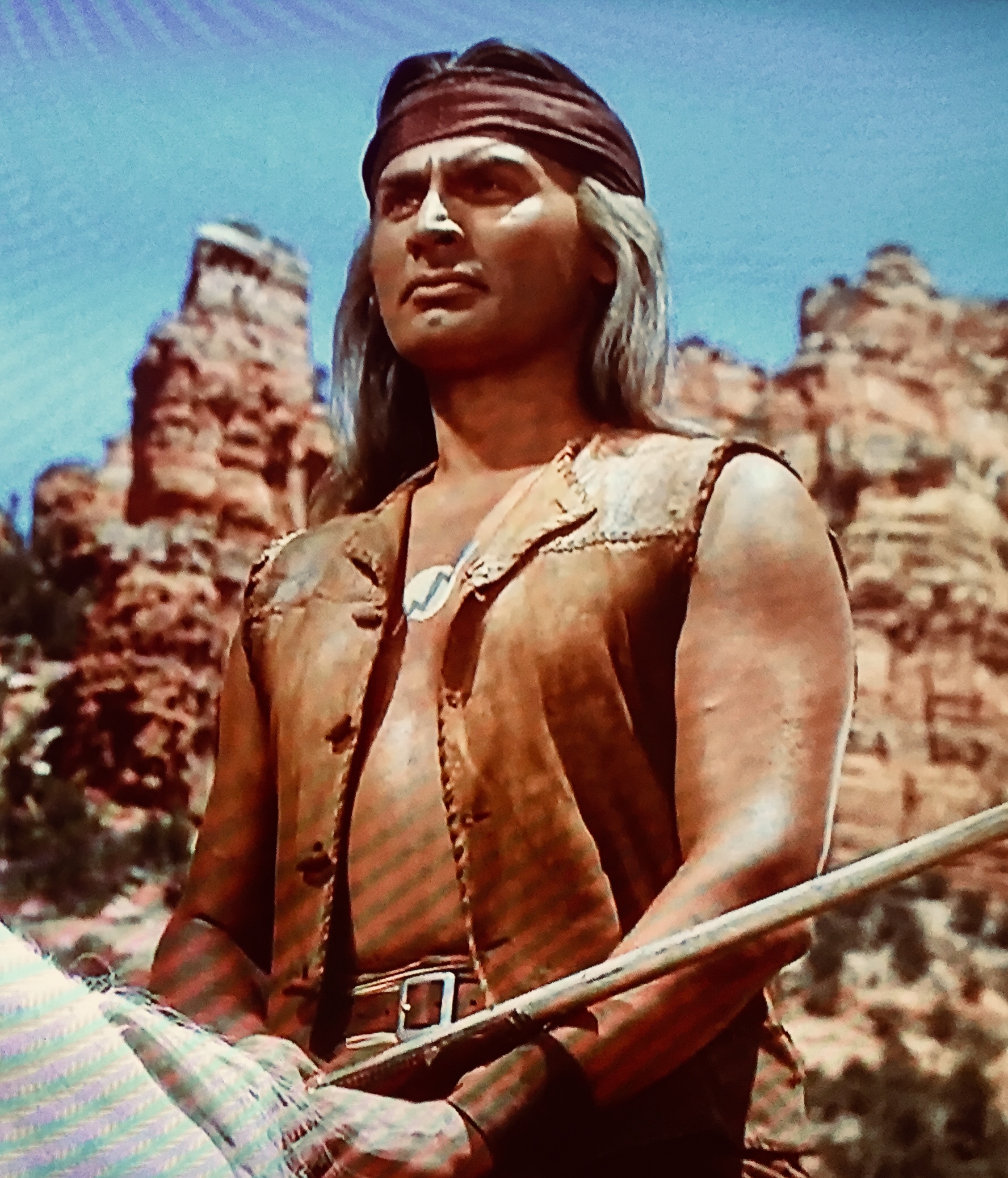
Recent decisions to scrap consideration of environmental impact of federal agencies’ actions–and public feedback on the impact of these actions–hints at landscape of reduced accountability of local environmental impacts as “unnecessary burdens and delays” designed to permit potentially devastating mining of uranium and coal, and the dominance of a blueprint of extractive industries with eyes on underground mineral resources, now seemingly superimposed atop the logic of cultural preservation. The decision openly erases the complex cultural legacy of Bears Ears. So much is apparent in how the monument was mapped below in Leaflet with open data, revealing the shrunken remains of a sweeping complex of canyon lands and rivers, nestled between wilderness and Navajo lands. The amazing absence of foresight to revise the boundaries in ways that make little sense as a form of land management, orienting the new Boundaries of Bears Ears to “preserve” two reduced areas that reflect needs for access to lands rich with mineral deposits or for the transport of uranium through the regions and “Wilderness Study Areas” they stand to pollute is a land grab that strips adequate protections form the Cedar Mesa, Bears Ears pass that separates the buttes, Dark Canyon Wilderness, a historical landscape of the American West, and the delicate sandstone geological formations of Valley of the Gods circled by smaller buttes and tall, reddish mesa within the monument, a striking ancient landscape mostly of sandstone region in the American imagination long used as a backdrop not only to historic John Ford films–

or in multiple television westerns, that purveyed the landscape as the residence of kitschy Native Americans wearing westernized garb–


The image of the defense of a color-saturated landscape of the open west by Native American movie extras has given way to the opening of the same lands for the energy industry on the most deceitful and sleaziest sort of faux patriotic grounds.
The deepest and most definitive disrespect seems its conversion to a backdrop of devastating drilling, mining, and mineral extraction. The risks of the regions pollution seemed destined to grow, and maps helped one envision the spectral landscape that might result from the appearance of oil rigs and uranium mines, methane gasses released from mined coal veins that cross its edges, oil derricks constructed on leased areas in the Valley of the Gods, as uranium loads shipped to a nearby refinery generate dust polluting nearby headwaters of the Columbia and San Juan rivers, altering a pristine landscape of sacred resonance and historical ruins beyond recognition.


The limits of protections to areas defined by flat primary colors concealed the hubris of drawing crisp lines around the peaks of a landscape that retains its own integrity.

Reduced Areas of former Bears Ears National Monument (outlined in black), CC-BY-SA

Dark Canyon Wilderness
This is an environmental disaster waiting to happen, in a warming world that will be increasingly beset by disasters, as well as a virtual in situ archive of fossil and archeological records–the precise rationale for which National Monuments were to be designated–that stands to be compromised if not permanently endangered by intense activities of industrial extraction that will bring increased traffic to a long-isolated area. Is this actually being re-designated as an area destined for mineral mining?

Remapping the recently declared National Monument fragments its fragile coherence, by privileging the interests of extractive industries who desire the land to be leased–and the vision of energy independence that they promote as a mens to guarantee access to hidden reserves of gas, coal, and uranium that have already been mapped in the region and on the current National Monument’s boundaries–and whose extraction the designation was designed to protect in order to preserve its rich archeological record and historic spiritual value as a site sacred to its long-term residents. The National Monument was adopted by working with land management organizations, local native peoples, and interests over an extended period of time to preserve its density of sites of historical and cultural interest and fossil ruins, partly evident in an interactive map of the region’s rich geocultural patrimony and fragile ecology.
The Maps for Good map sought to mobilize interest in protecting the region’s cultural landscape, registers a new sense of land use and history in an era of assigning value of land by its economic potential or underground mineral resources: indeed, the ability to transpose a leaked map, constructed on a UTM projection to the actual cultural geography of the region–not evident in the draft map of “boundary modification” leaked by the Wilderness Society–a map which failed to note any sites of cultural value–inviting one to perform one’s own archeological excavation of interests, given that areas released from federal protection correspond so closely to those areas rich with mineral deposits that the Bureau of Land Management has often already leased by extractive industries.


The tension between claims of ownership, priority, and value have indeed grown so tensely wound to blur any clear future vision of the local landscape and its integrity. The retrograde remapping of the region to expose it to outside interests in the name of an “America First” policies of energy independence destroys that map, and resurrects a map of underground reserves that seems informed only by the claims of an earlier era, recalled in the collective mobilization created by the misquoted but long distorting cry, “there’s gold in them thar hills“–and the misguided assertion that “there’s millions in it.”
Against a mandate of preservation, rooted in the famous misheard claim that triggered the Gold Rush, the GPS mapping of mineral deposits by extractive industries and American Petroleum institute had promoted the designation of Bureau of Land Management Lands and Forest Service lands as an “Energy Development Zone” in the largely uninhabited landscape and deep-red-voting region of southeastern Utah’s San Juan county, as approved, back in 2015, by the Utah Legislature,–

San Juan County Energy Development Zone
–beginning a pitted confrontation over the value, use, and mapping of lands that culminated in the recent downsizing of Bears Ears and the Grand Staircase-Escalante. Indeed, the designation of the National Monument, mapped to expand the regions that were agreed upon by the Public Lands Initiative the year after the approval of the San Juan County Energy Zone had streamlined its development for extractive industry,

–whose eastern border was negotiated to protect incursion into the area. The construction of the debate about the “Energy Zone” was however paradoxically effectively presented as a struggle between “local” and “outside” interests, as the designation by Utah’s legislature was cast as a decision of the County, even though this ran against many of the interests of residents in the area, and endangered historic lands long judged sacred by native residents, and filled with at risk archeological remains.


Daniel, you should send this to the New York Times Opinion editors.
Cheryl Koehler / Edible East Bay
Subscribe online at http://www.edibleeastbay.com Sign up for our e-newsletter here: http://eepurl.com/z-fkn Visit our advertisers to find your complimentary copy: http://edibleeastbay.com/find-a-copy
>
It seems on the long side, but thanks! Please feel free to circulate, Cheryl