
2. The fundamental role of seaweed performs as a habitat and algal plant, producing rich oxygenated environments that provide a unique near coastal ecology, are as difficult to examine in maps as their dynamic role is often lost in the individual images of seaweed we are most familiar to link to marine shores. If seaweed samples are preserved as frozen in time, and removed from their environments, its crucial role is all the more difficult to map within the environment that its abundant coastal presence creates. But the aporia of the dsiappearance of near-shore kelp forests are all the more difficult to reconcile with how are concept of seaweed seems to be often rooted in a frozen past of isolated specimens and, in the images of naturformen described in lovingly delineated fashion by zoologist Ernst Haeckle; for Haeckle the sea offered evidence of an earlier evolutionary time, its environment offering morphological evidence of a gospel of Darwinism, that seemed to embody preservation of submerged time.
In his Radiolarian Atlas (1862), the fruit of seaside discoveries made after ocean foraging, the creatures caught his net offered a chance to observe beneath a microscope the evolution of morphology of life. In images that continue to provoke a sense of ecstasy akin to a visitation by or glimpse of the divine, the sea provided an immersive environment whose phylogeny offered formal cues to examine admiringly for the keys of life or Naturformen that, in “lower organisms” as fish, one could detect not only clues for early evolution, but the essences of later evolutionary forms–but that might be detected also in animal embryos. Heackle’s Archimedian moment however began at the seashore, much as that of Rachel Carson, as he realized after honing his lenses to witness radiolaria on glass slides, finding unknown forms in “the happiest day of my whole life;” he rose form his microscope “half-demented with joy,” ready to dedicate his life to science but in the moment only inarticulately able to “cry my heartfelt to the blue sea and the generous sea-maidens, the fear Nerieds, who always bestow such wondrous gifts on me”–as if he had seen the secrets of the universe in a moment of revelation. The biogenetic laws he later mapped onto the formal evolution of embryos began with even smaller narratives detected in marine morphology that he felt invested with divine choice to take it upon himself to illustrate, and narrate, and to map–before proposing that embryological forms provided a mirror of evolutionary change.
For the formal complexity of radiolarians condensed a clear narrative of historical formation evident in their microscopic structure, which he took pains to delineate as a service to God, and which he was able to extrapolate among marine species, before he understook the embryological investigations for which he was later known If single-celled organisms presented a striking skeletal variations of untold symmetry, the symmetry that kept plants revealed on a greater scale was no less worthy of interest. But we have lost a spatial atlas of sea kelp, in some way, so obsessed by the static image of individual structure, and the possibility that the sea had effectively helped freeze time. allowing him to access a past that Darwin could only theorize, in a visual map of sort he later argued presented in human fetal development and embryological studies, sketching Ernst Haeckel set off for Italy in 1859 to study art and marine biology, moving from the mineral silicate skeletons he found in the Mediterranean near Messina, in the Ionian ocean, to the more animated submarine life.
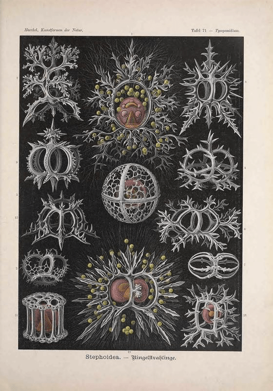
These images offered evidence of the even greater diversity of life that would fascinate if not obsess the 26-year-old Prussian; in addition to painting landscapes, he spent the climactic months of his stay glued to his microscope observing and sketching radiolaria—protozoa encased in delicately ornate silica skeletons—collected on the Sicilian coast near Messina as a visual archive of the diversity of natural forms, that after reading upon his return Charles Darwin’s illustration ramification across 14,000 generations from eight species as proof of the interrelatedness among life forms, he sought to integrate the apparently limitless evidence of life forms in such unicellular protists that Darwin omitted from the plant and animal kingdoms, as if they were the secrets to elements of life: the young Haeckel preserved a visual record of protests in his 1862 monograph Die Radiolarien, and later popularized in in the color illustrations in Kunstformen der Natur. It became his mission to catalogue and sort as a sort of lexicon of life, going on ocean missions with the H.M.S. Challenger and to arranged them for his audiences that popularized the images of these animals as decorative forms and life principles: did the morphology of these calcified radiolarians offer a precious living archive of the primitive forms of life, that might be expanded to jellyfish, shells, and other algae, in a mosaic of life that helped contextualize Darwin’s focus on land-dwelling species alone, as seeds of life born of the seas?

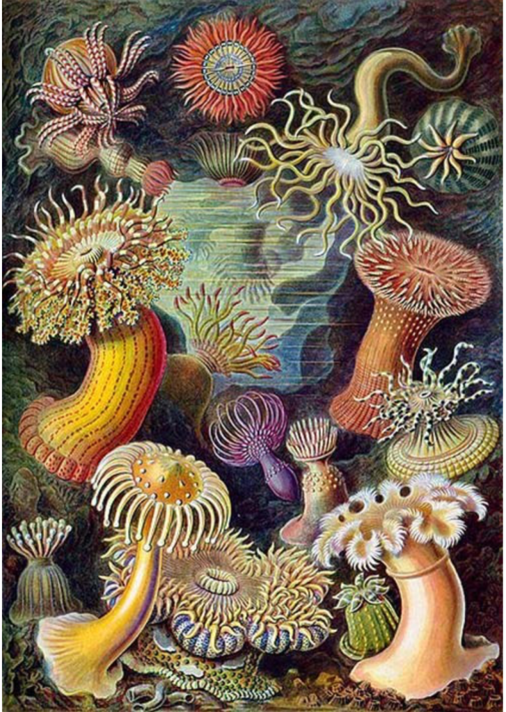
Microscopy offered the possibility of images of radiolaria morphology, so similar to modern seaweed, supplied the morphology of the past in 1866 monograph Generelle Morphologie der Organismen, including unicellular protists Darwin had left out of his study of plants and animal kingdoms alone–finding a third in the single-celled algae, urchins, anemone, sea slugs (nudibranchs) and plankton not only as seaweed but records of pasts, made visible by microscopes and detailed in line drawings that served as the basis for engravings the compatiave anatomist printed as Kunstformen der Natur.


For the active role of seaweed in coastal environments as sites of observation, if mediated through the glassine slide, were via Darwin understood as a vital ecological landscape on which coastal species depend, has all too often remained absent from our maps of our shores, even as they undergo dynamic change–which by 1874 he was ready to present as a condensing human evolution over the period of gestation, leading him to invest huge argumentation power in one woodcut to comprehend an atlas of comparative embryology, by using the embryos of eight species’ fetal development as a visual guide to evolution, and to the forms from which later life had crystallized.
Haeckel is of course best known for advocating the insights afforded by the ontogenic recapitulation of phylogeny. Haeckle mapped embryonic forms for the insight algae and seaweed and jellyfish as radiolarians available for easy study as naturformen that created a rage for replication on shorelines, the site of the observation of ecology–a term that Haeckel had proposed to describe their relations to the environment. And while often argued to provide a basis for racial differentiation of primitive and advanced species–and the incorrect evolutionary argument of ontogeny recapitulating ontogeny–he grasped the environmental unity of life on the seashore, as it were, studying not only radiolaria but sea urchins as visual clues to vitality.

The kelp forms and sea slugs that Haeckel observed made him a privileged observer of the seats of life, who had used the term “oecologia”–or ‘ecology’– to describe the relation of life forms to their organic and inorganic environments, and how organisms relate their world, based on his intense shoreline observation of life forms–seeing unicellular organisms as a type of vital monads, of Leibnizian character, from which one might formally decipher a morphological lexicon of life–an applied biology that emerged on the shoreline, if it was later embraced by Nazi ideologists to ground racial differentiation and “racial science” on scientific grounds–who embrace his dictum that “politics is applied biology” with devastating results that were far from Haeckle’s interests in invertebrates, from sponges (poriferans) to and segmented worms (annelids) to other invertebrates–making the shorelines a site of continued study of marine plankton, urchins, horseshoe crabs, and other protozoa, often static shells–

–or animated by subaquatic ambient environments, moving in the ocean waters.
His intense observations provided as a sense of the seaside as a laboratory for all, that anticipated investigations into shoreline ecology.

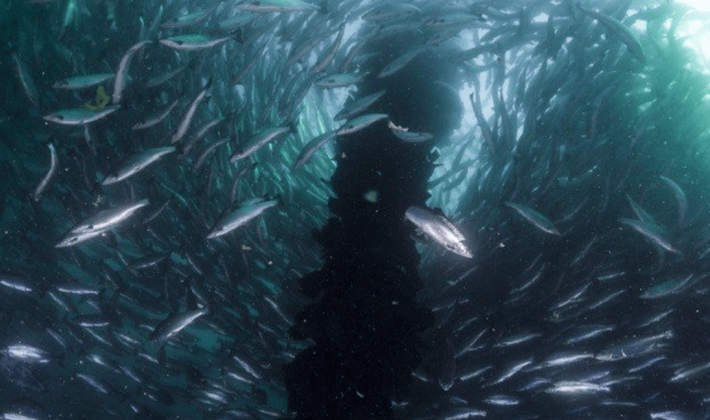
How to integrate the imaging of kelp forests within coastal oceans is a problem of inhabiting narrow geographic bands of submarine settlement, and the difficulty of surveying or registering the health and expanse of the coastal forests of kelp and seaweed currently threatened by unprecedented imbalances of coastal ecology. The considerable cartographical aporia of the coastline provide problems with which we will increasingly wrestle as oceans warm.
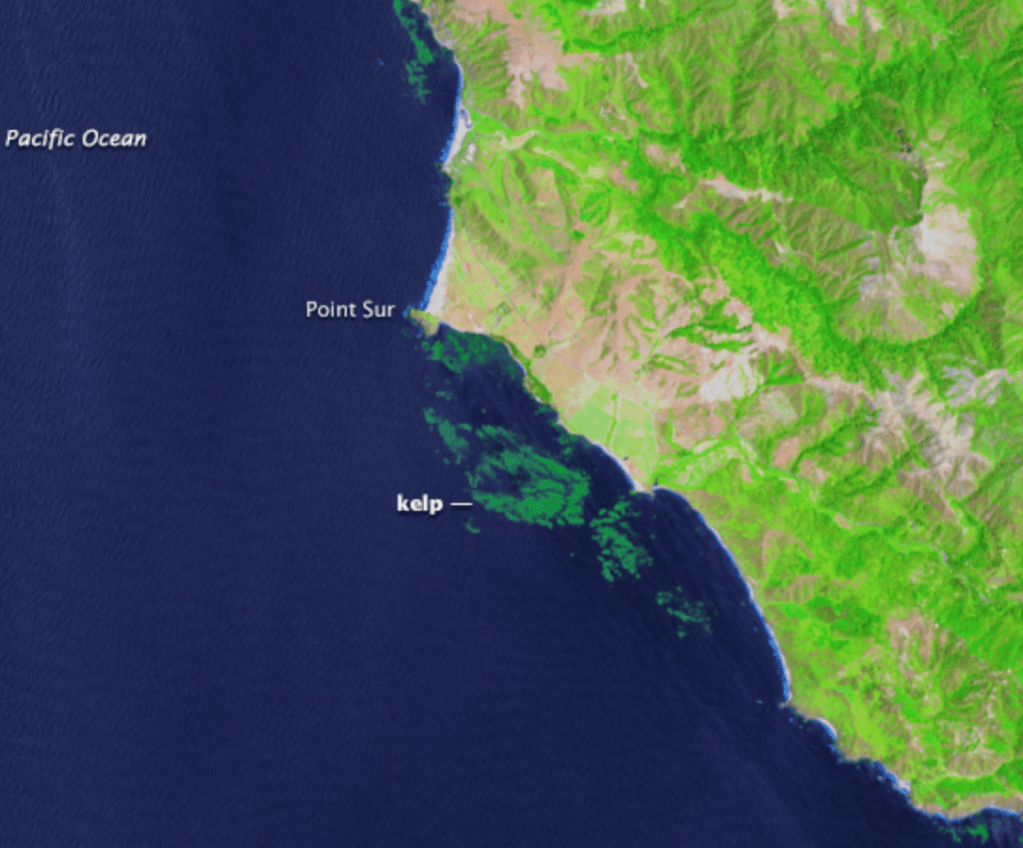
The near-coastal wonders of kelp forests lie in shallow waters to receive the most possible amount sunlight, and can be seen as well on rocky shorelines where they are washed by waves. As they are largely submerged in cold waters, kelp forests are hard to sense remotely, and their coastal distribution is still best charted by aerial photography: the tools of mapping based on navigation are especially unsuited to tracking kelp, and the point-based nature of GIS, despite its clear precision when it comes to geolocation, seems less suited to the sort of environmental mapping that demands consideration of volume, spread, and rates of growth, or the nourishing of the ecosystem.
Kelp’s long-standing historical presence on coasts, while long overlooked by much natural science in the nineteenth century, has gained renewed attention not only due its sensitivity as a register of polluted waters, but the decimation of forests whose critical role to the global ecosystem is being rediscovered after the massive loss of coastal seaweed in many near shore environments. The actual wealth of habitat kelp creates is often removed from the value of the megaalgal stalks and leaves measured on sea surfaces, in ways that flatten an appreciation of the rich habitats that kelp creates across coastal oceans.
Their nourishing habitat is being all but eradicated, however, even as the historical role that they played in encouraging human migration, and attracting coastal migrations of pelagics as well as local mammals, has been rediscovered; indeed if the specific value of the shore as a site of farming, feeding, and human development of algal biomass–promoted as an agricultural feed, fertilizer, alternative food supply, and possible solution to global warming, if the shore was long removed from industrial life. The possibility of a fragile nature of kelp forests and coastal seaweed in the Pacific was only appreciated as the threats to warming waters created by El Niño, as the shifting warmth of sea waters–here registered in sea-surface temperatures–seemed to target the Pacific coast–

–limiting upwelling in the Pacific basin, and suddenly reduced sea surface chlorophyll levels off the California coast in 2015’s El Niño, dramatically changing levels of oxygen and carbon in the waters that affected seaweed as well as ocean life, with an absence of cooler, nutrient-rich waters arriving into coastal waters.

And as the growing global decline of algae due to warming waters grew, while it is heartening to see the commitment, energy, and crowd-sourced activity in the Climate Strike across the world, as far as Antarctica to Singapore to Berlin to New York to Washington DC,

considerable activity had already occurred offshore, or near-shore, changing global oceans as oxygen-producing nutrient rich kelp forest were in the process of being somewhat systematically mowed down by urchins on much of the near-ocean floor–posing preying and ongoing problems of habitat preservation, not limited to oceans, but starting from them: if the photosynthesis of seaweeds and other algae–phytoplankton, algal plankton and kelp–produce over 70% of the world’s oxygen–300 billion tons annually– and support the oceanic ecosystem.

Courtesy SeaWiFS Project/NASA GSFC and GeoEye, Inc.
Algal plants provide the base food of all aquatic life, but their hidden nature poses multiple challenges of visibility and aerial or remote registration that makes them difficult to map, sense, or visualize. Indeed, long before the current crisis of the impending loss of kelp forests along the Northern California shore due to the overgrazing of urchins, sedentary detritivores dwelling on the ocean floor, the mapping of seaweed provided sources of difficulty both because of its volume, and the sense that it always lay there. along the shore, in an abundance that regenerated every year; the submerged volume of kelp stalks rooted by holdfasts was especially difficult to map quantifiably or visualize, as it not only moved but its appearance was highly contingent on the ambient light, making a baseline of kelp forests difficult to set.
And the digitized versions of even the most high quality aerial photographs on which we increasingly depend to chart the location, size, and assess the vitality of kelp forests is hampered by their remove–or two-fold remove–as being dependent both on image capture and the digitization of imagery. While implying the best possible overhead photographs, the digitization of images on which kelp surveys depend are of limited sensitivity to assess the very forests that are under increasing attack.
The attempts to chart “zones” of seaweed by aerial kelp surveys is helpful, an indicates the density of kelp presence, here by infrared imagery that lead it to be depicted in dark red, but even California only began annual surveys of kelp as a form of wealth in 2002, and before that had only attempted such surveys in 1989 and 1999, as kelp grew as a commercial harvest in some twenty-eight harvestable extensively abundant “kelp beds,”of which three prohibit harvesting save by leases gained from the Fish and Game Commission.
3. But the sudden decimation of kelp forests, only recently regarded as rich sources of plenty, pose challenges for a deeper historical mapping of coastal kelp forests and the kelp canopy. Images preserved in shapefiles reveal huge declines in the canopy around the Channel Islands (reduced by three quarters in extent), north central coast (stable until 2009, but then reduced by a bit more), and north coast mainland, that has suffered what seems the greatest proportional cataclysmic decline, setting the alarm for better mapping kelp and its threats, and its relation to its environment as a site of food, shelter, and carbon sequestration.
While this provides a graphic picture of regions of abundant kelp forests that is a useful shorthand, is it possible that the sea change of digital mapping, privileging points and relying on digitization of overhead aerial imagery creates insufficient layers–so to speak–to capture questions of the beds’ depth, persistence, and fragility? For if the pointillistic nature of GPS mapping fails us in embodying the consequences of climate change, the presence, volume, and hidden nature of many of the offshore submerged beds of kelp is especially poorly served by pointillistic visualizations, more often designed for inland areas where point-based precision is desired.

California Fish and Wildlife/Aerial Kelp Surveys

Kelp forests most often grow in shallow coastal waters to receive the greatest possible amount of sunlight. As they are largely submerged in cold waters, kelp forests are hard to sense remotely, and their coastal distribution is still best charted by aerial photography: the tools of mapping based on navigation are especially unsuited to tracking kelp forests, and the point-based nature of GIS, despite its clear precision when it comes to geolocation, seems less suited to the sort of environmental mapping that demands consideration of volume, spread, and rates of growth,–from nourishing of the ecosystem to historical baselines. We are in danger of having lost a sense of our connection to seaweed, and an ability to map the crucial role of its vitality and spread.
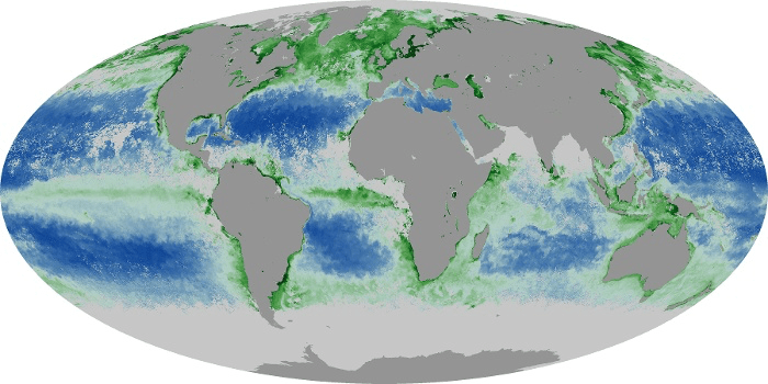
3. If algal plants are the base food of all aquatic life, their hidden nature poses multiple challenges making them difficult to map, sense remotely, and also to visualize, even before the current crisis of the impending loss of kelp forests along the Northern California shore due to the overgrazing of urchins, sedentary detritivores dwelling on the ocean floor. Attempts to chart “zones” of seaweed, while useful, most of all fail to account for or communicate the huge production of kelp and algae that is so distinctive to the region globally, making it into a site of massive foraging and migration, and indeed a pronounced concentration of chlorophyll in the global oceans, as Benjamin D. Hennig–a geographer who studied coastal ecosystems on the North Seas. His a stunningly disorienting map–a gridded cartogram of organ isms contributing to photosynthetic production, based on the remote sensing of NASA MODIS imagery–reveals the algae-producing oceans that invites us to consider the seas not as flat blue expanse.
Hennig’s gridded cartogram calls our attention to the roles coastal upwellings, algae, and ocean health play in living environments that forces us to think in terms removed from territorial waters. And it shift attention fromthe coast from Alaska to California to the North Sea to Pacific, often discussed less in terms of recent weather changes, from El Niño to global warming, to the disproportional nature of providing food within ocean ecosystems, that invite us to open attention to the seaweed rich regions of the seas where plankton dwell so abundantly offshore.
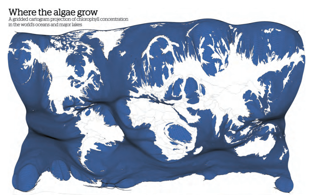
The global dataset that Hennig employed echoes the elegantly seaweed-tinted projection of NASA’s Earth Observatory: its long-term imagery of local and regional chlorophyll levels mirrors the vitality of areas of ocean life Hennig tracks, if their role for ocean-dwelling creatures are less often mapped for the public, who increasingly see coasts in anthropocentric terms: they provide a benchmark for future changes in warming oceans, however, for ocean life. The thin green line of chlorophyll running along the California coast helps us shift briefly from the local to a global to return to a local within what might be the first chapter of a new atlas of photosynthesis or underwater carbon sequestration..

The outsized role of mineral-rich shores in providing oxygenated waters and absorbing CO2 would be clear from this prospective atlas, prime among them the Pacific, and Gulf of Cortez, which waters from the Columbia River long fed, historically,, as other bays and downstream areas of the east coast–

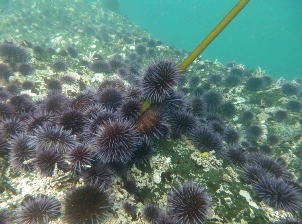
The mapping of relations of rivers to chlorophyll production might help complete the picture of a rich coastal ecosystem of delicate balance. But the quite fluid nature of seaweed–its drift, annual life cycle, or rates of growth–are less able to be mapped, and especially the vulnerability of seaweeds to increased amounts of predators, as the purple urchins who have overgrazed–if not mowed down–coastal kelp forests in many sites of the world, creating a problem of submarine deforestation, critically important in the challenges we face globally in carbon sequestration.
In a story that begins from the decimation of sea stars species along the entire west-coast, as it must, a puzzle was pulled from ecosystems as creatures from giant spined stars to sunflower stars precipitously declined in numbers as they washed ashore, as if melted, from 2013, in changes that Reef Check California tracked helplessly: suddenly absent by 2014 from San Francisco to San Luis Obispo, their still-mysterious decimation along the coast was uniform and cataclysmic consequence of a warming Pacific, and their subtraction led huge areas of the bull kelp forests off the coast to diminish and disappear: at the same time, the numbers of purple urchins who graze the near coast ocean floor ballooned beyond past precedent, growing tenfold in number along marine transects, as the understory of kelp was cut by the spiny urchins, and disappeared, creating effective barrens in their place, reducing “kelp cover” that were eliminated from many coastal environments.
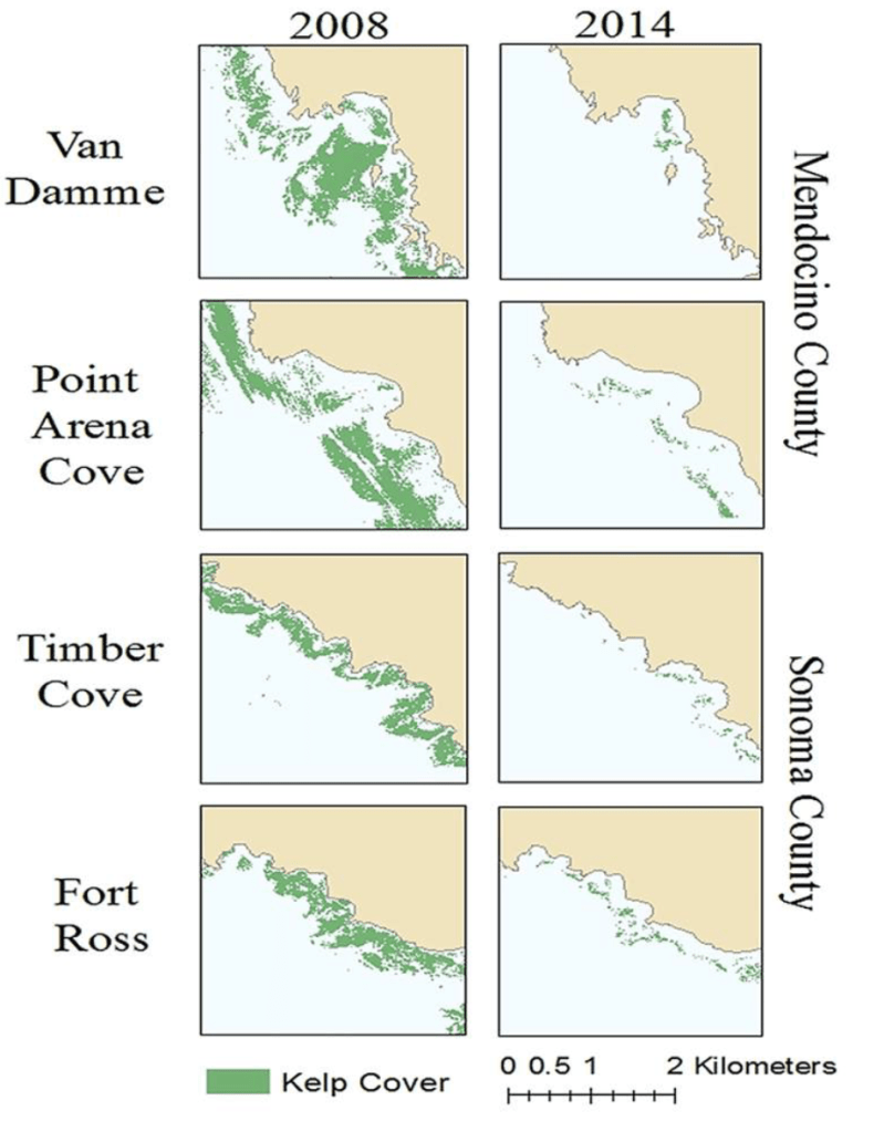
The considerable volume of seaweeds that once occupied regions close to the shore, linked by sinkers to the ocean floor or rocks on the seashore and islands, is difficult to appreciate or picture. For although the beds of kelp along coastal California were begun to be rigorously mapped by aerial photography from the mid 1990s, when the scale of the catastrophic losses of coastal kelp forests that lie off the coastal forests–or kelp deforestation–was first perceived by remote sensing and appreciated as an economic threat to fishing, seaweed farming, and habitat. But their locations are all but absent from most of our coastal maps. While the urchins played active roles in fragmenting kelp in benthic environments, their population boom an insurmountable obstacle to regenerating barely surviving kelp beds lying in near-shore coastal waters–even in protected marine areas.


As purple urchin populations have expanded sixty-fold along the California coast, with a collapse of sea stars due to an unprecedented wasting syndromethat has yet to be fully explained through its ties to coastal warming or to pollution, the canopy-forming kelp forests in the coastal ocean that long provided a habitat for many species grew: and the loss of bull kelp on the Northern California coast now measured at over 93 percent went far beyond the periodic reductions of giant kelp populations south of Santa Cruz and bull kelp forests that stretched on the Pacific rim south of Alaska. Divers off the coast of Southern and Northern California quite aggressively removed many purple urchins manually, but the labor intensive extraction of spiny creatures cannot keep up with their reproduction, as natural predators, both sea stars and otters, have either diminished or long disappeared.
The warming of waters of the coastal ocean during El Niño inversion of coastal upwellings compromised kelp reproduction even in marine sanctuaries: the shifting of kelp forests to urchin barrens witnessed as a result of warming waters long ago in the Aleutian archipelago, and more recently in the once cold waters of northern coastal waters of Japan’s coast, Norway, and coastal Australia and Tasmania shockingly spread to keep reduction workshops as Bull Kelp washed on the sandy coastline, signs of fragmented ecosystems that could take centuries to restore.

As kelp forests were granted the status of endangered species by the governments of southern Australia in 2012, an alarm was sounded for their future. Piles of kelp dislodged from ocean floor by urchin over-grazing seemed the latest refugees created by global warming; urchin removal would require a huge manual intensity, challenges recovery efforts, keep restoration, and coastal habitat. And while the growing industrial demand for kelp had led huge quantities of coastal kelp to be taken as if they would be long abundant in Monterrey Bay, as over 4,700 wet tons of kelp were harvested from the Marine Sanctuary, largely to make emulsifiers, 1997-98 El Niño inversions brought warmer temperatures that compromised kelp forests, leading to increasing attention to assessing kelp populations from the clear effect as early as 1982-1983 El Niño on southern California’s seashore kelp blight.
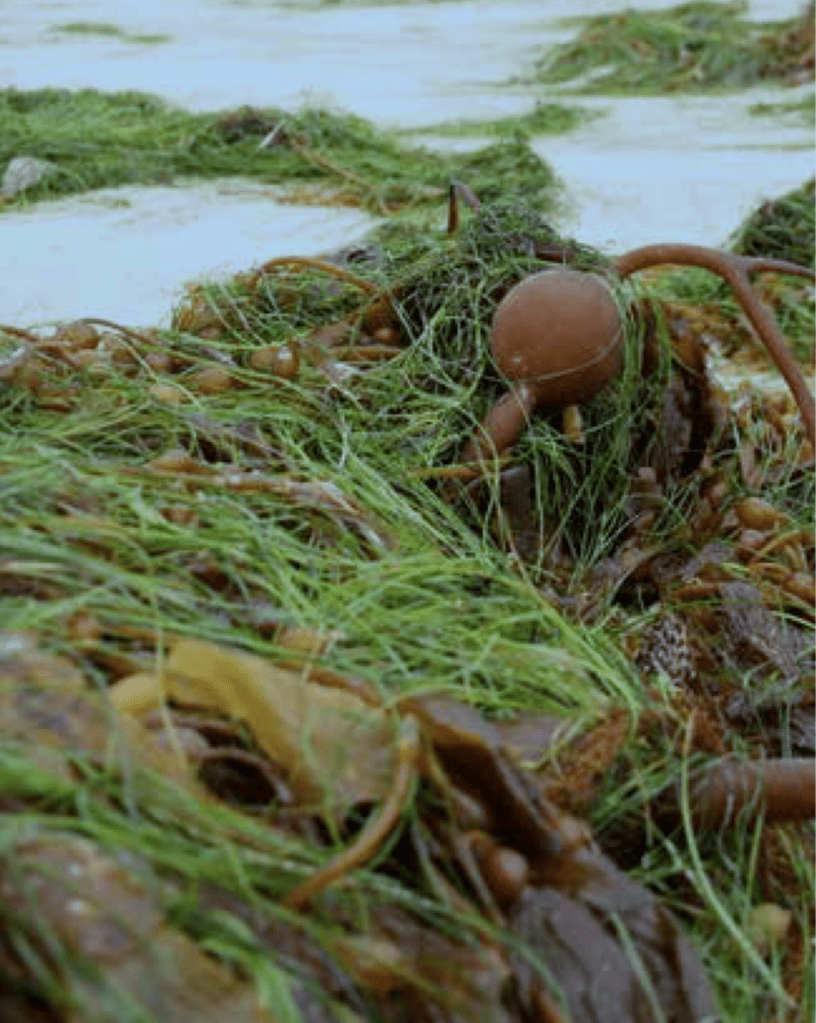
5. The kelp, and of the bull and giant kelp that have begun to wash up along California shores, as if severed from the holdfasts. The bull kelp once secured them on the ocean floor, with stems of up to 20 meters (sixty feet!) thatreproduced by spores that fall nearby, in what might be considered coastal families, has arrived ashore as if a severed canopy, tangled with other seaweed, where what had been an underwater shelter for young fishes and invertebrates, such as sea urchins, sea stars, snails and crabs, and a source of food, long offered a site of spatial orientation for the migratory species of the Pacific as well as those who live by the shore.
Their disappearance and fragmenting mean that that longstanding dense canopies that were the habitat for so many local species are suddenly subtracted in ways that change each setting, undermining a deep ecology of place.
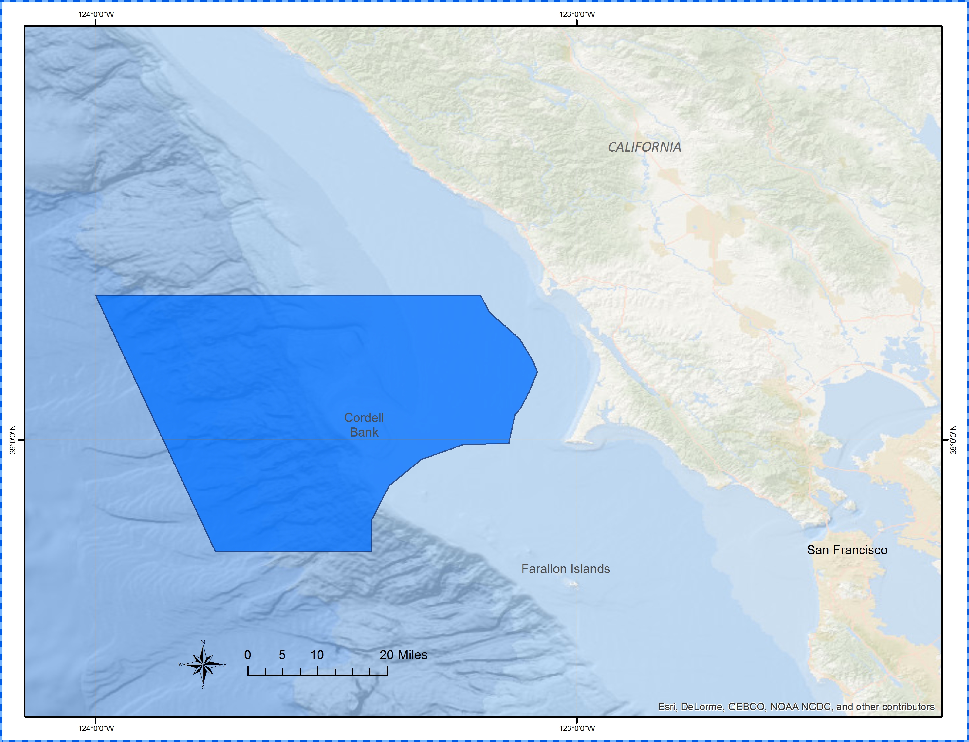
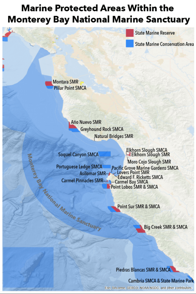
As much as the ecology of delicate offshore places lie Pt. Reyes ad Monterrey are mandated Marine Protected Areas in California, that primarily restrict human activity in them to safeguard their habitat and wildlife–in large part because of the presence of such forests of bull and giant kelp–
–the invasion of burgeoning populations of purple urchins who devour stalks and new shoots on the ocean floor in near-coastal regions may be driven by anthropogenic global warming, but has no ability to be regulated.
The tragedy of the degraded kelp forest and its canopy is not visible onshore, and is hidden save from trained observers of coastal life: but the revolution that is occurring in coastal oceans, globally, suggests a hidden form of deforestation with consequences beyond what have been linked to most fears of climate change, denuding the ocean floor of a hugely attractive source of food, habitat, and generator of oxygenated waters that serve as a goal of many pelagics’ migration and the start of a hugely complex food chain.

Purple urchins eating seaweed stalks, Sonoma County/ Jan Freiwald
If algal plants are the base food of all aquatic life, their hidden nature poses multiple challenges making them difficult to map, sense remotely, and also to visualize,–even before the current crisis of the impending loss of kelp forests along the Northern California shore. In part, the volumetric role of seaweeds that occupy regions close to the shore, but linked by sinkers to the ocean floor or rocks on the seashore and islands, makes their continuity difficult to appreciate or picture–if the beds of kelp along coastal California have begun to be rigorously mapped by aerial photography from the mid 1990s, when the scale of the catastrophic losses of coastal kelp forests was perceived: as urchin populations expanded sixty-fold along the California coast, with a collapse of sea stars due to an unprecedented wasting syndromethat has yet to be fully explained through its ties to coastal warming or to pollution, the canopy-forming kelp forests in the coastal ocean that long provided a habitat for many species grew.
Indeed, the sites of urchins are often more simple to map along the ocean floor along transects, rather than seaweed, and the global map of urchin barrens in the global ocean are an undeniable manifestation of globalization, as the occurrence of ocean barrens extends across a global expanse, the result and consequence of planetary global warming, as they creep along the world’s coastal oceans, devouring marine plants and algal stalks, threatening the areas in pink and purple, and leaving barrens in violet areas, according to this global distribtution of kelp in the world’s oceans, synthesizing a record of global range of kelp forests, based on both regions in danger of becoming barrens (dark purple; lavender) and observed areas of kelp growth (dark green), and potential areas (light green). The result shows the broad transformation of coastal oceans in much of the wormer climes, and the extreme susceptibility of coastlines that are encountering increased warming, from the easter and western shores of the United States, the southern Pacific of South America, New eland and Japan, as well as parts of the eastern Mediterranean near Anatolia.
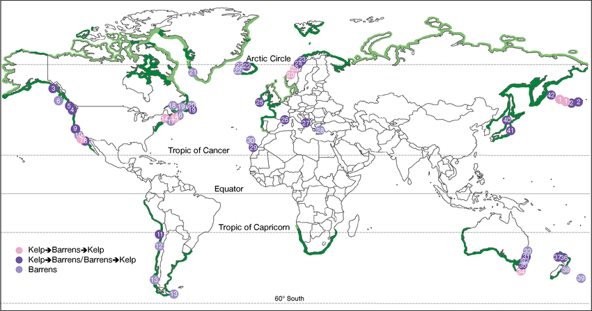
light purple denotes areas supporting kelp;
dark purple areas a shift from kelp beds to barrens,
light green potential kelp;; dark green observed range of kelp
Raffaelli & Hawkins 1996, redrawn from Steneck et al. 2002

The ongoing or impending loss of bull kelp on the Northern California coast now measured at over 93 percent went far beyond the periodic reductions of giant kelp populations south of Santa Cruz and bull kelp forests that stretched on the Pacific rim south of Alaska due to the El Niño warming of once-cold ocean waters.
Seaweed’s presence is hard to map, and kelp is slippery to slip through the lenses of most aerial photography of the coast–and indeed to register in satellite imagery. Although the direct equality of land and marine vegetation seems likely, aquatic vegetation is more easily hidden or concealed by fog, sunlight, cloud-cover, sea foam or the glint of the sun off oceanic surfaces, and the rendering of seaweed that seem mobile and less rooted in fixed space less clearly the record of flowering of kelp plants and the locations of their rootedness in oceanic environments, but also offers deep challenges of cartographic rendering–and of integration within a larger picture of local biomes or ecological environments.

6. The confusion in cartographical symbologies may have something to dow the fraught nature of the analogy–now overly familiar–of the peril of seaweed to the redwoods, themselves disappeared from the shore due to an earlier, and distinct anthropogenic intervention of the clear-cutting of coastal forests in an earlier era, over a signifiant time. The parallel images of loss–based on a sense of the drastic and unrecoverable changes in the kelp forests that have begun to vanish–seem to prepare us for the possibility of loss, as much as have much analytic power, especially given the central role that kept plays within the coastal ecosystem or coastal ocean. Given the considerable problems of image-recognition and data collection in the collecting data on kelp forests’ range, it’s not a surprise that considerably earlier technologies of marine mapping of the Admiralty offer important guideposts for ocean surveys of the health of underwater kelp populations.
To be sure, longstanding recognition of the importance of kelp beds as vital habitats led California Resouces to try to create a baseline in digitized from in 1996, hoping to replace hard-copy maps of kelp beds that date back to 1912: the hope was to establish new digital tools and standards to map zones of kelp resources across the state, creating the challenge of complete coastal coverage of a state whose southern coast is dominated by giant kelp (Macrocystis pyrifera), giant and bull kelp (Nereocystis luetkeana) cohabit the central coast, and beds of bull kelp stretch across much of northern California, processing kelp data into 87 administrative kelp beds, prompted by a new awareness in the 1990s of the centrality of kelp production to California’s economy and Marine Life Management Actions before the Fish and Game Commission.
During the 1990s, the California Fish and Game Commission helped generate aerial photographs of color transparencies of the kelp canopy were refined, projected onto 1:24,000 scale USGS maps, scanned, extracted and assembled in the only statewide mapping of kelp in existence—ESRI created a California Coastal Kelp Resources Survey (1989) of 84 discrete images across shorelines, intertidal zones, offshore islands, and beaches, despite difficulties in classifying images and interpreting kelp types, and some discrepancies of counting pixels from digitized photographs, even of the highest quality, across a coast stretching 1200 miles. Image recognition was difficult at 400 DPI, in the first aerial photographs of 1989 by ECOSCAN, but grew to 700 DPI ten years later, for JPEGs of better resolution.
The lack of uniform scale and changing techniques of georeferencing and photogrammetry, as tidal changes, made it difficult to generate a uniform baseline on questions such as kelp biomass or density by plotting beds by aerial imagery alone, even as technologies of the mapping of kelp beds were greatly refined during the expansion of ARC mapping tools, and an expansion of the sophistication and local detail of an ecological mapping of coastal habitats that might reveal much about their history. If rising near- coastal temperatures may have contributed to the catastrophic collapse of sea stars in the past years, is there a chance that a threshold has been crossed in the increased density of microplastics in coastal waters, and in areas around the San Francisco Bay?
The waters of Oakland and San Francisco reveal scary concentrations of micro plastics, approaching concentrations of the daunting number of 310,000 pieces per square km, equivalent to twice the highest levels found in Chesapeake Bay and three times the levels of micro plastics that can be found in Lake Erie, by far the most polluted body of water in the Great Lakes, with up to seven trillion pieces of plastic entering SF Bay daily.

