The anniversary of the bombing of Hiroshima gives one pause as it marks the emergence of a world of remote military strikes conducted by GPS, or on a UTM grid that cast agency at a distance from ethics or ethical choice. One thinks not only of the global cartoons of global expanse that seemed to unroll geopolitical spaces for their American readers, but of the new ethics of point-based precision. For the point-based maps created vertiginously elevated the subjectivity of their readers across the 40,000 maps produced between 1941-45 by the U.S. Army Map Service so as to remove most Americans from all sense of a shared ethical framework of humanity as the first atomic bomb was dropped on the city of Hiroshima.
The framing of military invasion as a game of geospatial dominance discounted the massive incalculable loss of human life in campaigns of prolonged fire-bombing and atomic holocaust. While the American military insisted that radiation burns were but “Tokyo tales,” as the government mole in the New York Times, William Laurence, asserted, due to the levels of radioactivity of the Atom Bomb, the cartoon suggested this was but the latest case of action at a distance, asserting a clear causality between the “invasion” of the city in Hawai’i, recently part of Japan, and the drawing and quartering that the explosive man-made catastrophe. The disembodied head miming words of feigned apology invoke a racist stereotype of a hasty apology delivered in pidgin English, disproportionate to the cascading effects it brought.
The oddness of this cartoon rests in its effective displacement of responsibility for the start of the atomic age. Indeed, the narrative this cartoon bears traces of how this new spherical global space suggested suggested a territorial dominance across the new spaces of air travel: the cartoon that appeared after the atom bombs were dropped on Hiroshima and Nagasaki on August 6, 1945 are particularly striking as it appears to remove any sense of the agency of atomic holocaust; it cast the explosive logic of the atom bomb as a delayed quid pro quo response to the “Jap Sneak Attack” of 1941; it asked readers to consider not the effects or impact of the atom bomb, but, rather evasively, who really was “the Fellow who Lighted the Fuse,” as if he were to blame: before any images of the destruction of both cities was described, the Chicago Tribune included testimony of Enola Gay crew members, hailing from Chicago, as an exclusive, with a discussion of the physics of atomic bombs and a reminder that a number of B-29 bombers were posed for further destructive missions.
The front-page color cartoon hid the explosion of the Atom Bomb over Hiroshima, offering an occluded view on a spherical globe: in colorfully eye-catching attractive Hearst style, the colorful cartoon map was the sole visual documentation of the bomb’s effects, masking the devastation of its impact by the geopolitical logic that led to dropping an atom bomb. The only sense of agency in the cartoon is that poor fellow, his head now rising into the sky, severed from his body, as his bloody knife, patriotic flag for the Empire of Japan, and his military boots and gloves were imagined to be blasted far above the globe’s atmosphere. While the cartoon surely registered the global significance of the dropping of the A Bomb over a densely populated city across the Pacific Ocean, the responsibility for doing so was identified with a racialized floating head, finally severed not only from limbs but militaristic flag that suggested a rising sun of Pacific domination, but was now distastefully merged with a stereotype of obsequiousness that belies militancy. Is the beheaded soldier who once wielded a now shattered sword sorry for the catastrophe of the atom bomb?

In fact, he is apologizing, or is forced to apologize, for similar stereotypical sneakiness of earlier attacking Pearl Harbor. The informed American reading the cartoon recognizes as clearly traceable to dropping the atom bomb, by a link as evident as the arcing flightpath by which Boeing B-29 Superfortress the Enola Gay carried the 9,000 pound Little Boy to drop 26,000,000 pounds of high explosives on Japanese civilians.
The spent match that lies on the “big island” of Hawai’i marks the site of where Japanese bombers attacked an extra-territorial military base, at Pearl Harbor. The map serves to help process the devastating precedent of aerial destruction. And it shifts the destructive impact of the bomb, incongruously, to a palette of a sunset just removed from U.S. territory, where the curling fuse that we can only see as running across the Pacific theater leads to a land lying behind global curvature of the earth, that almost occludes the global significance of introducing the atomic age. The bomb is an illustration of the end of the war by the victory of military mapping, and an affirmation of the fact that the only map is global now. But the ethics of that map are more than problematic. It carries a clear sense of “out of sight, out of mind,” imbuing the deaths of over a hundred thousand Japanese civilians–in an odd mirror reflection of the fears of Japanese attacking United States territory–with a sense of victory, painted as the conclusion to the war that Japanese single-handedly begun. The cartoon is a rather concerted shirking of collective responsibility for immediately killing 70,000 Japanese civilians and killing another 50,000 by radiation poisoning created a precedent of instantaneous mass slaughter. It must be paired with the sustained campaign of military disinformation that William “Atomic Bill” Laurence drove, downplayed any destructive effects of the atomic blast’s radiation levels as purely “Japanese propaganda,” as if to conceal its own efforts to portray the role of radiation in contributing to particularly painful and gruesome deaths.
As U.S. President Harry S. Truman would explain to the world that the delivery of the bomb had released nothing less than “the force from which the sun draws its power . . . against those who had brought war to the Far East,” in an impromptu lesson of nuclear physics, the payload of greater power than 20,000 tons of TNT, describing the bomb in empyrean terms that took one’s eyes off the ground as an act of “harnessing of the basic power of the universe” against the Japanese empire that had taken the rising sun as its emblem and flag, as if he was righting the natural order of the universe by using the sun’s awesome power to right the imbalance of a natural order and to deliver destruction in a purely retributive fashion. If almost a quarter of Americans stated after Japan’s surrender that they would have accepted the destructive explosive powers of more bombs earlier in the war, press dispatches claimed that the bombing would not leave any greater medical injuries than conventional bombs; as mortal effects of the absorption of radiation became clear, Lt. General Leslie Groves, having directed the atom bomb program, affirmed the same logic, enjoining reporters who “did not like the way we ended [the war], to remember who started it.” How many times had Lt. Gen. Grove, observing the same map, had arrived at the conclusion after contemplating the range of air routes the bombers would take, as a way of rationalizing the inhumanity of the event by reducing its devastation to the military logic of quid pro quo retribution for military deaths.


Who, indeed, was making the sneak attack? If the yellow and orange hued pyrocumulus clouds caused by atomic blasts suggested the fireball of a nuclear or atomic explosion, the cartoon clearly referenced not only the explosion that left 200,000 estimated dead in its immediate aftermath, but the fireball of the atomic explosion as a sunset of the Japanese Empire. The first dropping of an atomic bomb on civilian population by the United States–

–was sunset of the Japanese empire, seen from the empyrean perspective of the navigation of aeronautical space that allowed its delivery at precise global coordinates. Did newspaper readers who smiled at the grotesque cartoon vicariously delighting in the ability of precise targeting on geospatial coordinates to target two cities for atomic devastation, without considering the humanity of their civilian inhabitants? Or did it prepare the consumption of the news of the delivery of the payload
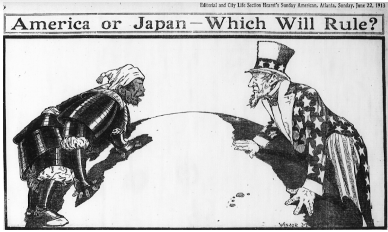
To be sure Hearst Newspapers had long promoted the Pacific as a theater of national jingoism in which the Hawai’ian islands were exaggerated as a potential site of struggle, frequently distorted as of defensible American interests; Hearst Newspapers Sunday Section of comics portrayed the contest in cartoons of racist tenor, as an antiquated samurai in full ceremonial armor confronted a spry Uncle Sam.
But the explicit use of a spherical projection to accentuate the aerial targeting of sites of bombing in Japan–and indeed of Japanese civilian populations–was both an assertion of the mastery of the maps that aviators followed in releasing Little Boy and Fat Boy, and a sense of the logic of the spherical projection as the conclusion of World War II. Early in the Pacific theater’s military expansion, to be sure, the Japanese Empire had carefully mapped the island in the paper maps that the imperial army drafted for all its soldiers to hold in fold-out versions in elegant form to foreground specific aerial and marine routes to the islands historically inhabited Japanese famers–
–the mountainous outcropping of islands righted by oceanic waters were remapped as the target of aerial bombers attack in 1941 in ways that the atomic bomb was imagined to respond as an analogous incursion into territorial rights. The results were far more terribly destructive, but seen as cementing the territorial retreat of Japanese empire across the Pacific. To be sure, the attack on the United States Naval Base had killed 2,300 Americans in 1941, when Japanese planes attacked the Mighty Seventh Fleet, sinking twelve ships and destroying the U.S.S. Arizona completely destroyed and capsizing the U.S.S. Oklahoma. But the logic of the global map creates a terrifyingly false equality of quid pro quo, or an eye for an eye, in spatial terms, linking the continuity of the spherical projection that enabled the American bombers to target Hiroshima and Nagasaki as a commensurate response to the 1941 Air Raid. The logic of the globe smooths over the disproportionate scale of the atomic bomb’s deadly payload and the attack on U.S. territory for American newspaper readers.
Yet in ways that are perhaps impossible to map, or to take stock of in its full consequences, the atomic fireball left massive human fatalities and injuries in its immediate radius, far beyond the devastation at the site of impact where buildings were flattened, leaving third degree radiation burns far beyond its alleged target, striking civilians both more violently and more deeper within the logic of war than was ever imagined. As if treating the sinking of the U.S.S. Arizona and capsizing of the U.S.S. Oklahoma as attacks on the actual landlocked states in the territorial United States, the treacherous logic of the continuity of the map’s surface created a false equivalence for cartoon readers that recast the dropping of an atomic bomb as a glorious imperial gesture.
The popular newspaper cartoon for the Hearst Sunday daily provided a rationalization of the explosion in maps that provide a continued basis for reflection on the scope of aerial bombardment, departing from the maps of worldly retreat of Japanese Empire on which American newspapers had focussed and were created by late August 1945 by the U.S. Army Information Branch, as if to justify the impact of one devastating attack.
University of North Texas Libraries
Many cartoons of the atomic bomb dropped by the U.S. Army were explicitly racist or misguidedly celebratory. This famous front-pager made open reference, perhaps fitting Chicago, where Rand McNally was based, as the spherical projection enabled dominance of aerial space and mastery of the virtual space of air strikes: the globe was now not inhabited by people, but a spherical surface over which one flew. And while the sign planted on the unidentified island of Oahu is suggested to be the site of the spent match that started it all, omitting that the 1941 aerial attack was staged on a military base–Pearl Harbor–rather than on a civilian population. The colors of the apocalyptic conflagration are muted, as we see only harm coming to the scattered limbs and bloodied knife of a caricature of the Japanese soldier scattered in a stratosphere.
The images of airplanes clustered like so many gnats over the empire of Japan provided an increasingly common typos in maps that affirmed the status of Japanese cities as targets. Boosterish jingoist maps had presented Japan as “the target” of aerial bombing, but delivery of the Enla Gay’s payload confirmed the targeting of the island empire by announcing the ultimate superiority of airspace dominance, in targeting two cities:

We are perhaps still measuring our relation to the decision and effects of the atomic bombs dropped on the civilian populations of Hiroshima and Nagasaki. If the interconnectedness of any two points on the globe was asserted by a spherical projection, the cartoon gestures to lines of longitude and latitude to link the unprecedented conflagrations of the destruction of Japanese cities to the rash act of aerial bombardment on a December morning, as if to suggest that the decision to suddenly drop two atomic bombs was a matter of just deserts in the new age of airborne explosives: the logic of air dominance had entered the cartooning landscape by 1943.

Of course, the real “sneak attack” one might have expected to see reported was not from the point of view of the pilots who had guided the two bombs dropped over Japan–oddly outside the field of terrestrial expanse that the staff cartoonist of the Chicago Tribune presented to readers the morning of August 6, 1945. But the space of flight commanders that cartoonist Carey Orr was invited to design celebrated the introduction of a new atomic age for its readers, that seemed to mark the global supremacy of the Americans in the destruction of Hiroshima that Harry Truman had commanded in Washington, DC, and that the US Army’s upper echelons had signed off on.
Readers of the newspaper acknowledged the impact of the blast the rocked large aircraft lying nearby, promising unprecedented damage as a result of a blast that obliterated a huge sector of the inhabited city–causing as yet unmeasured human casualties, spreading radiation illness among civilians-by a cartoon that clearly rendered the unprecedented degree of devastation as a consequence of the incursion of American airspace four years earlier, as the U.S. Navy threatened to “let loose more and more destruction on vital coastal installations,” with little regard for human life. The cartoon must have provided a critical way that this act of destruction could be mapped.
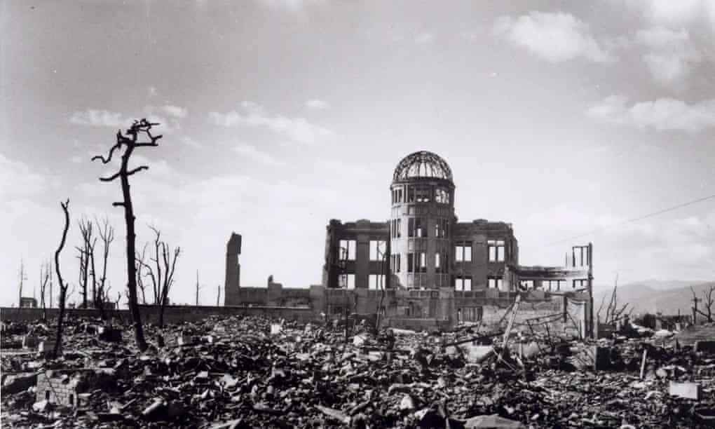
The pastoral scene rendered by cartooning was a sharp counterpoint to the way that the Manchester Guardian, for example, reported on the destruction that spread out from the hypocenter of the bomb in Hiroshima, carbonizing trees and reducing to rubble all but a skeletal framework of a building that survived the atomic blast that killed tens of thousands of civilians. While President Truman proclaimed to the nation with almost unhinged excitement (or glee) that “we are now prepared to obliterate more rapidly and completely every productive enterprise the Japanese have above the ground,” as he went on to threaten a “rain of ruin from the airtime like of which has never been seen on this earth,” the cartoon oriented readers to a view above the ground, justifying the scale of the explosion in wildly disproportionate terms as the result of restoring balance in a geopolitical theater, not a nation, and omitted the scale of its devastating destructiveness by orienting viewers not to the scale of human destruction by which some 60% of the city was obliterated, but the smooth surface of a spherical globe. that enabled the heinous act to be performed, as if to echoed how the B-29 Superfortress Enola Gay to fly across the ocean from Alaska to target it with precision.
The different ethics of understanding the atomic explosion two thousand times more powerful than the largest bombs the RAF dropped on Germany was stunning in its scale, but muted in its horror by being rendered in a “lessons learned” jingoism Hearst newspaper style, but taking advantage of the regular comic strips that supplemented its news coverage from 1940-43, to describe the most consequential global news that day by a color cartoon, as if by detracting attention from the four sq miles the bomb had flattened by the bomb by imagining the aerial view from outer space as a set of pastels through which fly, as if comically, a disembodied head, limbs, and a hand, in an all too unsubtle warning of where playing with fire will get you, placing the unnamed “fellow” in place of the men who ordered the bombs of devastating tonnage dropped on two civilian centers: the “editorial” penned by veteran cartoonist Carey Orr–whose explicitly racist cartooning in his regular strip in The Tiny Tribune was a model for Walt Disney–oddly replaced the horror of the bomb with a sequence of pastels of pinks, oranges, and reds as the glorious sunset of an Eastern military theater, almost allowing readers to ignore that 60% of a city had been wiped out.

The cartoon that fails even to “map” Hiroshima displaced all responsibility for dropping of an atomic bomb–pointing the finger, circularly, at the very folks whose populations it incinerated and introduced radioactive illnesses. If one followed the long fuse that curved around the surface of the globe, those who understood the new doctrine of hemispheric dominance might trace the origins of the massive explosions that rocked the earth to the spent match that lay–notionally–on the islands of Oahu in Hawai’i, where the evidence of who was the culprit in the recent air raid might be found–and located with geographic precision on exact global coordinates. The explosion was itself evidence of the interconnectedness of global war, and a decisive rebuff of images mapping a pan-Pacific Japanese Empire that radiated from the islands of Hawai’i that were a target of Pearl Harbor, that asserted the expansion of a Pacific empire in saturated reds in 1940 that took the Hawai’ian islands as their center and focal point, to underscore the Empire’s active encroachment on American sovereignty.

The tables were reversed in the double-duty that the atomic afterglow provided as a sunset of Japanese empire, and the precision strikes that pinpoint mastery of aerial targeting revealed. The cartoon underscored the power of bombing with such precision that the virtual landscape maps of the Army Service created; but the spherical projection erased any agency in the dropping of the bomb in ways that almost removed their users from humanity, replacing a landscape of national integrity with the world of geopolitics on grids, where the surgical strike of point-based intervention became more tempting than wars between nations, rewriting the harmony implicit in a leftist “One World” underscoring the shared humanity of global interconnections now allowed by high-speed air travel in a maleficent style.
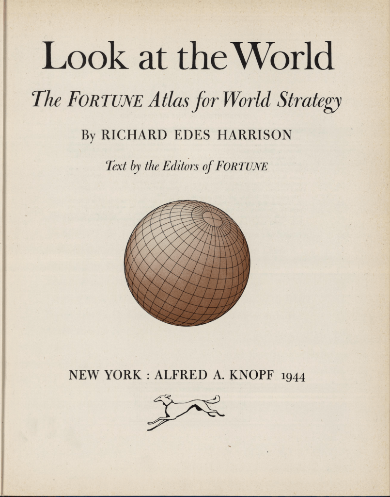
Politicians like Wendel Wilkie optimistically assured audiences in 1940 that “there are no distant points in the world any longer,” by using the magic of a Universal Transverse Mercator, Richard Edes Harrison exploited available global mathematical projections to teach Americans, as the editors of Fortune magazine or Harrison himself put it, there was now “One World, One War,” as a single map was entitled in the the atlas that Harrison helped produce to allow readers to “Look at the World” with new eyes, eyes of global strategy, in a view of the world fitting the “air age”–and global war.
The FORTUNE Atlas for World Strategy sought to provide the magazine’s subscribers to Time might expect by offering the very needed principles used in the U.S. Military to map global expanse in wartime–and indeed, as William Rankin noted, enabling the synchronization of air, water, and land troops in unprecedented ways, by the very spherical UTM projection that the U.S. Army helped to develop, as if to allow them inside on the new power of strategic mapping that the U.S. military sought to promote.
The resuscitation of such recondite Renaissance global projections as the azimuthal equidistant, that Gerardus Mercator used to map the pole, to foreground the notion of a global theater of military dominance by air–

–was later adopted, in something of a recuperation of the logic of a “one world” argument, as Rankin noted perceptively, in the wreath-bound emblem intended was a of global harmony in the United Nations, as if the war or cartographic logic of aerial bombardment had not occurred; what had provided a strategic sense of reducing global expanse in a world of air travel and the global reach of airborne bombs was repurposed by 1945 that for all practical purposes affirmed the centrality of American in a global discourse that dislodged the UTM projection from military theaters of war, as if to try to recreate a map of less militaristic intent, that ensured the global map would be continued to be framed by olive branches.

Harrison’s maps are the pictorial precursors of our ubiquitous satellite maps of today, yet hand drawn with great cartographic skill for specific arguments, detailed in text, statistics, and diagrams that erased the problems of military strikes across borders in a terms of a logic of efficiency and geometry–and of theaters of dominance.
They expanded emblems of transcontinental air travel to a global optic as Edes Harrison reinvented cartography as a skill of global dominance for American Strategy, far beyond the form of “transcontinental travel” of the recent past from New York City, unveiled in January 1942, as America entered into the global war effort, and sought to “sell” the war to domestic audiences through the logic of military maps by revealing geostrategic aims of airspace, as much as technologies of transcontinental air travel.

Global dominance in air travel was soon to arrive, opening up American dominance for a time in this global airspace, but the war became a critical time to promote this world view at the same time far beyond American frontiers: as war was increasingly fought in the air across Europe and the world by 1942, when the United States was joining, Life magazine assured readers that the United States frontier of Alaska was only “wait[ing] for war” in January 1942, months after Pearl Harbor, as the United States was readying itself for a showdown with the “ancient and imperial power of Japan,” the air map not only displaced the national map, but guaranteed a global purchase by high-speed air travel that could be readily imported to a military theater, now that the United States Air Force was stationed outside Anchorage in the Elmendorf Air Base, ensuring a Pacific Theater of War.
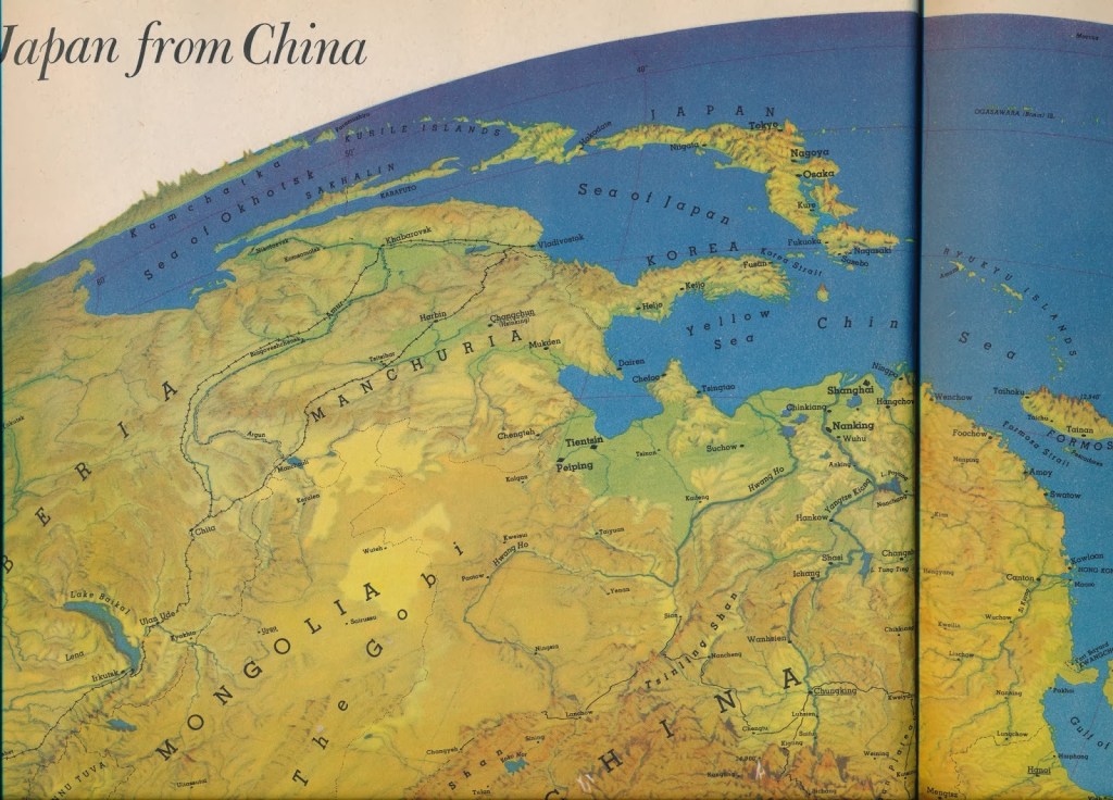
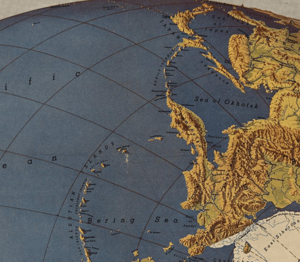
Harrison in 1943 gave us the simple ease of “seeing” Japan rom Alaska–from “our” own territory, as if, prefiguring Sarah Palin, on the horizon from her own window in Anchorage–presents the globe absolutely free from cloud cover, in all its topographic elegance, the Sea of Japan and the island’s extensive mountain ranges from the Sakhalin islands all present with a tactile quality of a molded plastic relief map, with a level of naturalistic local detail and topographic accuracy that the surface of a Rand McNally globe could only aspire–and which was, the reader knew, a virtual space as much as one that a person could ever apprehend, even from the air, but was the promise that airspace dominance provided to Americans in 1943-4.
The detailed topographic aerial views that Edes Harrison so expertly designed of four approaches–or possible incursions–into Japanese airspace seemed designed to familiarize readers to the prospect of high-speed air travel in ways that worked hand-in-glove with the U.S. Army Map Corps–

–into whose horizon line the reader could gaze, as if with wonder, seeing the island empire revealed on the horizon as lying essentially in its purview. The territorial proximity of the Empire of Japan seemed so near the Aleutian plans, that the text promising to reveal “various approaches to Japan” that could span, in the rapid travel across airspace, “the huge continental mass that Japan is trying to subdue” by confirming “the close geographic relationship that can be put to work in Allied offensive action” in the air–while conceding “difficulties of supply” of such offensive actions.

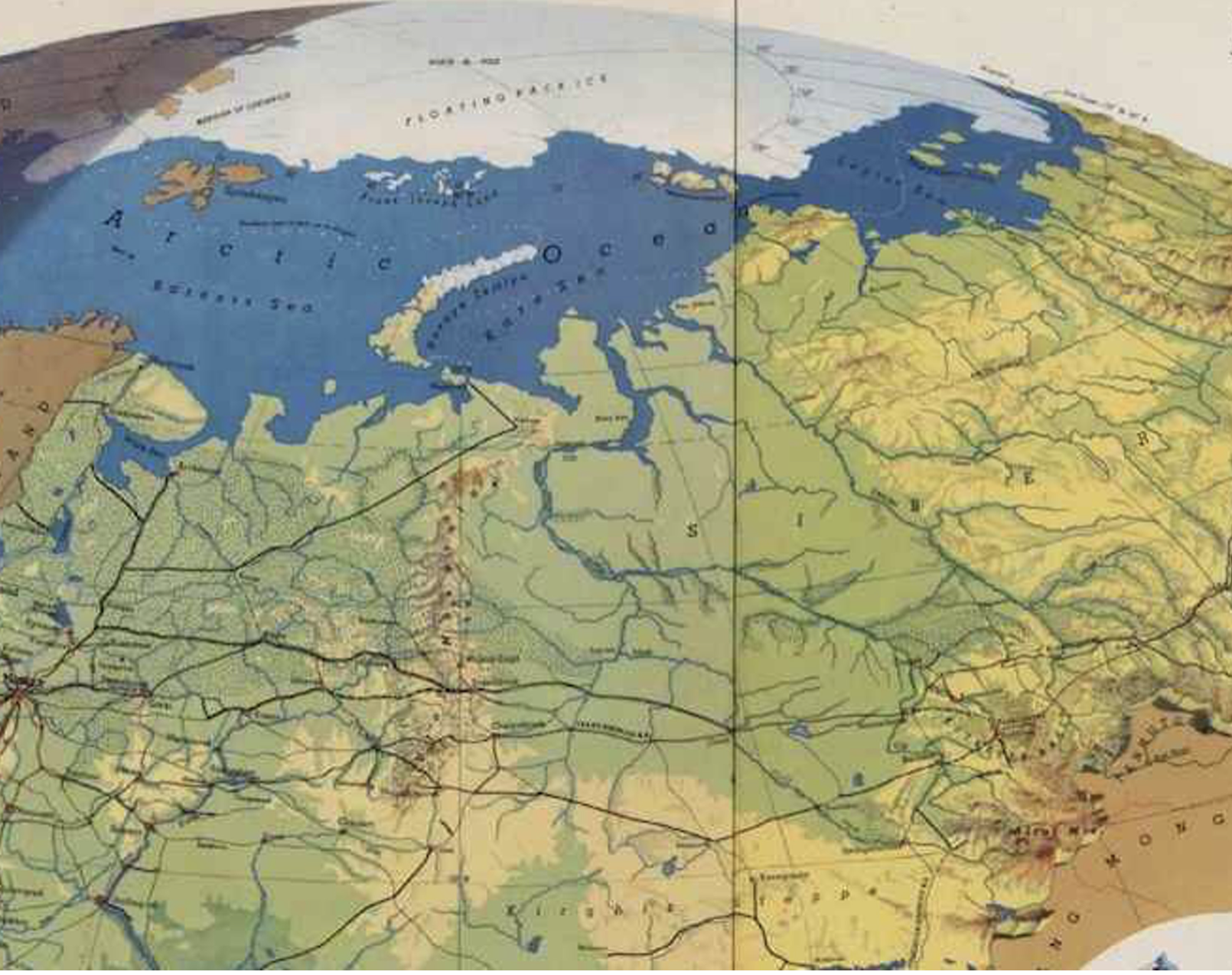
The shaded hemispheric relief maps of Richard Edes Harrison’s landscape maps of course offered evidence of a new purchase on global military theaters to civilian audiences in such elegant full-color inserts included in National Geographic and other publications. His global perspectives orient readers to global dominance that intersected with the ability of the Army Map Corps, as they naturalized the adoption of UTM coordinates by the U.S. Army to coordinate military forces in global war.
The critical nature of maps for global war were indeed apparent after Pearl Harbor was attacked, and the United States realized that few maps existed of this theater of war, William Rankin has noted: as if to conceal the absence, Newsweek assured readers that Washington DC had become in short order a veritable “city of maps” months after the attack on Pearl Harbor, as if to assure them of American mapmakers’ readiness to meet military needs in global war: “it is now considered a faux pas to be caught without your Pacific arena,” editors assured readers lest they still entertain some inner isolationism. Newsweek openly linked Harrison’s pictorial map to dominance over theaters of combat: the increased accuracy of such bifold pictorial maps served to process a spherical earth beyond national bounds, as President Roosevelt geared up to move troops, navy fleets, and air squads around the globe.

There were, Harrison assured readers of news maps made for the U.S. Army Service Forces, or Army Maps Corps, at least “four approaches to Japan” on the table by 1944, despite the considerable distance across the Pacific–which really, he implicitly argued, should not seem so far in an age of airspace and high speed flight–

–and the simplicity of these approaches “to Japan”–from Alaska, from Manchuria, from China-Burma, and from the SW Pacific–presented a defined “Pacific Theater” sought to orient readers to the nature of global geopolitics on grids. Relations of global geostrategy seemed complicated, in the specific, but Edes Harrison simply simplified the legibility of a global landscape no one had seen.
The pictorial landscapes that cast military theaters as verdant topographies were absent from war, but the picture was, readers would have known, quite different on the ground: the view might have been able to be naturalized as a continuous spherical map to suggest the close ties of air travel, but the same islands of the Alaskan peninsula were themselves “theaters of war” as well as stepping stones, where American army bases and U.S. Army and Navy airfields existed, providing the infrastructure for the global airspace that Edes Harrison’s bifold landscape maps promoted through their elegantly expansive pictorial form.
These islands that rest on the “seam of the Pacific and American geological plates” offered a powerful strategic bridge–and theater of combat–that is all but erased in Harrison’s hemispheric maps, which use the continuity of a UTM grid to define continuity, as if the illusion of perspectival unity habituates viewers in the know to the contraction of terrestrial relation that air power allows, without needing an infrastructure of air bases and refueling stations, or indeed human lives.

The unique global perspective that Edes Harrison offered Americans of the approach to Japan from Alaska was almost a creation of the U.S. Army Map Service geodeists, who plotted the continuity of air flights from these bases, as if to plot alternate flights from the Aleutians or Marianas–the eventual actual flightpaths Big Boy and Little Boy took–as if options on the table of future geopolitical strategies. The set of landscape images superseded any notion of national airspace, suggesting the “freedom of the skies” if not a global theater of geopolitics over which the United States presided from the air.

the approach over and into Japanese airspace–here reduced to a thin strip of land lying upper center on the global space Edes Harrison showed, must have normalized the possibility of an airborne invasion or bombing campaign as a game of sliding across a newly mapped global space. And when the Chicago Tribune asserted a false equality of wartime bombing, even in the case of the unicum of the unprecedented power of an atom bomb, as a tit for tat, that suggested in a color scheme straight out of Tiepolo–complete with cottony puffs of billowy clouds–that dramatically suffuses the cartoon panel with light, that cuts against the dismemberment of Japanese bodies, and, amidst the violence of airborne limbs that fly across the globe like so much detritus, assured readers, that the explosion was to be ethically accepted as a response to the “sneak attack.” American readers of the Tribune should feel no qualms at the dehumanized victims of the atomic strike or feel ethical qualms of deep, deep unease at the prospect of a world whose inhabitants bathed in radiation more than celestial light. Set in the paper above the monitory headline “Navy Tells Japan Fleet Again is Off Coast for New Raids,” the cartoon contextualized the catastrpone in a wartime narrative of Japan’s new vulnerability, given narrative momentum as an approach of the “end of war” that began back in Pearl Harbor, in ahistorical ways.

The tragedy of showing the dropping of atomic explosives by a cartoon map on the front page of “the world’s greatest newspaper” some seventy-five years ago recast the act of dropping an atom bomb as only the due delayed response for the Japanese Imperial Air Force’s aerial attack: the magnified register of this response was perhaps hinted at, or acknowledged, in the color scheme that recalled the bizarrely majestic illusionistic perspective in the Wurzburg staircase of in the truly global Apollonian perspective it offered over the continents, for visitors to the Wurzburg Residenz–a fresco that seemed to suffuse the stairwell and pick up the light that streamed through large bay windows below it, as one proceeded to the Imperial Hall on the first floor, on the way to the baroque Kaisersaal dominated by images of the genius imperil: was there a gesture to the frescoes of a sun god bathed in light in the cartoon of the explosive force of Genius imperil?

The cartoon may not have been a reference to the Tiepolo ceiling fresco that dominates the gallery through which one ascends the imperial staircase in Wurzburg, in a monumental passageway of Vitruvian ideals. The ceiling of the vescoval residence that echoes was the culmination of several vaulted ceilings Tiepolo designed and executed of planets orbiting round a sun god, bathed in radiating light, this one placing images of the continents in each cornice and caricatures of the world’s races on the ceiling fresco’s sides; the celestial court to which the visitor ascending the staircase ascends presents emblems of three continents–America, bearing a griffon, Africa, and Asia, but is dominated by the remove of the Apollo ringed by a golden glow. The cartoonist seems to have replaced Apollo by the Enola Gay, bathed in celestial rays that is the modern seat of cosmographic globalism.

Whereas Tiepolo rendered the continents paying service to the Sun God as if a courtly society, what was an allegory of triumph is rendered as a triumphant that conceals the purely destructive intent of America; if Tieopolo’s characterization of the continents on the ceiling was too be sure tinged by racism, and racial prejudice, the celestial celebration is now rooted in military triumph over the Japanese floe, the dawning of an atomic age whose radiance is rooted in new rays, hardly so removed from the terrestrial sphere–and now hardly an allegory at all–but perhaps only able to be imagined on August 6, 1945 as the dawn of a new age marked by the release of cataclysmic energy of divine transcendence.
There was, of course, little actual transcendence or any sense of transcendent sublime down on the ground, where actual humans lived. The dropping of the “Little Boy” atomic bomb that targeted Hiroshima was hardly an allegorical event, but was probably easier to see that way by the folks who dropped it, and wanted to see in it the conclusion of the war and the beginning of a new age. The explanation the cartoonist offered of the logic of dropping the first atomic bomb ever was preposterous indeed. The Japanese planes had attacked a territorial outpost over one third of whose inhabitants had recently been Japanese, before the United States government placed them under martial law–including its courts!–from December 7, 1941 through 1945, interning the small minority of Kibei who claimed loyalty to Japan, until the U.S. Supreme Court voided as illegal the military takeover of the civil government of Hawai’i, and the internment of those Japanese-Americans in relocation centers on the islands where they had, under considerable duress, come to renounce American citizenship.
The Tribune, as if making due on their marquee promise to be the “Best Newspaper in the World,” offered a local perspective on the obliteration of two Japanese cities for readers. For it promised, for what it was worth, exclusive coverage of the “Atom Bomb Crew’s Story,” that Americans were more likely to read about: as if obliterating the inconvenient fact that island of japan was inhabited, or that four square miles of Hiroshima had been just purposefully reduced to an “obliterated zone,” the sort of thing we should never try to create, and presented the “awesome scene from the plane” for all Americans to share–especially Americans already habituated to the removed view of a global landscape and hemispheric logic: the presence of the Aleutian peninsula that was so critical in the war, and the proximity of Alaska to the Pacific theater as Harrison had described it, both described the “inside story” of the Chicagoan in one of the planes that dropped the bomb was dropped on August 6, 1945, and provoked cries of “My god!” from those “battle-hardened American airmen” ten miles off the Marianas, as more bombers awaited to run raids “on other enemy targets” without noting or considering their human costs of such brutality; the dominant tone of the exclamatory headline is celebration and festive.

The cartoon is above all a celebration of the cartographic logic of wartime globalism that show the world as interrelated, and linked discreet points in the spatial continuum of airspace. This was the space Edes Harrison and the U.S. government had promoted served to advance priorities of strategic hemispheric dominance, to be sure in an extension of the “freedom of the air” of civil aviation, but in a logic and illusion of global mastery that was to militate against global peace for the second half of the twentieth century.
But that is not the end of the history, as we know, and the white-washing of the bombing raids Edes Harrison had mapped were smoothly continued, three years later, in the announcement of expanded air routes that offered travel along the newly smoothed global surface, with nary a trace of the bomb ash, but a quite alarmingly similar palette of globally transcendent “around the world connection” passenger jets allowed Americans by 1948 across a pacific Pacific, flying smoothly from Anchorage to Tokyo.

Runge, G., Northwest Orient Airlines: Northwest Orient Airlines. Coast to Coast… Alaska… The Orient (1948)/Courtesy David Rumsey Historical Map Collection

If the bold bands in the pictorial map traverse the Pacific were a vision of postwar cartography’s new global embrace, and the transfer of the military’s global mapping pioneered by Harrison to the convenience of American passengers on global routes, the postcard “Northwest Orient Airlines. Coast to Coast… Alaska… The Orient” promised a peaceful transit through Tokyo, no longer near a target. The routes of transpacific travel reveal a new familiarity of the global projection and a new subjectivity of global travel, not rooted on the world, but able to replace the self in bold bands of manned flight far from the surface of the earth, and opening access to the thin air of the stratosphere, in a broad democratization of the access to the shrunken earth that places us all on a truly Apollonian relation to the continents.
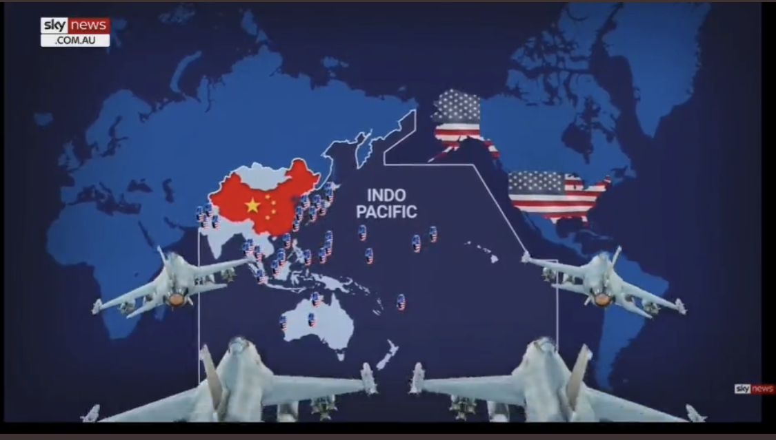
While it is easy to remember the dominance of these theaters in Edes Harrison’s colorful maps, we see them replayed, all too often watch the new geopoltics of a Pacific theater emerging on Australia’s Sky TV, aiming to rationalize a war still about to happen, as we watch the influence of a new Pacific theater that stretches from India to Alaska, where American troops are stationed at the ready–on bases or ships, as an extension in extremis of American sovereignty far from Hawai’i–


–extending manpower around China, as much as Japan, persuading television viewers of their superior advantage of weaponry and arms to cover the “Indo-Pacific,” a region that globalization seems to forge or bequeath for a military all too often removed rom the ground.