
20. Geodetic markers corresponded to a new geospatial notion of legibility, but are strewn across the state as far more minor monuments. As the obelisks made the border manifestly present in the landscape, the survey markers the USGS has since planted in the ground, over a million at set points on the peaks of mountains, sites of elevation and surveying, are an entrancing if opaque signifiers in the past bench marks of property lines, city planning, or earlier attempts at transcontinental triangulation, spatial address with alphanumeric codes: they promise and promote the public utility of the legibility of the land, as did the border markers that often began by including bilingual inscriptions. The legibility of the surface of the lower forty-eight still depends on attempts to reconcile the dangers of linear distortion of projections on distances at uneven elevations–either low-lying regions near the Great Lakes, for example, or the elevated areas expanding cities like Denver, where discrepancies between coordinates and natural topography might create underestimates of property.
The new spatial addresses offer alphanumeric codes overlain on the Universal Transverse Mercator better to orient ourselves along a uniform grid, superimposed over boundary lines of state sovereignty or county lines.
The degree of linear distortions that existed at the border, in Pima County, was low, but must have been a question of concern for the Border Patrol officers who patrolled the region.
Most bench marks were antequated mooring points for collective webs of security that seemed to belong to another era. Bench marks of local heights offer evidence of past spatialities one runs into by chance, set in pavement as relics or reminders of past collective efforts of measurement. In California and the Bay Area, many attempt to track the lines of fault lines that run beneath the ground –including under many California cities, known for registering occasional seismologic tremors that are intrusive (and alarmingly unwanted) reminders of our location beside fault lines, or just hidden-in-plain-sight overlaps of spatialities past.
More a million such markers exist across America as relics of an earlier age when geographical datum was not readily registered by GPS, a spatiality inscribed in fixed points of elevation in the ground–and sought to prohibit their removing them from the stone in which they were set prominently displayed for what was once a hefty fine, as they would undo their accuracy as surveying points. The city of Berkeley is not especially dense in surveying points, but a large number of classical horizontal bench marks exit near the shore, as well as downtown, with many designations of height, that were useful in city planning and property development, that NOAA allows us to scan.
–and far denser horizontal bench marks on the old Army base of Alameda, built on landfill, which rapidly developed as a site for residences, as well as horizontal and elevation markers in downtown Oakland.

It is hard to date the placement of USGS markers set up by the early Bureau of Land Management, but the bench marks that were sent in pavement or concrete monuments provided a needed surveying datum for construction, as well as staking property claims and mapping the west, and while many relate to the first coastal survey of 1836-78, interrupted by the Civil War but completed just before it broke out, the completion of the project of transcontinental triangulation expanded needs for such claims to the west. They are relics of a national form of mapping, but an invitation to local triangulation: these markers offer an interactive infrastructure for future development as a spatially distributed encyclopedia of orthometric heights.
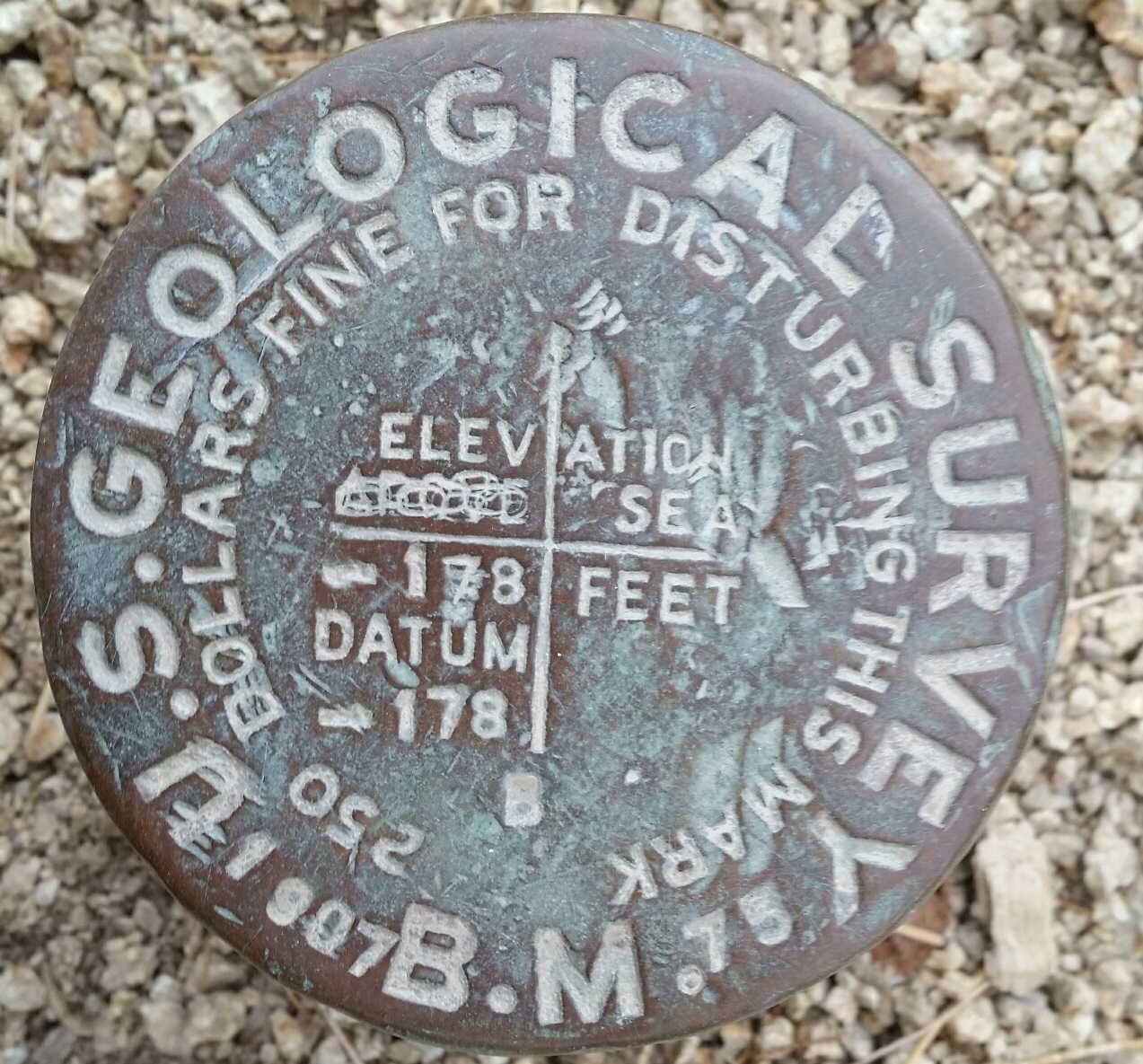
The geodetic markers set into the land as benchmarks of orientation recall points of surveying, but are the remaining residue of a dream of inscribing a one-to-one relation to a map, recalling Borges’ fantasy of a map coequal to the territory, inscribing locations on the ground as fixed points, predating Geographical Positioning Systems. They created a network over the terrain, preceding GPS, in the postwar period, with the adoption of he Universal Transverse Mercator projection (UTM), as benchmarks stabilized a broader metageographic system. Bill Rankin has argued that the new “geo-epistemologies” that were unmoored from nationa bequethed a logic of debordering, able to bridge land, sea, and air that altered geographic space within a geodetic imaginary of unparalleled intensity and coverage of which these markers were reminders–but increasingly lost their function of needing to affirm a geodetic imaginary as they were intensified from the 1990s.The authority of gridded space that was a response, Rankin argues, to the two world wars–and emerged victorious from them as a new global spatiality–provided the very spatial subjectivity which I was trying to navigate my way out of on my walks.
The products of a pointillist geographical imagination of establishing a sense of geospatial security for surveyors, property owners, and indeed drivers was moored in the benchmarks that affirmed the stability of the maps still made by surveying, survive only as traces of an old spatiality, if they now enjoy a sort of renaissance in the age of geocaching. I was, of course, doing something in the reverse: mining a sense of the meaning of the local with a growing sense local memory was being eroded and lost. Finding these names, and past spatialities, of the Bay Area, and locating impressions of the stamps of sidewalk pavers, seemed to constitute a sort of orientational act of saving them from oblivion.
The shift in the sense of mappability is suggested in the rich terrain for geocaching that the USGS bequeathed Bay Area residents, especially in the East Bay.
Or excavate the hidden early history of laying out San Francisco, from the comfort of one’s cel phone, and the readings of the height of Knob Hill. If set in an eminently pedestrian with particular density, these geomarkers of horizontal location and approximate height above sea-level, with many along the Embarcadero offering vertical controls, provide a space we walk through without noticing, but is sunk in stone beneath our feet.


Thanks for this wide-ranging meditation on our sidewalks. They’re a palimpsest of East Bay history, a diachronous record in constant turnover, that anyone can start to read once they turn their eyes to their feet.
https://oaklandunderfoot.com/
Indeed, it’s hard not to read a story of urban expansion and landcover change. The palimpsest of temporalities is cool to discover. I was amazed to find a Blake and Bilger stamp, as best as I can read of 1909, on my own block. The range of WPA strikes in many neighborhoods from Temescal to Sausal Creek evokes a large effort of local improvement, as well.
Thanks for this wide-ranging meditation on our sidewalks. They’re a palimpsest of East Bay history, a diachronous record in constant turnover, that anyone can start to read once they turn their eyes to their feet.
https://oaklandunderfoot.com/
Thank you! Indeed they are; while inspired by the very local pedestrian walks made mostly in the Lorin and Elmwood, I benefitted a lot from the great online commentary they’ve received.