Tag Archives: indigenous lands

“A Mighty Redwood of a Man Has Fallen”

Malcolm Margolin was among the coolest and most curious people I’ve known. And while terribly saddened by his recent death, and mourning his dynamic presence, he was long a model for struggle we will need to remember in a dark age. I first met Malcolm as we walked the Bayshore Trail in opposite directions, Malcolm appropriately seeming to patrol the newly reclaimed bayshore pathway a tradition of the Ohlone people. As if a modern Henry David Thoreau who found a new Walden in the East Bay, Malcolm seemed, walking along well-worn trails, self-appointed clearer-of-paths of the East Bay wilds. While from Massachusetts, this Harvard-educated hippie won a grant to write a book about working the land without transforming led him to appreciate the native ways of another tribe, what Gary Snyder called “old ways,” that were rooted in place as much as they channel American transcendentalists that was purely Thoreauvian in its spin.

As Thoreau, Malcolm saw the ethical traditions of the local as a deep purpose of “rules, customs and practices outside the dominant way of life,” evident in the local Indian community, as if he recognized it–and adopted the vision of straddling outsider cultures and communities on projects of refusing to tame wild lands, allowing them to exist for our benefit against all odds. Malcolm grasped–as have others –the value symbolic anthropologist Clifford Geertz ascribed “Deep Hanging Out,” as a basis for ethnographers’ sense of purpose was immediately recognizable to Malcolm. And it was a way of describing his longtime Berkeley residency on the margins of academia, and at the center of a large industry of small presses as as deeply purposeful as the noted generations of anthropologists who had studied–and indeed mapped–indigenous cultures in the state, more often reifying their presence as an “extinct” peoples. Malcolm’s work, if often based on oral accounts of life before westernization, provided a model of Geertz’s concept of “thick description” less tied to the symbolic webs of culture, than the immersion in a sense of place and vital relation to place. The purpose he gained in the rich local setting of Berkeley, CA, from its parks to its shell mounds to its coasts and islands left a bookish world for close study of the ethics of place, before he brought this attentive wonder to a home in the bookish world. And the deep knowledge of place–a sort of expanded “local knowledge” of the Bay, to cop another phrase from Geertz–offered an alternative anthropology of the local, rooted firmly on the West coast.

As a former parks ranger who had, indeed, cut his teeth rebuilding the trails in what was Oakland’s Redwood Regional Park–a jewel of native forested lands of old growth trees in the East Bay, one of the large redwood forests in the East Bay, and third East Bay park open to the public–the largest natural grove of coast redwoods in the East Bay. While Redwood Regional Park, where he first worked and developed a sense of the preservation of the wild, was renamed after Aurelia Reinhardt, Malcolm must have been nourished by its old growth redwoods; I’d like to imagine, their age, if actually not that deep, gave him a new sense of spatial orientation to place to Ohlone residents, and a sensitivity to the suffering it had undergone and he might save. His love of place may have begun earlier building trails, but in immersing himself in the practicalities of lost woodland trails as a redemptive process led him to become a proselytizer of many regional off-road trails, to treasure them as a site of contact to other worlds and pasts in danger of being lost. If AI algorithms somehow generate a tie from a search about Thoreau’s writing at Walden between “the site associated with Henry David Thoreau’s experiment in self-sufficient living and a more recent effort to return land in Berkeley” to the Ohlone people, a missing link may be Malcolm’s attention to the uncovering of indigenous practices and histories of place.

The understandings of Indian Country that he gained, and enjoyed, led him to move between many worlds to establish his footing, and gaining a sense of potential redirection of past injustices that he dedicated a great part of his life. If few cartographers are so resistant to following rules, Malcolm’s interest in the quirky and the overlooked led him to blaze new trails across much of the Bay Area. Whether the serendipity of Malcolm’s work in an old growth forest in the 1960s, as newly planted redwoods of the region first provided a hope of restoring forested lands that had ben cut down.

Redwood forest trail

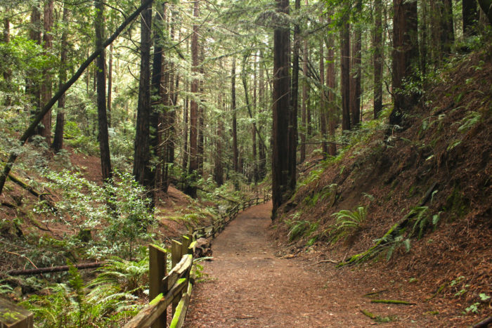
 Forested Trail in the Dr. Aurelia Reinhardt Redwood Regional Park. Photo credit: H Grimes 

While Malcolm told me a few times he would never have been able to research Ohlone Way (1978) or other works without the University of California’s library at the ready, praising the gift of the open stacks at the public university, this East Coast transplant who lightly tossed his Harvard credentials cast himself as an outsider intellectual who could serve to orient a new generation to the region’s native lands. Malcolm had, in Ohlone Way, animated a sense of preserving native ways. If in part this followed Alfred Kroeber and Henry David Thoreau in describing Indians as “extinct,” at first, at least in California, he spent much time and effort revising the remark with a celebration of native presence and the vital nature of traditional tribal arts–few did as much to stress their current relevance and continued presence in these lands. While Malcolm’s project of “cultivating the wild without taming it” became a sort of ethos of the outdoors, popular in the era, his guides to the practicalities of the wilder areas to enter just outside the East Bay and San Francisco presented a vital document of a world before urban sprawl, promising to rehabilitating one’s relation to the wild–and rehabilitate one’s soul–of deeply Thoreauvian ends of transcendental thought.

East Bay Out (1974)

For ever since idiosyncratic explorations of the region some fifty years ago, and the pioneering communication about the land he learned to know so well, East Bay Out (1985), the very deeply personal guide that allowed audiences to embrace to orient themselves to the Bay he loved, as if it were a world outside and beyond the familiar, to explore out of the paved regions of Berkeley, in what has been an increasingly compelling mode of deeply meditative work on the edges of settled world we collectively failed to pay sufficient attention as built infrastructure expanded. If an idiosyncratic sort of cartographer who bucked at the idea of having to follow rules, Malcolm developed a sense of wonder in the East Bay, as much as he simply moved there; as he immersed himself in its forested wilds, the parks became a keystone to the admiration of nature–as he grew to be the elder statesman of wonderment, never tired at pointing to the overlooked we needed to notice, and most at home when he engaged as deeply as possible in his surroundings, including, of course, its rich indigenous pasts to which he dedicated so much attention and wonder. As if the making of trails in Redwood Park were a weak fit with his ambitions and skill, trail-making lead him to blaze trails of inquiry across the East Bay, in part because of his resistance to following rules. If Thoreau had famously described himself as all mapping, for Thoreau, was indeed a form of reclaiming an ethical relation to space, from the recuperation of a mapping of an ethical relation to the Concord River that spanned its indigenous past and the present, through the French-Indian wars, but also, at Walden Pond, a universal history of heroic aspect and the present.  As Thoreau described himself to readers of his book–Malcolm knew it well–as the self-appointed “surveyor, if not of highways, then of forest paths and all across-lot routes, keeping them open, and ravines bridged and passable at all seasons, where the public heel had testified to their utility” Malcolm had a deep sense and deep meanings of new forms of mapping as a public utility.

As access to the wild shrinks and is constricted, Malcolm’s work stands as a theological practice of the outdoors, perhaps as rigorous as the ethical practices of his Yiddish-speaking grandparents, if more light-hearted and wondering, with an ample dose of John Muir’s sense of wonderment at the Cathedral of the wilderness. The sense of straddling worlds was perhaps a deeply Jewish angle to the past: if Malcolm was born in Boston in 1940, to a prosperous merchant family, less than a generation after Geertz had been born in San Francisco in 1926, the position that he had in Berkeley was one that left him little to be envy for his academic anthropological colleagues, more embedded than they were in local cultures in many way, but with the distance on academic preoccupations and terminology, or indeed on his scholarship: the sense that Jospeh Epstein expressed of both being “part of a great nation, and, having been born Jewish, simultaneously just a bit outside it, too” as being quite a position of advantage for a writer was, I think, an advantage Malcolm also felt–an ability to write as an insider and outsider that was magnified or redoubled in his relation to academic writing, and the establishment of a new press to publish his work on the Bay Area’s landscape–maybe in emulation of Thoreau’s self-publication of his first book, A Week on the Concord and Merrimack?–certainly gave him a sense of shared perspective on the massive extermination of indigenous California culture, and the ethical importance of preserving its vital life.

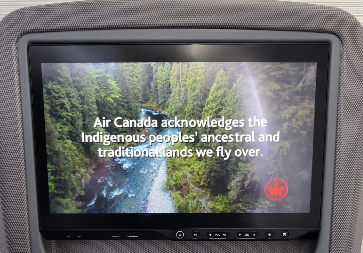
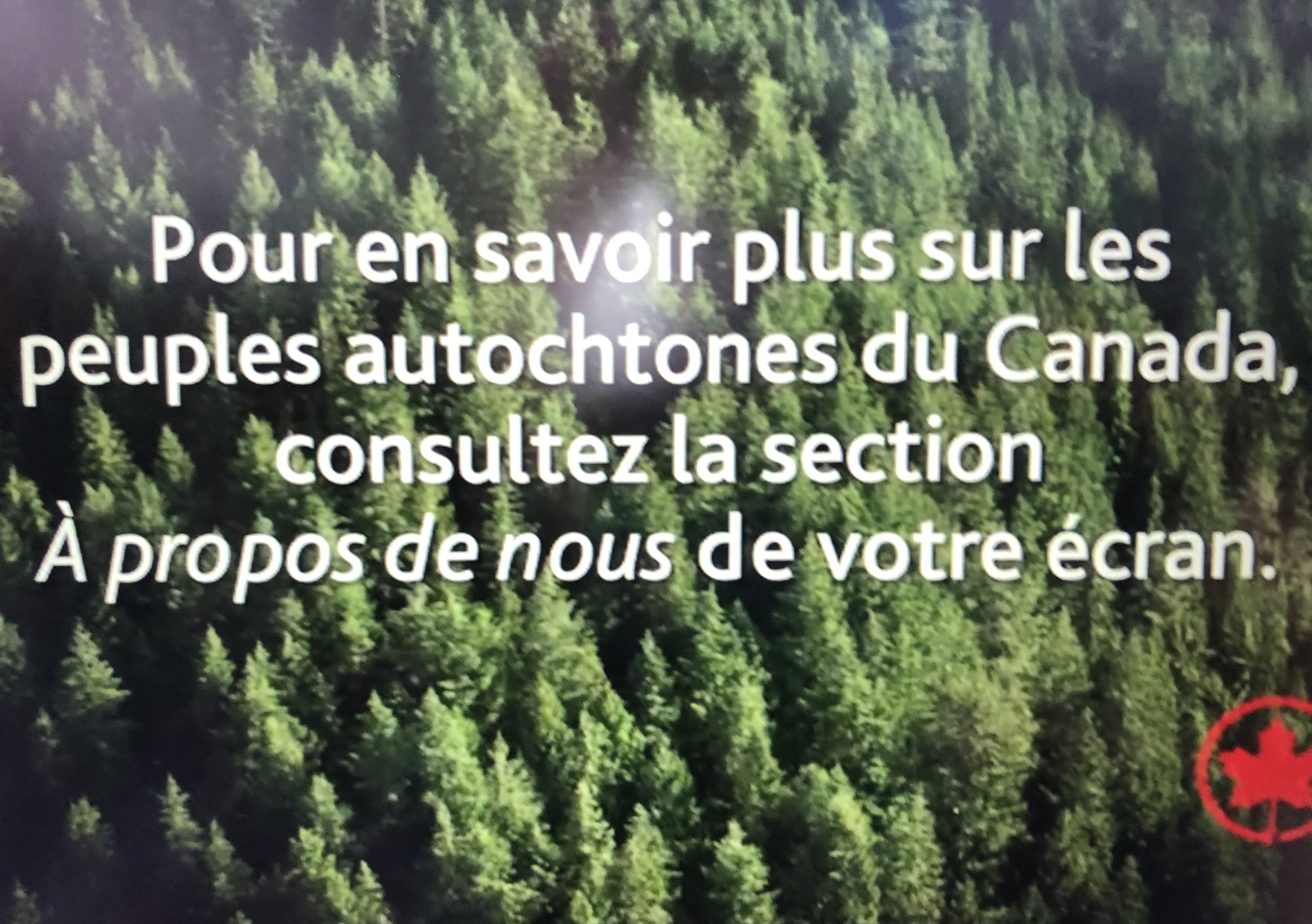
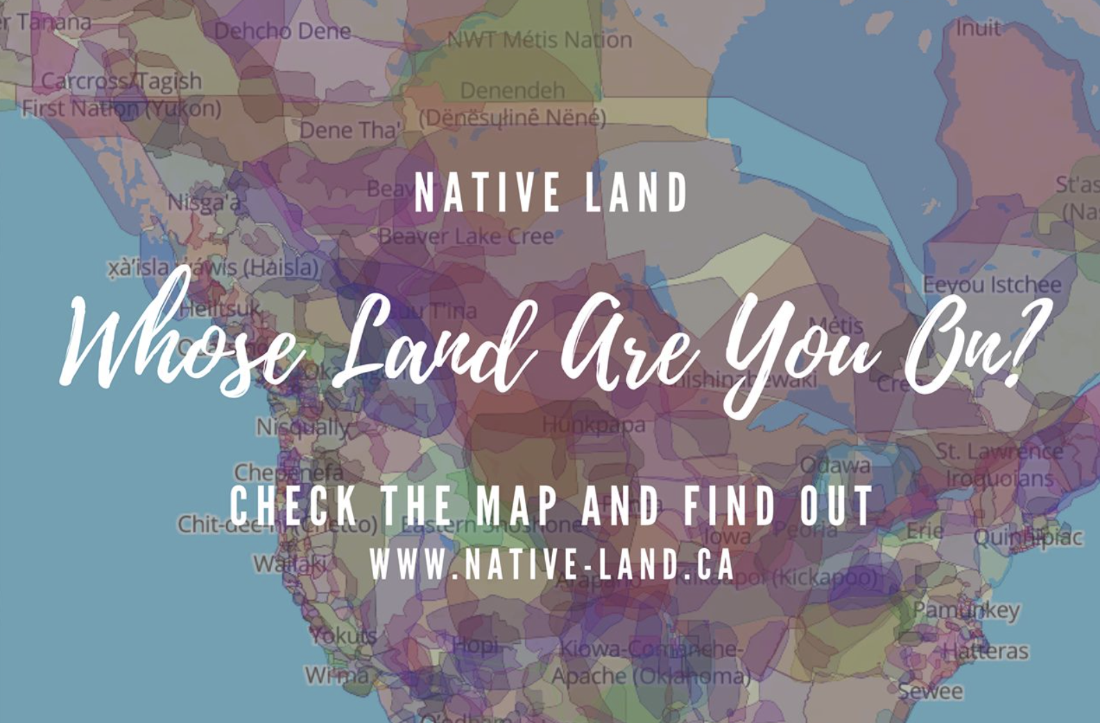
For if his sense of deep ethics were entirely secular, and resolutely so, the intensity of wonder and interest in the living landscape from which an indigenous past had been dangerously distanced was fundamental in his straddling of worlds. That book had helped re-interpret the regional landscape of the East Bay landscape that Malcolm, a transplant from the East Coast, to be sure, made his own to an ever=-growing audience of readers. He had self-published the book a few years before I arrived in Berkeley, CA myself, as it happens, after Malcolm had become a force in the attraction of renewed fascination to the rich ecology of the diversity of the Bay Area’s natural history and the scale of their loss–The Natural World of San Francisco (1967) had just appeared in print, and former rock climber David Brower had already started to agitate tirelessly to preserve the natural landscapes of the Bay Area, fighting for the conservation of areas of seashore and wilderness in nine national parks from the Point Reyes National Seashore led to the adoption of the pioneering Wilderness Act (1964), promoting the notion of coastal preservation was energized across the country, in ways that created a legacy for conservation only being recently turned back after a generation has taken it for granted. Soon after land acknowledgements became the norm in much of the United States, and were played regularly on the PA system of Berkeley Libraries, to remind all reading that they were so doing on “unceded” Ohlone lands that the tribe possessed from time immemorial, the ground has shifted under our feet. The position of wonderment that Malcolm long held, from tromping around different East Bay parks to exploring the region that he convinced all who would listen was a wonderland, provided a source of resistance to the development of the Bay Area, a deep environmentalism of historical consequence. And uncovering trails of wonderment was what Malcolm was all about.

It may make sense to take stock of the major shift of the Great Society and 1970s of land conservation as part of a massive shift in collective memory of which Malcolm was part. If the Regional Parks provided a crucial space to hold the state in abeyance, and indeed to keep the state out of one’s life, the shorelines preserved in seashore parks–including much of the coastal region of California, that would lead to the California Coastal Commission–afforded an early notion of a remove from the state, by the early 1970s, to preserve the entire coastal waters of 1,100 miles of coastline from uncontrolled development of coastal property that would prevent the loss of access to coastal waters and the shore by 1972—best understood in the somewhat longue durée of the foundation and preservation of a ten national seashores across the nation from the early 1960s, a distinction that defined the nation’s drive to coastal preservation during my own childhood.

David Brower and the Foundation of Ten national Seashore Parks, 1961-1972

The memory of conservation may have faded more quickly, if Malcolm’s work did not help keep it alive. The local new energy of treasuring wilderness by books on open spaces, environmental awareness, and nature photography, calling for an ethos of conservationists of leaving absolutely no mark in the landscape “save the scars upon the Earth that could have been prevented had they stood their ground.” The pioneering work was never so clearly seen as in the creation of national seashores–an effort that might have begun on McClure’s Beach in Marin County, just outside San Francisco, and Tomales Bay Park, but created energy that led to the creation of “national seashores” across much of America–from Cape Cod (August, 1961) to Pt Reyes (1962) to Fire Island (September, 1964), to Cape Lookout (1966) to the Gulf Islands (January 1971)–and Malcolm saw the regional parks where he worked as a groundsman 1970-72 as something like an alternate text to the map of the current Bay Area, developing as an East Coast transplant a distinct sense of wonder at the biodiversity of the parks that survived, even if the rich range of grasslands, nourishing streams, and herds of elk and bears that once roamed the land that was cared for by indigenous survived only in the testimony of the first settlers. And if many are annoyed but he land acknowledgements that have appeared on university stationary, movie theaters, and play houses and arts centers as if pious obligatory statements, offering but lip service, the importance of preserving and observing the forgotten history of the land was a movement at which much of Malcolm’s work set the ground.

As much as a new Henry Thoreau, Malcolm remained at the helm of the press of most of his life–only leaving with reluctance, continuing even after his retirement to be an advocate of offering a path for all to find their own Waldens, and by a plurality of Thoreaus, not only in the Bay Area but far beyond. And if the parks provided a way of thinking outside the state, and subtracting oneself from the state that was increasingly entering one’s head, it is more tragic than ironic that as we stand at the prospect of a government shutdown after his passing, the President defined by a moral void and absence of any moral center seeks to furlough parks workers in response to the eventuality of such a shutdown, and indeed to mandate leaving the parks open to all Americans, supervised only by a with a rump staff, flying in the face of expert advice, not deeming the workers who run them to be essential workers who must remain on their jobs for its duration–if some in the National Parks would be required to stay on the job, but have to wait for back pay. Parks Service was already reduced by a quarter since Trump took office at the year’s start, cutting backcountry visits, the presence of rangers, and relying on volunteers at parks as historic as Yosemite, but the reduction on critical maintenance of open lands and disaster preparedness may damage the very preserves for which a generation fought. If Malcolm would have hoped the compromise would spur a range of public protest and indignation at an end to wilderness protections, we’ve been so battered by an onslaught of public absence of oversight to make the prioritization of open park lands as a preserve to subtract ourselves from the state may be a challenge, even if it shouldn’t be.

A clear-sighted of environmental visionary, Malcolm was able to corral multiple folk behind his vision to crusade for promoting a sense of happiness in envisioning a future and better world. For much of what Malcolm agitated for was a better way of settling in the world–and indeed being settled in the Bay Area–than was evident in the landscape of development that was emerging in the years he arrived in the Bay Area, in ways that allowed him to make it home. The energy by which he teased out meanings from alternative geographies of his adopted home of the East Bay, of plants, animals, and past inhabitants opened eyes to new geography of place and space in the region, against an increasing automotive space defined by the straight lines of property, highways and trip-tiks–those ancestor of GPS, ordering spatial travel on fold-out paper map, highlighting stops only for hotels or scenic views, of clear edges, privilging boundaries and confines of attention in place of marginalizing the off-road parks. For rather than encouraging investigating the off-road regions at small-scale, maps offered a purblind image of place. (It may well have helped Malcolm didn’t drive, but made the lack of a license into a virtu:e: late in life, he smiled regaling me the distinct advantages of not driving, reminding me how he benefitted form never driving: both to getting driven home from parties and always meeting people in the rear seat or be given rides that had led him to meet the most interesting people who drove him home in the rear seat of their cars.). The handbook he wrote for exploring the Bay Area’s parks on foot, and to lead other groups to marvel at their wealth, was a large part of Malcolm’s source of energetic vitality.

Berkeley was a perfect place to find interesting people to talk to, no doubt remembering his life as a bon vivant. When we had met on the Bay Trail, Malcolm’s Old Testament beard wafting in the wind as he turned the Bayshore Trail that day seemed a sort of synecdoche for the testimony he offered and channeled of collective memory of the bay, and of the land, deeper than any map, that might be captured by deep time, or deep hanging out, to use the phrase of Clifford Geertz he was fond enough to use as a title for his final book, to claim the anthropological mantel he had been accorded even in the aftermath of some resistance to his appropriation of indigenous testimony as a record of a timeless past. And ever energetic, even in the assisted living quarters in Piedmont, he swept his hands in the air as he optimistically envisioned the ways that “people will take to the streets” against the Trump Presidency, which he asserted would bring the greatest revolution in political self-awareness since the sixties, convinced of the huge benefits on the horizon, if no doubt at this point also reliving his own love of the protest culture of the late 1960s, and perhaps taking a far more positive view on American politics than I had the heart to contest.

The belief in the value of a deeper knowledge of the Bay, deeper than the aims of developers or the maps of property, animated Malcolm as it had animated, in a sense, his entire energetic career. The promise and premise of East Bay Out, a work long in making, was that we’d all do better to cultivate the off-road and unpaved.) Was not the fixed itinerary one against which Malcolm rebelled in expanding attention in East Bay Out on a broader concept of space and place, worthy of attention, directing increased attention to the parks he knew so well? The elegant if austere line drawings of Nancy Curry helped to offer an assist to visualize the parks he knew so well as an off-road region worth exploring, to not allow to be reduced to rectangular regions of green–

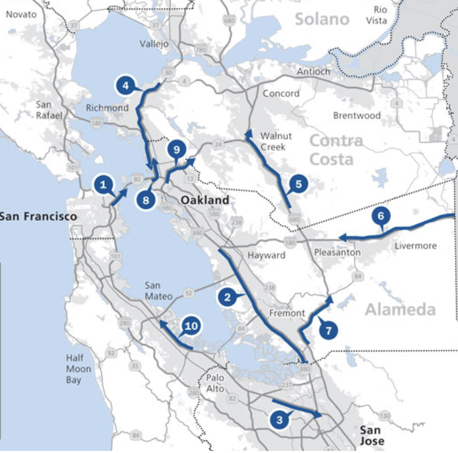
–providing personalized itineraries treated travel as a process with no detours or uncertainties, as an experience mimicked by the streamlined paths of AAA versions of Bay Area Rapid Transit map-

-a region where the transit map and commute intensity has grown rapidly, if not astronomically, in recent years–so that the average distance commuters have lived at an ever-expanding distance from work, and the already considerable ten mile commute of 2019 has nearly tripled by 2025, and commutes across Malcolm’s treasured Bay Area have put folks working in downtown Oakland from ever larger distances at which they rarely have time to experience the green areas in the map, or the riches of the Bay–a distance of commute that have dramatically expanded since the commute has grown to almost thirty miles, creating a hellish commute that compromises time outdoors.

Commute Distance at which Workers in Downtown Oakland Live, 2010

At the time as this distribution of the daily commute across the freeways of the East Bay, Oakland Mayor Mayor Libby Shaff promoted the tree the symbol of the city–affixing it to all street signs in the city as a new proud logo of the greening city–promoting a tree-planting project across the city that would reclaim the city’s live oaks celebrated as a the basis for plentiful Oholone harvest of acorns, a mission to  “re-oak” Oakland beginning with the planting of an inaugural stand of 72 saplings of coast live oaks in plastic buckets in a West Oakland park, realizing the deep belief, endorsed by landscape architect Walter Hood of UC Berkeley, how“Names are a powerful way to think about a place,” and first proposed the Mayor’s recent resurrection of the city’s forgotten groves, first celebrated by men like Malcolm Margolin as an indigenous inheritance. If the impact of the Ohlone Indians on the landscape they distinguished led Spanish and Mexican residents of the mid 19th century to name the place “encinal”–or oak grove–the protection of the trees already fast disappearing from the region in the 1850s as it grew led its first mayor, Horace Carpentier, to try to protect the trees, even as oaks were felled for development and the expansion of its gridded streets.

Today, few oaks survive save landmarks that stand as sentinels, as the Oak in front of City Hall, whose canopy of tributaries of branches was only planted in 1917, but was adopted as an icon of the hope to remake the city in the sign of the sheltering canopy of the expansive green tree once more.

Malcolm’s heroic task was to remind us all of the green areas that are on the map, before they are mapped out of existence or public consciousness, and remind us how easy they are to . Indeed, vast areas like the 5,924 acres of Sunol Regional Wilderness, the over 5,000 acres of Briones, the nearly 5,000 acres of Anthony Chabot, 2,000 acres of Redwood Park and Tilden Park, and the slightly less large but brilliantly illuminating grand 1,500 acres of the Morgan Territory were something like negative lands, too often unexplored, not to mention the reduced rump of what has the grandiose name of the Ohlone Regional Wilderness, situated between Sunol and Del Valle, that suggested a new topography of space in which Bay Area residents were urgently asked to reorient themselves in Malcolm’s pioneering work.

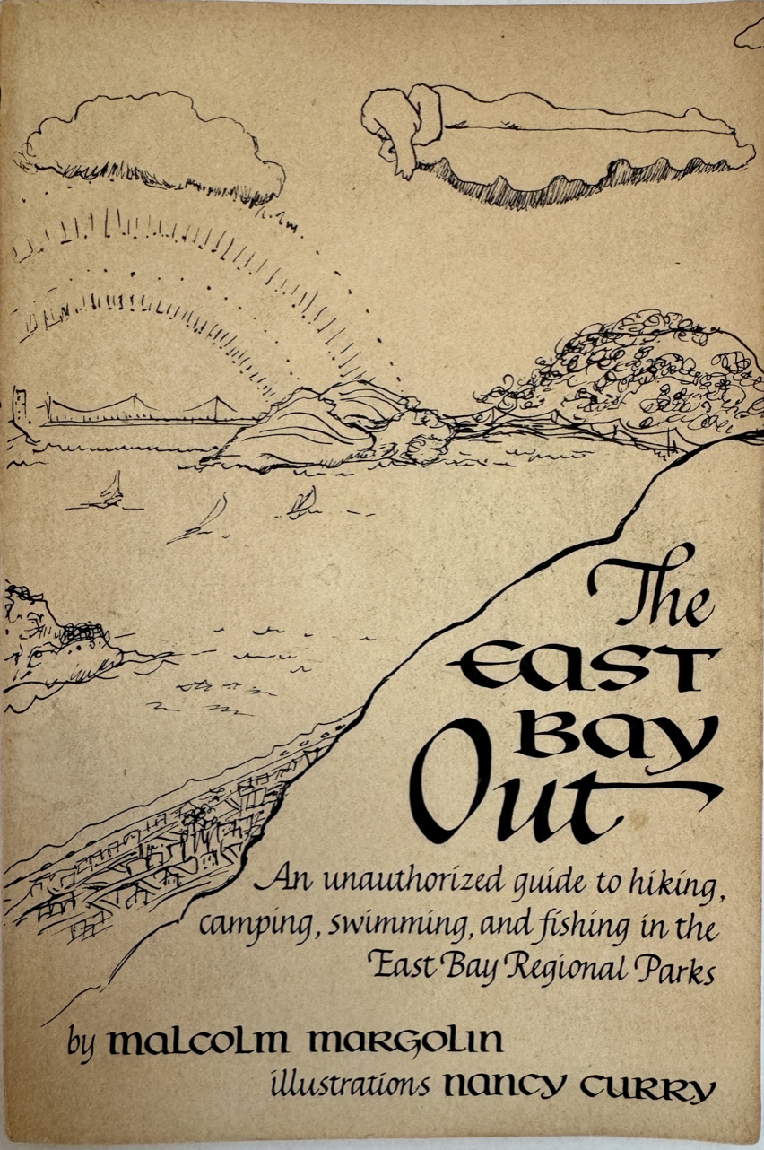
The dreamy cover of that “unauthorized” paperback guide to the region–East Bay Out (1985)–certainly offered a decidedly off-road record of outback experience of the region, neither a God’s eye or bird’s-eye view, its old cover featured a blissed out Malcolm or reader floating above the bay from atop a cloud, looking down on a built but intriguing bayshore, as if in harmony with nature, ready to descend explore the open areas for camping and swimming the book described. (It is hard not see the cover, as I never did before, as an image of Malcolm Margolin floating as a benevolent spirit presiding above the coast of a region he celebrate with enthusiasm and came to know well.). If perhaps the figure on the cloud was an iconic persona of the Aquarian Age, Malcolm adopted the calligraphic skill of Bay Area penmanship to invite all readers to tap their inner Thoreaus in the guide to living outdoors–hiking, camping, swimming, and fishing–in their own Waldens able to be discovered not far from the edges of urban life in the East Bay Regional Parks. An evangelist and a guru, as much as a historical anthropologist, Malcolm led the way from his own cloud to the future.

The East Bay Out (1989)

I first saw Malcolm one afternoon pacing leisurely on a recently restored shoreline in the Berkeley Marina, he seems rooted in the Bay Area he loved so much, moving along the path quite rapidly and deliberately on paths restored in by 2009. The remade wetlands home to many more birds than a decades previous had been a major victory of the restoration of the shoreline he had very much promoted and must have relished. Perhaps ever since Malcom came to Berkeley, he was seeking actively to front the wild, as Thoreau would put it, with joy–rediscovering the parklands as if facing a frontier–Thoreau’s sense of the word–but not the frontier of lands held by settlers, that deserved to be seen again by the wilds that it still contained.

1. Instead, it belonged to the bayshore people he had made his own alternative present. There was a sense of the urgency that he did so squinting in to the horizon, as if he were looking for signs of the past occupants of these native lands that he knew so well, seeming as he walked an Old Testament prophet on a New World coast, beard buffeted by a bayshore breeze. He caught my eye before we had ever met, and I already wanted to know what he was so clearly thinking about. But, if Thoreau was walking the paths alone, Malcolm seemed eager to invite others to walk the same old paths with him. When Malcolm confided somewhat conspiratorially either at the outdoor tables of Saul’s Delicatessen or Piedmont Pines how much Berkeley was a perfect place for “folks like us.” No doubt the had long honed the pitch of overly generous flattery to make one feel part of a club, and promote the rather miraculous trajectory by which he had founded a productive press and nourished a new community of readers long before Indian activism.

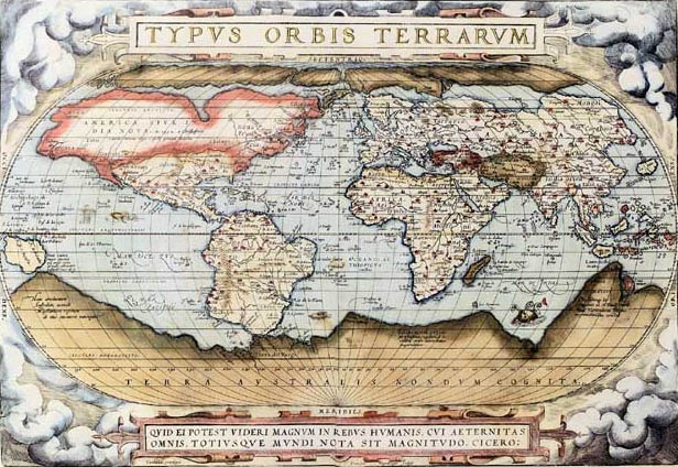
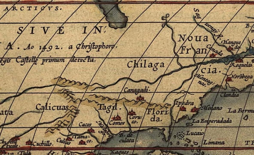
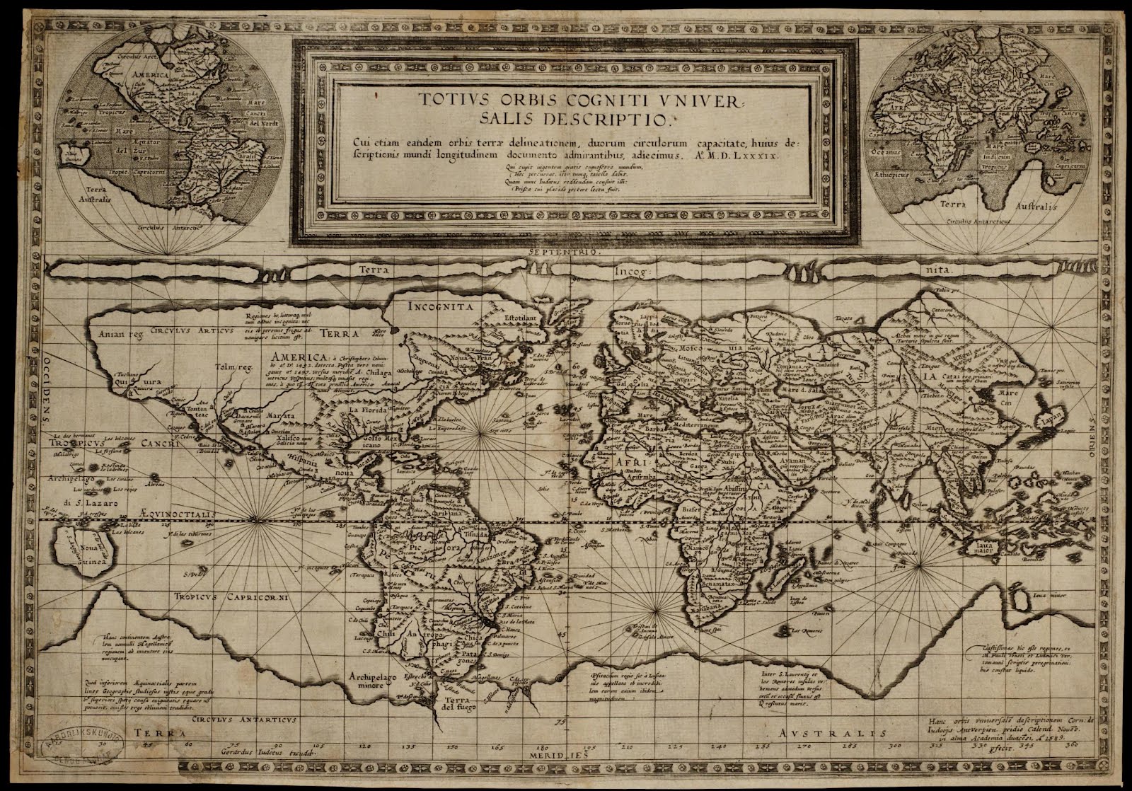
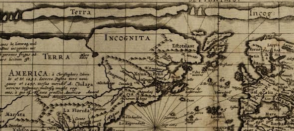
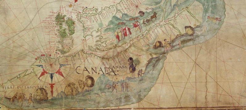
But he praised the city and its active readers, sense of responsibility, and accessible libraries as a treasure: access to the libraries of UC Berkeley that he so often used from when he first arrived in 1969. There was a vision of rediscovering the old landscape by a poetics removed from the present day. In ways, he echoed the sentiment of recovery that was voiced by Thoreau, when he imagined the poetic practice of exploring, as if “I walk out into a Nature such as the old prophets and poets, Menu, Moses, Homer, Chaucer, walked in,” a landscape he offered “you may name it America, but it is not America: neither Americius Vespucius, nor Columbus, nor the rest were discoverers of it [sic],” but was arbitrarily named on maps, in which but a “few old roads that may be trodden with profit.” Somewhere, Malcolm still walks wider trails. The sense of a pre-Columbian contact with a lost land was dear to Malcolm, who never got rid of describing the encounter–more accurately than one of conquest–as the arrival of a starved and tattered group of Spaniards disembarking from ships on the edge of a peaceful, settled, and economically established nation, hardly in need of mapping and having already persisted as the engaged custodians of its plentiful ecosystem whose rivers fed fields and forests regularly harvested and maintained for a range of coastal peoples.

When we met, I had no credentials or a university affiliation, but couldn’t help being flattered by the attention. I now realize how much the East Bay was a living library for Malcolm–a library without walls, and an interconnected one that couldn’t be segregated on shelves by call numbers or single volumes. I don’t think it is a library that won’t be so deeply appreciated without him here. But the energy and encouragement to interrogate and appreciate its hidden maps, and hidden pathways, will be wanting an active a set of prompts and stimuli. Malcolm Margolin had found a home in the East Bay, but also made it one of the more interesting places for discussing books and ideas outside of university libraries’ bookshelves. And Malcolm of course worked to open eyes to alternative geographies long before the multiple alternative hand-drawn atlases of urban nature and bayshore habitat evident in the restored wetlands,–or the new cartographies of Obi Kaufman or Rebecca Solnit of California–he did much to encourage, to open eyes far beyond the rich bay. But if John Muir saw the wilderness of Yosemite as a cathedral, to pursue my analogy, the more bookish Malcolm saw it as a living text, pulling out threads of narrative with endless curiosity that have altered our picture of it and encouraged the stability of a built geography to be questioned.

Malcolm was walking that afternoon with energy, around the bayshore trail, alone, as if in the footsteps of the shore-dwelling Ohlone, enjoying the restored shoreline rather recently completed, and of which he was so much apart. Eager to catch or notice something new, the man seemed a long-haired bearded prophet, to watch, even if I didn’t know who he was, with something like awe, as if he were looking for a new frontier of natural observation, retreading long untrodden shoreline paths able to be imagined of the indigenous community of a once highly populated East Bay.

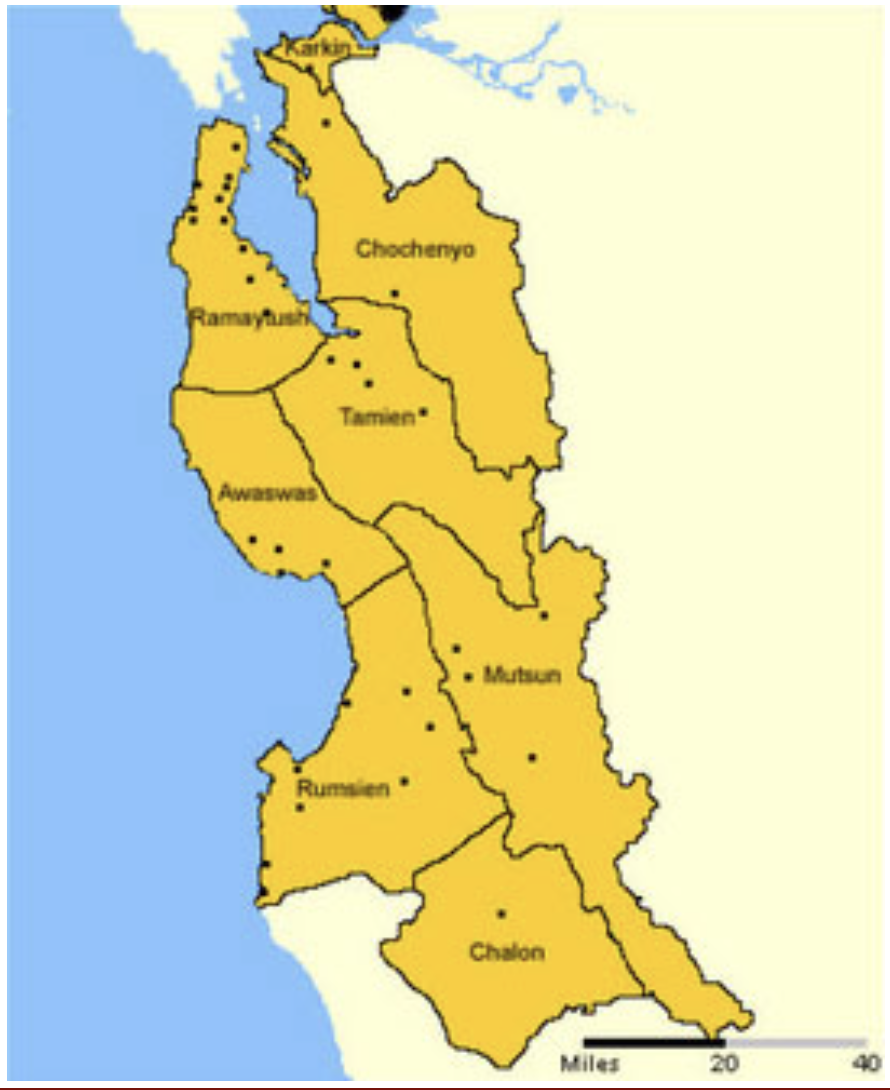
Bay Area Indigenous Language Groups and Coastal Settlements/Levy (1970), amending Kroeber, 1925

Malcolm may well have been in that moment envisioning the lost past of the coastal bayshore as he moved deliberately across the shoreline trail, as if searching for evidence while scanning the shoreline as if squinting for traces of Ohlone shell-mounds long since lost to the landscape. He had done so much to preserve the memory of the shell mounds, many of which were leveled in their entirety the 1920s, at the same time A. L. Kroeber had begun to teach anthropology courses about California’s indigenous in lecture halls at U.C. Berkeley. Kroeber, who was attracted the artifacts and symbols of the indigenous, seized on the project of “salvage ethnography,” in the footsteps of the mission that his teacher Franz Boas, linking archaeology and ethnology in artifacts, proclaimed the Yahi Ishi in 1911 to be the last surviving “wild man,” cornered by dogs in the hills near Lassen, of a tribe he believed exterminated by white settlers of the state, who he proclaimed “the last wild Indian in America,” who died from tuberculosis five years later in captivity. Seeking to preserve the final remaining traces of the indigenous cultures Kroeber believed vanishing or gone, he imagined a map torecover the expansive linguistic repertoire of a lost indigenous world across the state of California, mapping the linguistic groups of California’s former residents as a living world in a cartographic symbology of set boundary lines and distinct colors of discrete linguistic groups.

Linguistic Groups of California and their Families (1925)

While Kroeber did encourage skeletons from indigenous graves, including the massive shell mounds that had formed burial sites of ceremonial veneration over time, the massive structures of over thirty feet tall and longer than a football field in length to assemble knowledge stretching back thousands of years he believed confirmed “the permanence of Californian culture is of far more than local interest,” as he wrote in 1925, but “a fact of significance in the history of civilization.” The elevation of the moment of contact to an inverted picture of starving if not ravenous Spaniards, alienated from the land, meeting a stable society of flourishing tribelets living without money and not needing intentionally offered a new perspective on civilization itself.

Malcolm did much to affirm the importance of indigenous California in global history,–if for different reasons and an opposed logic by insisting on the necessary importance of indigenous anthropology for the present day: the veneration of these ancestral burial grounds had functioned as a permanent ceremonial site for the itinerant coastal peoples, and of orientation for a modern world that was far more out of joint and less attuned or aware of historical change. In keeping with the razing of many historical structures in the East Bay, the mounds Kroeber urged pillaging for evidence of native habitation were unceremoniously cleared for railroad tracks, paint factories, and parking lots of the malls now located on the level ground of “Shellmound Road,” a small stretch without hint of the massive structures over thirty feet tall that existed for each of the villages that dotted the bayshore before the arrival of the Spaniards, serving as navigational markers in the bay, as well as sites rich with ancestral meanings that often had their own names. Alfred Kroeber’s obsession with the pre-contact civilizations led him–much as Thoreau adopted the same word for indigenous at Walden–to call Amerindian tribelets “extinct as far as all practical purposes are concerned.” Insistently inverting that demeaning word–extinct–by revealing proof of the continued vitality of Ohlone culture and cultural practices was very much what Malcolm was about, as was asking us to re-see the Shellmound as a heap of rock to be excavated, cleared, or plundered. These were also lost worlds of a past that must have seemed fantastic, not only to his daughter, Ursula K. LeGuin, but to Kroeber himself, who, fresh from the east coast and armed with the toolbox of Frans Boas, saw a new world being able to be unearthed directly before his eyes with fascination.

Excavation of the Emeryville Shell Mound, 1924/Phoebe Appleton Hearst Museum

Many of the once abundant superficial traces of the shell mounds were long ago leveled, but they persist not only in local memory. Underground mounds are often intact, below the urban plant; when I saw Malcolm prowling the shore; he was smiling in satisfaction at encouraging negotiated agreements between the city of Berkeley and the Muwekama Ohlone, for the fate of mounds seen as sacred for over some 4,500 years, erased to the short-termism of the present, in which over four hundred and twenty-five shell mounds were constructed, often outlasting the villages that they once accompanied as sites of burial and focal points of community life of the sort Malcolm celebrated and waxed eloquent, as the oldest mound in West Berkeley, nearly 5,000 years old, only landmarked in 2000, long fought over by developers, more than anthropologists or historians.

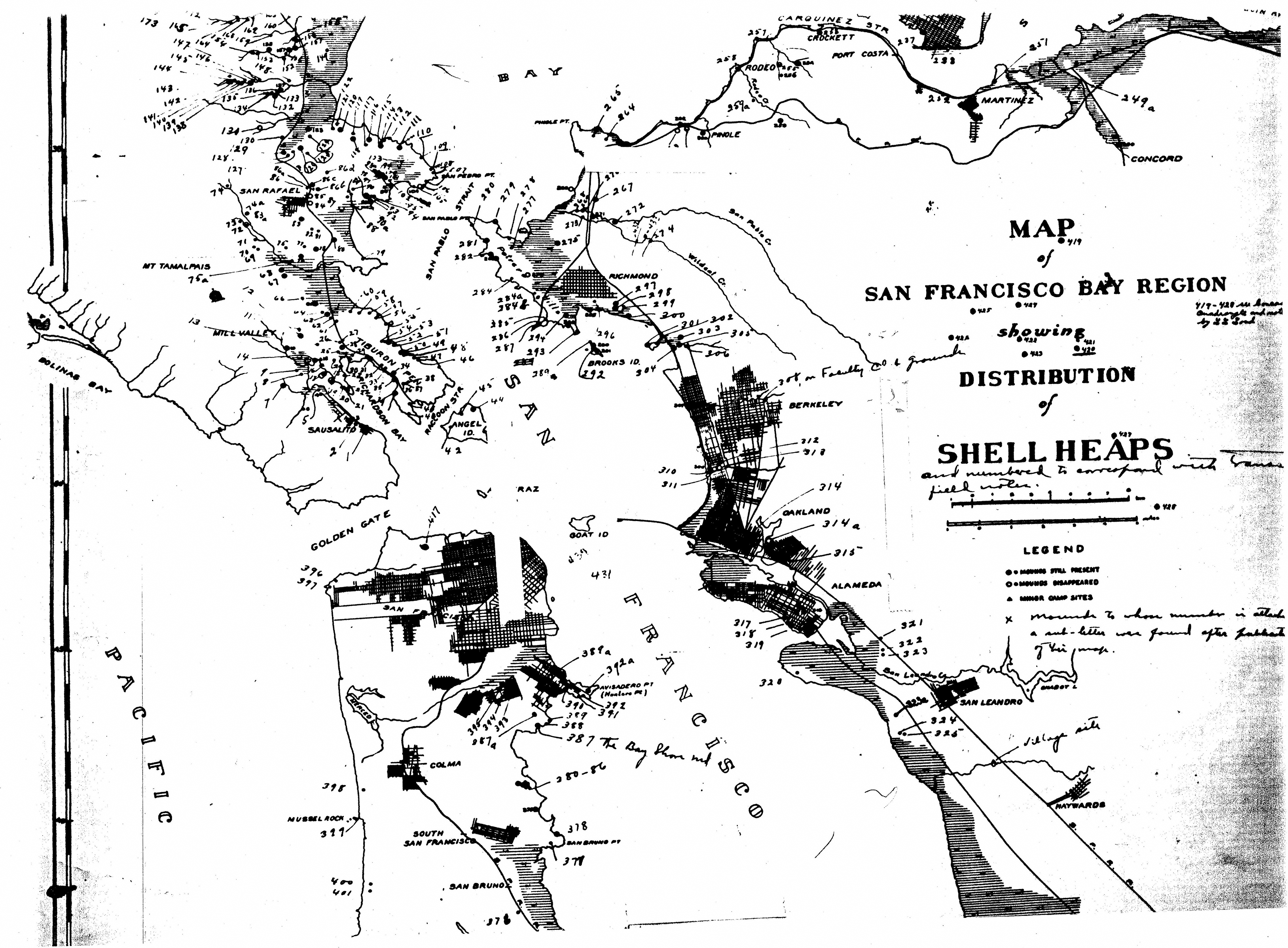
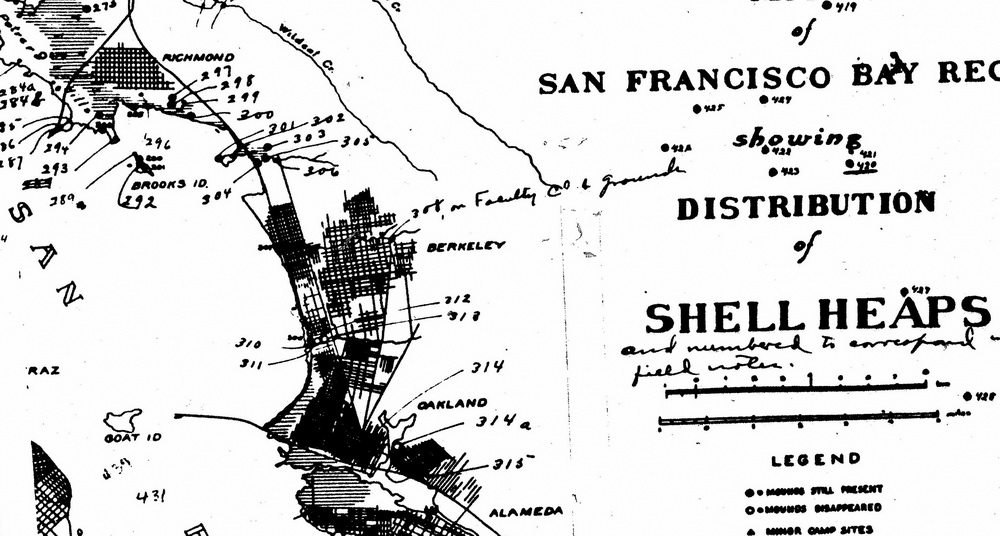
Map of the San Francisco Bay Region, Showing the Distribution of Shell Heaps along the Bay Area, noting mounds on the coast as Present, Partial and Destroyed/N.C. Nelson, 1909

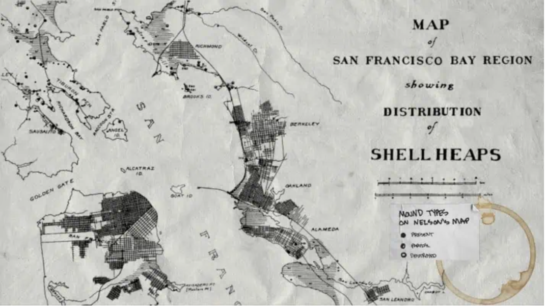
Map of San Francisco Bay Region, Showing Distribution of Shell Heaps (1909), Native History Project

As much as saddened by his death, Malcolm’s sense of the patrolling of the wild, or the edge of the frontier of wilderness, or just the shoreline, is a model for the persistent reminding of wilderness’ continued survival, and importance, to the world. Malcolm began as an East Bay Parks man, immersing himself in the 60,000 acres of east bay parks, far beyond the shore, For the relatively quite recent transformation of the parklands from open space bears historical traces not so far from living memory of the historical habitation of its open space, and the preservation of of the old shell-mounds in the recent historical record, and indeed present in local tangible artifacts that offered a new means and a pressing one to understand the history of many of the forty parks .

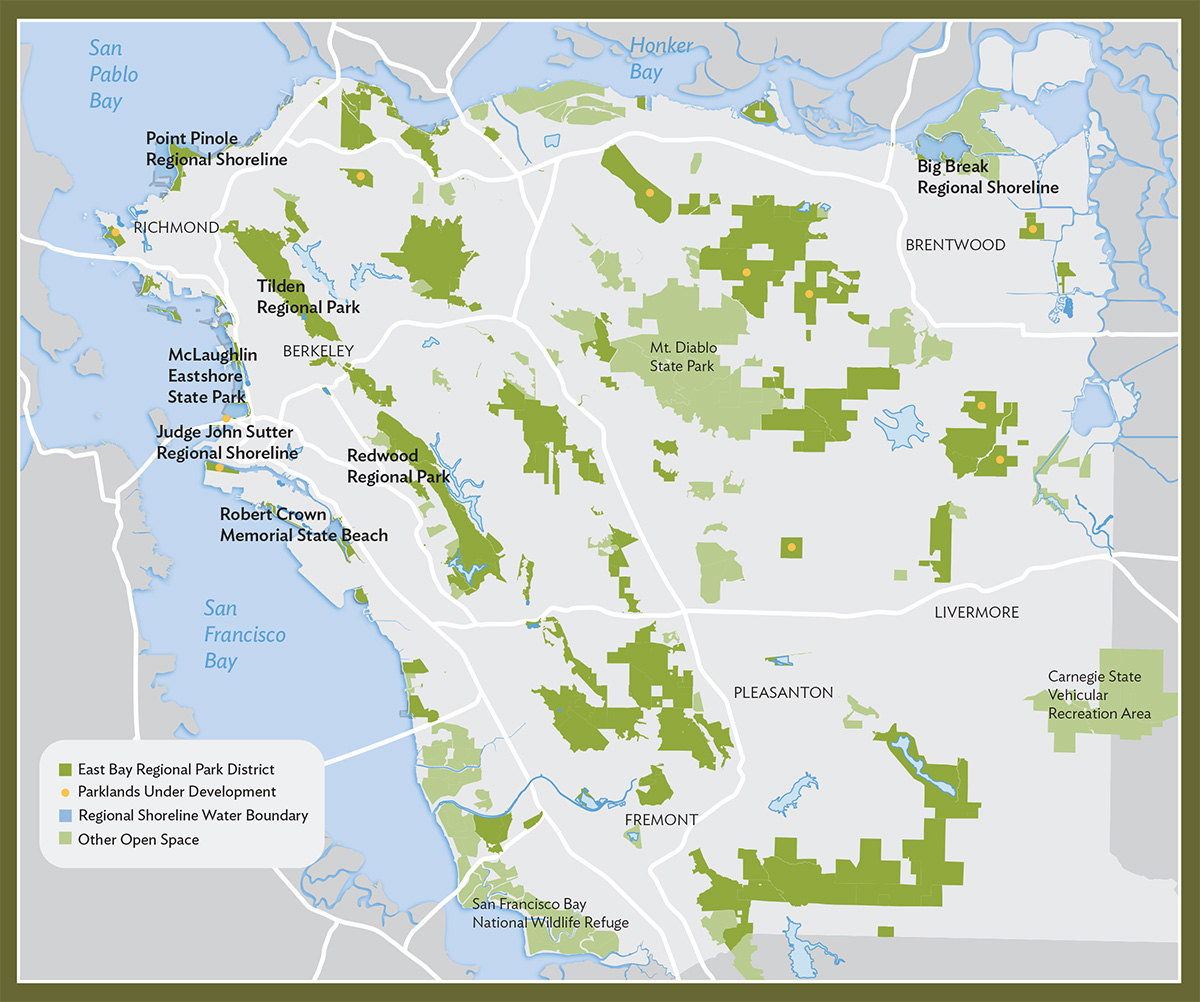
East Bay Regional Park District Today (2024)

The areas that were only just being explored, camped in, and lived in were something that he recognized as a valued historical repository, and indeed one to celebrate as part of the Bay Area. If Malcolm gained a new sense of himself in the East Bay as a ranger in Tilden Park, his unique brand of celebrating the region beginning from the orientation of the community to its parks, Malcolm was always looking for the survival of the wild. The light green overlaps of this map of the regional parks, or this modern expansion of the Regional Park District that exists today, omits much–the rich and enormous stately live oak trees, whose rich and nutritious acorns made the region a veritable storehouse of a plentiful supply food gathered, hulled, dried and stored as a nutritious staple later boiled as mush; or the seagrass of the Bay Area shores, that made the shore such an important meeting place and trading post for different tribes; or the willow stems and reeds in coastal marshes and rivers that are woven into baskets. These are of course among the layers of East Coast history, not evident in most data visualizations, if any, by which Malcolm taught many to re-see or see again the region of the East Bay–or offer, to cite John Berger, several ways of seeing.

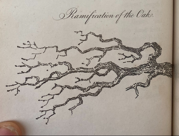
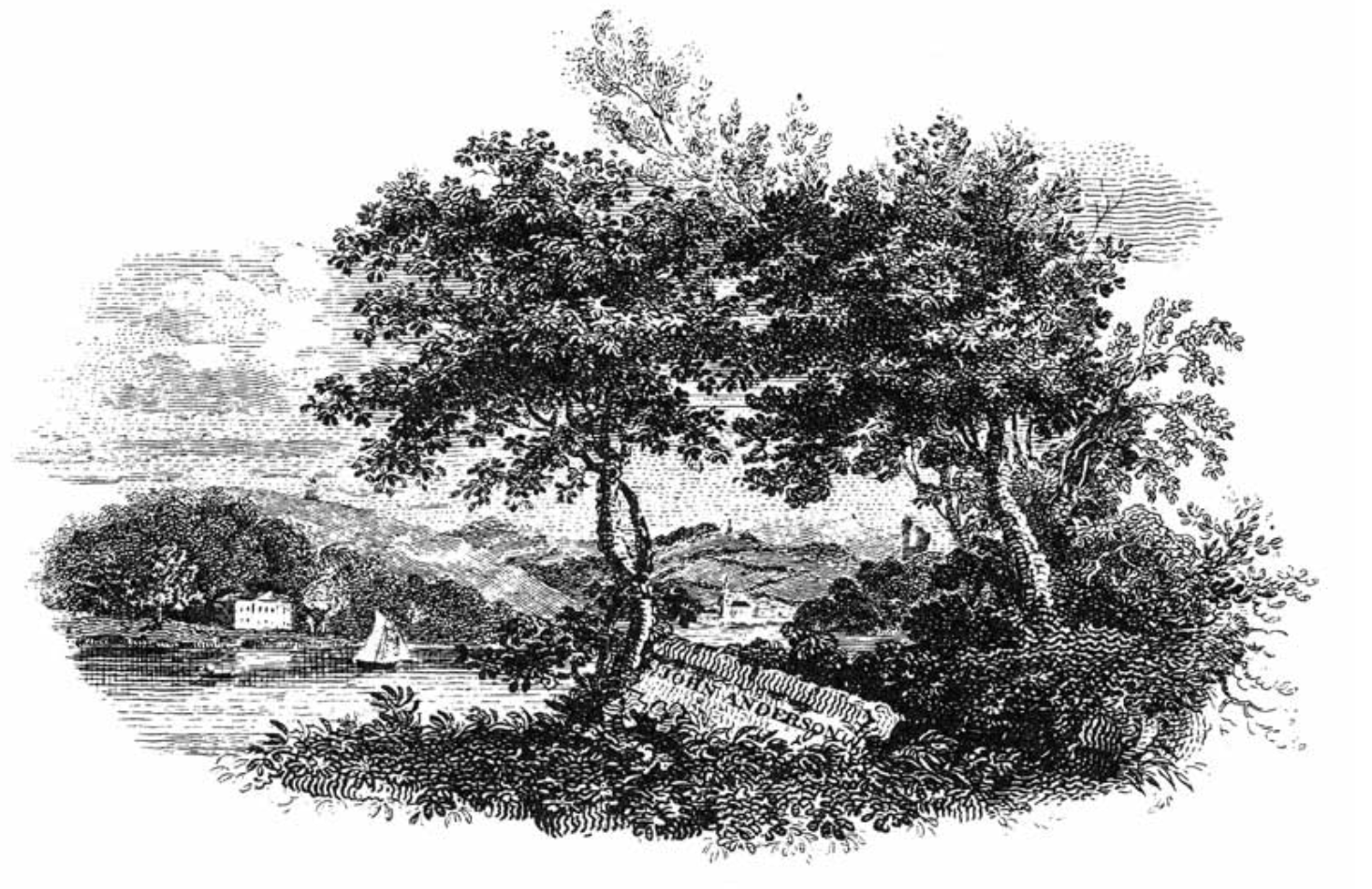
Perhaps it was during his stay as a ranger living in the park, touring visitors, and walking its paths, the arms of towering native live oaks of up to two hundred and fifty years old stand as witnesses of another age seemed to welcome him. Is it a coincidence that the cover illustration of Carl Dennis Buell of The East Bay Out, Malcolm’s “Personal Guide to the East Bay Regional Parks” written after leaving the Parks Service, featured in silhouette the capacious canopy of the elegant towering tree? The Enlightenment image of the Oak Tree on the cover of Malcolm’s book might have belonged to the engravings of the great English naturalist Thomas Bewick, who admired the brachiation of the oak as a source of divine marvel–a marvel that Malcolm seemed so eager to recuperate and transmit as a form of resistance during the shifting settlement of the East Bay. If Bewick became an engraver–and indeed raised the status of engravings–to communicate trees and avian riches of his native Northumbria, in boxwood woodblocks, that elevated wood engraving to a register of natural description, Malcolm became a printer to promote the Bay Area as a rich habitat, and increasingly as ancestral lands worthy of veneration and of better preservation, to encourage a sense of wonder and amazement by communicating the depth of his feelings about the East Bay.

Bewick was an early naturalist of the modern world, an author who brought attention to the rendering varied leaves and branches, birds, wildlife, and rustic places to the eye by borrowing the engraving burins to capture the gnarly branches of oaks laden with leaves in wood plate with a density of fine lines–opening to the world a warm generosity of wooded life–

Engraving of Live Oak after Thomas Bewick’s Engraving of Oak Tree

–it is hardly surprising that the great naturalist’s rendition of the generous canopy of the oak became something of an icon for Margolin’s own guide to the Bay Area, East Bay Out, the unknown “outback” beyond the built up area of the Bay, a sort of forager’s guide to the riches of wilderness akin to Bewick’s own investigations of Northumbria–

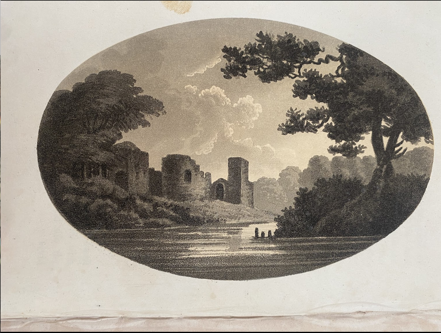
Thomas Bewick, Engraving of Oak Tree Dwarfing the Nearby Town

The oak trees that Bewick became famous for engraving–as birds; inhabitants of wooded lands–intentionally shift our focus of attention as readers of his books from the towns they lived in to the surrounding natural world. The images of the woodsmen who were more engaged in nature were Romantic icons, but, as a modern-day Thoreau, focussed on the natural world in place of the built world, less concerned with human engineering or artifice than the importance of attending to the surrounding natural world in Northumberland countryside that he most often drew, calling attention to its oaks, birds, and outdoors to offer a unique angle on the industrializing landscape.

If lying off of the beaten road, and outside built environments, showing other forms of life far from the city, foregrounding on details of the landscape the cleric William Gilpin had focussed attention, akin to moments of rural repast, drinking waters of fountains and waterfalls from a traveler’s leather hat.

Thomas Bewick, Tail-Piece of History of British Birds (1821)

There was a Thoreauvian sense of transcendence of the local that animated Margolin’s attention to the environment, of which the oak might stand as a transcendent icon. Although oak moths have recently arrived in the richly brachiated canopy of the large coast live oaks in UC Berkeley, as they regularly do, feasting o foliage of the Quercus agrifolia for multiple recent years–2019, 2020, before again 2025–and prematurely cause grey and brown litter of leaves to fall in heaps, live oaks endure the regular pillaging of leaves, returning to their familiar evergreen in a manner of weeks, as they regenerate buds, leafing out once again in a matter of months. suggesting the huge vitality of trees that seem sick. The rapid recovery that the coastal live oak makes regularly from the onslaught of voracious caterpillars as the e California oak moth strip the trees of their expansive verdant canopies without impact on the trees’ long-term health, as within three months they leaf out, regaining health almost suggestive of a rebirth by deep reserves of energy–making it unsurprising Malcolm adopted the distinctive tree as an emblem for much of his work. The brachiation of that oak branch recalled the eighteenth century aesthetic renderings of Reverend William Gilpin, one of the earliest coiners of picturesque “landscape,” with a scientific attention to detail, attening to natural forms as if revealed truths–admiring that “peculiar kind of beauty, which is agreeable in a picture” as able to provoke a discerning interest in the wilderness as providing esthetic forms–

The branches of the oak were an aesthetic opening of attention to the country–and provided Gilpin with a basis to ask his viewers, similarly, to adopt a new attitude to expanding cities, guiding their eye past those branches to the human space in the backgrounds of his paintings, cannily situated far behind those gnarly oak branches that frame historic ruins, far more worthy of attention.

The live oaks around Berkeley were part of the animate landscape that endured across time in the regional parks today whose green leaves regularly return even after their branches are stripped bare, taking part in an ecosystem they almost miraculously seem to refuse to leave. The brachiation of the oaks had been something of a pillar of natural history from the late eighteenth century, as naturalists as Thomas Bewick called attention to the brachiation of oaks within the complexity of natures worthy of marvel–an ancillary art to Romantic poetry, and William Wordsworth even vowed “that [if] the genius of Bewick were mine / And the skill which he learn’d on the banks of the Tyne / Then the Muses might deal with me just as they chose / For I’d take my last leave both of verse and prose.

Thomas Bewick

Malcolm was perhaps less willing to wear only one hat as a guide to the beauties of the unbuilt regions of the Bay Area, but more eager to play the Pied Piper to a generation in the outdoors.

2. The towering coastal live oaks in Berkeley inspire awe in their brachiated canopies,–maybe an awe Malcolm picked up, of going native in the arranged marriage between himself and Berkeley. The arranged marriage to the Bay Area may have arisen out of convenience and necessity but developed into one of mutual admiration and respect was deeply nourishing and profitable to many, born out of deep sensitivity to place and to forest grounds he encountered in the East Bay. The rich guide that he provided to the “outer” East Bay became almost an ecological resource of its own right, a prompt to preserve its wetlands and restore its parks, to act as a custodian of open space and forested hills, even in the fear of fires that has come to grip the region in later years.

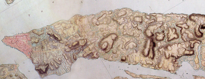
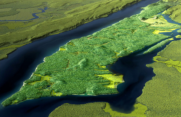
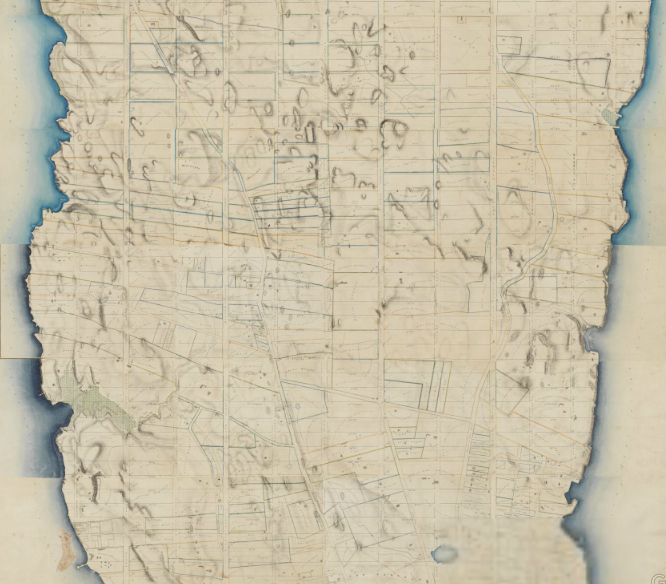
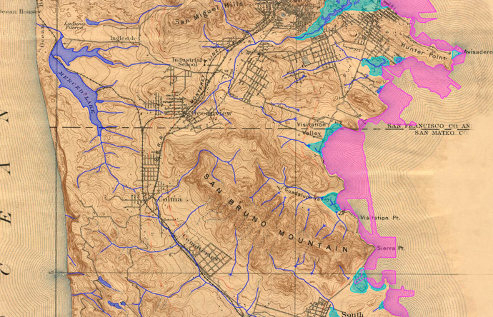
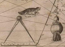
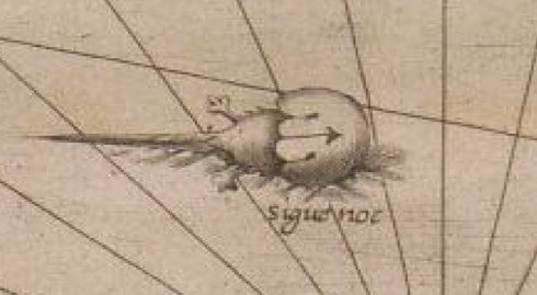
It led to a readiness to question the authority of the modern map–to see the “East Bay Out” in other words–and relish the absence of all anthropogenic presence in the first maps of a seemingly pristine Plane de Puerto de Sn. Francisco” (1776) of a fortuitous date indeed by José de Cañizares–stored by the Bancroft Library, the very year that Americans declared independence from England,–that offer a caring attention to the estuary and tidal marshals of the region, and its bay waters:

José de Cañizares, “Plano de Puerto de Sn. Francisco,” 1776

–long before, Malcolm would be the first to tell you with a large knowing smile of taking real satisfaction in an incontestable fact, Americans had arrived in San Francisco. Those drought dedicuous live oaks were indeed among the plants that native Bay Miwok and Oholone people had increased in their biodiversity in the canyon woodlands, offering year-round specialties as acorn soup, leaving a lasting imprint in the range of oaks, each tree able to provide up to 10,000 acorns and offering rich habitat for animals who would bury many of the acorns stored underground.

The trees offer a rich and often drought resistant canopy for birds across much of the state, that allowed the Coastal Live Oak a corner species for coastal ecosystems up to eighty feet tall, their dense green foliage often improving the health of nearby plants year-round, in a more recent map. I think of Malcolm as able to toggle between both maps, but as realizing the need to allow multiple ties between art and cartography, and recognize the poverty of relying on data-driven maps–an implicit point to which this section of this post will return in hopes to make his case. For indeed Malcolm, as much as anyone, was crucial in redefining how “we” see the East Bay, and the identity of the East Bay as a region over time–from the time of first contact, when a group of starving white European colonizers in rags arrived on the coast of what would be Alta California, and gave it its name as a region by 1804. Malcolm was interested in peeling back that map from local informants who might help tell the tale of how it existed earlier, a real “historian” of historical anthropologists.

Population of Coastal Oaks in coastal California/National Institute of Statistics and Geography

Perhaps from when Malcolm made a decisive stand of resisting wearing the uniform of a parks ranger–a moment I have long imagined was a deep-seated conviction based on the deep sense of kinship he felt to the stewardship and identification with the land–Malcom was listening to local signs of evidence of the Bay Area lands he loved so well, and his attentiveness to the bonds of local inhabitants to the lands, as much as the shores, in no small part led to a new awareness of the local indigenous settlement of the region, and the poverty of failing to appreciate indigenous inhabitants of the region as custodians of the lands he knew so well, whose lives are impossible to separate from it. The sacred nature of relation to the land that was fed by some thirty creeks, filled with freshwater fish, animals, and many thousand species of birds, who Malcolm imaged might fill the sky so densely to block out the sun, suggested a powerful narrative of the loss of colonization and the absence of stewardship he felt today, before which a better map of the region provided a deeply therapeutic and indeed restorative function, inseparable from attention to those lands.

Indigenous Tribes and Native Peoples of the East Bay/image courtesy Sogorea Te’ Land Trust

The traditional names of the lands he was so committed to exploring and orienting others was inseparable from the map, but had been forgotten and left off of it–and one of the last final efforts of Malcolm sought to mobilize, where I got to know him better, was the ambitious project of remapping the entire state of California in ways to make the forgotten indigenous presence more centrally legible. Malcolm’s urgent message is of course increasingly pressing today, and continues, and the importance of the deep relation to the fragile topography that of a web of rivers that the Seogorea Te’ map above so lovingly details by light shades of blue and green, in place of cities, urban settlements, or property lines.

Encouraged by the fertile grounds of increased awareness of the needs for ecological stewardship of the land of an early environmental movement, from the Save the Bay campaign already founded in January, 1961, and in the Bay Area fertilized by Wendell Berry, and Gary Snyder, and nourished by the small non-profit presses–whose rights to the work of Berry and Snyder sustained them by digital sales alone. Snyder, who had studied anthropology and folklore by the transcribed oral tradition of Haida storytellers at Reed University, glossed glossed the oral literature as the creation of healthy art of mythic narrative vibrant with keys to the forgotten sustainable cultures of North America. Already possessing a poetic ear, Snyder read the transcription and careful translation of what ethnographers presented as a local Haida informant as a vital resource of a vision quest in an era we had lost a sense of orientation to animal spirits or birds, examining the “dimensions” of the myth as a needed resource, perceiving the animism of its telling as a living artifact and meaningful performance of culture. Did his reading of Haida myth provide a direction in which Malcolm would work? The early works of what are now environmental classics would certainly pay dividends for the independent presses. (When Margolin retired after Heyday press’s fortieth anniversary, it was robust enough to expand to Los Angeles, and be a fixture in the region’s as well as the nation’s literary landscape; renewed interest in new editions of Snyder and Berry’s works helped expand it expand catalogues to popular works, updating the classic corpus of independent Bay Area presses.)

Did the regional parks offer an alternative text by which Malcolm was eager to map the open areas that still existed, not yet encroached by development, as sites of continued wonderment? They certainly stood as evidence of a former wilderness, encroached by the boom of expansion of so many of the cities that make up the Bay Area, a boom that began in the 1950s, evident in this map that imagines the tree rings of local population centers around the Bay, many of which emerged only in 1960, that provide one of the most unique forms of growth of an urban agglomeration in an area where wilderness was precious: if the metaphor o f the tree ring offers a nice cartographic symbology to imagine the Bay Area as a site of uneven, but rapid growth, 1960-2010, in ways that overlap with Margolin’s heyday in the region he provided so much of an alternative counter-cartography, the expansion of cities like Concord, Fremont, Antioch, and San Jose that now form a dense inner core of the Bay Area that might be called the inner ring of commuting, was an incursion into open lands greenspace, where the parks provided evidence of the rich biodiversity and offered more than a refuge–but an alternative way of imagining its future.

Growth of Population in Urban Cities and Towns in the Periphery of the Bay Area, 1960-2010

One might grasp the force of promoting the regional parks as a critically important heritage of surviving biodiversity of a region that was compromised already by farming, wood harvesting, and the damming of some of the most nourishing rivers of the coastal ocean, including the San Pablo to create a large reservoir for drinking water by 1919, that compromised the rich ecosystem where early settlers describe catching salmon with pitchforks in its waters, and Malcolm would have sought the local informants for evidence of the rich topography he felt still survived, but had been preserved by a relative miracle of land conservation and preservation as conservation and preservation efforts were blooming in their own metaphor ecosystem around the East Bay.

This was the destination of the readers of the books Malcolm was beginning to set out producing, at the same time as conservationists were promoting illustrated books, often with photographs, of the natural treasures of the region, as the Sierra Club  Brower and founded and directed, 1952 – 1969), became a leading environmental membership organization whose aggressive publishing programs offered wilderness testimony in large format books foregrounding high-quality nature photographs, setting a model for bearing witness of the changing landscape and ecological risks that we faced, as he promoted a range of new parklands as repositories of memory,–from public organizing of opposition to the damming Grand Canyon and Dinosaur National Monument, to national parks not only on the seashores, as Point Reyes, but including the North Cascades, and the Redwoods, and protecting millions of acres of public lands. The media advocacy Brower pioneered in newspapers and magazines so deftly dramatically communicated conservation to new audiences, and crated a market for practices of conservation that Malcolm added his unique sense wonder.

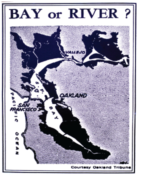
Before the Bay Bridge was imagined, Brower got behind the project proposed by civic engineer John Reber to dam not only the San Pablo River but to built a San Pablo Bay at the dammed San Pablo Reservoir, a project already so devastating to the ecosystem of regional grasslands. For Reber had in the late 1940s proposed a way to meet the postwar population growth in the region by adding a huge amount of landfill to the bay, ending its wetlands, and engineering two freshwater lakes that would divide the “Bay” into four zones, preserving but a newly dredged deepwater port in Berkeley. The almost forgotten plansto foreclose Bay waters and tidal shores showed little familiarity with the region–it might easily have been fully liquified by seismic activity!–but provided a model of the distance of local engineers of urban development and State Water Projects Authority from the custodial role indigenous had long played in maintaining the bay as a region of vital habitat, both of freshwater fish, sea grasses, and shorebirds–and the proposal for a massive construction project that projected the San Pablo Dam as a basis for the bay was only narrowly defeated due to the local activism–only after the over-eager U.S. Corps of Engineers builds a 1.5 acre hydraulic model of the Bay to test it, although the vision of barriers to bay waters stretching from Richmond to Treasure Island, essential to shipping channels, never survived the modeling of a bay comprised of landfill–a massive engineering project of terraforming before that world was used, luckily never realized.

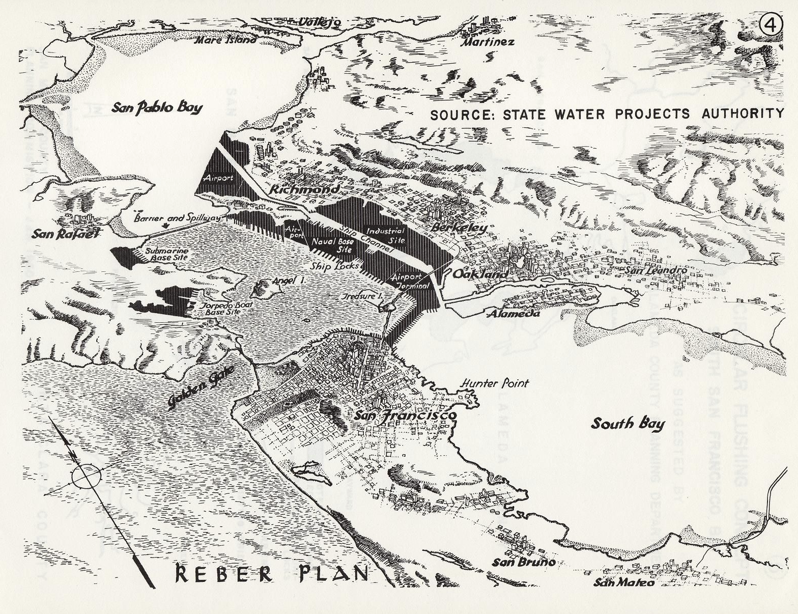
Detail of Reber Plan (1949) to filled in for a deepwater port, airports, and military bases (1949)

The ground for objecting to such plans for the threat of transforming the bay’s wetlands and natural habitat for economic markets and shipping lanes was rife–even if the liquefaction of the proposed landfill additions showed the accredited engineer’s almost basic unfamiliarity with the dangerous level of seismic activity that would be so prohibitive in any massive project of contracting the bay’s open waters.

The evidence of the inhabitation of the bay waters, increasingly threatened by development schemes, seemed to curtail any of the collective wonderment Malcolm dedicated so much of his life to cultivate and preserve. This included the expansive Bay Trail itself, replacing the old landfill to restore the shoreline to a space of vital habitat and healthy salt marshes, that might erase some of the imprint of rapid anthropogenic change, returning wildlife to the East Bay, and perhaps allowing the mists of the shoreline to be seen once again, if you squinted your eyes at the right time.

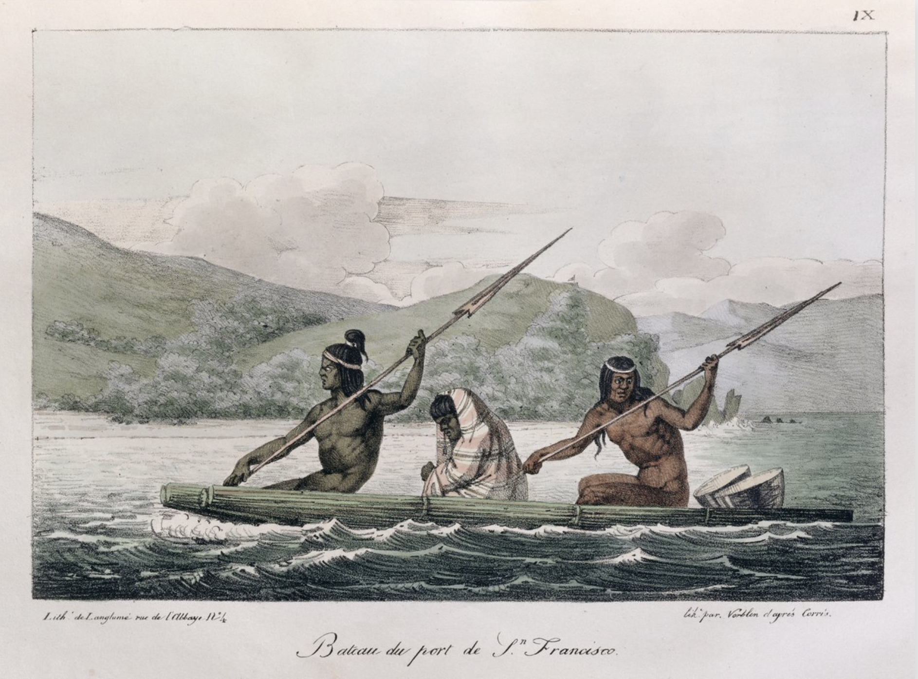
Louis Choris, Bateau de Port de San Francisco, c. 1815

The color lithograph of a ship paddled by indigenous residents of the Bay Area included in Voyage Picturesque Autour de Monde (1822) eroticized the west, as well as California, to be sure. The sense of reintroducing residents of the East Bay to the natural areas around them was more decidedly local for Malcolm Margolin. But as parks come under assault, and the sense of stewardship he celebrated by native inhabitants is being so openly and flagrantly disrespected by government, it seems important to remember how even in the face of an onslaught we have rarely seen in memory, Malcolm refused to be pessimistic, and saw himself as having had no reason to be so.

The awe before nature that inspired Malcolm, and that he always seemed to seek to inspire, urged we consider the enrichment of place that the Bay seemed to offer–its habitat must have provided a sense of encouragement and a sense of commitment he channeled from the descendants of native inhabitants. For Malcolm unearthed collective memories that he sensed in their stories and descriptions of the engagement with elements rathe than automobiles and automotive transit, offering a therapeutic alternative geography of the bay–and finding a real pharmakon of a new idea of space that needn’t be dominated by local real estate or what I’ve called the confines of automotive space amidst the increasingly congested stretches of commute that defines the Bay.

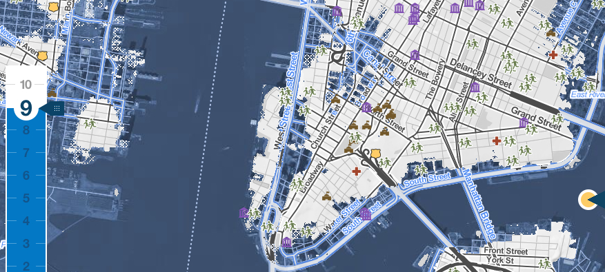
He actively explored and expanded the narrowing contours of a Bay Area increasingly defined and denaturalized as an expansive area of commenting, whose interconnections of traffic and highways. The automotive landscape of daily commutes have indeed offered a world of less and less connectedness–in contrast to the indigenous he reminded took themselves quite seriously as custodians of the land, without needing to see themselves as property owners. And as the construction of more and more paved space in the zbay Area fail to promise any sense of greater custody or responsibility for the land, our sense of the Bay has decidedly shrunk, as a recent exhibit in the Exploratorium’s Bay Observatory that asked visitors to map the San Francisco Bay has shown

.

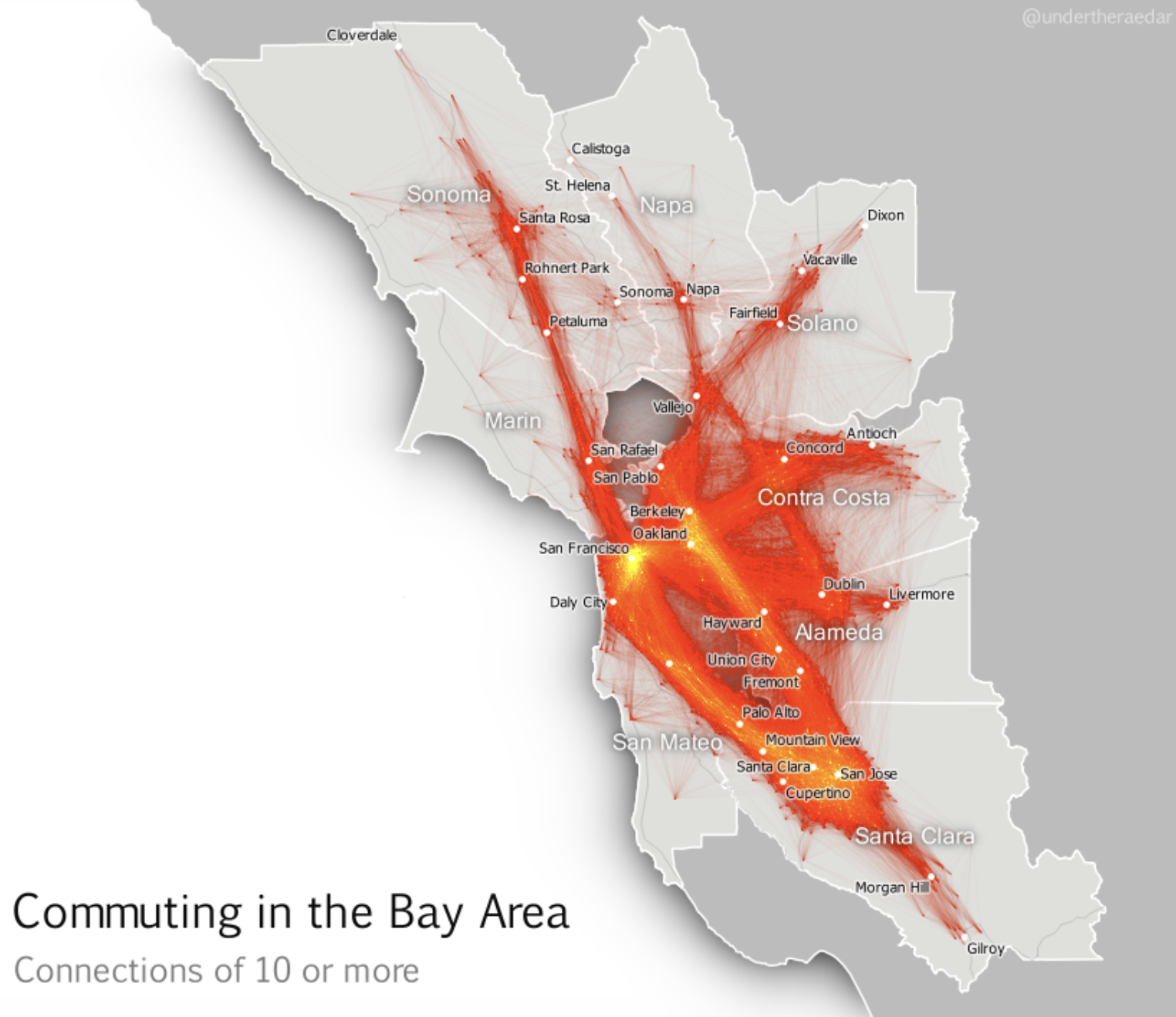
–or the pathways derived from the locations of over 10,000 geotagged social media posts that suggest the well-worn routes of automotive travel, compiled by Erica Fisher, that neglect large areas of the the East Bay, on roads that seem to fade into a white mapped unknown space.

Malcolm was energized from compelling others to explore and learn to re-recognize the riches of the region, and the state. Attendees of hisfinal projects were invigorated by his vision–or were encouraged and somehow empowered to feel the same way. His hopes for continuing celebrating an annual Festival of the Birds in Berkeley during the Trump era, ideated as engaging the public by a two-day extravaganza cum party featuring films, live performance, music, and art, in Malcolm’s style, as well as poetry readings and art-making sessions, and craft fairs, pointed to birds as signs of hope, and witnesses of the region. The festival celebrated the new habitat that the bayshore had indeed become, against all odds, a site of friendly avian habitat and attracted increased pelican, herons, egrets, geese, ducks, owls, and shorebirds to live in restored wetlands, as a continued sign of hope, if non-human signs, that Bay Area residents would do well to attend to. if birds provided a common language, outside of legal claims to ownership, to reorient ourselves to the land that can be seen as something like a living resource, the early decision to draft an “un-authoritative guide” to camping, hiking, and exploring that led to the new sense of authorship that Malcolm embodied, and the intense attention to local nature that midwifed the magazine Bay Nature, that continues to offer a new sense of orientation to better understand the natural landscapesf the Bay.

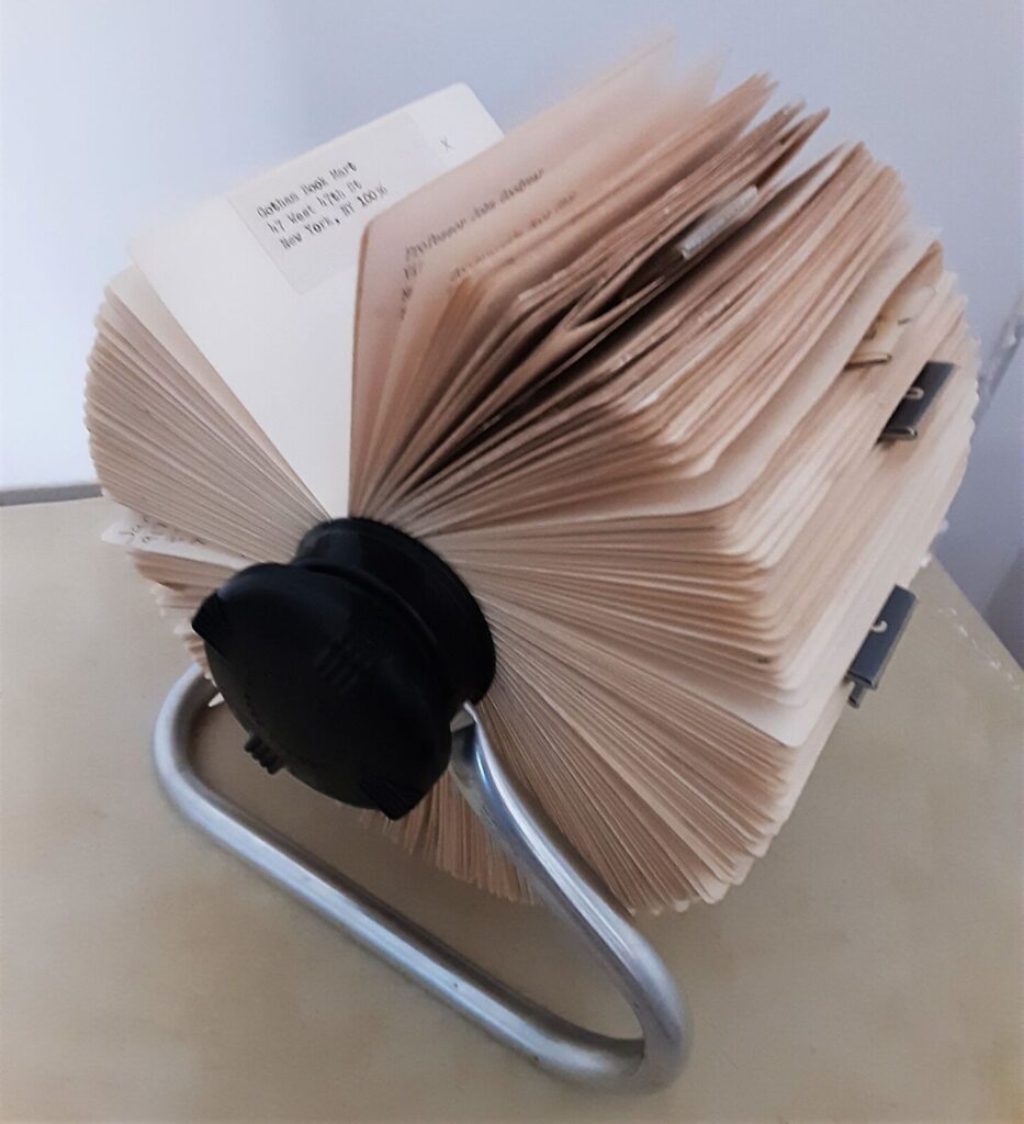
At the Festival of the Birds, I bought and picked up several hand-made bird key-rings made from colored beads. They were tokens of the needed uplift of hope that those small festivals provided, entirely animated by Malcolm’s rolodex and his animated presence, as a bobblehead in their midst, as if in a victory lap in the David Brower Center, but were also a remembrance of the power of birds to redefine our sense of place. If talking to animals was an indigenous trait Malcolm so celebrated, and were long tied to indigenous belief in animals’ souls, and the ability of speaking to animals long attributed indigenous by settlers not as possessing special talents to communicate with native animals, but to from whom they were seen as but a small step removed. The rolodex that was invented by Arnold Neustadter and Dutch designer Hildaur Nelson of Brooklyn NY in 1958 was initially marketed as a way to organize one’s professional and private life by a rotating card file became mastered as a medium by Malcolm as an active way he participated in public life, but joined private and public. The rolodex was far more than an archive, wielding it as a matchmaker moving in hyperspace, linking people, events, places and museums to animate ideas for a larger cause: it was almost able to keep up with the rapidity with which wheels moved in his mind. Malcolm arrived in Berkeley a decade after the Rolodex, in 1967, the Summer of Love, but used the invention that was Neustadter’s platform to vault out his father’s box-making business as a platform to enter the vibrant environmental and ecological community of a region associated with tech and Silicon Valley, that left a deep imprint on the Bay Area–as the Rolodex was able to survive the advent of computers, iPhones, and virtual planners. (It also offered an orientational tool for wandering Jews.)

This is important in the danger of affirming the parks and parklands, perhaps the first area that Malcolm got to know and worked in the East Bay, even if he acknowledged far more awe in, say, Yosemite than Tilden Regional Parks, which he knew so well. Despite growing visitors to national parks, and also the local parks where Malcolm Margolin got his start in the East Bay, their funding is for the first time increasingly at risk. The over eighty-five million acres that the Park Services manage attracted a record 331 million visitors last year, and park visitors provided benefitted local communities a $55.6 billion as well as supporting over 400,000 jobs, but the Trump administration has early cut a thousand park service workers–while predictably charging foreign visitors, as if a tariff on tourism, extra surcharges “to keep the parks beautiful”–but more national monuments and parklands stand to be sacrificed, as the President seeks to diminish national monuments far beyond the already striking diminution in size during his first term as U.S. President. And these include, famously, many monuments of indigenous native history, in danger of development for economic development and mineral extraction.

Trump distinguished his first Presidency by reducing the number of national monuments for the first time since Dwight Eisenhower, and reducing Bears Ears by 80% of its total designated size, the shrinking of national monuments and opening of forested lands to logging, mining, and extraction to increase America’s economic productivity or increase fire safety stands to be decreed without public input or review, and his Dept. of Justice Dept. has unprecedentedly acknowledged the President’s power to decertify or shrink national monuments judged “no longer are deserving . . . protections.” The shift in mapping protected national monuments and national parklands would open up the most sensitive lands to mineral prospecting, mining, and drilling; Doug Burghum tasked the Dept. of Interior to “review and, as appropriate, revise all withdrawn public lands” that might be opened them to potentially auctioning lands for oil and gas drilling and mining.

National Monuments at Risk of Opening to Corporations’ Gas and Oil Drilling or Mineral Extraction

Coming at the same time as cuts to park stewardship and preservation, the depressing dangers of a loss of access to park lands made me feel better by visiting the paths of the Claremont Canyon after hearing of Malcolm’s passing, and, in a visit to Yosemite, remember his vigorous faith in open land.

Continue reading

Leave a comment

Filed under Bay Area, Berkeley CA, California, East Bay Regional Parks, environmentalism, Malcolm Margolin

Blurred Boundaries and Indigenous Lands

Geodesy has increased the number of claims by extractive industries through remote sensing, and especially over indigenous lands. Yet crowd-sourced tools of geolocation have also enabled a range of counter-maps of indigenous native land claims that have pushed back on how industries that have increased access to the resources buried beneath the very lands to which indigenous groups have ancestral claims. Indeed, powerfully innovative webmaps like Native Lands–previously launched as “Tribal Lands”– provide not only a new standard for cartographic literary, but to change ideas of property–as much as give vitality to ideas of property within a new cartographic medium. Indeed, if the original moniker of “Tribes” suggests a non-state actor, the enhanced claims to a public voice in “native” lands suggests an alternative way to stake property rights, and acknowledge and redress the multiple land “cessions” that stripped indigenous property rights.

Boundaries were an invention of the enlightenment, creating clear lines of personal property as well as national bounds. The blurred boundary lines offer an opportunity for ethical redress of the lost of lands indigenous have roundly suffered from the uninvited Anglo settlers of North America, a counter-mapping that is alive and well on web maps. The decisive choice to blur these boundary lines reflects the cartographic preoccupations with which the American government long has regarded indigenous inhabitants–not only as the governors of states and then the federal government forced migrations of tribes into areas that they viewed as “uninhabited,” but as late as 1877, when the Secretary of Interior deemed “there is some difficulty in drawing a line sharp between the California Indians and their neighbors,” who, Stephen Powers told his superiors, “shade away from tribe to tribe, from valley to valley, so that one can seldom put his finger on a river or a mountain-range and say that here one nation ends and another begins.” If landscapes were refigured as bounded expanse, the attempt to inject a sense of on-the-ground experience in maps is the goal of the open source mapping platform Native Lands–an attempt to integrate indignity into the platform of mapping itself.

The cartographic undoing of the primacy accorded to settled land and settlers’ claims is not only revisionary, but a new reality we have rarely seen–the cartographic inheritance of the first settlers of North America eagerly imagined extending land claims westward to the Mississippi River, encompassing the Great Lakes in their maps–

–as if the claims of land might continue to extend westward, across what was seen as tempting green, fertile, and unclaimed, if perhaps not uninhabited, unordered lands populated by the Outworks, Outagamis, Osages, as the Uttawais in upper Virginia straddling to New York, Iroquois or Six Nations on the edges of Pennsylvania and New York, Missasagos north of Lake Erie in a nominal Virginia, Twigtees of Virginia, Cherakees in North Carolina, and Algomkins on the borders between Virginia and Canada, and Creeks in South Carolina and Georgia nestled within the borders of existing colonial land claims, as if their relation to the land didn’t need to be mapped, and had no borders of settlement–or rights–of their own. “Illinois” was “expelled by the Iroquois,” and the contested borderlands, but the conception of wandering or itinerant landless groups was clear.

A New and accurate Map of North America, Drawnfrom the famous M. Danville with Improvements from . . . English Maps, London, 1771

The map was printed in London with the benefit of recent cartographic sources from French Jesuits as D’Ainville as an invitation to settle North America, promising open lands able to be surveyed and owned by future immigrants, and an early evidence of envisioning America as a land of wealth, the landlessness of indigenous was clear. It was a legacy, moreover, firmly lodged in our nation’s own cartographic imaginary, that has long understood indigenous as outside of federal bounds. Indeed, the mapping of properties in the North Atlantic for English Plantation Owners in the British Empire saw no place for the very indigenous who were figured so prominently in feathered headdresses in the map of North America’s cartouche.

Indeed, the original 1755 map for the Earl of Halifax and other Commissioners of Plantations baldly all but invited the staking of claims to property as there for the taking across the entire continent!

Map of the British and French Dominions in North America (1755), Library of Congress

The mapping of property by straight lines and tools of surveying had promised the opening of the entire continent, as if without any objections or interference from those inhabitants who lived on ancestral lands. If the same pastel color scheme is adopted, for new ends, in NativeLands.com, the maps try to undo the tyranny of cartography in opening up the continent. For disregarding or blurring of any boundaries is a way of disenfranchising indigenous from the continent, and denying that any territory existing among a peoples long cast as lacking government and having or claiming a title to land. If one might succeed in mapping the inhabitants of a land continued to be seen as contiguous with an unbounded nature as better mapped by language groups than territoriality: even the largest of indigenous nations in the Central Valley of the state “have no common government, and not even a name for themselves”–just “a common language, with little divergence of dialects for so great an area as it embraces . . . but little community of feeling.” Rather than defend territorial boundaries, Stephen Powers noted in a North American ethnology Tribes of California, that tried to shoehorn indigenous into mapped states, tribes in the Sacramento Valley “believe that their first ancestors were created directly form the soil of their respective present dwelling-places.” Whether the language of borders and boundaries had been returned to in the expansion of the western settlements and the creation of reservations of bordered territories, already salient in newly mapped “Western territories” of the early nineteenth century, showing indigenous settlements in vague termsbeyond Little Rock, Louisiana, and the Kansas prairies.

The question of how to reconcile indigenous inhabitants of the new world with the tools of mapping states was.d long felt, an epistemological struggle, at heart, cast as a legal search to draw bounds on indigenous maps, less rooted in exclusive claims of property–the basis for western maps–or property laws. Rather than embody a “commons,” the long and tortured history of land sessions affirmed to native peoples, often signed under duress, without clear understanding of their consequences of what provided precedents for land claims, informed–or stand in uneasy dialogue with–maps of indigenous presence across North America, as rights of land use were marginalized from the 1830s, with the appropriation of indigenous lands sanctioned by the Indian Removal Act (1830). As the forced migration and approval of dispossession continued, Thoreau’s sought traces of indigenous inhabitation of New England–through the adoption and compilation of place-names and sites that he found of special significance to the nation–to push back against that Act, perhaps, as if to reclaim or restore symbolic awareness of that fast-fading past.

Thoreau returned eagerly to early maps, imagining an earlier era of cohabitation in the New World he imagined might be recuperated or intuited from Champlain’s 1612 “Carte Geographique de la Nouvelle France,” which he had idealized as capturing a moment of contact where natives were not yet mapped off a new national map. If Thoreau had little basis for creating blurred boundaries in his maps, NativeLands hopes to use online platforms to affirm the existence of precedents for the future, with the benefit of hindsight of the historical cessions that confined the indigenous presence of Americans into far more constrained territorial confines of current “reservations” and lands of indigenous governance–even in as small an area as Long Island, an area dear to Walt Whitman, who knew it as Paumanok in homage to its first inhabitants, and recognition of the early land cession of Algonquians resident in the region who in May 3, 1639, deeded the region to one Lion Gardiner of which the webmap shows a far more complex picture than Whitman rather idealistically and romantically imagined to derive from a historical document of the 1639 land cession signed by “Yovawan, Sachem of Pommanocc.”

Thoreau rather hopefully that he might access an accurate remapping of historical land-claims in his own native New England by an earlier print precedent. He viewed the early modern map as lenses to mediate an area of settlement before settlement and contact, soon after he had left his solitary retreat at Walden Pond. Although Champlain in 1608-11 only encountered the tribe he knew as the Armouchiquois while exploring the St. Lawrence River and Maine coast, he took far greater notice of their presence than the current federal government, or indeed the state of Massachusetts in its recently completed land surveys of privately held and public lands. Yet the historical map Champlain created of native peoples and fruits resonated with him as a deep tie to the land, leading Thoreau to retrace its contours to capture that primeval moment of real contact.

Clear designation of the past presence is oddly evident in notations of early modern maps, albeit outside of clear boundaries. Indeed, on the surfaces of many early modern maps, the capital letters of early colonial states commingle with the tribal presence of Shuman, usually mapped near the Rio Grande; Natchitoches, a Caddo-speaking people now located at the borders of Texas, Oklahoma, Arkansas, and Louisiana; the Cododaquio or Great Caddo on the Red River; Chicachas or Chickasaw of the southeastern woodlands, whose forced migration west of the Mississippi lost their ancestral lands in 1832; or Tchatas or Choctaw who once dwelled across what be came Alabama and Mississippi–or the Alabamans or Alibamu tribe, tied closely to the Coushattas, belonging to the Creek confederacy. These names, and others, legible on the map, as evident in the 1764 Atlas petit marine, were preserved in maps prior to American independence and sovereignty, can be seen as stylistic ancestors of the alternative forms of noting ancestral claims on web-based maps.

The growth of consciousness of ancestral land claims has promoted a need to accommodate property claims that had promoted a mapping of jurisdiction along clearly demarcated lines, ending or eroding indigenous land claims, and parallel the search for a new legal framework to acknowledge and recognize past claims of historical habitation that had been eroded by a treaties, land cessions from claims of collective possession, and fit a new legal language of ancestral lands often excluded from property law. After all, back in the famous if not canonic account of the Plymouth Plantation that the Puritan William Bradford wrote, the sites of Europeans were already firmly set back in 1650 on the “vast and unpeopled countries of America, which are fruitful and fit for habitation, being devoid of all civil inhabitants, where there are only savage and brutish men which range up and down, little otherwise than the wild beasts of the same,” perpetuating a quite distasteful image among Puritans–who saw the inhabitants as satanic in ways that are difficult to acknowledge–of lacking ‘civil’ grounds of inhabiting the selfsame lands, as well as being “cruel, barbarous, and indeed treacherous, . . . merciless [in their] delight to torment men in the most bloody manner.”

The rather hateful image Bradford painted meant that hey not only lacked license to inhabit the lands by property rights, but constituted a civil danger for those settlers who colonized them–or arrived to set up commerce and trade on them. Bradford, who wrote the Plymouth Plantation history in the immediate aftermath of the Peace of Westphalia, inscribed the New World as an anti-Westphalian order of no boundaries, akin to a state of nature, but also left open the possibility of inscribing the landscape in a post-Westphalian order, an imaginary of boundedness that was divided by frontiers and mapped indigenous outside boundaries around exclusion, an imaginary of space that has continued to inform the cartographic imaginaries of indigenous from early anthropologists as Alfred Kroeber’s maps of Indian languages in California to today–not imagining the indigenous societies of the world to exist outside of and in relation to a bounded state or miniature mini-states. To be sure, Kroeber, an upper middle-class German Protestant born in Hoboken, New Jersey, imbued with the ideals of Boasian anthropology was of deeply rationalist bent, if a proponent of cultural relativism, was an unapologetic positivist, if, as his fellow-student Edward Sapir, believed the individuation of what Sapir called ‘linguistic stocks’ were distributed in regions that did not reflect anything like national lines and allowed a flow distinct from race: as Sapir suggested that structurally unified linguistic groups in aboriginal America might spread over like-minded cultural groups, rather than being isomorphic with cultural divides, and indeed mingle with one another and go to the same intertribal religious ceremonies, the groupings of language are historically rooted, not coinciding with divides culture or race, and not implying a nation–so much as rooted in a distinct setting–

Alfred Kroeber, “Indigenous Languages of California,” University of California, Dept. of Anthropology (1922)

–the divides of “native California” Kroeber mapped stood as a surrogate for the absence of laws, or of national belonging or identity. Sapir, born in Pomerania but migrated to the United States at 5 years of age, must have studied with the father of American anthropologists worked with Kroeber to map indigenous languages after finishing his doctorate in Native American languages, was soon employed by the Geographical Survey of Canada given his expertise in indigenous language families as the Athabascan, Algic (Algonquin), Uto-Nahuatl, Southern Paiute and Chinkookian language groups, providing some of the first authoritative “maps” of regional indigenous languages, enticed by the manner that indigenous languages shook traditional assumptions of the origins of language, and committed to the study of linguistic typologies distinct from race or ethnicity, collaborating with indigenous informants and setting his sights under Kroeber’s influence on the Yahi language between the Feather and Pit rivers in Shasta county, the language of Ishi, the “last wild Indian” who claimed to ‘have no name because there were no people to name me,’ or left to speak his name. For Sapir, a German Jewish refugee, the problem of the study of disappeared languages as linguistic groups was painful, but must have promised a sort of weird redemption.

The problem of mapping the presence of past indigenous remained on the front burner of native peoples. The difficulty of mapping the inhabitation of the continent outside of a Westphalian optic of fixed boundaries, by European concepts of territoriality and land possession, posed problems of the mapping indigenous presence of an epistemic dimension. The cession of land and territory, and the removal of land rights, have been cast in this Westphalian optic, networks of migration, trade, and sacrality or social spaces of the indigenous societies–and their relation to entities like rivers, lakes, or mountains, fails to translate into a syntax of polygons and bounded edges,–even if these are the edges by which property and parklands are increasingly understood. This has pose a problematic that Tribal Lands seeks to resolve. How can the multidimensional relation to space among indigenous be figured or mapped?

The problem of the plurality of land recognitions that NativeLands documents in its mobile maps across America document the complexity of native land claims in its web maps as a bounteous flowering of a multitude of local claims that seek not only to evoke the ancestral lands, but to show the wealth of inhabitants who, far from wandering, regard their claims to land as historical, and indeed were compelled to historically compelled to cede them. By the mapping of actual cessions and land claims, the wealth of material the mapping engine assembles offers a radically different nature of continental inhabitation–inhabitation that long antedated the Puritans’ arrival.

The rich range of pastel colors in these webmaps suggests the range of claims that we must, moving forward, be compelled to entertain and would do well to celebrate. Modern Canada constitutionally only explicitly recognizes three groups of aboriginal or indigenous–the Inuit, Métis, and generic “First Nations”–the multi-color blocks of native lands and historic “cessions” of tribal lands suggested a new understanding of how Canada had long celebrated its multiculturalism as a “mosaic” and not a “melting pot”–but showed the divisions of the land claims of a plurality of indigenous groups never recognized by Canadian law–and still quite problematically recognized in public acknowledgements of respect for land long inhabited by indigenous or “autchothones” proclaimed with piety by national airlines whose flight paths criss cross endangered boreal forests that tribes have long inhabited.

Air Canada went to pains the national company took at presenting a land acknowledgment in the form of a public announcement to all passengers, as if a remediation of the incursion of their airspace. But the video quickly turns to promote the airline as a platform for personal advancement that actual indigenous elders–if not leaders–embraced, affirming the cultural mosaic called into question if not challenged by the shard-like divisions staked on NativeLands, and its maps of historical land sessions. The flight over land seems to acknowledge indigenous claims to regions of pure waters and lands of a boreal forest, that maps an odd acknowledgement of indigenous presence from the air–paired with testimonials from Air Canada workers of native parentage attesting to longstanding fascination with the planes flying above over native lands and in airspace that was never properly defined–and the company’s commitment to secure these rights, as the major national company of state-run transportation.

–that suggest a respect traditions from the perspective of the modernity of air flight–as First Nations asserted data sovereignty over the lands they inhabit by a system of automated drones from 2016, to build a transportation infrastructure available to communities often isolated from infrastructure roads–and the notable fact that Canadian indigenous constitute the fastest-growing population in Canada, a notable fact of increased political significance, raising questions of the integration of their communities that could be reconciled with the historical transfer of land in the numbered treaties, 1871-1012, to transfer tracts of lands to the crown for promises that were rarely kept.

The odd status of indigenous lands in the nation puts the national airline of Canada at a unique relation to indigenous territories in recent years: while Canada’s divided system of federal sovereignty has begun to affirm aboriginal title in legal terms, and recognize autonomy of regions of indigenous settlement within Canadian sovereignty of the entire nation, the status of First Nation’s title are like islands of federal supervision in provinces, leaving national agencies like Air Canada, which reserves Parliament’s legislative jurisdiction over “Indians and lands reserved for Indians,” in an outdated legal formulation, a unique and privileged ties to lands of aboriginal title: the title of the nation is understood as parallel to and not in conflict with historical title of First Nations, which are incorporated into the nation as islands of federal sovereignty which still exists over the regions of the Numbered Treaties, which have never been legally dissolved.

Numbered-Treaties-Map.svg

Numbered Treaties and Land Cessions with Indigenous First Peoples, 1871-1921

Is Air Canada, the national airline service, not acting as a proxy of the federal government in acknowledging the continued land claims of Native Peoples hold to old growth boreal forests below routes the airline often flies? The question of indigenous properties and indigenous autonomy is in a sense bracketed over areas Canada acquired from Great Britain in 1867 and purchased from the Hudson’s Bay Company three years later? The increasingly pressing question of how to acknowledge native sovereignty is hoped to be accommodated to the Canadian image of a “cultural mosaic” of sorts, and the NativeLands offers what might be best seen as a response to that mosaic–not an image of interlocking shining cultures of sparkling individuality, but the overlapping rights of possession not rooted in firm boundary lines, but in forests, rivers, and streams, not as a generic bucolic region out of cities or accessible infrastructure, but a new form of mapping, rooted in notions of neighboring places, and acting as a neighbor to places–and inhabiting spaces–that is distinct from an Anglo-American system of property rights.

To Learn More about the Indigenous Peoples of Canada, Click the ‘About Us’ Onscreen Tab”

For although the maps of Anglo settlers–attracted by the shifting global markets for goods, from cotton, to gold, to petroleum, all claimed without consent from their longtime inhabitants–erased or omitted local claims to land by those seen as nomadic, and of an earlier historical developmental stage, with a cutting logic of relegating their very presence to the past, the reframing of collective memories to inhabiting lands and regions offers a plastic and particularly valuable cartographic resource for remediating the future. The change parallels the first assertion of reversionary practices to land title, marked by. the Nisga’a Land Title act of 2000, which guaranteed title to lands outside of a historic chain of property deeds, allowing the determination of titles dependent on competing interests, by which the state can ensure ownership that incorporate traditional ways of recording property interests, outside of a property system of deeds: the new legal authority of the state may as well have inspired, this post suggests, a new form of mapping, in a webmap able to register mutually competing interests in compatible ways, rather than privileging historical titles of written form. In this sense, the growth of webmaps offer a new form of an open repository for competing claims, not linked to a legal system that has long favored colonial or settler claims.

The problem of a project of decolonization of course was greater than a map could achieve–but the relentless colonization of indigenous spaces and places needed a public document or touchstone to return. The presence of native tribes was never in question during the colonization of the continent–if one can only ponder the notion of the Library of Congress, Daniel Boorstin, who commemorated the approach of European and native cultures as so culturally fruitful for American culture, rather than one of loss. But how to take stock of the scale of loss? Northern California has been recently a site of active indigenous resistance to a legacy of colonization, the cartographic unearthing of land claims offers a new appreciation of increasing pluralistic possibilities of occupying the land.

Webmaps offer the possibility of stripping away existing boundaries, in cartographically creative ways, by interrogating the occupation of what was always indigenously occupied in new ways. Henry David Thoreau was plaintive as he voyaged down the Concord River, realizing how native lands had been not only usurped by the introduction of European grasses and trees, not only leading the apple tree to bloom beside the Juniper, but brought with them the bee that stung its original settlers; pushing downriver and “yearning toward all wilderness,” he asked readers, “Penacooks and Mowhawks! Ubique gentium sunt?” The signs of longstanding presence are not erased, but present on the map. And although lack of fixed boundaries on native lands have long provided an excuse to stake claims that exclude inhabitants who are seen as nomadic, or not settled in one place, and laying claim or title to it, and “without maps,” the blurred boundaries of NativeLands re-places longtime residents on the map, wrestling with the long-term absence of indigenous on the map.

NativeLands.ca

It is, perhaps, not a surprise that the crowd-sourced interactive website Native Land Digital that was the brainchild of Victor Temprano, in the midst of the heady environment, CEO of Mapster who worked on a pipeline-related project, circa 2016. The sourcing of maps for indigenous land claims was pushed by his own anti-pipeline activity that involved remapping the place of planned lines of transport of crude oil from the boreal forest south to New Orleans on the KXL project and to Northwest ports Victoria threatened native lands and the ecological environments exposed to threats by drilling and clearcutting and risks of leaks. The current live charting at a live API offers total coverage of the globe, as may be increasingly important not only at a time of increasing unrestrained mineral extraction to produce energy but the retreat of ice in global melting that will alter animal migration routes, thawing permafrost, and sudden drainages of inland lakes that might call attention to new practices of land preservation.

The rich API provides a reorientation to the global map promising a powerful new form of orientation. Temprano, an agile mapmaker, political activist and marketer, framed the question of a more permanent digital repository of a global database of indigenous geography, that put the question of indigenous map front and center on the internet globally. The product, that led to an ambitious open source non-profit, sidestepped the different conceptions of space, time, and distance among indigenous communities, or the blurriness of fluid bounds, and opted the benefits outweighed the costs of an imagined the collection of maps of ancestral lands in term by the GIS tools of boundaries, layers, and vector files, as a rich counter-map to settler claims, able to collate lands, language and treaty boundaries on a global scale. The dynamically interactive open-source interactive project, known for its muted pastel colors, rather than the harsh five-color cartography that reify sovereign lines that posits divide as tacit primary categories of knowledge, is subtly compelling in its alternative non-linear format, that invests knowledge in sensitivity to the contributions of each of its viewers: dynamic, and administered by a non-profit with native voices on its board.

It is, inventively, able to maintain the dual display of a site where one could easily navigate between native and Canadian place-names and explore “indigenous territory,” as if it might be mapped by mapping space onto time in the broadly used cartographic conventions that have developed and flourished in online mapping ecosystems–and offered the benefit of creating layers able to be toggled among to layers of treaties by which land was legally ceded, overlapping language groups, and a decolonized space that was particularly sensitive in Canada, where the ability to engage outside colonial boundaries had been placed on the front burner by extractive industries. There is a sense, in the crowd-sourced optimism that recalls the early days of OpenStreetMap and HOT OSM, of the rewriting of maps and the opening of often erased land claims that crashed like so many ruins that accumulate like a catastrophe as wreckage that has piled at the feat of an Angel of History who is violently propelled by the winds to the future, so she is unable to ever make the multiple claims and counter-claims in the wreckage at her feet whole, and the pile of ruins constituted our sense of the progress of the present, even as it grows toward the sky. Was this a new take on the cultural mosaic of Canada, now revised as a problem of staking claims to the visions of property that the land cessions of the Native Treatise of Canada erased.

The website was the direct reaction to the active search for possibilities of extracting underground petrochemical reserves on indigenous lands in Canada. The growth of the website north of the border however has resonated globally, underscoring the deep cultural difficulties of recognizing title to lands that was long occupied by earlier settlers. If many of the claims to petroleum and mineral extraction in indigenous land is cast as economic–and for the greatest good–the petrochemical claims are rooted in an aggressive military invasion, and are remembered on NativeLands.Ca as the result of abrogated treaties and land cessions that must be acknowledged as outright theft.

The history of a legacy of removing land claims and seizing lands where Anglos found value has led many to realize the tortured legacy–and the unsteady grounds on which to stand to address the remapping of native lands. General Wesley Clark, Jr. acknowledged at Standing Rock, asking forgiveness in 2016, almost searching for words–“Many of us are from the units that have hurt you over the many years. We came. We fought you. We took your land. We signed treaties that we broke. We stole minerals from your sacred hills. We blasted the faces of our presidents onto your sacred mountain. . . . We didn’t respect you, we polluted your Earth, we’ve hurt you in so many ways, but we’ve come to say that we are sorry.” Crowd-sourced maps of claims on NativeLands offer an attempt at remediation, although a remediation that might echo, as Chief Leonard Crow Dog responded at Standing Rock, “we do not own the land–the land owns us.”

Oceti Sakowin (Sacred Stone) camp near the Standing Rock Reservation, Cannon Ball, North Dakota, United States on December 6, 2016.

The sacred lands that had long reserved sacred lands in ancestral territory to indigenous tribes were indeed themselves contested at Standing Rock in 2015-6, when the 1868 Treaty of Ft. Laramie that assigned Sioux territory east of the Missouri River and including the water that runs through these ancestral lands as including the water, but the protection of these waters as within ancestral lands was not only challenged but denied by the proposed Dakota Access Pipeline, even if the water runs through Sioux territory, as it long had, leading the Sioux Nation to bring suit against the US Army Corps of Engineers for having planned the pipeline through their ancestral lands, and attracting support of military veterans who objected to the continued use of Army Engineers to route the pipeline through historical and cultural sites of the Upper Sioux that ran against the lands reserved fort he Sioux nation.

Indian Claims Classification Determination of Sioux Territory across Missouri River

The challenge or undermining of ancestral claims to land by the DAPL offered a basis for accounting or tallying of the respect of previous treaties and land claims. In the rise of the webmaps Native Lands, a new and unexpected use was made of the very cartographic tools that facilitate international petrochemical corporations–and indeed military forces–to target lands valued for mineral production with unprecedented precision have helped to stake a claims for the land’s value that undercut local claims to sovereignty. The website offers a way to preserve claims that were never staked earlier so clearly, and to do so in dialogue with broken treaties as a counter-map taking stock of the extent of indigenous lands. It is as if, within the specters of extractive industries’ deep desire to possess the targeted energy reserves, and at the end of a history of dispossession and destruction, the indigenous that were systematically killed and removed from their lands over the nineteenth century, at whose close 90-99% were killed, in a massive and unprecedented theft of land, forcing them from migratory habits to receive religious instruction and live on bound lands to which they were confined. In Canada, where NativeLands grew, displacement of land rights began from clearing herds of bison herds from Prairies to begin construction of the Canadian Pacific Railway, the principle commercial artery to the West, that had by 1869 shifted indigenous resources to rations that rarely arrived, to be replaced by cattle on lands settled by European farmers and style of agriculture. The melancholy history Plenty Coups framed of the extinction of Crow sovereignty went beyond land rights: “when the buffalo went away the hearts of my people fell to the ground, and they could not lift hem up again: after this, nothing happened.”

Time stopped because the imposition of new modes of agrarian regime recast native lands as terra nullius to be settled by Anglo and European farmers, a surrender of land title from 1871-1921 that nullified local land claims. The cartographer and framer of the U.S. Census, newly appointed to what would be the Bureau of Indian Affairs, Francis Amasa Walker conducted the first review of 300,000 Native American in the United States of 1874, trying to sort out the theft of land over four hundred treaties. Walker’s agency was not clear, but if he bemoaned theft of ancestral lands fertile and rich with game, confined in land that could not support them and dependent on rations, there is some sort of redress in how the NativeLands maps invites us to retrace the sessions of lands that undermined these indigenous land claims, erasing the nations not deemed fit to have place or stake belonging in American made maps that Walker helped to codify, placing the loss of land that Plenty Coups did so much to try to protect and retain, against all odds, in making trips to Washington DC to allow Crow claims to survive in this new White Man’s world. Even if the claims that he preserved were less than they had been originally allotted–just 80%–he forestalled desires to claim land for gold prospecting and mineral extraction that are effectively on the cutting block once again today.

Continue reading

2 Comments

Filed under California, data visualizations, indigenous land claims, native lands, tribal lands

The New Arid Regions of the United States

The southwest and states east of the Sierras magnify the effects of global warming in the intensity of their aridity. But global warming reveals a new relation of regions to overheating, and reveals the depths of inflexibility to accommodate water scarcity, as well as the tragedy of its effects. As aridity of the soil and reduction of groundwater reaches unprecedented scales, our passivity is accentuated as we are suspended before maps that try to visualize unprecedented aridity magnified by global warming and its magnifying effects.

For the cascading effects of warming on the land and environment might be mapped in ways that cannot essentialize the greater “aridity” of the region, but the effects of increased aridity of soil, air moisture, and dry air on a region that we have remade into a region of food supplies, agriculture, and livestock, but, beyond, on hydropower. While the Colorado mountains long provided an effective basin to gather rainwater for western states that have been funneled to state reservoirs for agricultural irrigation, the man-made irrigation networks were drying up as the snowpack determinedly fell, and warmer temperatures evaporated what snowpack fell.

The logic of this longstanding pattern of appropriation of water from across the Colorado Basin was in a sense begun with the Hoover Dam, but was, writ large, organized by very process of appropriating water rights to redistribute water that had been enshrined in California from the turn of the century, circa 1914 and the policies of filling reservoirs to redistribute water rights. While we have considered appropriative water rights a distinct feature of how water is redistributed unique to the Golden state, the appropriation of water rights by reshuffling of water in state’s now precarious supplies how diverts over 99 million acre feet of surface water diverted along the Sacramento and San Joaquin Rivers to farmland, created a powerhouse of national agriculture. Much of the 75 million acre feet that flow from reservoirs across the state evaporates before it arrives at crops, however–far more that actually reaches the farms or cities.

–and the growing heat of the Great Plains have likewise diminished surface flow of the Colorado Basin already reduced by diminished rainfall. The increasingly warmer atmosphere of recent years has created a new “Arid Region” of the United States, of even greater aridity than when it was first mapped by John Wesley Powell in 1890, and the renewed aridity of the region not only challenges the calculus of water distribution according by appropriative rights that is structured by the Interstate Compact, but the very logic of redistributing water.

The past two decades have seen the departure of seven trillion gallons from Lake Mead, the largest reservoir on the Colorado River, holding rainflow from the Upper Basin before it crests the Hoover Dam. The drop will trigger hydrologic stresses across western states, as ever ever-increasing amounts of water are sucked up into drying out air and atmosphere, requiring more abundant irrigation of croplands and grazing grounds. This new and expanded “Arid Region” suggests a return of the repressed, returning at even greater scale and aridity to haunt the nation by a lack of groundwater again.

Evapotranspiration Rates in Colorado River Basin, Landsat 13

that is not to say it ever left. But the solutions of diversion have been undermined by the cascading effects of climate change and increasing temperatures, across an expanse of irrigated lands where water from the Upper Colorado, as from the western slopes of the Sierra Nevada, are funneled to cities, farms, and irrigation projects, and used to generate electricity. Even as Californians and westerners face the threat of further fires more destructive than any in recorded history–potentially enough to energize an implausible recall effort in the state of California–we face the problems of managing not only historic drought, mandated energy shortages, reduced water supplies. The climate crisis appears to have provoked a deep crisis in leadership, but one without easy means of resolution.

The most improbable political candidates–global warming skeptics after Donald Trump’s heart–have argued drought, wildfire, and electrical storms reveal Gavin Newsom’s lack of leadership, even as they stridently object to aggressive climate legislation aimed at emissions reduction as restraining the free market business,– preferring a free market approach for all climes that would be the laissez-faire redistribution of water to the highest bidder, monetizing a scarce resource to consolidate financial profits and gain in response to diminished water supplies.

As more water is being released from Upper Basin reservoirs to make up for the shortfall in Lake Powell, but the shortage of water in Lake Mead–the largest reservoir in the United States–to less than 40% capacity by 2022 will mean reducing water for lower basin states like Arizona of 812,000 acre-feet, Nevada–by 21,000 acre feet, and Mexico, by 80,000, that have led to the call for new “water markets” to be created across the western states. Indeed, even western states no longer carry the brunt of increased use of freshwater for irrigation–

High Country News

–the demand for conserving water in agriculture is increasingly incumbent on western states, so much so that the shift to less water-intensive crops–like California’s almonds–at a time when many crops require more irrigation, and a shift toward fewer acres of pasturage for livestock–good luck–have become a necessity. Increasing the efficiency of irrigation systems is necessary–ending customs of flooding fields, increasing drip irrigation, center-pivot irrigation, or micro-irrigation, in a New Deal for agriculture, even regulating irrigation systems before water markets price rural communities out of their accustomed access to freshwater. The increased trend toward shifting the distribution of water by “water markets” from lower- to higher-value use is dangerous for farmers, and indeed all rural areas, but also for the western ecology, as it would be the most difficult to preserve water in rural communities or farming areas less able to pay for pricing of water for higher use-value, although they currently consume over 70% of the water in the Colorado basin, or encourage sustainability in regions that are increasingly facing realities of sustained drought, if not megadrought of unprecedented intensity.

United Stated Drought Monitor for Western States, October 2021

Yet the systems of allocating water from the Colorado River by a system of dams, diversions, and canals have led to broad calls to end further projects of water diversion, as the diversion of water to western states may be drying up itself by up leads to calls for new policies of allocating water, not based on the highest bidder, as the river we have made increasingly mobile across boundaries will be divided or redivided between agriculture, urban use, indigenous Americans, and land trusts, as we are in need of redefining the working basis for conserving the redistribution of water rights beyond capture and diversion, and outside of existing water markets and appropriative water rights within states. While the Bureau of Land Reclamation has run the reservoirs, dams, canals, and hydroelectric plants and contracting with individual districts, a broad reconception of practices of regulating water markets, allocations of water, and costs of large-scale water diversion, as demand for water outstrips supply.

Yet as increased farmers are withdrawing water from the ground, or from rivers, from California’s Central Valley to the Lower Colorado River Basin, in Arizona, New Mexico, and Nevada, the need to reduce the eighty percent of water dedicated to agriculture across the west will demand new practices of conservation, beyond what John Wesley Powell mapped, in 1880, when he advocated new practices of land use, as climate change increasingly destabilizes the Basin, including the thirty sovereign Native American tribes along the river basin. The need to manage demand and riverflow that will begin with the start of the “Tier One Shortage” from 2022, will introduce new rules on water-use and supply that stand to reduce the amount of water flowing to Arizona by a third. Water diversion from the Colorado River has transformed the land west of the hundredth meridian by re-engineering its flow to make the “desert bloom.” Yet the recent dramatic reduction of rainfall, river flow, and increased aridity of the lands, leave us contemplating the viability of relying on water diversion.

John Wesley Powell, “Arid Region of the United States, showing Drainage Zones” (1880)

The new arid region is reflected in weather maps, but will be a region of radically reduced piped water and a new landscape of hydrologic diversion. If the “Arid Region” was mapped in earth-tones of clear distinction as a cautionary way by explorer and geologist John Wesley Powell, to alert the government to the distinct climate of lands west of the hundredth meridian, the recent area is both based on more detailed and specific remote sensing records, often from satellite observation, but suggests a far more complex area to manage.

For the western states are linked, both by projects of water diversion, and by hydropower, to a region where rainfall and snowpack has declined, and far less water enters into the river-flow of the rivers whose diversion allowed the expansion of agriculture and livestock across the western states. Due to global warming, the earlier “arid region” expanded, returning bigger and better than ever since it was described as extending west from the hundredth meridian by John Wesley Powell, in one of the foundational maps of climate aridity. In today’s parched California, dangerously low levels of rainfall across the central valley seem to belong to the Arid Region. But we have hardly come to terms with its new expanse or migrating edges. The “lands of the ‘Arid Region'” that Powell had hand-colored with earth-tones to communicate the dramatically falling rainfall west of the hundredth meridian long ago mapped a biting response to the eagerness of homesteaders to Go West, cautioning about constraints on water-rights that division by states–rather than drainage districts–would bring. If current rainfall maps of USDA or EPA seem to engage in dialogue with Powell’s old polemical cry, the limited traction of mapping policy against increased pressures of climate change place most maps in a sort of Scylla and Charybdis, located not in the Straits of Messina, but the scissors of decreased rainfall, rising temperatures, and lack of groundwater retention.

1. The problems of managing water rights and ensuring flow are now far greater than what Powell’s creative palette of before the fact overlays even imaged was able to depict, and was a puzzle beyond the interlocking pieces of drainage districts that he–as if akin to the first puzzle-boards composed of hand-painted maps, as this forty-nine piece puzzle map of ca. 1849, painted by Kelly & Levin, of the similar region, that curiously compressed the western United States. Was Powell’s map indicative of the difficulty of solving the puzzle of allocating water resources across arid western states?

Puzzle “Map of California, Mexico, Texas and the United States,” ca. 1849, Kelly & Levin. Boston MA

While the puzzle pieces rarely echoed the shapes of individual states, undoubtedly because o the difficulty of their cutting the contours of states, the puzzling of how the rivers of the west would align with states in this roughly contemporary 1880 Milton Bradley map-puzzle, an “Outline Map of the United States,” posed by including light blue rivers across a map with little sense of varied topography.

ca. 1860, M. H. Traubel, Lith., Philadelphia PA/American Antiquarian Society

In contrast to the resolution of assembling individual pieces of a map of fixed bounds, the expanded arid region mapped by remote sensing spans a farther territory and expanse, and raises deep questions of access to water or even soil moisture in a region that developed as an agricultural breadbasket and locus of husbandry of livestock.

The growing puzzle broached by how the water supply of the west will be reassigned is rarely faced or addressed, although it is ruminated upon as the sub-text–or super-text?–of terrifying maps of rising aridity and low rainfall across the western states, that magnify a new “arid region” with less clear suggestion of an outcome of land management but pause before the cyclically compounded effects of rising heat, low soil moisture, limited run-off, and the specter of drastic irrigation cuts.

Current remotely sensed maps use far less clearly set boundaries or edges of water-shortages, but pose similarly pressing puzzles of how to resolve the appropriative logic of water rights, as drought intensity reduces the water that once flowed from the “upper basin” of the Colorado, feeding the river and redistributed water, and even more surface water is lost to evaporation.

Snow drought is worsening the American West's water woes | The Economist

The puzzle of hydrological access to land-water has become so curtailed across western states, that increased pumping of groundwater risking depleting aquifers by draining vital aquifers, irreparably damaging rivers and riverine waters. The New Arid Region, afflicted by far more aridity and low soil moisture than at any time, parallel to increased global suffering of warming and increased heat, the persistence of private water “rights” to agrarian expanse stand increasingly on a collision course with global warming throughout the new arid West in ways we have yet to address, even as we recognize that we are facing a climate emergency of the sort without precedent in modern memory.

2. No single visualization can, perhaps, adequately come to terms with the unprecedented aridity of the recent years. For no visualization can fully capture the cascading and magnified effects of declining water and soil health, and their effects on ecosystems, as much as on livestock or irrigated crops: the distance from reduced irrigation and new climate specters demands an intensified map. But the terrifying nature of the intense aridity of western states in part lies in how we have seem to forgot the semi-arid nature of the region. The deeper effects of a drying out atmosphere were evident in the huge deficit in water vapor in the past decade during the “fire season” from August to September, dramatically unlike how fire fighters navigated the same terrain in previous decades, when many fire containment strategies were developed and many active firefighters had trained. The map is one that should raise immediate fears of the loss of a landscape of future irrigation, and the need for tightening agricultural belts and shifting our conceptions of food supply and water budgets–as well as the same landscape’s increased combustability and inability to manage or control by an old playbook.

Decreased Water Vapor Present in the Air in Past Decade from Two to Three Decades Previous

The previous month has brought an even more pronounced record of drought across the Upper Basin of the Colorado on which so much hydropower relies, as do other schemes of water diversion.

US Drought Monitor for Colorado River Basin, September 23 2021/Brad Rippey, USDA

The revelation of a new intensity of exceptional drought in many pockets of the Upper Basin of the Colorado River presses the bounds of how we imagine dryness, aridity, and their consequences, even as we rely on older methods of fire-fighting, and fire-prevention, and outdated models of water diversion and energy resources.

The historical denial of what John Wesley Powell had already called the “Arid Region” west of the hundredth meridian, has become a snare for ecological disaster translating into a process of the drying out of long-irrigated zones, with consequences that the nation has not been able to comprehend–and demand a New Deal of their own to replace the diversion of water and generation of energy in the Hoover Dam. Or have we forgotten the intensity of a differential of climate, soil moisture, and increased aridity that Powell long ago mapped in order to illustrate the new regime of government its unique atmospheric conditions it would require, using his uniquely designed palette to hint at the best way to organize the region of water scarcity according to the units that its drainage districts–rather than the state lines surveyed by latitude and longitude?

John Wesley Powell, “Arid Region of the United States, Showing Drainage Districts” (1890)

Powell had explored the canyons, rivers, and plains, as he addressed the Senate Select Committee on the Reclamation of Arid Lands in 1890, he crafted an eloquent seven-color map of rich earth-tones to impress readers with the sensitivity of the region’s texture and urge restraint for expanding the westward flow of homesteaders with hopes to make the desert bloom. Indeed, by circumscribing areas for which sufficient water in this “Arid Region” would be able to providently allow future settlement, Powell neatly divided areas for settlement in a region by hydrographic basins collecting sufficient rainfall for farming. Whereas rainfall maps of previous years mapped a blank spot of water scarcity, Powell hoped to direct attention by a devising a map of the region’s subdivisions that called attention to its soil quality and decreased moisture, focussing on its distinctly variegated terrain in ways foreign to Senators in Washington. Powell hoped to convince who were removed from the region to acknowledge the commanding constraints created by these drainage districts for all future agricultural development and settlement–an unpopular position that ran against the notion of allocating free land in an age of expansive homesteading. If the image of a “drainage district” was foreign to existing state lines, Powell’s image of an “arid region” long haunted the geography of the American West–and contributed in no small part to the subsequent reengineering of the waters of the Colorado River.

In light of the dramatically increased aridity now endemic to the western states, Powell’s map gains terrifying relevance as western states enter severe drought, placing the breaks on once-expanding developments across western states. Powell’s map articulated a historical vision of the limited infrastructure of water in the American west. While the technologies of irrigation that allowed such a massive project of damming and canalization only later developed, did his map inspire the need for a project of such scale as a better model of land management? The intensified aridity that afflicts the western states responds not only to low levels of rainfall. We continue to hope groundwater depletion that afflicts the lower basin won’t extend to the Upper Basin of the Colorado River that has captured water on which so many farmers rely–and thirty-five million north of the border and three million living in Mexico depend, across its Lower Basin. The escalating megadrought has created pressures across the overpopulated west that the water-sharing model Powell proposed for drainage districts cannot resolve, but the distinct forms of water management he advocated have been forgotten, as the declining water level on the Colorado River seems a time bomb as its waters have fallen so far below capacity that while the waters that drain from the Upper Colorado into Lake Mead, the largest reservoir in the western states, are only 37% full, and Lake Powell stands at 34% capacity. As less and less water enters the river system of a drying-out west, the future of the river on which so many rely for irrigation and energy is all but uncertain.

The water-level of Lake Mead, the largest reservoir in the US and a critical source of water for millions across the Southwest, has fallen 140 feet since 2000, a third of capacity.  Can we come to terms with the increased aridity across the west that the drying out of the Colorado River may bring?   The western states are haunted by the return of the "Arid Region" John Wesley Powell once mapped.
Lake Mead, May 2021

Demand for water in the upper basin and older technologies have meant far less water reaches the lower basin, but what does has been redistributed across western states–absolutely none reaches the ocean at the river’s old delta. Supplies of surface water and groundwater barely provide for the border region, as the overdraft of the basin’s aquifers have made trans-border water management a crisis often overlooked in favor of water management north of the border. As unprecedented soil aridity currently seems to run off the rails, after three summers of no rainfall have depleted soil moisture, may remind us how we have missed the lesson of Powell’s map of instilling new set attitudes toward the land, as the volume of riverflow consistently dropped as it crosses the Mexico border since the filling of the Glen Canyon Dam.

Does selective amnesia underlie how we map the drying out of the west? Most data vis of rising temperatures and low rainfall across the western states is already magnifying and escalating the effects of unprecedented heat over twenty years in a deeply melancholic vein, daunted by the scale of dryness across such an interstate expanse, and passive before an absence of atmospheric moisture that seems a modern casualty of global over-heating. If we were already “living in the future” in California’s frequent and increasingly extreme fire regimes, the multi-hued data visualizations electrify the landscape–and not with power or hydro-energy, but by the all-too familiar color ramp of the extremes of climate change we have been trying hard not to normalize. These images chart a landscape that has gotten away from us, outside seasonality changes, making the American West a cautionary case study for global climate change inspires melancholy.

The additive logic and graphic syntax of maps, long before the separate map-“layers” that accommodate information from GPS, provided a basis to define the fungibility of water and the emergence of “rights” to water across the Arid Region, enabling the idea of governing the transference of water and water “rights” across the region, that separated water from the landscape and environment. The flow of water had long been understood and reconstrued in the west by a logic of irrigation needs–and the “rights” to unpolluted water for livestock raising, pasturage, and agricultural needs of land owners–that was removed from conserving groundwater needs. The increased nature of the fungibility of water as able to be transacted across basins, state lines, and counties reflects the legal fiction of considering water as a “good” tied to the needs of property owners, that, long before global warming, had already sanctioned the removing water from the ground.

If we use metaphors rooted in temporality that try to come to scale with the new era of global warming that cut down and perhaps minimize the era of water scarcity. in which we are entering–“heat waves,” for example, that broke records in states from Washington to Idaho in June and July, breaking or matching records of hot temperatures, the levels of aridity that have allowed the ground to grow arid and degrade have not only led to a spate of western wildfires, but have changed the levels of soil moisture over the long term in ways we have difficulty to map in the scale of our weather maps, or even the maps of the U.S. Drought Monitor, as the cascading influence of such unprecedentedly dry conditions–where stresses on river water create extraction of groundwater that stresses aquifers and groundwater supplies–can be scarcely imagined, or confined to the conventions and color ramps of weather maps.

We have struggled for decades to process the cascading effects of waves of unprecedented heat that over time have produced a drying out of soil and reservoirs over the past twenty years, resulting in an expanded and far more destructive fire season and parched lands whose effects we cannot fully come to terms or comprehend, as we have not seen or experienced the extent of dryness of subsoil, soil, and low rainfall which the US Drought Monitor seems to have mapped, as drought expanded not across the entire Pacific Northwest, from Oregon to Idaho, or 86% of Idaho–by the land’s combustibility, impossible to read without premonitions of lost forests–including old growth forests–melancholic fears more than tinged by an acute sense of a lack of agency.

The sense of struggle with an absence of agency–at the same time as an almost moral urgency–reflects the difficult to process such absence of water as a landscape we have inherited from the rapidly accelerating dynamics of climate change. The history of the increased aridity is all the more poignant as a source of melancholy not only because exceptional drought was the standard before President Trump, and a national emergency before his Presidency. We have failed to register this national emergency with the same immediacy, even as the theater of the border was magnified in disproportionate ways in public discourse on migration. The sense of melancholy is compounded as the map seems haunted, if only tacitly, and perhaps without acknowledgment, by the fact that the head of the USGS in 1890 admonishingly illustrated virtually the same basins now suffering severe and moderate drought as distinguished by semi-aridity–if the current levels are nothing like those faced over a century ago, when the transition of public to private lands. We have recently mapped the substantial threat of increased aridity to the Great Plains–less than a tenth of whose croplands are irrigated–where farmers depend entirely on rainfall to grow soybeans, sunflowers, cotton, and winter wheat, the fear of greater “dry spells” as anthropogenic emissions drive decreasing rainfall and groundwater reserves–a term that tries to convince us they are not permanent–led red flags to be drawn in broad brushstrokes in those states, where extreme and exceptional ‘drought’ .

But climate change has created a new concept of “water stress”–stresses best be pictured not by the isotherms of weather maps, but the watersheds and drainage districts that were the basis of Powell’s revolutionary map, and matching the very region of the Arid Zone where the soil scientist Powell turned viewers’ attention to the crucial index of ground and soil moisture, the true determinant of the future of agrarian settlement and the future of food. The regions determined of greatest future stress were the very basins that Powell mapped, and suggest the relevance of his map, as well as his caution of the difficulties of governance in an area of severe water stress-stress being understood and indexed as a relation between supply and demand, as well as rainfall, in national watersheds.

3. The “Arid Region” of the Untied States had been austerely and admonishingly described by John Wesley Powell as a geologist to caution against the administration of its future settlement with a level of clarity that reveals his Methodist upbringing. It is hard to know how clearly we can ever parse aridity, in an age when rising temperatures have unremittingly drained soil of water. As if informed by a deep respect for the map as a clarity of record, possessing the power to reorient readers to the world by preaching a new relation to the land, Powell had placed a premium on cartographic form as a tool to re-envision local governance–and prepared his striking eight-color map of the limited rainwater that arrives west of the hundredth meridian, the eastern border of what he baptized as the Arid Region, an almost zonal construction akin to a torrid zone.

The imposing title of this reclassification of the interior of the United States revealed Powell’s own keen sense of the map as a visual record of the territory, whose transparency as a record of the quality of the land would be a basis for all discussion of settlement. Powell parlayed his own deep study of the geography of the Colorado Basin to query the value of parsing the administration of water rights by state lines in 1890, convinced of the need to oversee later apportionment outside the jurisdiction of the arbitrary boundaries of western states, but joined them to his sense of duty of preparing a legible map of striking colors to convey the constraints and difficulties for its future settlement– not only by the scarcity of the threads of rivers curled against its topography, but the few watersheds.

Powell trusted the map might mark the opening of the “Great American Desert” in order to alert the US Congress that the dry lands west of the hundredth meridian was a divide. Even if the meridian no longer marking as clear a divide of reduced rainfall, as we confront the growth with unprecedented degree of global warming of a parched west–both in terms of reduced rainfall and declining soil quality–it may serve as a model for the map we need for the future governance and administration of already contested water rights. Powell’s place in the long story of soil quality reflects how neatly the American west as a microcosm of global warming is rooted in the conversion of public lands to private ownership, into which warming has thrown such a significant wrench.

Arid Region of the United States, Showing Drainage Basins (1890)

For the Arid Region’s aridity has since been unremittingly magnified, producing a region more arid than we have ever experienced and struggle to find an adequate color ramp adequate. But we would do well to try to map the forgetfulness of that arid region, even as we confront the quandary of the stubborn continuity of sustained dryness of a megadrought enduring multiple years, compounding the aridity of the soil, and multiplying fire dangers–and the conditions of combustibility of the region–far beyond what the west has ever known or Powell imagined possible. If aridity of soils and poor land quality has spiraled out of control due to “global warming,” raising questions about the future of farms and livestock, the absence of groundwater and surface water alike, global warming demand we shift from national lenses of water shortage to beyond American territory,–but also to discuss the warping nature of national lenses on the remaking of the sediment of the west–and Colorado Basin.

The difficulties of parsing river-flow by “states” as helpful political aggregations for future settlement was rebutted by the map, which sought to direct attention to the aridity of the ground’s soils to orient its administration in a region where water was destined to remain front and center on settlers’ and residents minds for the foreseeable future. The subsequent attempt to jerry-rig the question of scarcity of water by entitlements that rely on re-apportioning unused water escaped the constraints Powell located in the basic common denominator of groundwater.

As much as the region needs to be mapped outside a national context–despite the national nature of climate tracking–the hope of revealing imbalances of the drought indeed exist across borders, and impact water-sharing agreements, much as the smoke from recent northwest fires has traveled across the Pacific northwest. National territory is as meaningless an analytic category for global warming, or water scarcity, which, this blogpost argues, exists in a global contest of migration, as the migration or transborder transit of fires’ smoke.

4. The conditions of aridity that Powell described in the Colorado Basin and its neighbors offer an oddly productive image of the dryness of the ground, in an era before irrigation, that may be useful for how we can come to terms with the fear of a suspension of irrigation across western states. But it is as if the very definition of aridity was forgotten, as infrastructures of irrigation have re-mapped the region that John Wesley Powell in 1890 mapped as an area of difficult agrarian settlement, as farmlands of agrarian fertility and wealth. Powell proposed to view the “arid region” of the United States east of the Rockies with a clarity approaching scripture in a powerful eight-color map to instructively show how limited water constrained settlement of the region after surveying the Colorado Basin.

Powell probably imagined his map in somewhat revisionary as much as rebarbative, reorienting attention to the dry nature of the soil of the semi-arid region of the Colorado Basin by parsing it in areas by which the availability of water constrainted the settlement of the “open” government lands of the west, obscuring that they were seized from indigenous, to correct the mythic geography propounded by official state-sponsored geologists. Unlike Powell, most state geologists had boosterishly endorsed a site for future pasturage, to be enriched by unknown artesian springs, and ripe for settlement by homesteaders, and Powell’s map posed a more tempered image of resettlement that would obey the laws of the availability of water in the Colorado plateaux and other regions he knew so well, cautioning against the encouragement of settlement and sale to prospective farmers in ways that have improbably made the map something of an icon of conservationist thought. Against promise of prospective bucolic lands of pasture, the dry colors chasten viewers by communicating scarcity of water of drainage basins.

The arid region that Powell correctively propounded was long inscribed in the psycho-geography of the United States to be forgotten, but the arrival of irrigation infrastructure allowing irrigation of western states continues to inform, even in our own era of global warming, the return of the boosterist sloganwhere water flows, food grows,” that is still raised in Northern California’s San Joaquin Valley, to protest “cuts to farmwater” in the recent order of an “emergency curtailment” across rivers of the Sacramento-San Joaquin Delta watershed — essentially the entire Central Valley. The recourse to an engineering “miracle” of making water flow uphill and redistributing more water from reservoirs contest calls for conservation–and only demand the further construction of dams, reservoirs, and water storage for better irrigation. The very promises that the flow of the Colorado River would irrigate lands, that made good on the promises made to homesteaders by describing the region to settlers as a New Canaan, where the growth of future streamflow and even rainfall that had never been documented, would make it suitable for the expansion of animal pasturing and farming, suggests a mythic geography of timeless bounty has replaced its actual conditions.

Friant-Kern Canal Flowing past Kern Dam/Septmeber 2020, Eric Paul Zamora, Fresno Bee

The mythic geography led to a rewriting of America’s irrigation infrastructure that in itself may be one of those pieces of infrastructure just no longer adaptable to extreme climate change. And as we face the scale of the national emergency of water shortages about to be triggered by falling reservoir levels, the crisis of using and recycling water, and the inefficiency of desalination plants of riverwater and groundwater, on which the world currently relies–and were predicted by the US Bureau of Reclamation back in 2003 to provide a “sustainable” solution to the dwindling water provided by the Colorado River, which had allowed the unexpected expansion of the settlement of western states. While desalination plants currently generate worldwide over 3.5 billion gallons daily, with 50 million gallons produced daily in Carlsbad, CA alone, desalination plants in one hundred and twenty counties, only half using sea-water, its energy expense justified as Colorado River decreased, promoted as a “sustainable and drought-proof water supply in Southern California” in an era of climate change, as if to calm our concerns at the dramatically decreased groundwater of western states.

Reclamation scientists assured the nation in 2016 of future recharge in the Upper Colorado Basin would offset temperature increases in their modeling scenarios through 2099, projecting basin-wide precipitation, the fears of the persistence of a mega-drought of extreme aridity with little recharge that may last decades has left fifty-sevens million living in drought conditions across the west according to the U.S. Drought Monitor, that has brought a new era of mega-fires. The thin blue line of the Colorado River is but a crack or thread coursing through a combustible landscape in this recent map of the expansion of unprecedented extreme drought in western states from National Geographic:

For all the disturbing and disquieting elegant if terrifying spread of deep red isotherms in Riley D. Champine’s map, the consequences of such exceptionally below-average levels of precipitation and aridity are difficult to comprehend as cumulative and deep in our nation’s history, as well as the effect of man-made climate change.

The utter saturation of this data vis of growing dryness of a region where rain far below previous norms fell forces the viewer to process an undue range of measures of aridity that they must struggle to process-if the deep orange and reds approaching emergency warning to suggest that surely a climate emergency is at hand. The absence of text in the visualization invites viewers to acknowledge they stand an eery remove of familiarity with an irrevocably landscape, posing unspoken if also unanswered questions about hydrological infrastructure in the Colorado basin, and greater west, that all but erases the geopolitical formation of this landscape–interruption of a rich color ramp at the southwestern border compartmentalize the large-scale decline in precipitation apart from national categories; but the danger lies in its focus on the economically developed north, more than the global south, as if it lacked adequate resources to prudently respond to groundwater shortages, but as an emergency for the developed world.

The focus of the climate emergency is on a large scale, daunting the possibility of individual response, but focussing on prudence at a local level, even if its scale is not defined, questions whether state politics can even resolve the intensity of the dilemma of declining rainfall levels below a thirty-year norm, a deviation on so broad a scale to be impossible to process save in local terms, but that omits the way the basin has been engineered as a site where groundwater now all but fails to accumulate, increasing the basin’s deep aridity more than the color ramp reveals.

The trust that Powell placed in his maps stand in sharp contrast to the “purple” coloration of regions of extreme heat introduced across western states to suggest so many “red-flag” warnings of excessive heat. In a year already tied with 2017 for receiving “excessive heat” warnings from the National Weather Service, already in early summer at a rate that is increasingly alarming, purple designates the need for caution when leaving air-conditioned environments, and suggests the booming of electric cooling across the west: the metric of a prediction of temperatures reaching 105°F for a two-hour stretch has paralleled the debate in Washington on infrastructure spending that suggest a similar disconnect that Powell confronted when he tried to describe the need for constraints on planning settlement west of the hundredth meridian in 1890.

Four Excessive Heat Warnings issued from late May 2021 have introduced yet a new color to prominence in National Weather Service maps, the new deep purple was introduced in weather maps in 1997 as a venture of the NWS into health alerts; rarely used in other weather maps, which in recent years have shifted from urban areas to large stretches of the nation, shifting from a use of red to designate high temperatures to purple to designate risk of triple-digit temperatures, especially in man-made surfaces like asphalt (able to rise to 170°-180° Fahrenheit–territory of third-degree burns–or cars which can rise thirty degrees above air temperature.

Heat Advisories, July 11, 2021/National Weather Service

During the decade before 2003, the water-level of Lake Mead had begun to decline precipitously, inaugurating a historical decline that led it to fall to but 35% of its storage abilities. While the decline was not more precipitous than the two earlier declines in its water-levels in the reservoir from the mid-1950’s and mid-1960’s, the current decline in storage capacity of what is the largest reservoir of water in the United States has raised the unthinkable and unimaginable arrival of water cutbacks, as Arizona’s share of the Colorado River’s waters will be reduced by 7%, and Mexico–where the Colorado runs–will lose 5% of its share, in a scenario never foreseen in the dam’s history, but that reflects the increased aridity of the watershed from which the Colorado River draws. The decline to 1,075 feet in the reservoir’s depth that triggered the Tier 1 reductions in flow may only be a harbinger of the arrival of future Tier 2 reductions, should Lake Mead drop to 1,065 feet, as is expected in 2023, and raises the fear of a Tear 3 reduction, should the lake level fall below 1,025 feet, reducing the water allocated to western cities. In ways that the infrastructure of irrigating the Arid District of the United States could never have foreseen, the arrival of the driest period that the basin has ever experienced in 1200 years has brought longer periods of drier weather without rainfall that have reduced the riverwater that fills the reservoir.

The declining level of Lake Mead plunged below average lake elevation of 1173 feet, by 2003, in ways that should have sent alarms across the west, were we not consumed by a war against terror. The Bush administration’s attacks on global warming grew, questioning the science of global warming and the dangers of increasing aridity. But the disconnect between the expectation for irrigation by the farming industry and farming states was dismissed, with global warming and climate change, as temporary shifts that wouldn’t alter the landscape of irrigation or river flow.

Robert Simmon, based on data provided by the U.S. Bureau of Reclamation

Continue reading

Leave a comment

Filed under border studies, climate change, data visualization, global warming, mapping global warming

Green Urbanism? Blue Urbanism?

Since maps invite their viewers to enter an image of the natural world, as well as to relate places to the broader geographic context in which it lies, they offer increasingly useful perspectives to relate the ocean to the land.  The perspective they offer on all regions has long been rooted on the land,  however.  And the coasts–and indeed the dangers–for adhering to such a “landlubberly perspective” on our rising oceans are increasingly apparent.  A perspective that privileges mapping inhabited lands –and orienting viewers to a set notion of place–places us at a particularly disastrous disadvantage when assessing questions of climate change, or reacting to the increasingly lethal storms, tsunami, and typhoons encountered as the inevitable consequences of climate change, and that coastal cities–from New Orleans to New York to the devastated Philippine coastal cities of Tacloban, Ormac or Baybay–seem condemned to repeat.

In continuing to rely on maps whose perspective denies that of the future expansion of oceanic seas, we threaten to lose perspective on our changing relation to the sea.  We have long found threats of the invasion of ocean waters difficult to integrate in an inherited image of the city as a bounded entity, and continue to draw clear lines around the cities in which we dwell:  our maps draw clear lines between land and water.  Perhaps this is because waters seem so difficult to circumscribe or bound, and the fluid relation between land and water difficult to render accurately or draw.  When an influential movement of urban architecture and planning calls for a greater integration of the natural world–so often bound outside of cities or city walls–within urban entities, they retain the notion of the bounded city.  Recuperating the term the entomologist and biologist E.O. Wilson coined, “biophilia,” to express the “innately emotional affiliation of human beings to other living organisms” in human nature that demanded attention, they argue that cities need to promote contact with nature, since, Wilson argued, such contact provides a spur to creativity, productivity, and well-being.  The planning of “biophilic cities” is dedicated as a movement of urban design to “contain abundant nature” in their structure.  The championing of “model cities”–such as Perth or Singapore–are promoted as examples of the “biophilic” age of urban architecture.

Yet are these models (often located in semi-tropical climates) not limit cases where we can most easily integrate oceanic waters into a built environment?  For by isolating the city as a unit in which to restore nature, there seems more than a bit of bio-fetishism in singling out new spaces where blue waters can enter an urban environment:  the optimism of its evangelical tenor as a movement of urban planners, dedicated to reframing the reintegration of cities with the watery surroundings has gained a broad charge and dedicated following, including partner cities that border on water such as San Francisco, Portland, Milwaukee, Vitoria Gastiez (Spain), Birmingham (England), and Wellington (New Zealand).  While the benefits of such urban architecture appear considerable, the challenges for expanding the role of the ocean in the horizons of city-dwellers seem only the start of restoring the historical isolation of the city from watery life, or integrating the oceans within our future urban planning.

The movement of blue urbanism is an illustration of courageous dedication to a project of reintegrating aquatic and urban environments–at least, presumably, before the shores of cities will be redrawn by ocean waters.  The considerable cognitive benefits claimed for these more enriched urban networks build on movements for integrating networks of urban “green-spaces”–including not only parks but green-belts and even forests is a reasoned reaction to urban sprawl and overbuilding and way to take charge of the built environments we create.  “Blue urbanism” would comprehend a watery frontier, offering opportunities for immersing children in rivers, urban parks, watery excursions, and underwater ambients which surround cities.   Blue urbanists espouses an improved integration among the fauna and flora lying near aand around cities within something like a green belt–and espouse the value of an analogous “blue belt” as a way to foster a new attachment to the waters and their shores, rather than seeing them as limits of built city.

Yet does emphasis on the human benefits of such contact carry a all too narrowly restricted notion of what a watery surrounding might be?  The watery oceanic borders of cities are in themselves rarely mapped, though the shifting waters of the Gulf Stream and other currents determine the shoreline inhabitants of North America, but might a map provide a fuller perspective on the interchanges and ecosystems lost by drawing firm barriers between urban and ocean life?

1.  The “blue urbanism” that Timothy Beatley advocates wields the rhetoric and best practices of green architecture’s “integrated network of urban space” to invite us to re-imagine cities’ relation to the shores on which they border.  Yet there is concern that such projects of rebuilding turn away from the depth of our historical remove from the waters that surround our cities–an increasingly pragmatic concern after the very fragility of this divide has been so traumatically revealed in recent decades, from damages inflicted on US cities by Hurricanes Katrina and Sandy or, afield, the Indian Ocean Tsunami and super-typhoon Haiyan.  The ecology of biophilic design, for all its benefits, could benefit from a broader global ecology, basing itself less on the benefits of human friendship with the biosphere, and being more oriented to global contexts of the cost of climactic shifts by looking back to the geography of the past–lest the affections of biophilia border on the bio-fetishism of the philistine.  The precepts of adaptation and resilience to mitigate bad policy decisions are of intense importance; historic maps offer base-lines to qualify the alienation of cities from their shores that compliment the need to build green and blue belts.  The maps we have drawn about urban areas may provide a basis to recuperate the integration of life along the shorelines we have lost, in short, and the nature and settlement of life along the city’s shore–as well as the ways that oceans serve less as a barrier to than interface with the shore.

While we map the trespass of waves over the finely drawn boundary lines of territories, measuring incursions across demarcated shorelines and property lines, and mourning the scope of damages and loss, we seem to remediate via maps–much as how OSM-mappers have begun to chart buildings and routes in the Philippines for delivering humanitarian supplies, as a way of rebuilding, if at first in virtual form–to restore urban infrastructures in digital form.

Mapping Tacloban via OSM

Yet these maps do not comprehend, for lack of a better word, the sea.  The terrible human costs of each of these events serve as something of an intimation of the threats global warming poses to urban environments, and invite rethinking notions of ‘planning’ replacing the imagined stability of  a built frontier of urban society with a more permeable line of inter-relations, even as we come to appreciate how little conscious “planning” went into the drawing of earlier boundary lines.  Both the human and material costs of these events compel an appreciation of the role of the shoreline, as well as intimations of the threats global warming poses to urban environments and indeed the world we have built.

Homes in Samar provinceReuters

Naturalists have recently begun to realize the power of maps to invite reexamination of our relations to place, however–often by using historical maps to excavate the shifting historical relation to the natural world that have led us to draw such finely parsed lines between planned urban environments and their surrounding waters to assess the costs of these sorts of fantasies of spatial distinction:  if we don’t build on the water, we cannot ignore it but at our collective peril.

Map offer a particularly precise if plastic means to situate place that are able to register deeper, less easily visualized, chronological changes and global contexts, or shifts within a regional ecosystem that would be otherwise difficult to conceive.  In age of rising oceans and global warming, maps draw relations between local settings and global changes to help assess the extent to which global warming threatens to obliterate or erode the stability of our concepts of place.  Maps of the circulation of waters around specific cities compel us to rethink an inherited oceanic boundary.

2.   Can a “blue architecture” invite us to re-imagine bifurcated schema of ordering of space to which we have reduced the relation between land and sea to a simply drawn line?  Or have we lost a relation to the land that a new building project cannot recover without clearer lenses to view the relation between water and planned environment, and to be invited to appreciate a clearer register of the relations between coastal cities and the surrounding sea, and, indeed, of the delicate interdependencies that are the basis for our sense of place, and underwrite how we imagine “place” as a category?  A historicized art of mapping stands to call attention to the ecosystem that might lurk beneath the threat of climactic change, and understand the changes they pose to local ecosystems.  The art of mapping provides unique tools to invite viewers to consider local settlements, and develop tools to re-imagine a relation to the sea new building projects alone cannot foster.

Sanderson's Base Map

We can appreciate the huge changes wrought in a relation to the shore by how a cartographical reconstruction of Manhattan island revealed in this stunning 1782 British Headquarters map drawn at the painstaking scale of 6 1/2 inches per mile reveals the island’s coastline as it was experienced by Lenape tribespeople.  Using the watercolor map as the base-map for his digital reconstruction of the local environment, landscape ecologist Eric W. Sanderson of the Wildlife Conservation Society worked over five years to create GIS database, geo-referencing landmarks and sites to reconstruct the forgotten landscape based on 200 control points.

Sanderson’s completed map has a beauty that invites viewers to explore a computer generated landscape’s verdant arboreal landscape and rich wildlife, moving with amazing apparent precision over a web of lost streams, rivers, and hills that agricultural and urban development erased over time–most all of the more than 570 that distinguished the island Lenape members to give the name “Mannahatta,” the ‘island of many hills,’ and to map over 627 varieties of plants in the island, and the 233 types of birds and 24 different mammals who lived in its delicate interstices of interlaced ecosystems, in its swamps, ponds and the estuaries of its shores.

The older shoreline strikingly engages one’s mental map of Manhattan’s shore.   It jar one’s notion of place, and shift the stability of shorelines, streets, and riverine banks within one’s head.  Superimposing data from a Google map visualization of the verdant forests, ponds, streams, and marshes before four centuries of landfill shrunk its coastal geography, the map reveals a huge change in place in a powerfully persuasive graphic form.

Indeed, the superimposition of the shifted maps–the street grid and coastal drives laid above the earlier contours of the island’s expanse– is compelling by the complex cognitive dissonance it creates, placing multi-lane expressways and drives on the expanded edges of the island, so that they run across the marshland estuaries of the Lower East Side or cut into the blue waters around the island, suggesting the actual de-naturing of the landscape even more than the de-naturing of place that all Google Mapping templates seem to afford–and far more eerily reminding us of the extent to which we’ve effectively distanced ourselves from the expanse that the island once occupied as well as the ecosystems that it held.

Welikia 1609 Map of Mannahatta

3.  The remove of the world of this island situated on merging saltwater and freshwater, and with a dynamic verdant ecology is apparent from Markley Boyer’s stupendous digitization, which recreates the island seen by Henry Hudson in 1609, and which, if not a map per se, compels us to both explore its content by mapping them against our own experiences and spatial imaginaries.  The almost palpable landscape invites us to explore its content, as if as it invited Henry Hudson and his men in:

Mannahatta's verdant paradise 1609
These now absent beaches, marshlands, and estuaries in the landscape offer a striking contrast to the current shore.

Mid-Manhattan
The integration of its coasts to the river echo the shorelines that John Randel, Jr. famously mapped in delicate watercolors in a detailed rendering of its many hills between 1818-20, even as the grid of streets was lightly traced and projected above a far less level urban topography, where the city descended in differently manners to the rivers and estuaries on its shorelines, most of which have been erased by time:
Randall Farm Maps

Boyer’s glorious digital reconstruction recreates the shimmering presence island of hills, rivers, and trees that Lenape knew in its speciated glory, mapping the messiness of that shore in ways that inspire a vision of or compelling case for the optimistic dream of restoration of these shores:
Mannahatta:Manhattan from south
4.   Maps offer persuasive forms to re-think cities’ relations to oceanic shores, perhaps more compellingly altering deeply set attitudes than new practices of planning to integrate more fluidly and esthetically water and land.  Although Beatley calls, at http://www.biophiliccities.org, for new attitudes to the surrounding world, and fostering a new culture of lifestyle, curiosity, and an integration of the tactile presence of the seas in “blue urbanism,” we  might better appreciate the nature of the frontier created between city and water not only in the benefits of immersive aquatic environments in cities, but respond to the absence even of registering seas in urban planning by examining how we came to map a disconnect between cities and ocean– and the cultural divide that has emerged between shore and urban space that was elaborated from the mid-nineteenth century, and is now deeply established by zoning, districting, EPA standards and urban planning texts.

In asking to extend our concepts of cities to the oceans that surround them, we might work not only to make new maps, but use old maps to be mindful of the need to extend our sense of place through the refiguration of urban spaces–noting how maps mark and register the depths of the cultural divide between urban and oceanic space, and examining maps to chart the losses of a shifting historical relation between the city and ocean.  Such a remapping of the city’s relation to the land is echoed in the recent interactive mapping project of Stamen Design, Surging Seas, which tracks rising sea-levels caused by storms or flash-floods, mapping sea levels in relation to the inhabited land–and visualizing a nine foot rise in sea-level of nine feet, here in lower Manhattan, based on data from Climate Central.

Stamen-TriState Submerging Seas
And the interactive site allows one to track what changes would happen if the sea-level were to rise it to a ten full ten:

Surging Seas--NYC, 10 Feet

5.  At a recent discussion in San Francisco’s Exploratorium about relations between land and sea promoting such a “Blue Urbanism,” the relations between place and global change rightfully gained considerable attention.   Most presentations focussed on specific examples of cities, but the problem was pressingly (and depressingly) relevant given the recent typhoon.  Occurring in a room exhibiting such splendid shifting nine-panel global color video projections, courtesy NASA’s LandSat satellite photographs or the Goddard Flight Center, of Global Precipitation Levels, Sea Surface Currents and Temperatures, Ocean Currents, or, below, Global Aerosols, they seemed to provide a unique context for rethinking the presence of the local in relation to the sea.  For only in rethinking built relations between land and sea, and the compartmentalization that led to the diffusion of aerosols, the shifting of water temperatures, and  changes in the level and salinity of oceans over the past one hundred years, can we measure the human footprints already left on environment.

Global Aerosols Exploratorium

One such remapping of such relations and attitudes might begin from maps, it began to appear–and from the inspiration maps might provide to remap relation around San Francisco, not only by seeing how space was filled by the city–or the urban conquest of space–but rather how the negotiation of the boundary with the sea was based on spatial practices of such longstanding nature, entailing and perhaps rooted in the representational practices of defining space as an area of settlement and urban planning–and a practice of planning that sees space as filled up by housing projects that cut off the marine space of the sea.

The projected maps on plasma screens raised questions of how to rethink the sedimentation of such deeply set cultural practices, if only by providing a context for the dramatic remapping of urban environments at a remove from the ocean’s ebb and flow–or relate place to a far broader context of environmental change.   When Rebecca Solnit recently offered a haunting analogy between global warming to the processes of gentrification that threaten the fabrics of urban neighborhoods–both occurring with blinders to the overall structure and coherence ecosystems, whether the social ecosystem of urban space or global ecologies, and of removing oneself from our role in creating a scenario of global warming or urban change.

6.  The history of spatiality and of spatial practices that define the city may suffer, one soon realized, from the separation of such “spatial practices” from an appreciation of urban environments.  The circumscription of the spatial is partly inherited from the conceptually pioneering–if idealizing– strain of thought in the work of the French sociologist Henri Lefebvre, whose notion of in The Production of Space was rooted in an Aristotelian or Kantian categorization of space as a human creation.  For when Lefebvre distinguished forms of apprehension among social practices, representations of space, and symbolic models of spatial representation, he refined how Aristotle cast position as a category of human apprehension and Kant affirmed space as an attribute of human judgement–rather than an ecological space of multiple species’ interaction, or indeed of biological overlap.  Instead of commodifying space from a human point of view, we fail to register either local specificity or the density of coexistence around place:  maps can return attention to all too often forgotten margins of settlements, and effectively reconstitute place in a greater environment.  A similarly broad sense of the sea-shore as a “primeval meeting place of the elements of earth and water, a place of compromise and conflict and eternal change,” as much as opposition, was suggested by Rachel Carson, who suggested the basis for understanding the shorelines by “the long rhythms of earth and sea that sculptured its land forms and produced the rock and sand of which it is composed”–and the biological communities specific to each.  She chose a map of the Gulf Stream as a sort of emblem for the situated knowledge of the shore, using a version of the 1769 chart of Benjamin Franklin based on the working knowledge of a Nantucket sailor, Timothy Folger, that is the end-paper for her 1950 The Sea Around Us; Carson praised the map for transmitting understanding of ocean currents–and for the first time locating the course of the equatorial Gulf Stream, or “Gulph Stream,” on a map, in ways that embodied a tacit familiarity with the flow that many sailors well knew, but which Franklin, as Postmaster General, was frustrated to find absent from any chart.

seaarndusop2
The recovery of the rare original Franklin-Folger map showed a pointedly less centrally defined Gulf Stream than the composite map reprinted above, but illuminated a new need for mapping oceanic expanse–in this case, for the postmaster general to elucidate the greater time needed to traverse the Atlantic from England, which world maps or charts had long excluded, in failing–or, more accurately, not knowing how–to map the seas.

Franklin- Map

7.  The question then becomes how to adequately map the seas, as much as urban space.  The ability to register and communicate familiarity with place–and with a watery space–is particularly lacking in most urban maps.  The absence is a considerable difficulty for adequately registering knowledge of the sea on its own terms, or the shoreline and its inhabitants.

Or can we use maps to register a shifting knowledge of the ocean’s shore?  One charge for spatial history would be to excavate the construction of space in different environmental contexts.  If it is to extend beyond the recapitulation of space as a human construction, “space” might be more adequately placed in a global–and less of a human–context by recognizing and affirming space as an ecological category.  One place to start would include the negotiation of deeply set cultural categories of division and differentiation that are framed in maps, taking the map as a human artifact–rather than a representation or a practice, a model of interaction that conditioned and provides evidence of lived experienced.  For the tendency to idealize space at an Apollonian remove–an image perpetuated, to be sure, in maps which subject the cognition of space to human understanding–abstracts space as a category of apprehension, rather than registering the density of interaction through a suitably “thick mapping” across boundaries, borders, and regional change that recuperate buffer zones, watersheds, and shorelines we have lost–in ways the art of mapping is uniquely suited to portray.

The challenge of recuperating the network of estuaries and streams that once surrounded the low-lying areas around the San Francisco Bay, for example, might negotiate with how we constitute the terrain for urban life by drawing a clear divide from the surrounding waters–or the perpetuation of the fantasy of drawing a clearly demarcated line dividing water and land.  Rising seas once flooded a river valley to create San Francisco Bay, whose many inhabitants  long existed in relation to a less clearly defined shore.  Maps can reveal how humans have interacted with the Bay over time that created deep mental barriers to interaction.   One can trace the shoreline moving in hundreds of feet inland, and slowing in past centuries to but a millimeter a year, or a city block over the last century, as a  shape-shifting feature with which bay residents have negotiated in different ways since a time when people lived near the bay, and negotiated with its salty marshlands, as a map of native American Shell Heaps that ring the bay eloquently reveals by noting the clear buffer zones that inhabitants created on beaches to meet rising tides.

BayShellmounds 001

The maps registers crucial details of the negotiation with marshlands and wetlands now lost or recently restored, outlining an image of interaction with the sea that is not immediately recognizable, and difficult to negotiate with our own changed landscape.

The particular coastal region near El Cerrito indicates the building up of these mounds to create a permeable barrier from the resident crustaceans along the marshlands running from north of Albany Hill to behind Point Isabel–now landfill, then a remote rock in the Bay.

BayShellmoundsCerrito)

The salt marshes, and the five creeks that fed them, are evident in this detail of the 1856 US Coastal Survey:

Salt Marshes

Yet as people moved inland from an 1850 shoreline was reduced by almost a third all of a sudden in last fifty years in a quite rapid and decisive manner, to create a new sense of the stability of the shoreline that segregated land and sea which will be particularly challenging now with the rise of sea levels projected global warming.  The illusory stability of the shoreline is however inevitable . . .  and the bay on track to expand again by 2100, to return to its size of 1850, in ways that pose disastrous consequences for such overbuilt regions of low elevations.  All low-lying areas are threatened by this projected expansion of the ocean, from Foster City to the treatment plants near to the Bay, to Oakland and San Francisco’s low-lying airports . . . and Oakland’s port.  In cities with waste facilities, oil tanks, refineries, ports and airports lie close to the water, as in Richmond, Oakland, the Carquinez Strait and Albany, ocean waters pose very real environmental threats illustrated by the tsunami’s breaching of the Fukushima Daini power plant.

8.  Can we redesign the shoreline differently?  Observing these low-lying areas that stand in close relation to the water in this map of 1850, we might consider the importance of beaches that can constitute a natural buffer to the shore, and the need for restoring their role as transitional zones and regions that has been so precipitously eroded in our environment.  For the erosion of such transitional spaces–and the overbuilding of the shores–has rendered more vulnerable low-lying areas such as Albany, Emeryville, Oakland or El Cerrito, encouraging blinders about the potential possibilities of future risk.

Sandy beaches that once circled San Francisco similarly served as barriers to the encroachment of the sea.  The loss of beachfront corresponded to a huge expansion of reclamation by landfill, and a resulting loss of estuaries, widely known around the Marina, and evident in the expansion of the city’s shores from an 1895 USGS topographic survey:

Lost Land SF-Historical Creeks and Shore marina detail

The loss of estuaries, creeks, and rivers in the entire peninsula of San Francisco since 1895 is less well-known, but even more dramatic:

SF Built Out:Loss from 1895 Topo

Will the process of getting to know the shoreline again provide a way to make them stable barriers once again?  Will we be able to provide natural resources by fluvial deltas, and support the growth of these buffer zones to do better on a second chance, by expanding an estuary system linking to the ocean that was so drastically mis-designed in the 1950s, when it was even proposed–if the proposal was reversed–to pour more landfill into the Bay, and re-zone the estuary, in order to fill an expanding housing market?

Bay or Rivewr

While it was not so prominent as the urban planners had proposed, the dramatic loss of such crucial buffer zones as tidal wetlands is evident in a comparison of first coastal survey of 1850  in this overlay of coastal maps, courtesy the San Francisco Estuary Institute, detailing the configuration of the coastline as it was and as we have made it,  over the century and a half of urban growth throughout the Bay Area–and the dangers that this poses:

baynature_829

The map cannot begin to conjure the shifting dynamic within the landscape and ecosystem we have lost–although the system of dykes and landfill suggests the beginning of the possible excavations of a lost shoreline.

This image of the expansion of the city’s urban claims to housing derives from a cultural and deeply anti-ecological view of the city as a site of stability–and ocean was seen as a site of antagonism on which, in the domesticated image of the bay, the city could rightfully expand–and the estuary be recast as a river to accommodate housing needs.   In starting to change our attitudes to our shorelines, and to view them as sites for other residents and as permeable barriers, we might start from changing our attitudes to the sea:  and remember, with Rachel Carson, that it is through our expansion of the “artificial” nature of cities that we have forgotten and somewhat brazenly rewritten our relation to the shoreline and the sea.

florida-coastline

Maps, of course, forge bridges between nature and culture in provocatively engaging ways–and engage viewers by mapping these relationships.  If we are starting to remap place in provocatively interactive ways, the challenge is to best map the shifting relation between place and the global changes that call for an extensive remapping of place within the world.

Leave a comment

November 14, 2013 · 10:19 am

Mapping the New World from France: Savages, Vegetables, Animals, Pelts

We often can’t detect traces of cartographers in their maps.  Yet Samuel de Champlain left multiple clues concerning his new world encounters the maps of New France printed between 1612 to 1632 in Paris.  Champlain’s experiences are not encrypted in emblems, moreover, but explicitly recorded in his depiction of a territory whose rivers he opened for navigation and commerce through a set of maps printed in Paris, as well as by actions as a proxy of the French realm.

Champlain mapped the interior of New France as Hydrographer Royal shortly after he gained the charge to secure trading rights in New France from about 1602, which led to some twelve sojourns in the New World from 1603-35.  His encounters are not only noted but prepared for a French audience of readers in his maps:  and while Champlain is cast as an explorer, so much as tracking his own exploration of the region, the multiple maps he designed and printed in Paris staged graphically dense appeals for the New World’s settlement, not only marking outposts of French settlement, but investing value in a region earlier described as “frozen wilderness” as a land of viable trading partners, rich in beaver and otter pelts, cod, and fruits–mapping the New World, as it were, from France.

Whereas the prolific cartographer Giacomo Gastaldi had provided the earliest qualitative map of the region of the “Terra del Labrador” and “La Nuova Francia” in 1556, synthesizing nautical maps probably made from those of Jacques Cartier with rich qualitative details of the region an its inhabitants, as well as its plenitude of marine fish, the abundance of islands and crisscrossing rivers suggested a need for navigating by canoes, more than an outpost of easy nautical approach, but a richly peopled region.

1556 Gastaldi Nuova Francia

When Champlain returned to the region Jacques Cartier had more cursorily mapped in his 1545 “nauigation faicte es ysles de Canada, Hochelaga, et Saguenay” by expanding the account in Cartier’s Brief recit & succincte narration of his travels up the river, using the toponyms known to Europeans through Cartier’s account, to expand detailed cartographical canvasses  whose rationales for its settlement were adopted by missionaries to make their own arguments of conversion.  As he travelled on what we call the St. Lawrence, for Champlain “la riviere de Canada,” he incorporated native Amerindian accounts to map the resources of New France.  Champlain’s hidden need was to present both an image of Amerindians as potential trading partners, and to present an image of the territories as open to future settlement, expanding Cartier’s manuscript journals, published in 1598, not as wild regions from which Cartier had returned from Canada with two indigenous from the Gaspé peninsula, before returning with several Iriquois chiefs and promising a route that extended west and promised passage to China.

The routes that Cartier described may have seemed perilous, extending through lands of “men living without knowledge of God or use of reason [vivans sans cognoissance de Dieu et Sans usaige de raison]” and on the edges of the known world.  The maps that were drawn of the river now known as the St. Lawrence offered graphic–and quite colorful–visual testimony of “sauvages” who wore no recognizable clothes  and lived outside walled settlements they were apt to defend, showing the indigenous armed with bow and arrow, and ready to fight with a ferocity that necessitated construction of small fortresses from abundant trees.

Vallard Atlas extract on hung

Champlain rather presented himself as an intermediary to the New World, echoing his given name of a prophet, visionary and seer, called by God to be an advisor to Kings, as a prophet of new worlds.  he cultivated the image of a prophet who advised the nation fit the role Champlain styled himself as an intermediary of judging areas of potential trade in the New World.  From the time he served as a captain of a Spanish ship to “Porto Rico,” Mexico, Colombia, the Bermudas (Santo Domingo) and Panama to the persuasive images of regions that he mapped for French settlement from 1603–travels described in his 1604 “Des Sauvages: ou voyage de Samuel Champlain, de Brouages, faite en la France nouvelle l’an 1603 [Concerning the Primitives: Or Travels of Samuel Champlain of Brouages, Made in New France in the Year 1603].  The title was probably chosen by the printer, and perhaps also the name New France, but in calling the Amerindians “Sauvages,” he colored the book’s reception.  The term later invested with connotations of incivility or wildness, of lacking habitations, material possessions, or even wearing cloths, of such absolute and deep-set difference so that by the mid-seventeenth-century Jesuits as Allouez asserted Europeans doubted the ability even to convert Amerindians to true Christians, seemed far more fluid.

Later missionaries adopted cast the task of ‘civilizing’ as necessary precedent to evangelization–a recognition that “qu’il faut rendre les sauvages raisonnable” before their conversion, as Fénelon wrote in 1671, combined their nomadism or lack of stable residence with indigenous tribes’ recognition of French territorial sovereignty of the land.  But the mission to “civilize” was not always to clearcut.  Michel de Montaigne had humanely played with the very expectations readers brought to the term when he had sought to reason on the relation of New France (Brazil) and his own readers’ habits in the 1580 essay “Des cannibales” that Greeks called all foreign nations “barbares,” the inhabitants of what we call South America “there is nothing barbarous and savage in that region [n’ya reinde barbare et de sauvage en cette nation], from what I have been told, except that each man calls barbarism [barbarie] whategver is not in his own practice.”  When he wrote “Ils sont sauvages, de mesmes que nous apellons sauvages les fruicts que nature, de soy et de son progrez ordinaire, a produicts,” Montaigne  played on the word that Champlain used, noting the “vitality and vigor” of their “virtues and properties”  as not yet debased “to gratify our corrupted taste” [les avont seulement accommodées au plaisir de nostre goust corrompu]. 

For Montaigne, rather than being truly “barbarous” are so in the sense they are “fashioned very little by the human mind, and are still very close to their original naturalness [pour avoir redeu fort peu de façon de lesprit humain, et estre encore fort voisines de leur naïvfité originelle],” as if to invert customary standards of judgment that Champlain relied upon:  their laws are more natural than ours; we may indeed today lack the ability to judge the purity of their lives, lacking altogether the esteem for artifice that dominates France, or ability to esteem the absence of occupations, wealth and poverty, or servitude, as well, he extrapolates, vices of lying, dissimulation, slander, envy, or indeed belittling, or the violence of firearms and bodily violence in their wars.   While Montaigne surmises with reference to the defiance captured indigenous show to their torturers, he surmises that not only is cannibalism of a dead man not less barbarous than physical torture before acknowledging if these men are indeed savages—by our standards; for either they must be or we must be: there is an amazing gulf between their souls and ours [voilà des hommes bien sauvages; . . . il y a un merveilleuse distance entre leur forme et la nostre].”  The marvel of the New World whose inhabitants were displayed at court become, in Montaigne’s hands, a “wonderful distance” or “amazing gulf” between the inhabitants and Europe.

The conceit of a distance that was not so much spatial as cultural contested the prejudgments made on the civilization of the indigenous of New France.  Champlain’s map made a similar promise of direct contact with the New World that Montaigne had placed in a man more familiar discussing with merchants and sailors than men of law.  Champlain was the very ‘honest broker’ of information akin to the travel Montaigne trusted rather than cosmographers.  “Sauvages” described the depths of otherness which habits of eating “wild food” that went uncooked to the nomadism and lack of religion that missionaries returned repeatedly in describing Amerindian life as utterly foreign to Europe or European culture.  The evocative title that the printer gave to Champlain’s account of his encounters  transformed the search for natural resources conducted after the governor of Dieppe, Aymar de Chaste, asked the Royal Hydrographer to help expand his monopoly on the fur trade at the trading post of Tadoussac, based on Cartier’s accounts, and then, after de Chaste’s death, from 1604-7, plan the settlement of Acadia to make good on its Governor’s patent on trading rights.

Whereas the Vallard atlas offered an inviting illustration of the benefits of settlement along the riverine network with potential Amerindian trading partners, Champlain’s maps of 1604, 1608, and 1638 compiled convincing arguments for the logic of New France’s settlement, based both on the Dictionary that Cartier had compiled and the even more intense engagement of native Amerindians in hopes to secure a monopoly in the fur trade and, as he sought to learn from them a convincing route and, after his 1612 commission, to “search for a free passage by which to reach the country called China.”  The potential of such a route had been long advanced in the Ortelian 1570 “Typus Orbis Terrarum,” but was not cartographically realized, as the interior of “Nova Francia” left unmapped beyond Cartier’s account, through the de Jode map of 1589.

OrteliusWorldMap

Ortelius' Nove Francia

cornelisdejode_totiusorbis

Terra Incognita, de Jode

Champlain was trained as a nautical cartographer, but unlike the pictorial maps prepared from nautical charts in the French Dieppe school, whose pictorial images attracted nautical exploration in ways I’ve discussed, Champlain’s printed maps invited a French readers to examine a region about which there was particular curiosity.  The chorography of New France that Champlain prepared as hydrographer to Henri IV  detailed a less imagined view of the region’s topography and navigability, mapping inhabitants of  North America with considerable care:  Champlain’s map boasted of the possible benefits of furthering direct contact with several  indigenous of the region, combining  his own surveys and charts with knowledge to showcase knowledge of the indigenous inhabitants of the region and their centers of habitation gathered from native Innu peoples who lived there–known by Champlain as the Montaignais and Etechimani–whose inhabitation of the region was poorly mapped and previously “unknown.”  By presenting himself as an “honest broker” of information about the new world, in other words, although the map may be seen as mapping the St. Lawrence Valley for future settlement, although the map made the land “New France,” and the  title for his book “voyages en France nouvelle” of 1608 was probably chosen, as its discussion of “Sauvages,” by a publisher,  its appearance presented a charge to open the St. Lawrence valley for interaction with locals as much as colonial  settlement, shifting the dynamic between European metropole and the outlying areas of North America’s coast.

map new franceb

If it was included in a book, not surviving in editions with the map that seems intended to accompany it, the early map designed in 1608  registered a  fascination with native cultures, not linking the “Sauvage” to the pagan, but to a different lifestyle, before a primary urge to transform Amerindians through Catholic conversion and intermarriage with the French  probably informed by his increased contact with and dependence on missionaries by the 1630s.  In the map of New France he had engraved in 1612, an expansive regional map of New France, detailed the coasts of islands that he had first travelled among extensively along its coast and the riverine network to the Great Lakes he first saw or described–and whose path Champlain pursued to gain the most complete monopoly of the fur trade, rather than the search for silver and gold that the French king hoped to pursue, which increasingly come to subsidize his expeditions.

In shifting the mapping of New France from a tradition of nautical charting to the medium of terrestrial mapping, Champlain both gave his maps richly ethnographic material functions that allowed him to stage broader arguments for the region’s future exploration, even as he continued to raise the possibility and promise of mapping routes of trade to the east by a Northwest passage.  The engraved regional map of New France detailed the coasts of islands that he had first travelled among extensively along its coast and the riverine network to the Great Lakes he first saw or described as he sought to gain advantages in the fur trade.  The current exhibit Moving with the River organized at a museum in Ottawa, CA,s then saddled with the unfortunate name of the Museum of Civilization, seems to live down the name of the museum:  it  examines the role played by the St. Lawrence River in Canadian identity from its place as an avenue of Champlain’s contact and alliance with native peoples.  Yet Champlain mapped the region for French readers to pivot from nautical maps of coasts of Acadia and Newfoundland, parlaying skills of mapping developed on the west coast of France and voyages to the Indies, to exploit the legibility terrestrial map-making to chart future ties of trade and the prospect of potential intermarriage of peoples that was far less hewing to ideals of civilizing.

*                                   *                            *                         *                             *

His expansive maps of the region and its inhabitants shifted his brief from mapping sites of settlement in New France to mapping inland avenues for trade on a web of rivers and lakes.  The maps command our attention for how they provided a compelling record of the region for French readers by introducing them to it alternately as a site for potential settlement, commerce, and conversion–combining the ends of mapping and combining several formats of mapping that had often been previously held distinct competencies or forms of expertise and subject-matter.  In an almost improvisational way, Champlain was adapting his mapping techniques for new audiences that the printed maps might address.  Whereas Champlain’s initial project of nautical mapping echoed a conception of Canada voiced Marguerite of Navarre, who saw “Canada” as an island (and possible obstacle to voyage to the orient), the engravings that he provided during his many trips to the region re-mapped an image of the region as an area of trade and settlement, embodying a network of routes of trade around where he founded the first French cities in the New World.

The map that he designed in 1608 redefined French readers’ relation to the New World in a magisterial synthesis of nautical and terrestrial cartography, bridging charting and surveying to map the mouth of the river that Cartier had earlier entered to the inland region known as the Great Lakes that would be so profitable for fur trading, after he concluded a lasting peace with native tribes to allow French settlement.  The map suggests a new sense of having mapped lasting peace in New France.  A lower left cartouche conspicuously mapped the inhabitants of the region from whom Champlain he was asked to make a treaty with and from whom he learned so much.  Champlain not only conducted peace with the Montaignais, but relied on native accounts to map much of the Great Lakes–trusting Algonquin accounts of the upper St. Lawrence and eastern Great Lakes, openly seeking them out to map of the region from Lake Ontario to Lake Erie, and mapping its imagined relation to a great saltwater sea.  Although it is doubtful he traveled beyond the current site of Montreal on the St. Lawrence, where he began to write his text–but amplified the map beyond where he had traveled by incorporating Algonquin accounts obtained in 1603–the imagined expanse of New France created a New World with the hint of the promise of a North-West passage, and ample evidence of trading partners along the river’s path.

map new franceb

Champlain’s printed account of 1608 consciously exploited the term of “Sauvages” or ‘forest-dwellers’ popularized by the arrival at the royal French court of native North Americans.  The term was not derogatory, but described the forest-dwellers who since an alliance of 1602 had helped orient himself in the region, and whose considerable attention after their visit to the royal court increased the interest in the work he prepared at just short of thirty years, Des Sauvages: ou voyage de Samuel Champlain, de Brouages, faite en la France nouvelle l’an 1603 [“Concerning the Primitives: Or Travels of Samuel Champlain of Brouages, Made in New France in the Year 1603“].  Indeed, the term–if introduced by his publisher, advertised his status as a privileged informant, more than a map-maker, that echoed his first post aiding a secret agent and  member of the royal household in Brittany.

Champlain styled himself as a principal informant about New World life for the French public.  At roughly the same time Native Peoples arrived at Henry IV’s court and piqued interest in “Sauvages” among court figures, the striking title capitalized on wide curiosity in the figure of the New World Native, rather than as a derogatory term, in ways that opened the map to further readings as a site of conversion and commerce alike, calling the natives likely to welcome Catholic colonizers from France for the order that they would provide, and concepts of prayer they would introduce, even if “most of them live like brute beasts” (1603:  117) and often in ritual dances “stripped themselves stark naked” (1603: 107-8; 180).  Champlain wrote admiringly of their government, costumes, nautical knowledge and bravery, offering that “I hold that they would quickly become good Christians if their lands were colonized [je tiens que qui leur monstreroit à vivre & enseigner le labourage des terres, & autres choses, ils l’apprendroient fort bien],” his work would in ways provoke debates about the possibility of conversion for Jesuits, and about the limits of converting, civilizing or “Frenchifying [franciser]” Amerindian natives.  When Champlain sought to teach Amerindians the nature of a beneficent God and the efficacy of prayer to Amerindians, he presented their absence of religious ceremonies as akin to their absence of law , but did not see why this could be changed:  “You see why I believe they have no laws, nor know what it means to worship and pray to God [je croy qu’il n’y a aucune loy parmy eux, ne sçavent que c’est d’adorer & prier Deu],” he wrote; yet “I believe that they would be quickly brought round to being Good Christians if their lands were colonized, which they might well mostly desire [croy que promptement ils seroient reduicts bons Chretiens si l’on habitoit leurs terres, ce qui’ils desireroient la plus part].”  (Only later, among debates between the limits of conversion to French customs among Recollect and Jesuit missionaries, did the notion of a “sauvage” become associated with a pagan.)

Champlain’s richly ethnographic account provided little sense of natives’ nobility, but his images of these warriors–the Montaignais had encouraged the French to be their allies against the Iroquois–reflected in his sustained interest in “their countries . . . and forms of assembly,” as well as their songs, clothing, hunting practices, food, tobacco, and snowshoes, as well as hairstyles, public oratory and dance-steps.

Champlain’s dependence on native accounts of the region led to his expansion of ties with natives on the Saguenay River that Cartier had earlier encountered.  Indeed, in 1602 Champlain concluded a treaty or peace with the natives that he called the Montaignais, native Americans on the St. Lawrence’s shoreline and Labrador and Quebec and those he called the Etchemin [Maliseet], and later the Algonquin, admiring the superior quality of their furs to those he had seen in the future Nova Scotia; Henri II eagerly founded the Acadia and Canada Company and granted it a monopoly on the fur trade which Champlain was to help protect.  The map recorded to some extent the longest-standing alliance Europeans created with Natives–or “sauvages,” as he put it–to that point, much as Champlain himself discussed their “nations” and treated their leaders as heads of state.  The “sauvages” who Champlain had ‘tamed’ were displayed in the map, as something of a token of what he saw as his accomplishment:  it seems that two of these peoples had returned from France while as he was in Tadoussac, increasing the possibility of the alliance, as did a treaty against their Iroquois enemies–dragging the French into a conflict lasting through the eighteenth century.

For Champlain, the engraved map was a complex and subtle register to mediate his encounter with New World, unlike the pictorialized charts of the Dieppe school before Champlain’s birth that rendered natives hunts such as the  “Vallard” atlas.

Harleian Map c. 1542-44

Although the atlases of the Dieppe school, as Vallard atlas above from the Huntington, or the Harleian Map, presented enticing images of natives along green river-banks, attempting to attract interest in their settlement through images of peaceful relations with local inhabitants Champlain’s maps promoted the settlement of a region poorly known to Europeans still “Terra Incognita” as late as 1589, if contiguous with New France, as in this Dutch map of Cornelis de Jode, one of the competitors with the French in the potentially lucrative fur trade, as well as in the charts of Nicolas Nicolai’s Isolario for Henri II.

Terra Incognita:AMerica

The map Champlain drafted of the interior contrasted strongly to the routes of potential Atlantic trade that Nicolas Nicolai, predecessor as royal hydrographer for Henri II, created to foreground routes of potential trade, which plotted routes to North America in his Isolario and 1548 Navigazioni del mondo novo, reprinted through the late 1560s, whose paucity of detail revealed limited knowledge of the Montaignais at the mouth of the Saguenay and only vague knowledge of anything about the land through with the river’s course runs, and focus on the Indies as a locus of trade, limiting New France to the mouth of the St. Lawrence.

Nicolay_iso

ca 1565 gastaldi map

In the series of maps that he made which provide something of his increased encounters with New World natives, and search for new potential trading partners, Champlain shifted his sights dramatically to the unknown rivers of the interior that he explored not by ship–as he was familiar from his first voyages of 1598, but by canoe.  After several natives the French knew as the Montaignais or “mountain-people” had travelled to the French court of Henry IV, popularizing the term–and category–Champlain adopted the term of New World curiosities as subjects worthy of description and mediation in a map.

The geographic and ethnographic detail in Champlain’s map of 1608 reflect not only curiosity with the figure of the “Sauvage,” but Champlain’s decisive engagement in tribal disputes in attempting to secure fur trading rights–as well as rivers’ course.  The map reflected not only the considerable inter-breeding of French settlers and fishermen with the nomadic natives they called “mountain-men” or mountaineers because of their knowledge of the hills at the mouth of the St. Lawrence, and since the contact promised further knowledge of the region. Rather than follow the precedent of nautical map, familiar in from the picturesque images of “Canada” in the manuscript atlases of the Dieppe school whose pictorial images had promoted the material benefits nautical exploration from the time of Champlain’s childhood, or maps of the New World that first circulated in engraved in France.  Unlike these maps, Champlain’s maps situated the Atlantic islands around modern Nova Scotia and the Bay of Fundy on meridians in ways that gave a material presence to the northern expanses of North America to Hudson Bay and past Lake Ontario, in ways that offered readers a material record of geographic fixity as well as documenting the goods, mapping both products and routes for future mercantile expansion in the New World for which Henry IV was so desirous, by placing its inhabitants as crucial figures who might both be converted to Catholicism and be active partners in colonial trade.  (The legend continued far after the settlement of Canada:  Claude Levi-Strauss remembered in Tristes Tropiques that an older Frenchmen described the Nambikwara as “sauvages“–and never otherwise—as if “on l’eût cru débarqué en quelque Canada, aux côtés de Cartier ou de Champlain.”  Levi-Strauss may have made a similar connection in contemplating their “sauvagerie” when describing his arrival at a land “as large as France and three-quarters unexplored,” by filled with nomadic indigenous peoples.)

Although Champlain’s first mission as Royal Hydrographer seemed to have been to establish a permanent seat of settlement for France in the New World, his maps both lent greater fixity to place; if Cosgrove suggested that the “geographic indeterminacy [of islands] also increased their imaginative resonance,” Champlain’s New France supplanted the colored islands on the edges of earlier world maps with newly determined coordinates.  Indeed, he noted routes of trade and objects of interest with far more restraint than the abundance of fantastic creatures in marine maps of northern seas like the chart that the Swedish patriot and priest Olaus Magnus drafted as a comprehensive visual geographic history of Scandinavia and surrounding waters in 1538, with Roman artisans, as a graphic register of the arctic seas.

Carta Marina

The maps printed in Paris that traced Champlain’s explorations of North America for French readers mirrored a shift from a nautical network of travel around the coasts of Newfoundland and the present Nova Scotia, where he founded the first French cities in the New World of Port-Royal and St.-Croixe as outposts of trade in minerals or furs.

Champlain (1604-1607)

The terrestrial maps that Champlain would later design reflect a shift form a network of routes of nautical travel, seeking to found outposts for trading ports in the New World, to a search for inland connections to new networks of trade in furs to secure the monopoly on the fur trade that Jacque Cartier described:  a position from which he sought to both better understand and present a convincing picture of a network of trade in the interior.  After years spent mapping possible seats of France’s first city or entrepot in the New World in Acadia, Maine, the Bay of Fundy, and even down to Cape Cod, Champlain had returned to France to print the map–the precursor of subsequent printed maps of 1612, 1631 and 1638, each of which seems to punctuate twenty-one voyages Champlain made to the New World–and turned his attention to the interior, a decision that probably encouraged him to decide to attract Jesuit missionaries  from 1614 to help establish colonies in New France.

Champlain’s terrestrial maps of 1608, 1613 and 1637 present gradual  syntheses of the assiduous reconnaissance in a New World he visited over in twenty voyages, each giving greater materiality to the project of exploring and settling New France.  The intense return to map-making suggests a new attempt to define the primacy of a Francophone version of the medium of maps, as well as to seek increased funding and support of his own voyages and contact with natives in the New World.  If Champlain was indeed raised as a Huguenot, as suggested in archival research of baptismal records which place his family in La Rochelle, it is striking that his detailed map distinctly privileged the legibility of the New World more than the maps he drew on the basis of his earlier voyages to the Barbadoes and Indies as commander of a Spanish ship:  the detailed prospect that they presented for exploring lines of contact with Natives placed him among the Huguenot ministers Henri IV cultivated to develop his kingdom’s economy and infrastructure, but to do so in the new setting of New France, much as the Sieur de Monts, a Calvinist, had been granted the rights to the territory of Acadia (Nova Scotia), by Henri IV, “to cultivate, to cause to be peopled, and to search for gold and silver mines from the forty-sixth to the fortieth degree North latitude,” despite his Calvinism–enjoining him to teach Catholicism to the Micmac natives.  (It also placed him in a coterie of suspected reformists who include Ortelius, among those who stressed the transparency of the map as a printed text.)  The religious background of Champlain may be striking, given his close cooperation with Jesuits and other orders, but seems echoed his sailing with Récollet missionaries in 1615, a small group of reformed Friars Minor repressed in the French Revolution, who arrived in Quebec City, and only later with Jesuit missions in Acadia and in Ontario and Quebec from 1609.  (The Récollet were far more hopeful of introducing French customs to Amerindians than their Jesuits brethren.)

The image of New World natives indeed strongly contrast to the striking image he had earlier described, when sailing to Santo Domingo as commander of a Spanish ship, of the horrors of witnessing burning of unconverted natives–no doubt a scene that haunted him–and provided a model for cultivating new models of exchange in New France.

Inquisition in Champlain's MS from Journal JCB

The stunning and particularly striking image from the Brief Discours documented the torture of natives who did not convert to Catholicism at the hands of the Spanish, “Indians Burned by the Inquisition,” must have stuck in Champlain’s mind as an opposition of pagan and European–he argued the “evil treatment” that caused Indians to flee to the hills at the Spaniards’ approach, he noted in a manuscript in collections of the John Carter Brown Library.  In contrast, existing intermarriage among natives and French sailors created less of a duality of otherness if not a greater appreciation of cultural difference.

The 1598-1601 manuscript “Breif discours” about his travels to the Indies included a prized description of the local dragons that Champlain described as indigenous to the region, as Susan Danforth of the John Carter Brown has also noted, whose care reveals his deep attention to preserving a record based most likely on native accounts–“dragons of strange shape, having a head approaching to that of an eagle, wings like a bat, a body like a lizard and only two rather large feet, the tail somewhat scaly” who are in appearance “as large as a sheep, but not dangerous, and do no harm to anybody, though to see them one would say the contrary.”  While Champlain probably did not see these dragons, pictured in his manuscript below, they were a central to his description, and his care at their description echoed the interest in fantastic creatures in the New World, which later informed his later striking descriptions of the Gougou in the Bay of Chaleur, a “terrible monster” male but “in the form of a woman, but very frightful, and so large that the masts of a sailing vessel would not reach [her] waist” which “possessed pockets” on her body where the Gougou stored its captives before eating them.

Item6d

If his account is only slightly incredible, Champlain similarly trusted his native informants accounts of the Gougou, from whom several natives told him of their escape, and others of having heard the Gougou’s “horrible noises” as they passed by its home:  “What makes me believe what they say,” Champlain wrote, “is the fact that all the savages fear it, and tell such strange things about it that if I were to record all they say it would be regarded as a myth; but I hold that this is the dwelling place of some devil that torments them”–translating the legend into a Christian cosmology, as much as in credulous tones.  He did not draw the Gougou in his maps, but readily included information from a range of local informants.

Although Champlain’s continued dependence on native informants, including the Montaignais and Etechemani, depicted in the 1608 map as we have seen.  Their relation to the French were no doubt closer than many may have realized:  members of these tribes who allied with the French increasingly may have intermarried with French settlers, becoming the first New World allies of French after their decisive conclusion of peace in 1603–described in the Museum of Civilization as the first durable peace with New World natives.  The treaty must have blurred such clear oppositions among natives brooked by earlier cartographers, if they did not explicitly return to the map as collaborators or co-authors if not guides.  His subsequent dependence on native informants may have further encouraged by the intermarriage of Montaignais and Etechemani, the New World allies of French from 1603, with traders and sailors, and led Champlain to dignify them as noble warriors–and to study their arts of oratory, politics, and political order, as well as their dress.  The cartouche blurred such clear oppositions, increasing the subjectivity of these warriors more as objects of curiosity than as collaborators or co-authors of his maps.

Figures des montaignais

Indeed, they suggest Champlain’s hope to pursue a lucrative trade in furs that Cartier hoped to secure.  For Champlain, the map was a complex and subtle register to mediate his own encounter with New World.  Indeed, the rich detail of the maps of the Dieppe school, like the fantastic maps of mountains of Nutmeg and Cinnamon in the imaginary continent of Java la Grande conjured in maps of the Dieppe school–discussed in an earlier post–may have lead Champlain to promote equivalent trading routes, and map the imagined wealth of trade routes that would nurture an imagined French empire, and  to place images of sought-after beavers and otters which populate the surface of he prepared in his 1612 map.

map new franceb

Similar dreams of trade motivated the creation of these promotional atlases to win sponsorship and support of future voyages, to an extent realized when Champlain gained far more extensive privileges and support to expand the fur trade.  The engraved maps Champlain composed during over twenty voyages to the New World turn attention from the charting of routes of sea-travel where France might establish a seat of maritime investigation to upriver trade on what is now the St. Lawrence or “rivière de Canada.”

His Travels in 1613

His maps from 1613 most always were left rivers as the St. Lawrence and Hudson Bay conveniently open-ended, as if to suggest the possibility of linking areas of trade and bodies of water by transcontinental navigation along a North-West passage that responded to his charge, and secured further voyages in the New World he increasingly adopted as his charge and of which he became raconteur and rapporteur.  In seeking to establish trade with native peoples led him to travel for reasons of commerce, as much as exploration, he charted advantageous sites for dominating the fur-trade from the Saguenay to the St. Lawrence, and inland to the  lakes later named the Huron, Erie and Ontario, of which he learned from Native informants, encountering natives on the great river who remembered Cartier’s arrival and capture of their chief almost seventy years earlier but were eager to cultivate trading ties, choosing the city of Stadacona as a center of trade and describing its lands as uninhabited.  Champlain’s far more expansive map of 1613 presented a comprehensive case for joining the nautical exploration of the shores, with their rich marine fish, to travels into the interior, with its rich traffic in beaver pelts, on an accurate meridian; it also prefigured Champlain would continued to seek greater trading routes in the interior after his 1615 journeys to the Hudson Bay, even if he discovered the ruse of a direct route to Cathay, traveling up the Ottawa River to Lake Nipissing and the Georgian Bay in Lake Huron, and crossing Lake Ontario–regions that his 1608 map show as open for settlement, minimizing the local presence of native nomadic tribes.

The alliance that Champlain formed with Montaignais and Etchemin [Algonquin] tribes from provided a turning point in introducing native informants into maps of New France, and indeed in the mapping of New France as a community open to French trade.   When Champlain turned up the St. Lawrence to gain dominance in the pelt trade from the Dutch and English, he depended on Native guides.  He had admired the Iroquois for their navigational skills–he relied on the sailing skills he had learned in France’s coast.  But as he increasingly dedicated himself to inland mapping for possible commerce routes, focussing on the riverine paths that he would open to trading for fur pelts, exploring what would be the St. Lawrence and its tributaries, traveling upriver to found the city of Montreal.  There is some evidence of how Champlain relied increasingly on native interlocutors to determine place-names in his map; his subsequent founding of Ottawa–perhaps as his sites had shifted.

The more expansive and detailed 1618 map of New France, meant to accompany an account in his 1619 Voyages of his travails and unsuccessful battles against native peoples while attempting to discover a Northwest Passage that obsessed him from 1615, and provide a tantalizing teaser of potential routes to continue to explore, as much as it describes a region which he had become such a primary informant.  The map printed in 1619 in Paris staked out an argument for continuing to fund his successive voyages not only of exploration but of potential commerce, leaving open much of the possibility of arriving at a route to the Orient and China across polar ice as a hint of future riches that he wanted to pursue.  Champlain’s 1619 “La Nouvelle France,” engraved in Paris, narrated his own exploration of the region in detail through 1618, now focussing on his travails in the course of exploration; the Voyages describe unsuccessful battles with Native Americans as a tale of frustration and self-sacrifice in enlarging the surface of the map for French readers at a new stage in their mission of settling the New World.

Whereas Champlain had charted French towns on the coasts of his first voyages of 1598 and 1602 with Francophone toponyms as Port Royal in the current Prince Edward Country or Sante-Croix between 1604 and 1605, the maps mirror his decisive move inland and engage native inhabitants and guides in founding cities from Quebec in the voyage of 1608. And in later periods, Champlain engage the Iroquois at Lake Champlain in 1619 to modern Montreal and Ottawa in his later travels with the Huron guides to lake Ontario of 1615, meeting the “Cheveaux-Relevés” (Odawa), whose painted and pierced faces Champlain noted, as he offered their chief a hatchet in exchange for a map drawn on tree-bark with charcoal of the expanse of the region around the Georgian Bay (III: 43-5), in what they took as a symbol of their future alliance, most likely, rather than the securing of a new trade route.

The title and inclusion of a topical notion of cartography Champlain practiced in this ‘chorography’ of New France contrast with the abstract universalist perspective associated with early modern maps.  It is interesting to observe some connections between Champlain’s own ethnographic perspective in the charts drawn when had sailed to the Indies and Santo Domingo, serving commander as a ship of his uncle which was leased for a voyage to the “Indies” in 1599-1600, and whose “Brief discours” provided a model he expanded upon in the far more extensive geographic cartographies he executed of New France for the French King.  While the map of Santo Domingo recalls a book of islands, the mapping of New France suggests less a bound area of trade, so much as a region of continued engagement.

Champlain Santo Domingo

There is another continuity with the maps he drew of the Indies in the late sixteenth century.  Each provided a detailed account of the economic advantages of each site he explored–including the notation of the suitability of copper mines or existence of gold–revealing their deep reliance on a material culture of New World goods, as in this rendering of the Cassava.

Champlain Cassava

Champlain famously even included a rendering of a New World dragon–boasting it was completely harmless despite its appearance, as if to create interest in the beast–indicating what would be a longstanding curiosity in recording foreign fruits or animals in naturalistic detail.   Champlain’s work reflects keen interest both in the marketing of New World goods–copper mines or the availability of gold; beaver pelts; marine seals; horseshoe-crabs–and a sites of raspberries or cod, potential products of economic value, if not curiosities that demonstrated knowledge of the terrain.  In the cartouche in the lower boundary of his 1608 map of New France, appear images of almost botanical naturalism for readers hungry for pictorial detail on natural curiosities and material goods:

Fruits and Veggies from New France

Champlain’s maps of the Bay of Fundy and eastern seaboard, drawn as he searched for sites of potential cities in three years of intense chart-making along the Atlantic coast in Acadia, and sailing from Cape Cod to Maine, and before his later voyages turned from nautical to terrestrial cartography, tracing the inland riverine paths, were long focussed on regions that the French crown determined were of economic interest.   The equation of the ‘voyage’ with ‘the savage’ raises multiple questions, however, as much as reveal his skills of terrestrial hydrography, both about the medium of the map, and the roles maps played between travel literature and a concerted program to promote New World trade for which France was eager.

The Royal Hydrographer engaged an established model for mapping in print by noting the rivers that created an area of future commerce and trading in mapping New France.  In the same year that Bougereau’s Le Theatre francoys (1594) delineated hydrographic routes of travel and the borders of the principal fluvial basins, for readers, demonstrating courses of travel and commerce as sources of the country’s nourishment and “natural ornament” by its detailed hydrography, which had challenged both royal cartographers as Jolivet or the valet de chambre et geographe ordinaire de roi in his surveys of the Bourbonnais, and to encompass the hydrographic network that united regions of trade so important to Henry IV and his ministers, and may have led Louis XIV from 1665 to later fund the construction of a Canal du Midi linking the Atlantic and Mediterranean.  Bougereau’s maps already focussed on the network of commerce that rivers enabled in the realm as they knit together regions whose inhabitants were bitterly divided by confessions:

Bougereau Langue d'Oc

If Oronce Finé, Nicolas and Bougeraux sought to create a united chorographic image of the religiously divided nation, as Peters has argued in Mapping Discord, their precedents of hydrographic mapping certainly created a dynamic charge for crafting a chorography of the  French presence in the New World.  If rivers and fluvial networks were the central focus of the more detailed chorographic images that royal cartographers delineated in France, the river as a source of trade and network of exploration among native nomadic tribes was thematized in Champlain’s maps.  Indeed, the river became the central vehicle of transport and terrestrial portage, as Champlain and a small body of French men adopted the vehicle of the canoe to move from Tadoussec, the major post for previous fur-trading, and Quebec, the city he had founded in the 1608 voyage, moving inland after obtaining the charge to “search for a free passage by which to reach the country called China” that he had gained in 1612.

Champlain was convinced in the form of a Northern Sea, probably based on responses from Native guides to his questions about the river’s paths and its relation to the great salt-water body that they described.  His attempts to seek protection of trade routes led to increased siding with Huron and Algonquin natives against the Iroquois, traveling up the St. Lawrence by boat and abandoning his large ships to move to native-made canoes from 1613, traveling in the Great Lakes and up what is now the Ottawa River, reaching the Georgian Bay using native crafts of canoes to cross the network of rivers and lakes, and by 1615 traveling up the Oneida River.

The notion of such a passage was already retained in Dutch global maps by de Jode, pictured below, but the inland route he hoped to obtain promised a more advantageous and direct route–much as Mercator, relying on Cartier, had drawn the Saguenay and St. Lawrence as extending to a freshwater body–“hic mare est dulcium aquarium, cujus terminum ignorari Canadenses ex relatu Saguenaiensium aiunt“–whose end was unknown to the natives on the Saguenay; Ortelius had showed the great lakes as extending to the Arctic Sea.

As Champlain came to trade with Huron, Algonquin, and Montagnais, he responded to their appeals to fight against the Iriquois in ways that expanded the charge he had gained to broker piece in 1612 Charter to become enmeshed in local conflicts, using gun-fire at the same time as he confronted the warrior skills of provoked Iroquois.  The images that he drafted reveal an even greater level of violence to other images of the New World, dramatically documenting his immersion within local conflicts, as this description of resisting the attacks of Iriquois in 1608 printed in 1613; the image of Champlain holding his firearms against the Iroquois cast natives in a positive as allies, and placed Champlain in a heroic pose in a rare surviving image.

DefeatOfIroquoisByChamplain

The native bows and canoes echoed images of Staden’s encounter in his popular travelogue, yet the far more sophisticated attention to their dress and customs reveal Champlain’s attention to their culture and society to a far greater extent, evident in the attention to the Algonquin in his writings of 1615-17, pictured below Staden’s earlier woodcut images:

violence tupinamba staden

17 bis  Algonquin indians 1615-17 by Champlain

The detailed attention to the particulars of their costume and dress, formal postures, and family structures provided a detailed map of their society as befit allies he cultivated for the French monarchy, and whom he would increasingly depend upon as he continued to seek new routes to expand French settlement inland along the region’s rivers–as well as to seek a pathway to arriving at the Pacific through the frozen waters of the north.  (Levi Strauss must have seen Champlain, indeed, as a sort of model for ethnographic observation, even if he attributed an elder Frenchman’s distaste for the Nambikwara to echoing Champlain’s remove from the customs of “les sauvages.”)

The map Champlain compiled by 1613 mapped his travels adopted the criteria of proof long applied to terrestrial maps , accurate meridians, and the emblems of his craft as cartographer–a surveyor’s compass and scale bar–which overshadowed the rhumb lines of charts, and reflected his new interest in a northern bay.  The northwest passage that became the prime object of his 1615 westward journey in the map he made of his voyages in 1616, which, though not included in his 1619 Voyages, provided a convincing record of an open path to the north or northwest passage for which he had so assiduously searched, seems to have been encouraged by the natives from whom he sought increased assistance, and who provided him with the materials for an expanded trade that funded his successive New World voyages.

Champlain ms map La Nouvelle France 1616, pre Voyages 1619

Champlain maps his Voyages on a true meridian

These maps of the Hudson Bay, region of Ontario, and great rivers across New France stand in contrast to the form of isolari, even as they borrow from them in showing the islands that cluster around the coast of New France.   As he travelled inland on the St. Lawrence to the site of Quebec, the town of Champlain boasted in his journal with the zeal of the European that “all this lovely area was uninhabited,” as its residents had fled before the arrival of the French, and conveniently “abandoned it for fear of Iroquois raiders.”  So it is not, perhaps, surprising, that the savages assumed a primary role in the marketing of this book, as did images of the same native peoples appear banished from the surface of Champlain’s maps of 1602 or 1613:  the maps lacked inhabitants, and provided a sort of advertisement for future sites of trading posts with Francophone Catholic names, in contrast to the 1638 map’s display of Native settlements and “nations” or “petites nations,” and detailed images of the Algonquin and their customs, dress, and families.

champlains map %22Des Sauvages-  ou voyage de Samuel Champlain, de Brouages, faite en la France novelle l'an 1603%22

Golfe de l'homme

So much was probably what viewers had come to expect from a map of the New World–as well as because of the fact that the importance of securing the fur trade from the early 17th century led the French to enter into a longtime war between Native Peoples in the hopes to protect trading routes.  The more expansive and elegant “Carte Geographique de la Nouvelle France par le Sieur de Champlain, . . . Cappitaine Ordinaire Pour le Roy en la Marine” of 1612 would also banish most all of the native inhabitants from the territory it depicted, as if to erase the very wars that he had begun, moving them to the status of curiosities in separate parts of a cartouche.  By that time, a royal charter gave him licence to negotiate alliances in the name of the monarch, and he more openly charted the open lands that his privilege from the King had charged him to explore.  The map commanded assent from readers in new ways that extended Champlain’s own bid for authority of organizing routes of trade in the New World.  After returning to the Bay of Fundy, founding the French city of Port-Royal on the coast of Nova Scotia in 1605, as a new site for the St.-Croix island settlement in 1604, as a seat for the French in the New World.   After three years of intense chart-making along the Atlantic coast in Acadia for seats for colonies from Cape Cod to Maine–he visited Cape Cod twice in reconnaissance voyages to the “beau port” of what is now Gloucester during the summers 1605 and 1606 to search for further sites for possible trade and explored possible areas of settlement in the Bay of Fundy.

Item8

After mapping options and noting their advantages, he turned from charting sites for possible trading posts on the coasts, all of which met with limitations, to mapping courses of trade along riverine paths by which he could gain advantage over Dutch or English traders through the alliances he developed with the region’s inhabitants.  Champlain proceeded up the river after growing disillusioned after having no further suitable sites for colonies on the Atlantic in previous voyages and eager to map out a route for further trade.  His later famous voyage of 1608 led him to sail inland up the St. Lawrence where in June sought to found a French base beyond the treading post of Tadoussac at the Saguenay River’s mouth, and followed Cartier’s route north seeking dominance in the fur trade with his new Montaignais and Etchemin allies, and later with the Huron and Odawa peoples.

As the later itineraries of his over 20 voyages turned from nautical to riverine paths, Champlain seems to have interacted even more with native guides to explore his potential course.  Did this create a lack of trust between him and his interlocutors, as he sought to develop an authoritative record of potential trading routes?  There must have been some ambivalence with which he engaged native peoples as he moved up the St. Lawrence river, entering the territory with a group of men he came to call “sauvages” in his Journals, even as he allied with them.  The term “sauvages” had far less to do with Champlain’s personal perceptions than the currency that the image of the savage had gained in early modern France, and as talismanic of the New World.  Champlain was dependent on native indications and advice as he sailed upstream in Cartier’s footsteps:  his immersion in native culture on the river, rather than on his ocean-bound craft, surely marked a shift in his attitudes perhaps visible in maps he drafted after his manuscripts: by the 1638 map, he not only noted native habitations with interest, but described the precise locations of the “nation of the Algomequins [Algonquins]” or the “nations of Montaignais,” French names for local nomadic tribes; Champlain acknowledged their own possession of territory, reflecting both the durable treaties he had made with them and assigning their fixed sites of habitation in an unprecedented manner by recognizing their spatial location on his 1638 map.

Nouvelle France 1632

Champlain Banishes Iriquois

Pettit nation des Algommeguins

Habitation de sauvages maniganatico

DSCN4260

Mapping the settlement of Canada by the natives they called Montaignais, Etechemins, and Iroquois became central to the project of mapping the rivers and coasts of New France, and particularly as important an artery of trade as the river known as the St. Lawrence, much as it was central to the understanding of the New World in later periods.

Indians in Canada-  Iroquois, Etechemins, Montaignais

Although it is difficult to know what sort of help natives provided in mapping the interior of modern Ontario, it is instructive to examine a later map that an unidentified Chickasaw mapmaker presented to the Governor of Carolina that described the situation of native nations near the banks of the Mississippi River, in this copy of a map “Drawn upon a Deer Skin by an Indian Cacique and Presented to Francis Nicholson Esqr. Governour of Carolina,” covering some 700,000 square miles from Texas to New York around 1723.  The unidentified Chickasaw mapmaker distinguished each native nation that inhabited the region in relation to local rivers–and notes the tribes allied with the French who surrounded the Chickasaw:

Chickasaw map of Indian Nations

Did Champlain encounter similar oral descriptions of different nations, or did he translate these terms into French?  This Chickasaw map of about a century later demarcated the positions of native residences primarily in relation to the river, noting natives allied with the French by a simple “F”:

Nations mapped

The Algonquin relations about the upper St. Lawrence on which Champlain depended were later mapped, but must have included considerable information about neighboring tribes. After Champlain had left his ships and traveled inland, he had deepened his relations with the native guides who took him on the “Iriquois trail” up the river.  He was drawn further inland out of the need to reach further inland trading posts to secure advantages in the fur trade, as much as exploration; but perhaps his attitudes shifted as he traveled beyond the trading post of Tadoussec in his 1608 voyage from France, and adopted native place-names, perhaps reflecting some dependence on local guides.  In fact, he seems to have come to adopt Native names for the first time in his cartographical career, arriving at a narrowing of the river [“Kebec” = “where the river narrows”] where he chose to found a city of trade whose cliffs could be adequately defended, and choosing it to translate into French.

He described the site of the future city as abandoned, perhaps by natives who fled the Iroquois:  in fact, the place was deserted after Small Pox devastations.  Quebec was the third city he founded in the New World:  “I could not find any more suitable or better situated than the point of Quebec [at July 3 1608], so called by the natives, which was covered with nut-trees.” 

Item8a

The arrival of the French paradoxically had earlier both cleared the map of the Native inhabitants he had come to call “Sauvages,” much as he had renamed the cities in New France with Christian place-names in his very first chart-like maps:

Baie_des_Chaleurs_1612

As Champlain grew enmeshed with the rivalries of native informants who defined the project of mapping and the larger still project, never completed, of actualizing deep belief in the ability to reach Pacific Ocean and an imagined route to Cathay–and the maps seem to reveal this search for a North-West passage–probably on the basis of what informants told him about a river that opened to an ocean, either the Mississippi or Hudson, or perhaps a sort of white lie.

Champlain's coastal map

Champlain was  similar intermediary, converting local knowledge of riverine paths and lakes to his own land-charts, and trying to exploit local knowledge to discover a North-West passage that had eluded the English or Dutch, but which Iroquois or Huron led him to believe:  this was in a sense the real war that he had engaged in, struggling for more exact knowledge of the land.

DefeatOfIroquoisByChamplainSavages and Champlain

The famous woodcut images by which he narrated his own involvement in what was the beginning of the Iroquois War in 1608–the first sustained military engagement with native inhabitants in which France remained so long involved.  The images reveal the extent to which, as a royal hydrographer, Champlain knew well natives’ experience in canoes as tools of river-navigation–the careful detail was no doubt in part a reference to his own mapping skills, presumably to recall his dependence on native guides, moving between the native world and providing new information for future trade routes to the naval officials at the French court who might encourage future voyages.

There must have been a degree of ambivalence in the elevation of the “savage” or “sauvage” for Champlain.  Historians have suggested that he used the term to refer to his guides and the natives who accompanied him on the “Iroquois trail,” as they ate raw meat, and as he introduced his young  twelve year old French bride to the men with whom he did regular business.  His riverine navigations were the basis of the travels that occasioned the narrative, of contact with fur traders and exploration of what would be the Great Lakes, on which he was assisted by numerous guides, but whose inhabitation of local areas he had earlier regularly omitted.   Natives sketched the routes of rivers and travel in the sand and on birch bark: Champlain learned the lay-out of local hydrography from them, and probably not only achieved his migration up the St. Lawrence but gained increased convictions of a route to Cathay that lured him up the river further, as informants described the sort of river that opened to the Ocean that he must have sought to question them in order to find.  When he followed the river past modern Ottawa in canoes, by portages between rivers and lakes, traveling past Allumettes Island to Lake Nipissing, Lake Ontario and Lake Huron after 1615, in search of the great salt-water sea Hudson Bay, he appears to incorporated sketches from local mapmakers in his maps, as the somewhat odd rectangular islands from his 1632 “Carte de la Nouvelle France, augmenteé . . . par le Sr. de Champlain, captaine de le Roy [Map of New France, expanded since the previous one, by Sieur de Champlain, Captain for the King]”–a map which, despite its greater accuracy, depended on native sketches for lands west of Montreal, or to the north in the Hudson Bay.

Nouvelle France 1632 WISC

Is there a chance that Native Peoples convinced him of the path for a what became later known as the “North-West Passage,” eager to appease him in his search to discover a path that would bring further economic wealth to France as an empire?

The New France that he surveyed on these travels was striking not only for its extension to the interior, but filled a similar taste for depicting the inhabitants at first-hand that he had removed from the land itself that he surveyed.  The map seems also hopeful of a Western opening to water, and suggests a rich alluvial plain in the Americas.  The image of an unending plain of voyage continued until the early eighteenth century, when cartographers noted that “The country is laid out in such a way that by means of the St. Lawrence one can travel everywhere inland, thanks to the lake which leads to its source in the West and the rivers that flow into it along its shores, opening the way to the North and the South,” Jean Talon wrote in 1670 to the French monarch, echoing the North-West passage Champlain sought to indicate in leaving open the “Mer du Nort Glacialle” to which boats cold easily arrive.

Mer du Nort Glacialle in Nouvelle France

Champlain’s maps of both 1612, 1618 and 1635 suggest a combine the rhumb lines of nautical cartography and surveyor’s tools, and present geographic maps as of considerably increased precision, the final of which portrayed New France “on the true Meridian” that combined the accuracy of topical mapping of New France’s topography while describing the advantages of nautical access that New France offered, in ways that continue to echo the cartographical imaginary of an isolario or book of islands, to which he almost rendered the Great Lakes as an extension.

Champlain_Carte_1612

Champlain maps his Voyages on a true meridian

A sign of his whole-heartedly identification of himself with the construction of his 1632 map may lie in the common interpretation of the centrally-located image of the sun’s face as a concealed portrait Champlain, a center from which rays spread across the map’s surface as if to illuminate the complex coastline and the detailed network of rivers and lakes in its interior.

Champlain in sun 1632c

The image of New France that was transmitted in the work of Nicolas Sanson from Champlain’s work effectively erased any analogous ethnographic components, although Sanson retained the toponomy of native towns in New France that still often survives.

Sanson Canada

Yet Champlain’s terrestrial mapping of the region’s future settlement is his legend.  The surveying instrument or mariner’s astrolabe of French manufacture found near the Ottawa River in Muskrat Lake, and dating from the early seventeenth century that is enshrined at the Museum of Civilization under glass as a treasure, believed to have been used by Champlain to perform sightings for his survey of the region–and a talisman of his ability to transform multiple sightings to a surface of uniform continuity–is preserved in Ottawa’s Museum of Civilization under glass as a material relic of mapping of New France; although its provenance is impossible to substantiate, its seventeenth-century instrument of surveying is presented as the medium of Champlain’s is relation to the project of mapping New France.

Champlains's Own Astrolabe-Museum of Civ, Ottawa

No image of Samuel de Champlain exists, but the image of the explorer popularized in prints as the below, that imagine native witnesses to his expertise as in awe of the terrestrial surveying he performed to chart his entry, as if to erase his own role in helping Champlain map the region.  His awe is perhaps a reflection of Champlain’s ability to expand his nautical chart by meridians–and to assemble his inland map without clear base-lines.

Champlain-Jefferys-LAC

The engraving of course erased or whitewashed dependence on Native informants and their knowledge of the river.  By evoking unknowing amazement at Champlain’s instrument, the notion is to mythologize his acquisition of the country through a map–a classic if all too familiar 19th-century narrative of modern competence and expertise.

The narrative was launched in part by his inscription of the lake bearing his name in the map.

Lake Champlain:Trois Rivieres (a bit blurred)

If there are traces that Champlain left of his encounters all over the surface of the map of 1612, traces of the encounter are prominently celebrated in Burlington, Vermont, site of Lake Champlain and Champlain College, where recent interest on the relation of the namesake of the Lake–and celebration of his relatively enlightened contact with native peoples–are commemorated in multiple banners (and maps) that decorate the local airport.

Banner Champlain

As befits the proposal of expanded commercial traffic in the territory of New France, in his map of the region Champlain embedded multiple sightings native animals traded there on its surface–otters and beavers, whose pelts were particularly valued, and whales or native fruits–encouraging readers to peer into the content of the map’s surface they scanned for further natural curiosities.

But unlike the fairly fantastic sea-creatures depicted with abundance in sea charts, the marine seals, beavers, otters, horseshoe-crabs and other local curiosities in his 1632 map transform what was known as a “frozen wilderness” of little interest to the French court into a surface of abundance and copious meaning, and land of commercial plenty.

beavers in New France

Champlain Beaver?

Seal otter champlain

horse-shoe crab

beavers in New France

But it was the inhabitants of the land that Champlain knew–his informants–that were in part his cartographic assistants as well, and are depicted in greatest detail, but wearing costumes to separate and distinguish them from the French readers of Champlain’s maps, but offered an object of wonder at which to gaze at the inhabitation of New France that the map revealed: but from objects of wonder who participated in the crafting of the map, however, the native inhabitant were effect transformed to subjects of conversion.

Figures des montaignais

In preparing this post, I was inspired by an exhibit at the Canadian Museum of Civilization/Musée des civilizations in Ottawa CA, Moving with the River.  Any and all errors in my discussion of Champlain’s maps are of course my own; the maps of Champlain’s travels depicted in this post appear on the Museum’s website.  I’ve also adopted passages of the recent editions of Des Sauvages in Samuel de Champlain before 1604, ed. Conrad E. Heidenreich and K. Janet Ritch (2010).

2 Comments

Filed under Canada, Native Peoples, Nautical Charts, nautical maps, New World