
It was clear that the maps targeted the increasingly messy area between undeveloped and developed land in California–an area studied as a borderland of biologic interpenetration and dramatic ecosystemic change as the “Wildland-Urban Interface,” because they are the very areas where one is apt to encounter wild animals from deer to bear, transformed by their new surroundings into scavengers, effectively rendering many wild species more urban at the same time as acting as the host to urban pets turned feral, an area of former wildness that has been recently magnified into an area of concern for the dangers of fire ignition in sites susceptible to fires of heightened intensity and difficult for fire-fighters to access.

The maps that the energy corporation issued were so terrifying to customers that there was a rapid demand to make clearer maps–showing the broader dynamics that necessitated or prompted shut-offs, or placed the turquoise overlay into a broader context.
The below ArcGIS or ESRI maps render risk, wind speed, and outages in more legible form than some of the maps provided by PG&E–


But the God-like view of the land managed by the utility company and concealed how they have not done so very good a job in managing the underlying landscape, and the deeper challenges of orienting oneself to living in landscapes of such elevated fire risks, where winds can drive fires across the landscape and increase the vulnerability of combustible plants, challenging us to map and manage the new pyrogeography of the state, or the explosiveness of old growth forests and acres of chaparral whose poor managmenet Davis argued were so perilous to the future of southern California’s imperiled wild landscape and terrain, in a sort of self-fulfilling prophecy of regional destruction, where an acre of old chaparral has the combustible force of seventy-five barrels of crude oil, and the danger of fire intensity grows over each decade of chaparral growth. Indeed the very strategies of fire suppression in Malibu and much of Southern California have fostered an unprecedented abundance of brush, chaparral, and grasses over multiple years of considerable combustibility that are increasingly vulnerable to anthropogenic ignition.
The sense of the “wild” increasingly lacks clear boundaries in California. PG&E maps erase the form or outlines of a Wildland-Urban Interface–a region that suggested the lack of boundedness in the wild areas that are being settled with increasing regularity in northern California, driven partly by high urban real estate, cheap loans, and low fire insurance, that may seem not the California that we once knew, but is in fact more like the nation–and that Californians are increasingly in need of managing in better ways, as many have begun to do to accommodate the demographic scissors of the growing population of the state and the increased drying out of its hilly terrain.

In an era when anthropogenic influences on the atmosphere stands to redefine climate, anthropogenic influences on the climate remain absent from the layers of such maps. They remain a hidden factor of fire risk in the abundance of remotely observed data from satellite feeds that have tracked fires’ increasingly rapid spread, oddly removed from the new landscape of growing anthropogenic change in alarming ways Indeed, despite the coverage of detailed remotely sensed data from satellite-sensed maps of fires, the spread of maps are themselves increasingly challenging to process by viewers, shocked mostly by the proximity of fires to cities, more than their origin, in an odd echo of the fears evoked by Nathanael West so hauntingly in The Day of the Locust, the story of arriving in a combustible landscape of Southern California c. 1932, itself recycled in the recently burgeoning cinematic genre of urban apocalypse. Driven by the escalating dynamics of global warming, whose dynamics defy statistical extrapolation or projection, the ever-increasing intensity of firestorms reflect unknown dynamics of parched ground, dead vegetation and underbrush, and an absence of air moisture across the Golden state. The increasing amounts of carbon that fires unleash undo any restrictions that the state enacted on emissions, intensifying the long-term release of black carbon and climate-warming compounds, as we only wait for fires to reach the 120 million dead trees whose combustion will create unstoppable conflagrations that would themselves remove the state from international climate accords.
When the North Bay Fires led the New York Times to inform the nation that the fires were “not caused by natural causes,” but of anthropogenic origin, it seems a sign of our inability to discriminate “natural causes”–

–mapping the location of fires’ start in a Wildland-Urban Interface, where infrastructure of urban scale blend into less developed wooded regions, or “Wooey.” The characterization of fires as “not natural” in causation confuses in an impossible entanglement of the human and natural difficult to map or define: the failure to cease construction in areas of high fire risk–with a further 1.2 million homes are projected to be built in high-risk areas of the Sierra Nevada foothills, between Redding and Bakersfield of increased significant wildfire hazards.
Describing California’s wildfires as not due to “human activities” may fail to acknowledge an increased inability to distinguish wildlands from man-made environments. The elevated fire alerts issued over in the last five years across the state, and decisive extension of the length of “fire seasons” defies easy categorization and horizons–


Fire History in the State of California, 2012-present/NASA MODIS data
–the distinction of “natural causes” from global warming make it hard to describe the fires as occurring in wilderness, or as wild, given the new constellation of factors that increase risk of of extreme fire. Unregulated local settlement of extra urban areas, under pressure of rising rents and expanding real estate markets, increasingly fill urban-wildland interface with transmission lines, telephone wires, and roads without margins of safety, while pointillistic maps of the drying out of our global atmosphere suggests changing local environments difficult to integrate with individual fires.
Fires in Northern California claim our attention in banner headlines and as local tragedies, without any compelling synthesis, as each grows more difficult to process than the last, each of greater intensity, duration, and increased difficulty to comprehend or control. And despite the massive data accumulated by remote sensing and satellite MODIS measurements, allowing the intensity of fires to be observed as if at second- or third-hand in discrete points of temperature change in real-time, mapping fires in any point-based map barely suggests the new relation between the local and the global or the management of a broadly combustive landscape.
The logic of the accumulation of capital,burning of carbon and release of greenhouse gasses extend a logic of global warming across the world that conspires to produce an unheard of expansion of a fires in intensity and size–as charred lands, consumed by fires, standing to erase the value of homes, farms, and forested lands once they are reduced to so much blackened dirt. Last year’s Ranch Fire in Mendocino near Clear Lake rapidly spread in two days to 130,000 areas to over 200,000 acres over Clear Lake to grow beyond 410,000 acres grew with unprecedented intensity that were only partly contained, as it spread across freeways and rivers to grow ten-fold July 20-August 7, to become the largest in California history, engaging nearly 4,000 fire crews in triple digit temperatures as it consumed 238,000 acres in a weekend to threaten 10,000 structures across rugged terrain without easy access to water, and reliant on flame retardant not suited to containing forest fires–

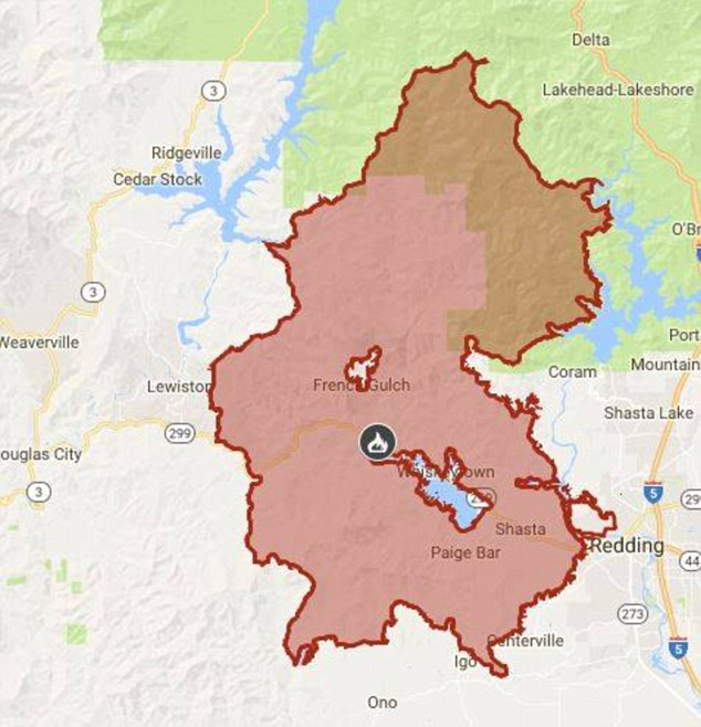
–as the Ranch Fire in Mendocino County near Ukiah spread on the July 27-9 across thirteen thousand acres, with high winds, the Carr Fire grew from a spark on the rear wheel of trailer to a conflagration which spread to an unprecedented 220,000 contained only after over a month, burning 1,604 buildings and over a thousand residences–
–and spread of the North Fire across rugged terrain in early September 2018 to 500 acres, quickly enlarging to 700, posed similar problems of containment: the Delta Fire in Shasta County, spread quickly to 37, 000 acres and closing I-5 for forty-five and then for several hundred sq miles in three days, just beside the Carr Fire, itself long uncontained, cut off access to the major interstate freeway for a significant amount of time.

The spread of fires crated huge collateral damages, from increasing the toxicity of waters in what are considered pristine lakes, by introducing quantities of ash, and even more by the huge problems of land erosion that would occur in the aftermath of fires, when further phosphorous stands to be released into water bodies from Clear lake to Lower Lake to alpine lakes in the Trinity Forest near Redding, possibly encouraging harmful algal blooms–FHAB’s–that could create toxic environments for local animals. Increased phosphorous from ash and erosion could poison the complex water system in California through the increased incidence of algal blooms in ways that are difficult to fathom or comprehend.
These catastrophic consequences of fires led to the cutting off of electricity in 2019, as the privately held energy company faced problems of liability against which it knew it could not protect itself, and could not separate its own interests from the interests of the state.

